
Heavy to excessive rainfall is expected today into Wednesday over New Mexico into far west Texas. Flash flooding and debris flows in wildfire burn areas will be possible. A strong coastal storm will develop off the Mid-Atlantic coast Wednesday, intensifying toward southern New England this weekend. Significant coastal flooding, strong rip currents, and beach erosion from high surf expected. Read More >
Denver/Boulder, CO
Weather Forecast Office
A winter storm moved across Colorado Thursday and Friday, March 17-18, 2016. This storm system brought heavy snow to the mountains, Front Range Foothills, and nearby plains. Lighter amounts occurred east of I-25. Snowfall Totals are shown below.
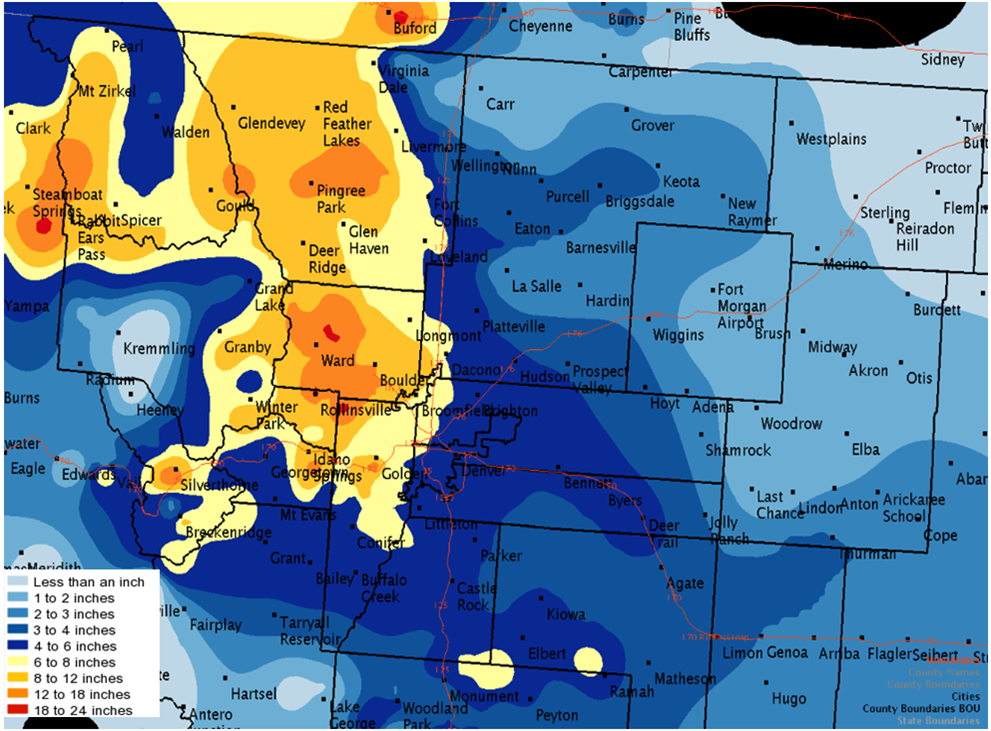
The snow continued into Friday morning, before finally decreasing over most areas by afternoon. Total accumulations, with as much 15 to 20 inches of snow recorded in the foothills of Larimer and Boulder counties. This map is zoomable. Data sources include Spotters, COCORAHS and Snotel sites.

US Dept of Commerce
National Oceanic and Atmospheric Administration
National Weather Service
Denver/Boulder, CO
325 Broadway
Boulder, CO 80305-3328
303-494-3210 for a recording call 303-494-4221
Comments? Questions? Please Contact Us.


 Follow us on X
 Follow us on Facebook
 Follow us on YouTube
 BOU RSS Feed