
Showers and thunderstorms are expected from Texas to the Northeast through Tuesday. Heavy rain will create mainly localized areas of flash flooding across the central Gulf Coast into the Appalachians. Elevated to Critical fire weather conditions due to gusty winds and low humidity are expected through Tuesday across Oregon and Nevada. Showers and thunderstorms will develop over the Northwest. Read More >
Denver/Boulder, CO
Weather Forecast Office
Ryan Fire Weather Decision Support
| Click on any area for more detailed information on each Warning, Watch or Advisory. (Current Fires depicted by a green triangle) |
 |
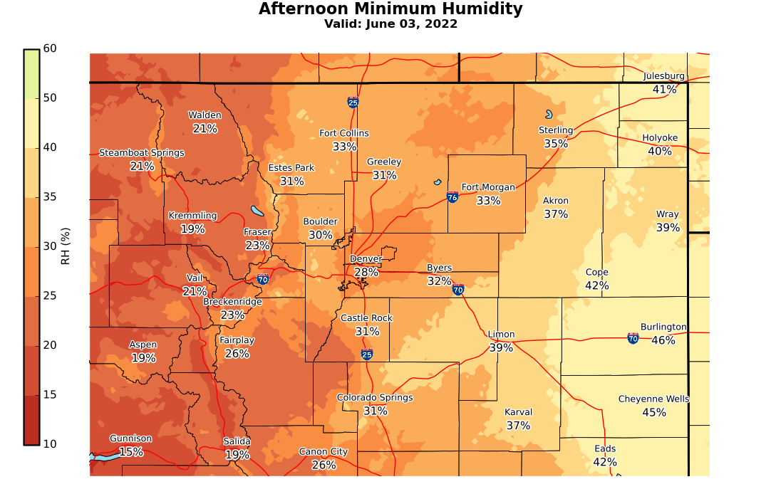
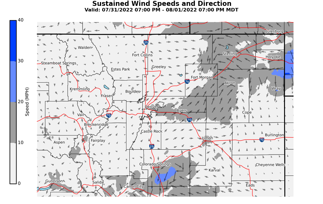
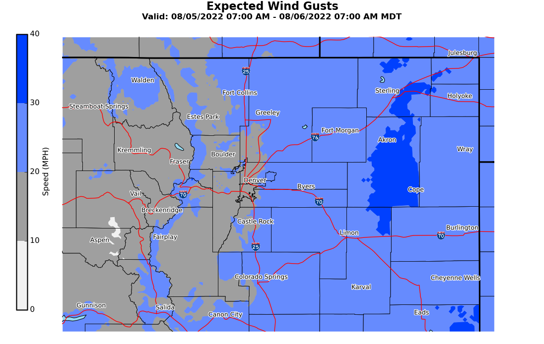
Hourly Forecast of Temperatures/Humidity/Winds
Middle of Ryan Fire on the Colorado/Wyoming Border
Fire Weather Decision Support
Today's Fire Potential

 |
 |
 |
Latest Radar Image
(Brightest Colors indicate Strongest Storms)

Real Time Lightning Data
Number of Lightning Strikes over a 2 Minute Period provided by COLMA (updated every 60 seconds)
 ​
​
US Dept of Commerce
National Oceanic and Atmospheric Administration
National Weather Service
Denver/Boulder, CO
325 Broadway
Boulder, CO 80305-3328
303-494-3210 for a recording call 303-494-4221
Comments? Questions? Please Contact Us.

