Denver/Boulder, CO
Weather Forecast Office
Severe Weather Outbreak on September 11th, 2019
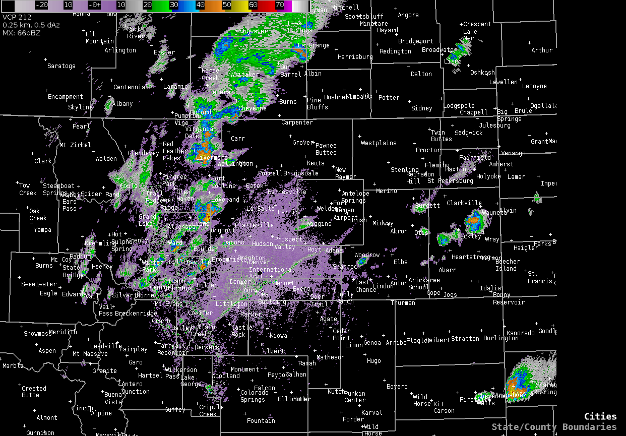
Severe thunderstorms developed north of Denver, by late afternoon, and then tracked east northeast across the plains through early Wednesday evening. Several reports of large hail, up to baseballs at times, along with strong winds occurred in some areas.
Two brief EF2 tornadoes occurred early Wednesday evening west Northwest of Fleming, Colorado. Tornado #1 snapped power poles while tornado #2 demolished a well constructed pole barn.
.TORNADO #1...

RATING: EF-2
ESTIMATED PEAK WIND: 118 MPH
PATH LENGTH /STATUTE/: 0.5 MILES
PATH WIDTH /MAXIMUM/: 50 YARDS
FATALITIES: 0
INJURIES:   0

DATE: 09/11/2019
TIME: 703 to 704 PM MDT
LOCATION: 9 MILES WEST NORTHWEST OF FLEMING, COLORADO

.TORNADO #2...

RATING: EF-2
ESTIMATED PEAK WIND: 112 MPH
PATH LENGTH /STATUTE/: 0.5 MILES
PATH WIDTH /MAXIMUM/: 50 YARDS
FATALITIES: 0
INJURIES:   0

DATE: 09/11/2019
TIME: 705 to 706 PM MDT
LOCATION: 6 MILES WEST NORTHWEST OF FLEMING, COLORADO

EF SCALE: THE ENHANCED FUJITA SCALE CLASSIFIES
TORNADOES INTO THE FOLLOWING CATEGORIES.

EF0...WEAK......65 TO 85 MPH
EF1...WEAK......86 TO 110 MPH
EF2...STRONG....111 TO 135 MPH
EF3...STRONG....136 TO 165 MPH
EF4...VIOLENT...166 TO 200 MPH
EF5...VIOLENT...>200 MPH

NOTE:
THE INFORMATION IN THIS STATEMENT IS PRELIMINARY AND SUBJECT TO
CHANGE PENDING FINAL REVIEW OF THE EVENT AND PUBLICATION IN
NWS STORM DATA.
Radar Loop from late Wednesday afternoon through Wednesday evening.
Preliminary Storm Reports for September 11th
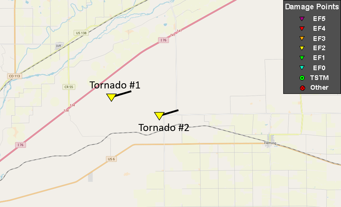
Logan County, Colorado tornado tracks.
Colorado storm reports.
US Dept of Commerce
National Oceanic and Atmospheric Administration
National Weather Service
Denver/Boulder, CO
325 Broadway
Boulder, CO 80305-3328
303-494-3210 for a recording call 303-494-4221
Comments? Questions? Please Contact Us.

