
Heat expands across the Desert Southwest, Plains, Mississippi Valley and Midwest into Monday. Fire weather concerns continue for portions of the Intermountain West. Active monsoonal moisture fuels thunderstorms over the Southwest with possible flash flooding. Tropical cyclone Fausto in the Pacific, should weaken as it approaches Hawaii; Dangerous surf, swells and rip currents are expected. Read More >
Denver/Boulder, CO
Weather Forecast Office
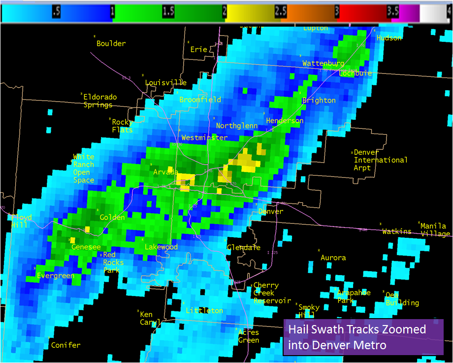
Locations around Golden, Lakewood, Wheat Ridge, and northwest Denver received the brunt of the storm with very large hail with up to baseball sized hail reported. Cars were dented, windows were shattered, and considerable roof damage also occurred as the storm moved through.
Spotter reports from May 8, 2017...
Here's a look at hail swath output and size estimates from the NWS KFTG Front Range Radar across the Denver Metro area...
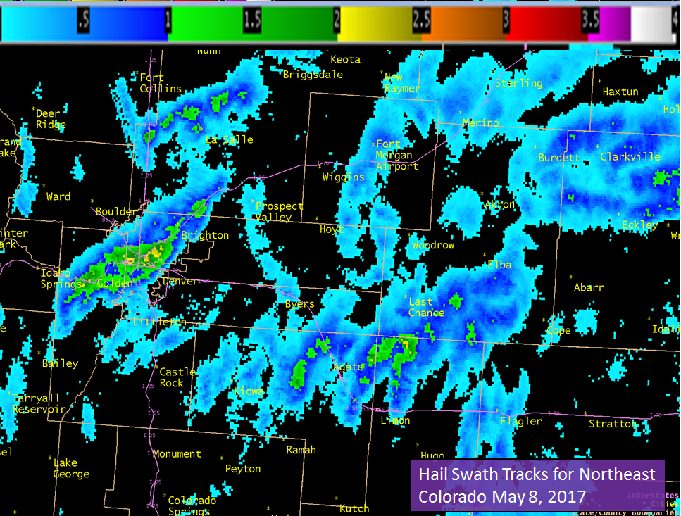
And across all of northeast Colorado....
US Dept of Commerce
National Oceanic and Atmospheric Administration
National Weather Service
Denver/Boulder, CO
325 Broadway
Boulder, CO 80305-3328
303-494-3210 for a recording call 303-494-4221
Comments? Questions? Please Contact Us.

