Denver/Boulder, CO
Weather Forecast Office
Elk Fire Weather Decision Support
| Click on any area for more detailed information on each Warning, Watch or Advisory. (Current Fires depicted by a green triangle) |
 |
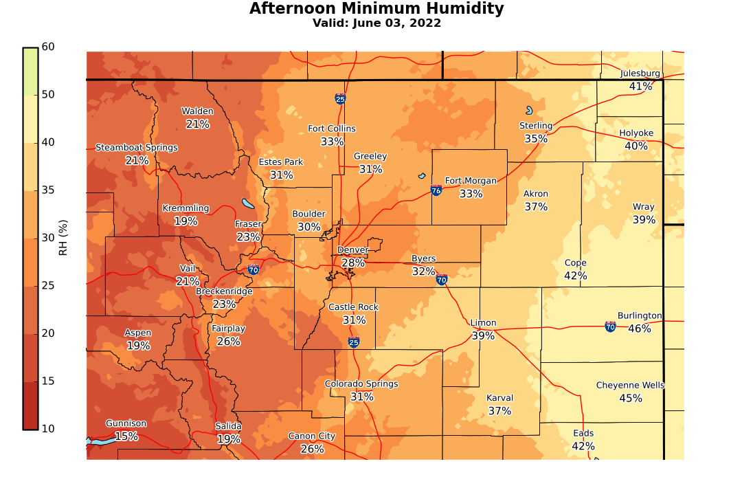
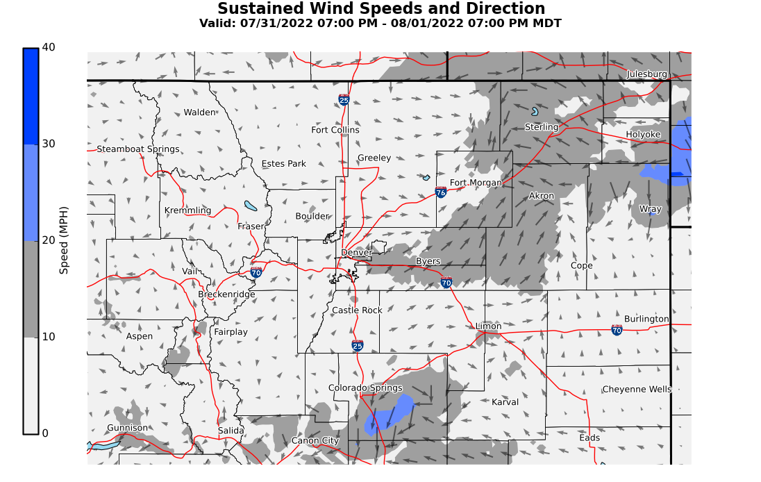
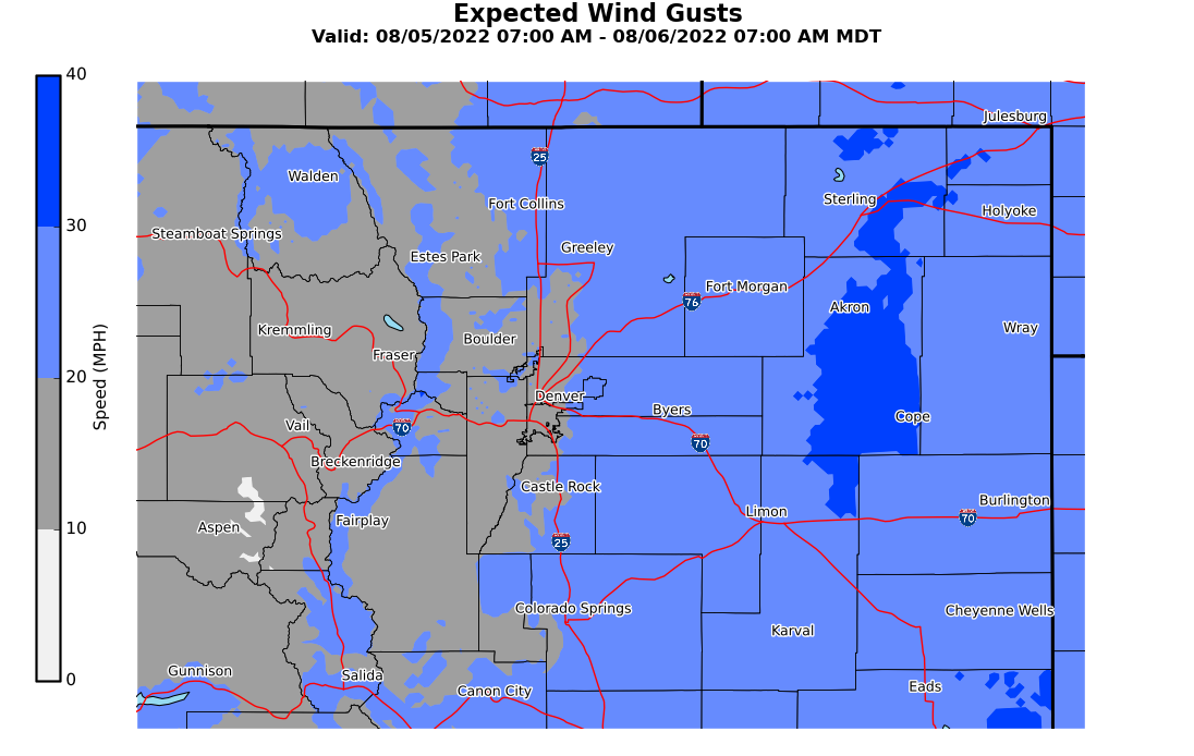
Hourly Forecast of Temperatures/Humidity/Winds
Point B Southern Side
Fire Weather Decision Support
Today's Fire Potential

 |
 |
 |
Latest Radar Image
(Brightest Colors indicate Strongest Storms)

Real Time Lightning Data
Number of Lightning Strikes over a 2 Minute Period provided by COLMA (updated every 60 seconds)
 ​
​
US Dept of Commerce
National Oceanic and Atmospheric Administration
National Weather Service
Denver/Boulder, CO
325 Broadway
Boulder, CO 80305-3328
303-494-3210 for a recording call 303-494-4221
Comments? Questions? Please Contact Us.

