Overview
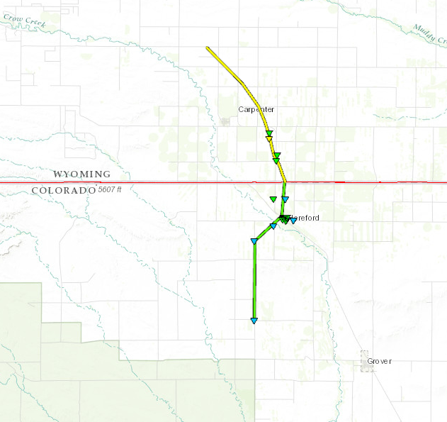
A Tornado occurred over northern Weld County late in the afternoon of June 12th. There was sporadic damage from 5.5 miles south southwest of Hereford to 2 miles north of Hereford along the Colorado-Wyoming border. All of the damage was in the EF-0 to EF-1 range. In addition large hail from 3 to 4 inches inches in diameter occurred with the storm.
Tornadoes:
|
Tornado - LOCATION
Track Map
|
||||||||||||||||
The Enhanced Fujita (EF) Scale classifies tornadoes into the following categories:
| EF0 Weak 65-85 mph |
EF1 Moderate 86-110 mph |
EF2 Significant 111-135 mph |
EF3 Severe 136-165 mph |
EF4 Extreme 166-200 mph |
EF5 Catastrophic 200+ mph |
 |
|||||
Photos & Video:
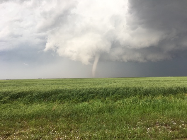 |
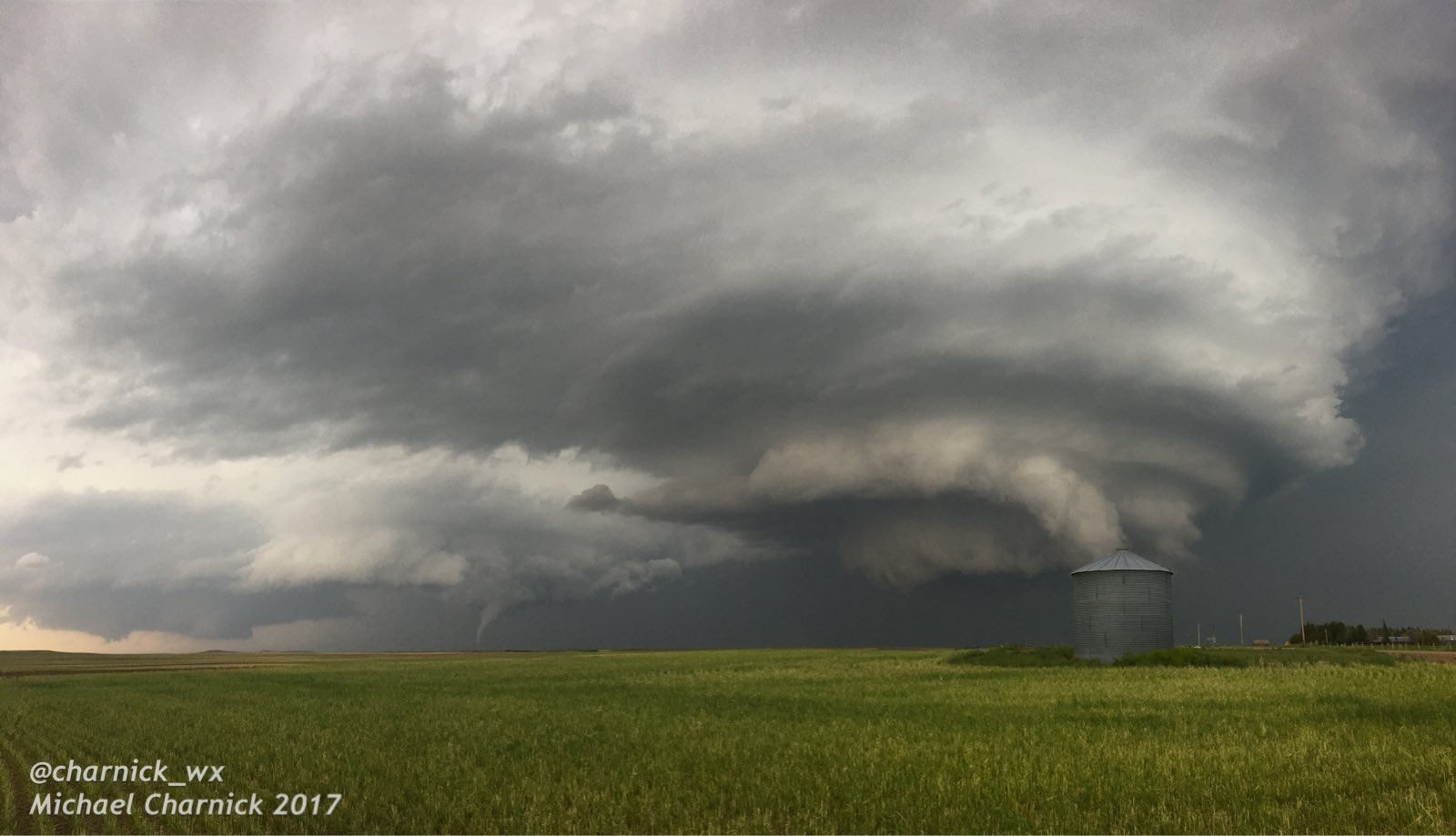 |
| Photo Michael Charnick NWS GJT |
3 Separate Mesocyclones |
Radar:
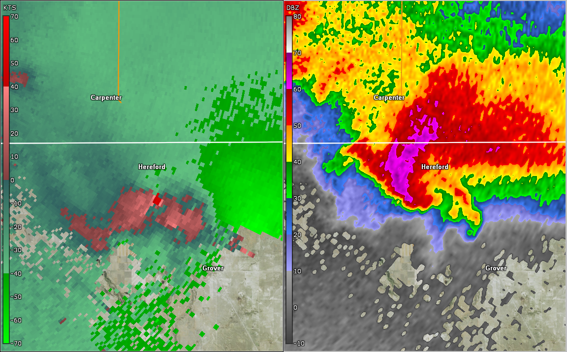 |
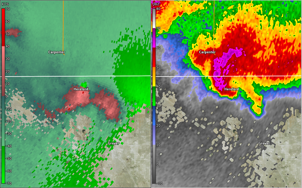 |
| Radar Image at 445 pm MDT | Radar Image at 450 pm MDT |
 |
Media use of NWS Web News Stories is encouraged! Please acknowledge the NWS as the source of any news information accessed from this site. |
|