
A few severe thunderstorms with large hail and damaging winds are possible this evening into tonight from eastern Kansas into western and central Missouri. Thunderstorms with heavy to excessive rainfall may produce flooding through tonight over parts of the northern High Plains, central Missouri, and along the Florida/Georgia line. Read More >
Overview
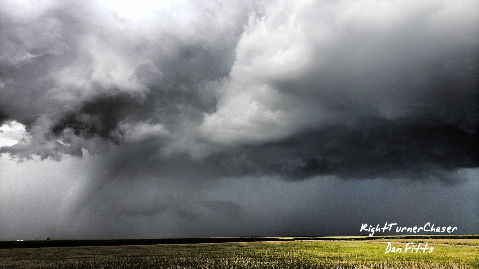
Severe Thunderstorms affected northeast Colorado Sunday afternoon. 5 tornadoes were confirmed over Washington county. In addition very large hail ranging from Tennis Ball to Grapefruit size occurred as well.
Tornadoes:
|
Tornado #1 - 4 Miles Northeast of Akron
Track Map >
|
||||||||||||||||
|
Tornado #2 - 6 Miles Northeast of Akron
Track Map
|
||||||||||||||||
|
Tornado #3 - 2 Miles East of Otis
Track Map
|
||||||||||||||||
|
Tornado #4 - 3.5 Miles East of Otis
Track Map
|
||||||||||||||||
|
Tornado #5 - 5 Miles East Northeast of Otis
Track Map
|
||||||||||||||||
The Enhanced Fujita (EF) Scale classifies tornadoes into the following categories:
| EF0 Weak 65-85 mph |
EF1 Moderate 86-110 mph |
EF2 Significant 111-135 mph |
EF3 Severe 136-165 mph |
EF4 Extreme 166-200 mph |
EF5 Catastrophic 200+ mph |
 |
|||||
Wind & Hail:
Hail
Very Large Hail ranging from Tennis Ball up to Grapefruit Size occurred over portions of Washington county especially from Platner to Otis. As a result considerable hail damage was reported.
 |
 |
|
Hail around 4.25" in diameter near Otis |
Hail around 4.50" in diameter near Otis Photo courtesy of John Sirlin |
Photos & Video
 |
 |
| Large Tornado northeast of Otis Courtesy of Dan Fitts |
Another shot of the same Tornado Courtesy of John Sirlin |
Radar
 |
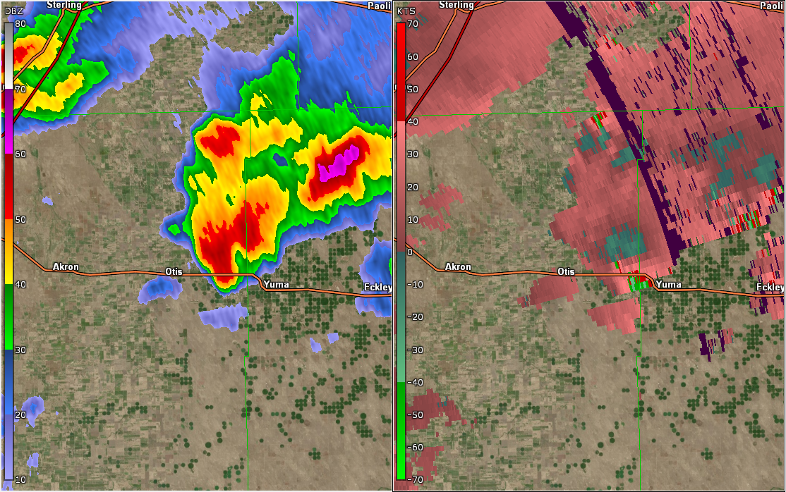 |
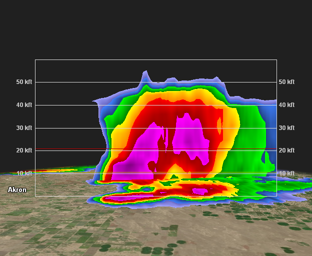
| Cross-section of Otis, CO Storm | Velocity couplet east of Otis at 410 pm |
 |
Media use of NWS Web News Stories is encouraged! Please acknowledge the NWS as the source of any news information accessed from this site. |
|

