Location...4 SSW Wakeman in Huron County, Ohio
Date...November 5, 2017
Start Time...5:21 PM EST
End Time...5:24 PM EST
Maximum EF-Scale Rating...EF-1
Estimated Maximum Wind Speed...90 mph
Maximum Path Width...100 yards
Path Length...1.83 miles
Fatalities...0
Injuries...0
* The information in this statement is preliminary and subject to
change pending final review of the event(s) and publication in
NWS Storm Data.
...Summary...
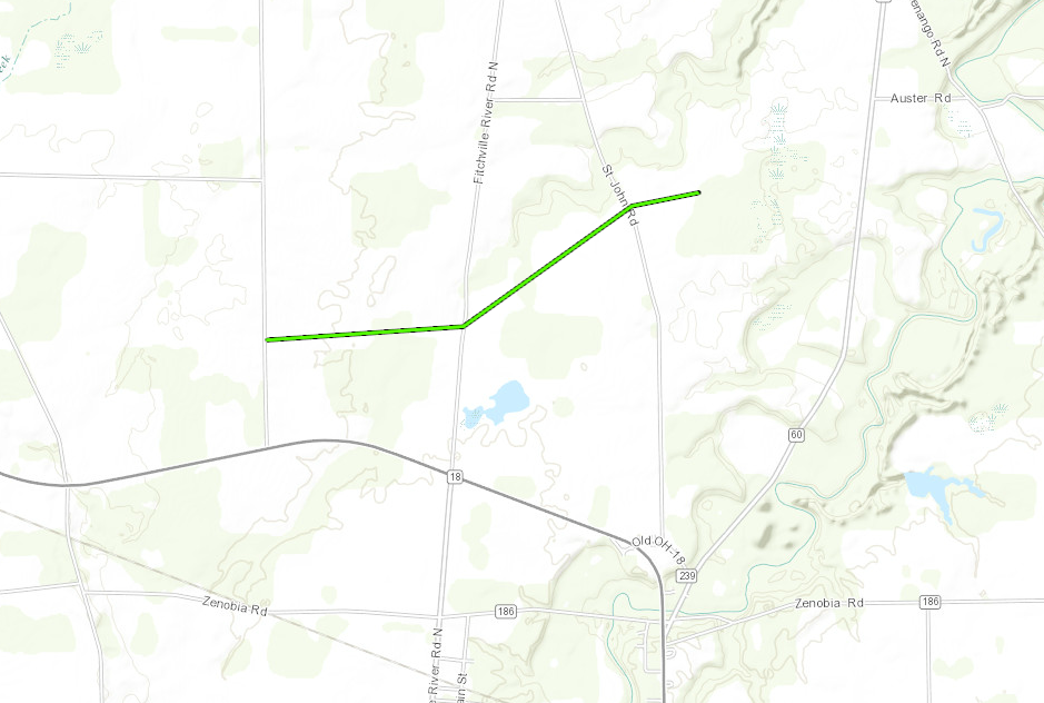
The National Weather Service in Cleveland OH has confirmed a
tornado south of Wakeman in Huron County Ohio on November 5, 2017.
A tornado formed near Wakeman Town Line Road just north of State
Route 18 about 4 miles south-southwest of Wakeman. This tornado
impacted a residence on Wakeman Town Line Road, lifting up
portions of a roof and damaging several hardwood trees. The
tornado continued east crossing Fitchville River Road with damaged
trees and power lines noted and roofing material removed from a
couple buildings and scattered over the area. This tornado then
proceeded northeast where significant roof damage occurred at a
barn on St. John Road. Debris from this roof was tossed up to
1200 yards from its origin. The upper interior of the barn showed
fracturing in the beams, however, the sides of the barn remained
overall intact. Wooden boards were lodged into the ground as
projectiles around the property, pointing from the east to the
west.
This information can also be found on our website at
weather.gov/cle.
For reference: the Enhanced Fujita Scale classifies tornadoes
into the following categories:
EF0...Wind speeds 65 to 85 mph
EF1...Wind speeds 86 to 110 mph
EF2...Wind speeds 111 to 135 mph
EF3...Wind speeds 136 to 165 mph
EF4...Wind speeds 166 to 200 mph
EF5...Wind speeds greater than 200 mph
$$
Sefcovic