
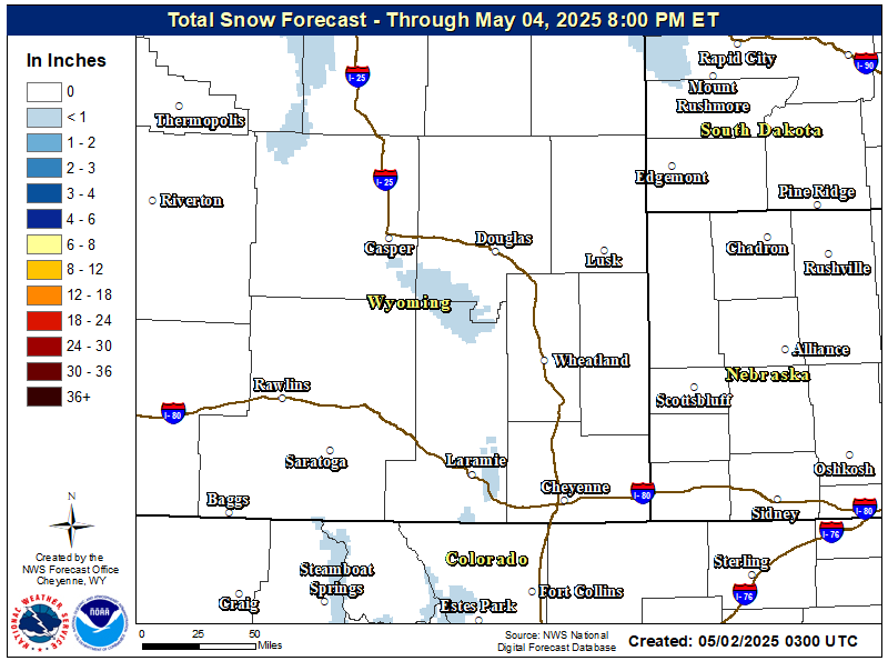
Storm Total Forecast Snow Accumulations
|
.png)
Latest Warnings, Advisories, and Watches
|

NWS Cheyenne Weather Story
|
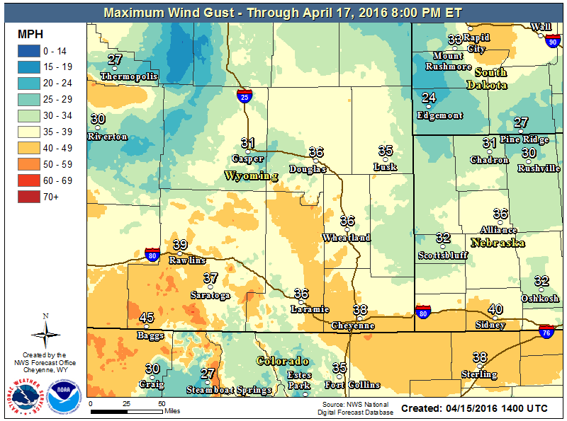
Maximum Wind Gusts
|
Amounts: Additional snow accumulations up to one inch, mainly over southeast Wyoming
Impacts: Snow will be heavy with high water content, leading to possible power outages, structural damage, and tree/plant damage. Travel conditions will gradually improve today and this evening.

Visit www.wyoroad.info for Wyoming, and 511.nebraska.gov for Nebraska. You can also access the latest road conditions on your phone by dialing 511.
Click the Image for Current Road Conditions Across Wyoming
|
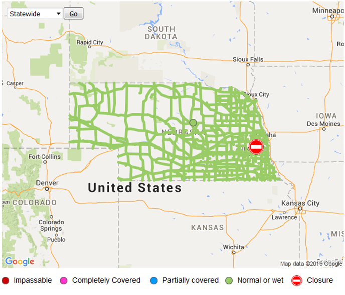
Click the Image for Current Road Conditions Across Nebraska
|
|
I-80 Laramie |
I-80 Sinclair |
I-80 at Arlington |
|
I-25 College Drive (Cheyenne) |
I-25 Bordeaux |
I-25 Chugwater |
For the full list of webcams across Wyoming and Nebraska, visit:

Want to track the storm? Here are the local and regional radar loops:
 |
  |


 Weather Story
 Weather Map
 Local Radar