Grand Forks, ND
Weather Forecast Office
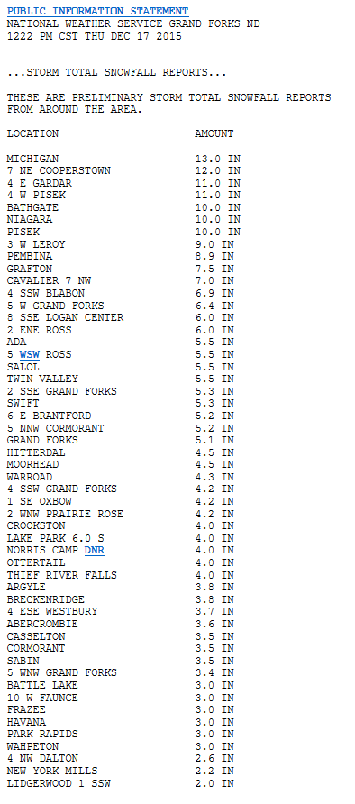
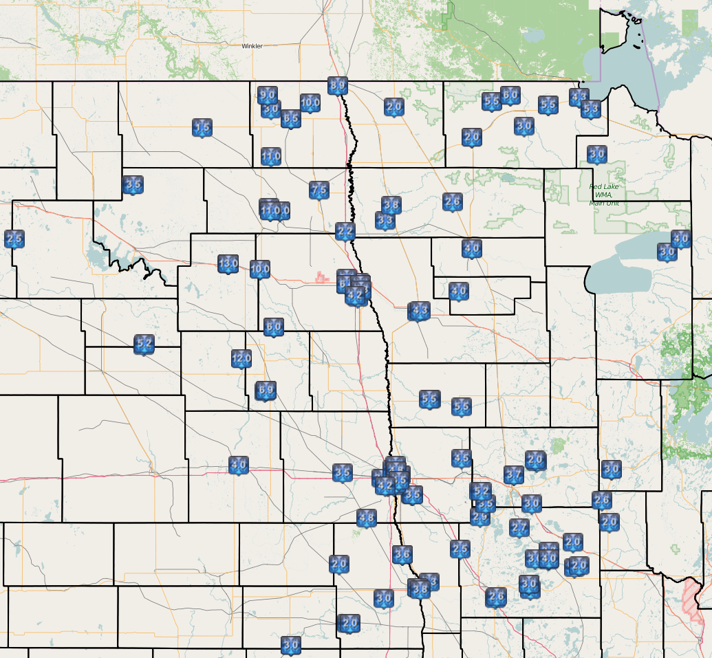
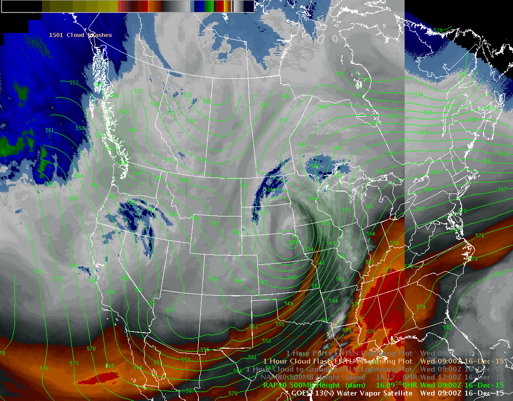
A strong Colorado low pressure system moved northeast during the daytime hours on Tuesday with a band of intense snowfall working into the southern Red River Valley before midnight. This intense snowfall was quickly cutoff in the central and southern valley as a dry layer aloft known as the "dry slot" lifted into the area in the early morning hours on Wednesday. This initial intense band of snow produced a quick 3 to 4 inches of snowfall in a 2 to 3 hour period. This band rotated around the low and stalled over part of eastern ND, allowing heavy snow to fall for a long period of time from near Pembina, ND to Cooperstown, ND. This is evident on the radar imagery and in the snowfall map where locations under the prolonged banding snowfall received up to 13 inches of snow.
Radar Estimated Storm Total Snowfall Map
.PNG)
Storm Total Snowfall Map (Link to Map Interface)
Water Vapor Imagery Loop - 3 AM to 1130 AM Wednesday
Radar Loop (early part of storm) - 527 PM Tuesday to 813 AM Wednesday
Radar Loop (latter part of storm) - 705 AM Wednesday to 737 AM Thursday
US Dept of Commerce
National Oceanic and Atmospheric Administration
National Weather Service
Grand Forks, ND
4797 Technology Circle
Grand Forks, ND 58203-0600
701-772-0720
Comments? Questions? Please Contact Us.

