Overview
A cold front moved across the area during the afternoon and evening hours on Tuesday, June 4, 2019. This front was the focus for thunderstorm development across southeastern North Dakota and into northwestern Minnesota. Isolated large hail and brief heavy rain were the main threats with these storms. Most hail that occurred was up to the size of quarters with the exception of hail over two inches in diameter occurring in Beltrami County, Minnesota with a slightly stronger storm cell.
SPC Products
 |
 |
 |
 |
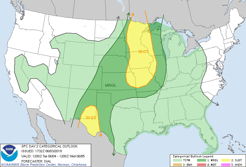
| SPC Day 2 Convective Outlook (6/3 1130 am) |
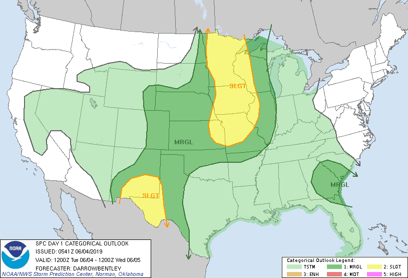
SPC Day 1 Convective Outlook (6/4 100 am) |
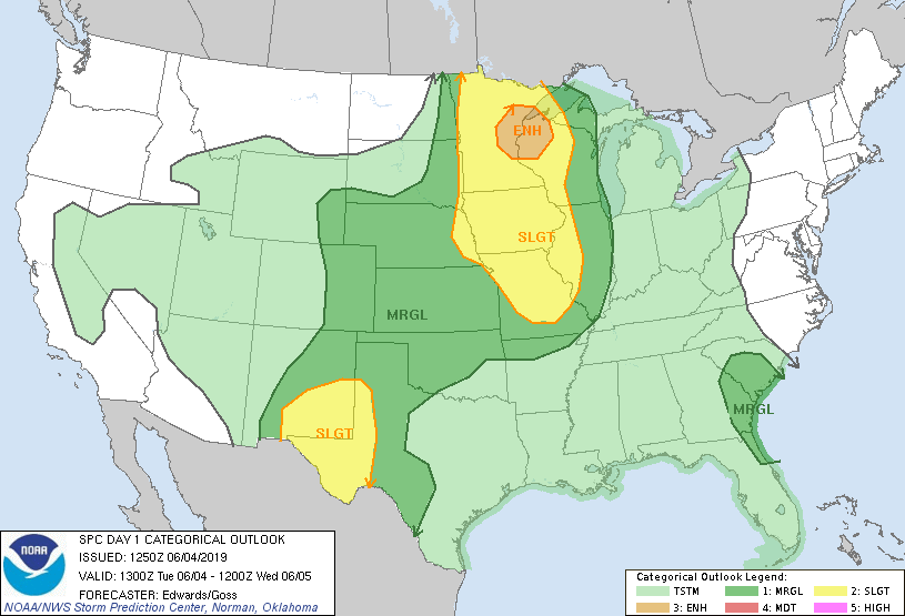
SPC Day 1 Convective Outlook (6/4 800 am) |
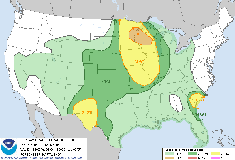
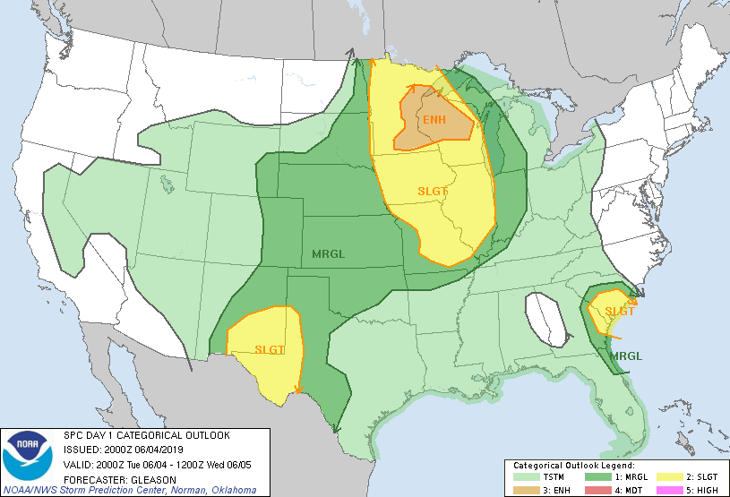
SPC Day 1 Convective Outlook (6/4 1130 am) |
 |
 |
 |
 |
| SPC Day 1 Convective Outlook (6/4 300 pm) |
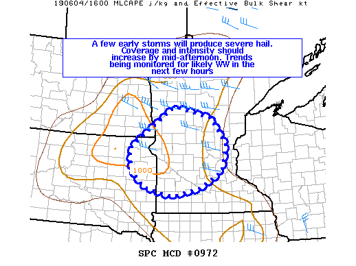
SPC Mesoscale Discussion (1144 am) |
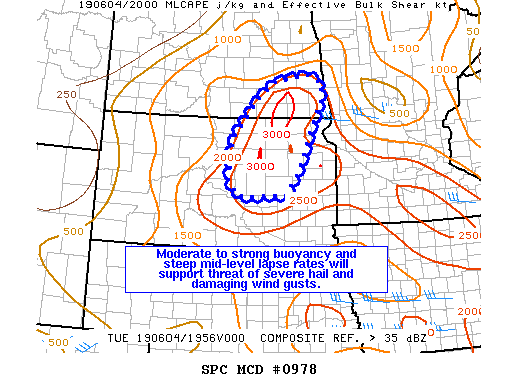
SPC Mesoscale Discussion (333 pm) |
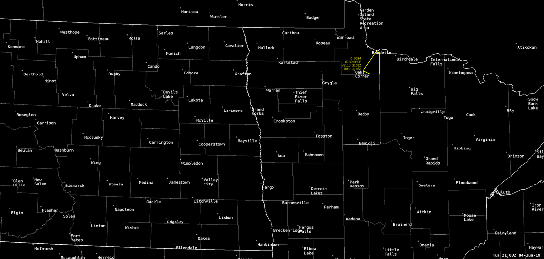
NWS Grand Forks Severe Thunderstorm Warnings |
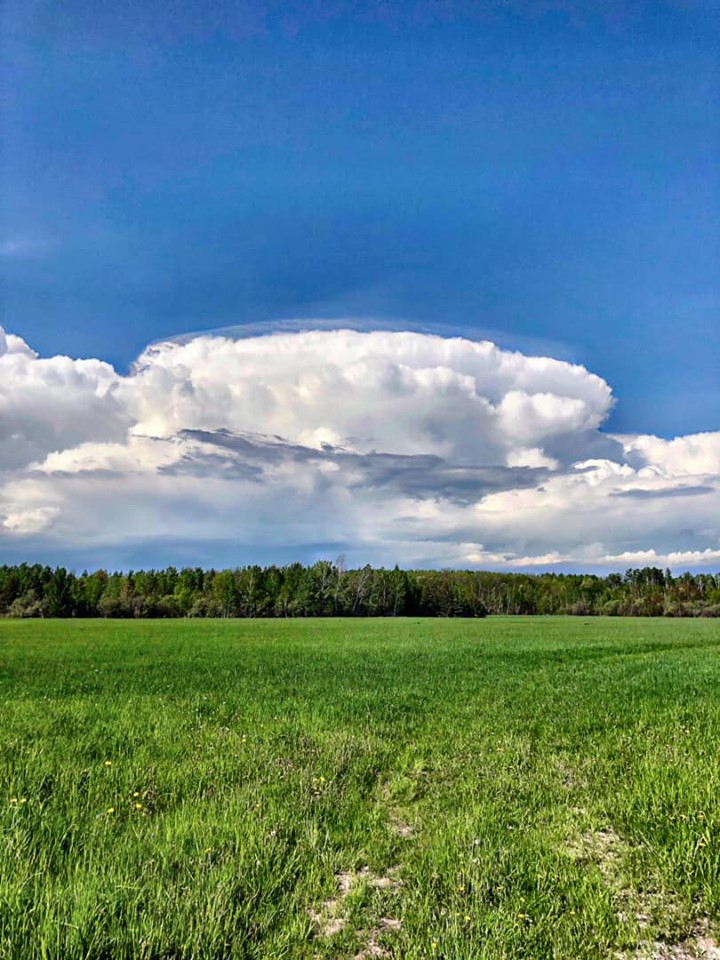
Photos & Video
|
|
 |
| Near Saum looking towards NE Beltrami County (Photo Courtesy Eric Richards) |
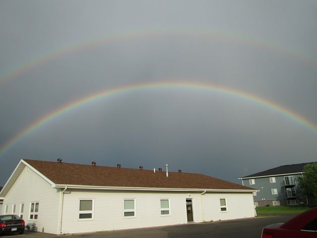
Double rainbow in Thief River Falls (Photo Courtesy Alison Johnson) |
Radar & Satellite
| Satellite loop of Beltrami County storm. |
Radar Loop from 3:00 p.m. to 7:00 p.m.
Radar loop from 7:00 p.m. to 11:00 p.m.
Storm Reports
PRELIMINARY LOCAL STORM REPORT...SUMMARY
NATIONAL WEATHER SERVICE EASTERN ND/GRAND FORKS ND
515 PM CDT THU JUN 6 2019

..TIME...   ...EVENT...      ...CITY LOCATION...     ...LAT.LON...
..DATE...   ....MAG....      ..COUNTY LOCATION..ST.. ...SOURCE....
            ..REMARKS..

1150 AM     HAIL             6 E NORCROSS            45.87N 96.07W
06/04/2019  E1.00 INCH       GRANT              MN   PUBLIC

            QUARTER SIZED HAIL AND 0.80 INCHES OF RAIN.

0430 PM     TSTM WND DMG     10 SSE CARP             48.37N 94.56W
06/04/2019                   LAKE OF THE WOODS  MN   PARK/FOREST SRVC

            A FEW 4 TO 6 INCH DIAMETER LARCH AND POPPLE TREES WERE
            SNAPPED ALONG HWY 72 NEAR THE BELTRAMI COUNTY LINE.

0457 PM     HAIL             PARK RIVER              48.39N 97.74W
06/04/2019  E0.88 INCH       WALSH              ND   PUBLIC

            ESTIMATED SIZE VIA SOCIAL MEDIA

0515 PM     TSTM WND GST     2 ESE GRAFTON           48.40N 97.36W
06/04/2019  M52.00 MPH       WALSH              ND   AWOS

            AWOS STATION KGAF GRAFTON ND /AIRPORT/.

0530 PM     HAIL             STEPHEN                 48.45N 96.88W
06/04/2019  E0.88 INCH       MARSHALL           MN   PUBLIC

            TIME ESTIMATED BASED ON RADAR

0539 PM     HAIL             4 SSW WASKISH           48.11N 94.55W
06/04/2019  E1.00 INCH       BELTRAMI           MN   PUBLIC

            A SERIES OF STRONG TO SEVERE THUNDERSTORMS FORMED IN
            NORTHCENTRAL BELTRAMI COUNTY AND TRACKED SOUTHEASTWARD
            ACROSS THE NORTHEAST END OF UPPER RED LAKE. A LAKESIDE
            RESIDENT REPORTED RECEIVING AN INCH OF DRIVING RAIN AND
            DIME SIZED HAIL WITH A FEW UP TO QUARTER SIZED. TIME
            ESTIMATED BASED ON RADAR.

0540 PM     HAIL             DILWORTH                46.88N 96.70W
06/04/2019  E0.75 INCH       CLAY               MN   BROADCAST MEDIA

            PEA TO DIME SIZED HAIL REPORTED

0550 PM     TSTM WND GST     6 SW WARREN             48.13N 96.86W
06/04/2019  M46.00 MPH       POLK               MN   MESONET

            WARREN NDAWN

0635 PM     TSTM WND GST     3 S THIEF RIVER FALLS   48.07N 96.18W
06/04/2019  M47.00 MPH       PENNINGTON         MN   AWOS

            AWOS STATION KTVF THIEF RIVER FALLS MN /AIRPORT/.

0650 PM     HAIL             6 SE RICHWOOD           46.91N 95.73W
06/04/2019  E0.88 INCH       BECKER             MN   TRAINED SPOTTER

            LOTS OF HAIL FELL FOR 5 MINUTES UP TO THE SIZE OF NICKELS


0655 PM     HAIL             6 ESE RICHWOOD          46.94N 95.71W
06/04/2019  E1.25 INCH       BECKER             MN   PUBLIC

            HAIL FROM QUARTER TO HALF DOLLAR SIZED FELL FOR A GOOD 10
            MINUTES... UNTIL 705 PM CDT.

0718 PM     TSTM WND DMG     3 N HEIGHT OF LAND LAKE 46.93N 95.61W
06/04/2019                   BECKER             MN   PUBLIC

            STRONG WINDS BLEW FOR SEVERAL MINUTES. A FEW POPLAR TREES
            WERE BROKEN DOWN OFF THE NORTHEAST SHORE OF HEIGHT OF
            LAND LAKE.

0730 PM     HAIL             10 N BEMIDJI            47.63N 94.88W
06/04/2019  E0.88 INCH       BELTRAMI           MN   PUBLIC

            VIDEO FROM SOCIAL MEDIA OF NUMEROUS HAIL STONES UP TO THE
            SIZE OF NICKELS FALLING

0739 PM     HAIL             10 ESE BEMIDJI          47.43N 94.68W
06/04/2019  M1.00 INCH       BELTRAMI           MN   EMERGENCY MNGR

            EM OBSERVED A WALL CLOUD AND QUARTER SIZED HAIL

0740 PM     HAIL             7 E BEMIDJI             47.48N 94.73W
06/04/2019  M2.00 INCH       BELTRAMI           MN   PUBLIC

            PICTURE ON SOCIAL MEDIA WITH RULER OF 2.1 INCH HAILSTONE
            WITH TIME ESTIMATED BASED ON RADAR

0740 PM     TSTM WND DMG     6 E BEMIDJI             47.48N 94.75W
06/04/2019                   BELTRAMI           MN   LAW ENFORCEMENT

            SHERIFF DEPUTY REPORTED THAT STRONG WINDS HAD DOWNED 8-10
            MATURE TREES AT THEIR BASE AND UPROOTING HALF A DOZEN
            REPORTED VIA BELTRAMI EM

0746 PM     HAIL             5 ESE ROSBY             47.40N 94.72W
06/04/2019  E2.50 INCH       HUBBARD            MN   PUBLIC

            VIDEO ON SOCIAL MEDIA SHOWING MULTIPLE HAIL STONES PING

            PONG SIZED AND GREATER WITH SOME AS LARGE AS TENNIS BALLS

0748 PM     HAIL             5 ESE ROSBY             47.40N 94.72W
06/04/2019  E1.50 INCH       HUBBARD            MN   EMERGENCY MNGR

            BELTRAMI EM OBSERVED HAIL ON NORTH SIDE OF MIDGE LAKE
            JUST UNDER GOLF BALL SIZE ESTIMATED AS PING PONG BALL
            SIZE.

0750 PM     HAIL             4 W CASS LAKE           47.38N 94.69W
06/04/2019  E1.00 INCH       HUBBARD            MN   PUBLIC

            DELAYED REPORT RECEIVED VIA FACEBOOK.

0805 PM     HAIL             1 SSE ROSBY             47.41N 94.80W
06/04/2019  E1.00 INCH       HUBBARD            MN   EMERGENCY MNGR

            BELTRAMI EM OBSERVED ONGOING QUARTER SIZE HAIL JUST SOUTH
            OF COUNTY LINE IN HUBBARD COUNTY.

0840 PM     TSTM WND DMG     4 W LAPORTE             47.21N 94.84W
06/04/2019                   HUBBARD            MN   PUBLIC

            ABOUT 5 MINUTES OF DIME SIZED HAIL AND VERY STRONG WINDS.
            SEVERAL 3 TO 5 INCH DIAMETER POPLAR BRANCHES WERE BROKEN
            DOWN AND A SMALL PINE TREE WAS SNAPPED.
Environment
 |
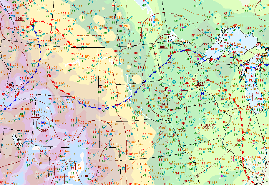 |
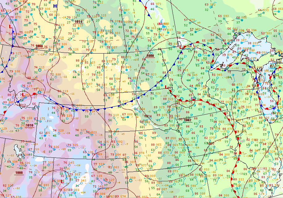
| 4 pm Surface Map | 7 pm Surface Map |
 |
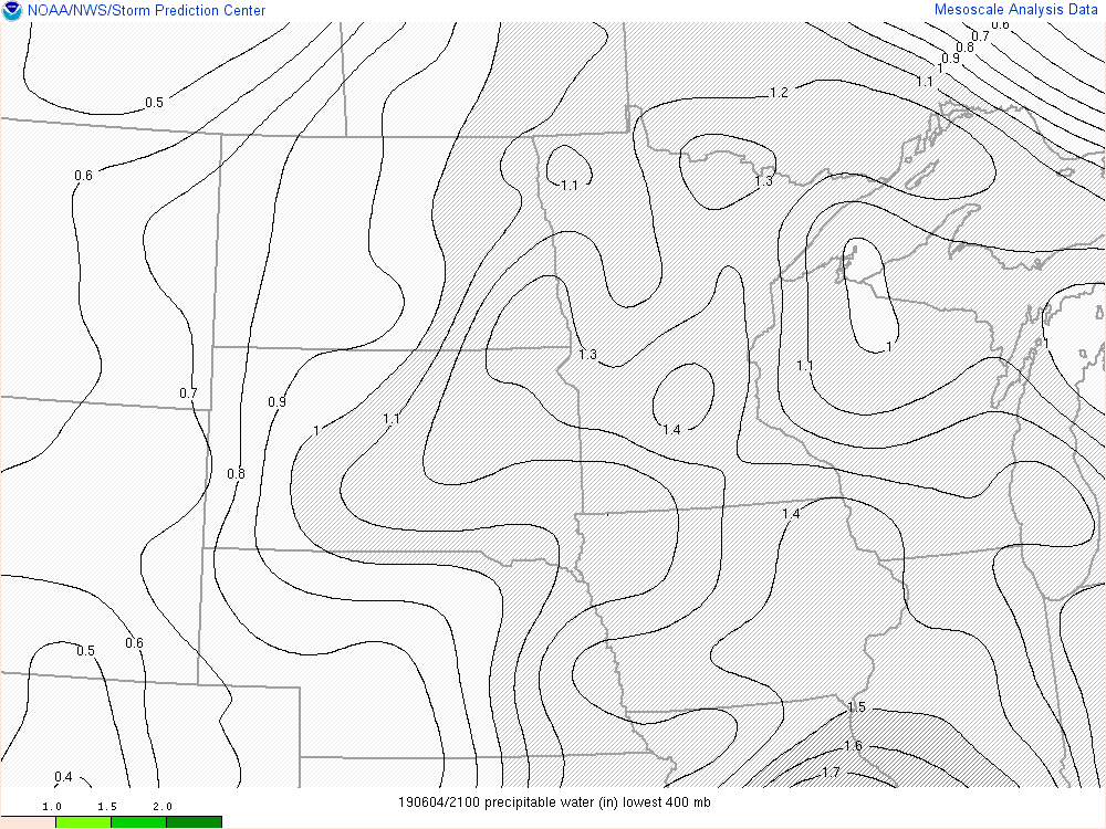 |
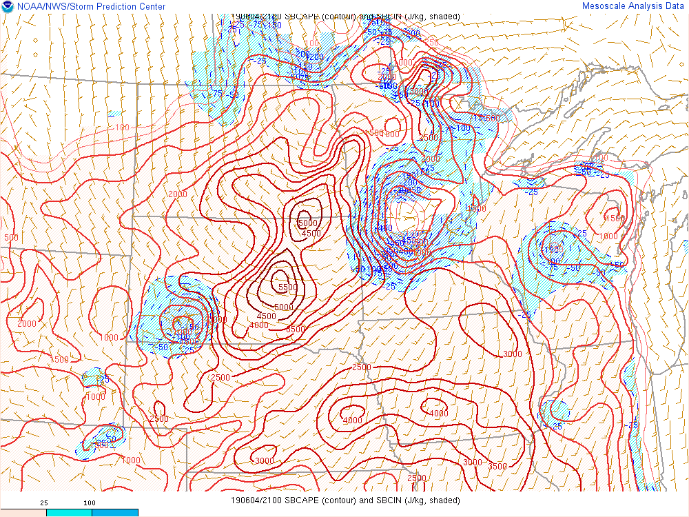
| 4 pm SBCAPE | 4 pm Precipitable Water |
 |
Media use of NWS Web News Stories is encouraged! Please acknowledge the NWS as the source of any news information accessed from this site. |
|

