Overview
After a warm and fairly comfortable day across eastern North Dakota and northwest Minnesota, evening thunderstorms began to develop along a warm front draped across the region. These thunderstorms quickly strengthened and began producing severe hail and strong winds from southeast North Dakota to the Bemidji area.Wind & Hail:
PRELIMINARY LOCAL STORM REPORT...SUMMARY
NATIONAL WEATHER SERVICE EASTERN ND/GRAND FORKS ND
801 PM CDT THU JUL 4 2019

..TIME...   ...EVENT...      ...CITY LOCATION...     ...LAT.LON...
..DATE...   ....MAG....      ..COUNTY LOCATION..ST.. ...SOURCE....
            ..REMARKS..

0645 PM     TSTM WND DMG     2 N MCVILLE             47.79N 98.18W
07/03/2019                   NELSON             ND   PUBLIC

            A SQUALL WAS NOTED MOVING THROUGH CENTRAL HAMLIN
            TOWNSHIP, FROM 640 THROUGH 650 PM CDT, WITH A FEW LARGE 3
            TO 5 INCH DIAMTER BRANCHES BROKEN DOWN IN SHELTER BELTS.
            SOME LODGING OF CROPS WAS ALSO NOTED. TIMING BASED ON
            RADAR AND NEARBY MESONET REPORTS.

0657 PM     HAIL             1 S FINGAL              46.75N 97.79W
07/03/2019  E1.00 INCH       BARNES             ND   TRAINED SPOTTER

            FEW HAILSTONES SIZE OF QUARTERS FELL FOR MINUTE OR SO

0710 PM     HAIL             4 W ANETA               47.68N 98.07W
07/03/2019  E1.50 INCH       NELSON             ND   BROADCAST MEDIA

            PHOTO AND REPORT POSTED VIA SOCIAL MEDIA. TIME ESTIMATED
            BASED ON RADAR.

0715 PM     HAIL             NOME                    46.68N 97.82W
07/03/2019  E1.00 INCH       BARNES             ND   PUBLIC

            SOCIAL MEDIA PHOTOGRAPH OF HAILSTONE.

0719 PM     HAIL             ANETA                   47.68N 97.99W
07/03/2019  E1.25 INCH       NELSON             ND   PUBLIC

            REPORTS OF SEVERAL QUARTER-SIZED HAILSTONES WITH SOME
            LARGER. TIME ESTIMATED FROM RADAR.

0747 PM     FUNNEL CLOUD     6 NNE FOSSTON           47.66N 95.70W
07/03/2019                   POLK               MN   PUBLIC

            A FUNNEL CLOUDS WAS BRIEFLY VIEWED AND PHOTOGRAPHED FROM
            MULTIPLE LOCATIONS. IT WAS FIRST REPORTED VIA SOCIAL
            MEDIA AND BROADCAST MEDIA AS BEING LOCATED BETWEEN
            FOSSTON AND GULLY. TIME WAS ESTABLISHED BASED ON SPOTTER
            REPORTS AND LOCATION DETERMINED VIA RADAR.

0750 PM     TSTM WND DMG     3 N LEONARD             46.69N 97.25W
07/03/2019                   CASS               ND   PUBLIC

            PUBLIC REPORTED A 1 TO 1.5 MILE SWATH OF CORN CROP DAMAGE
            DUE TO WIND DRIVEN HAIL AS WELL AS SEVERAL TREE BRANCHES
            DOWN IN THE AREA.

0825 PM     HAIL             1 N CASSELTON           46.92N 97.21W
07/03/2019  E1.00 INCH       CASS               ND   BROADCAST MEDIA

            MAINLY DIME SIZED WITHA FEW UP TO QUARTER SIZED. REPORT
            POSTED VIA SOCIAL MEDIA.

0850 PM     HAIL             4 W ARGUSVILLE          47.05N 97.03W
07/03/2019  E1.00 INCH       CASS               ND   PUBLIC

            LOTS OF HAIL OF AT LEAST QUARTER SIZE AND STRONG WIND
            BASED ON SOCIAL MEDIA VIDEO

0905 PM     TSTM WND GST     OXBOW                   46.67N 96.80W
07/03/2019  E65.00 MPH       CASS               ND   AMATEUR RADIO

            ROTTEN TREE FELLED.

0915 PM     HAIL             3 ESE GARDNER           47.13N 96.91W
07/03/2019  E1.75 INCH       CASS               ND   PUBLIC

            GOLFBALL SIZED OR LARGER HAIL REPORTED IN NORTHWEST WISER
            TOWNSHIP.

0934 PM     HAIL             3 WSW BEMIDJI           47.47N 94.94W
07/03/2019  E1.00 INCH       BELTRAMI           MN   PUBLIC

            LOTS OF DIME SIZED HAIL AND SOME JUST A LITTLE LARGER
            THAN QUARTERS WERE REPORTED NEAR THE HIGH SCHOOL. TIME
            ESTIMATED BASED ON RADAR.

0935 PM     TSTM WND DMG     3 SE CRETE              46.17N 97.92W
07/03/2019                   SARGENT            ND   PUBLIC

            PUBLIC REPORTS NUMEROUS TREE BRANCHES DOWN INCLUDING
            SEVERAL LARGER BRANCHES. TIME ESTIMATED BASED ON RADAR.

0935 PM     TSTM WND DMG     5 WSW BEMIDJI           47.46N 94.97W
07/03/2019                   BELTRAMI           MN   PUBLIC

            REPORT OF A TREE DOWN ON ARCHERY ROAD NEAR BEMIDJI WITH
            TIME ESTIMATED BY RADAR.

0936 PM     HAIL             PERLEY                  47.18N 96.80W
07/03/2019  M1.00 INCH       NORMAN             MN   BROADCAST MEDIA

            REPORT AND PHOTO POSTED VIA SOCIAL MEDIA. TIME ESTIMATED
            BASED ON RADAR.

0950 PM     HAIL             BEMIDJI                 47.48N 94.88W
07/03/2019  E1.00 INCH       BELTRAMI           MN   AMATEUR RADIO

            ALONG DIVISION STREET

1015 PM     TSTM WND DMG     5 S FORMAN              46.03N 97.64W
07/03/2019                   SARGENT            ND   PUBLIC

            PUBLIC REPORTED DAMAGE TO CORN CROPS DUE TO WIND DRIVEN
            HAIL APPROX. 5 S OF FORMAN. ALSO NOTED SMALL HAIL IN
            FORMAN.

1035 PM     TSTM WND DMG     2 E RUTLAND             46.05N 97.47W
07/03/2019                   SARGENT            ND   TRAINED SPOTTER

            SPOTTER REPORTED SEVERAL SMALL TREES DOWN ALONG WITH PEA
            SIZED HAIL. SPOTTER ALSO MENTIONED THAT MANY NEIGHBORS
            RECEIVED 2-4 INCHES OF RAINFALL.

0602 AM     HEAVY RAIN       CAYUGA                  46.08N 97.38W
07/04/2019  M2.32 INCH       SARGENT            ND   PUBLIC

            STORM TOTAL RAINFALL

0714 AM     HEAVY RAIN       5 SSE FORMAN            46.04N 97.60W
07/04/2019  M2.36 INCH       SARGENT            ND   CO-OP OBSERVER

            STORM TOTAL RAINFALL

0719 AM     HEAVY RAIN       6 N LIDGERWOOD          46.16N 97.15W
07/04/2019  M2.30 INCH       RICHLAND           ND   TRAINED SPOTTER

            ND ARB TOTAL RAINFALL

0951 AM     HEAVY RAIN       2 SE FORMAN             46.09N 97.60W
07/04/2019  M2.85 INCH       SARGENT            ND   TRAINED SPOTTER

            ND ARB OBSERVER STORM TOTAL
Photos
Thanks for sending in your pictures and videos!
 |
 |
 |
 |
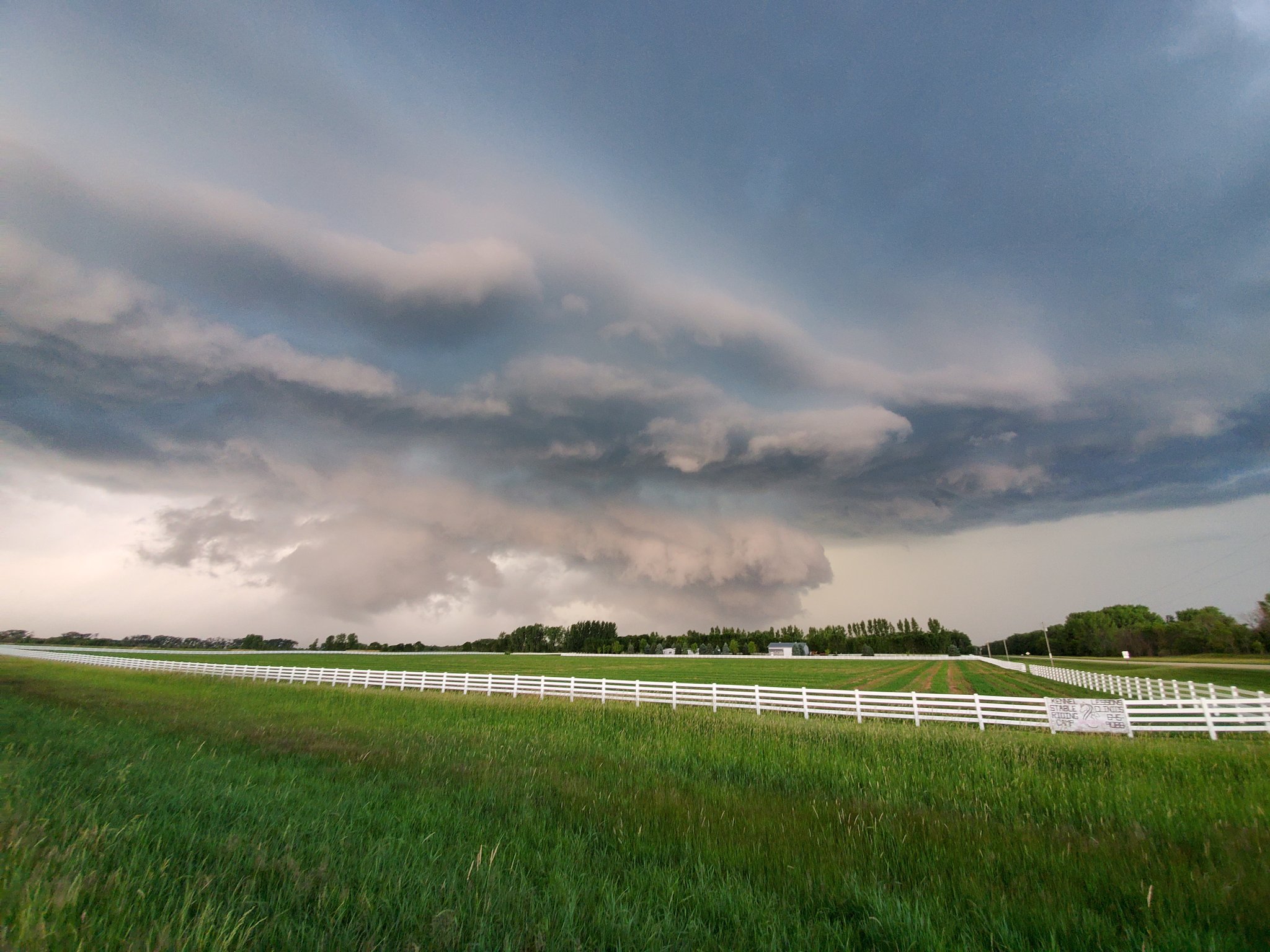
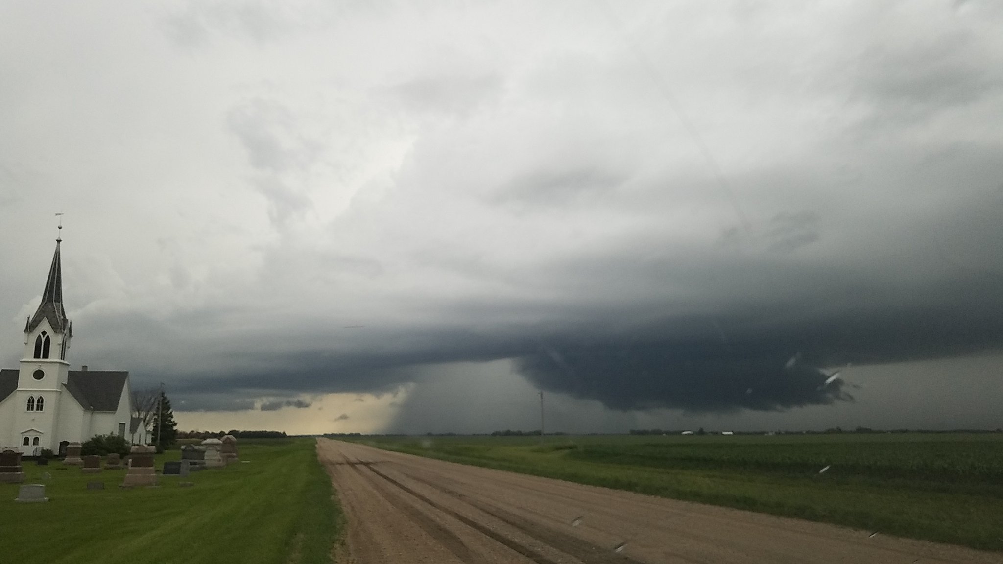
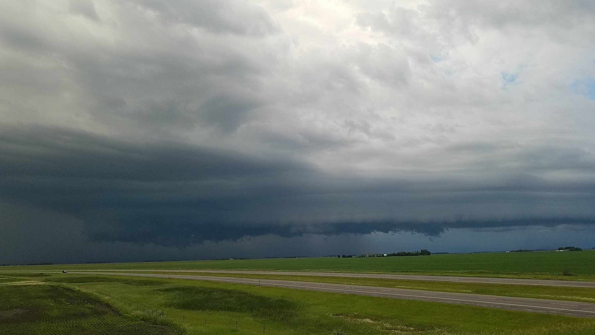
| Updraft base of a strong supercell near Kindred, ND. (Courtesy Jason Bednar) |
The same updraft base slightly later near Kindred, ND. (Courtesy Jason Bednar) |
A well defined wall cloud near Nome, ND. (Courtesy Jason Bednar) |
The same wall cloud as it approached Nome, ND a little while later. (Courtesy Jason Bednar) |
 |
 |
 |
 |
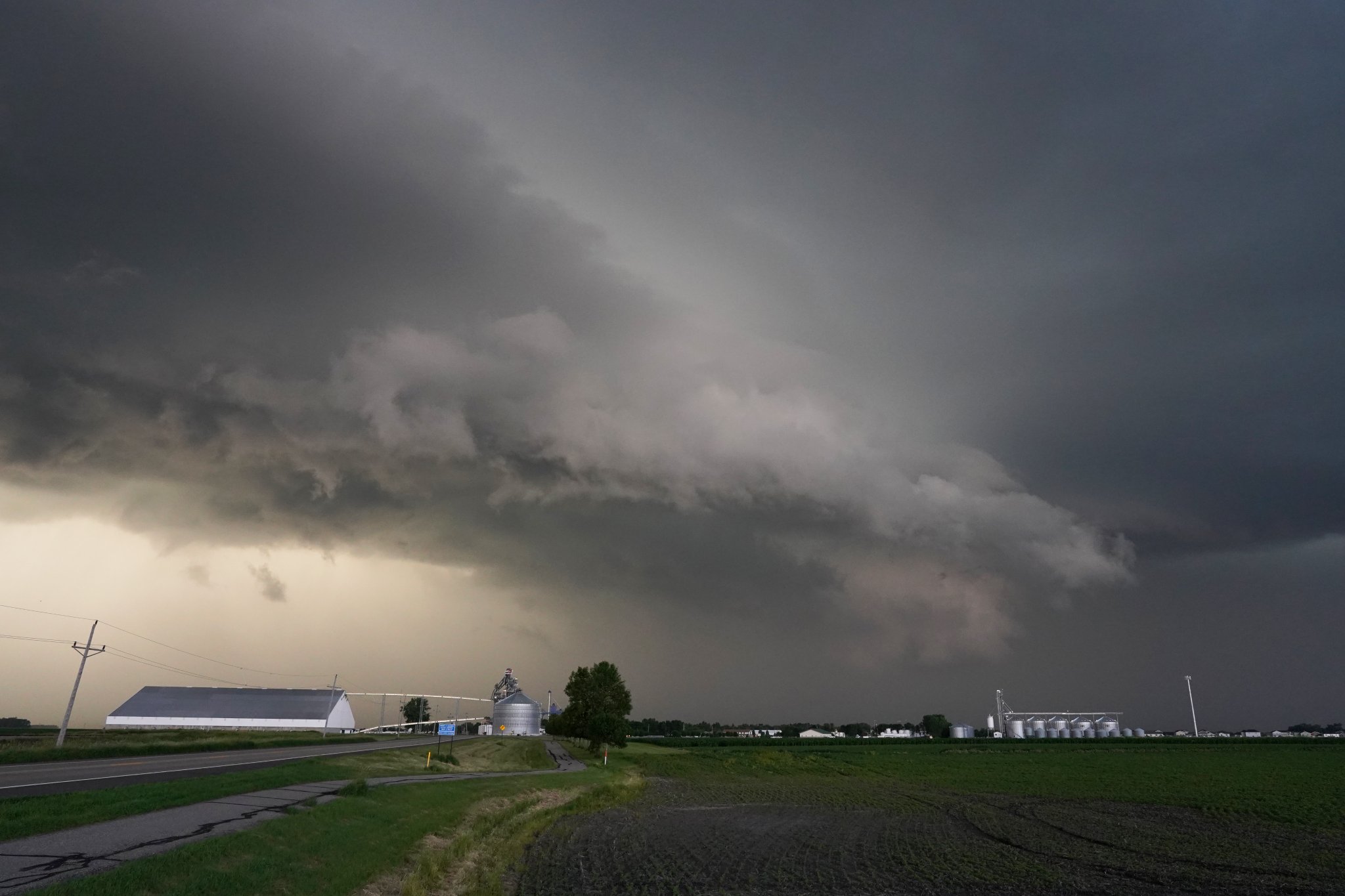
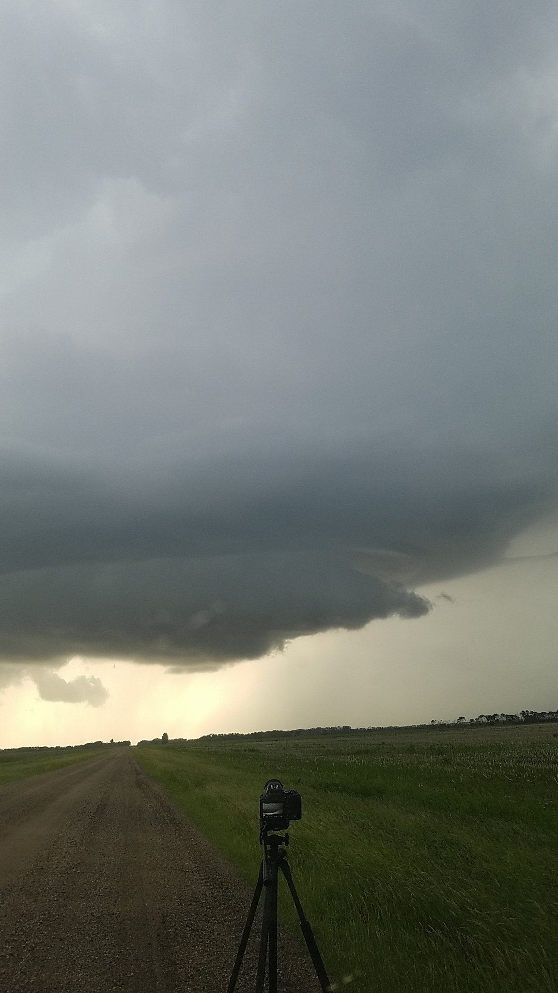
| A storm near Hatton, ND trying to restrengthen and develop a new wall cloud. (Courtesy Ben Remington) |
The Hatton, ND storm a little while later struggling to maintain an updraft base as the storm became outflow dominant. (Courtesy Ben Remington) |
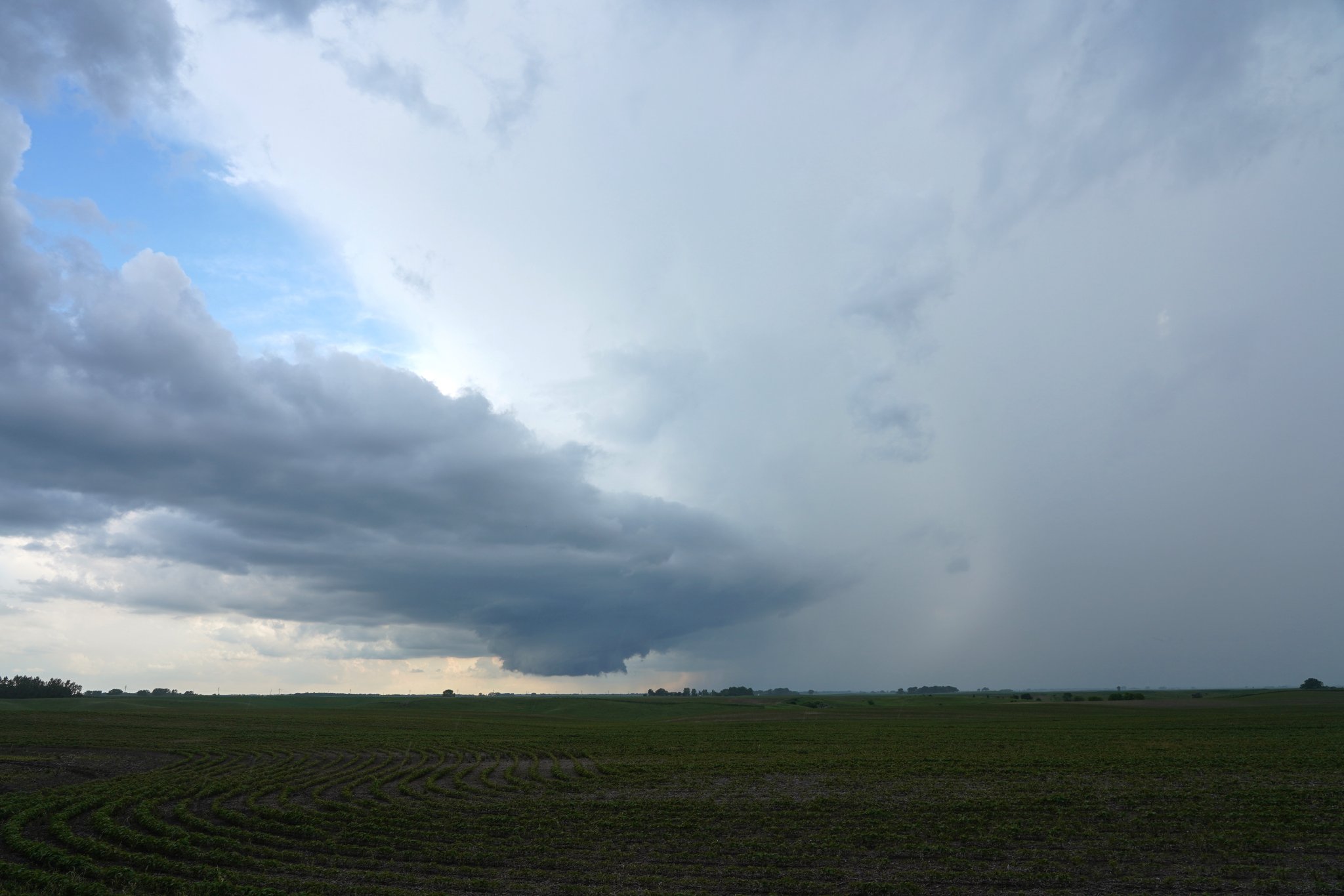
The updraft base of a strong left split supercell as it approached the I-29 corridor near Gardner. (Courtesy Ben Remington) |
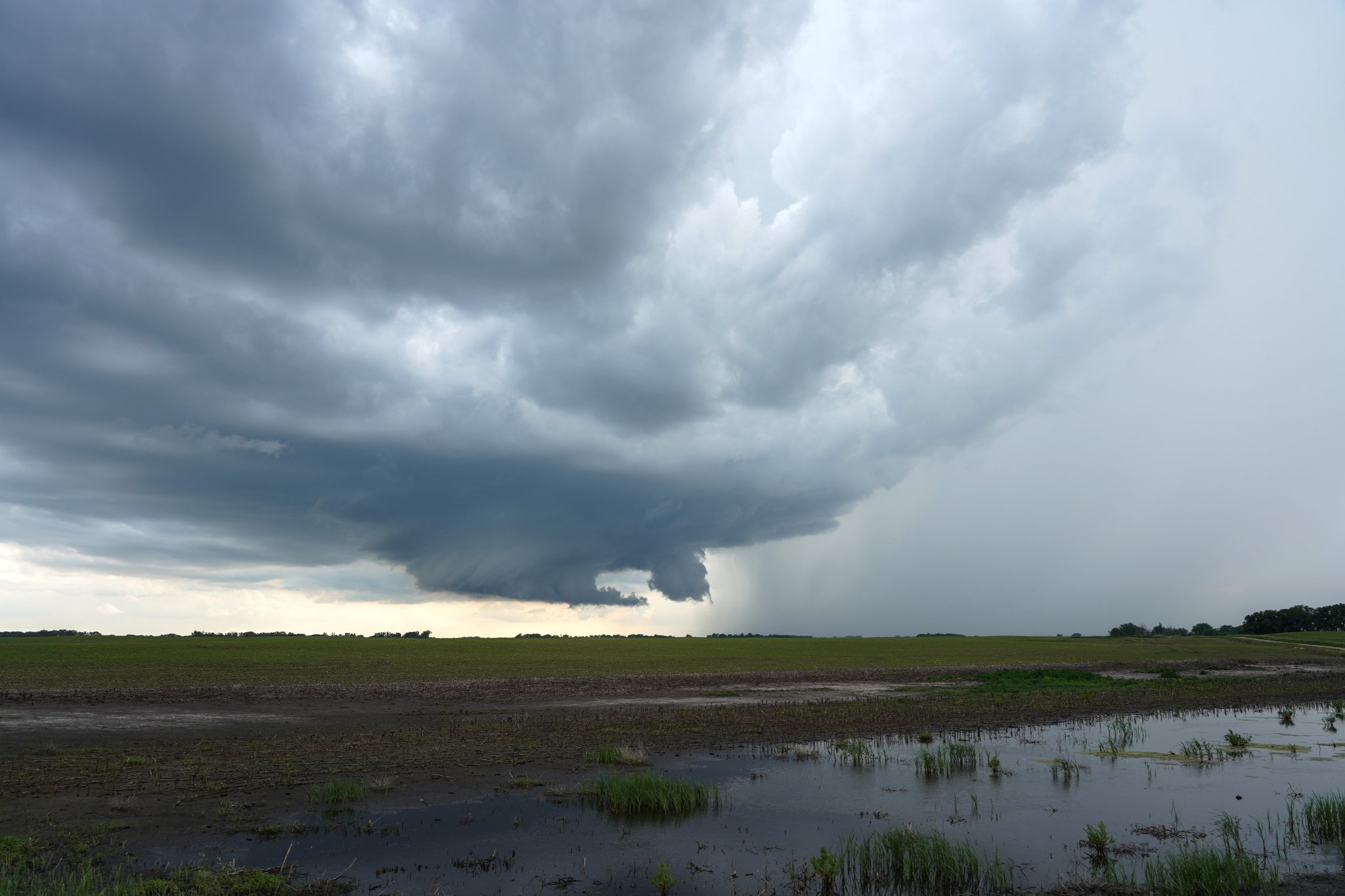
Updraft base and rear flank downdraft taken east of Jamestown, ND along I-94. (Courtesy Adam Bjornberg) |
Radar
Radar imagery from 4 PM July 3 to 4 AM July 4, 2019
4:00 p.m. to 10:00 p.m. on July 3rd
10:00 p.m. July 3rd to 4:00 a.m. on July 4th
Environment & Synoptic Review
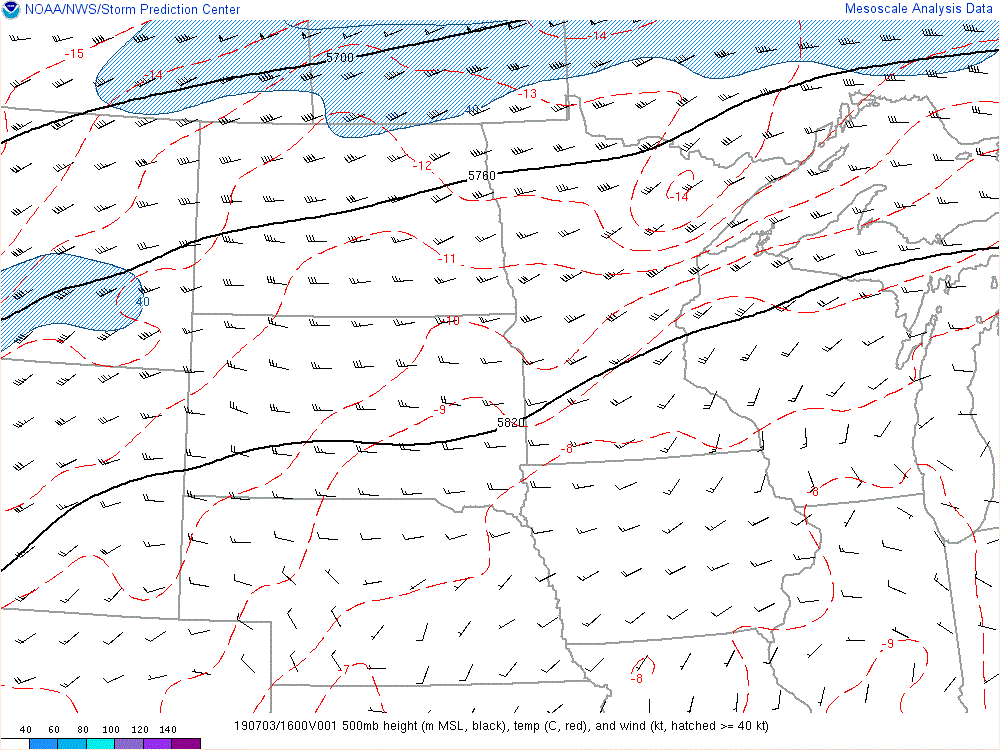
By the afternoon of July 3rd, 2019 two surface boundaries were identified as possible sources of storm initiation later in the evening. The first was a weak warm front across far southeast ND, northeast SD, and western MN. This boundary was in place largely as the result of an old outflow boundary from the previous night's widespread, but fairly weak, thunderstorms and rain showers that had moved through the region. To the south of this boundary, surface dewpoints climbed into the 70s with temperatures warming into the mid 80s. Further to the north, a more distinct synoptic warm front was present that separated the warmer/moist air to the south from cooler, more stable air to the north. These features can all be seen in Figure 4, and the synoptic warm front can also be seen in the mid level temperature and wind fields in Figure 3.
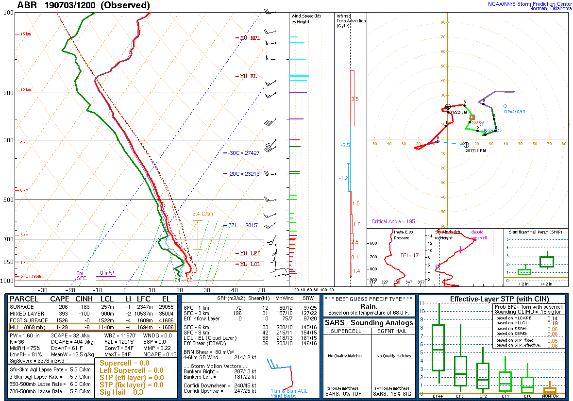
Although these boundaries were in place, capping in place over the region helped keep storms at bay through the afternoon as moisture pushed north and temperatures climbed from daytime heating (This weak capping can be seen in the morning upper air soundings from Aberdeen, SD and International Falls, MN (Figures 9 and 10). This led to a build up of instability by the early evening hours (Figure 5).
With the atmosphere primed, a forcing for ascent was needed to kick off thunderstorms. This came in the form of a fairly subtle and weak upper level low that propagated from western ND northeastward into southern Manitoba. This feature can be observed in Figure 1 as the upper level heights fall and winds strengthen through the evening as well as in Figure 2 as a weak wave moves eastward. As this upper level forcing for ascent moved over the lower level forcing for ascent (i.e. the surface boundaries and synoptic warm front) the combined lift was strong enough to initiate storms.
Storms that developed in the Devils Lake region quickly began to experience storm interactions since the deep layer winds were pushing storms along the initiating boundary and into nearby developing storms. This allowed much of this convection to be sub-severe, but a single storm managed to develop just ahead of nearby convection and strengthen to severe limits, dropping 1" hail. This storm eventually moved southeastward towards the Hatton, ND area as it strengthened and is pictured above.
To the south, storms began to develop along the weak surface warm front/remnant outflow boundary. Thanks to weaker forcing for ascent along this boundary, only one to two storms developed in this region and were able to remain discrete for an extended period as they moved to the east. One particular supercell from this region was able to develop a well defined wall cloud (pictured above) and produced severe hail. Later on, this storm split into a left-moving and right-moving supercell, just barely missing the Fargo/Moorhead metro while producing minor wind damage near Oxbow, ND and severe hail near Argusville, ND.
To the east across Minnesota, storms struggle to develop and maintain strength thanks to increasing cloud cover, greater capping, and weaker forcing for ascent. However, one storm near Bemidji, MN managed to maintain strength as it moved northeast and produced 1" hail and a brief funnel cloud.
A final cluster of severe thunderstorms moved across south central to southeastern North Dakota after sunset, but the loss of daytime heating and weakening wind shear helped diminish the severe threat, and by midnight all strong thunderstorms had weakened or moved out of the region.
 |
.gif) |
.gif) |
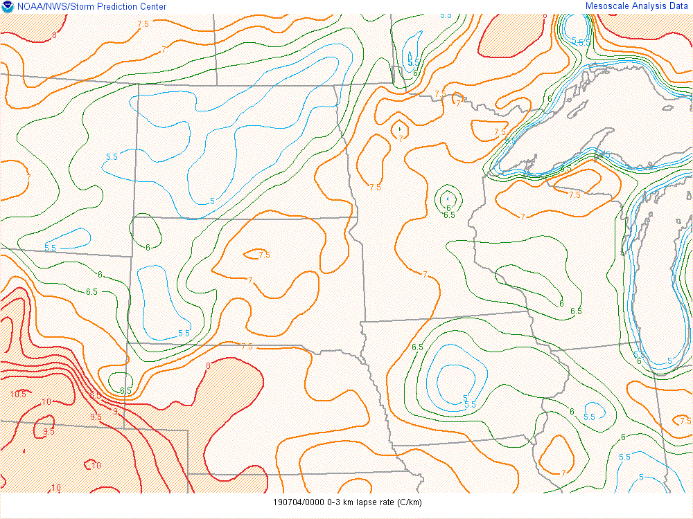
| Figure 1: 500 mb height, winds, and temperatures | Figure 2: 700 mb heights, winds, temperature, and RH | Figure 3: 850 mb heights, winds, temperatures, and dewpoints |
.gif) |
.gif) |
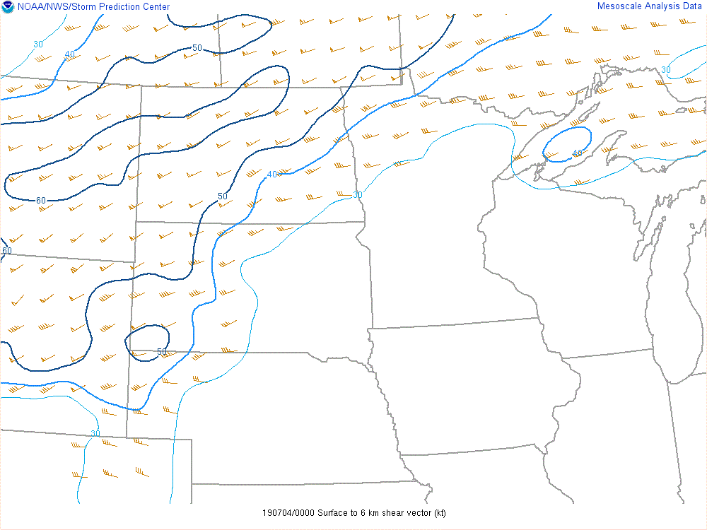 |
| Figure 4: MSLP, surface temperature, dewpoints, and wind | Figure 5: Mixed-Layer CAPE and Mixed-Layer CIN | Figure 6: 0-6 km Bulk Shear at 7 PM July 3rd, 2019 |
 |
 |
 |
 |
| Figure 7: Mid level lapse rates at 7 PM July 3rd, 2019 | Figure 8: Low level lapse rates at 7 PM July 3rd, 2019 | Figure 9: 7 AM upper air sounding from Aberdeen, SD | Figure 10: 7 AM upper air sounding from International Falls, MN |
 |
Media use of NWS Web News Stories is encouraged! Please acknowledge the NWS as the source of any news information accessed from this site. |
|

