Overview
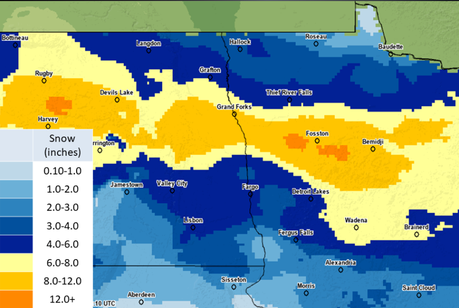
A Winter Storm that transitioned to a Blizzard (for portions of the area) brought a swatch of 6-12 inches of snow, mainly along the Highway 2 corridor, from 6 pm on 12/4/2021 to 6 am on 12/6/2021. Isolated areas west of Bemidji saw the highest amounts, near 14 inches. The snow was associated with strong frontogenesis and warm air advection. This band of heavier snowfall amounts was tricky to pinpoint, as the frontogenesis axis was finite and it shifted with multiple ensemble runs. The system started out with lower wind gusts (near 30 mph at times), but these later grew to 50 to 55 mph as the surface low passed through the area. The stronger wind gusts caused whiteout conditions within the Red River Valley Sunday night, which resulted in the closure of Interstate 29. Snow began to decrease along with wind gusts early Monday morning.
Snow
Snow totals from 6 pm, Saturday, December 4, 2021 to 6 am, Monday, December 6, 2021. Note that these totals are preliminary and may not be exact in all areas. Snow measurement is extremely difficult during high wind events.
000
NWUS53 KFGF 061933
LSRFGF

PRELIMINARY LOCAL STORM REPORT...SUMMARY
NATIONAL WEATHER SERVICE GRAND FORKS ND
133 PM CST MON DEC 6 2021

..TIME...   ...EVENT...      ...CITY LOCATION...     ...LAT.LON...
..DATE...   ....MAG....      ..COUNTY LOCATION..ST.. ...SOURCE....
            ..REMARKS..

0700 AM     HEAVY SNOW       LARIMORE                47.91N 97.62W
12/06/2021  M14.7 INCH       GRAND FORKS        ND   COCORAHS

            STORM TOTAL. COCORAHS STATION ND-GF-23
            LARIMORE ND 0.4 SE.

0700 AM     HEAVY SNOW       3 NNW LAKE GEORGE       47.25N 95.01W
12/06/2021  M13.0 INCH       HUBBARD            MN   COCORAHS

            STORM TOTAL. COCORAHS STATION MN-HB-6
            LAPORTE 12.0 W.

0630 AM     HEAVY SNOW       1 ENE CROOKSTON         47.78N 96.59W
12/06/2021  M11.0 INCH       POLK               MN   COCORAHS

            STORM TOTAL. COCORAHS STATION MN-PK-13
            CROOKSTON MN 0.6 ENE.

0700 AM     HEAVY SNOW       4 E LAVINIA             47.52N 94.72W
12/06/2021  M10.4 INCH       BELTRAMI           MN   COCORAHS

            STORM TOTAL. COCORAHS STATION MN-BM-15
            BEMIDJI MN 7.8 ENE.

0700 AM     HEAVY SNOW       4 SSE GRAND FORKS       47.87N 97.05W
12/06/2021  M8.0 INCH        GRAND FORKS        ND   COCORAHS

            STORM TOTAL. COCORAHS STATION ND-GF-13 GRAND
            FORKS ND 3.7 SSE.

0800 AM     HEAVY SNOW       DEER CREEK              46.39N 95.32W
12/06/2021  M8.0 INCH        OTTER TAIL         MN   COCORAHS

            STORM TOTAL. COCORAHS STATION MN-OT-42 DEER
            CREEK 0.1 WNW.

0635 AM     HEAVY SNOW       1 SSW OTTERTAIL         46.42N 95.57W
12/06/2021  M7.5 INCH        OTTER TAIL         MN   CO-OP OBSERVER

            STORM TOTAL. CO-OP OBSERVER STATION OTTM5
            OTTERTAIL MN.

0700 AM     HEAVY SNOW       5 SSW BLABON            47.34N 97.83W
12/06/2021  M6.6 INCH        STEELE             ND   COCORAHS

            STORM TOTAL. COCORAHS STATION ND-ST-3 HOPE
            ND 5.4 WNW.

0700 AM     HEAVY SNOW       4 WNW PISEK             48.33N 97.80W
12/06/2021  M6.0 INCH        WALSH              ND   CO-OP OBSERVER

            STORM TOTAL. CO-OP OBSERVER STATION LNKN8
            LANKIN ND 6 E.

0700 AM     HEAVY SNOW       SEBEKA                  46.63N 95.08W
12/06/2021  M6.0 INCH        WADENA             MN   CO-OP OBSERVER

            STORM TOTAL. CO-OP OBSERVER STATION SEBM5
            SEBEKA MN.

0500 AM     SNOW             MICHIGAN                48.03N 98.13W
12/06/2021  M5.5 INCH        NELSON             ND   CO-OP OBSERVER

            STORM TOTAL. CO-OP OBSERVER STATION MCEN8
            MICHIGAN ND.

0730 AM     SNOW             3 ENE RICHWOOD          47.00N 95.77W
12/06/2021  M5.3 INCH        BECKER             MN   COCORAHS

            STORM TOTAL. COCORAHS STATION MN-BK-19
            CALLAWAY 7.0 E.

0700 AM     SNOW             5 ESE ANGUS             48.06N 96.61W
12/06/2021  M5.0 INCH        POLK               MN   COCORAHS

            STORM TOTAL. COCORAHS STATION MN-PK-21
            EUCLID MN 6.2 NNE.

0700 AM     SNOW             1 NW PRAIRIE ROSE       46.83N 96.85W
12/06/2021  M5.0 INCH        CASS               ND   COCORAHS

            STORM TOTAL. COCORAHS STATION ND-CS-1 WEST
            FARGO ND 3.8 SSE.

0700 AM     SNOW             5 NNW CORMORANT         46.80N 96.12W
12/06/2021  M4.9 INCH        BECKER             MN   COCORAHS

            STORM TOTAL. COCORAHS STATION MN-BK-6 LAKE
            PARK MN 6.0 S.

1159 PM     SNOW             3 S FARGO               46.83N 96.82W
12/05/2021  M4.6 INCH        CASS               ND   CO-OP OBSERVER

            STORM TOTAL.

0700 AM     SNOW             2 NNE MOORHEAD          46.89N 96.75W
12/06/2021  M4.6 INCH        CLAY               MN   COCORAHS

            STORM TOTAL. COCORAHS STATION MN-CY-1
            MOORHEAD MN 2.0 N.

0622 AM     SNOW             5 W DUNVILLA            46.66N 96.11W
12/06/2021  M4.5 INCH        OTTER TAIL         MN   COCORAHS

            STORM TOTAL. COCORAHS STATION MN-OT-6
            PELICAN RAPIDS MN 6.3 NNW.

0845 AM     SNOW             SABIN                   46.78N 96.66W
12/06/2021  M4.4 INCH        CLAY               MN   CO-OP OBSERVER

            STORM TOTAL. CO-OP OBSERVER STATION SBNM5
            SABIN MN.

0700 AM     SNOW             4 SSE BATTLE LAKE       46.24N 95.70W
12/06/2021  M4.3 INCH        OTTER TAIL         MN   COCORAHS

            STORM TOTAL. COCORAHS STATION MN-OT-36
            BATTLE LAKE MN 3.3 SSE.

0607 AM     SNOW             MOORHEAD                46.86N 96.76W
12/05/2021  M4.0 INCH        CLAY               MN   BROADCAST MEDIA

            .

0700 AM     SNOW             4 N MUSKODA             46.92N 96.41W
12/06/2021  M4.0 INCH        CLAY               MN   COCORAHS

            STORM TOTAL. COCORAHS STATION MN-CY-20
            HAWLEY MN 5.2 WNW.

0700 AM     SNOW             LISBON                  46.43N 97.68W
12/06/2021  M3.7 INCH        RANSOM             ND   CO-OP OBSERVER

            STORM TOTAL. CO-OP OBSERVER STATION LISN8
            LISBON ND.

0700 AM     SNOW             4 NE BRECKENRIDGE       46.30N 96.52W
12/06/2021  M3.5 INCH        WILKIN             MN   CO-OP OBSERVER

            STORM TOTAL. CO-OP OBSERVER STATION BKEM5
            BRECKENRIDGE MN 3 SE.

0700 AM     SNOW             1 WSW LIDGERWOOD        46.07N 97.17W
12/06/2021  M3.5 INCH        RICHLAND           ND   CO-OP OBSERVER

            STORM TOTAL. CO-OP OBSERVER STATION LGRN8
            LIDGERWOOD ND.

0800 AM     SNOW             WARREN                  48.20N 96.78W
12/06/2021  M3.5 INCH        MARSHALL           MN   CO-OP OBSERVER

            STORM TOTAL. CO-OP OBSERVER STATION WAAM5
            WARREN MN.

0700 AM     SNOW             1 ESE LANGDON           48.76N 98.34W
12/06/2021  M2.7 INCH        CAVALIER           ND   COCORAHS

            STORM TOTAL. COCORAHS STATION ND-CV-4
            LANGDON ND 1.4 ESE.

0700 AM     SNOW             GREENBUSH               48.70N 96.18W
12/06/2021  M2.3 INCH        ROSEAU             MN   CO-OP OBSERVER

            STORM TOTAL. CO-OP OBSERVER STATION GBHM5
            GREENBUSH MN.


&&

$$
Watches & Warnings
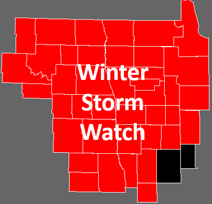
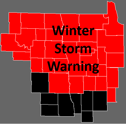
The first Winter Storm Watch for the event was issued at 322 AM CST on Friday, December 3rd. The first Winter Storm Warning was issued at 352 AM CST on Saturday, December 4th. Finally, the first Blizzard Warning was issued at 604 PM CST on Sunday, December 5th. All warnings expired at 3 AM CST on Monday, December 6th.
 |
 |
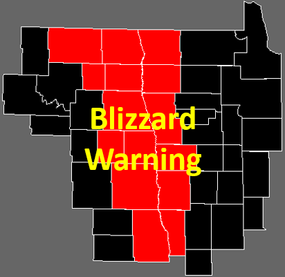 |
| Figure 1: Final Winter Storm Watch area | Figure 2: Final Winter Storm Warning area | Figure 3: Final Blizzard Warning area |
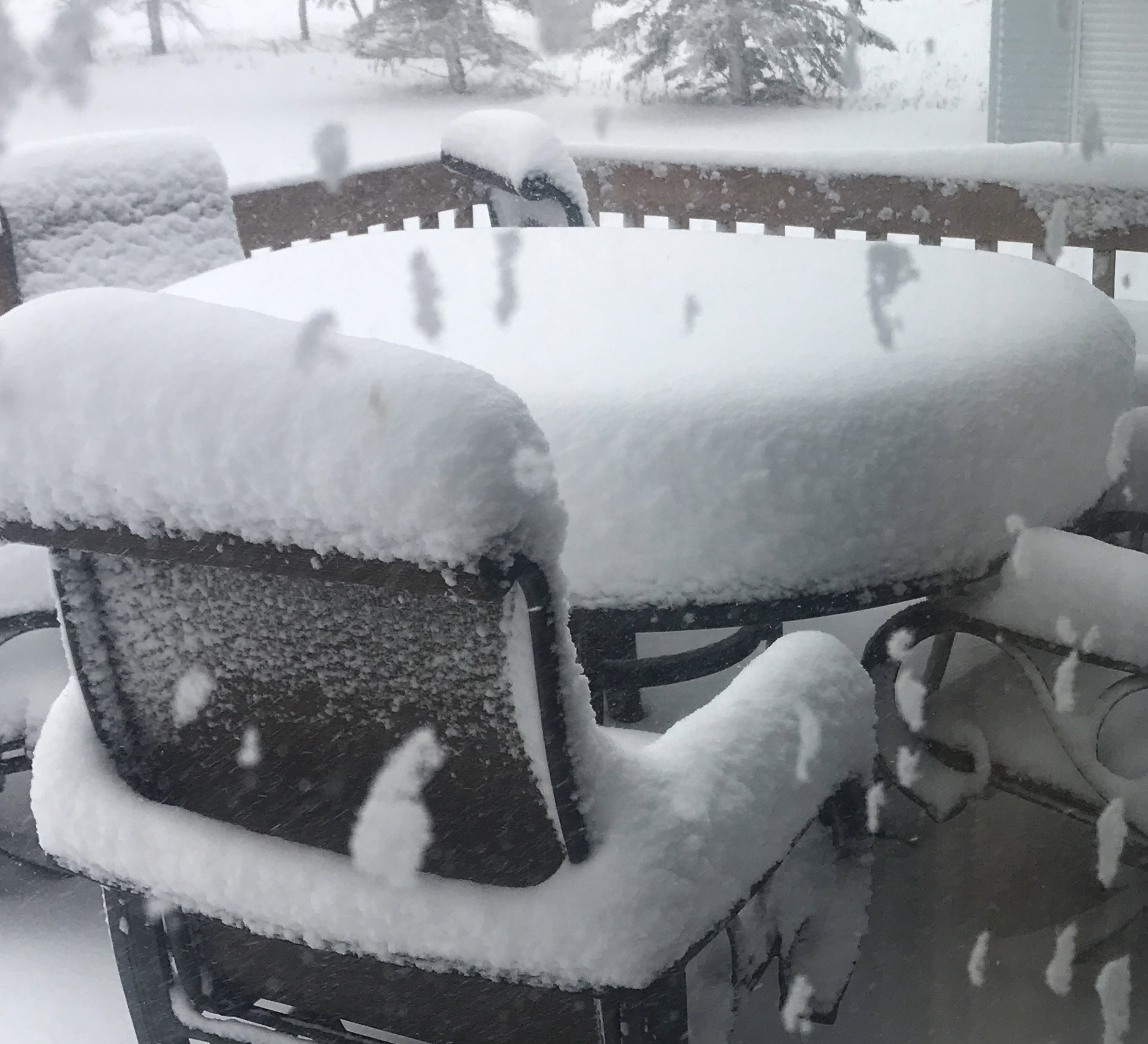
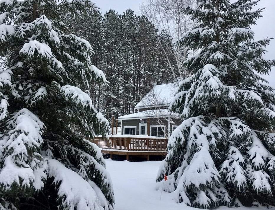
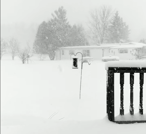
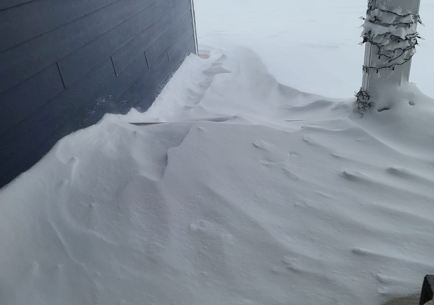
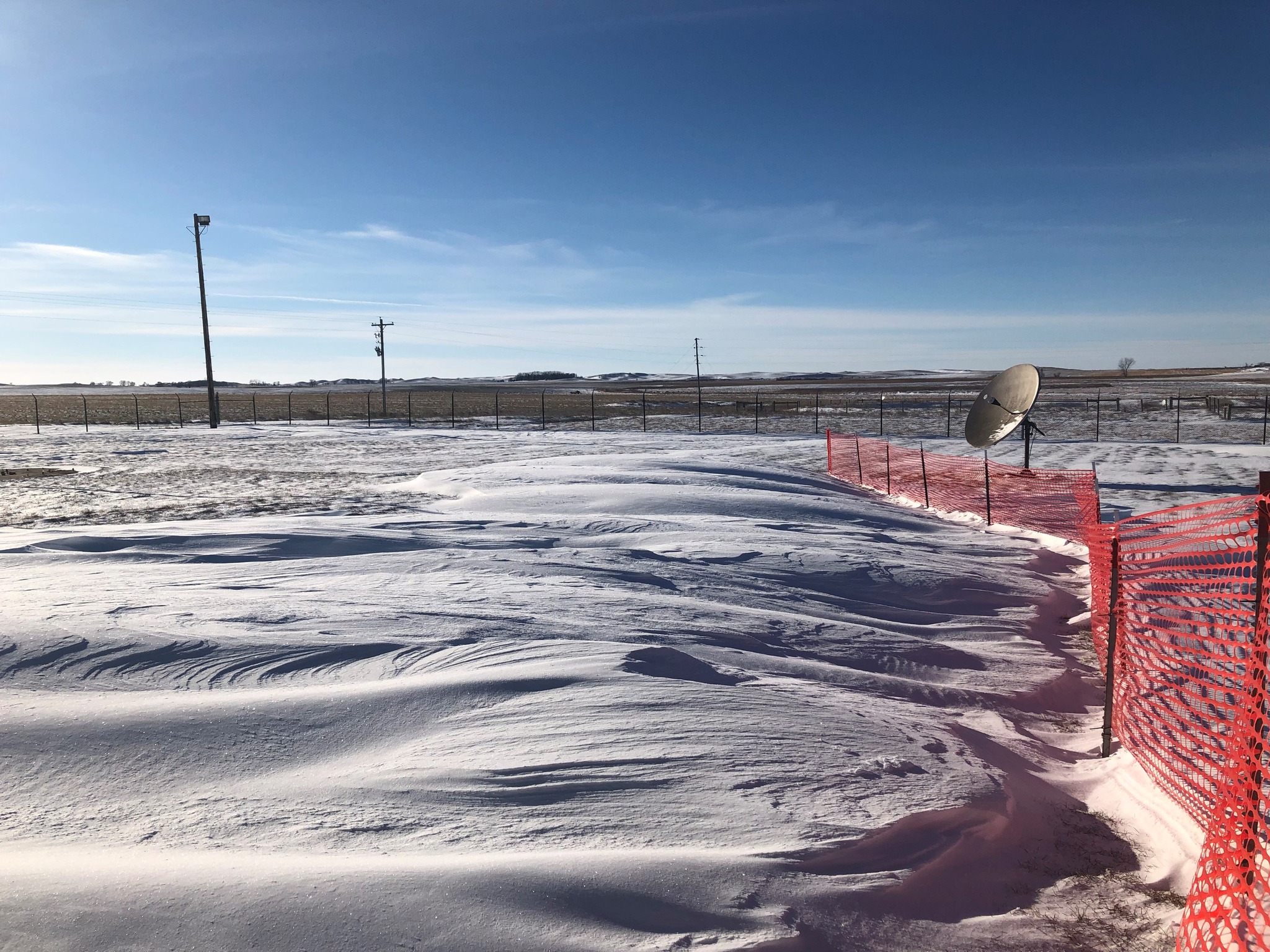
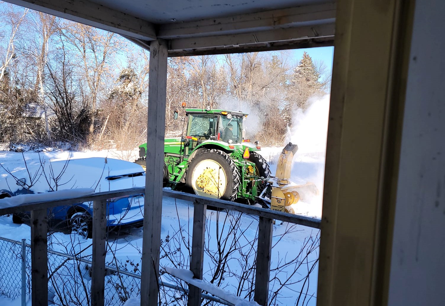
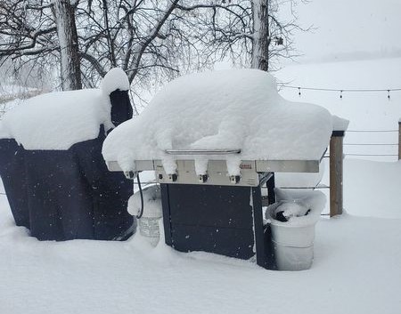
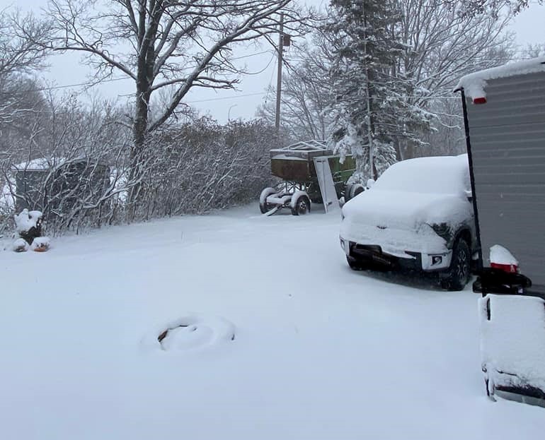
Photos
 |
 |
 |
 |
| Near Devils Lake, ND (Courtesy: Marla Luehring) |
Roosevelt, MN (Courtesy: David Hagebeck) |
Bemidji, MN (Courtesy: Michael Patrick Miller) |
South Grand Forks (Courtesy: Cassie Campbell) |
 |
 |
 |
 |
| Near Cooperstown, ND (Courtesy: Rob Branting) |
Inkster, ND (Courtesy: Mike Salinas) |
Erskine, MN (Courtesy: Fawn Bruggeman) |
Red Lake Falls, MN (Courtesy: Jennifer Lopez) |
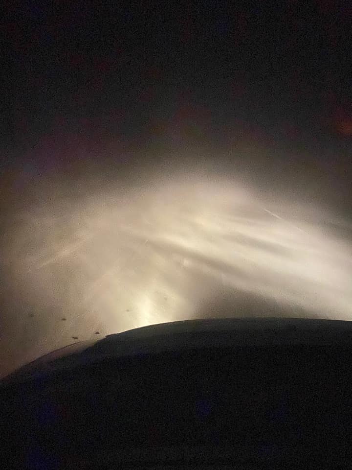 |
Blizzard Conditions Sunday evening between Wyndmere and Lidgerwood, ND.(Courtesy of Stephanie Cameron) |
Radar
Regional radar during the winter storm.
Radar loop from 12:00 PM. to 6:00 PM. on December 4th
Radar loop from 6:00 PM. to 12:00 AM. on December 4th
Radar loop from 12:00 PM. to 6:00 AM. on December 5th
Radar loop from 6:00 AM. to 12:00 PM. on December 5th
Radar loop from 12:00 PM. to 6:00 PM. on December 5th
Storm Reports
Public Information Statement
National Weather Service Grand Forks ND
1026 AM CST Mon Dec 6 2021

...HIGHEST WIND REPORTS (40 MPH OR GREATER)...

Location                     Speed     Time/Date       Provider
Fargo AP ND                  56 MPH    0835 PM 12/05   ASOS
Grand Forks AP ND            56 MPH    0617 PM 12/05   ASOS
E Grand Forks MN 6 SE        54 MPH    0841 PM 12/05   MNDOT
Wahpeton AP ND               52 MPH    0835 PM 12/05   AWOS
Donaldson MN 1 W             50 MPH    0950 PM 12/05   MNDOT
Tenney MN 2 W                50 MPH    0920 PM 12/05   MNDOT
Cooperstown AP ND            49 MPH    0835 PM 12/05   AWOS
Moorhead MN                  49 MPH    0715 PM 12/05   MNDOT
Prosper ND 5 NW              49 MPH    0620 PM 12/05   NDAWN
Crookston AP MN              48 MPH    1135 PM 12/05   AWOS
Dilworth MN 2 S              48 MPH    1020 PM 12/05   MNDOT
Grafton AP ND                48 MPH    0455 PM 12/05   AWOS
Fergus Falls AP  MN          47 MPH    1155 PM 12/05   AWOS
Wahpeton ND 6 N              47 MPH    0830 PM 12/05   NDAWN
Warren MN 6 SW               47 MPH    1235 AM 12/06   NDAWN
Moorhead AP MN               46 MPH    0815 PM 12/05   AWOS
Rothsay MN 0.5 NW            46 MPH    0800 PM 12/05   MNDOT
Bowesmont I-29 MP 196        45 MPH    1027 PM 12/05   NDDOT
Campbell MN 3 SE             45 MPH    0800 PM 12/05   NDAWN
Cavalier AP ND               45 MPH    0435 PM 12/05   AWOS
Eldred MN 2 W                45 MPH    0735 PM 12/05   NDAWN
Langdon AP ND                45 MPH    0435 PM 12/05   AWOS
Hampden ND 3 SE              44 MPH    0458 PM 12/05   RAWS
Kempton ND 6 SE              44 MPH    0500 PM 12/05   NDAWN
Mooreton ND 3 SW             44 MPH    0820 PM 12/05   NDAWN
St Thomas ND 2 WSW           44 MPH    0510 PM 12/05   NDAWN
St Vincent MN 1 E            44 MPH    0740 PM 12/05   MNDOT
Baudette AP MN               43 MPH    1044 PM 12/05   ASOS
Elbow Lake AP MN             43 MPH    0135 AM 12/06   AWOS
Gwinner AP ND                43 MPH    0755 PM 12/05   AWOS
Logan Center ND 2 E          43 MPH    0520 PM 12/05   NDAWN
McHenry ND 8 N               43 MPH    0700 PM 12/05   NDAWN
Crary ND 1 E                 42 MPH    0510 PM 12/05   NDAWN
Dazey ND 2 E                 42 MPH    0610 PM 12/05   NDAWN
Humboldt MN 4 SW             42 MPH    0945 PM 12/05   NDAWN
Pekin ND 2 NE                42 MPH    0655 PM 12/05   NDAWN
Sabin MN 2 NE                42 MPH    0700 PM 12/05   NDAWN
Detroit Lakes AP MN          41 MPH    0155 AM 12/06   AWOS
Kennedy MN 6 W               41 MPH    0950 PM 12/05   NDAWN
Mayville ND 2 E              41 MPH    0610 PM 12/05   NDAWN
Valley City AP ND            41 MPH    0815 PM 12/05   AWOS
Ada MN 1 N                   40 MPH    0725 PM 12/05   NDAWN
Brooks MN 3 S                40 MPH    1105 PM 12/05   MNDOT
Flag Island MN               40 MPH    0115 AM 12/06   AWOS
Hillsboro ND 7 SE            40 MPH    0735 PM 12/05   NDAWN
Park Rapids AP MN            40 MPH    0234 AM 12/06   ASOS
Perley MN 6 E                40 MPH    1140 PM 12/05   NDAWN
Thief River Falls AP MN      40 MPH    1014 PM 12/05   AWOS
Walhalla AP ND               40 MPH    0915 PM 12/05   AWOS

Observations are collected from a variety of sources with varying
equipment and exposures. We thank all volunteer weather observers
for their dedication. Not all data listed are considered official.

$$
Public Information Statement
National Weather Service Grand Forks ND
1041 AM CST Mon Dec 6 2021

...MINIMUM WIND CHILL REPORTS...

Location                     WC Temp.  Time/Date       Provider
Adams ND 5 N                 -36 F     0835 AM 12/06   NDAWN
Edmore ND 3 NW               -35 F     0850 AM 12/06   NDAWN
St Vincent MN 1 E            -34 F     0220 AM 12/06   MNDOT
Donaldson MN 1 W             -34 F     0305 AM 12/06   MNDOT
Crookston AP MN              -34 F     0535 AM 12/06   AWOS
Devils Lake AP ND            -34 F     0556 AM 12/06   AWOS
Flag Island MN               -34 F     0635 AM 12/06   AWOS
Crary ND 1 E                 -34 F     0650 AM 12/06   NDAWN
Langdon ND 1 E               -34 F     0710 AM 12/06   NDAWN
Langdon AP ND                -34 F     0735 AM 12/06   AWOS
Cando AP ND                  -34 F     0855 AM 12/06   AWOS
Badger MN 3 NE               -33 F     0450 AM 12/06   MNDOT
Lake Park MN 0.5 W           -33 F     0535 AM 12/06   MNDOT
Gatzke MN 3 ENE              -33 F     0550 AM 12/06   MNDOT
McHenry ND 8 N               -33 F     0725 AM 12/06   NDAWN
Webster ND 2 N               -33 F     0735 AM 12/06   NDAWN
Hampden ND 3 SE              -33 F     0758 AM 12/06   RAWS
Mahnomen MN 3 SSE            -33 F     0836 AM 12/06   MNDOT
Bemidji AP MN                -33 F     0915 AM 12/06   AWOS
Baker ND 1 N                 -33 F     0930 AM 12/06   NDAWN
Logan Center ND 2 E          -33 F     0950 AM 12/06   NDAWN
Humboldt MN 4 SW             -32 F     0235 AM 12/06   NDAWN
Warren MN 6 SW               -32 F     0420 AM 12/06   NDAWN
E Grand Forks MN 6 SE        -32 F     0431 AM 12/06   MNDOT
Ulen MN 7 SSE                -32 F     0640 AM 12/06   NDAWN
Brooks MN 3 S                -32 F     0700 AM 12/06   MNDOT
Fergus Falls AP  MN          -32 F     0715 AM 12/06   AWOS
Mahnomen AP MN               -32 F     0715 AM 12/06   AWOS
Niles ND 3 SE                -32 F     0735 AM 12/06   NDAWN
Rothsay MN 0.5 NW            -32 F     0800 AM 12/06   MNDOT
Greenbush MN 7 W             -32 F     0815 AM 12/06   NDAWN
Williams MN 6 N              -32 F     0815 AM 12/06   NDAWN
Thief River Falls MN 2 W     -32 F     0825 AM 12/06   AWS
Mavie MN 3 WSW               -32 F     0835 AM 12/06   NDAWN
Wadena AP MN                 -32 F     0915 AM 12/06   AWOS
Fox MN 4 NE                  -32 F     0955 AM 12/06   NDAWN
Thief River Falls AP MN      -31 F     0530 AM 12/06   AWOS
Waukon MN 3 S                -31 F     0620 AM 12/06   NDAWN
Detroit Lakes AP MN          -31 F     0715 AM 12/06   AWOS
Kempton ND 6 SE              -31 F     0800 AM 12/06   NDAWN
Parkers Prairie MN 2 NW      -31 F     0845 AM 12/06   NDAWN
Inkster ND 3 W               -31 F     0850 AM 12/06   NDAWN
Park Rapids AP MN            -31 F     0853 AM 12/06   ASOS
Kennedy MN 6 W               -30 F     0330 AM 12/06   NDAWN
Dazey ND 2 E                 -30 F     0625 AM 12/06   NDAWN
Fosston AP MN                -30 F     0635 AM 12/06   AWOS
Baudette AP MN               -30 F     0721 AM 12/06   ASOS
Pekin ND 2 NE                -30 F     0725 AM 12/06   NDAWN
Warroad AP MN                -30 F     0735 AM 12/06   AWOS
Maddock ND 2 N               -30 F     0745 AM 12/06   NDAWN
Michigan ND 2 W              -30 F     0750 AM 12/06   NDAWN
Roseau MN 11 S               -30 F     0755 AM 12/06   NDAWN
Frazee MN 3 E                -30 F     0805 AM 12/06   CWOP
Perham MN 2 NW               -30 F     0810 AM 12/06   NDAWN
Cooperstown AP ND            -30 F     0815 AM 12/06   AWOS
Shooks MN 0.5 E              -30 F     0905 AM 12/06   MNDOT
Verndale MN 2 NW             -30 F     0945 AM 12/06   MNDOT
Walhalla AP ND               -29 F     0115 AM 12/06   AWOS
Buxton ND 4 ENE              -29 F     0405 AM 12/06   AWS
Moorhead AP MN               -29 F     0535 AM 12/06   AWOS
Tenney MN 2 W                -29 F     0620 AM 12/06   MNDOT
Pine Point MN 2 N            -29 F     0710 AM 12/06   NDAWN
Elbow Lake AP MN             -29 F     0735 AM 12/06   AWOS
Hubbard MN 1 SE              -29 F     0810 AM 12/06   NDAWN
Valley City AP ND            -29 F     0815 AM 12/06   AWOS
Glacial Ridge Portable       -29 F     0832 AM 12/06   RAWS
St Thomas ND 2 WSW           -28 F     0130 AM 12/06   NDAWN
Grafton AP ND                -28 F     0135 AM 12/06   AWOS
Finley ND 1 NNW              -28 F     0220 AM 12/06   NDAWN
Cavalier AP ND               -28 F     0335 AM 12/06   AWOS
Eldred MN 2 W                -28 F     0445 AM 12/06   NDAWN
Ada MN 1 N                   -28 F     0540 AM 12/06   NDAWN
Mayville ND 2 E              -28 F     0700 AM 12/06   NDAWN
Ottertail MN 2 SW            -28 F     0705 AM 12/06   MNDOT
Pillsbury ND 1 N             -28 F     0725 AM 12/06   NDAWN
Grand Forks AP ND            -28 F     0728 AM 12/06   ASOS
Hillsboro ND 7 SE            -28 F     0825 AM 12/06   NDAWN
Galesburg ND 4 SSW           -28 F     0825 AM 12/06   NDAWN
Forest River ND 7 WNW        -28 F     0850 AM 12/06   NDAWN
Staples AP MN                -28 F     0855 AM 12/06   AWOS
Grand Forks ND AFB           -27 F     0234 AM 12/06   ASOS
Perley MN 6 E                -27 F     0435 AM 12/06   NDAWN
Wahpeton ND 6 N              -27 F     0445 AM 12/06   NDAWN
Dilworth MN 2 S              -27 F     0615 AM 12/06   MNDOT
Wahpeton AP ND               -27 F     0615 AM 12/06   AWOS
Hannaford ND 3 N             -27 F     0645 AM 12/06   AWS
Waskish AP MN                -27 F     0655 AM 12/06   AWOS
Stephen MN 1 NE              -27 F     0705 AM 12/06   NDAWN
Hope ND 5 NE                 -27 F     0755 AM 12/06   NDAWN
Campbell MN 3 SE             -27 F     0800 AM 12/06   NDAWN
Chamberlain MN 1 N           -27 F     0805 AM 12/06   MNDOT
Fingal ND 4 W                -27 F     0925 AM 12/06   NDAWN
Grafton ND 10 E              -26 F     0255 AM 12/06   NDAWN
Alvarado MN 5 NNE            -26 F     0350 AM 12/06   AWS
Prosper ND 5 NW              -26 F     0355 AM 12/06   NDAWN
Karlstad MN                  -26 F     0506 AM 12/06   RAWS
Fargo AP ND                  -26 F     0805 AM 12/06   ASOS
Holt MN 15 E                 -26 F     0820 AM 12/06   RAWS
Wadena MN 4 W                -26 F     0920 AM 12/06   NDAWN
Roseau AP MN                 -26 F     1015 AM 12/06   AWOS
Lake Itasca MN 2 SE          -25 F     0707 AM 12/06   RAWS
Red Lake MN                  -25 F     0709 AM 12/06   RAWS
Hendrum MN 4 ENE             -25 F     0721 AM 12/06   MNDOT
Sabin MN 2 NE                -25 F     0750 AM 12/06   NDAWN
Leonard ND 5 N               -25 F     0800 AM 12/06   NDAWN
Bowesmont I-29 MP 196        -24 F     1027 PM 12/05   NDDOT
Kelliher MN 1 W              -24 F     0707 AM 12/06   RAWS
Gwinner AP ND                -24 F     0755 AM 12/06   AWOS
Fort Totten ND 5 ENE         -23 F     0751 AM 12/06   RAWS
Staples MN 2 N               -23 F     0835 AM 12/06   NDAWN
Lisbon ND 2 W                -23 F     0955 AM 12/06   NDAWN
Gonvick MN                   -22 F     0620 AM 12/06   CWOP
Brampton ND 2 WSW            -22 F     0625 AM 12/06   NDAWN
Bagley MN 5 N                -22 F     0738 AM 12/06   CWOP
Cormorant MN 5 NW            -21 F     0640 AM 12/06   AWS
Badoura MN 2 E               -21 F     0706 AM 12/06   RAWS
Barrie ND 2 SW (Ekre)        -21 F     0925 AM 12/06   NDAWN
Arygle MN 12 WNW             -20 F     0145 AM 12/06   CWOP

Observations are collected from a variety of sources with varying
equipment and exposures. We thank all volunteer weather observers
for their dedication. Not all data listed are considered official.

$$
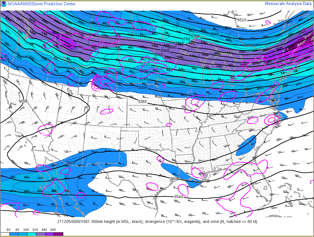
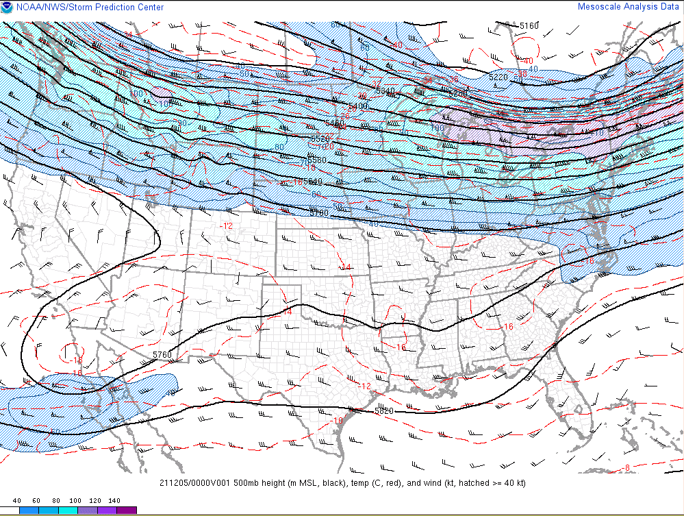
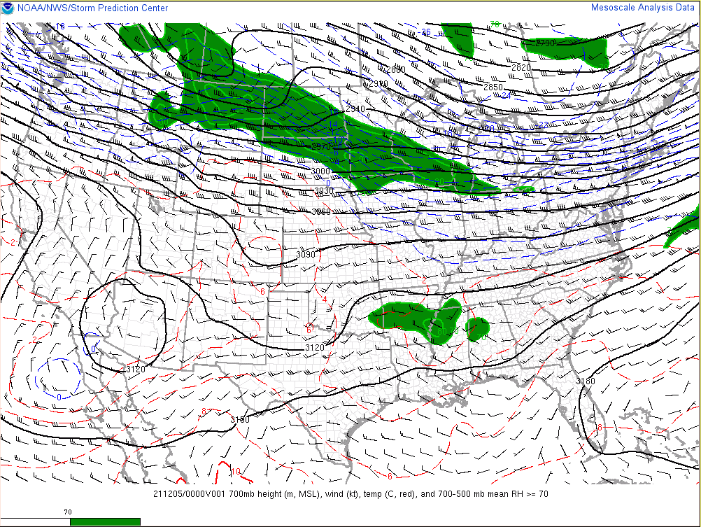
Environment
 |
 |
 |
| 300 mb Analysis (00z 12/5) | 500 mb Analysis (00z 12/5) | 700 mb Analysis (00z 12/5) |
 |
 |
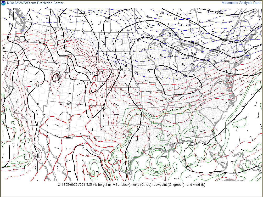 |
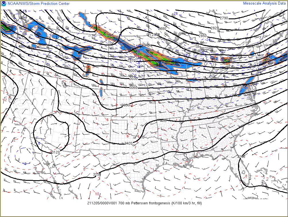
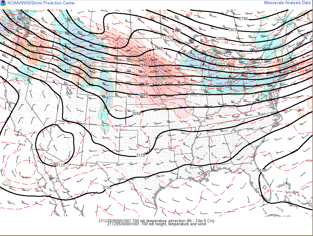
| 700 mb Frontogenesis (00z 12/5) | 700 mb Temperature Advection (00z 12/5) | 900 mb Analysis (00z 12/5) |
 |
 |
 |
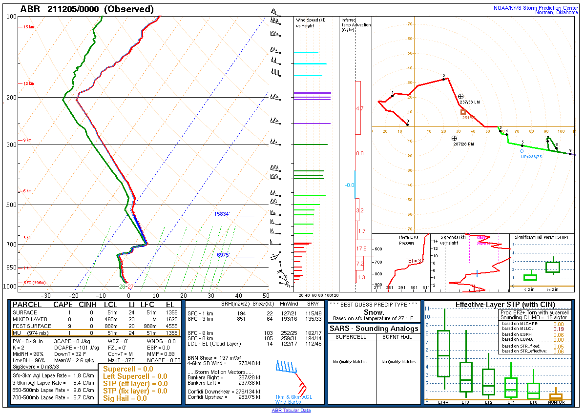
| Surface Analysis (00z 12/5) | Aberdeen, SD Sounding (00z 12/5) | International Falls, MN Sounding (00z 12/5) |
 |
Media use of NWS Web News Stories is encouraged! Please acknowledge the NWS as the source of any news information accessed from this site. |
|

