Overview
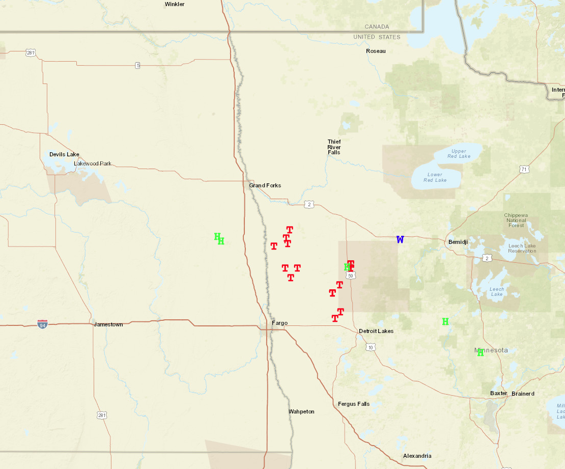
Surface low pressure system tracked across the North Dakota/South Dakota border creating and environment supporting the threat for low top supercells in Southeastern North Dakota into adjacent West Central Minnesota. Several low top supercells developed and tracked along portions of Minnesota Red River Valley. Portions of Norman, Polk, Becker, and Mahnomen counties saw multiple tornadoes. Several uprooted or snapped trees, house/garage/barn, and 2 wooden power were damaged where an EF2 tornado tracked through Mahnomen county along and then just east of Hwy 59. Several other tornadoes tracked through Norman, Becker and western Polk county, but luckily stayed in fields and did little to no damage. Large hail and damaging winds accompanied some of the storms, with quarter size hail being reported in Clearwater, Hubbard, and Wadena counties. Heavy rainfall and training thunderstorms generated flash flooding in Clearwater and Pembina counties during the evening and overnight periods.Tornadoes:
|
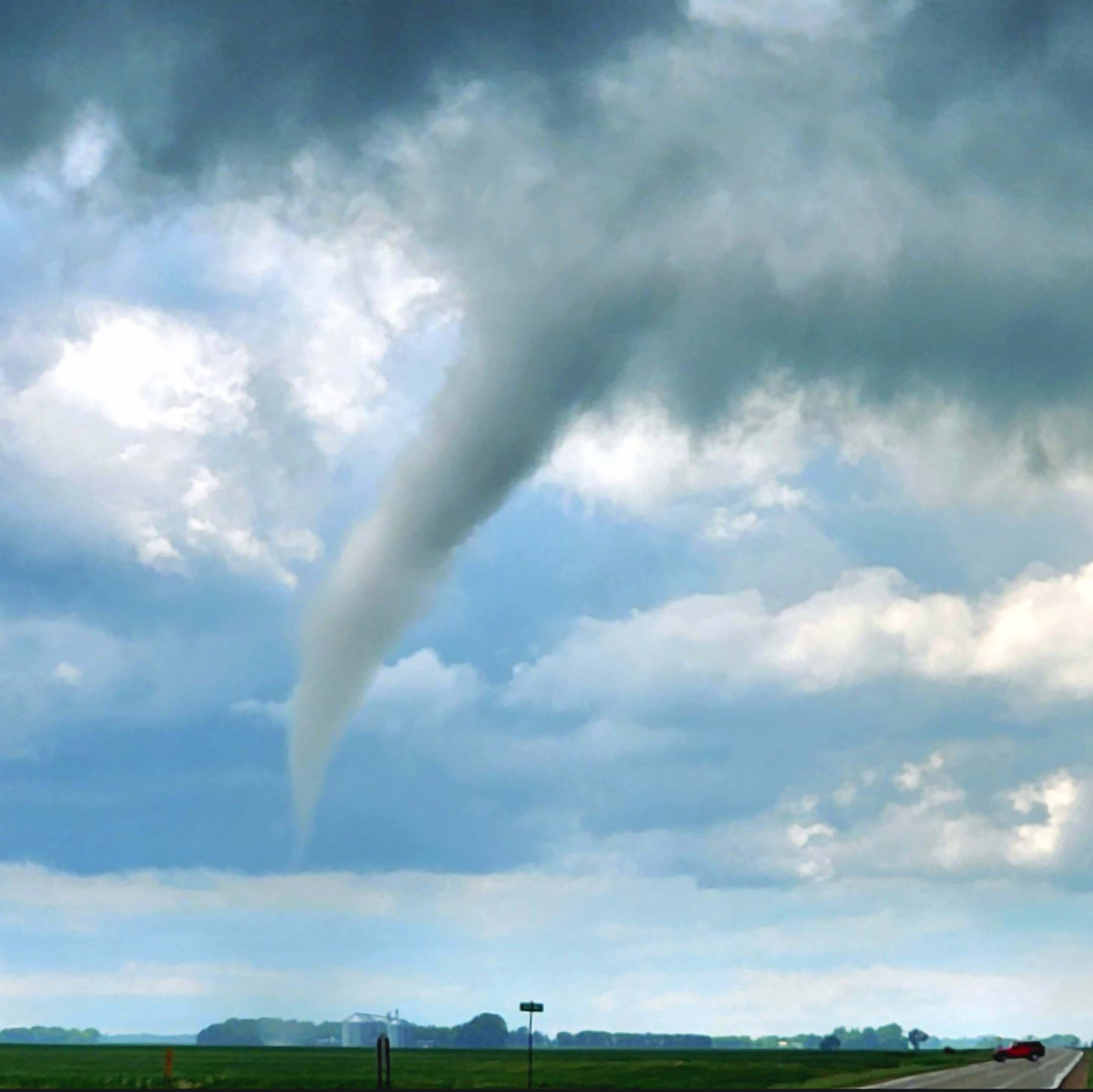
Tornado - Mahnomen
Track Map 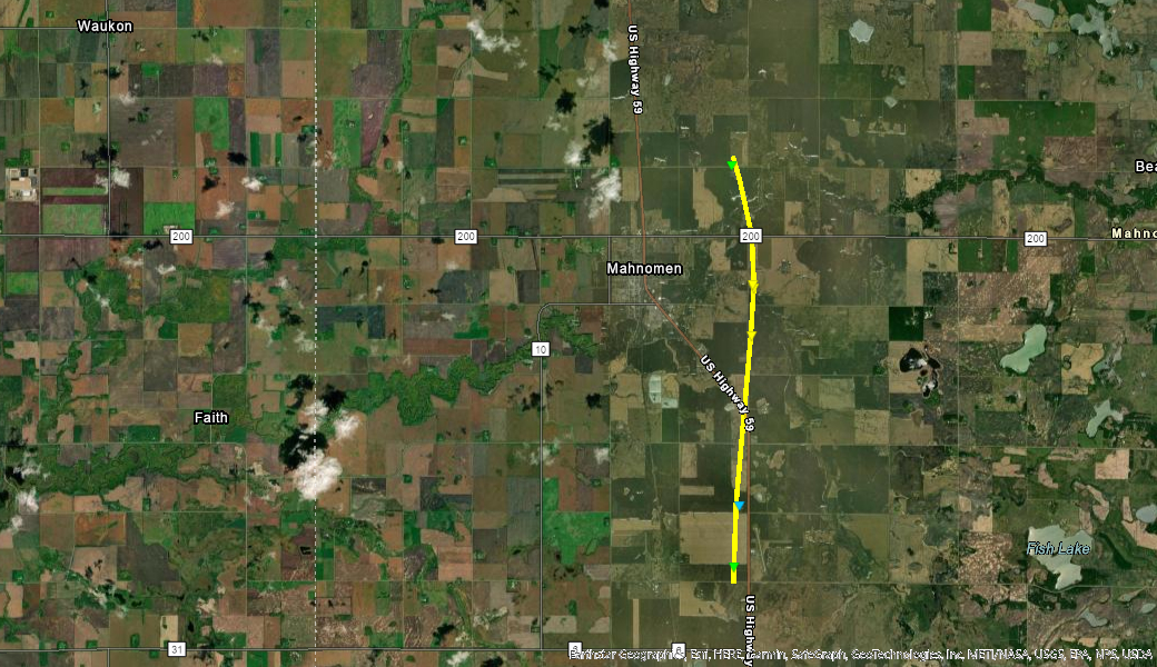 
|
||||||||||||||||
|
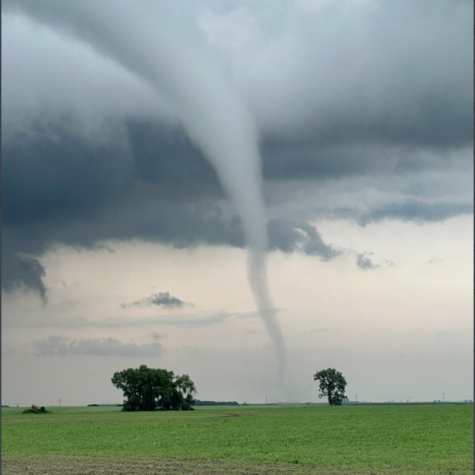
Tornadoes - Rural NW Becker and SW Mahnomen
Approximate Tornado locations 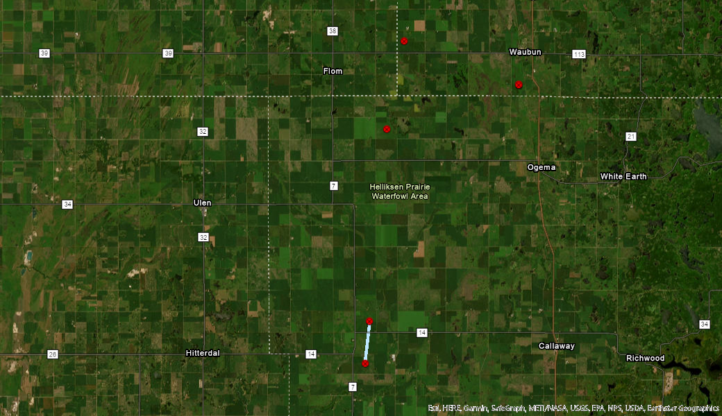
|
||||||||||||||||
|
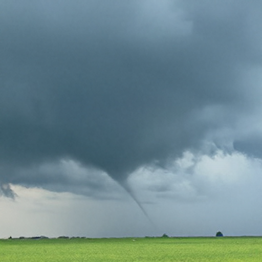
Tornadoes - Rural Norman and SE Polk
Approximate Tornado locations 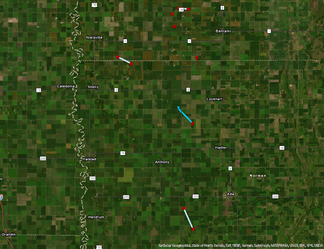
|
||||||||||||||||
The Enhanced Fujita (EF) Scale classifies tornadoes into the following categories:
| EF0 Weak 65-85 mph |
EF1 Moderate 86-110 mph |
EF2 Significant 111-135 mph |
EF3 Severe 136-165 mph |
EF4 Extreme 166-200 mph |
EF5 Catastrophic 200+ mph |
 |
|||||
Photos
.jpg) |
.png) |
.png) |
.png) |
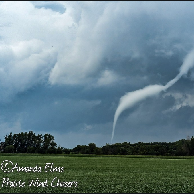
| Tornado near Waubon - Photo Courtesy of Matthew Marshall | Tornado 5NW of Borup,MN - Photo Courtesy of Amanda Elms | Tornado 5m North of Lake Park - Photo Courtesy of Matthew Marshall | Tornado 5miles SW of Beltrami - Photo Courtesy of Nick Wagner |
 |
 |
 |
 |
| Tornado near Borup, MN - Photo Courtesy of Amanda Elms | Tornado 6m West of Callaway MN - Photo Courtesy of Hunter Anderson | Tornado near Lake Park, MN - Photo Courtesy of Cassidy Holth | Tornado near the intersection of Hwy 18 and 140 S looking NE - Photo Courtesy of Dillon Vogt |
Radar
|
|
| Radar Imagery from June 24th, 2023 |
Storm Reports and Rainfall
A large number of tornado reports where reported in west central MN, with just a few hail and damaging winds reports. Damage was reported in Mahnomen county which was caused by a EF2 tornado moving along and then just east of HWY 59.
Here is a summary of reports from the Storm Prediction Center's Storm Reports Page. This is for the entire United States.
Heavy Rainfall accompanied the thunderstorms, with up to 7 inches falling in some locations. Below is a storm total rainfall map including the PNS statement of all rain reports received.
Public Information Statement
National Weather Service Grand Forks ND
926 AM CDT Sun Jun 25 2023

...PRECIPITATION REPORTS...

Location                     Amount    Time/Date       Provider
2 WSW Saint Thomas           7.03 in   0849 AM 06/25   NDAWN
4 NW Crystal                 3.15 in   0854 AM 06/25   NDAWN
Lankin ND 6 E                2.80 in   0600 AM 06/25   COOP
4 NNW Park River             2.80 in   0747 AM 06/25   Public
Mahnomen MN 1 SE             2.77 in   0545 AM 06/25   HADS
2 W Michigan                 2.67 in   0852 AM 06/25   NDAWN
9 NNE Warsaw                 2.63 in   0911 AM 06/25   NDAWN
4 NE Hannaford               2.52 in   0737 AM 06/25   Public
2 WSW Brampton               2.47 in   0851 AM 06/25   NDAWN
5 NE Hope                    2.36 in   0852 AM 06/25   NDAWN
4 SSW Galesburg              2.31 in   0853 AM 06/25   NDAWN
1 NNW Finley                 2.25 in   0853 AM 06/25   NDAWN
Michigan ND                  2.16 in   0500 AM 06/25   COOP
Harwood ND                   2.14 in   0600 AM 06/25   CWOP
Arygle MN 12 WNW             2.14 in   0745 AM 06/25   CWOP
5 N Adams                    2.14 in   0900 AM 06/25   NDAWN
Karlstad MN 1 NE             2.11 in   0506 AM 06/25   RAWS
2 E Dazey                    2.11 in   0855 AM 06/25   Mesonet
Badoura MN 2 E               2.07 in   0506 AM 06/25   RAWS
3 W Inkster                  2.06 in   0856 AM 06/25   NDAWN
3 W Cooperstown              2.05 in   0854 AM 06/25   NDAWN
7 ESE Ulen                   2.04 in   0855 AM 06/25   NDAWN
3 S Waukon                   2.04 in   0856 AM 06/25   NDAWN
Valley City ND 2.0 NW        2.00 in   0700 AM 06/25   COCORAHS
Larimore ND 0.4 SE           1.96 in   0700 AM 06/25   COCORAHS
Mahnomen AP MN               1.96 in   0755 AM 06/25   AWOS
1 SE Hubbard                 1.91 in   0857 AM 06/25   NDAWN
2 W Lisbon                   1.91 in   0857 AM 06/25   NDAWN
3 W Stirum                   1.89 in   0858 AM 06/25   NDAWN
Bagley MN 5 N                1.83 in   0756 AM 06/25   CWOP
1 NE Stephen                 1.83 in   0914 AM 06/25   NDAWN
Fargo AP ND                  1.78 in   0753 AM 06/25   ASOS
6 NNE Hamar                  1.75 in   0722 AM 06/25   Public
5 NW Prosper                 1.73 in   0858 AM 06/25   NDAWN
1 N Ada                      1.73 in   0858 AM 06/25   NDAWN
Mayville ND 4.2 SSE          1.71 in   0700 AM 06/25   COCORAHS
Park Rapids 9.8 NNE          1.70 in   0700 AM 06/25   COCORAHS
Park Rapids 4.9 E            1.68 in   0600 AM 06/25   COCORAHS
Mayville ND                  1.67 in   0700 AM 06/25   COOP
7 WNW Forest River           1.67 in   0909 AM 06/25   NDAWN
2 W Arthur                   1.66 in   0800 AM 06/25   Public
Arygle MN 12 WNW             1.65 in   0515 AM 06/25   CWOP
2 E Logan Center             1.62 in   0859 AM 06/25   NDAWN
Ulen MN 3 WSW                1.61 in   0500 AM 06/25   COCORAHS
Gonvick MN                   1.59 in   0610 AM 06/25   CWOP
2 E Mayville                 1.58 in   0859 AM 06/25   NDAWN
3 NE Northwood               1.56 in   0859 AM 06/25   Mesonet
1 SW Casselton               1.54 in   0901 AM 06/25   NDAWN
Moorhead MN 1 NE             1.53 in   0605 AM 06/25   CWOP
Mahnomen AP MN               1.52 in   0555 AM 06/25   AWOS
Gonvick MN                   1.52 in   0800 AM 06/25   CWOP
Moorhead MN 0.5 W            1.51 in   0700 AM 06/25   COCORAHS
4 W Fingal                   1.48 in   0900 AM 06/25   NDAWN
Lake Park 5.2 SSW            1.41 in   0700 AM 06/25   COCORAHS
Mentor MN 2 SW               1.41 in   0758 AM 06/25   CWOP
Mentor MN 2 SW               1.40 in   0608 AM 06/25   CWOP
Fargo 1.8 S                  1.40 in   0700 AM 06/25   COCORAHS
Casselton ND 0.4 ENE         1.40 in   0700 AM 06/25   COCORAHS
1 NW Ayr                     1.39 in   0901 AM 06/25   NDAWN
Hatton ND 9.1 WSW            1.37 in   0600 AM 06/25   COCORAHS
Lake Park MN 6.0 S           1.36 in   0700 AM 06/25   COCORAHS
4 N Alvarado                 1.36 in   0912 AM 06/25   NDAWN
2 W Eldred                   1.35 in   0902 AM 06/25   NDAWN
Mentor MN 2.5 SSW            1.32 in   0700 AM 06/25   COCORAHS
2 NE Pekin                   1.28 in   0909 AM 06/25   NDAWN
2 SSE Bluffton               1.27 in   0902 AM 06/25   Mesonet
Fargo                        1.26 in   0902 AM 06/25   NDAWN
Alvarado MN 5 NNE            1.23 in   0755 AM 06/25   AWS
Fertile MN 3 WSW             1.22 in   0745 AM 06/25   HADS
1 E Crary                    1.22 in   0903 AM 06/25   NDAWN
2 E Emerado                  1.20 in   0908 AM 06/25   NDAWN
Mentor MN 6 WNW              1.19 in   0532 AM 06/25   RAWS
3 WSW Mavie                  1.17 in   0913 AM 06/25   NDAWN
5 S Fort Totten              1.14 in   0819 AM 06/25   Public
Fargo ND 3 S                 1.13 in   1200 AM 06/25   COOP
Alvarado MN 5 NNE            1.12 in   0605 AM 06/25   AWS
3 S Grand Forks              1.12 in   0910 AM 06/25   NDAWN
2 NE Sabin                   1.10 in   0909 AM 06/25   NDAWN
E Grand Forks MN             1.09 in   0610 AM 06/25   CWOP
AGASSIZ NRW GOODRIDGE 12 NNW 1.08 in   0700 AM 06/25   HADS
Grand Forks AP ND            1.07 in   0553 AM 06/25   ASOS
Park Rapids MN 2.0 NNW       1.07 in   0700 AM 06/25   COCORAHS
3 E Kelso                    1.06 in   0910 AM 06/25   Mesonet
Brooks MN 3 WNW              1.05 in   0745 AM 06/25   HADS
Sheyenne ND 2.7 WSW          1.05 in   0800 AM 06/25   COCORAHS
2 NW Perham                  1.04 in   0912 AM 06/25   NDAWN
Oslo MN 2.7 WNW              1.02 in   0700 AM 06/25   COCORAHS
Brooks MN 3 WNW              1.01 in   0545 AM 06/25   HADS
Frazee MN 3 E                1.01 in   0605 AM 06/25   CWOP

Observations are collected from a variety of sources with varying
equipment and exposures. We thank all volunteer weather observers
for their dedication. Not all data listed are considered official.
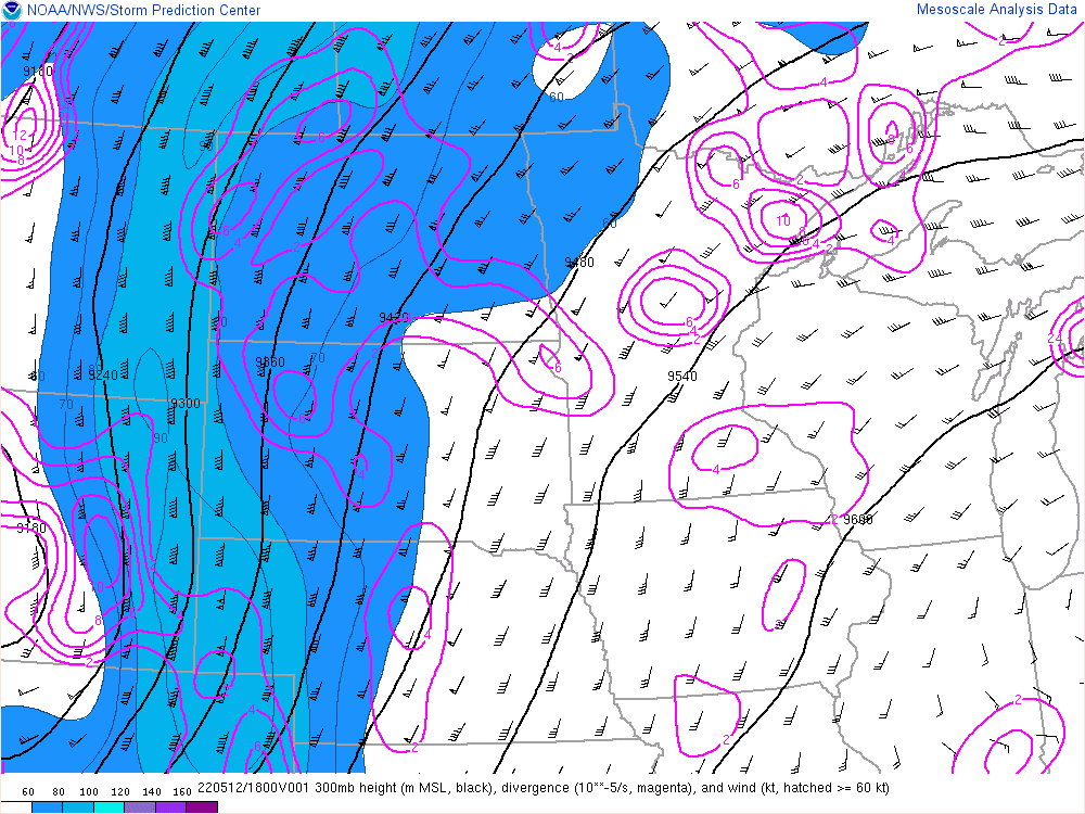
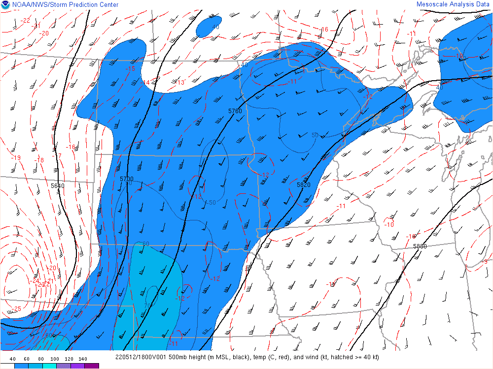
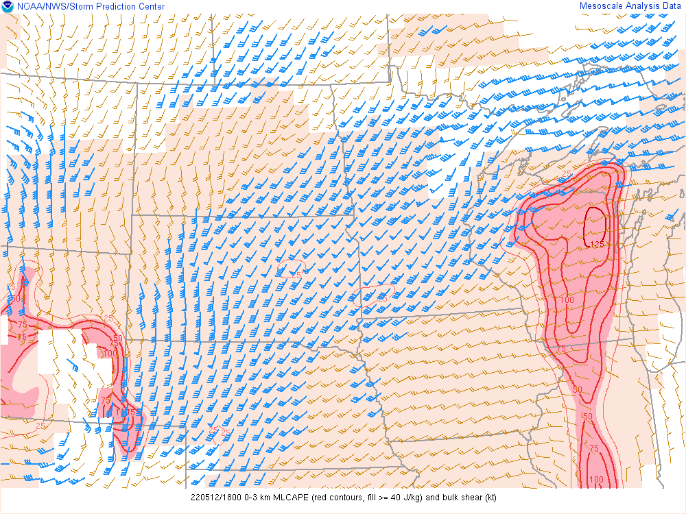
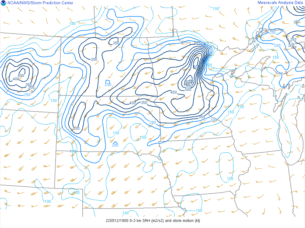
Environment
Click here to see SPC's Severe Weather Event archive of June 24, 2023, including mesoscale discussions, environmental data, upper air analysis, soundings, and outlooks.
 |
 |
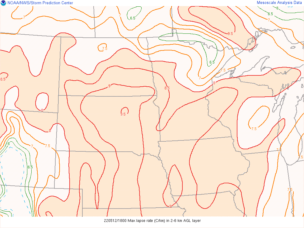 |
| 300 mb 18 - 21 UTC | 500 mb 18 - 21 UTC | Max Lapse Rates 18 - 21 UTC |
 |
 |
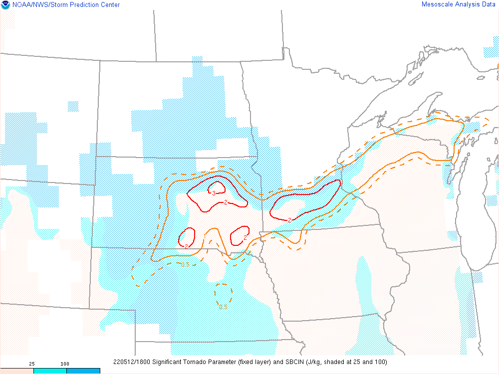 |
| MLCAPE (0-3km) and bulk shear 18 - 21 UTC | 0-3km SRH 18 - 21 UTC | Sig Tor Parameter 18 - 21 UTC |
 |
Media use of NWS Web News Stories is encouraged! Please acknowledge the NWS as the source of any news information accessed from this site. |
|


