Overview
|
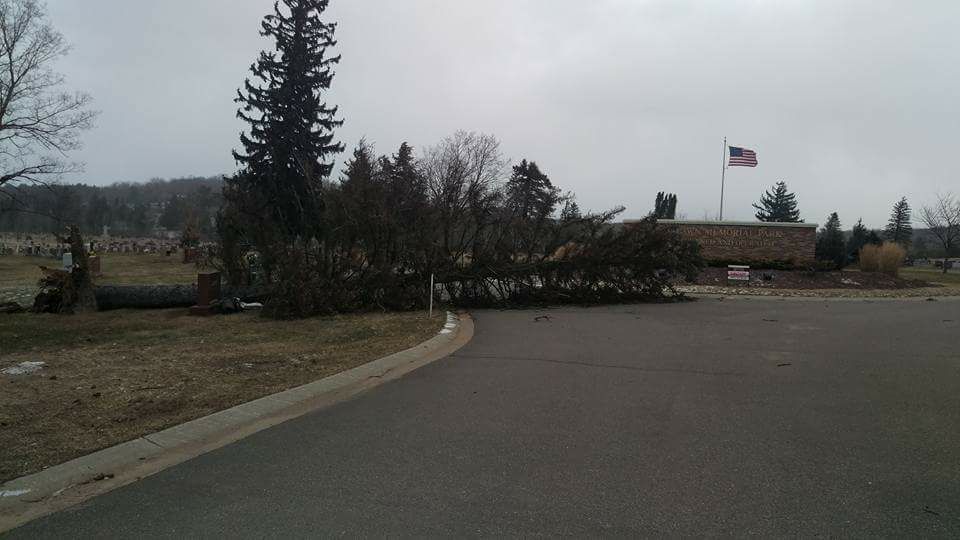
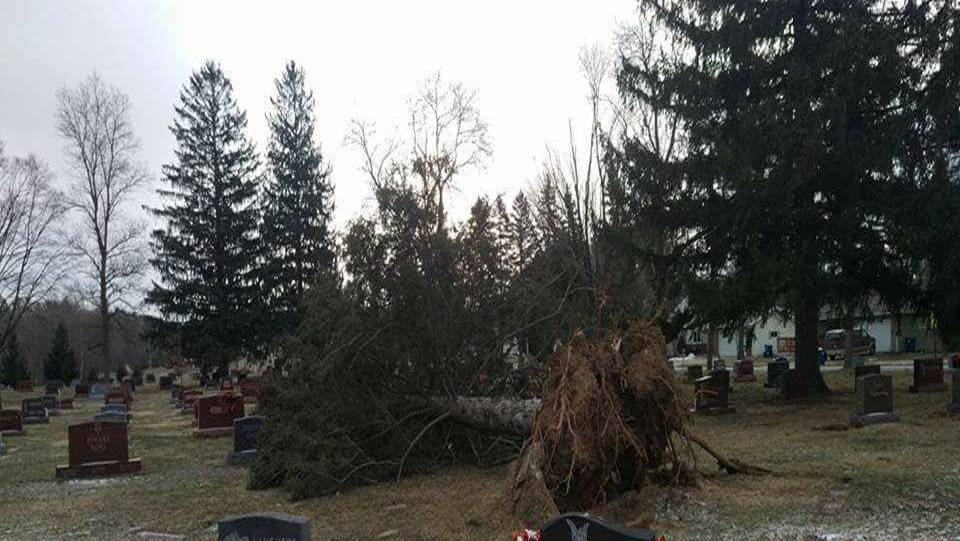
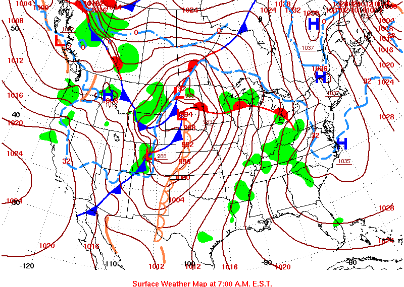
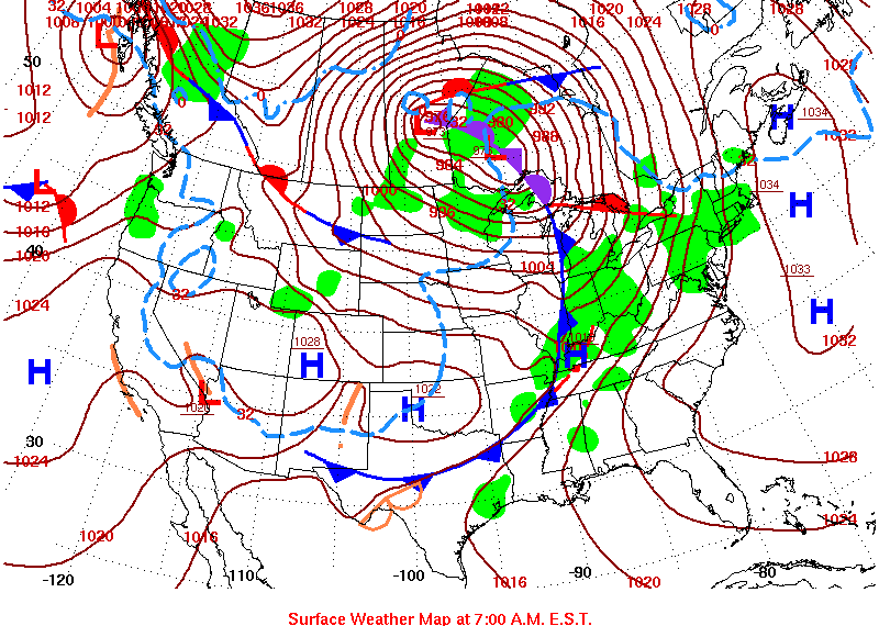
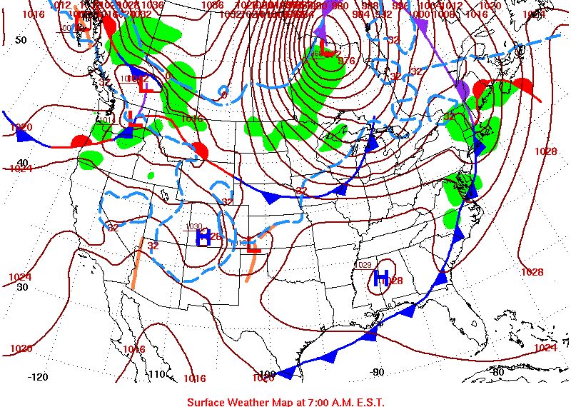
A line of strong to severe thunderstorms moved across central Wisconsin late on March 6, producing very gusty winds and some wind damage. Then, strong southwest/west winds of 30 to 40 mph with gusts of 55 to 60 mph were observed across Wisconsin March 7th and 8th behind a strong cold front and strong low pressure system moving into Canada. The low pressure system deepened to around 963mb over Ontario. This is comparable to a Category 3 hurricane! Some of the strongest winds were associated with rain/snow/graupel showers on March 7. The gusty winds made driving difficult on north/south roads, especially for high profile vehicles. There were reports of uprooted trees, semi trailers tipped on highways, power outages due to trees falling on power lines, and minor roof damage. The strong winds also created ice shoves on Lake Winnebago and the Bay of Green Bay, causing some damage.
Please click on the tabs below for more information. Click on any image for a larger view. |
Wind Gust Reports
Location                     Speed     Time/Date       Lat/Lon
--------------------------------------------------------------------
Plover 1 WSW                 74 MPH    1022 PM 03/06   44.44N/89.55W
Wisconsin Rapids Airport     64 MPH    0957 PM 03/06   44.36N/89.84W
Scandinavia                  62 MPH    0327 AM 03/08   44.46N/89.15W
Rhinelander Airport          61 MPH    0448 PM 03/07   45.63N/89.47W
Mosinee Airport              61 MPH    0450 PM 03/07   44.78N/89.67W
Zittau 3 SSE                 60 MPH    0727 PM 03/07   44.17N/88.77W
Wautoma Airport              59 MPH    0652 PM 03/07   44.04N/89.30W
Antigo Airport               56 MPH    0435 PM 03/07   45.15N/89.11W
Yacht Works Sister Bay       55 MPH    1150 PM 03/06   45.20N/87.12W
Omro                         55 MPH    0626 AM 03/07   44.03N/88.75W
Marshfield Airport           53 MPH    0335 AM 03/08   44.64N/90.19W
Eagle River Airport          52 MPH    0355 PM 03/07   45.93N/89.28W
Menominee 2 SE               52 MPH    1212 PM 03/07   45.10N/87.59W
Combined Locks 1 W           52 MPH    0540 AM 03/07   44.24N/88.34W
Appleton Airport             51 MPH    0545 AM 03/07   44.26N/88.52W
Oconto Airport               49 MPH    0715 AM 03/07   44.87N/87.91W
Wausau Airport               49 MPH    0306 AM 03/08   44.93N/89.63W
Stevens Point Airport        49 MPH    0315 AM 03/08   44.55N/89.53W
Shawano Airport              49 MPH    0640 PM 03/07   44.79N/88.56W
Oshkosh Airport              48 MPH    0154 AM 03/07   43.98N/88.56W
Manitowoc Airport            48 MPH    0647 AM 03/07   44.13N/87.68W
Breed 5 NE                   48 MPH    1203 AM 03/08   45.12N/88.37W
Manitowish Waters Airport    47 MPH    1015 PM 03/07   46.12N/89.88W
Arbor Vitae Airport          47 MPH    0215 AM 03/08   45.93N/89.73W
Sister Bay 1 NNW             46 MPH    0935 AM 03/07   45.20N/87.12W
Clintonville Airport         46 MPH    0415 AM 03/08   44.61N/88.73W
Merrill Airport              46 MPH    0435 AM 03/08   45.20N/89.71W
Sturgeon Bay Airport         46 MPH    0606 AM 03/07   44.84N/87.42W
Winchester 3 ENE             46 MPH    0243 PM 03/07   46.23N/89.83W
Kewaunee                     46 MPH    1012 AM 03/07   44.47N/87.50W
Moon 6 SW                    45 MPH    0505 PM 03/07   44.70N/89.87W
Green Bay Airport            45 MPH    0948 AM 03/07   44.50N/88.11W
Mountain 2 ESE               44 MPH    0503 PM 03/07   45.17N/88.44W
Wabeno 2 NNW                 43 MPH    0101 AM 03/08   45.46N/88.68W
Tomahawk 3 W                 42 MPH    1110 PM 03/07   45.47N/89.80W
Wautoma 1 WSW                40 MPH    0712 PM 03/07   44.06N/89.29W
Wayside 1 SW                 40 MPH    0522 AM 03/07   44.23N/87.96W
Greenville                   40 MPH    0437 AM 03/08   44.29N/88.52W
Greenleaf 4 NNE              40 MPH    0419 AM 03/08   44.37N/88.07W
Tomahawk Airport             40 MPH    1155 PM 03/07   45.48N/89.81W
Keshena 2 WNW                40 MPH    0405 AM 03/08   44.89N/88.66W
Potawatomi State Park 4 ESE  40 MPH    0551 PM 03/07   44.83N/87.34W

Note: The peak wind gust at Plover and Wisconsin Rapids occurred during
a thunderstorm March 6.

Observations are collected from a variety of sources with varying
equipment and exposures. Not all data listed are considered official.
|
|
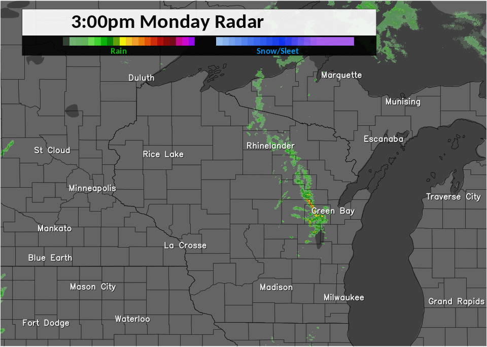
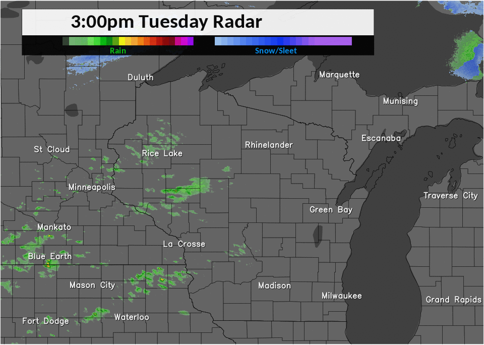
Radar / Surface Maps
|
Line of strong to severe storms late March 6 / early March 7 |
Rain/snow Showers on March 7 Note: Many of the showers labeled as rain were actually snow showers |
|
Surface Map - 6am March 6 |
Surface Map - 6am March 7 |
|
Surface Map - 6am March 8 |
Damage Photos
|
|
 Wausau (courtesy of David Line) Wausau (courtesy of David Line) |
 Wausau (courtesy of David Line) Wausau (courtesy of David Line) |
|
|
|
.jpg) New Hope/Rosholt (courtesy of Sara Scott) New Hope/Rosholt (courtesy of Sara Scott) |
||
 |
Media use of NWS Web News Stories is encouraged! Please acknowledge the NWS as the source of any news information accessed from this site. |
|


.jpg)
.jpg)