Green Bay, WI
Weather Forecast Office
A weak tornado occurred in southeast Brown County, about 8 miles southeast of Green Bay, during the afternoon of June 15. The brief touchdown occurred at about 3:10 pm just east of Highway G (Dickinson Road) near Glenmore. A swing set was toppled and a metal shed was moved by the weak twister.
.png) |
| Still image from video shot by Dan Unright. |
Below is a radar image about the time of the tornado. Very weak rotation was indicated in what was otherwise a heavy rain-producing thunderstorm.
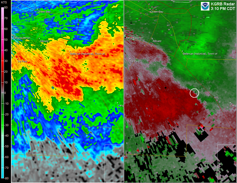 |
| Radar reflectivity (left) and velocity at 3:10 PM. Click image for larger view. |
US Dept of Commerce
National Oceanic and Atmospheric Administration
National Weather Service
Green Bay, WI
2485 South Point Road
Green Bay, WI 54313-5522
920-494-2363
Comments? Questions? Please Contact Us.

