Overview
|
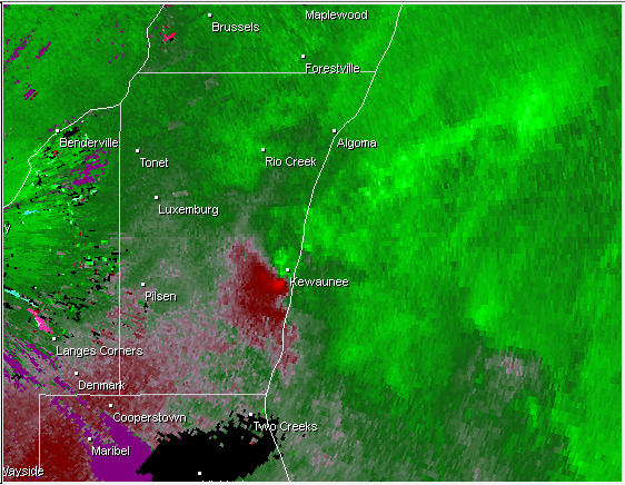
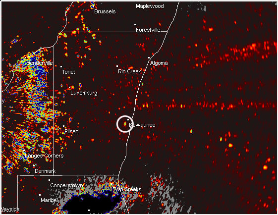
A weak tornado formed just west of the city of Kewaunee shortly after 10 am on August 20, 2016. In addition, straight-line winds of 51 mph were measured at the Kewaunee lake shore. This is preliminary information. Additional assessments are ongoing.
|
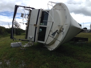 A boat that was dry-docked was toppled over by the strong winds. |
Tornadoes:
|
Tornado - City of Kewaunee
Track Map 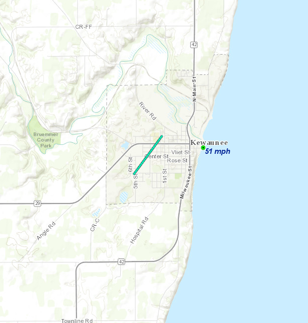 
|
||||||||||||||||
The Enhanced Fujita (EF) Scale classifies tornadoes into the following categories:
| EF0 Weak 65-85 mph |
EF1 Moderate 86-110 mph |
EF2 Significant 111-135 mph |
EF3 Severe 136-165 mph |
EF4 Extreme 166-200 mph |
EF5 Catastrophic 200+ mph |
 |
|||||
Photos:
Damage Around Kewaunee
 |
 |
|
|
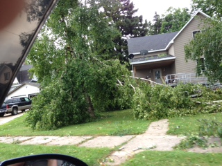
| Damage near Kewaunee. (Kewaunee Co. Emergency Mgmt) |
Damage near Kewaunee. (Kewaunee Co. Emergency Mgmt) |
Damage near Kewaunee. (Kewaunee Co. Emergency Mgmt) |
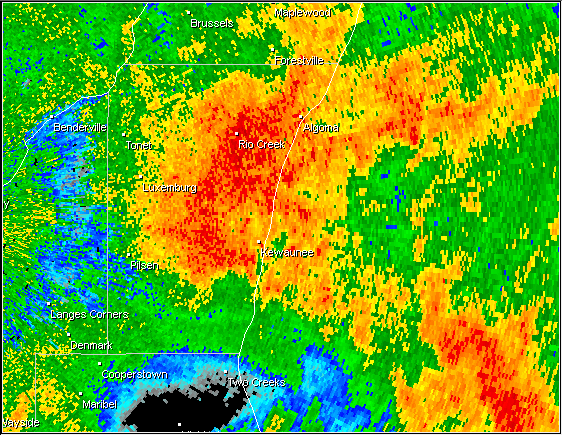
Radar:
NWS Green Bay Radar at 10:04 AM
 |
 |
 |
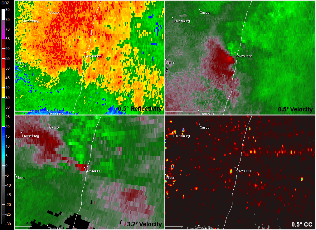 |
| Base Reflectivity (0.5 deg) | Storm-Relative Velocity (0.5 deg) | Correlation Coefficient (0.5 deg) | Radar 4-panel. |
 |
Media use of NWS Web News Stories is encouraged! Please acknowledge the NWS as the source of any news information accessed from this site. |
|

