Green Bay, WI
Weather Forecast Office
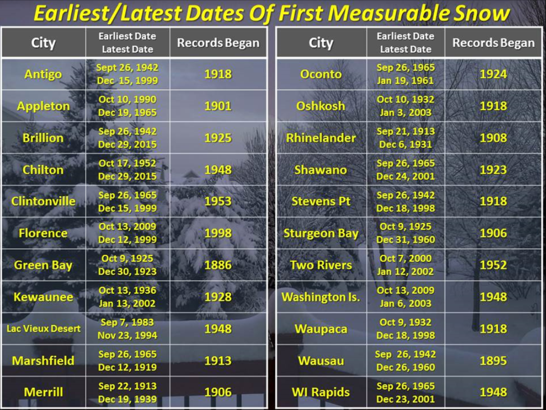
Many locations across central into north-central and northeast Wisconsin received the first measureable snowfall of the season over the past few weeks. Let's take a look at past first measureable snowfalls of the winter.
The first snowfall of the season can vary greatly from year to year. The earliest snowfall of the season has occurred as early as mid to late September across northern Wisconsin, and early to mid October across the Fox Valley and lakeshore region. The latest first snowfall of the season has occurred as late as mid December into early January in drier periods in the late fall and early winter.
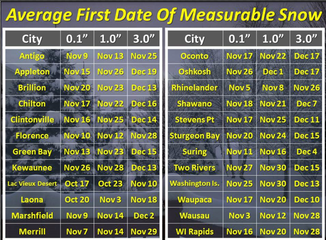
The average date of the first measureable snowfall ranges from mid to late October across far north-central Wisconsin to mid to late November along the Lake Michigan shore line. There is just over a months difference in the average date between Lac Vieux Desert in Vilas County and Two Rivers and Washington Island (near Lake Michigan). Higher terrain and lake effect snow showers off Lake Superior are prime reasons for the early date of the first measureable snowfall across northern Wisconsin, while the relatively warmer waters of Lake Michigan delay the onset of the first measureable snowfall at Two Rivers and Washington Island.
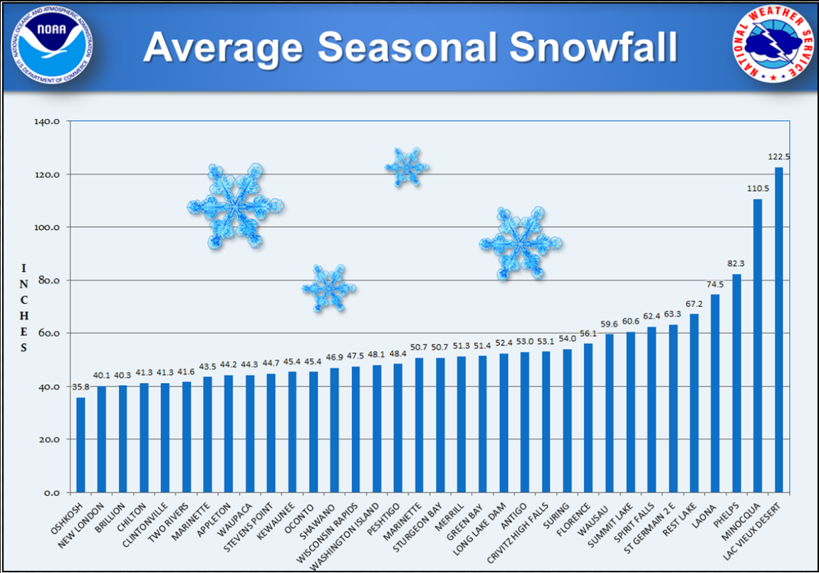
Here is a look at seasonal snowfall averages for many locations across north-central and northeast Wisconsin.
US Dept of Commerce
National Oceanic and Atmospheric Administration
National Weather Service
Green Bay, WI
2485 South Point Road
Green Bay, WI 54313-5522
920-494-2363
Comments? Questions? Please Contact Us.

