Although the heaviest snow has ended, moderate to briefly heavy snow, and some gusty winds will continue to create hazardous travel conditions this afternoon into Wednesday. The hazardous conditions could linger into the Wednesday morning commute.
Those traveling should be prepared for very poor road conditions and visibility. Plan to leave early in order to slow driving appropriately for conditions and for other delays. Do not leave without a stocked winter safety kit in your car. Before you go, check the latest forecasts, road conditions and plan extra time for your trip. You may consider postponing or canceling your plans, if possible.
What/When: Moderate to heavy snow is expected to continue for the afternoon hours. Travel conditions will remain very poor this afternoon and evening due to the falling and minor blowing/drifting snow. The strongest gusts, which are expected more towards the Fox Valley and Lakeshore this afternoon and evening, could be up to round 30 mph. Lighter snow, at times decreasing to freezing drizzle, is expected later this evening into Wednesday morning.
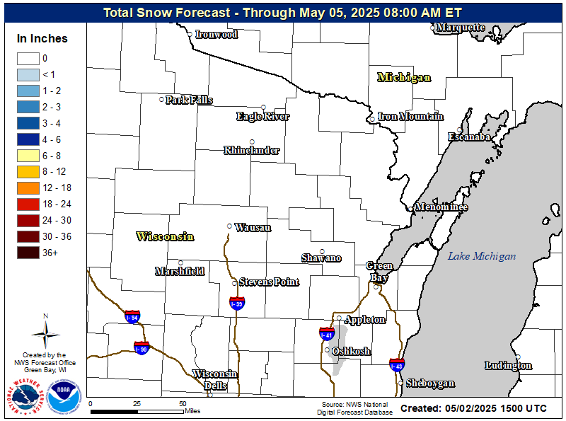
Amounts: Total accumulations of 4-9 inches are forecast through Wednesday morning. Periods of freezing drizzle may emerge in central and east-central Wisconsin from this evening into the overnight hours. Though little to no ice accumulation is expected, any glazing could further aggravate poor travel conditions.
Here is our most recent graphic created about the upcoming weather situation:

Here are the latest watches, warnings, and advisories, and STORM TOTAL forecast snow amounts (click for a larger view):
 |
 |
Here are the latest snowfall reports from across the state (click for a larger view):

Want to track the storm? Here are the local and regional radar loops:
 |
  |
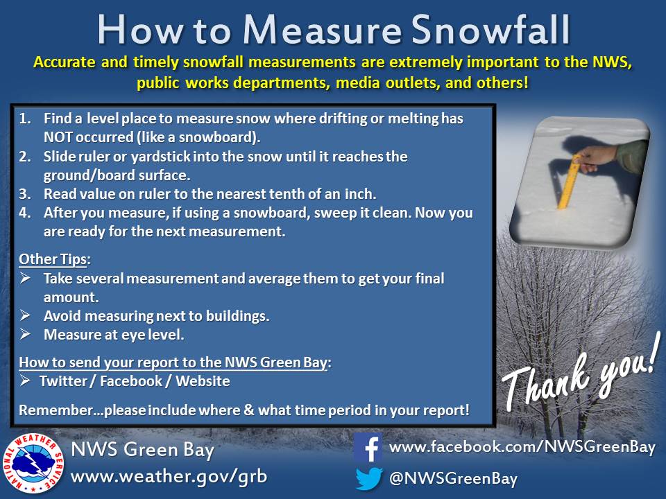
Here are some helpul hints on how to measure snow:
Here are some additional links to help monitor the winter weather:

