Overview
|
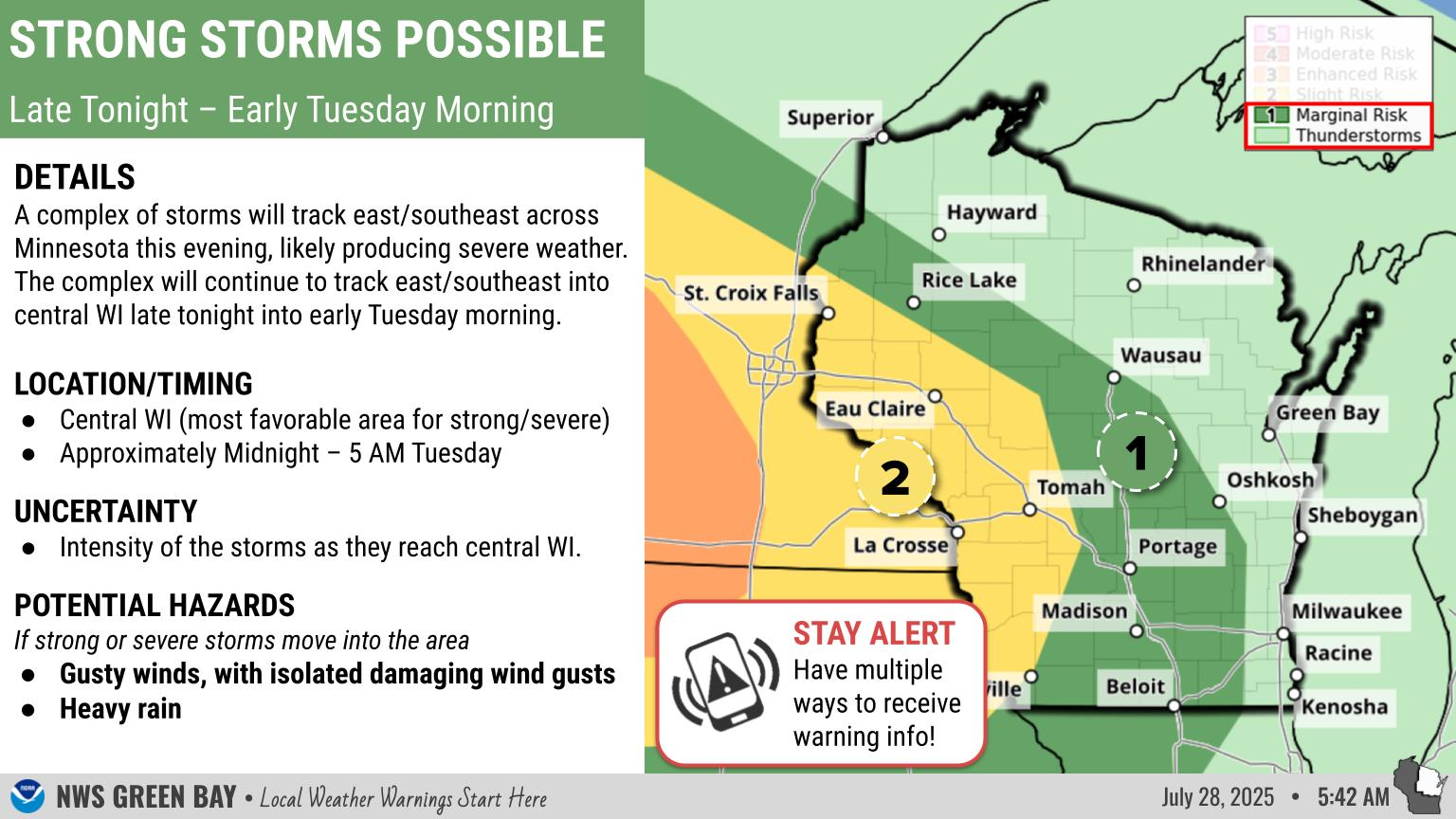
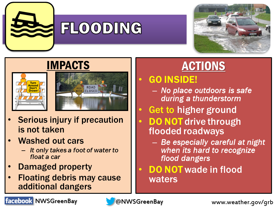
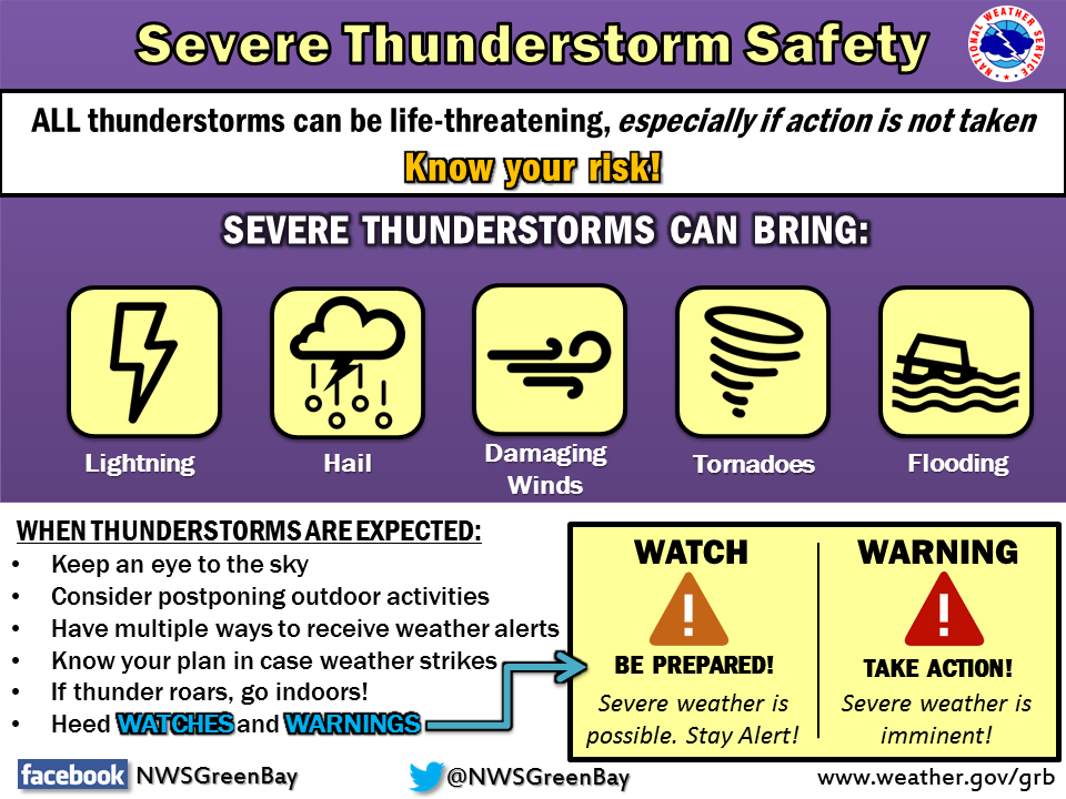
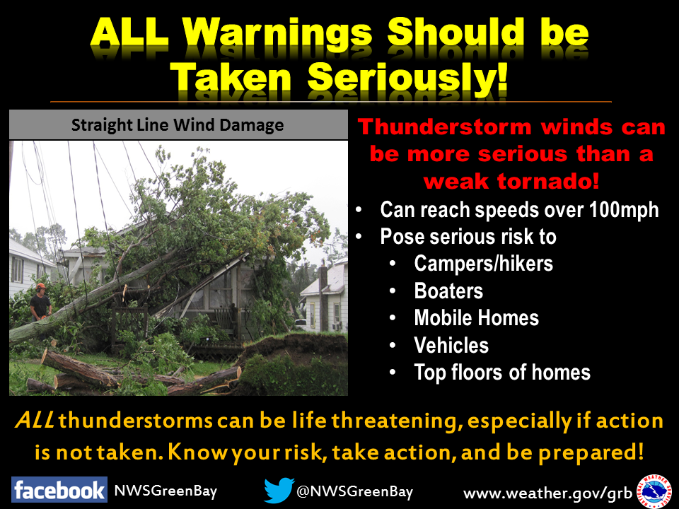
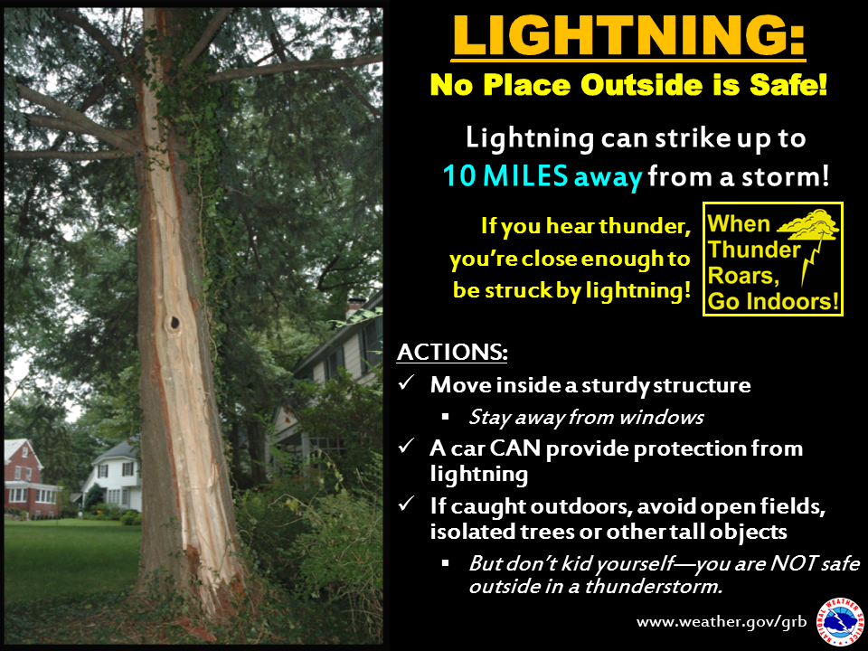
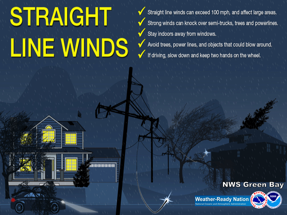
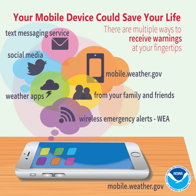
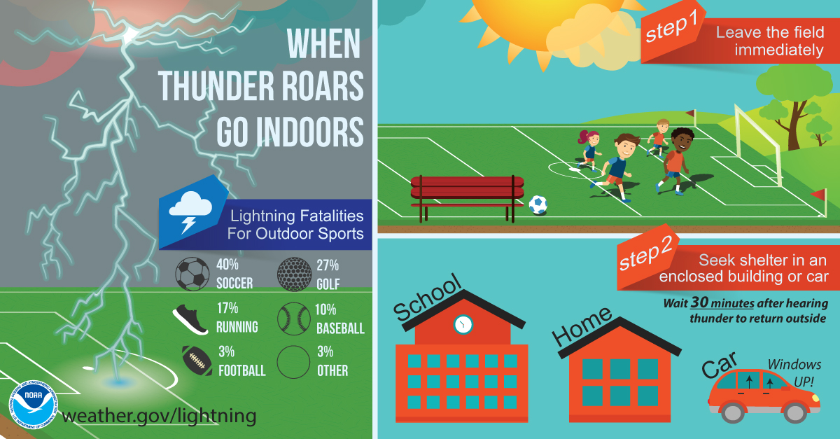
Thunderstorms: The primary severe threat is from mid evening through around midnight or a little later. The primary concern is damaging wind gusts and more heavy rain. Large hail and isolated tornadoes are also possible, especially in/near the enhanced risk area. Remember...When Thunder Roars, Go Indoors! Heavy Rain: Rain, possibly heavy at times, is expected at times across the entire area through tonight. The highest amounts are forecast across northern Wisconsin, where another inch or two of rainfall is possible by Friday morning. Locally higher amounts will be possible. See the "Rainfall/Flooding" tab below for additional information from the Weather Prediction Center. The heavy rain could cause low visibility when driving, and also cause some localized urban and small stream flooding. Remember, if you come upon a flooding roadway...Turn Around, Do Not Drown! Greatest Threat Times: Central & North-Central WI: 7:00 pm to 1:00 am. Eastern WI: 9:00 pm to 3:00 am (storms likely weakening as they move toward Lake Michigan) Make sure you follow the forecast and have a way to get the latest weather information, including any watches or warnings. If you are planning outdoor activities on land or water in the risk area, have alternate plans in place, including knowing where the nearest sturdy shelter is, in the event severe weather threatens your area.
Please click on the tabs below for more information. Click on any image for a larger view.
|
|
  |
|
Latest Watches & Warnings
|
|
 Current Watches, Warnings, & Advisories Current Watches, Warnings, & Advisories |
|
 National Hazards Map National Hazards Map |
 Current Convective Watches Current Convective Watches |
Rainfall Forecasts / Flooding
|
|
|||
 WPC Excessive Rainfall Day 1 (discussion) |
SPC Outlooks
 Day 1 (discussion) Day 1 (discussion) |
 Day 1 Tornado Probabilities Day 1 Tornado Probabilities |
 Day 1 Hail Probabilities Day 1 Hail Probabilities |
 Day 1 Wind Probabilities Day 1 Wind Probabilities |
 Day 2 (discussion) Day 2 (discussion) |
 Day 2 Probabilities Day 2 Probabilities |
 Day 3 (discussion) Day 3 (discussion) |
 Day 3 Probabilities Day 3 Probabilities |
 Mesoscale Discussions (more info) Mesoscale Discussions (more info) |
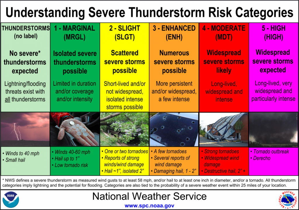 Severe Storm Risk Categories Severe Storm Risk Categories |
|
Radar & Satellite
| Radar Data | ||
 |
|
|
|
|
||
    |
||
| Satellite Imagery | ||
|
Visible (Click here for LOOP) |
|
|
Severe Weather Reports
|
Today's Storm Reports |
Yesterday's Storm Reports |
 |
Media use of NWS Web News Stories is encouraged! Please acknowledge the NWS as the source of any news information accessed from this site. |
|