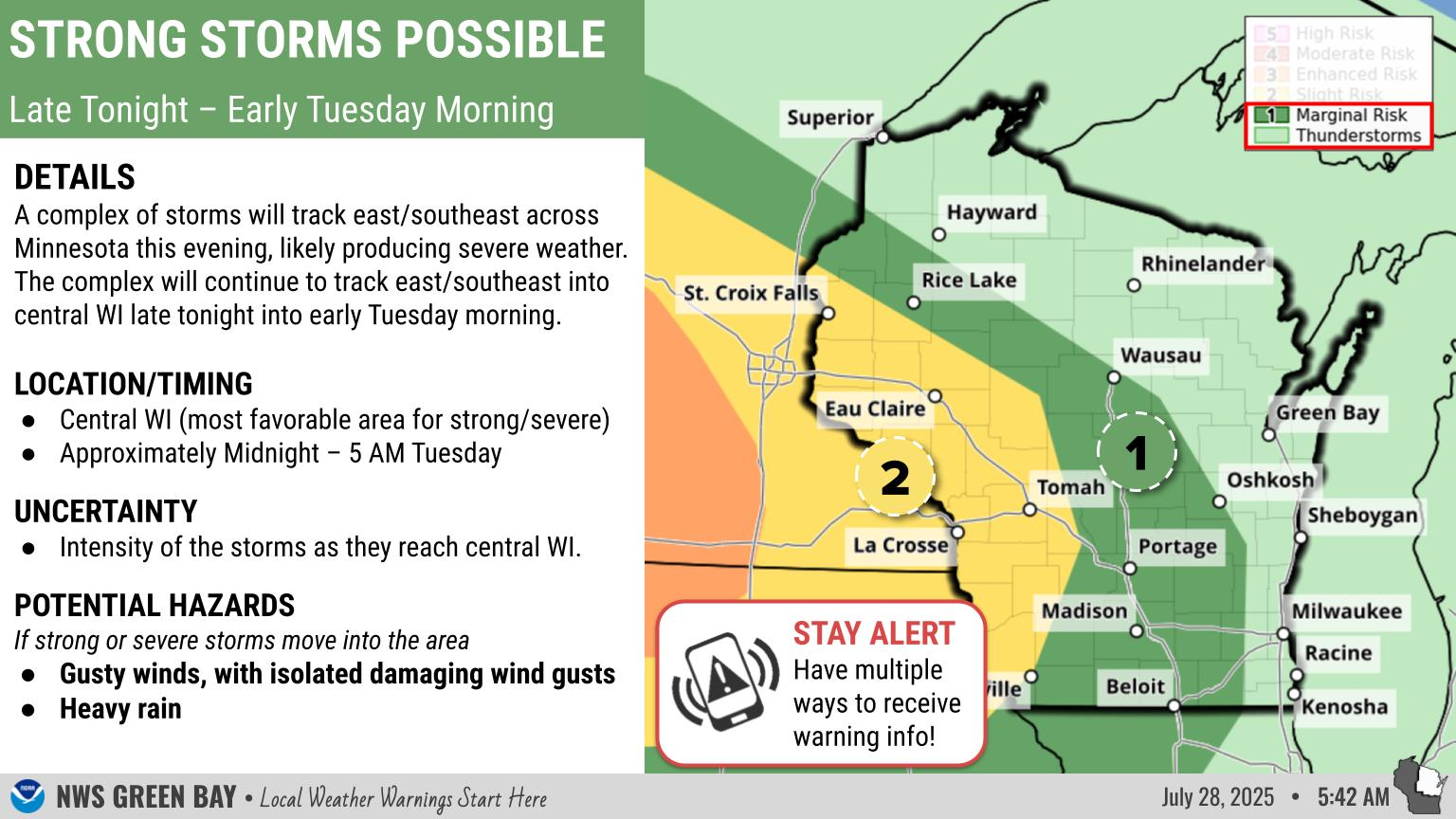
National Weather Service United States Department of Commerce

[8/12/25] Some rain will pass through east-central Wisconsin this morning before dry conditions return everywhere for the late morning to early afternoon. Then, another chance for active weather arrives in the late afternoon to early evening, with some potential for isolated strong or even severe storms. Any stronger storms are not expected to become widespread. Behind the storms, dry conditions return but smoke may also return to the region for a portion of the midweek period. The next chance for rain won't be until Friday.
A broken line of showers and storms will develop ahead of and along a cold front as it sweeps southeast across the area this afternoon and evening. Some of these storms may become strong or severe, capable of producing damaging winds and large hail. There is still some uncertainty in the severity of the storms as morning cloud cover may hinder the severe potential. Be sure to monitor the forecast for changes!