
Record setting heat is expected over the next several days from the Intermountain West through the northern Plains. Furthermore, fire weather concerns increase with dry and breezy conditions. Meanwhile, heavy rainfall and severe thunderstorm threats for the Ohio/Tennessee Valleys, central Appalachians and Southeast today. The threat shifts to central Gulf Coast and across central Texas this week. Read More >
Severe Weather Drought Continues in Southwest Lower Michigan
You may have noticed that it's been a while since we've experienced widespread severe weather across southwest Lower Michigan. We ran some stats to determine just how quiet we've been this year, and the numbers are quite telling.
By this point of the year, we typically would have issued a combined total of ~60 Tornado and Severe Thunderstorm warnings. However, this year, we've only issued a total of 18 Severe Thunderstorm and 0 Tornado warnings! This is the "quietest" severe weather season so far since 1993 when 16 combined warnings were issued by this point in the year. The past three years have been relatively quiet as well with fewer than 40 combined warnings issued by July 20th. Note that the average annual combined number of warnings our office issues is ~92.
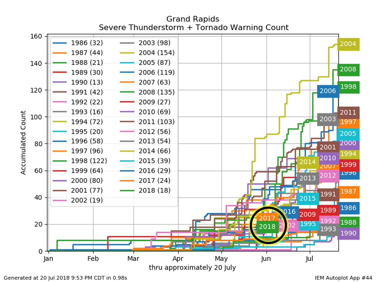
Combined number of Severe Thunderstorm and Tornado Warnings from January 1 to July 20th, between the years of 1986 and 2018. The count of warnings is on the Y-axis with time (in months) in the X-axis. (Note the location of "2018" at "June" on the X-axis does not mean the database ends in June; rather, the labels for each year are spread out to make them legible).
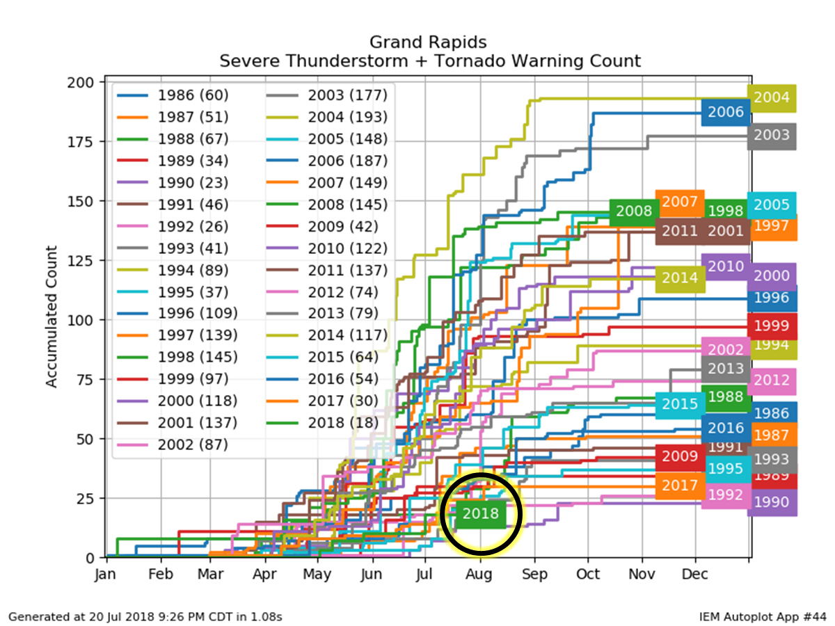
Combined number of Severe Thunderstorm and Tornado Warnings from January 1 to December 31st, between the years of 1986 and 2018. The count of warnings is on the Y-axis with time (in months) in the X-axis.
Yet, this is the time of year when we are typically most active. Climatologically (e.g. historically) speaking, we usually experience severe weather in a period stretching from late April to early September with May, June, July, and August as the most active months. Incredibly, this was the first year since 1995 in which we did did not issue a single Severe Thunderstorm or Tornado warning during the entire month of June!
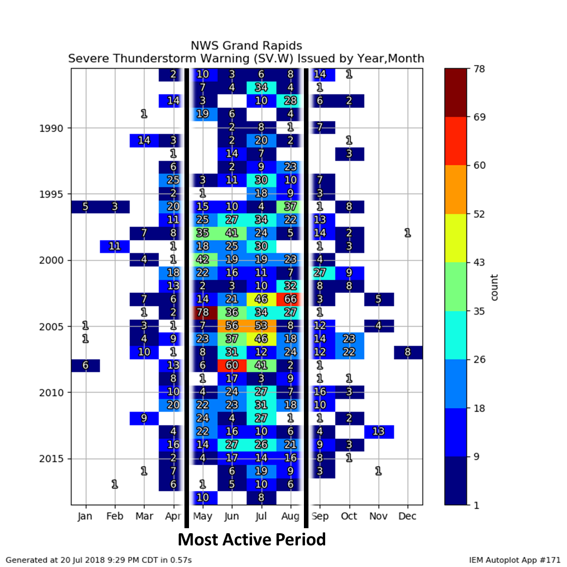
Count of Severe Thunderstorm warnings issued per month between the years of 1986 and 2018. Years is on the Y-axis with months on the X-axis, with the colors corresponding to the number of Severe Thunderstorm warnings issued in a given month and corresponding year.
So, how does our quiet severe weather season compare to the rest of Michigan? How about the rest of the country? As you can see, much of Lower Michigan has had a quiet severe weather season this year with the NWS Offices in Gaylord and Detroit/Pontiac having similar paltry warning counts. Surprisingly, the Upper Peninsula of Michigan has had more severe weather than Lower Michigan so far this year! However, notice the lower numbers across much of the Great Lakes. Typically, the southern Great Lakes (e.g. NWS Milwaukee, Chicago, Northern Indiana, and Cleveland) would have much higher warning counts by this time of year. So, we are not alone in our relative lack of severe weather.
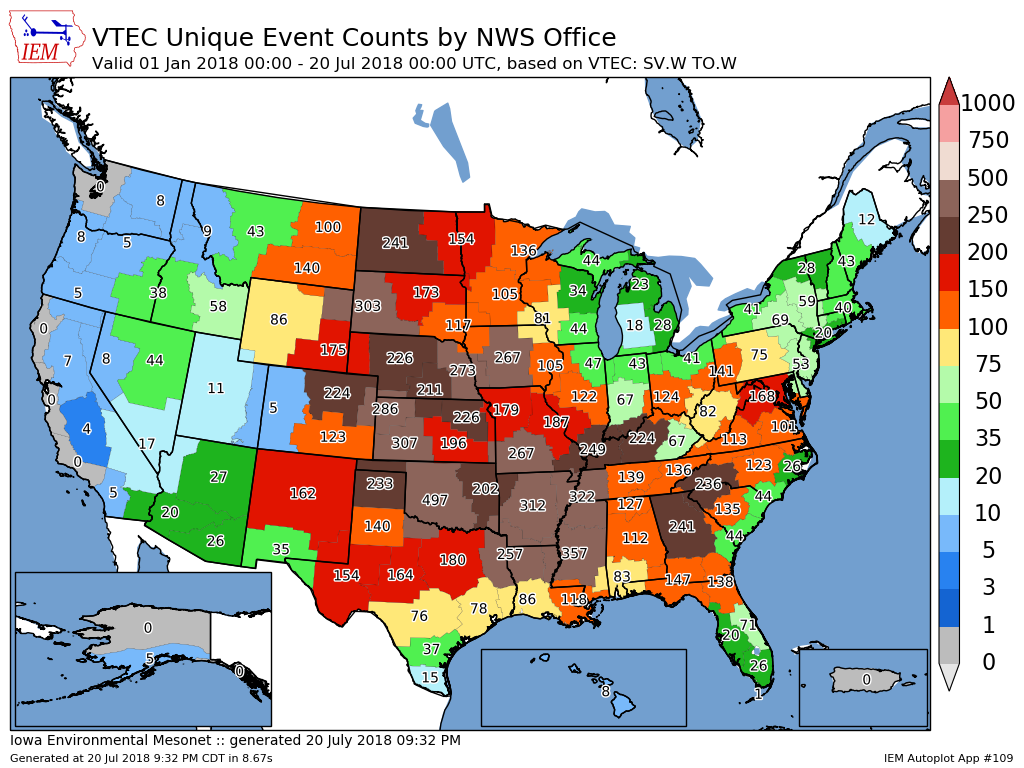
Combined number of Severe Thunderstorm and Tornado Warnings issued per NWS County Warning Area (CWA) across the United States from January 1st, 2018 to July 20th, 2018 (*image made at 9:32 PM ET)
However it is worth noting that southwestern Lower Michigan has been especially quiet compared to our neighbors. Perhaps most telling is the fact we haven't issued a tornado warning in over a year! Compared to the rest of the United States were severe weather is common (e.g. east of the Rocky Mountains), we hold one of the longest stretches of time without issuing a tornado warning.
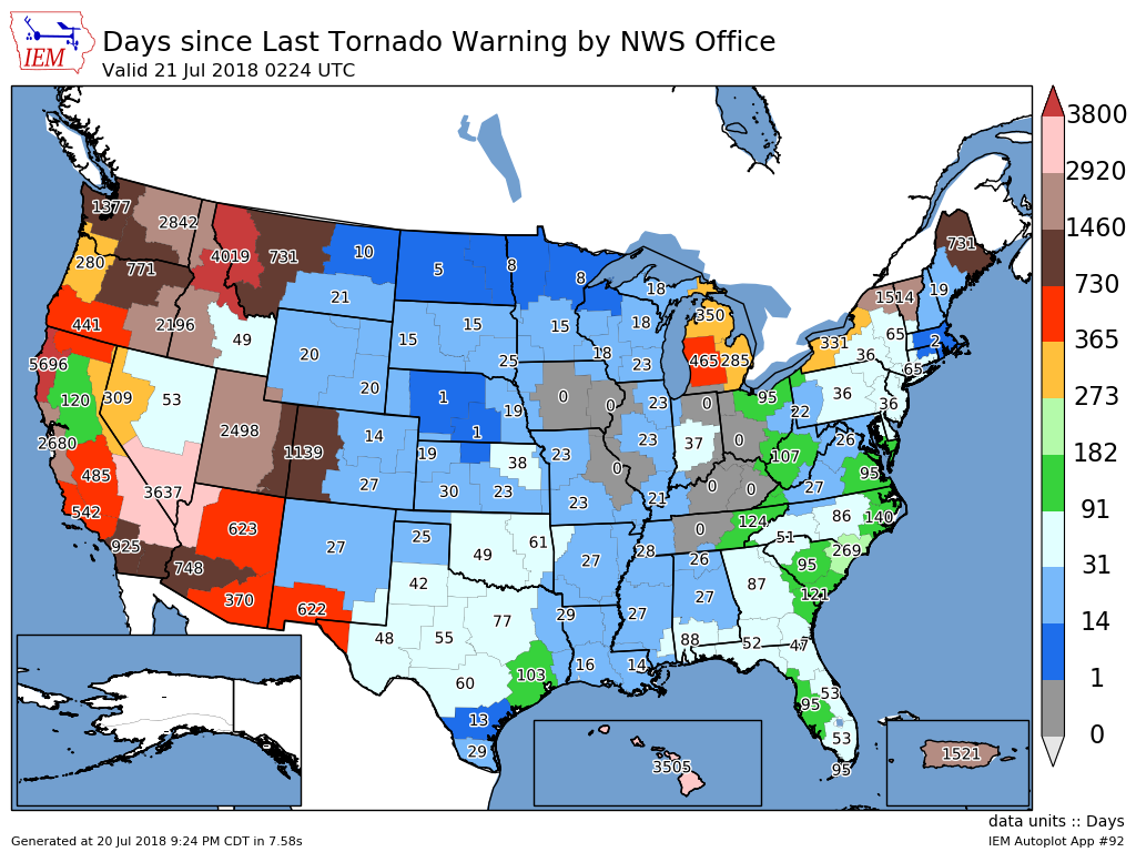
Number of days since the last tornado warning issued per NWS County Warning Area (CWA) (*image made at 9:32 PM ET)
So, what does this mean for the rest of the year? Severe weather, at least a significant episode of which, does not look likely at least in the next 5-10 days. However, this does not mean we are out of the woods. For example, 2002 started quite slow with only 19 warnings issued by July 20th, yet the year finished with around the average number of warnings (87) indicating a very active late summer/early fall. As such, you should always stay prepared for severe weather, any time of the year. Moreover, a thunderstorm doesn't have to be severe to be dangerous as lightning and flooding can be deadly. It is never too late to prepare!
Notes about this study:
 |
Media use of NWS Web News Stories is encouraged!
Return to NWS Grand Rapids Home Page
|
|
Last Updated at 4:45 AM 7/21 by BB

