May 8, 2008
Weak Tornadoes
On May 8, 2008, a weak cell of convection spawned a number of tornadoes and funnel clouds across Clinton, Greene, and Clark Counties in southwest Ohio. The cell was associated with an area of low pressure and an associated warm front; this disturbance was also responsible for dropping 0.5-1.5 inches of rain across most of the region.
This event was certainly not a classic setup for tornadoes. It is notable that no cloud-to-ground lightning was occurring with this cell. In addition, the cell was only 10,000 to 12,000 feet tall. A typical tornado-producing supercell can reach heights of over 40,000 feet. However, two factors in particular helped the development of this situation. First, the interaction with the warm front allowed for winds that changed significantly in speed and direction in the low levels of the atmosphere. Second, the copious moisture near the surface allowed for very low cloud ceiling heights, especially near and north of the warm front.
Two tornado warnings were issued for this event. The first was for northern Clinton and southeastern Greene Counties, from 5:20 PM to 5:45 PM. The second was for eastern Clark and northeastern Greene Counties, from 5:46 PM to 6:30 PM.
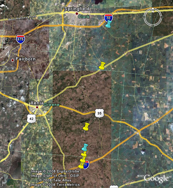
Here is an overview of the locations of reported tornado touchdowns (yellow) and documented funnel clouds (blue). This page will step through the events from south to north in chronological order.
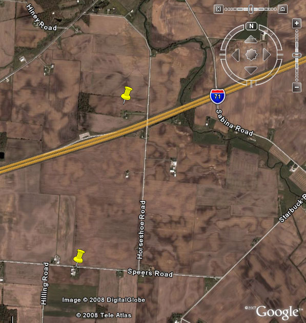
5:18 PM:
Damage reportedly occurred to a garage on Speers Road due to a brief tornado touchdown.
At around the same time, an Ohio State Highway Patrol trooper reported a tornado touchdown near mile marker 54 on Interstate 71. A nearby truck driver corroborated the sighting. Reportedly, the tornado touched down intermittently, lifting briefly while crossing the freeway.
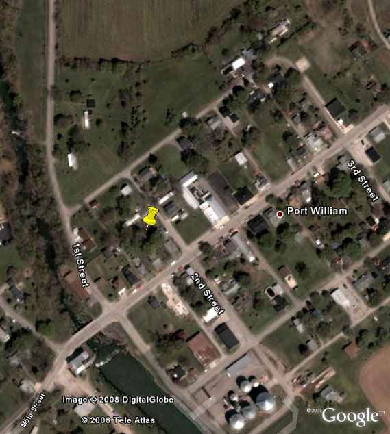
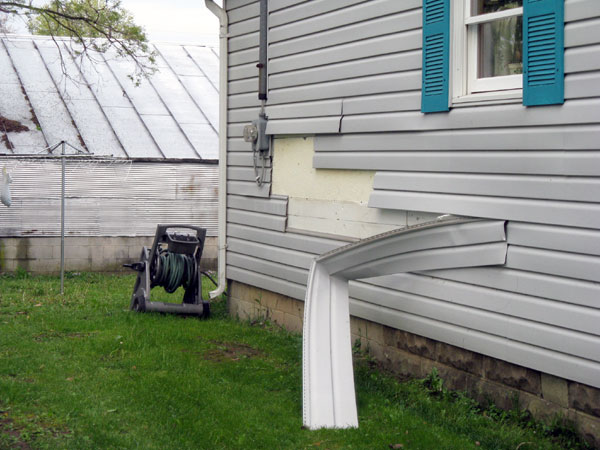
5:20 PM:
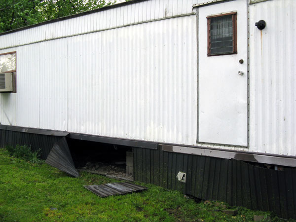
A tornado touched down briefly in Port William in northern Clinton County. Minor damage occurred to a few homes and trailers, and one large tree limb was downed. The tornado has been rated an EF0 on the Enhanced Fujita Scale, with winds estimated of 65 to 70 mph. A few photographs of the damage have been placed below. Images courtesy of the National Weather Service.

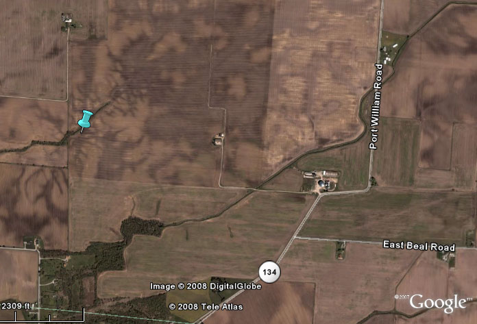
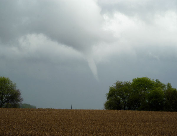
5:20-5:25 PM:
A well-defined but intermittent funnel cloud was caught on video. The funnel was located in a field just northeast of Port William. A still image from the video has been placed below. Image courtesy of Josh Curtis.
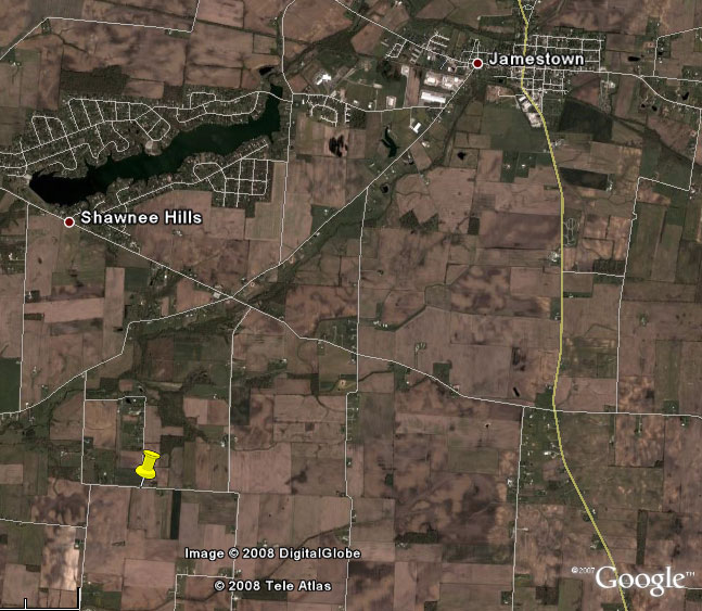
5:25 PM:
A brief tornado touchdown was reported southwest of Jamestown in Greene County, near the intersection of Sheridan and Charles roads. No damage was reported.
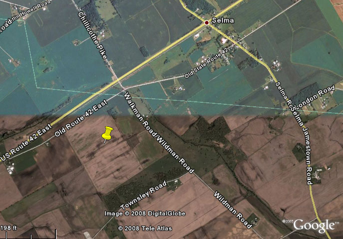
6:13 PM:
A trained spotter just southwest of Selma reported a brief tornado touchdown in a field along the Greene/Clark County line. The tornado was on the ground very briefly -- around 10 seconds -- and the funnel disappeared entirely soon thereafter. The sighting was near the intersection of US Route 42 and Chillicothe Pike.
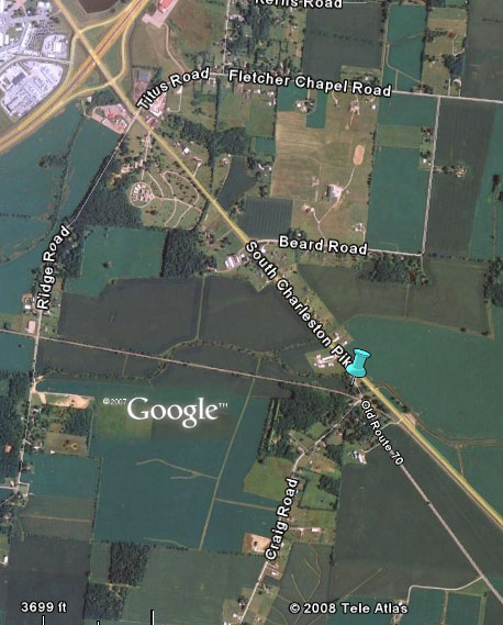
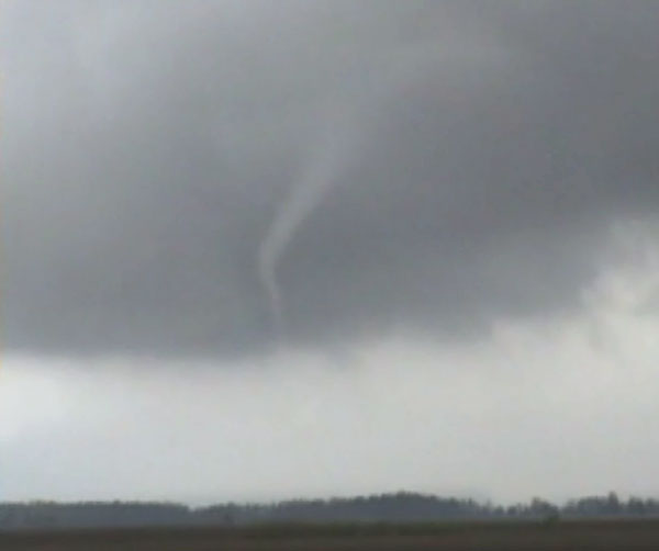
6:47 PM:
The final funnel cloud sighting occurred southeast of Springfield near OH Route 41 and Old 70 Road. The funnel cloud was photographed, and one picture has been placed below. Image courtesy of Jim Kohut.
The National Weather Service in Wilmington would like to thank our weather spotters and amateur radio operators, the emergency management and law enforcement communities, and the media, for a great deal of help during this event.
Hatzos / Shobe
|
|

