|
Remnants of Hurricane Ike - Ohio Valley Windstorm |
|
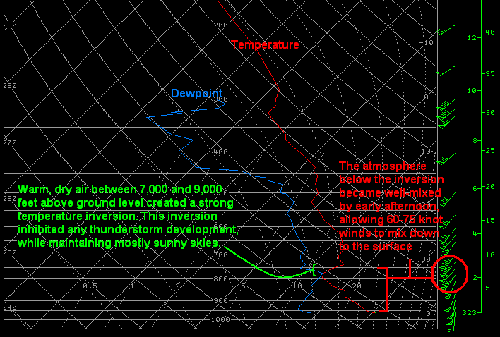
Upper Air Conditions Contributing to 14 September 2008 Widespread Damaging Winds: NWS ILN conducted a special 18Z upper air sounding on Sunday afternoon, September 14, as the windstorm was beginning. The sounding indicated that a very strong temperature inversion had developed between 7,000 and 9,000 feet, as a layer of warm, dry air spread over top of the planetary boundary layer. This inversion indicated to our forecasters that the potential for convective development was gone, as instability was significantly diminished. The inversion acted as a "cap" to the air rising through the boundary layer below. This not only limited any possibility for thunderstorms to form, but largely kept clouds from developing as well. As a result, skies remained mostly sunny until the cold front arrived during the late afternoon. The sounding also indicated that the air was well mixed below the inversion. A strong low level jet rotated through the Ohio Valley ahead of the remnants of Ike Sunday afternoon, with 70 to 85 mph winds near the inversion. With maximum mixing taking place through the boundary layer, these winds were able to translate through the boundary layer and down to the surface nearly uninhibited as verified by the hurricane-force wind gusts experienced Sunday afternoon. |

