PUBLIC INFORMATION STATEMENT
NATIONAL WEATHER SERVICE WILMINGTON OH
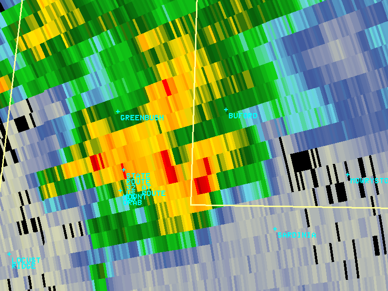
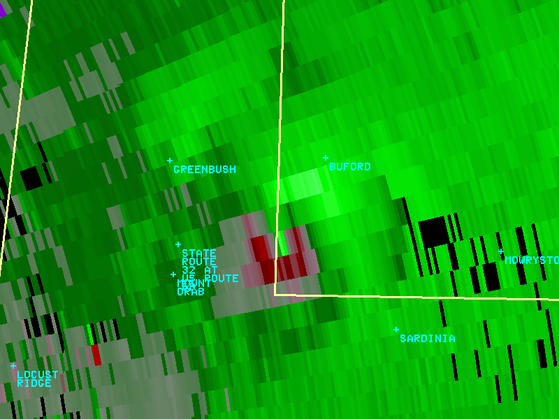
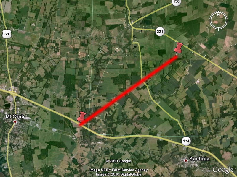
...TORNADO CONFIRMED NEAR MOUNT ORAB OHIO...
LOCATION...NEAR MOUNT ORAB, OHIO
DATE...05/21/2010
ESTIMATED TIME...6:44 PM EDT
MAXIMUM EF-SCALE RATING...EF1
ESTIMATED MAXIMUM WIND SPEED...100 MPH
MAXIMUM PATH WIDTH...50 YARDS
PATH LENGTH...3 MILES
* The National Weather Service in Wilmington OH has confirmed
a tornado near Mount Orab in Brown and Highland Counties of Ohio,
on May 21, 2010. The tornado touched down in the vicinity of Highway
32 and Klein Road in Brown County, and crossed into Highland County
before lifting near Highway 321 southeast of Buford. The worst
damage occurred to a residence on Sicily Road in Highland County,
which was rated EF1 damage (estimated wind speeds of 100 mph) due to
a section of roofing removed from parts of the home, the front porch
supports lifted and removed, numerous uprooted trees, and a 2x4
driven into decking material. Several other barns and outbuildings
were destroyed or heavily damaged along the path. Witness accounts
indicate there may have been two tornadoes on the ground at the same
time, though damage assessment could not confirm this.
|