
An outbreak of severe thunderstorms is expected across portions of Illinois and Indiana tonight. Intense tornadoes, swaths of damaging gusts, and hail in excess of 2 inches in diameter possible. Tropical Storm Arthur will continue to produce strong winds across coastal Upper Texas and Louisiana tonight, as well as potentially life-threatening flooding across southern Louisiana into Mississippi. Read More >
|
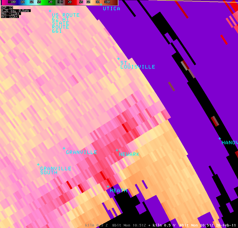
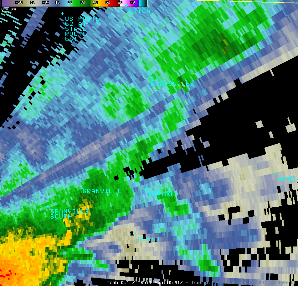
Straight-Line Wind Damage Near Newark, OH |
PUBLIC INFORMATION STATEMENT NATIONAL WEATHER SERVICE WILMINGTON OH 411 PM EST MON FEB 28 2011 ...STRAIGHT LINE WIND DAMAGE CONFIRMED IN NEWARK OHIO... THE NATIONAL WEATHER SERVICE IN WILMINGTON OHIO HAS CONFIRMED STRAIGHT LINE WIND DAMAGE ON THE NORTH SIDE OF NEWARK OHIO. THIS DAMAGE WAS ESTIMATED TO OCCUR AT AROUND 550 AM ON MONDAY FEBRUARY 28. THE SWATH OF SIGNIFICANT DAMAGE WAS MAINLY CONFINED TO MYRTLE AVE...ABOUT 2.5 MILES NORTH-NORTHWEST OF DOWNTOWN NEWARK. SIGNIFICANT DAMAGE BEGAN NEAR THE INTERSECTION OF MYRTLE AVE AND WYNNEWOOD DRIVE (40.0922N 84.4454W) AND ENDED NEAR THE INTERSECTION OF MYRTLE AVE AND STATE ROUTE 13 (40.0915N 82.4204W). THERE WAS ALSO SOME DAMAGE JUST TO THE SOUTH ON GREENFIELD AVE...WITH LIGHTER DAMAGE ON OTHER STREETS IN THE AREA. LIGHTER DAMAGE ALSO EXTENDED ACROSS STATE ROUTE 13. NUMEROUS TREES...MAINLY PINES...WERE UPROOTED OR SNAPPED OFF. THERE WAS ALSO SOME STRUCTURAL DAMAGE...WITH ONE HOME HAVING ITS ROOF REMOVED AND THE SUBSEQUENT COLLAPSE OF THE GARAGE. SEVERAL OF THE LARGE PINE TREES LANDED ON OUTBUILDINGS AND CAR PORTS. AT LEAST ONE LANDED ON A HOME. THE DEGREE OF DAMAGE IN THIS AREA IS CONSISTENT WITH PEAK WIND GUSTS AROUND 90 MPH. $$ BINAU/HATZOS |
| Radar Images | |||
 |
 |
 |
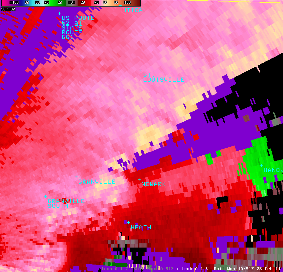 |
| KILN 0.5° Z - 5:51 AM | KILN 0.5° V - 5:51 AM | TCMH 0.1° Z - 5:51 AM | TCMH 0.1° Z - 5:51 AM |

