|
Funnel Clouds, Wind Damage and Weak Tornadoes Several small clusters of thunderstorms during the evening of June 27th, 2011, produced numerous funnel clouds and a few confirmed tornadoes. There was also some isolated wind damage. Storms began developing during the early evening hours as a weak weather disturbance crossed Indiana into Ohio, and interacted with an extremely moist and moderately unstable airmass. Dewpoints well into the 70s allowed for very low cloud bases, which aided in the viewing of numerous funnel clouds that developed with the storms. The funnels, for the most part, were extremely photogenic given the lighting near sunset. Storms quickly weakened with the loss of daytime heating, and diminished below severe levels by late in the evening. Numerous tornado warnings were issued due to the volume of funnel cloud reports and associated reports of rotation in the clouds. The warnings were concentrated in central and south central Ohio. Overall slow storm movement also led to some localized flooding in central Ohio.
|
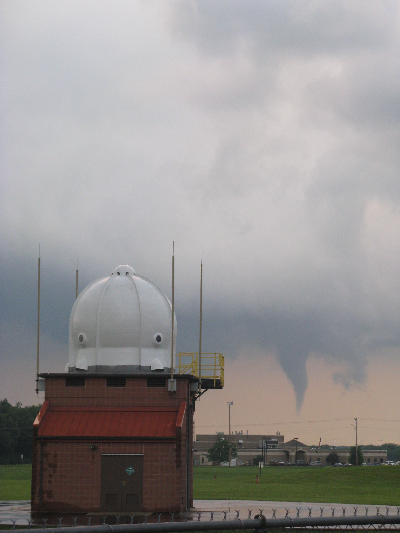 5 miles SSE Wilmington OH -- June 27th, 2011 |
|
|

