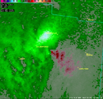
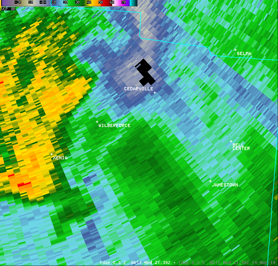
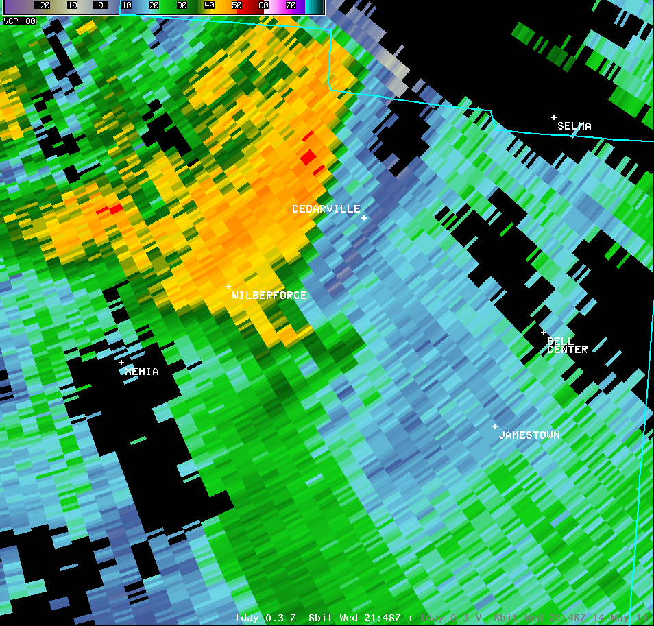
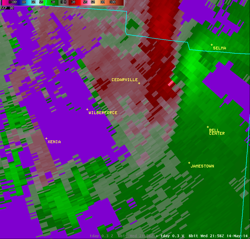
| Vertical Loop of KILN Radar Imagery (5:47 PM) |
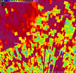
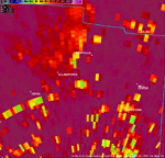
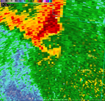
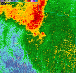
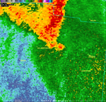
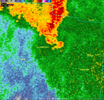
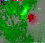
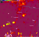
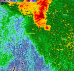
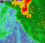
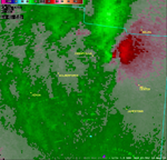
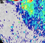
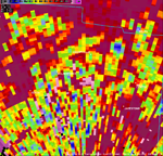
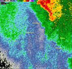
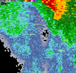
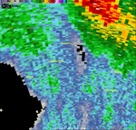
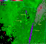
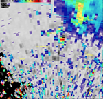
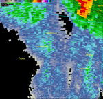
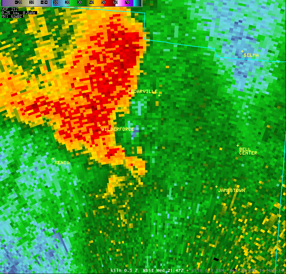
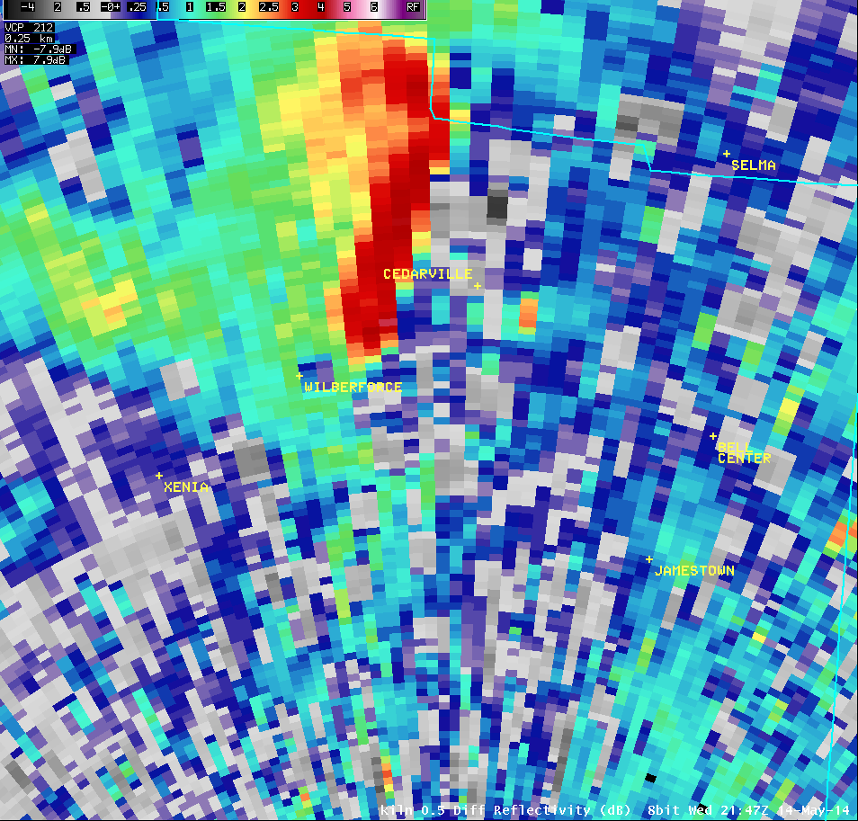
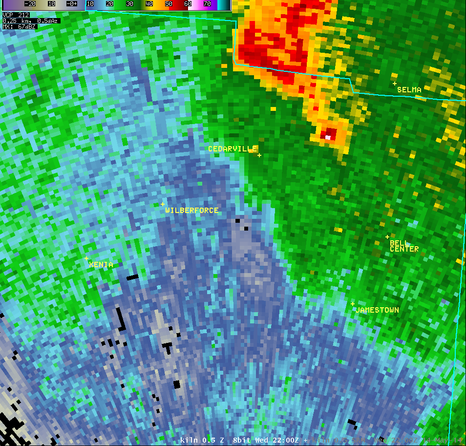
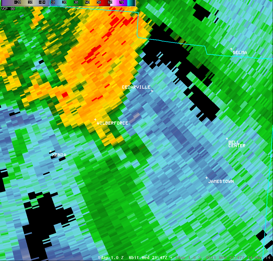
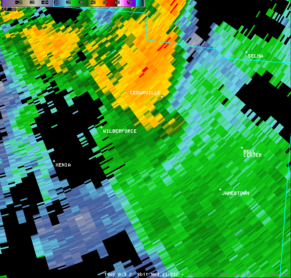
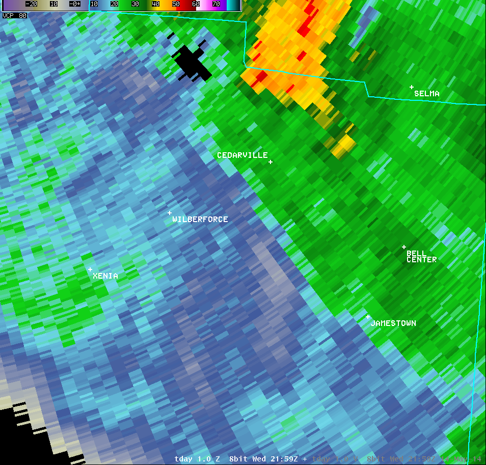
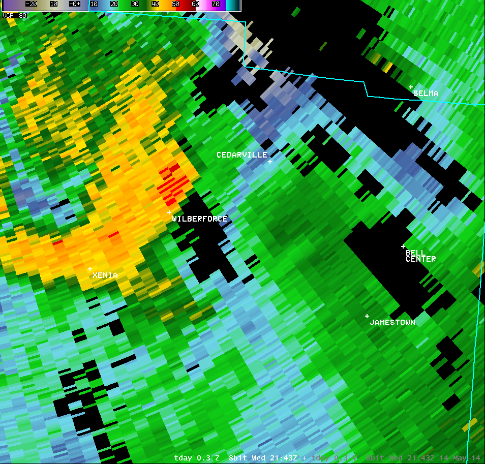
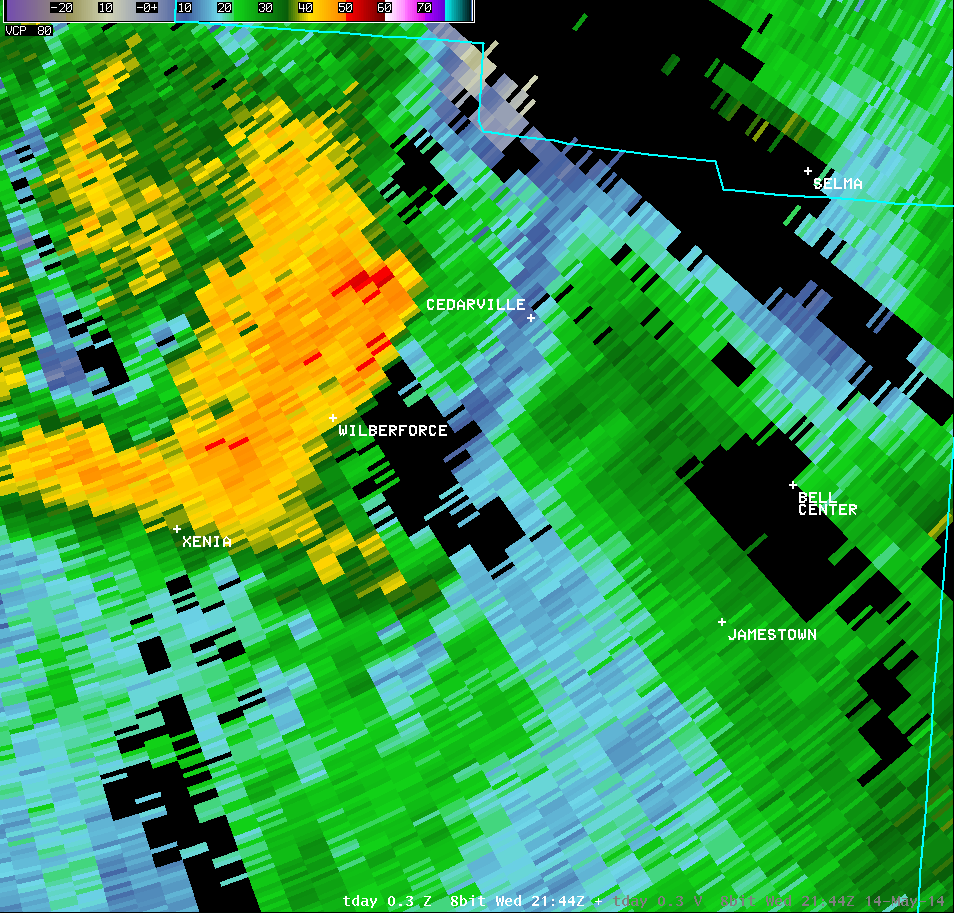
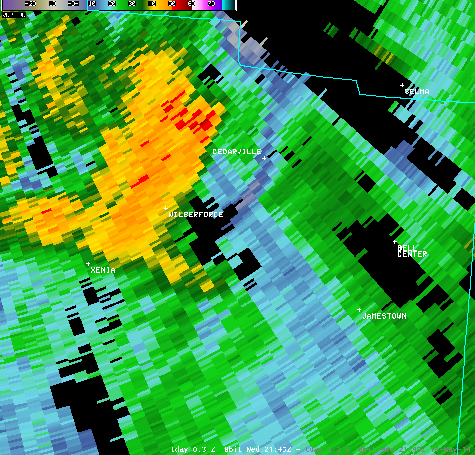
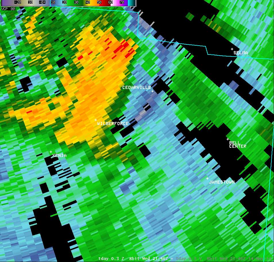
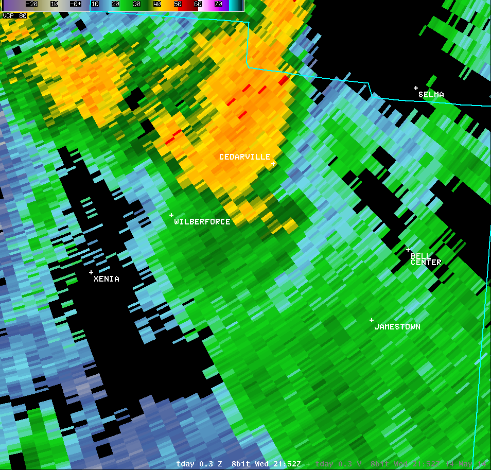
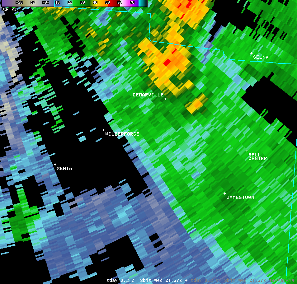
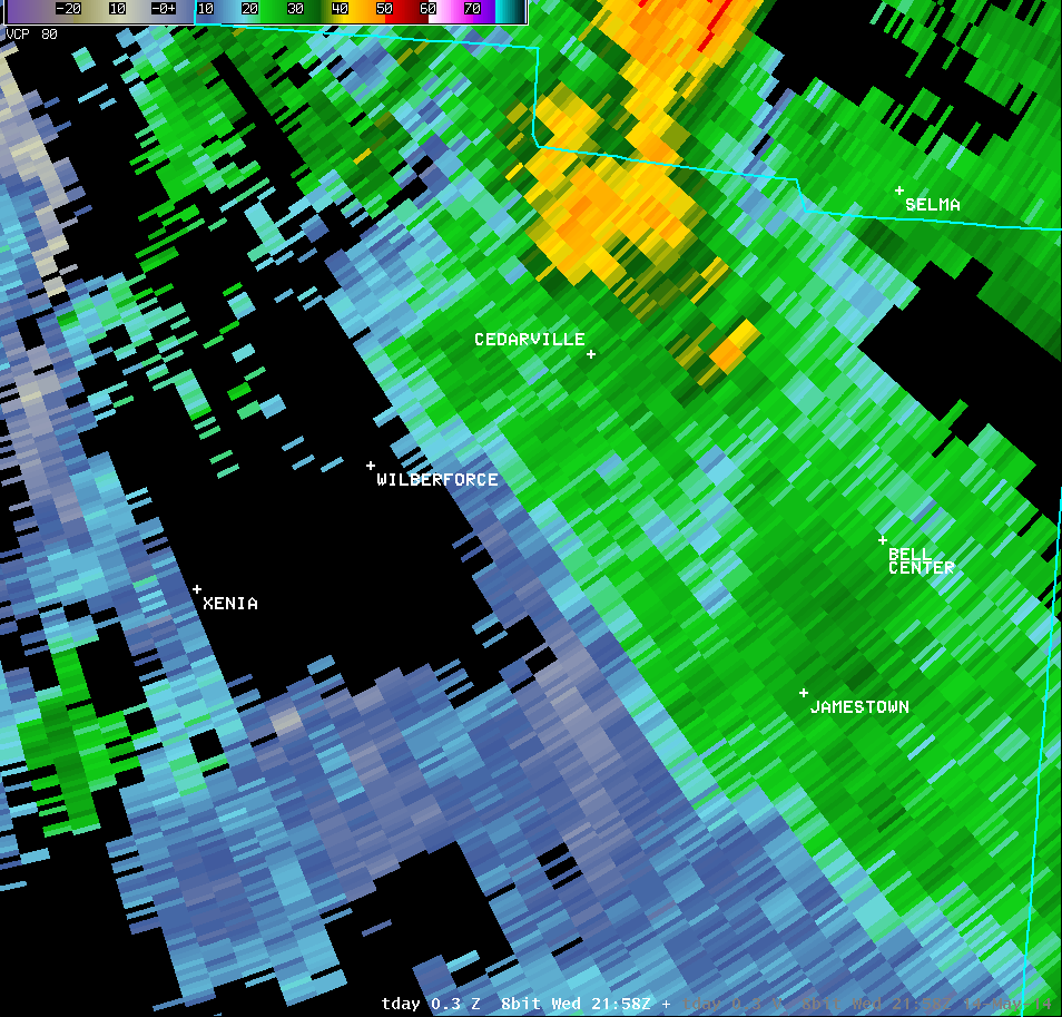
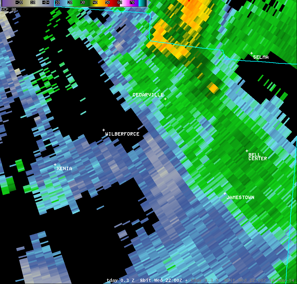
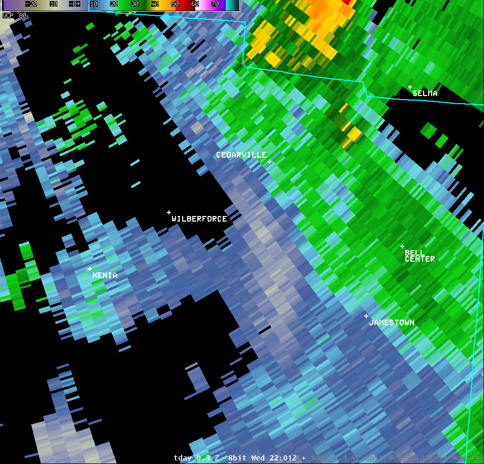
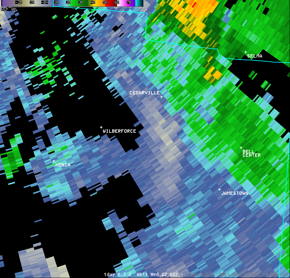
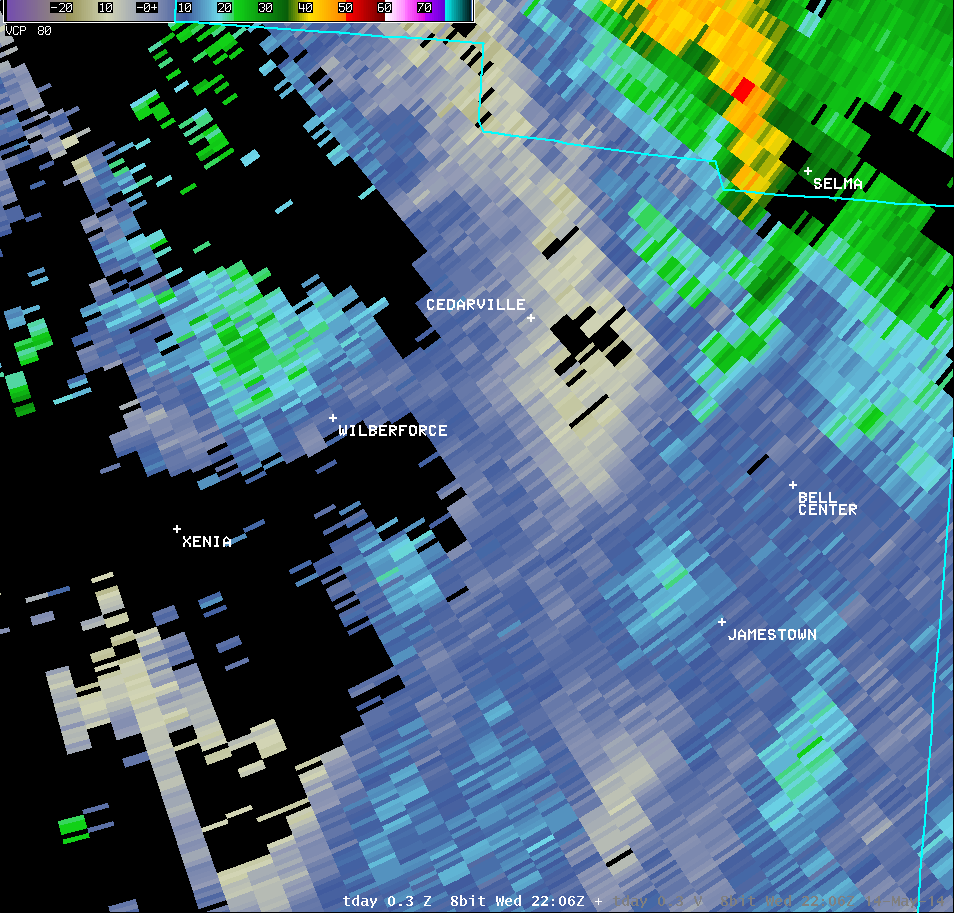
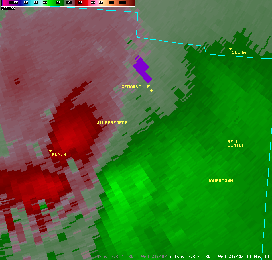
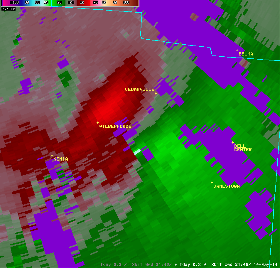
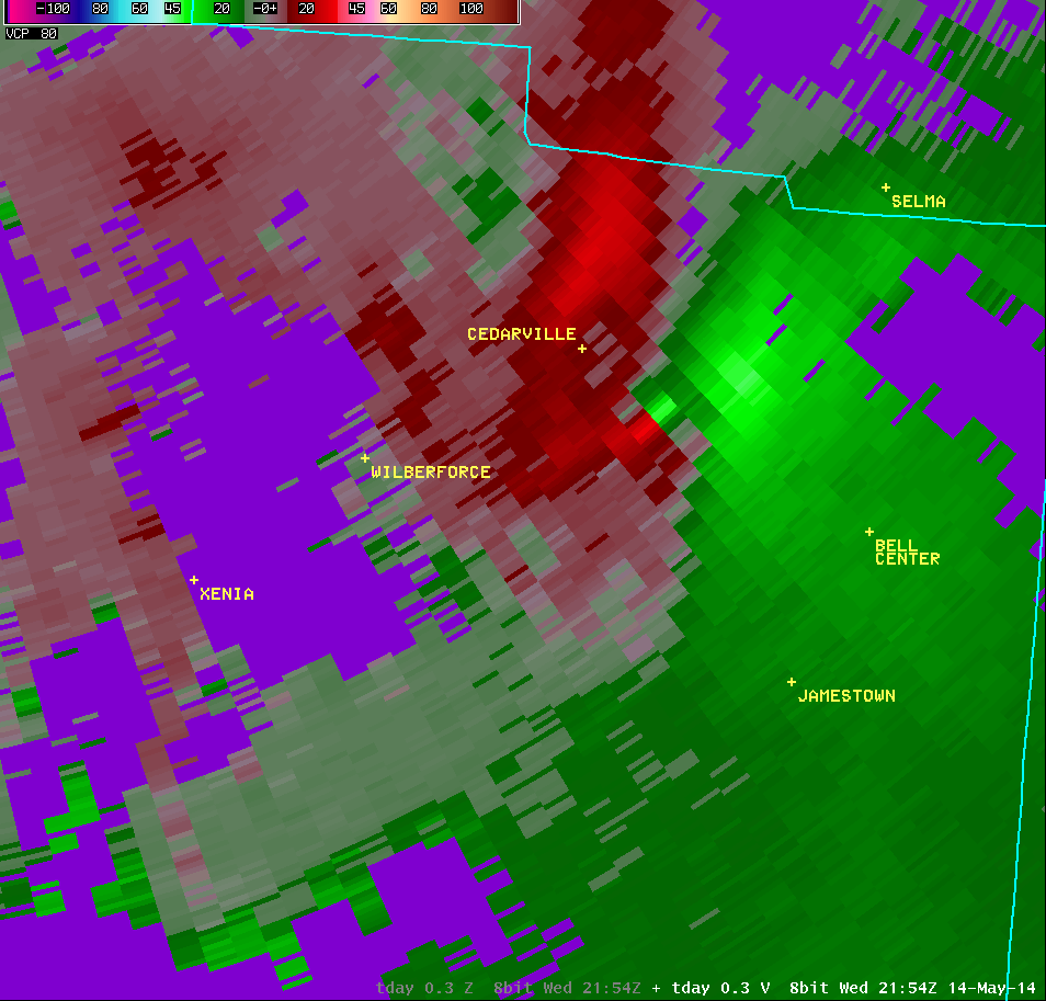
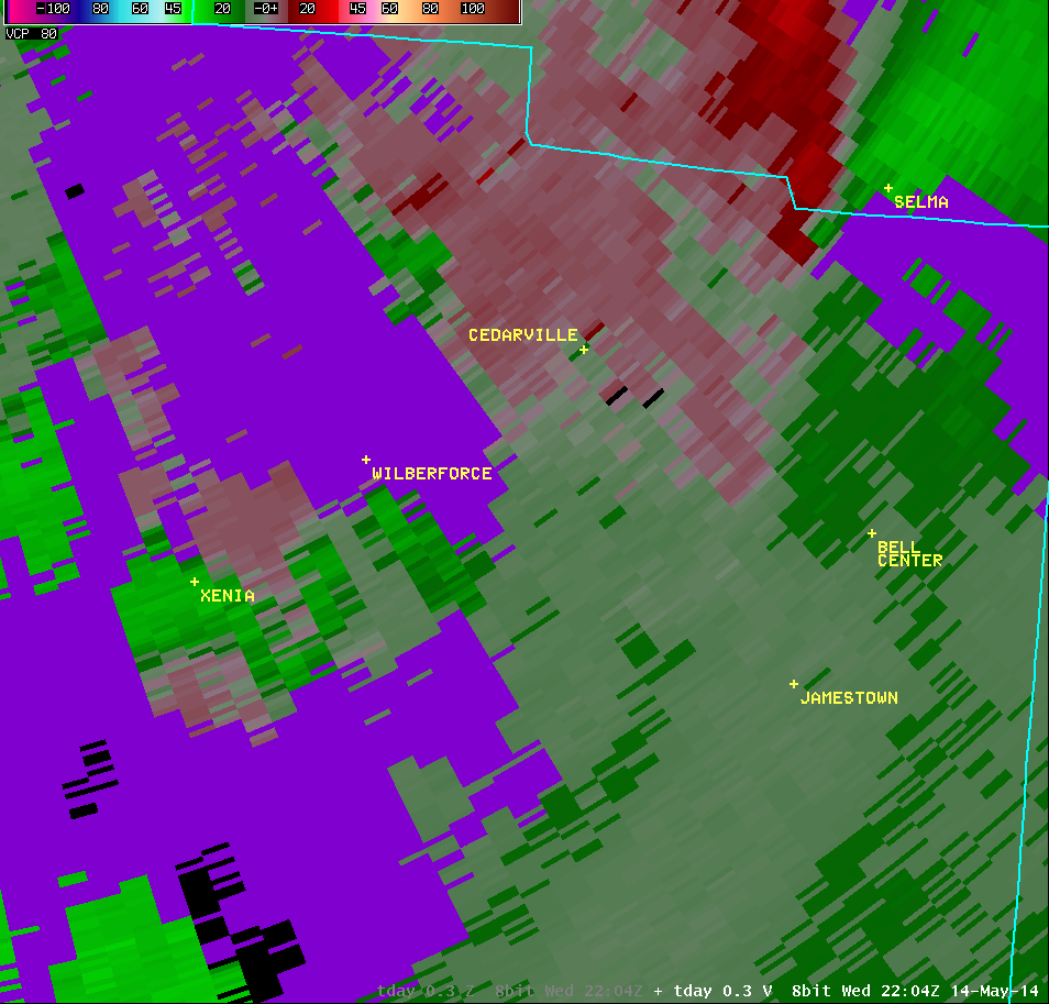
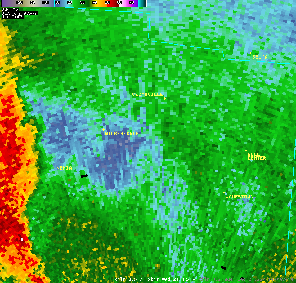
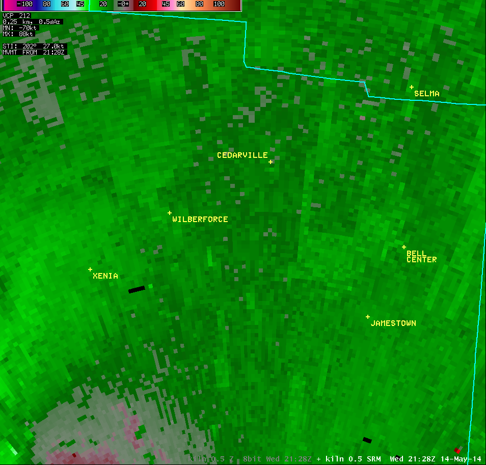
| 0.5° Reflectivity |
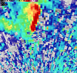
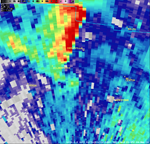
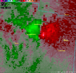
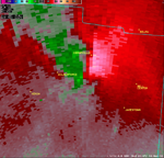
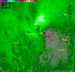
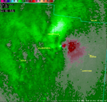
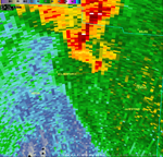
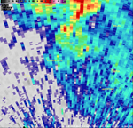
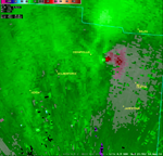
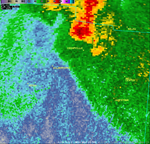
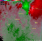
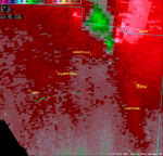
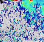
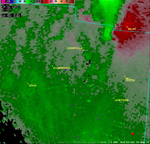
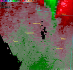
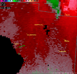
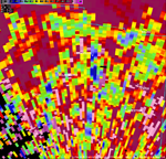
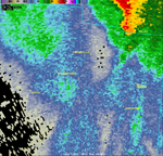
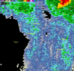
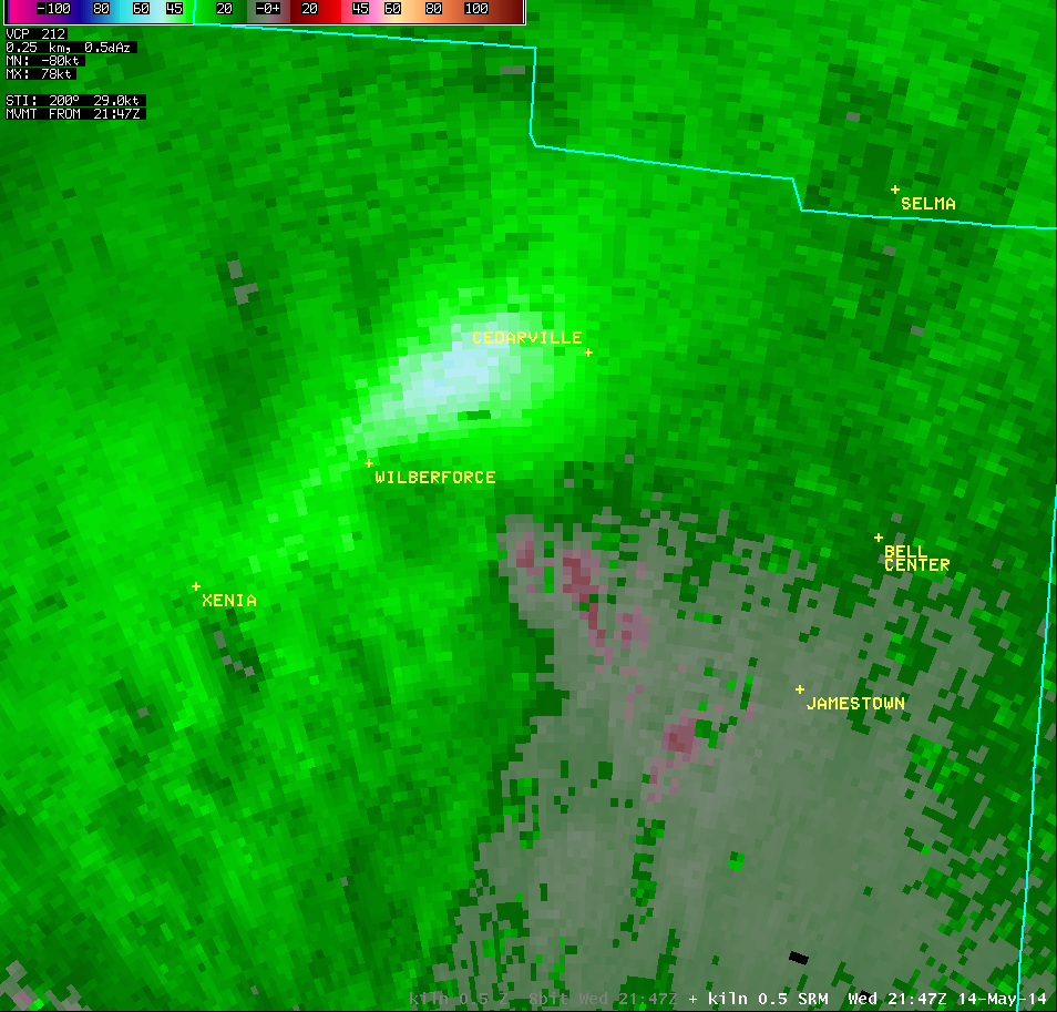
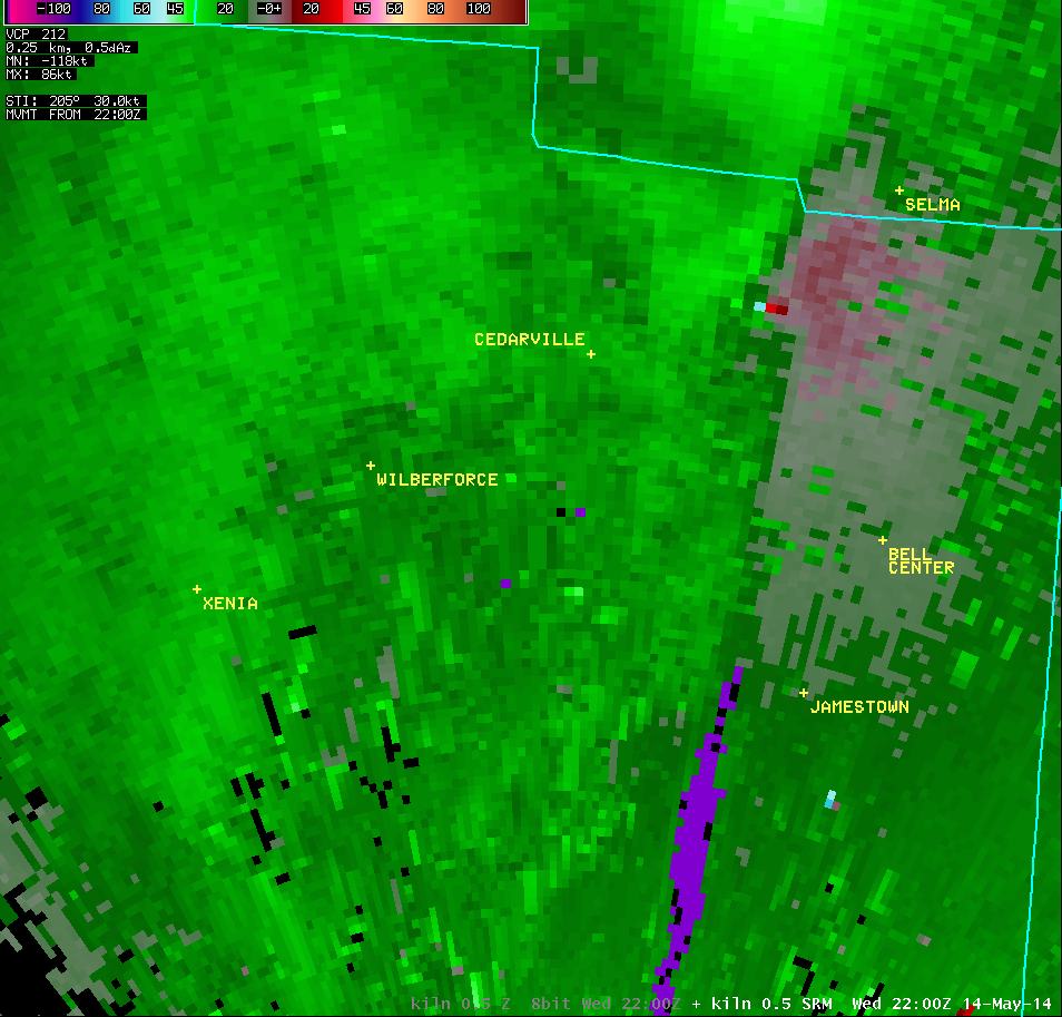
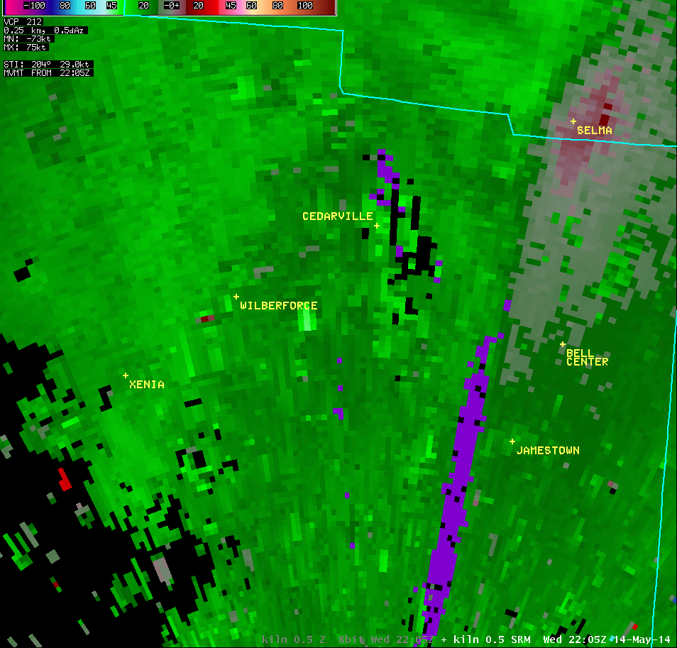
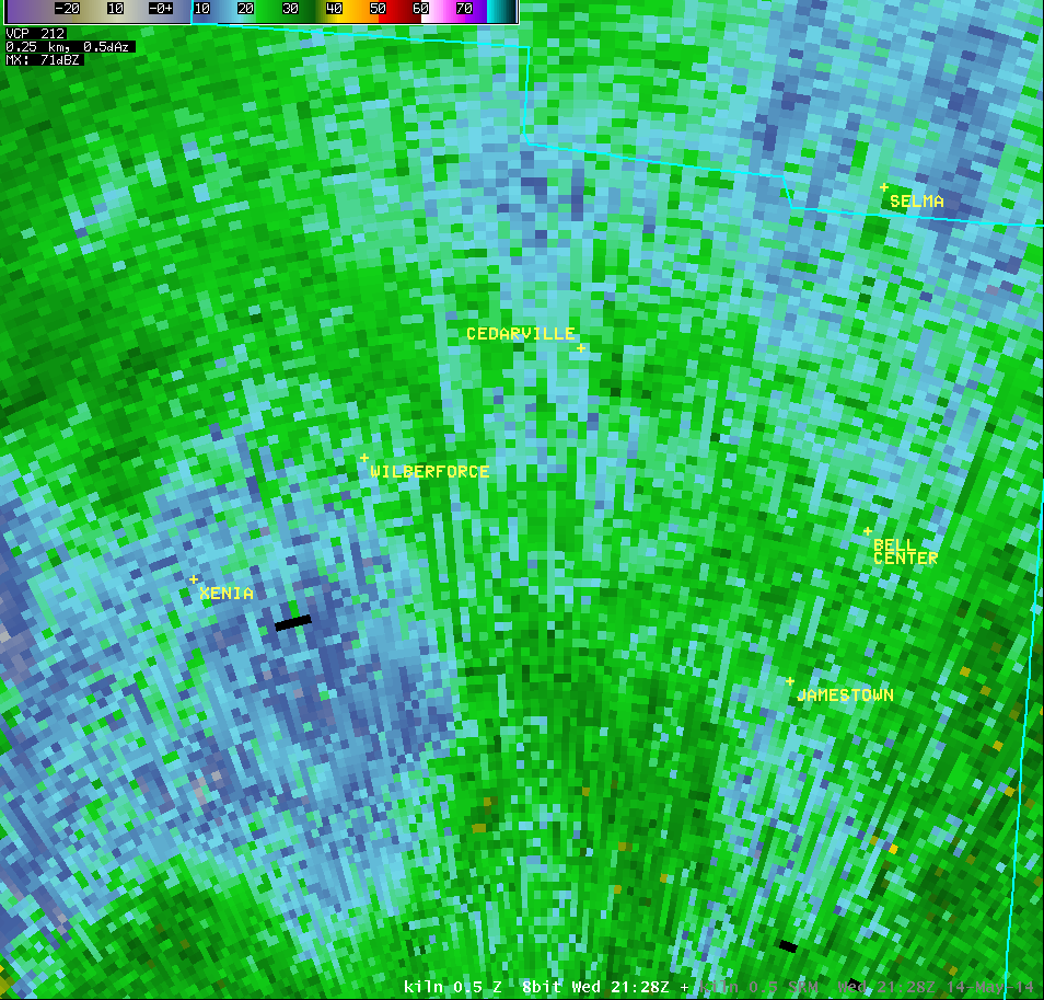
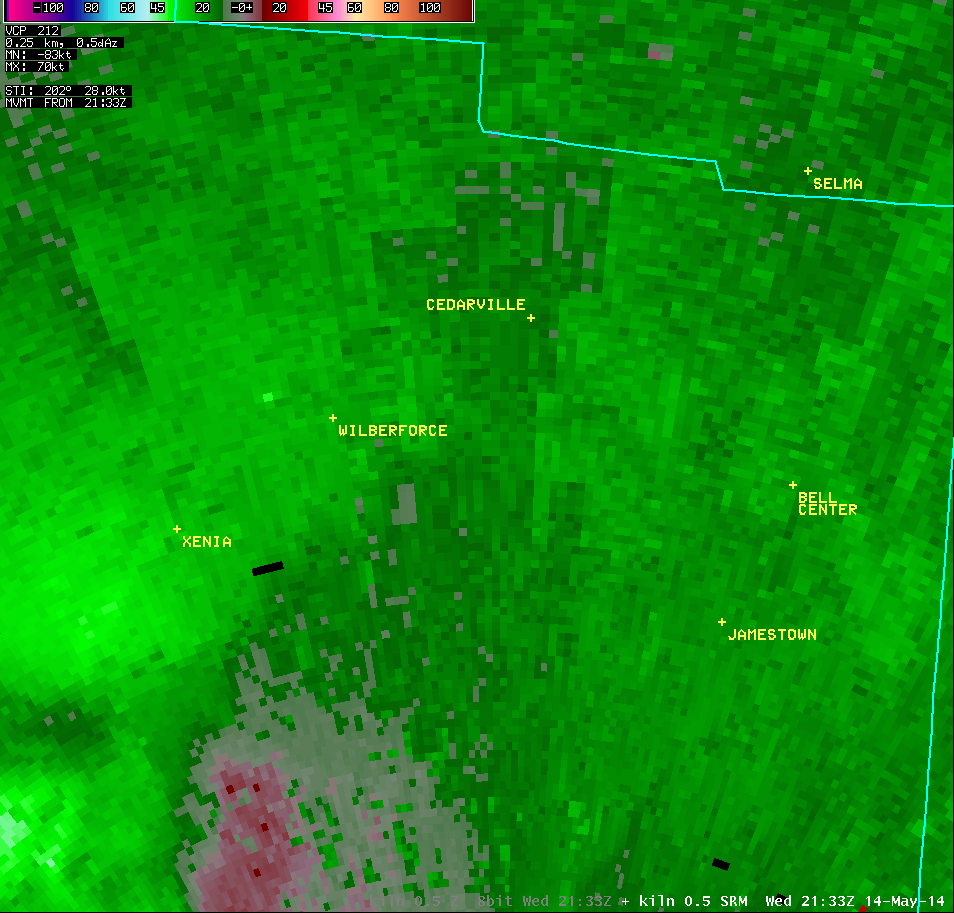
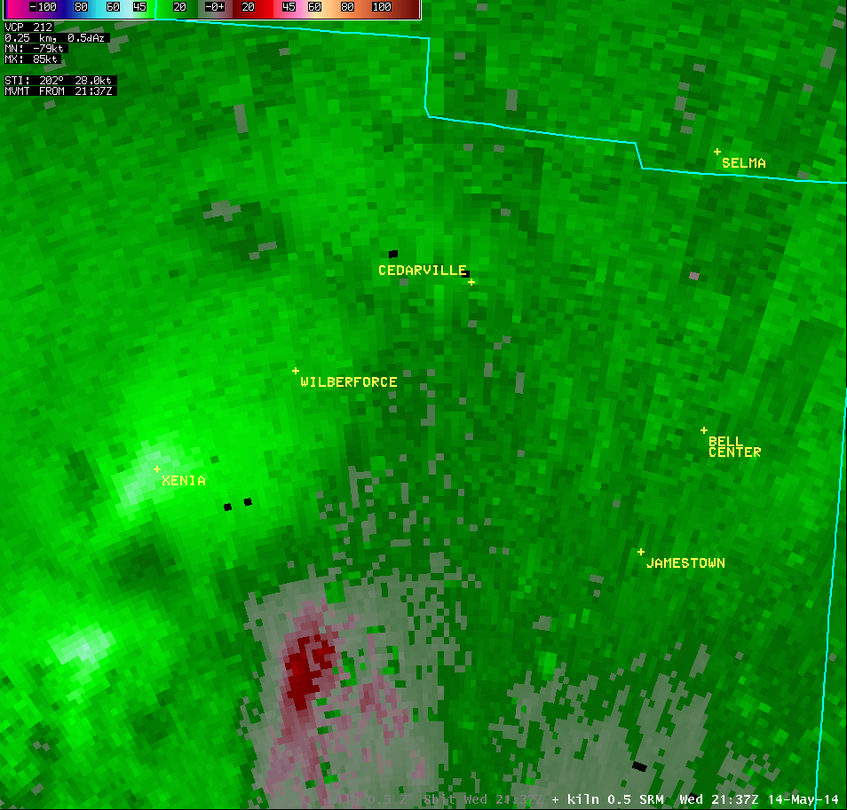
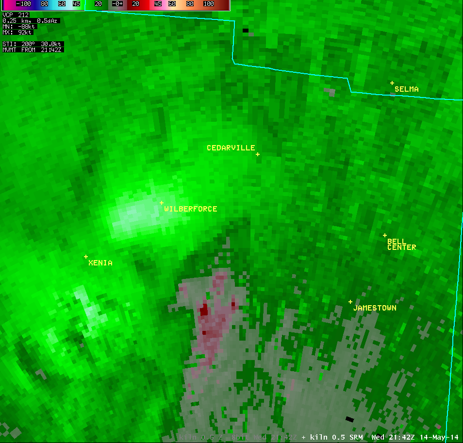
0.5° Storm-Relative Motion |
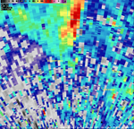
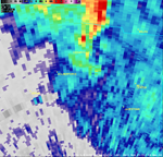
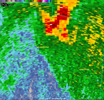
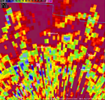
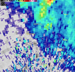
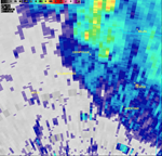
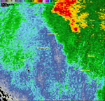
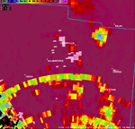
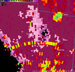
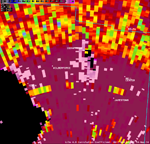
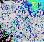
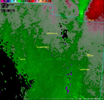
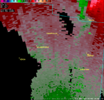
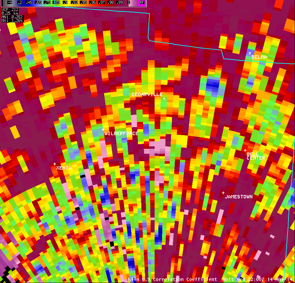
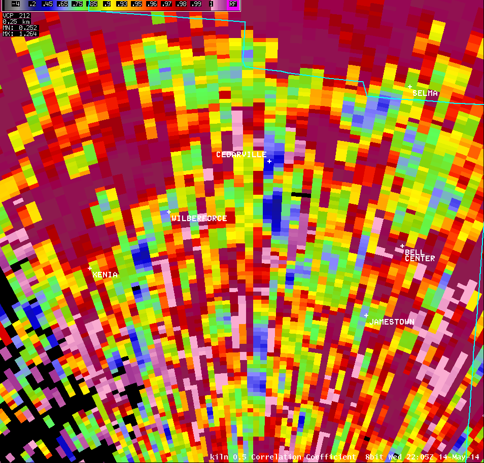
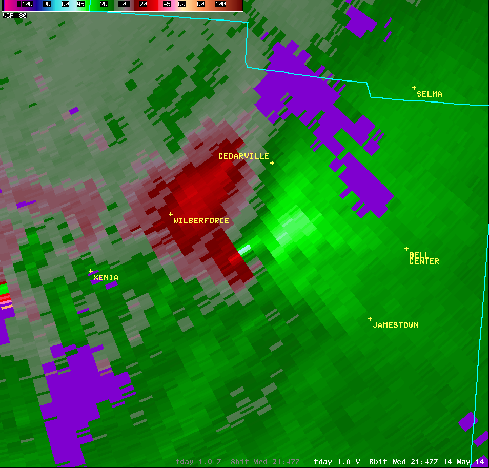
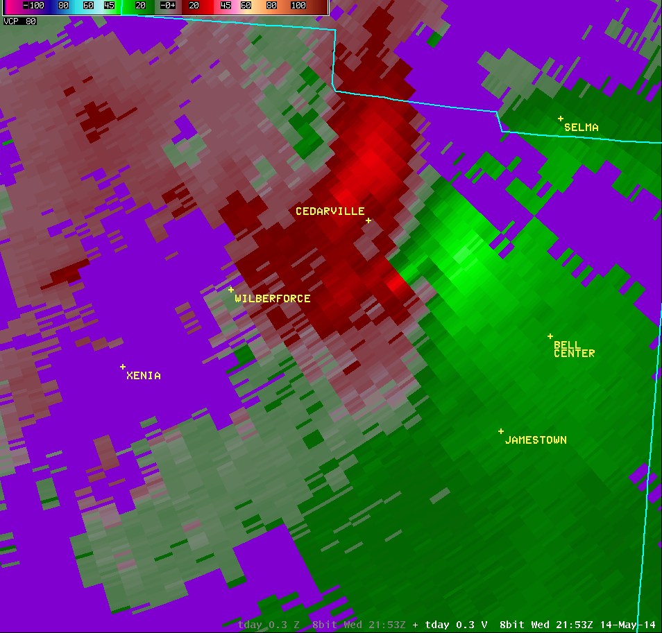
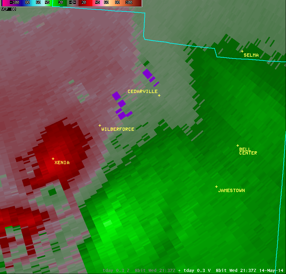
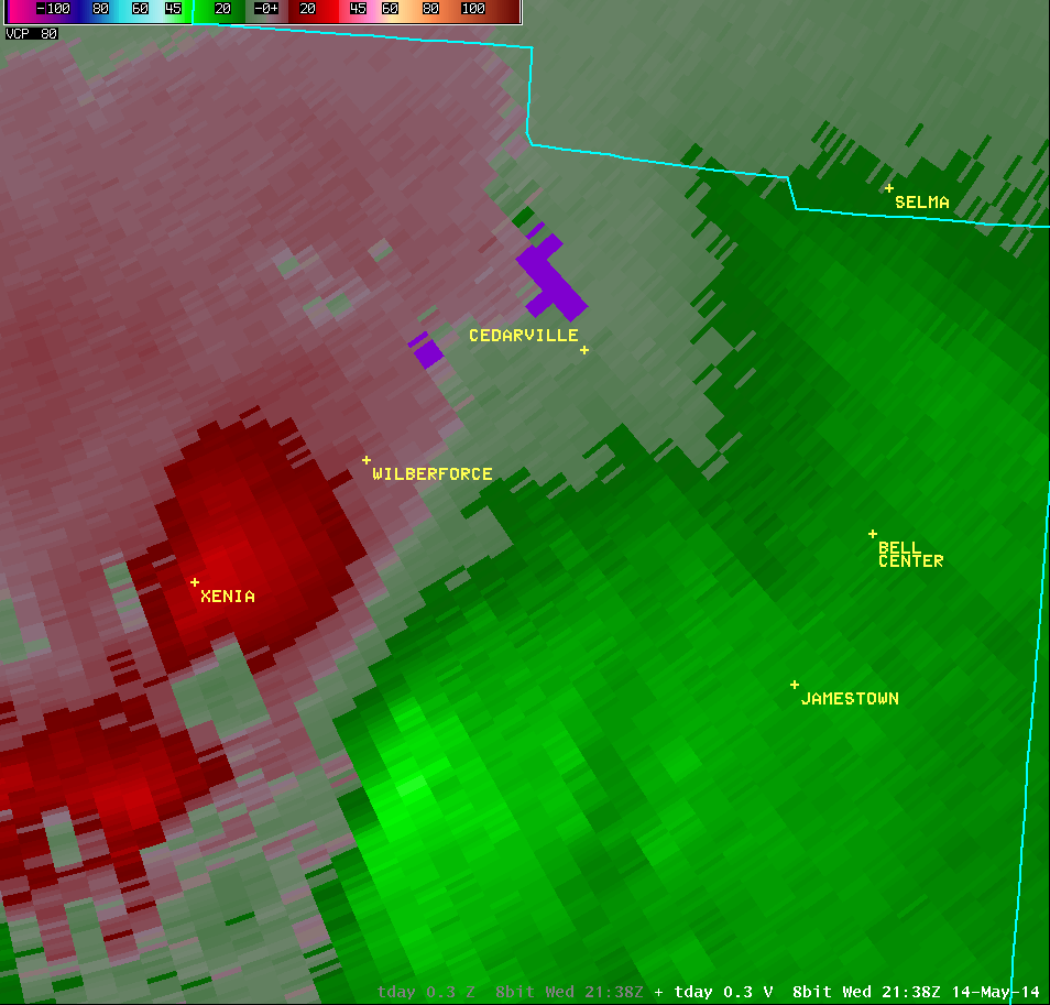
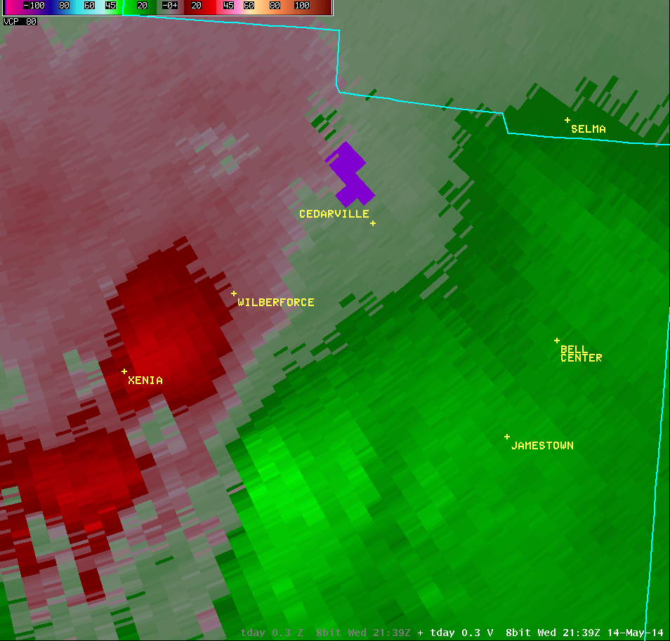
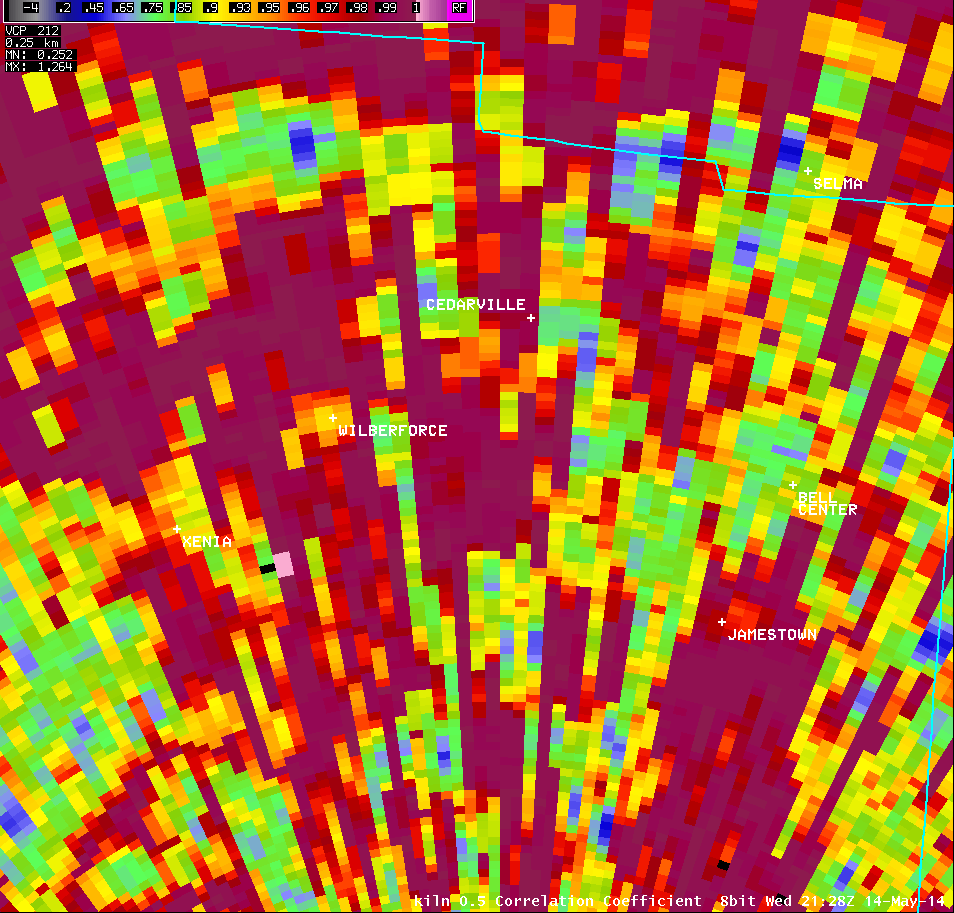
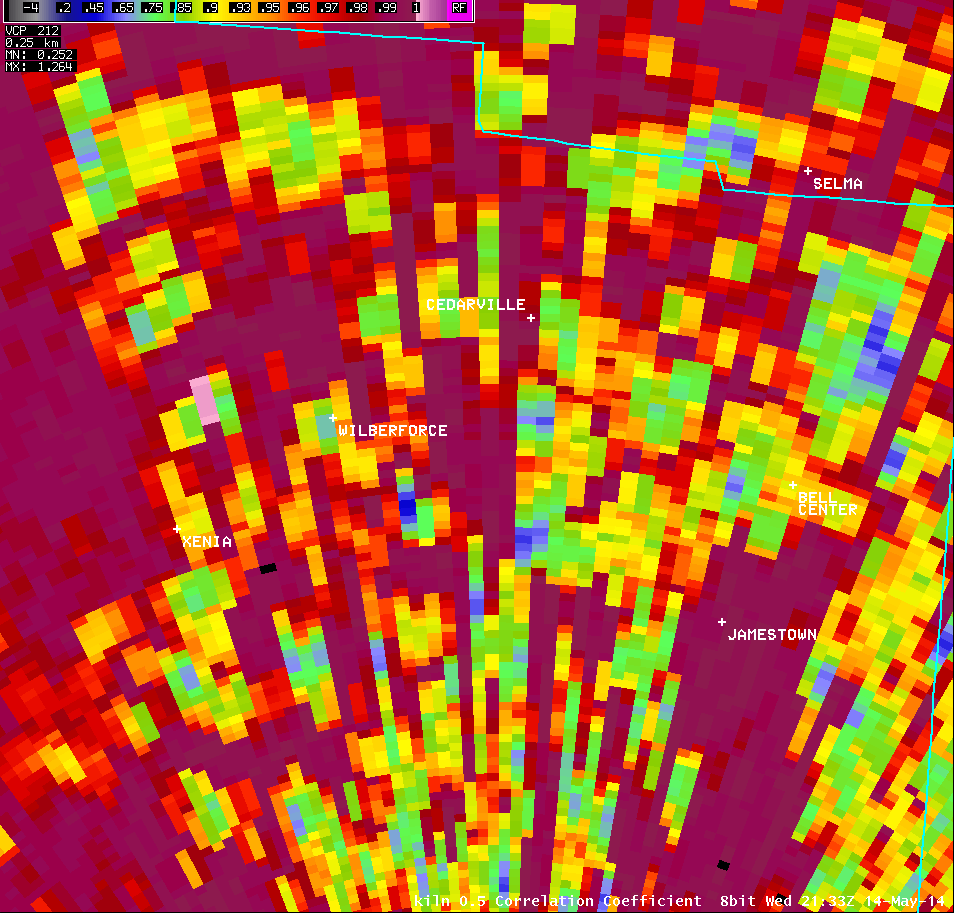
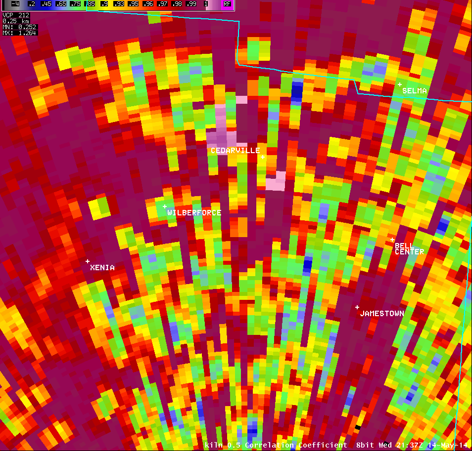
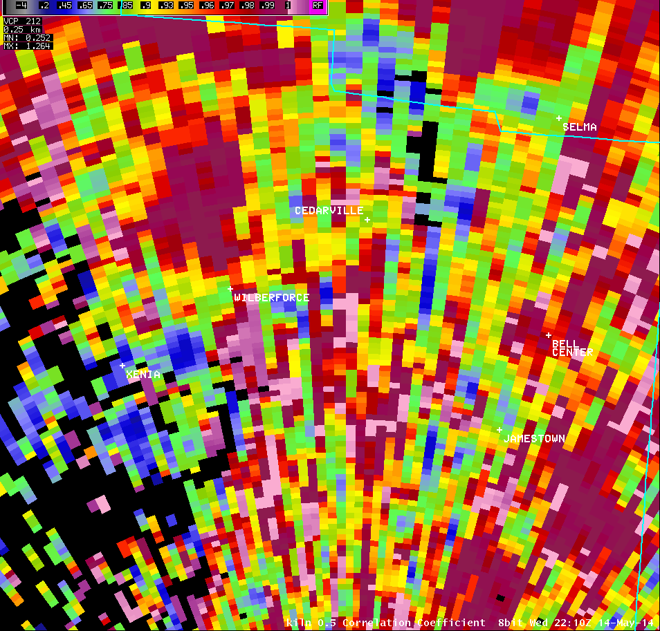
0.5° Correlation Coefficient |
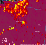
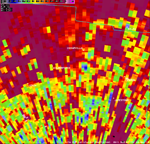
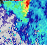
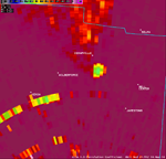
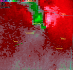
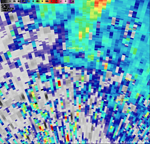
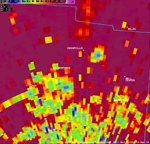
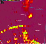
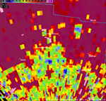
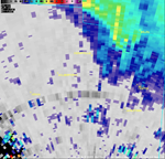
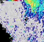
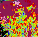
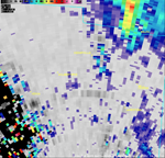
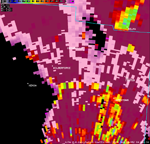
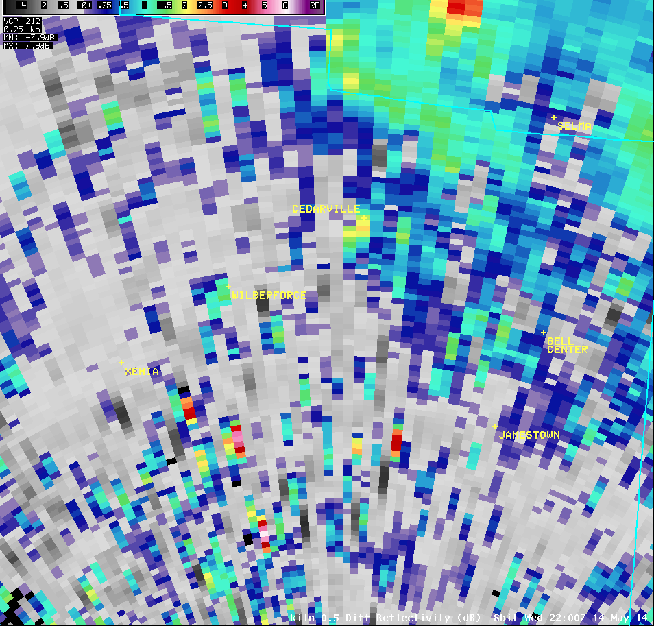
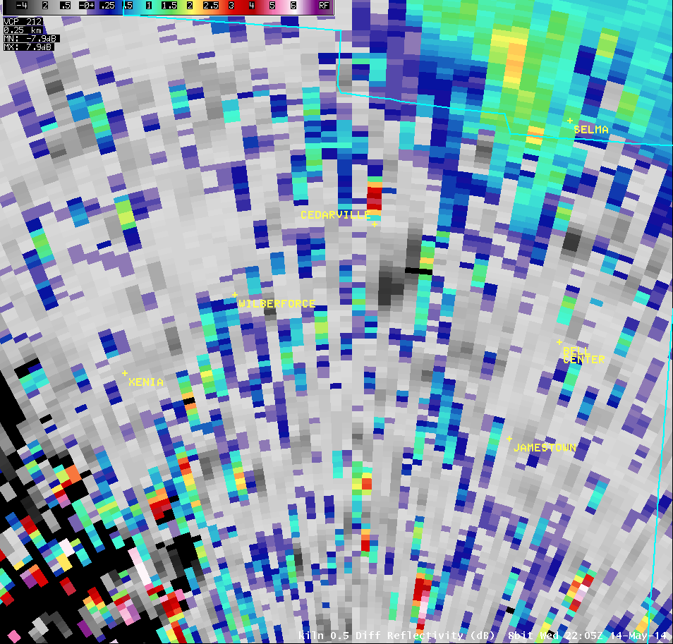
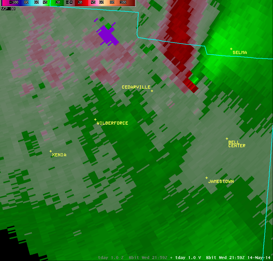
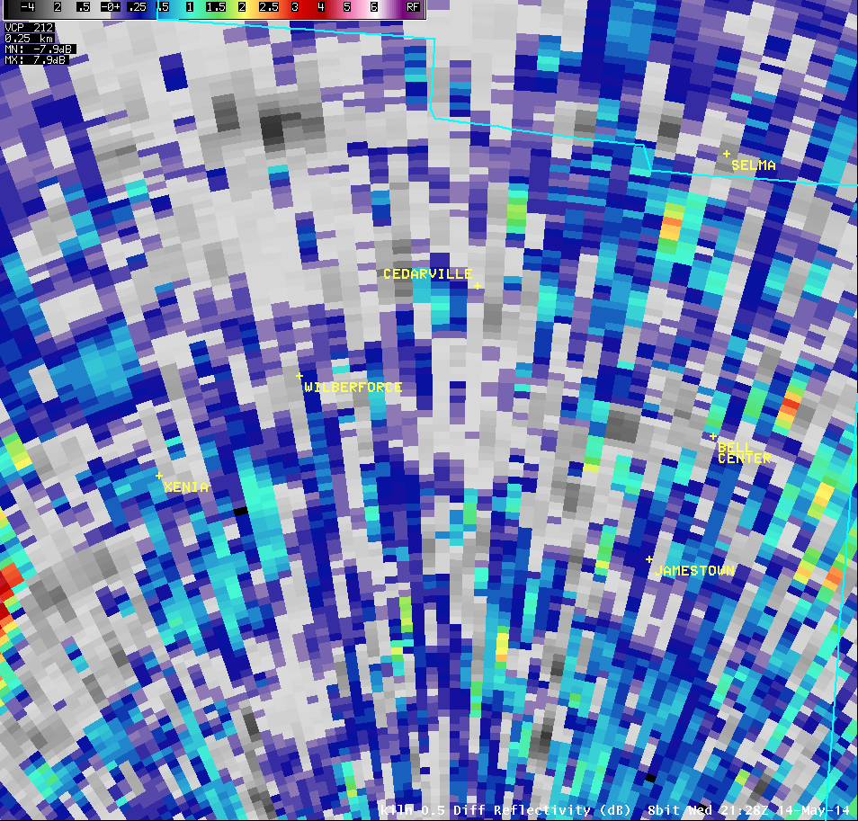
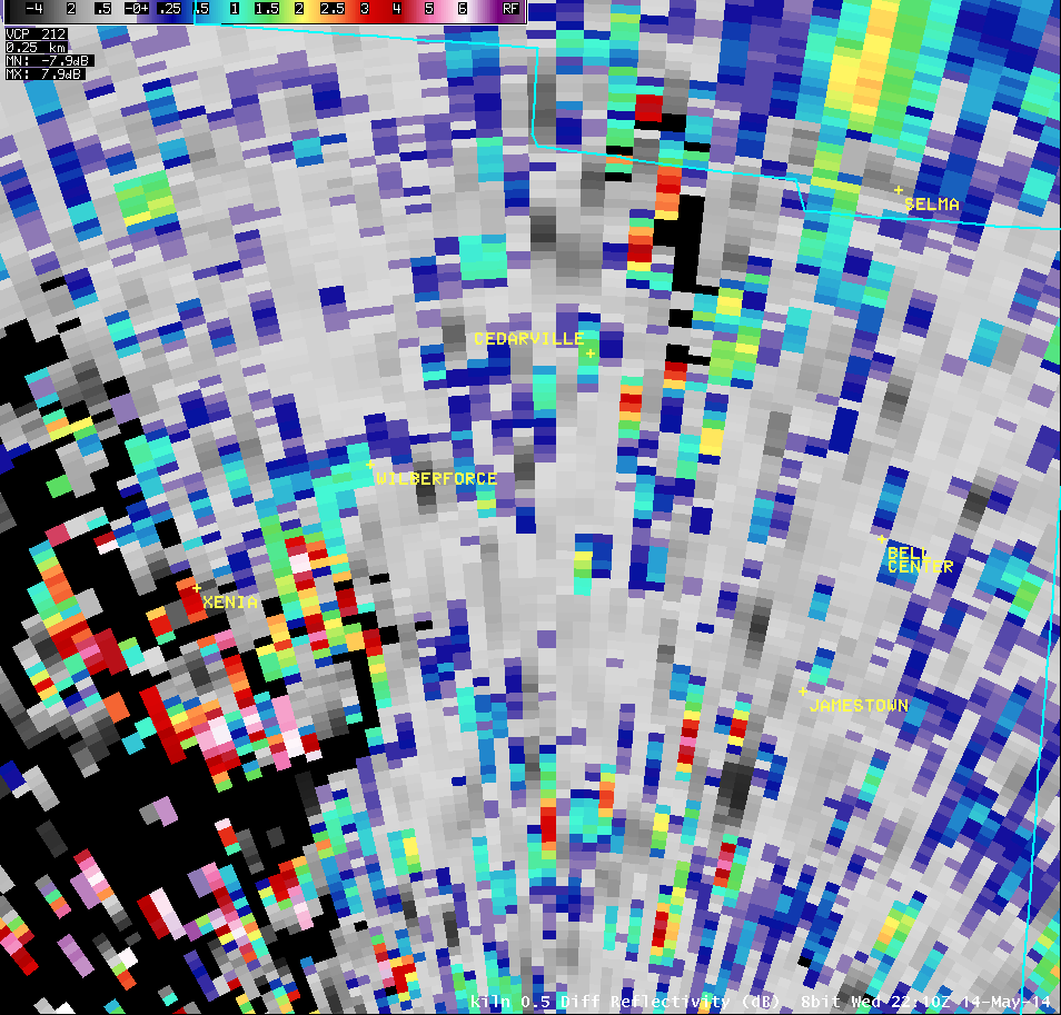
0.5° Differential Reflectivity |
 |
 |
 |
 |
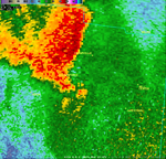
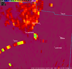
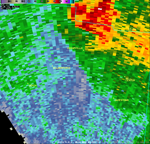
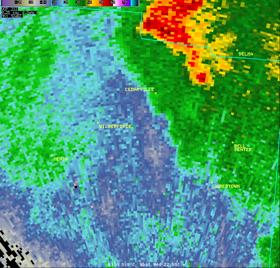
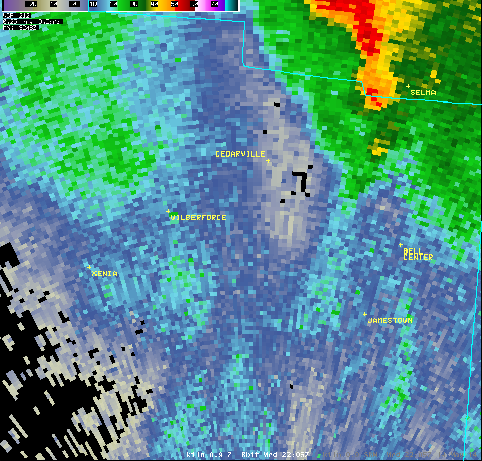
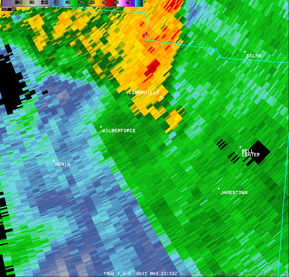
| 0.9° Reflectivity |
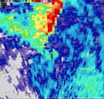
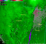
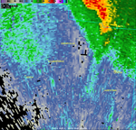
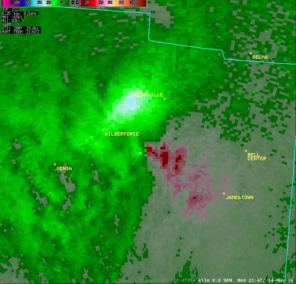
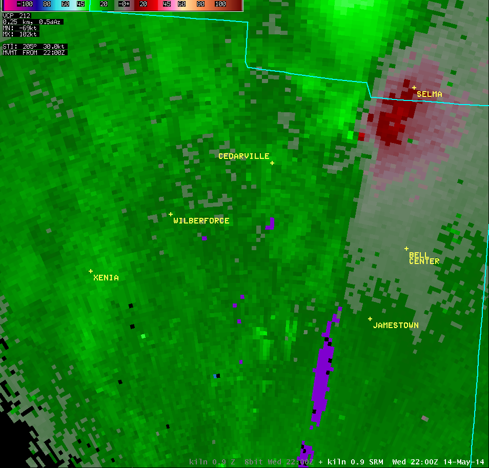
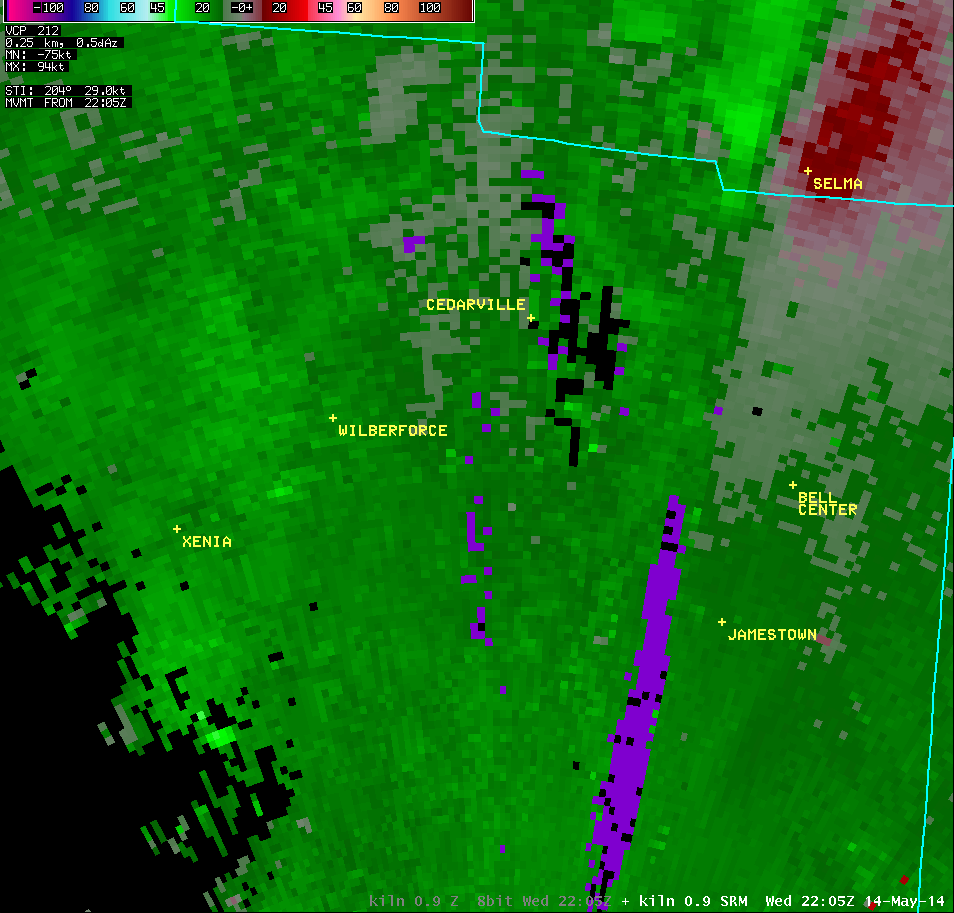
0.9° Storm-Relative Motion |
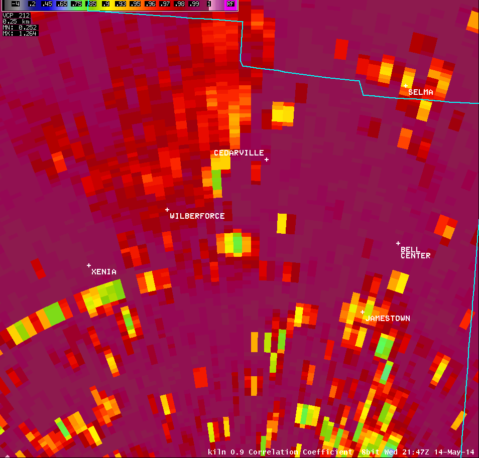
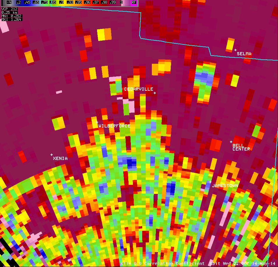
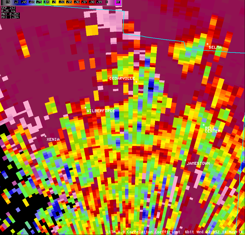
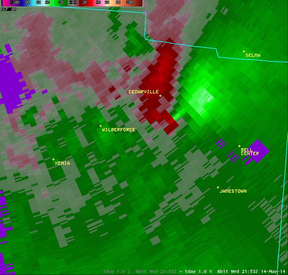
0.9° Correlation Coefficient |
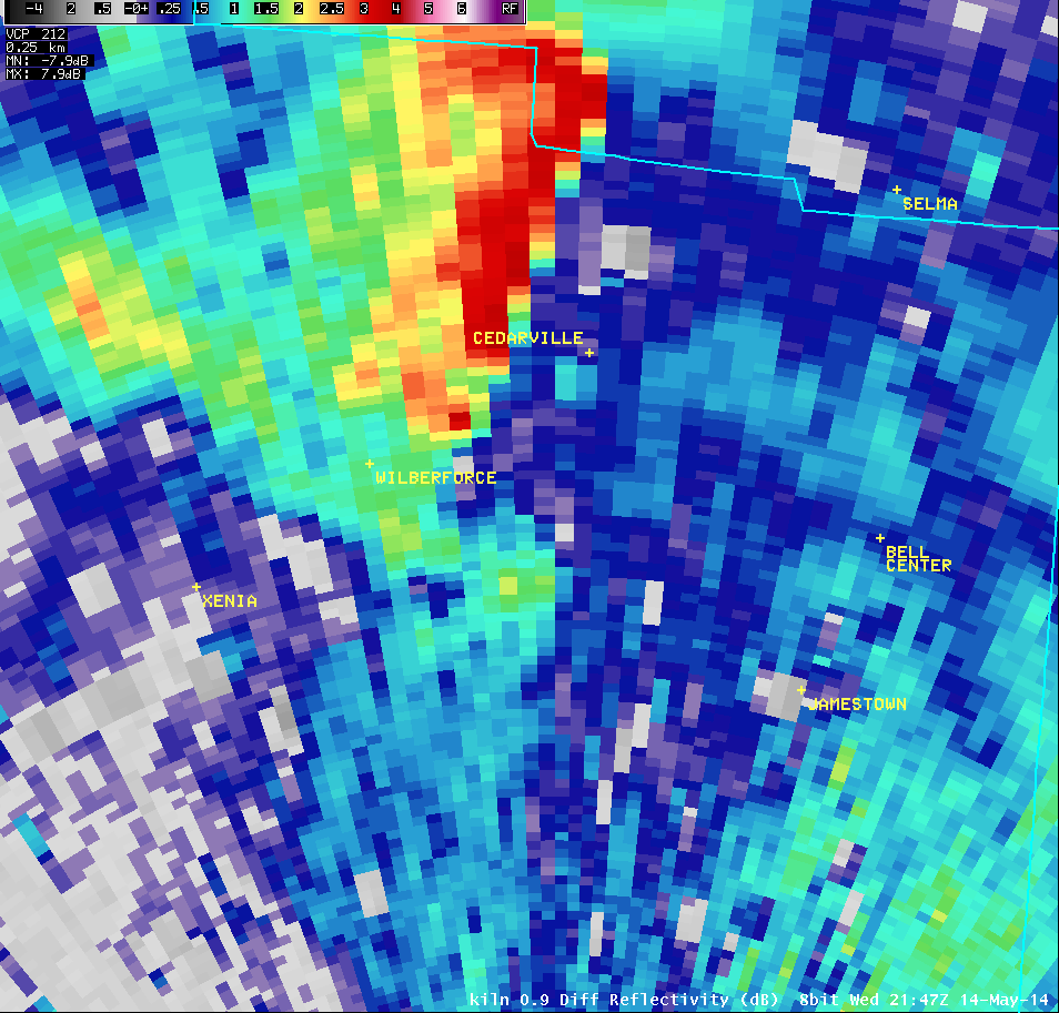
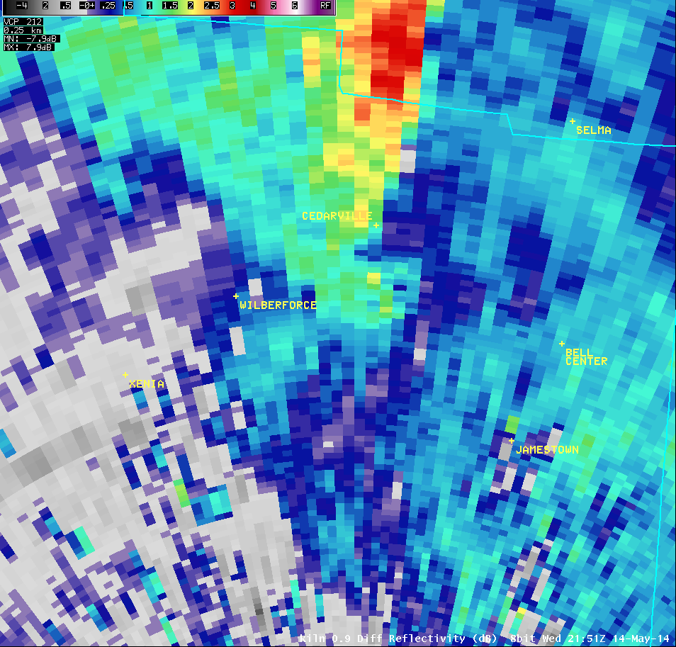
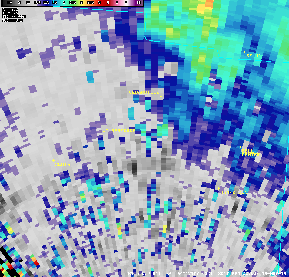
0.9° Differential Reflectivity |
 |
 |
 |
 |
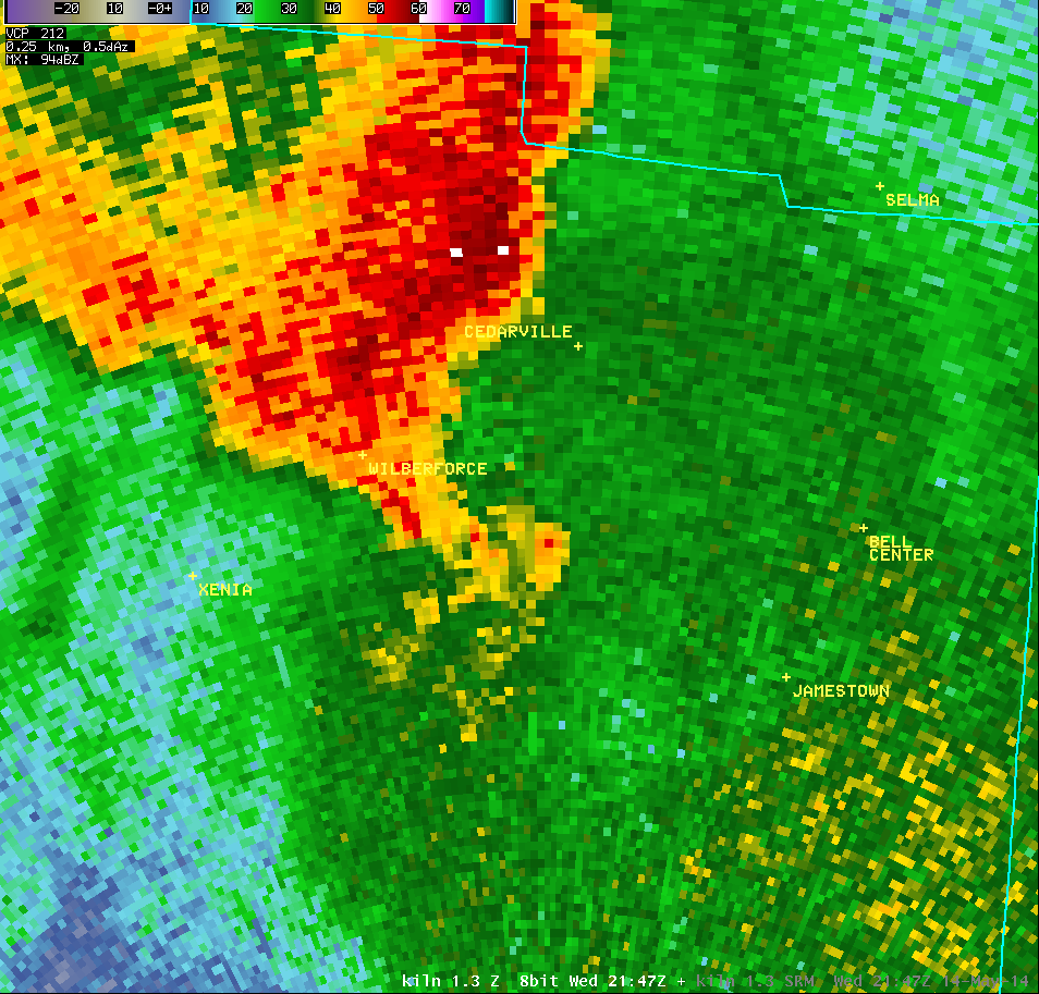
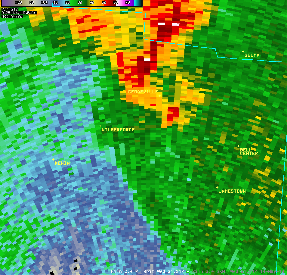
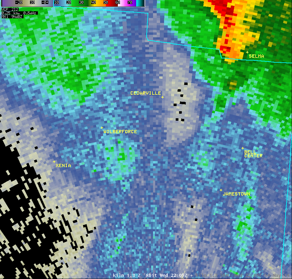
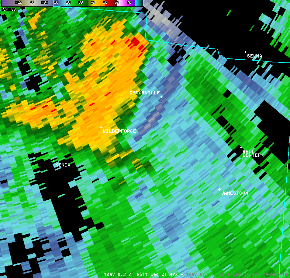
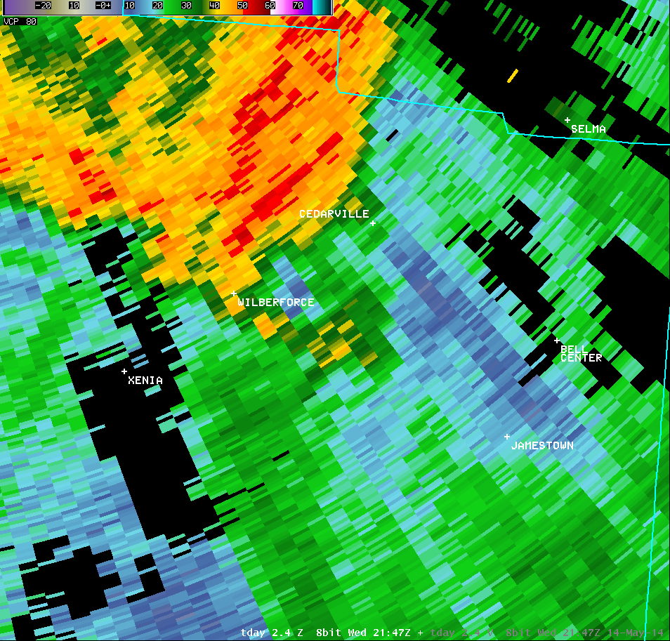
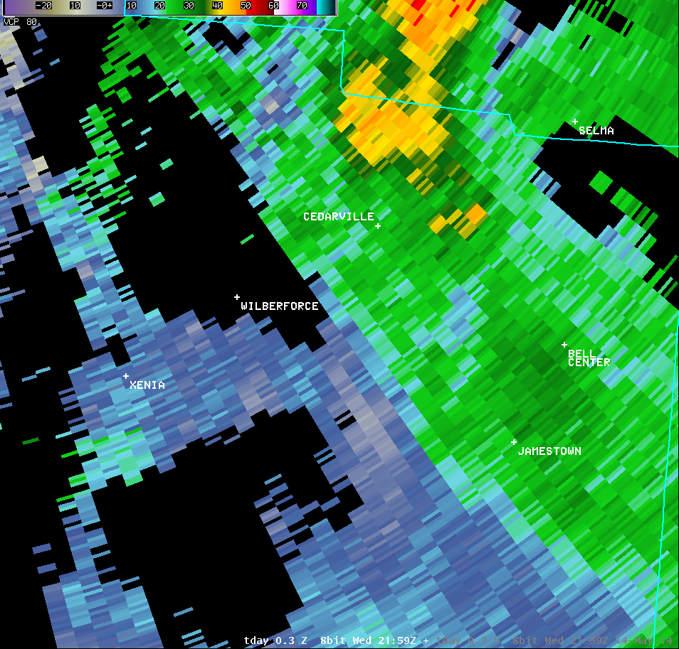
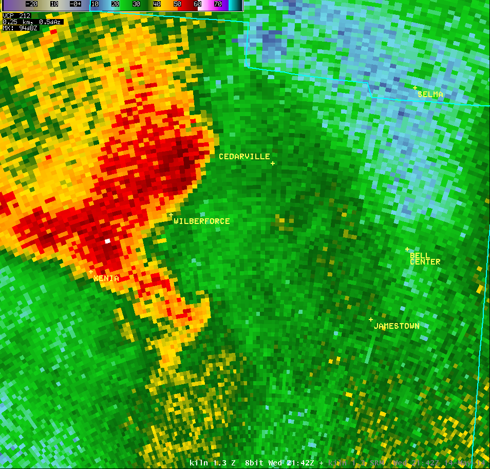
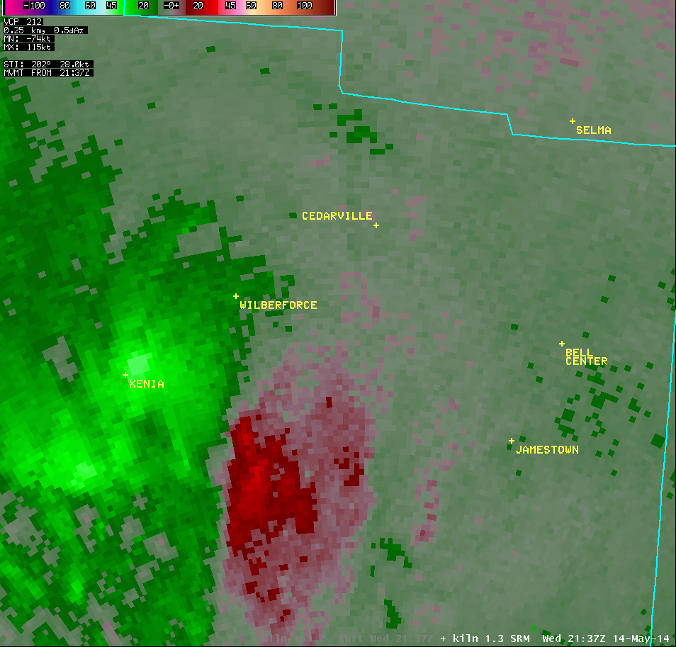
| 1.3° Reflectivity |
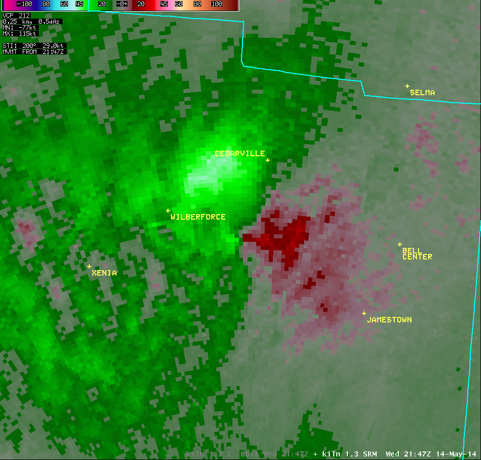
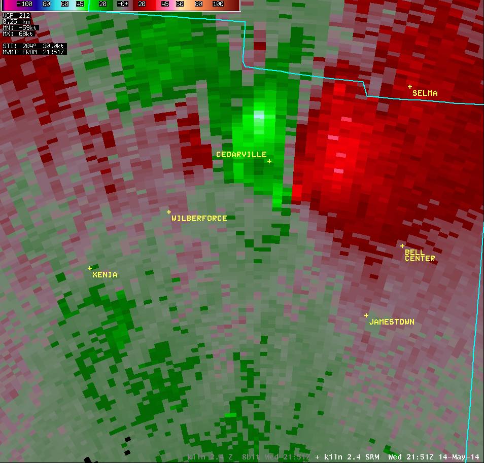
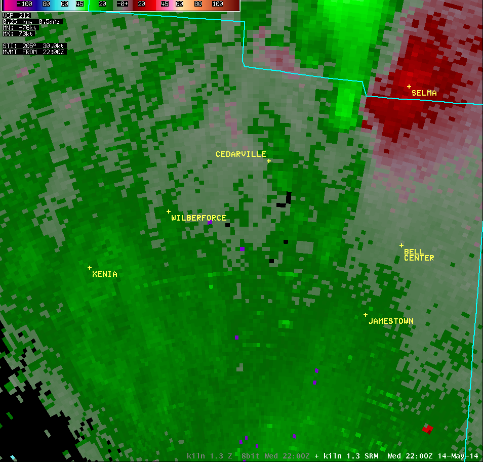
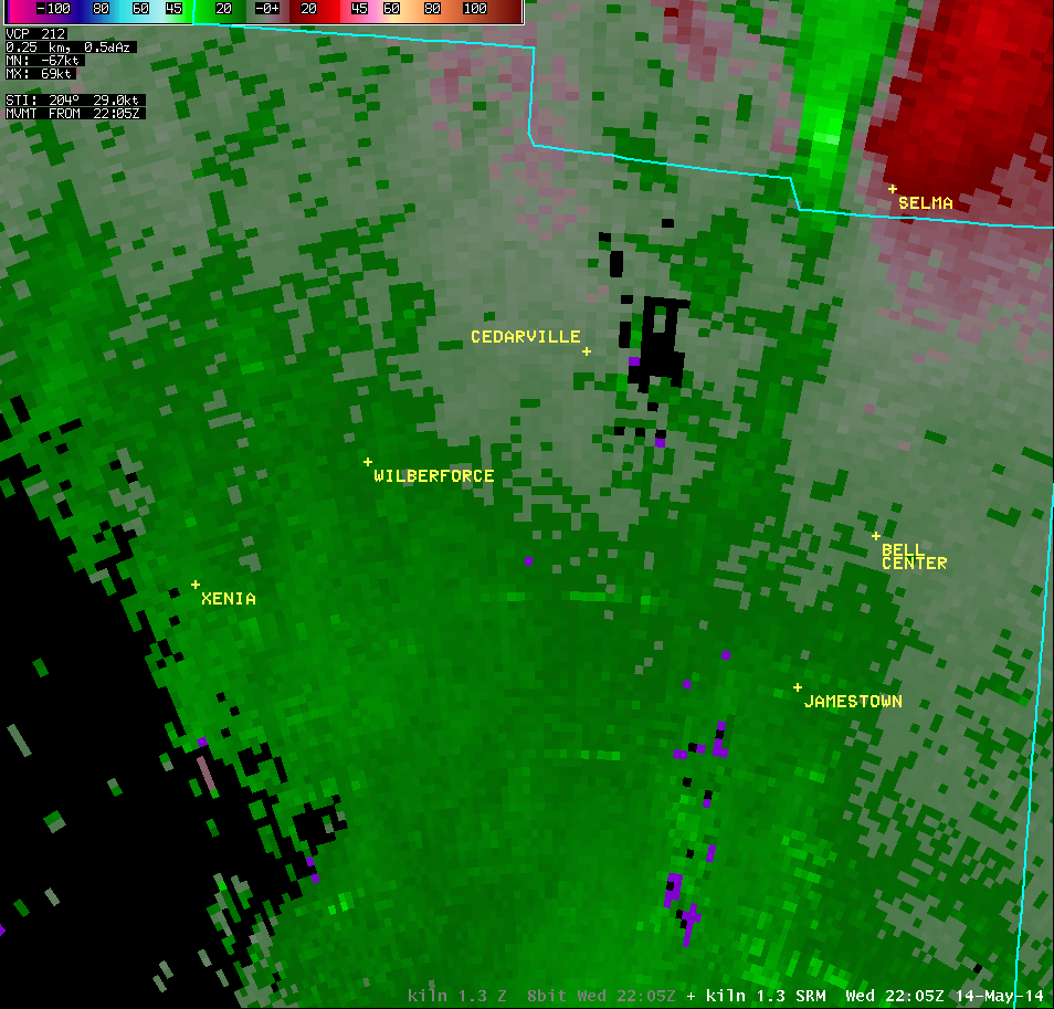
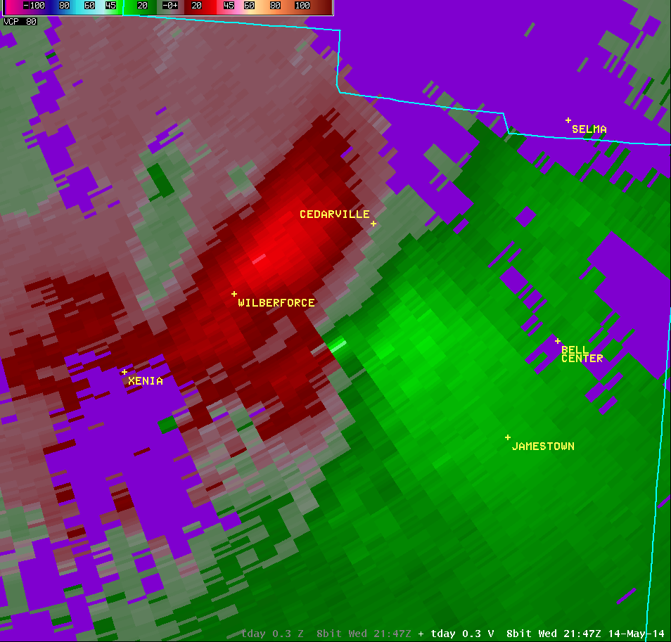
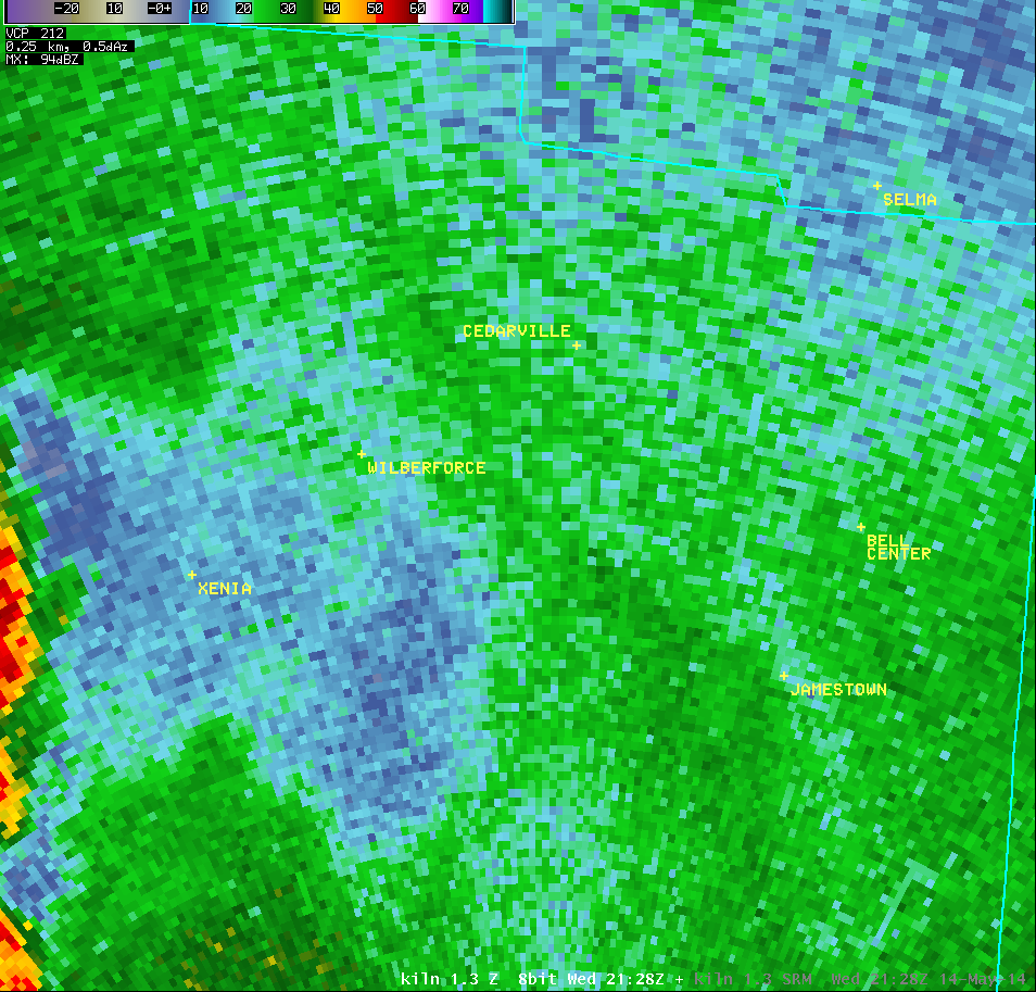
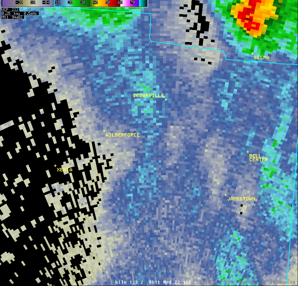
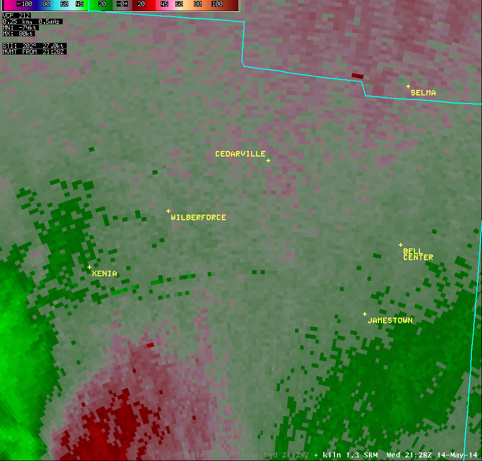
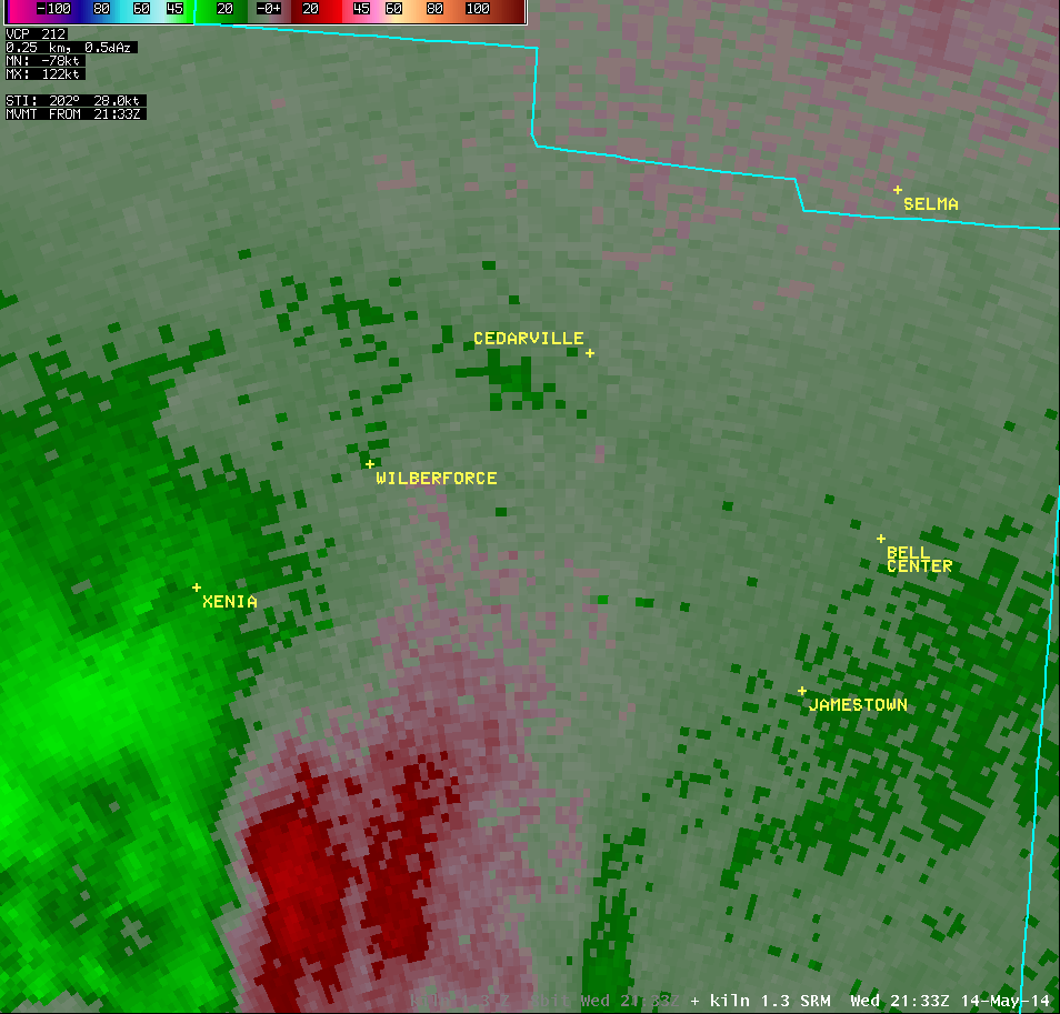
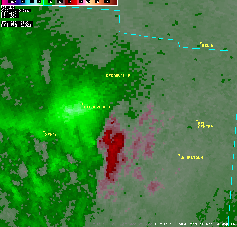
1.3° Storm-Relative Motion |
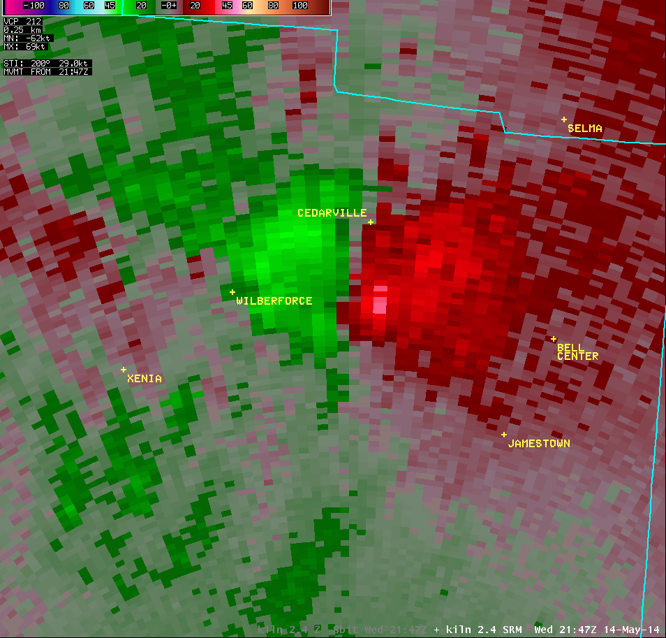
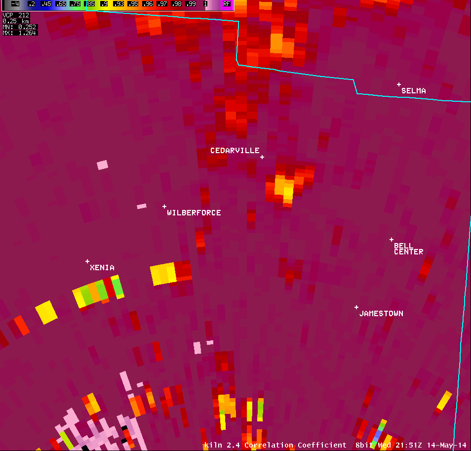
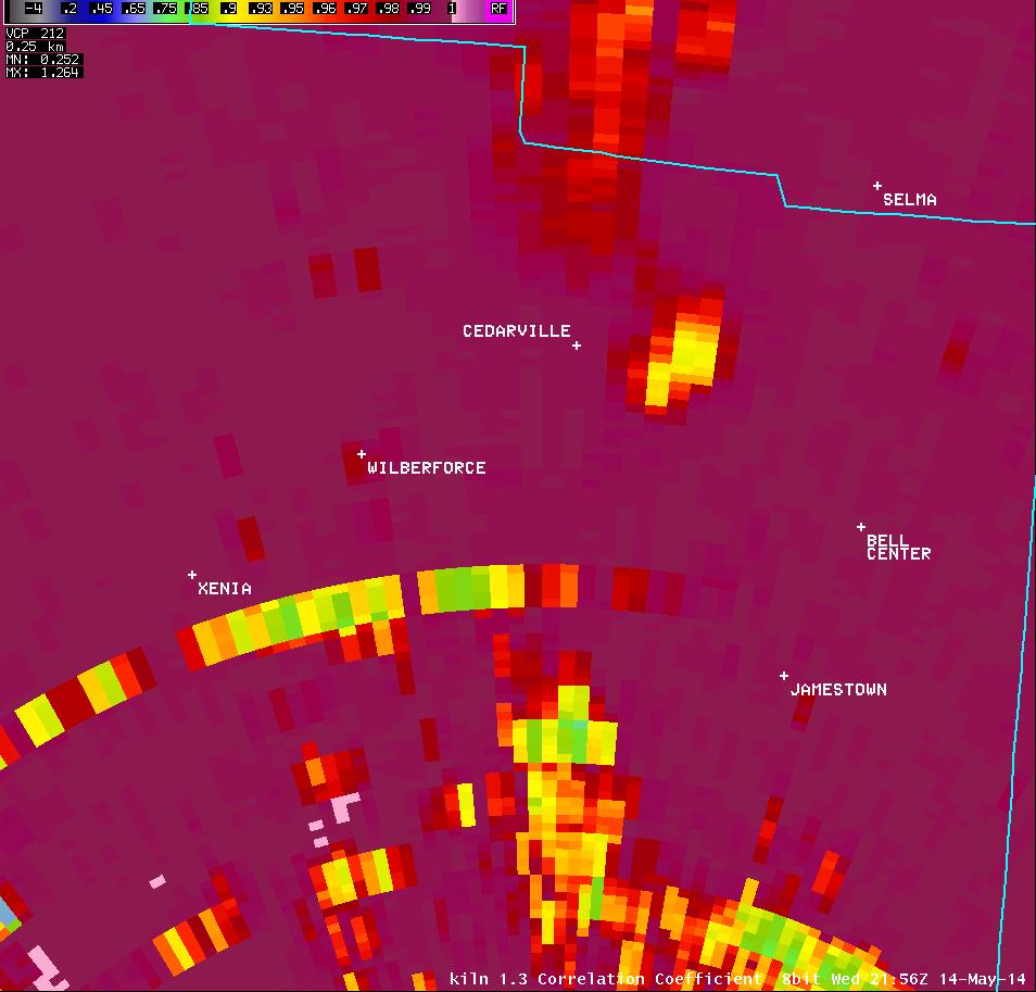
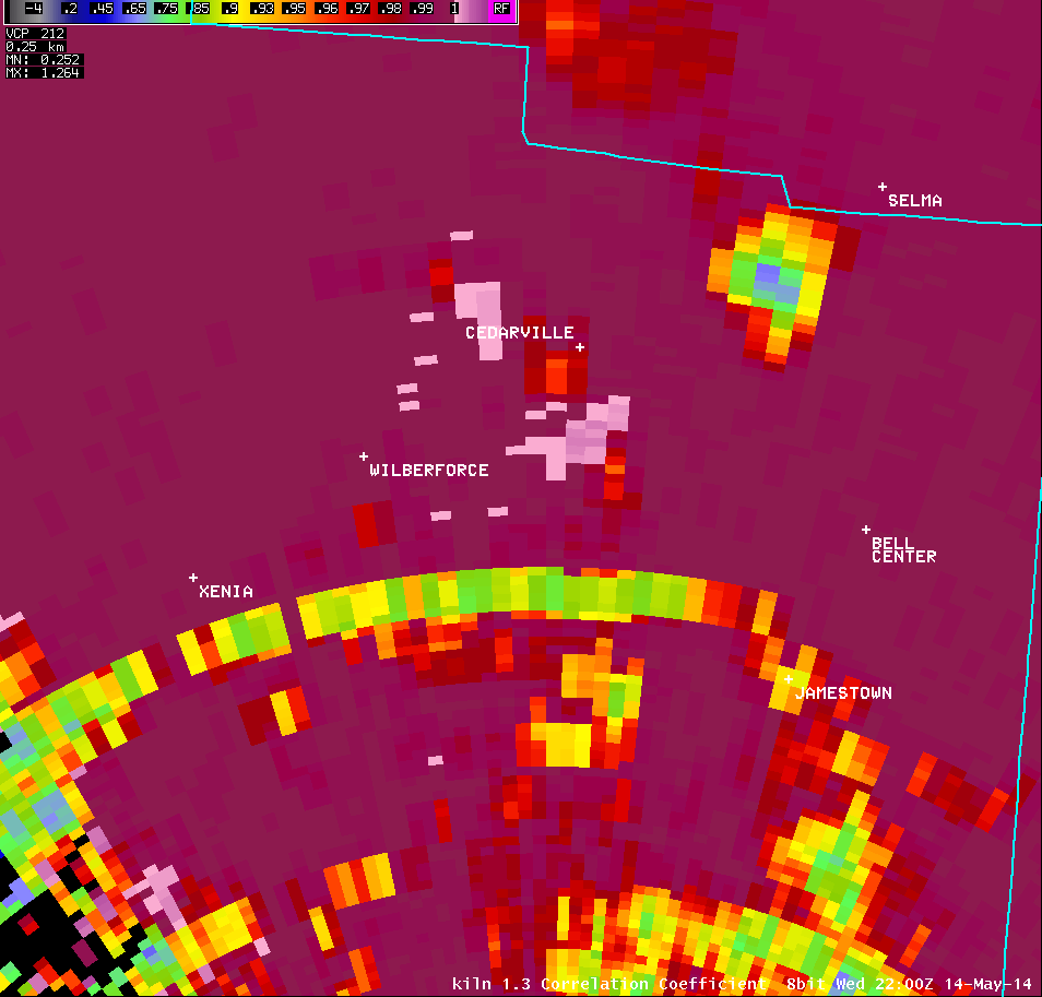
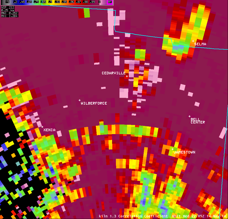
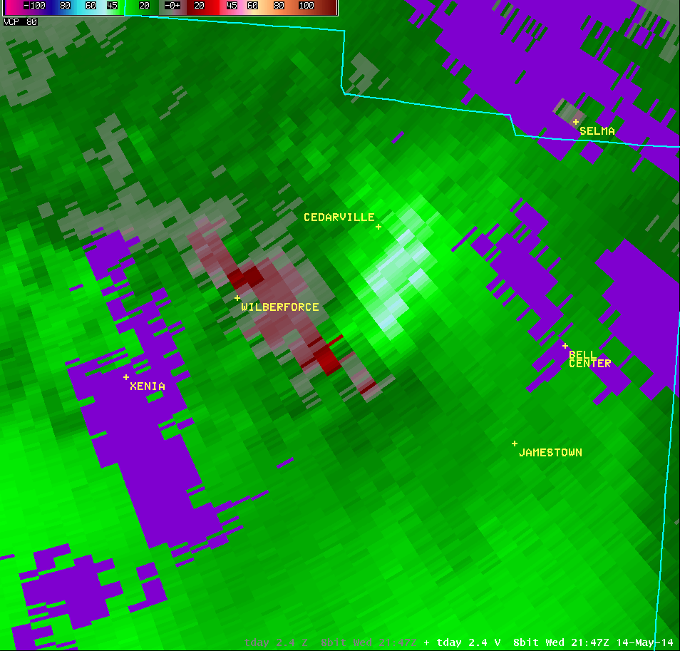
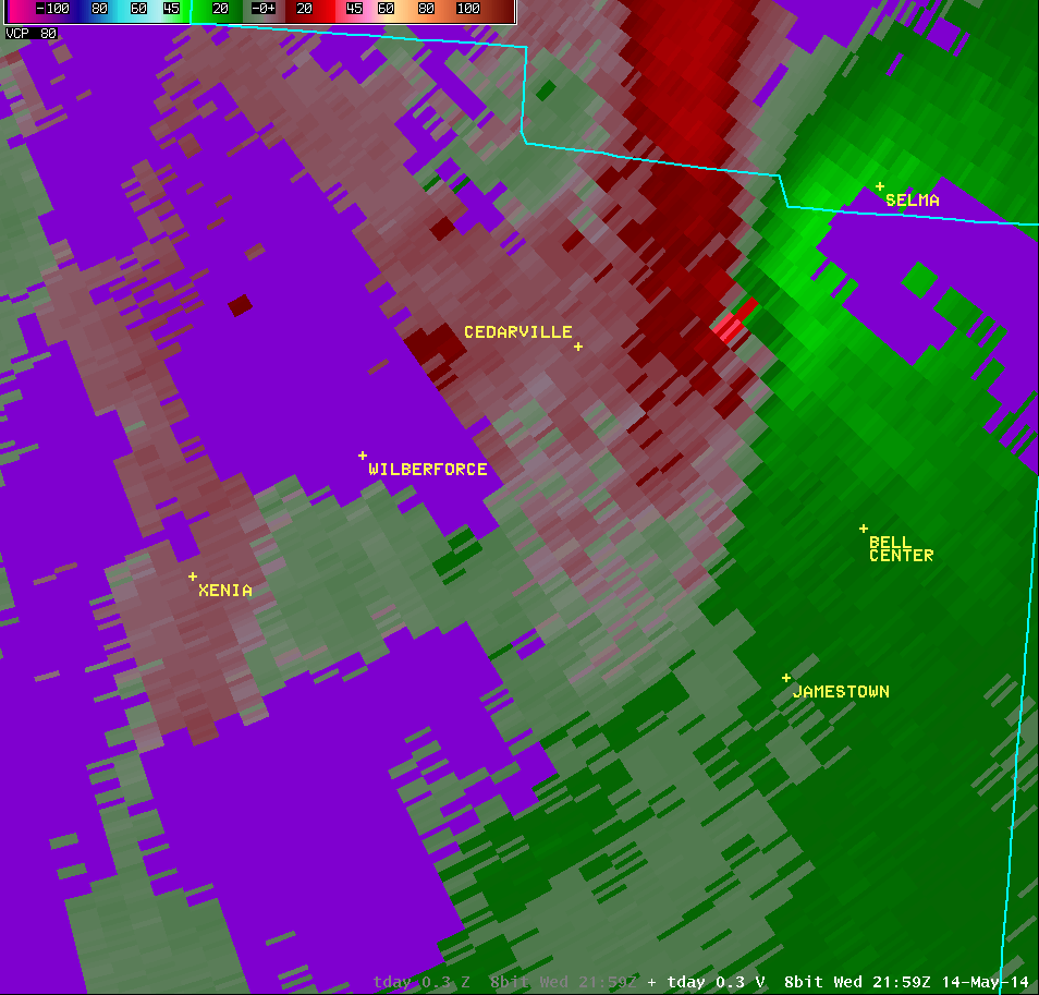
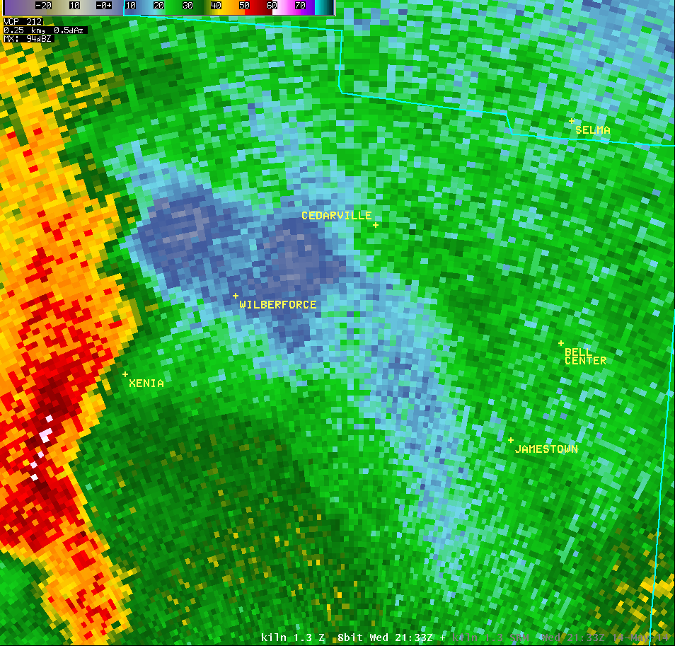
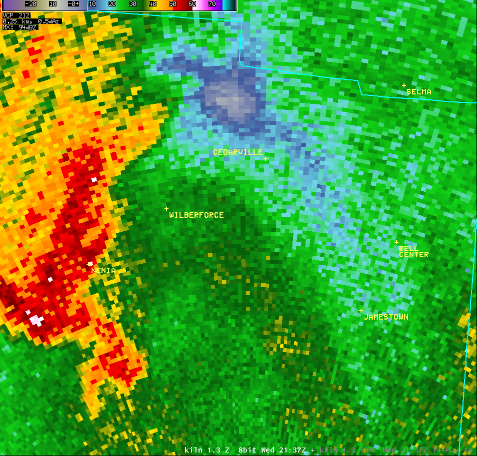
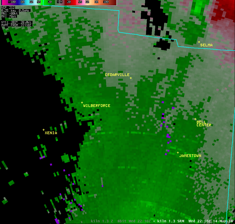
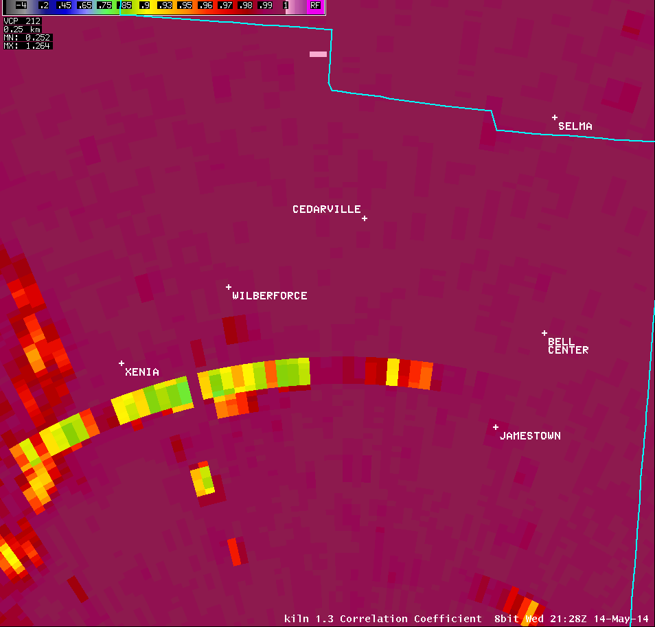
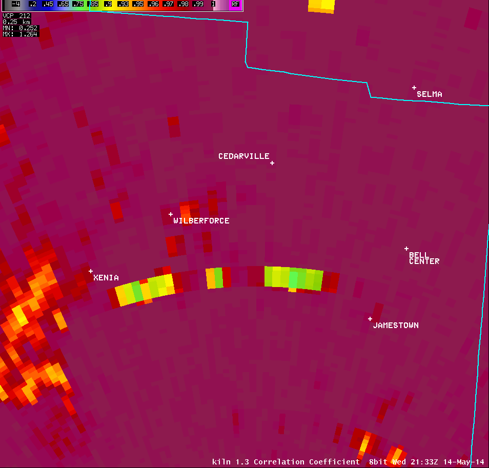
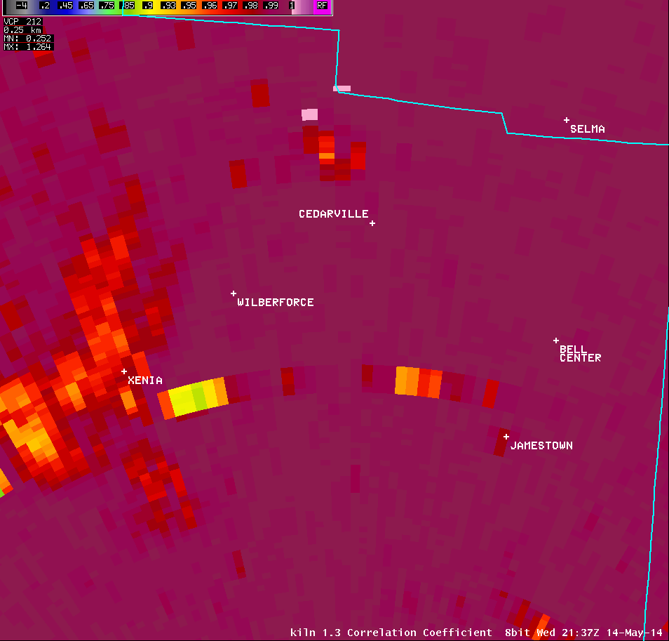
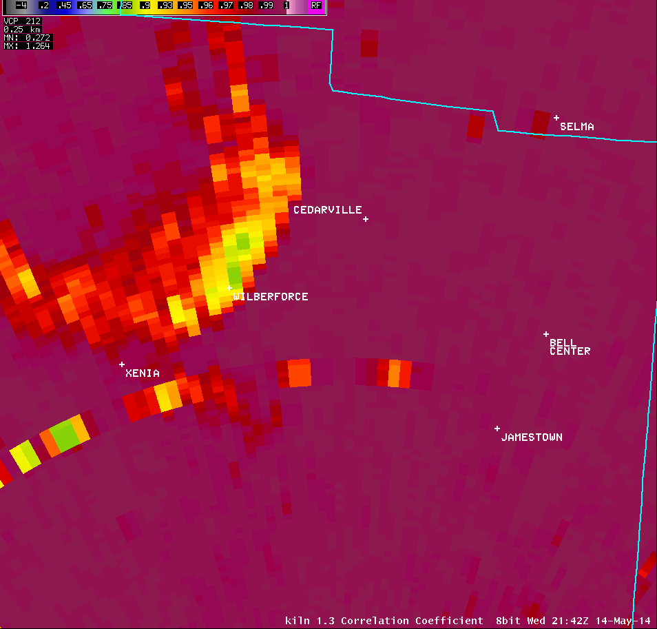
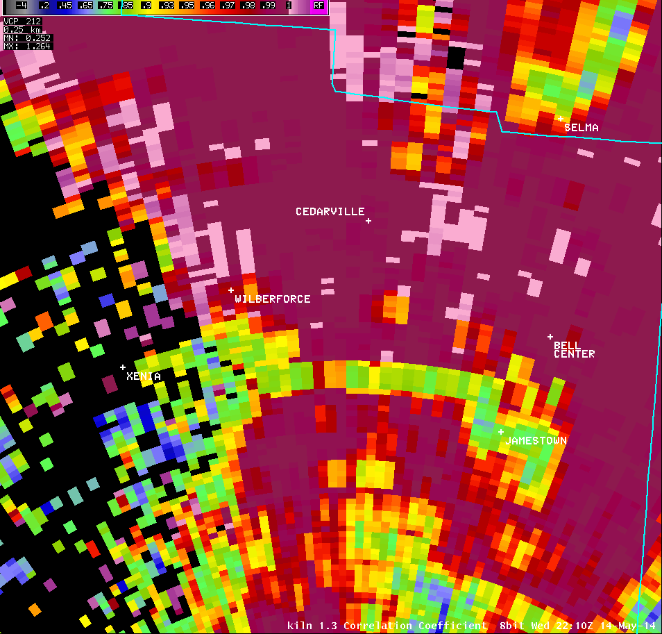
1.3° Correlation Coefficient |
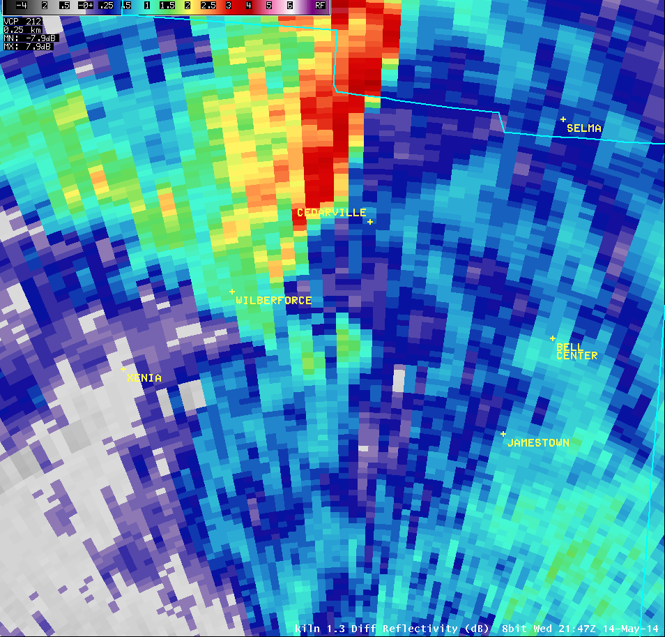
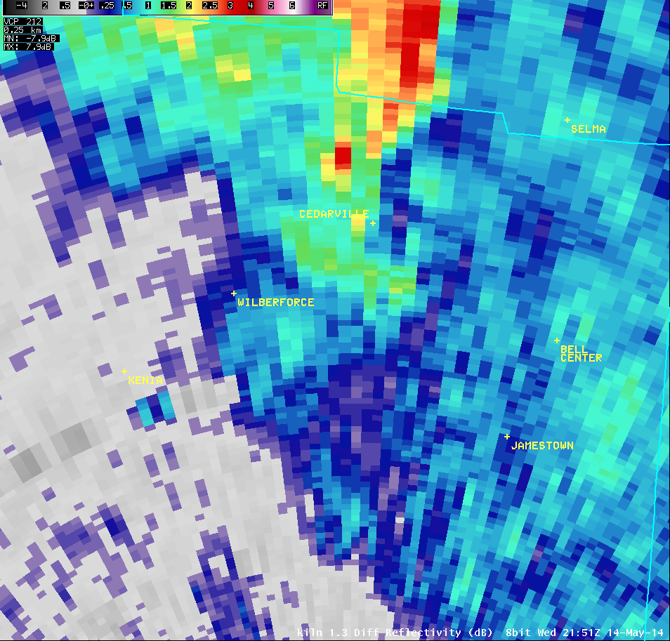
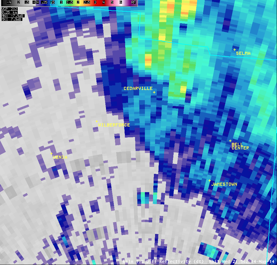
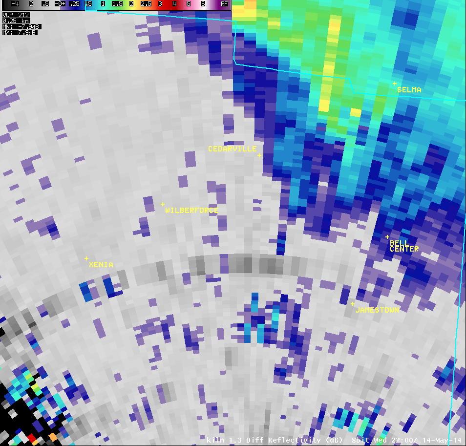
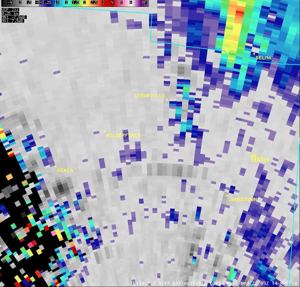
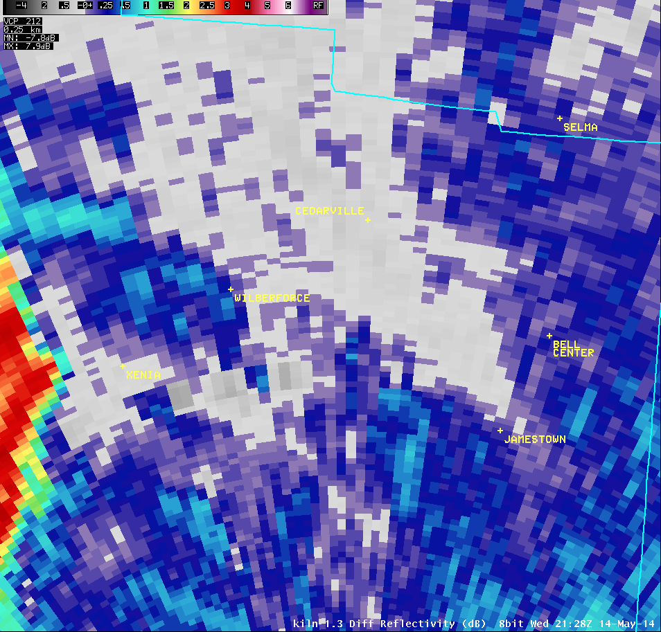
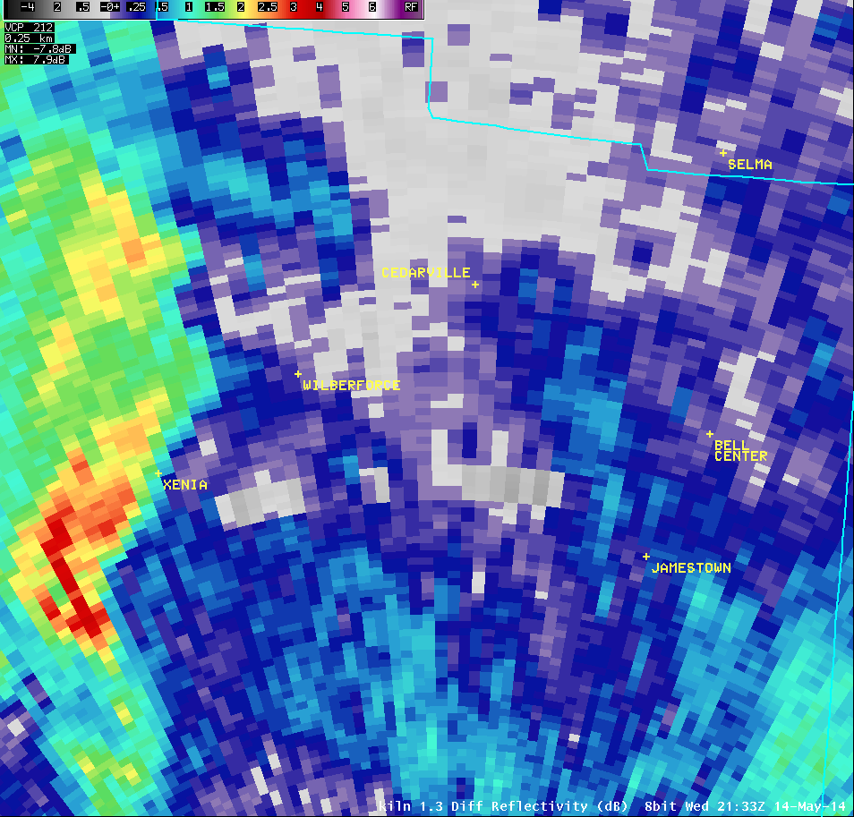
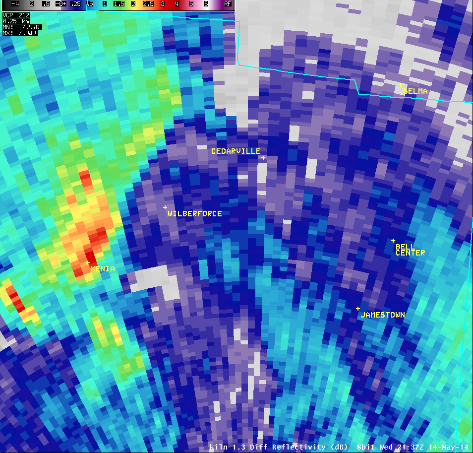
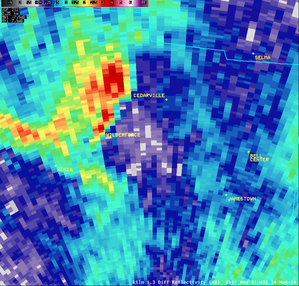
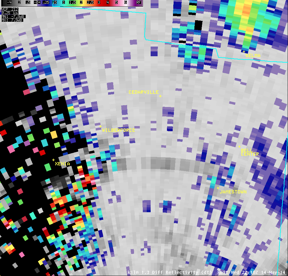
1.3° Differential Reflectivity |
 |
 |
 |
 |
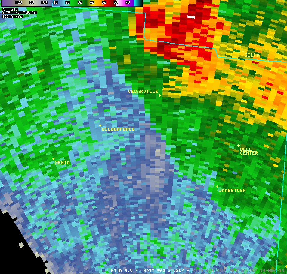
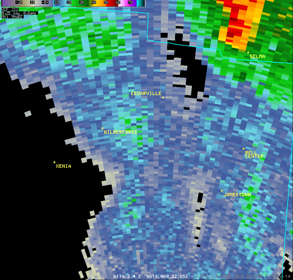
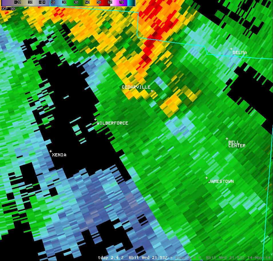
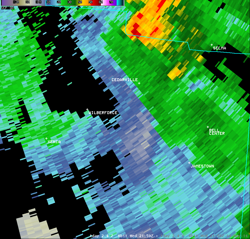
| 2.4° Reflectivity |
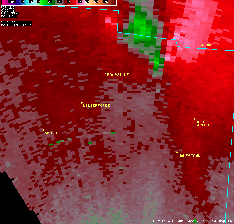
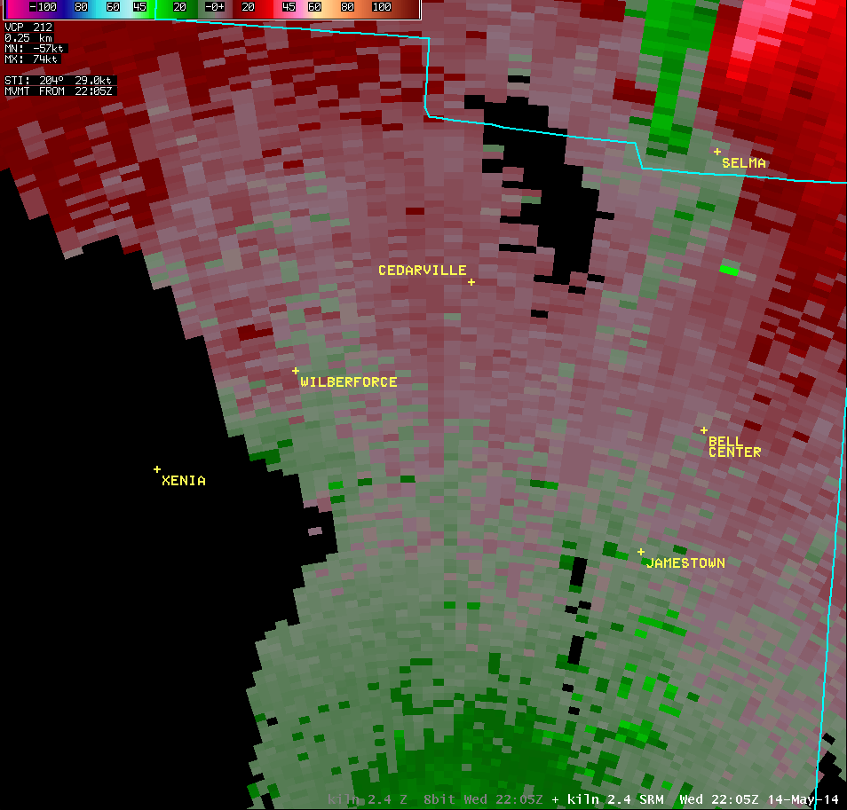
2.4° Storm-Relative Motion |
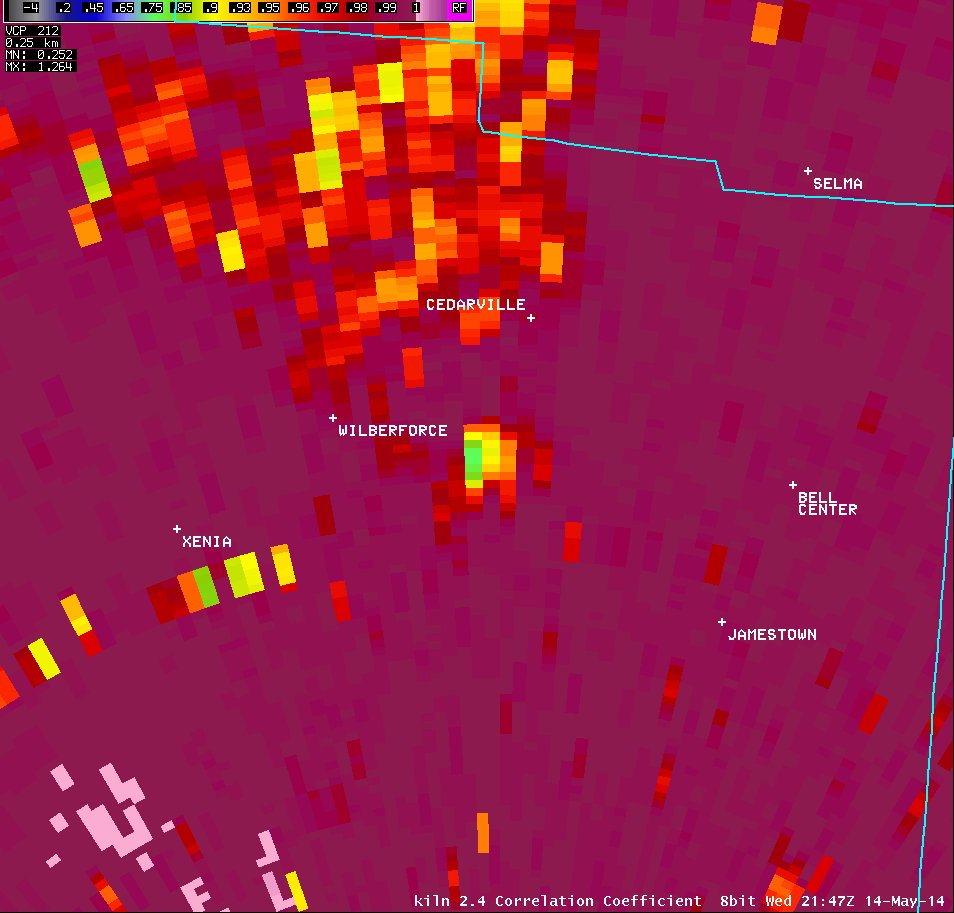
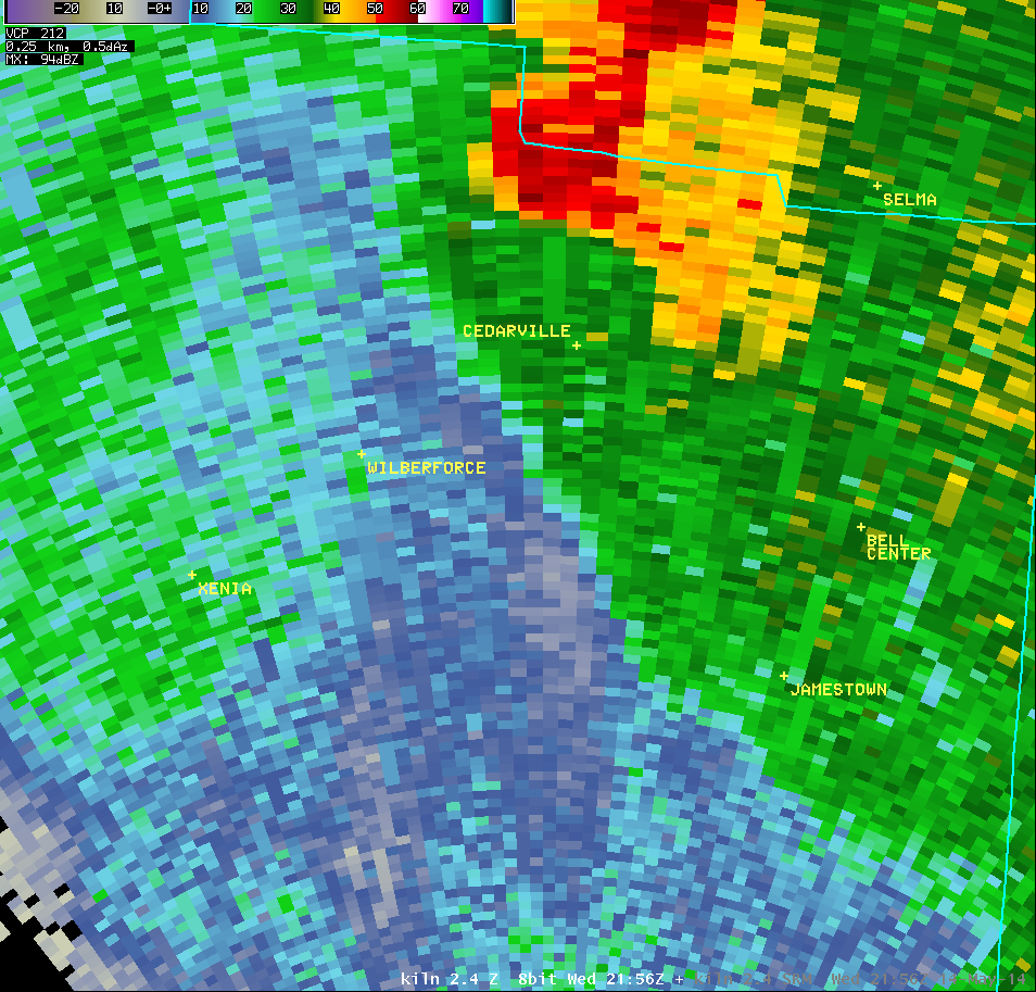
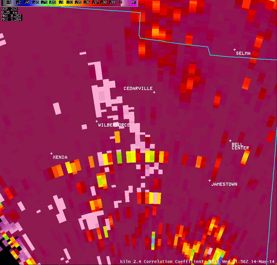
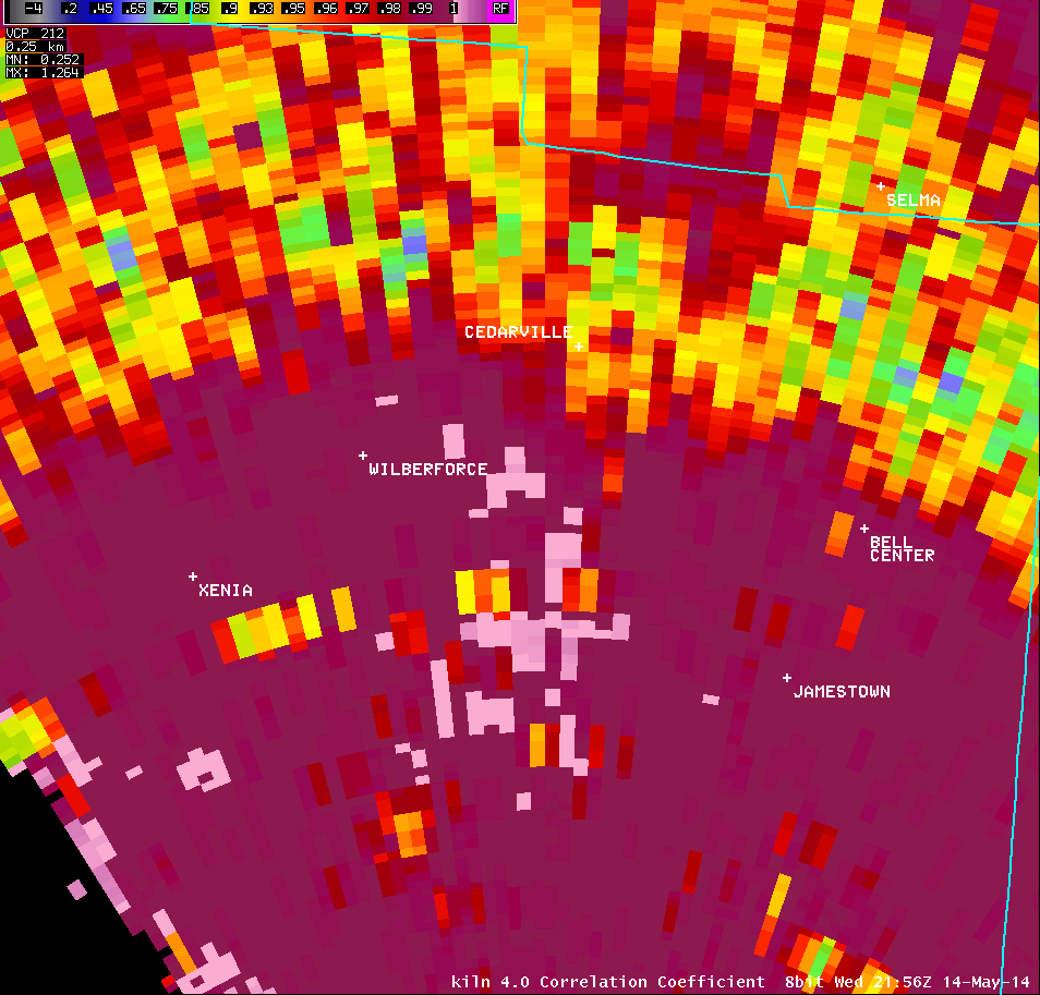
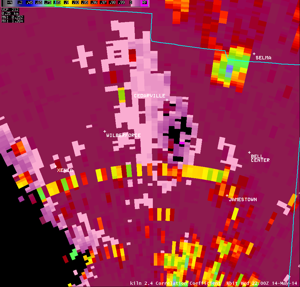
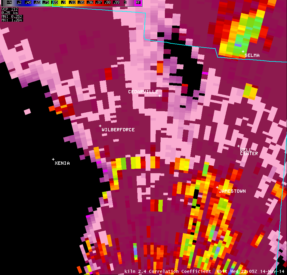
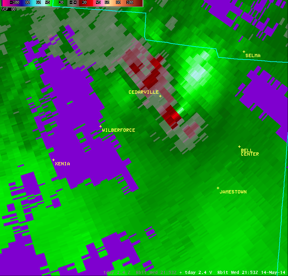
2.4° Correlation Coefficient |
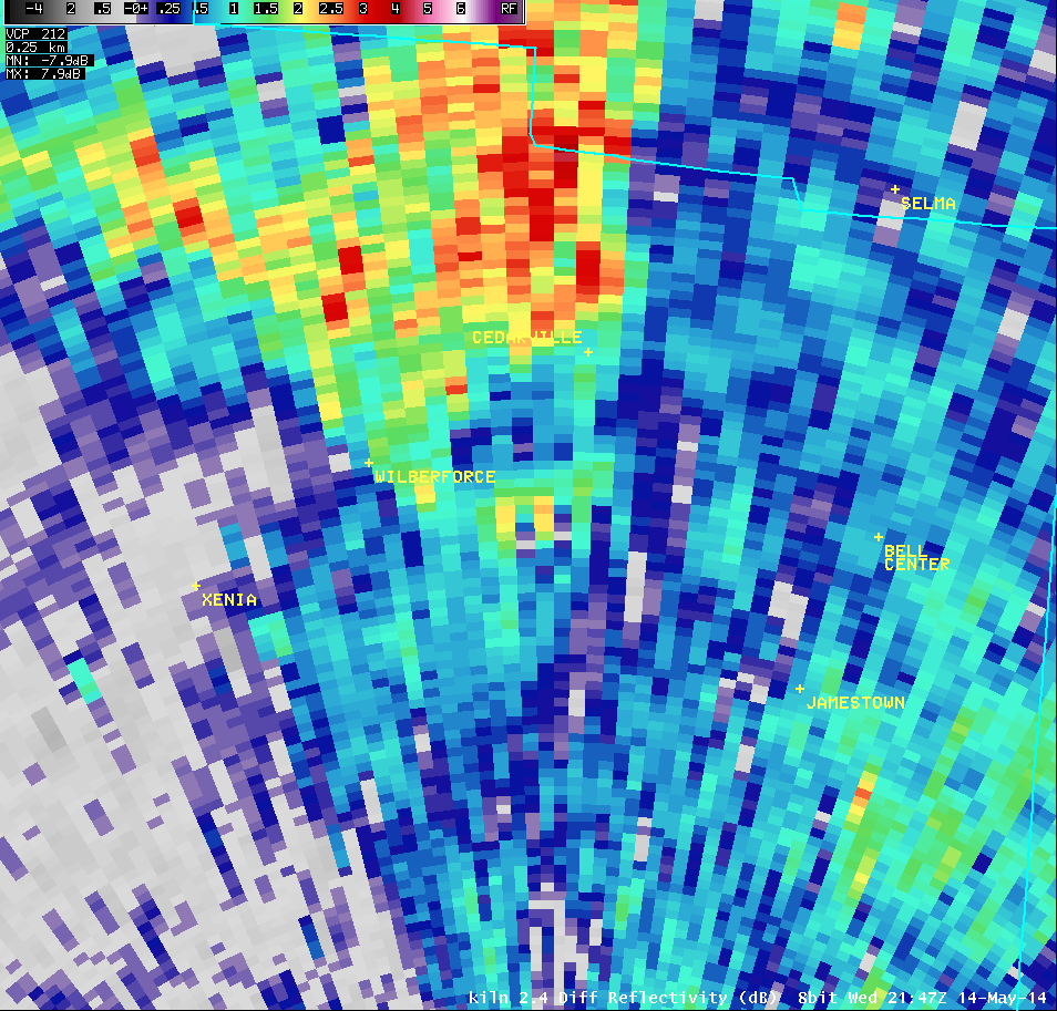
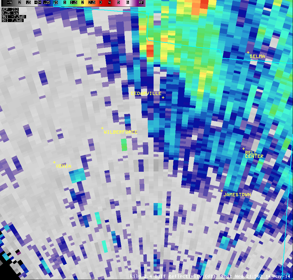
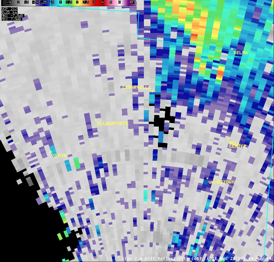
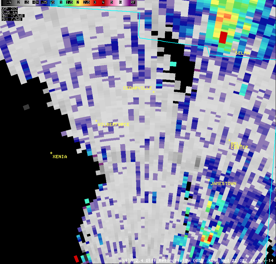
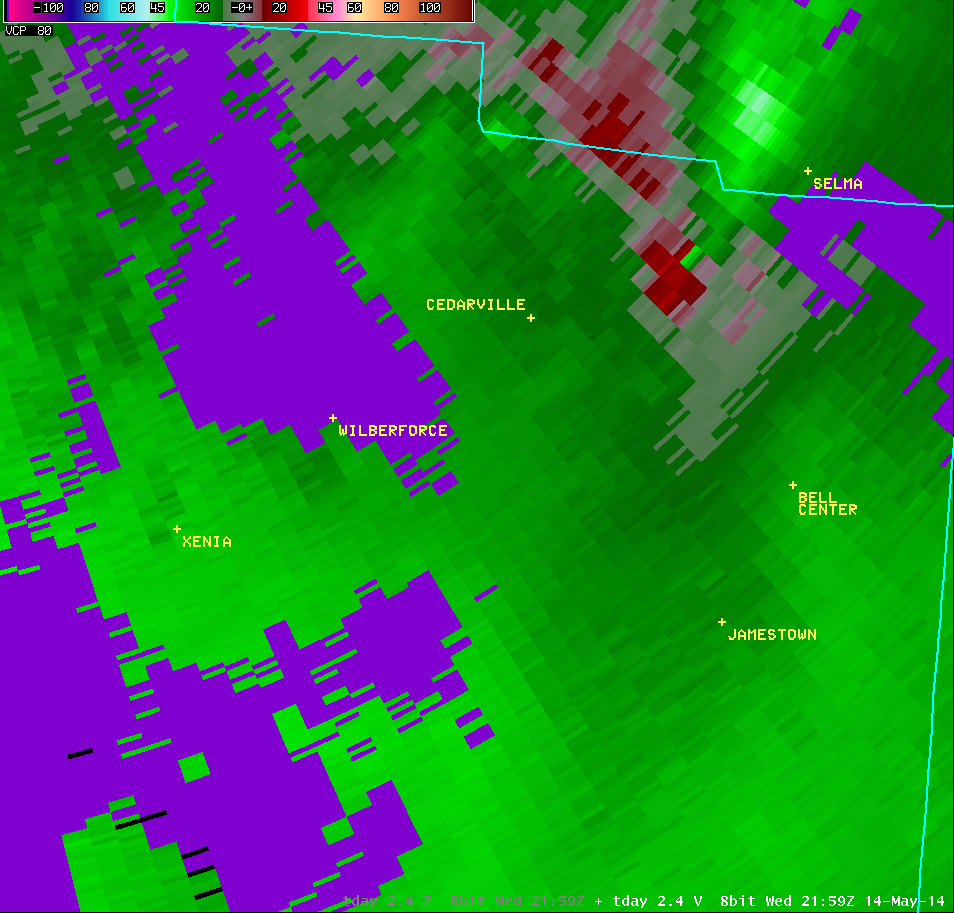
2.4° Differential Reflectivity |
 |
 |
 |
 |
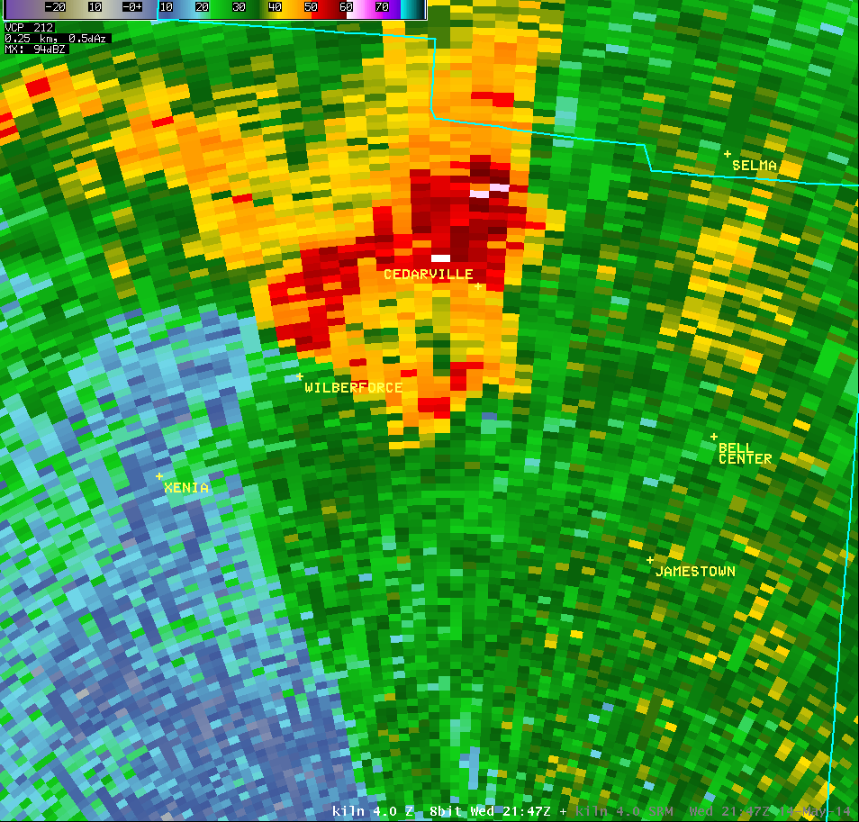
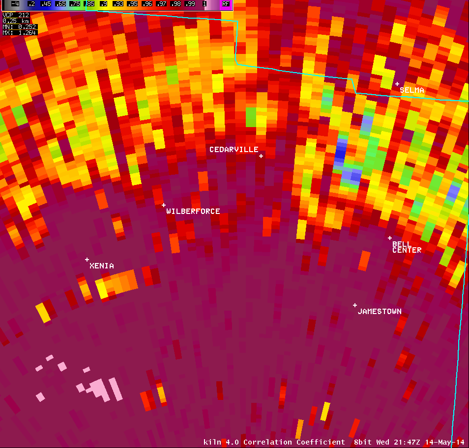
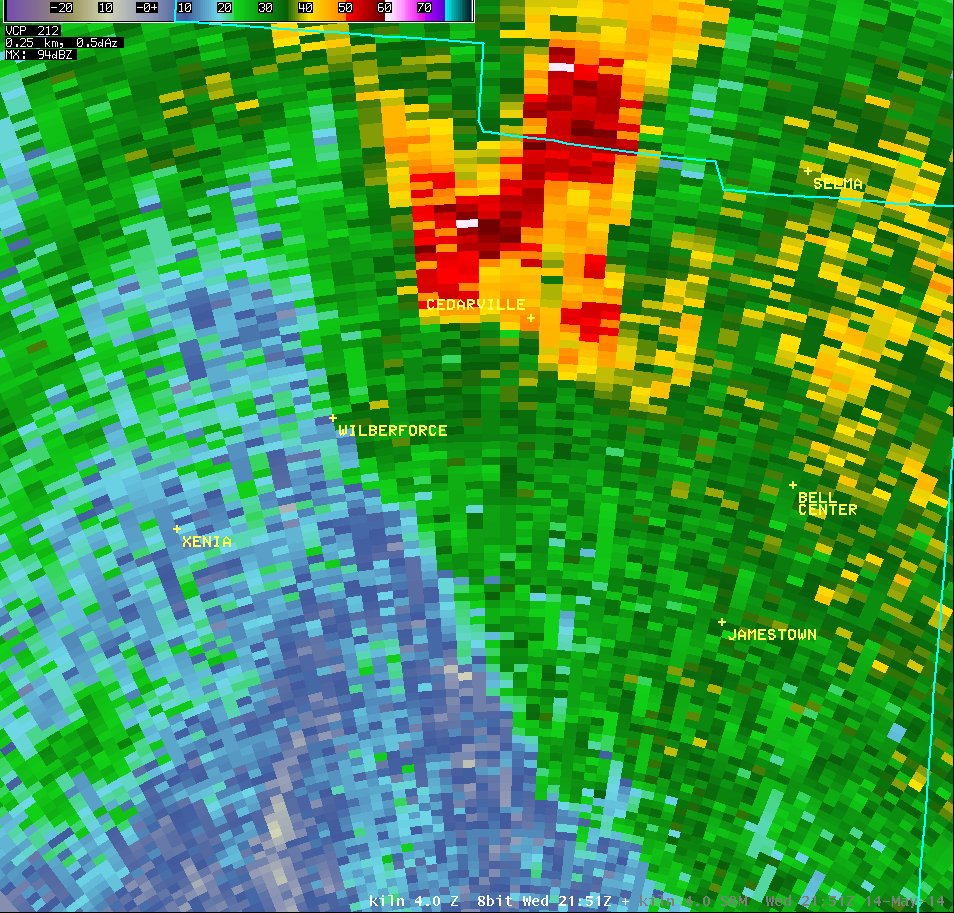
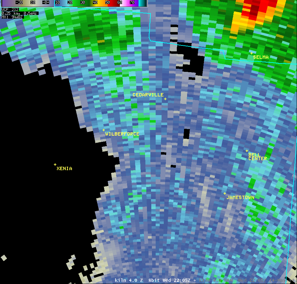
| 4.0° Reflectivity |
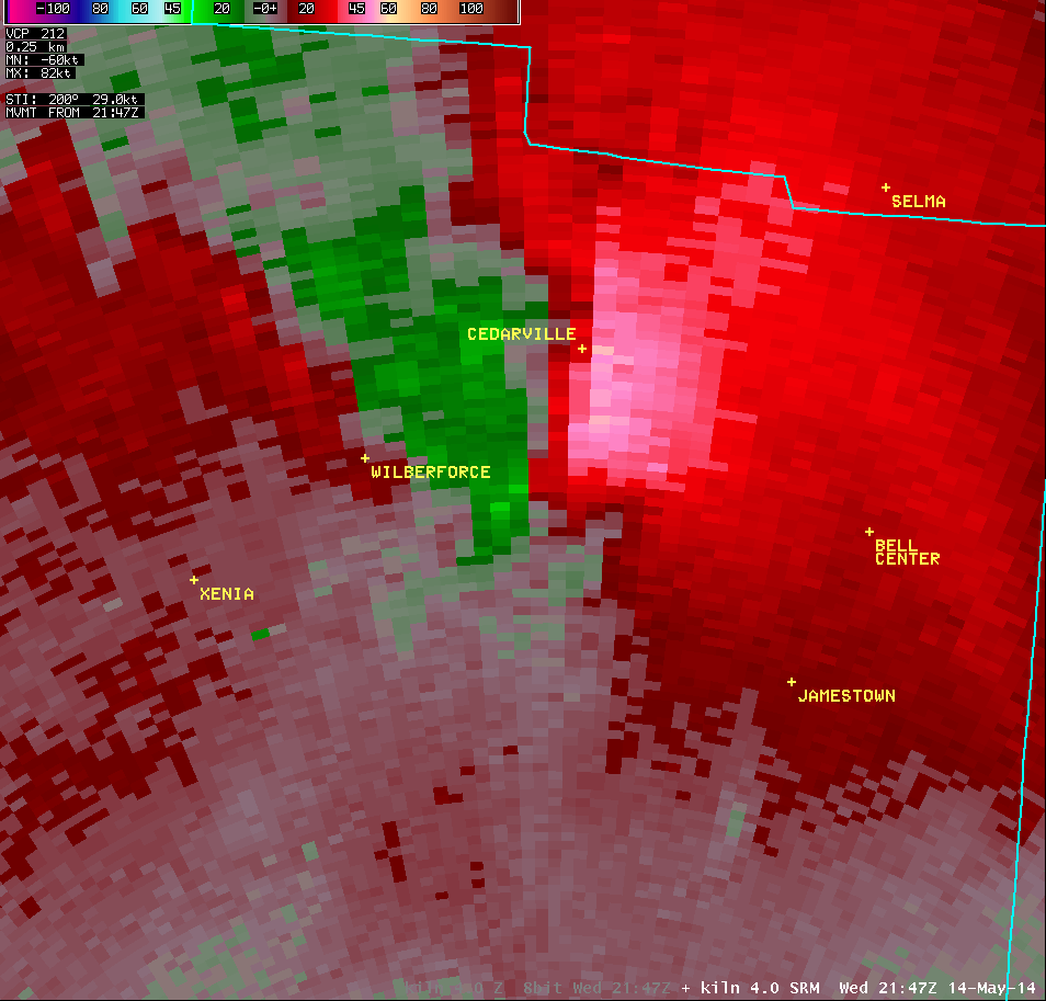
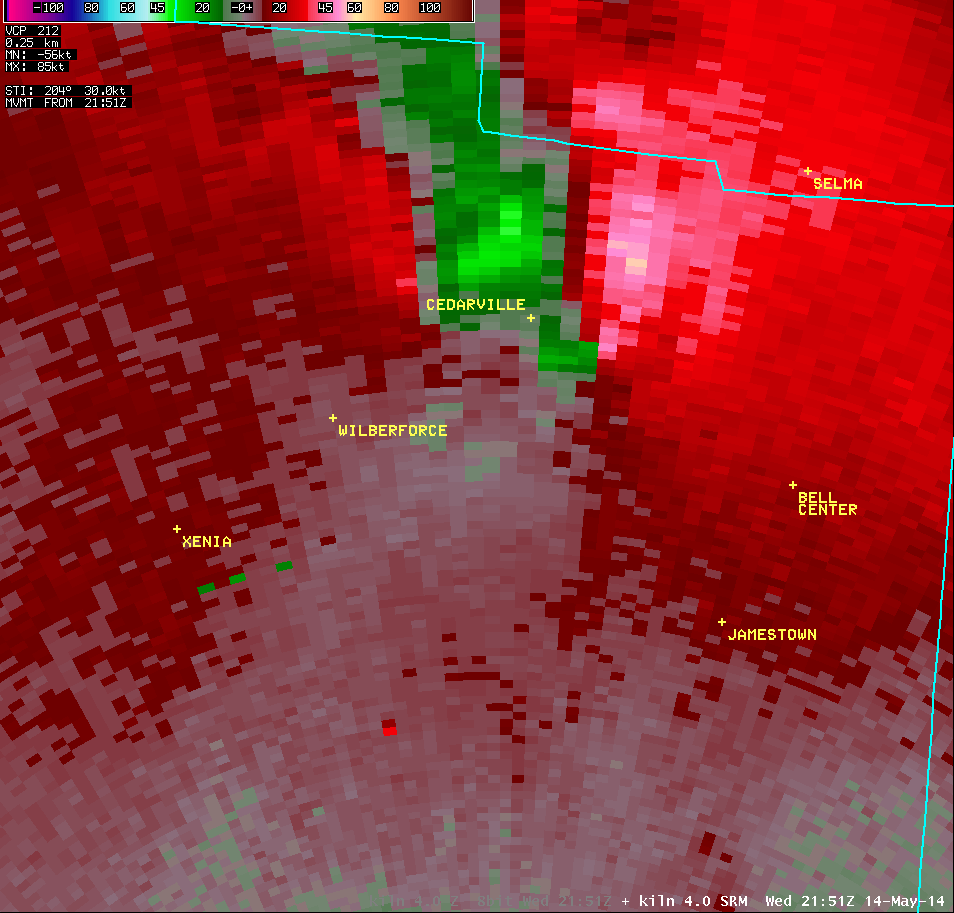
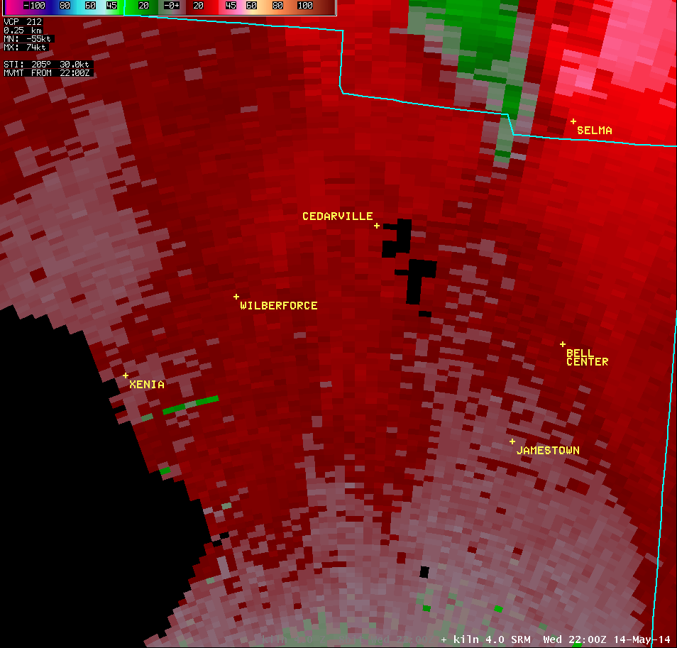
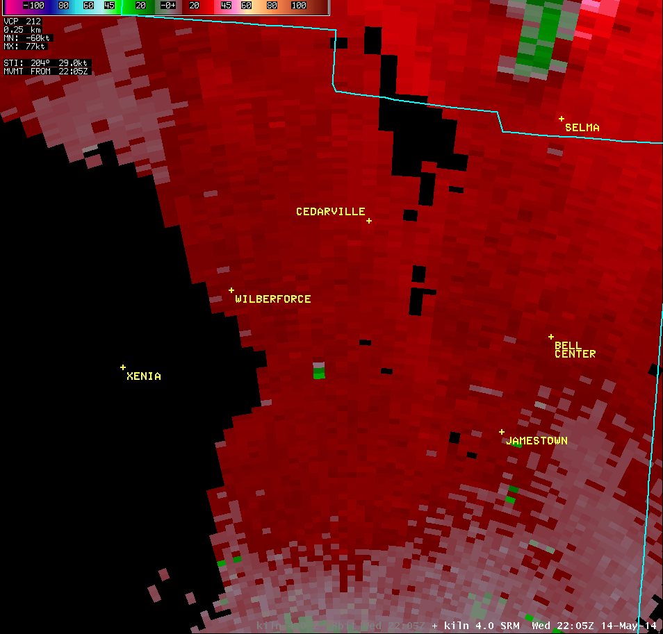
4.0° Storm-Relative Motion |
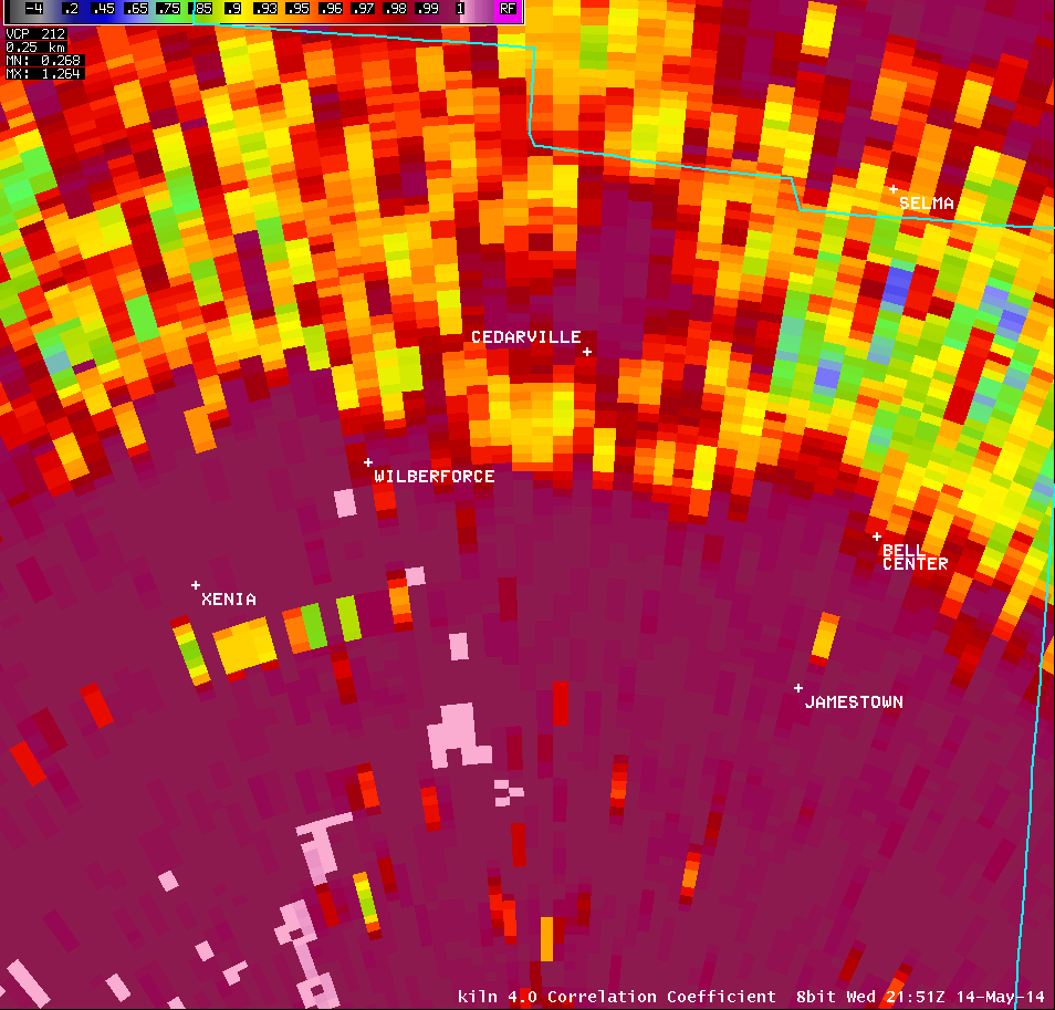
4.0° Correlation Coefficient |
|
 |
 |
 |
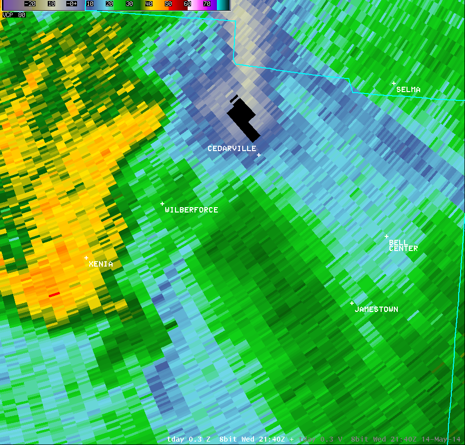
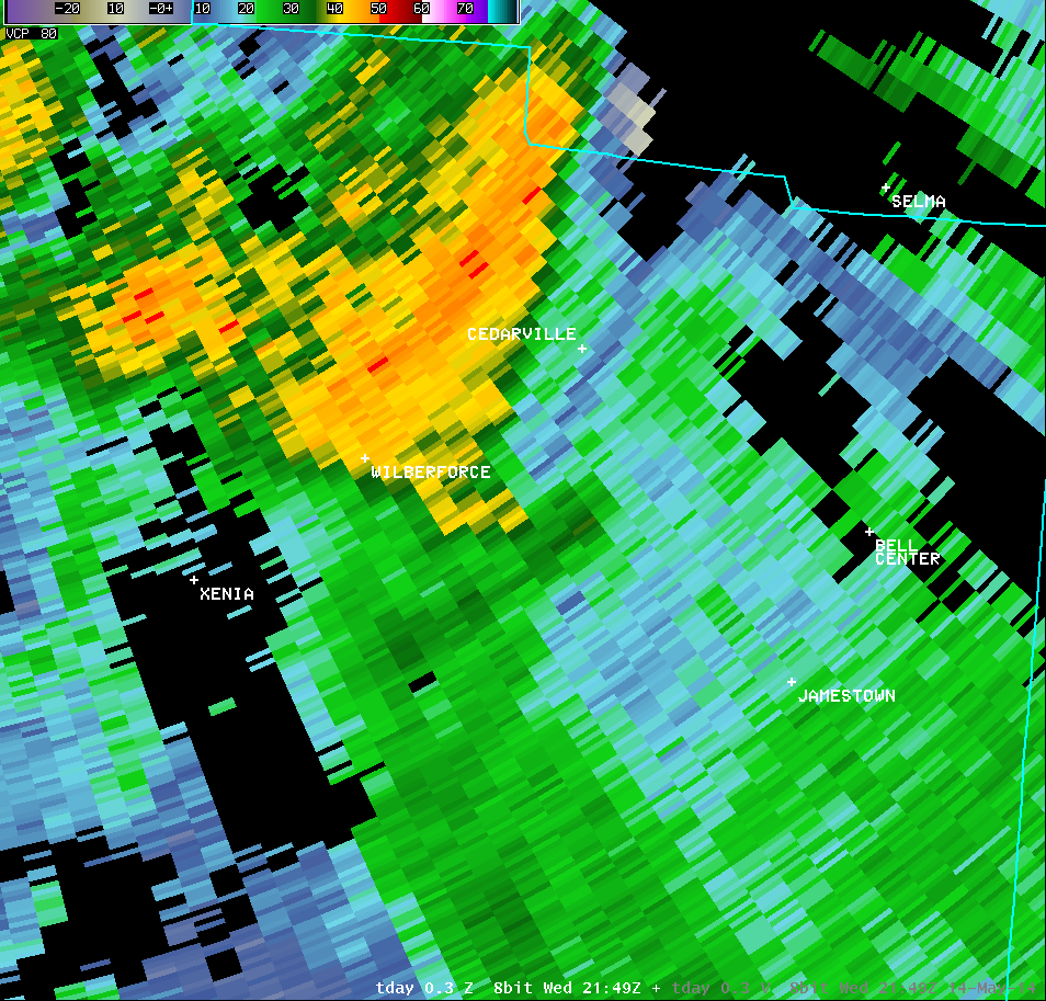
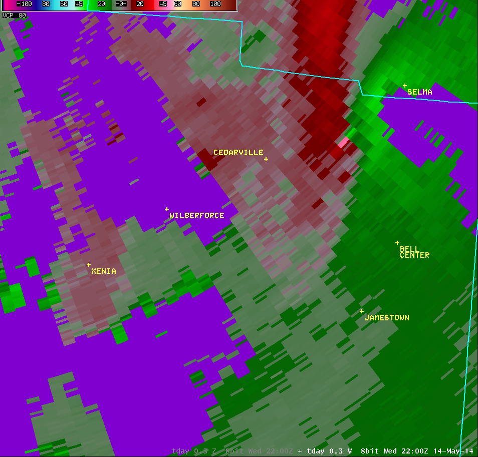
| Vertical Loop of KILN Radar Imagery (5:51 PM) |
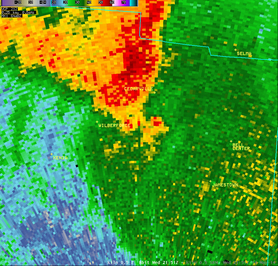
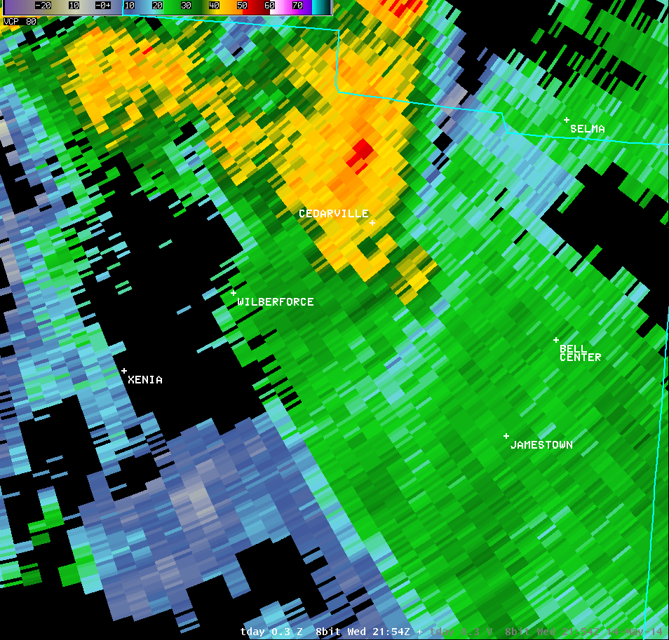
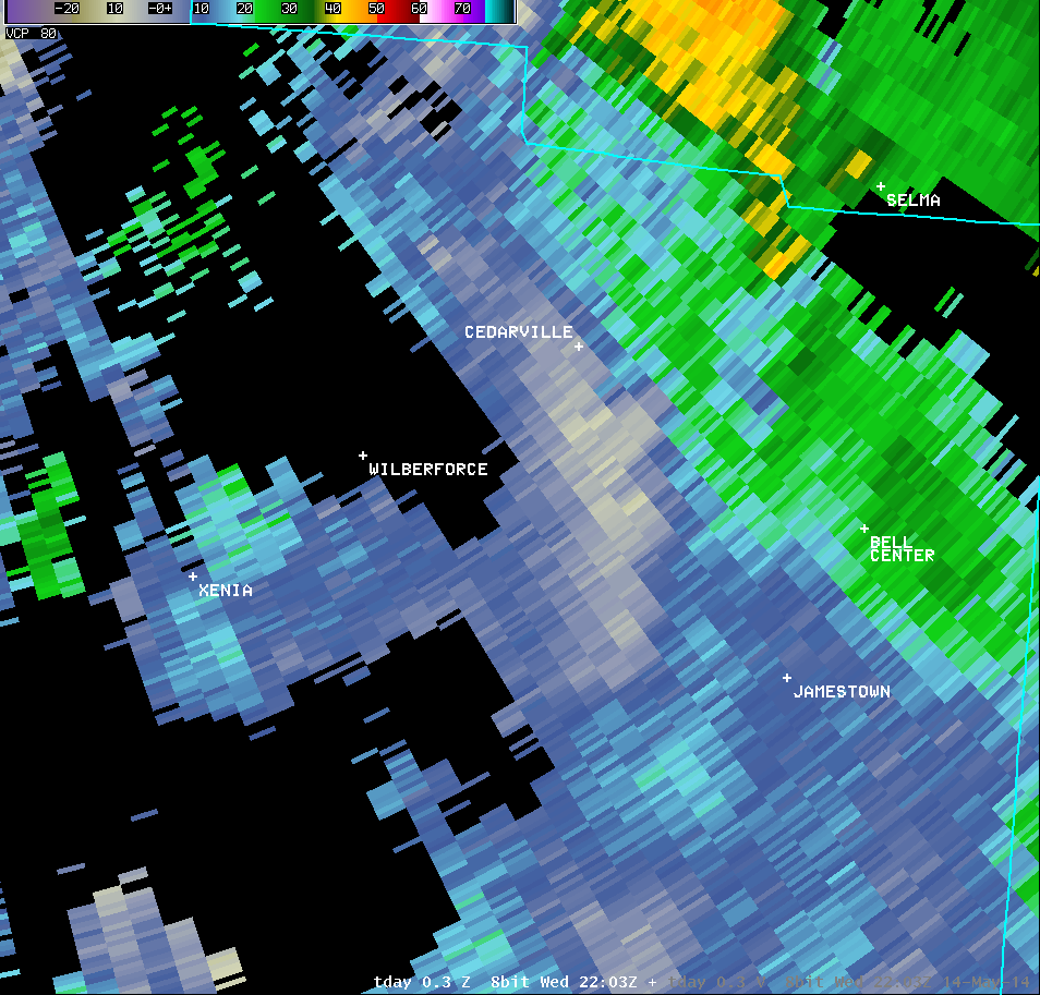
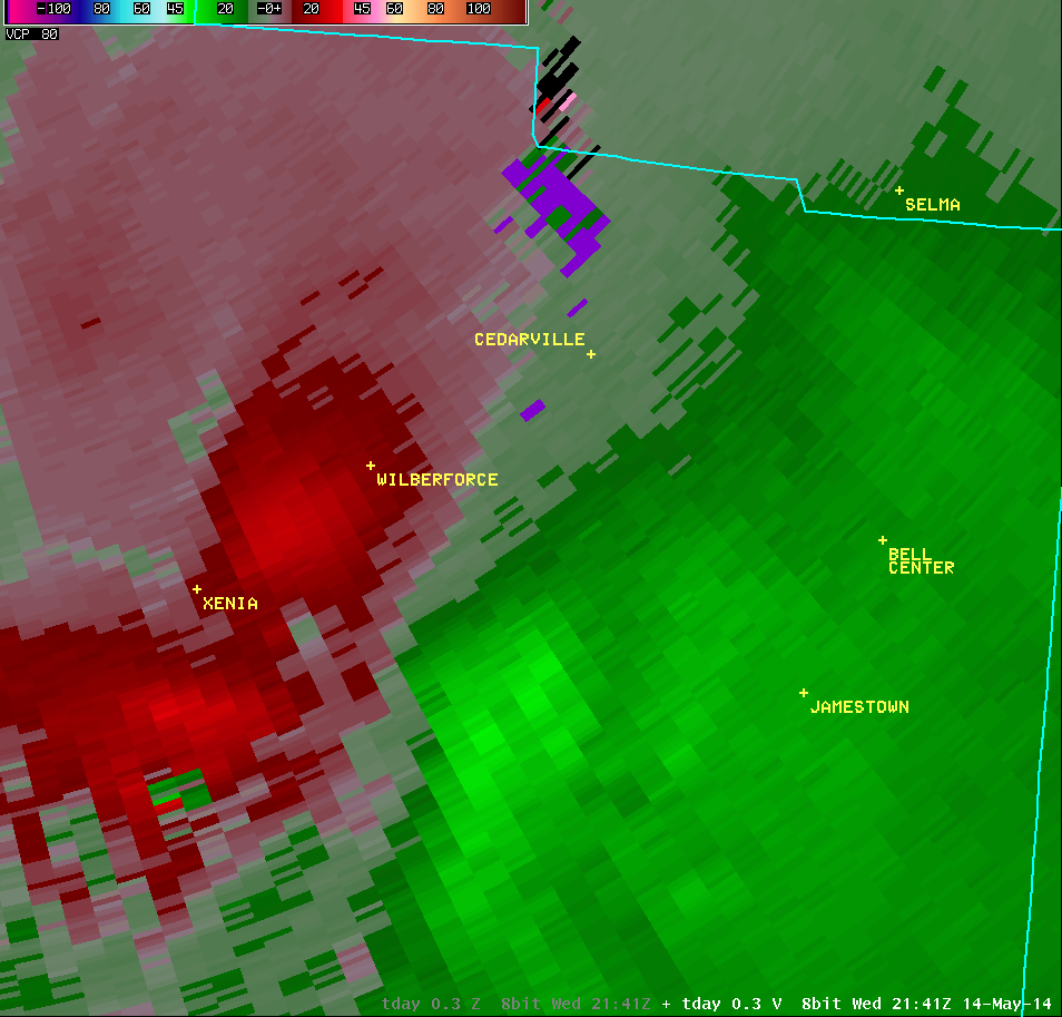
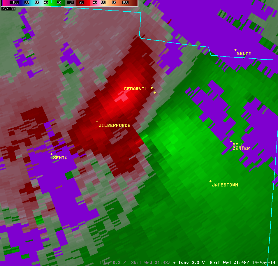
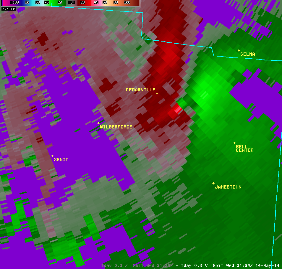
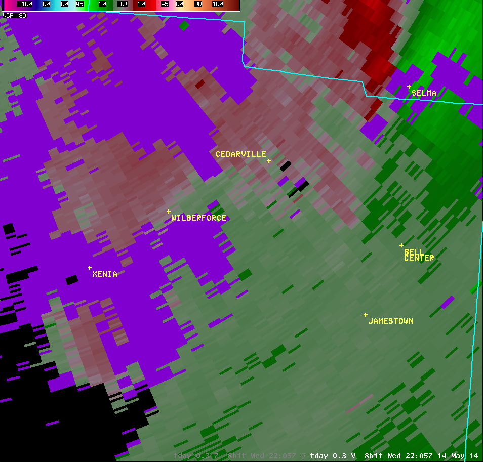
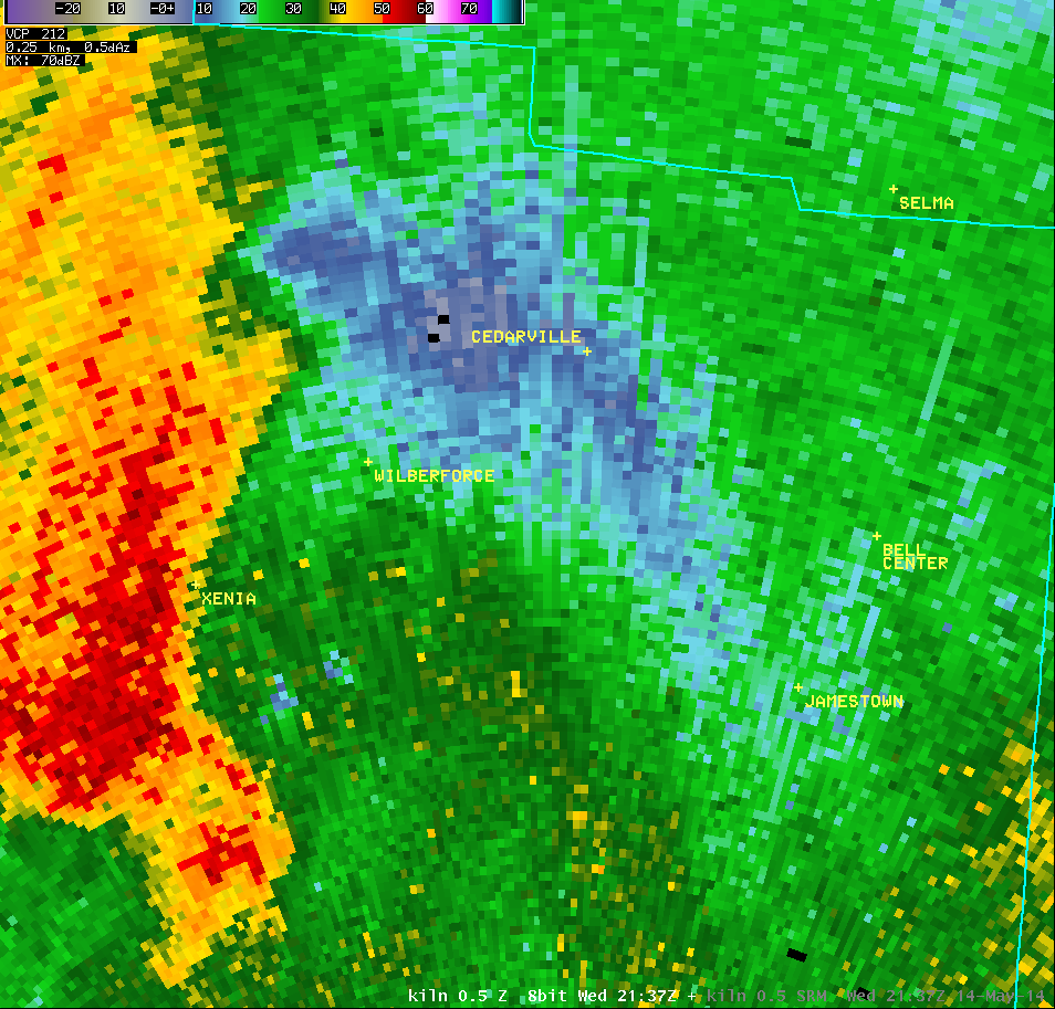
| 0.5° Reflectivity |
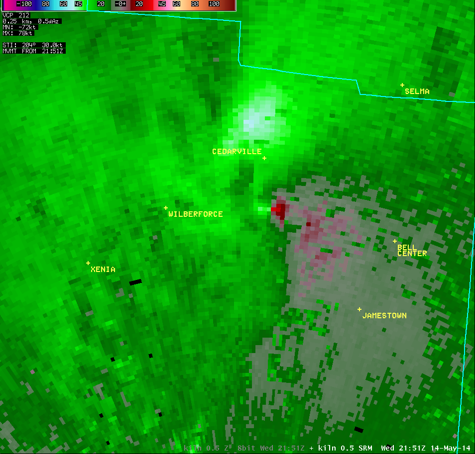
0.5° Storm-Relative Motion |
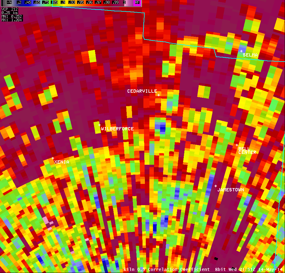
0.5° Correlation Coefficient |
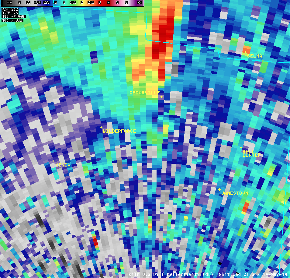
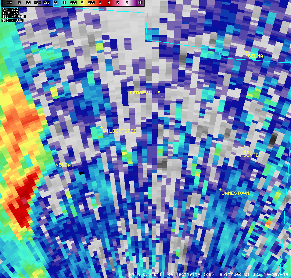
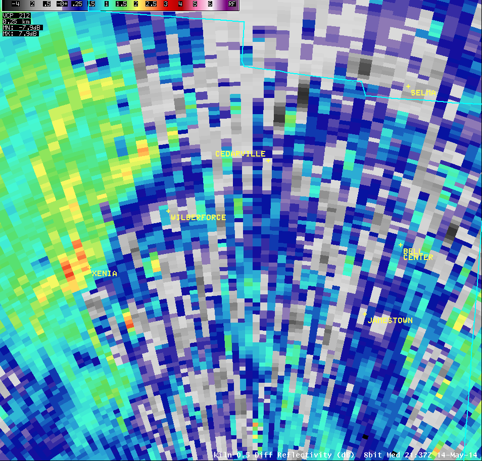
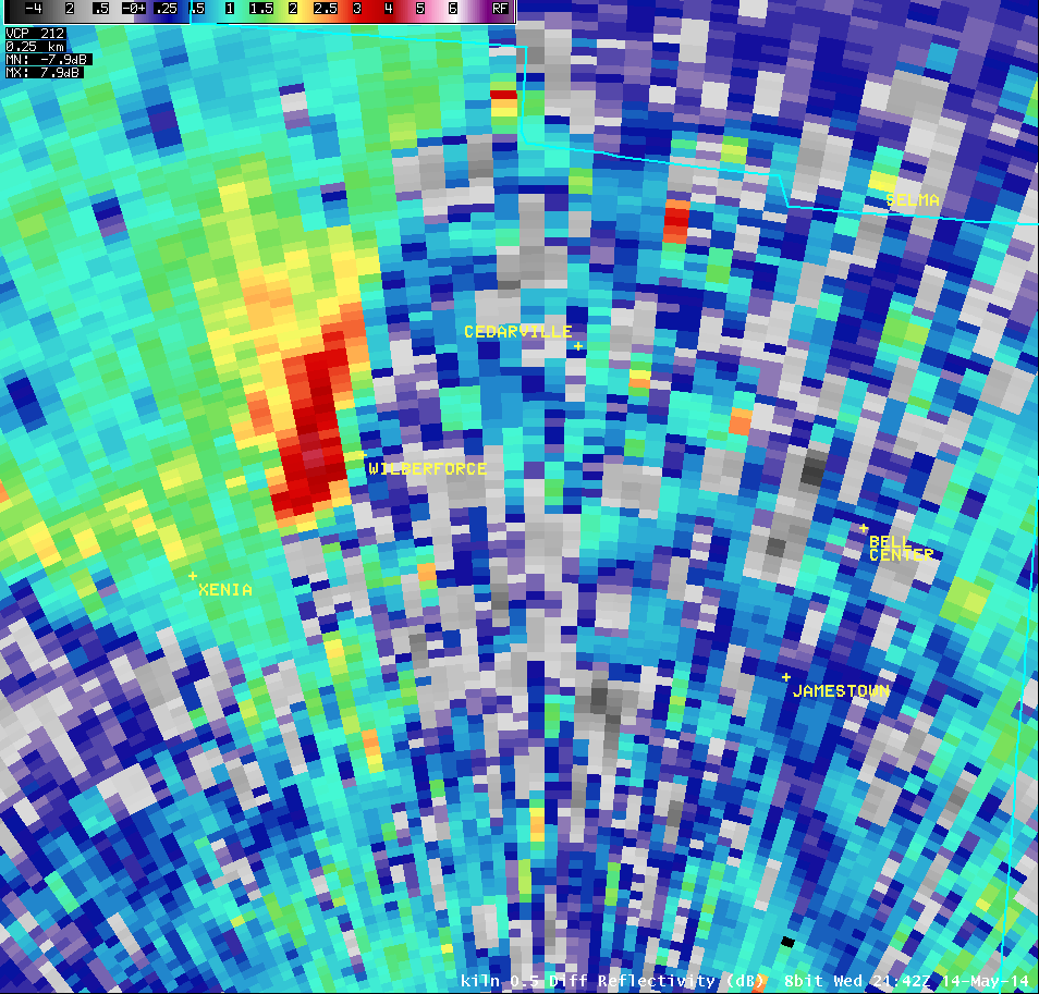
0.5° Differential Reflectivity |
 |
 |
 |
 |
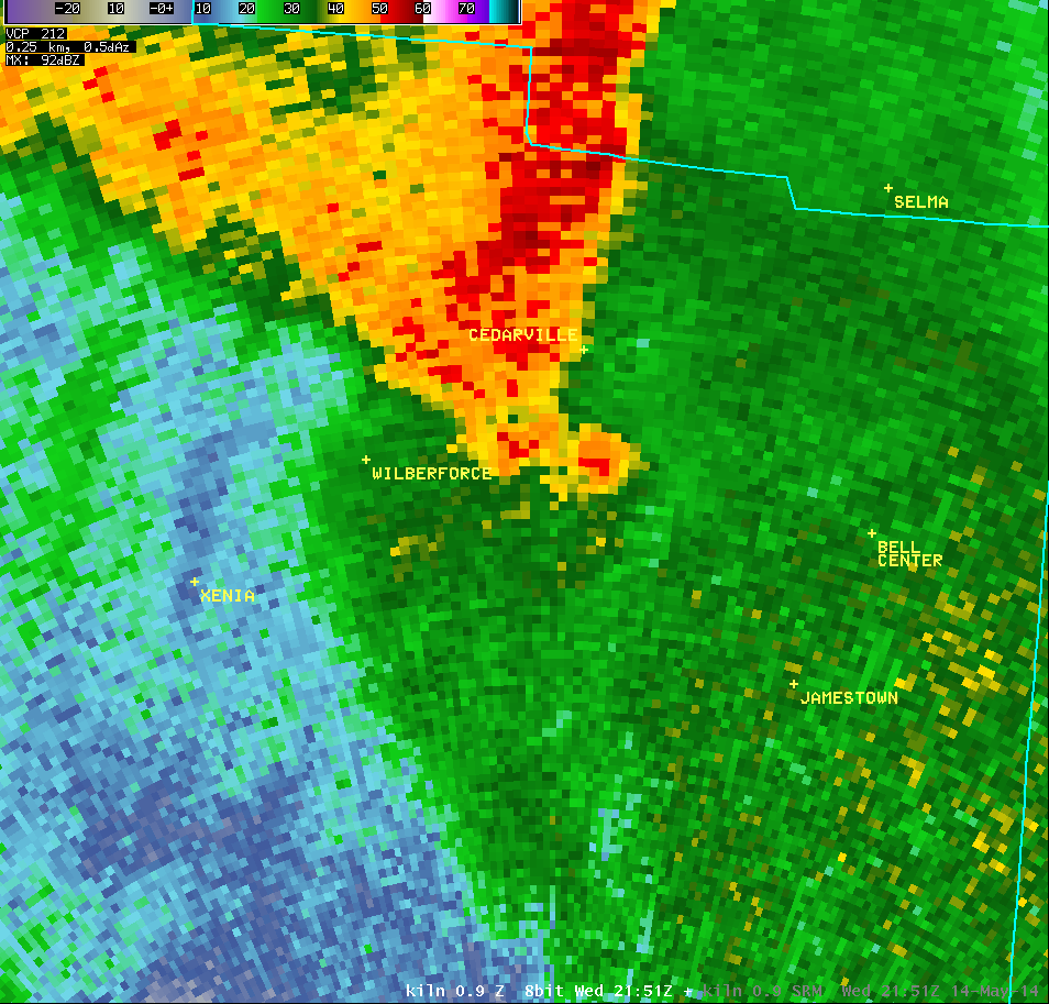
| 0.9° Reflectivity |
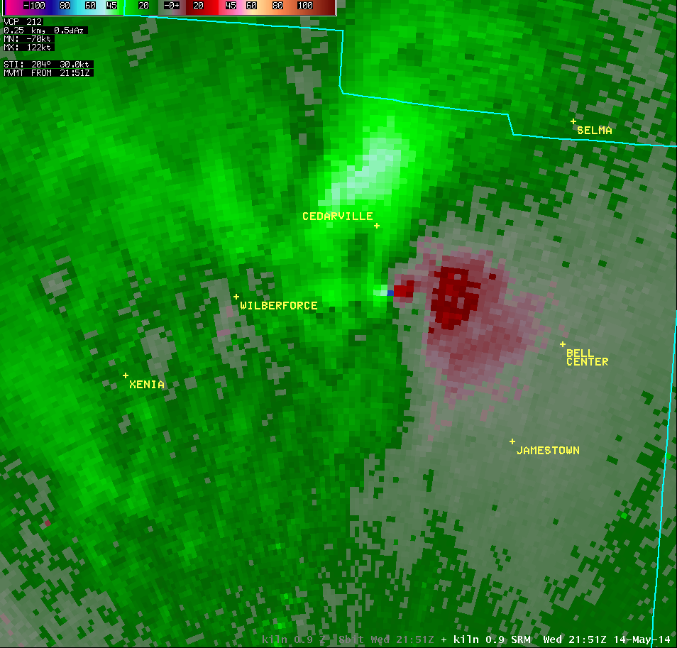
0.9° Storm-Relative Motion |
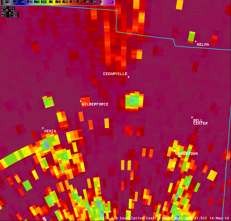
0.9° Correlation Coefficient |
0.9° Differential Reflectivity |
 |
 |
 |
 |
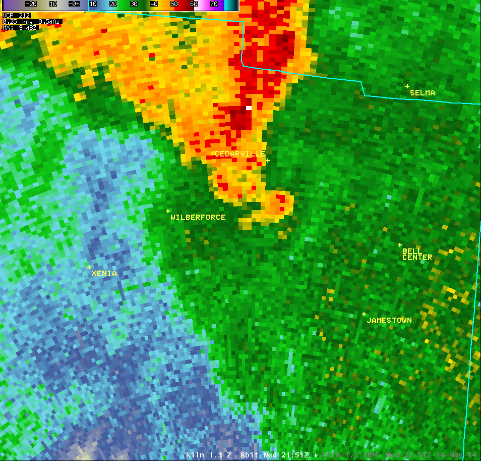
| 1.3° Reflectivity |
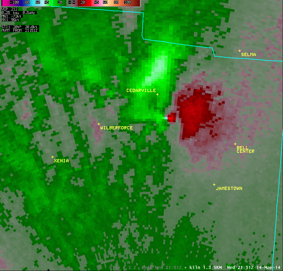
1.3° Storm-Relative Motion |
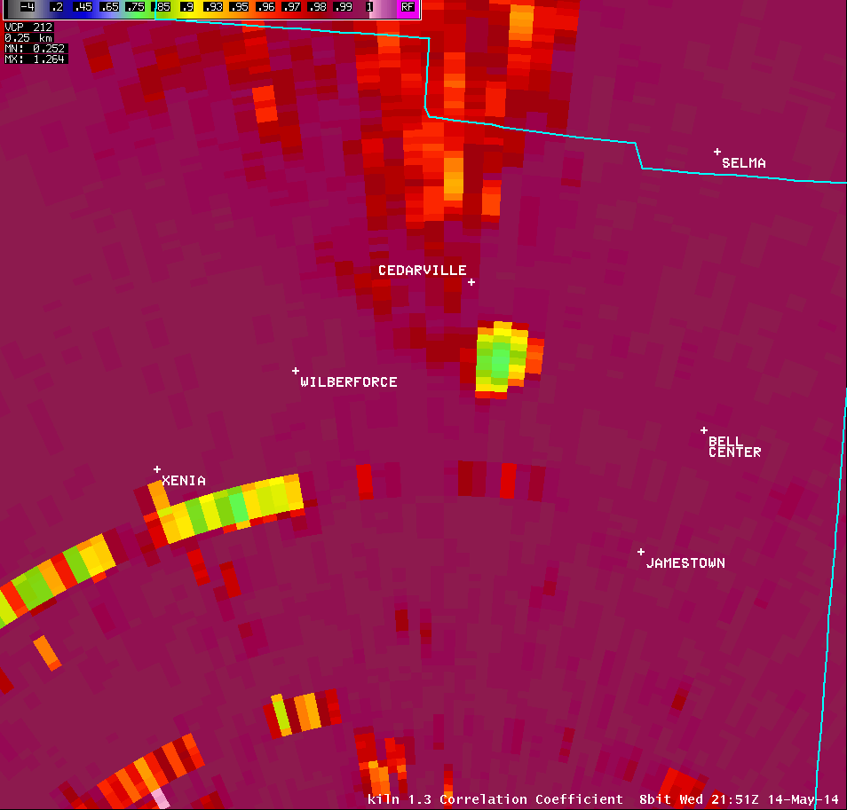
1.3° Correlation Coefficient |
1.3° Differential Reflectivity |
 |
 |
 |
 |
| 2.4° Reflectivity |
2.4° Storm-Relative Motion |
2.4° Correlation Coefficient |
2.4° Differential Reflectivity |
 |
 |
 |
 |
| 4.0° Reflectivity |
4.0° Storm-Relative Motion |
4.0° Correlation Coefficient |
|
 |
 |
 |
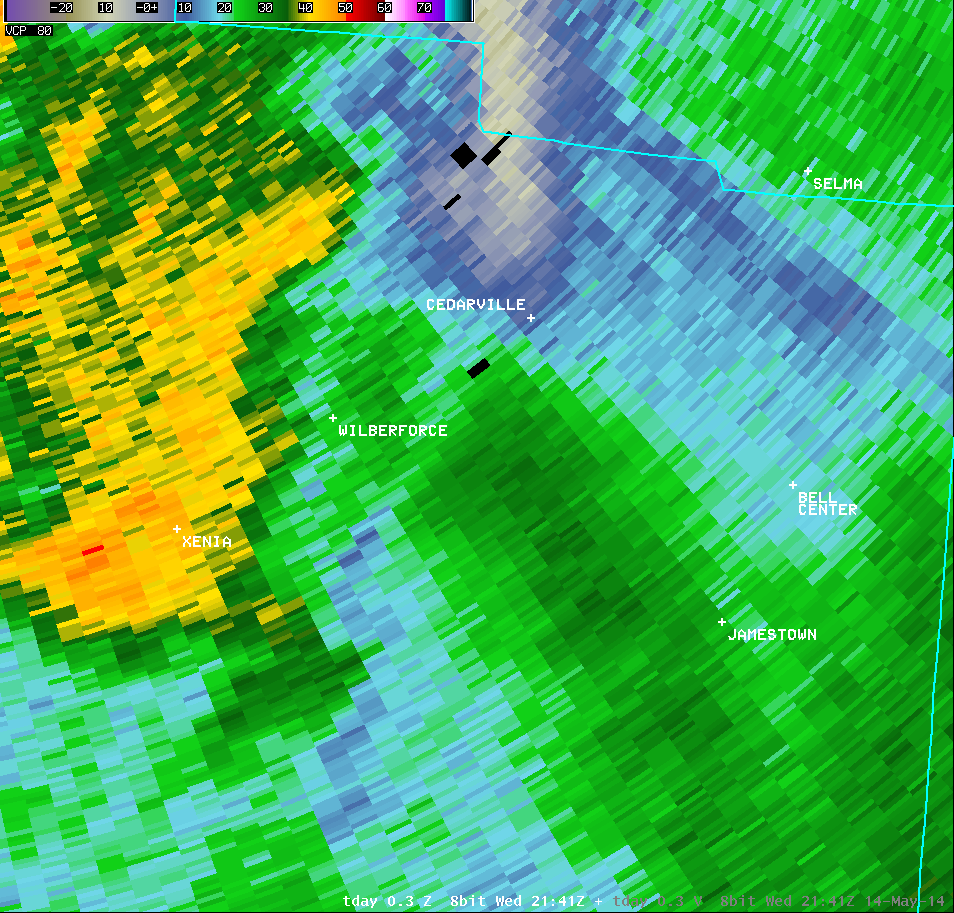
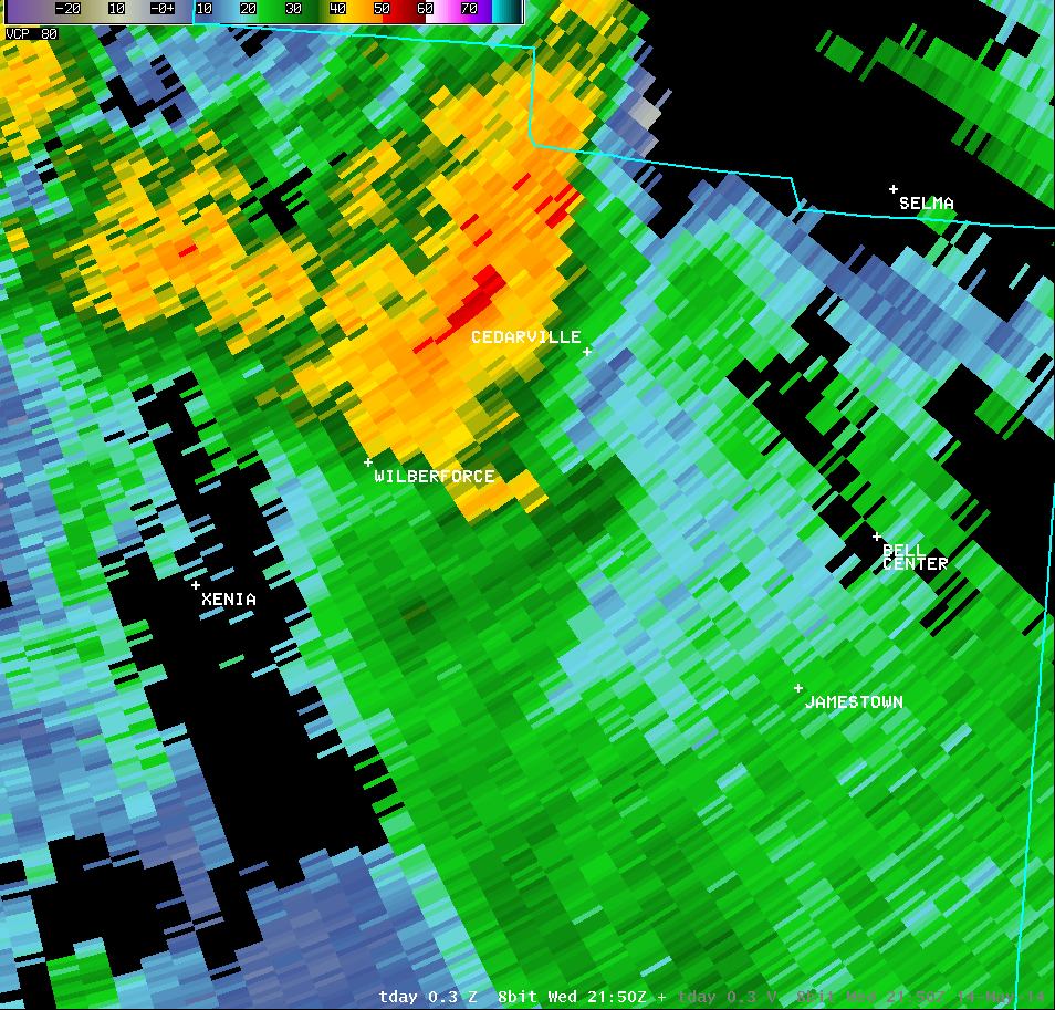
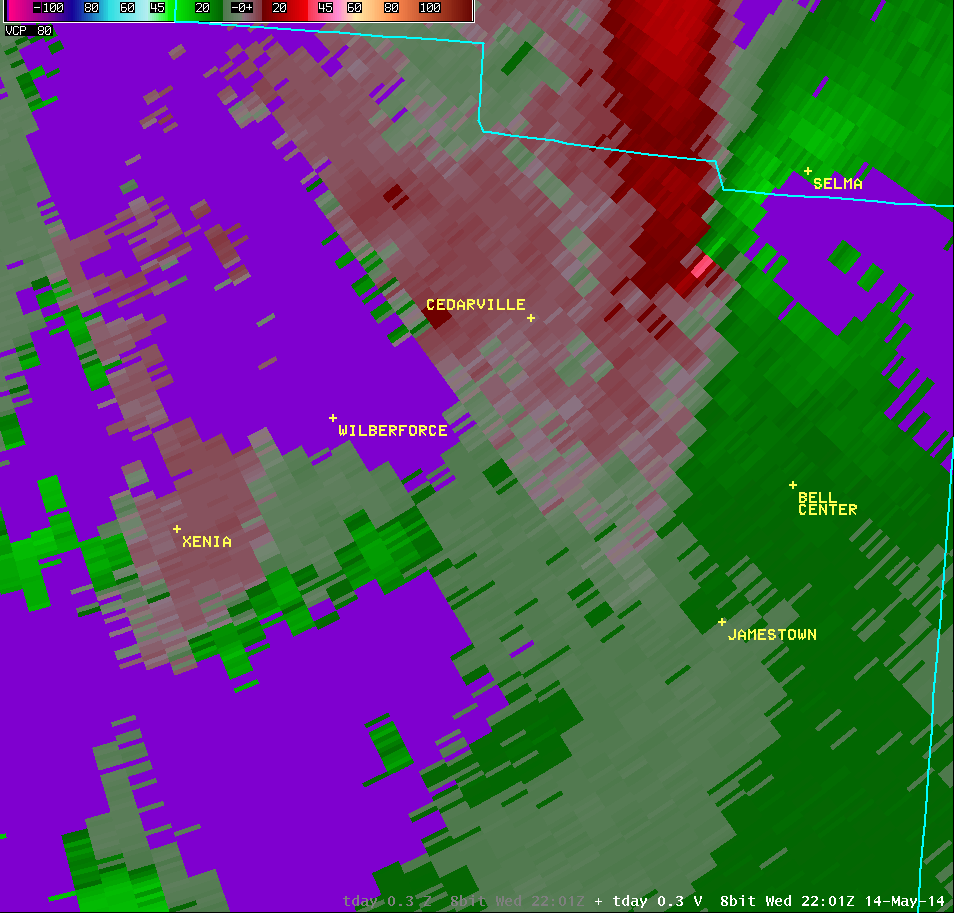
| Vertical Loop of KILN Radar Imagery (5:56 PM) |
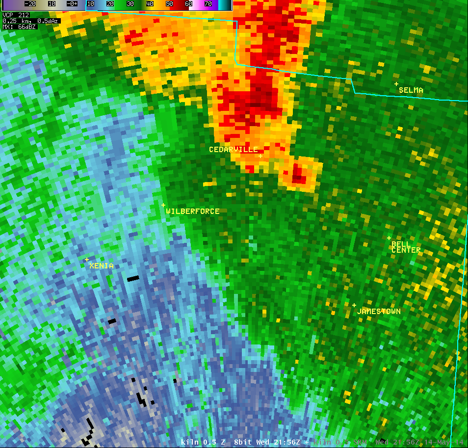
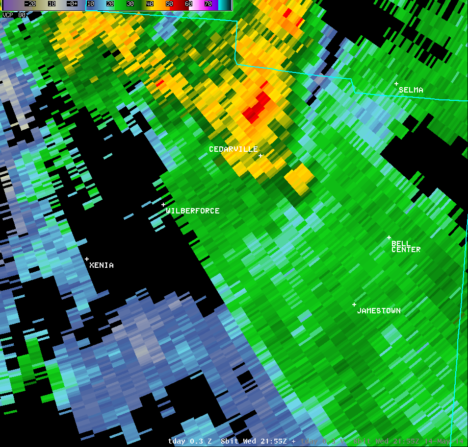
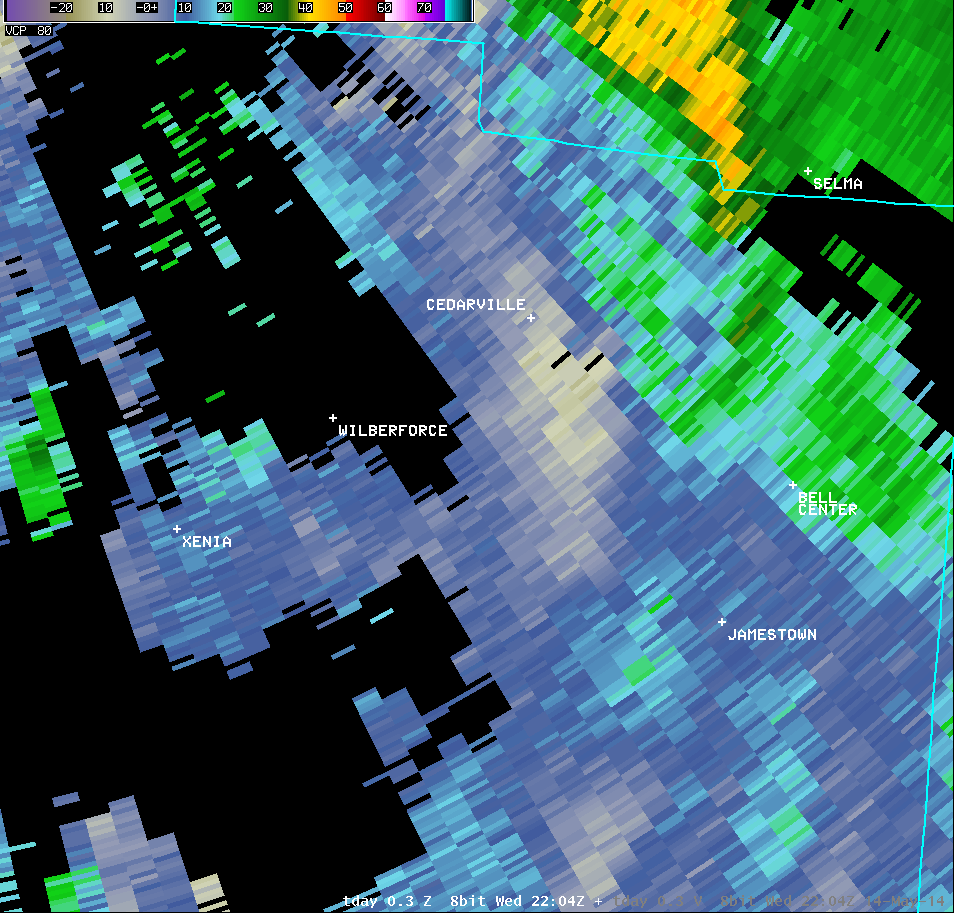
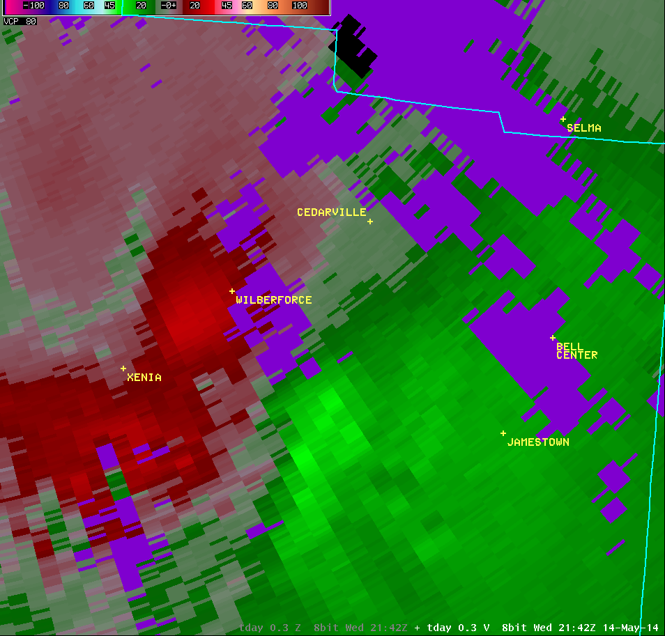
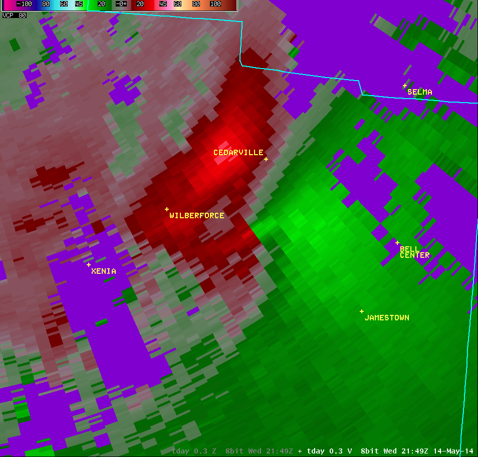
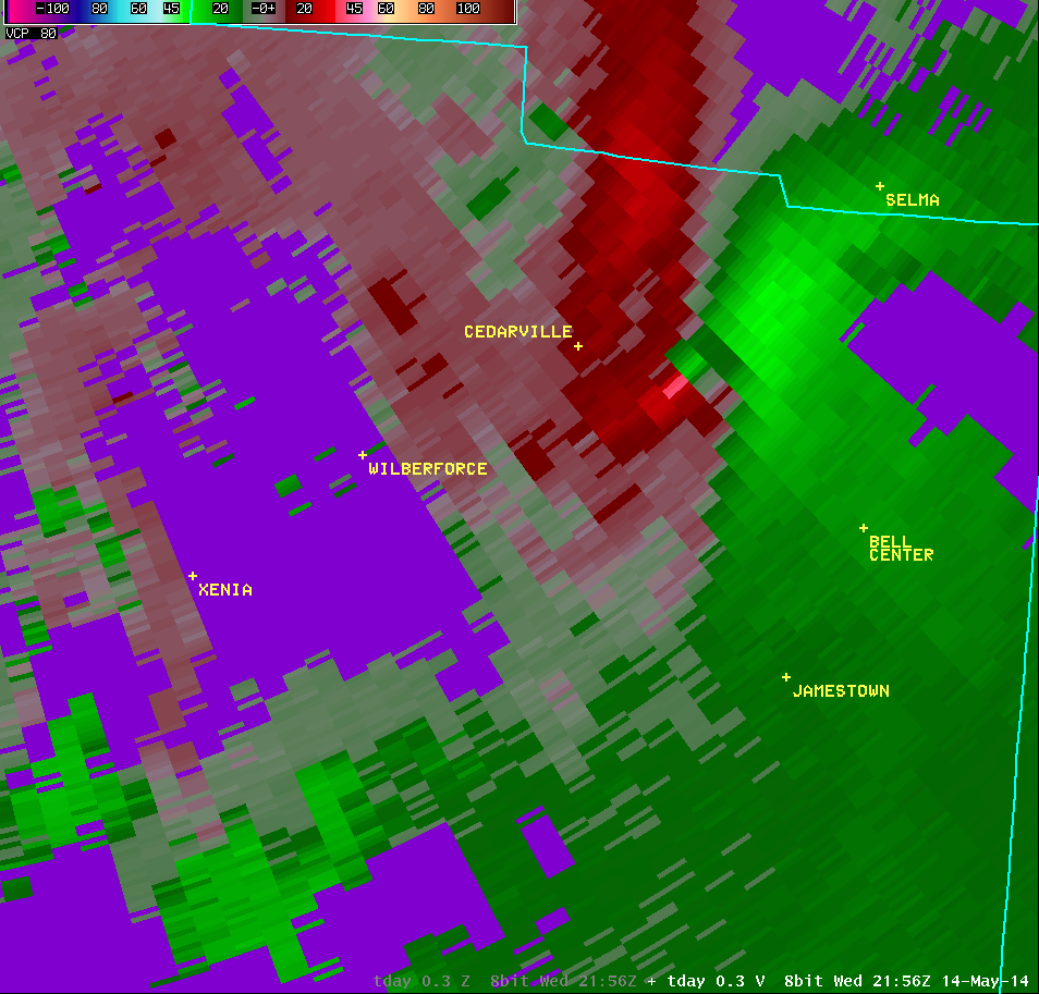
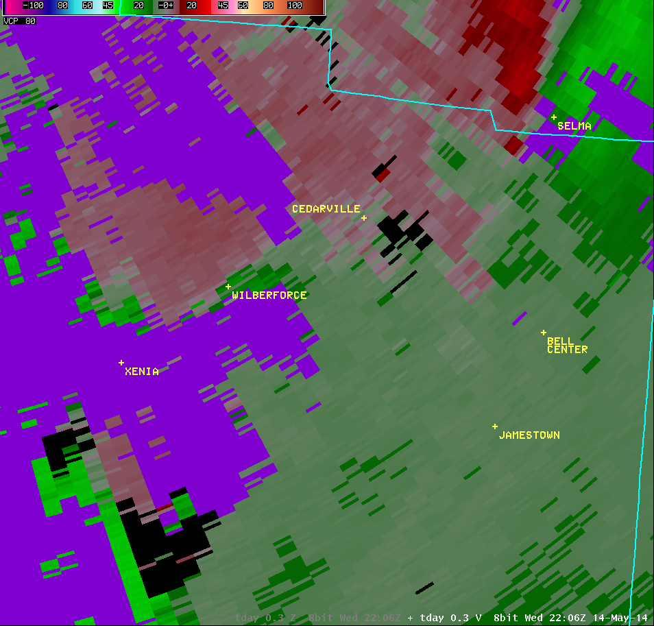
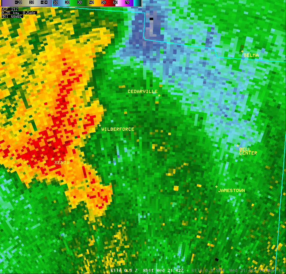
| 0.5° Reflectivity |
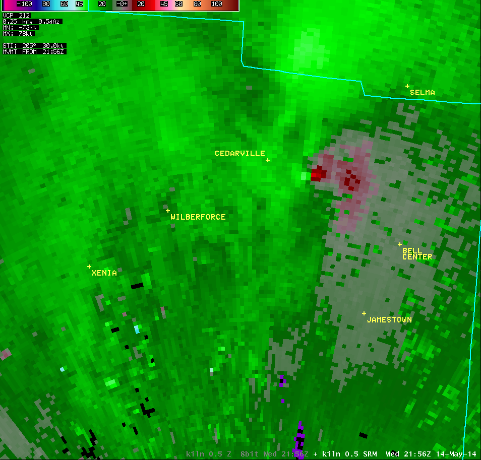
0.5° Storm-Relative Motion |
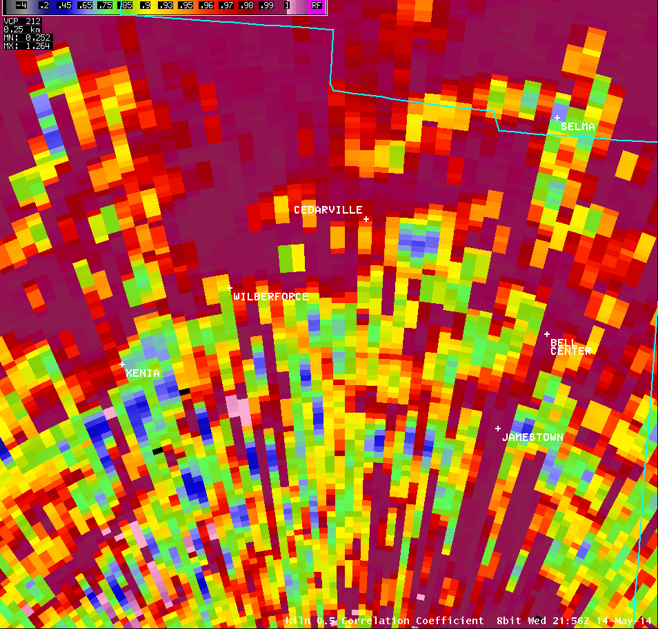
0.5° Correlation Coefficient |
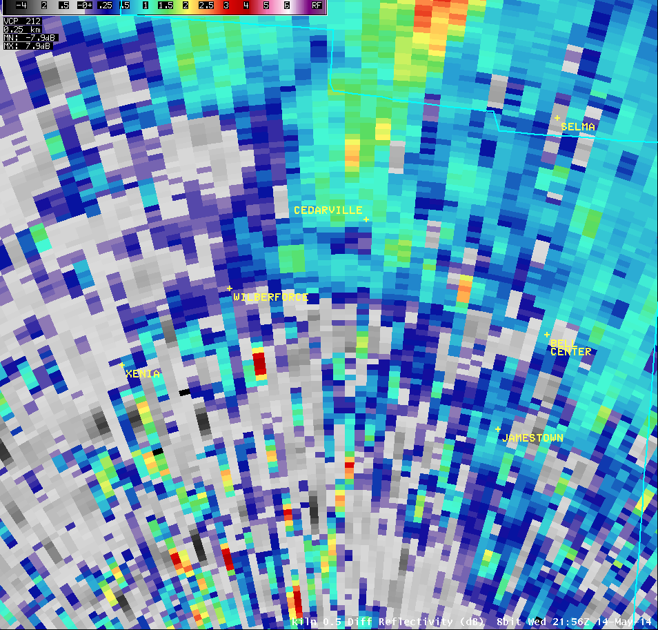
0.5° Differential Reflectivity |
 |
 |
 |
 |
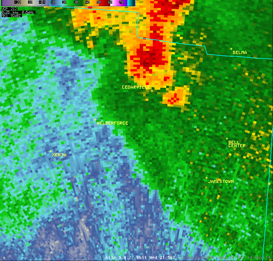
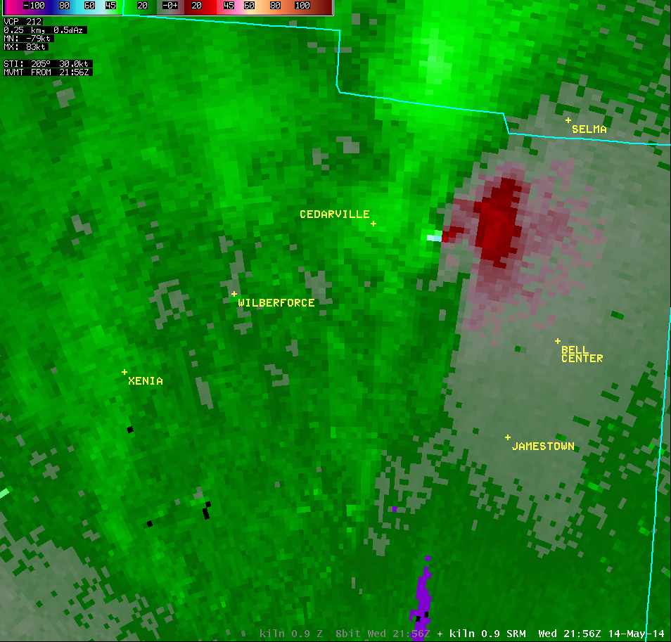
| 0.9° Reflectivity |
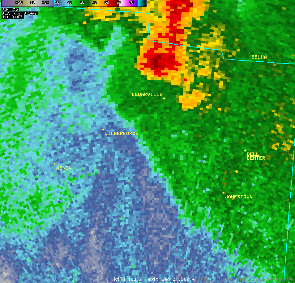
0.9° Storm-Relative Motion |
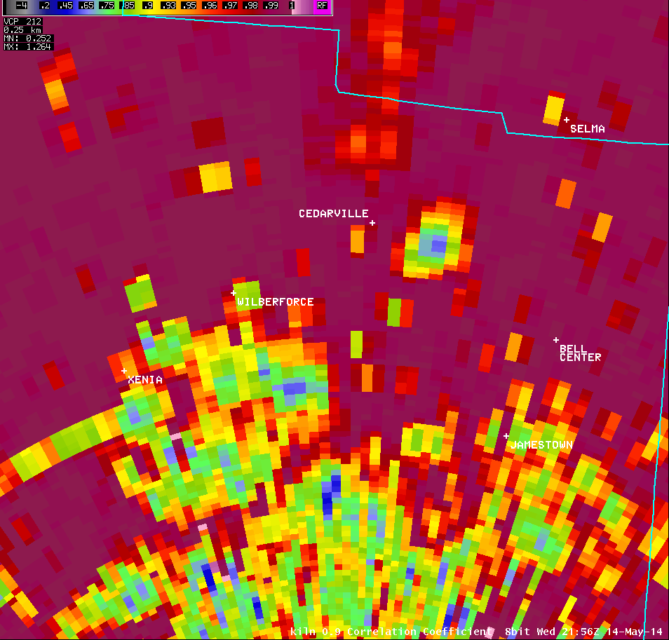
0.9° Correlation Coefficient |
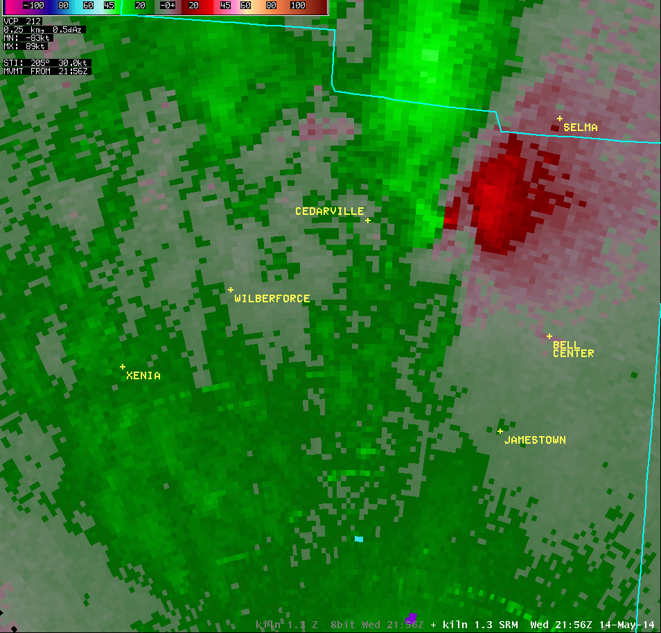
0.9° Differential Reflectivity |
 |
 |
 |
 |
| 1.3° Reflectivity |
1.3° Storm-Relative Motion |
1.3° Correlation Coefficient |
1.3° Differential Reflectivity |
 |
 |
 |
 |
| 2.4° Reflectivity |
2.4° Storm-Relative Motion |
2.4° Correlation Coefficient |
2.4° Differential Reflectivity |
 |
 |
 |
 |
| 4.0° Reflectivity |
4.0° Storm-Relative Motion |
4.0° Correlation Coefficient |
|
 |
 |
 |
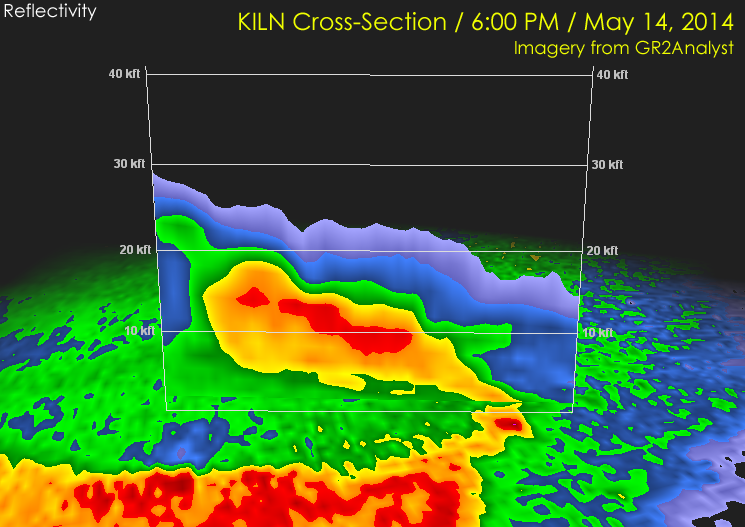
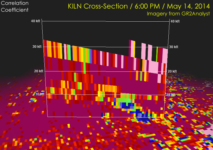
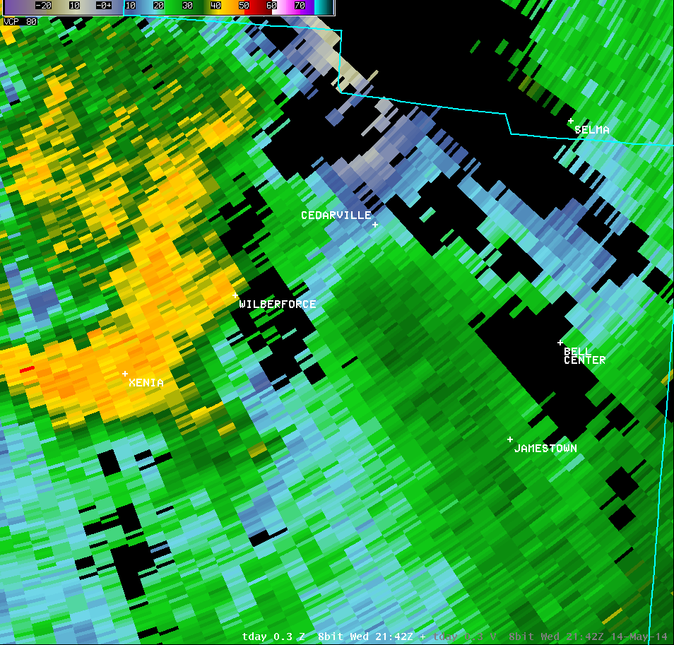
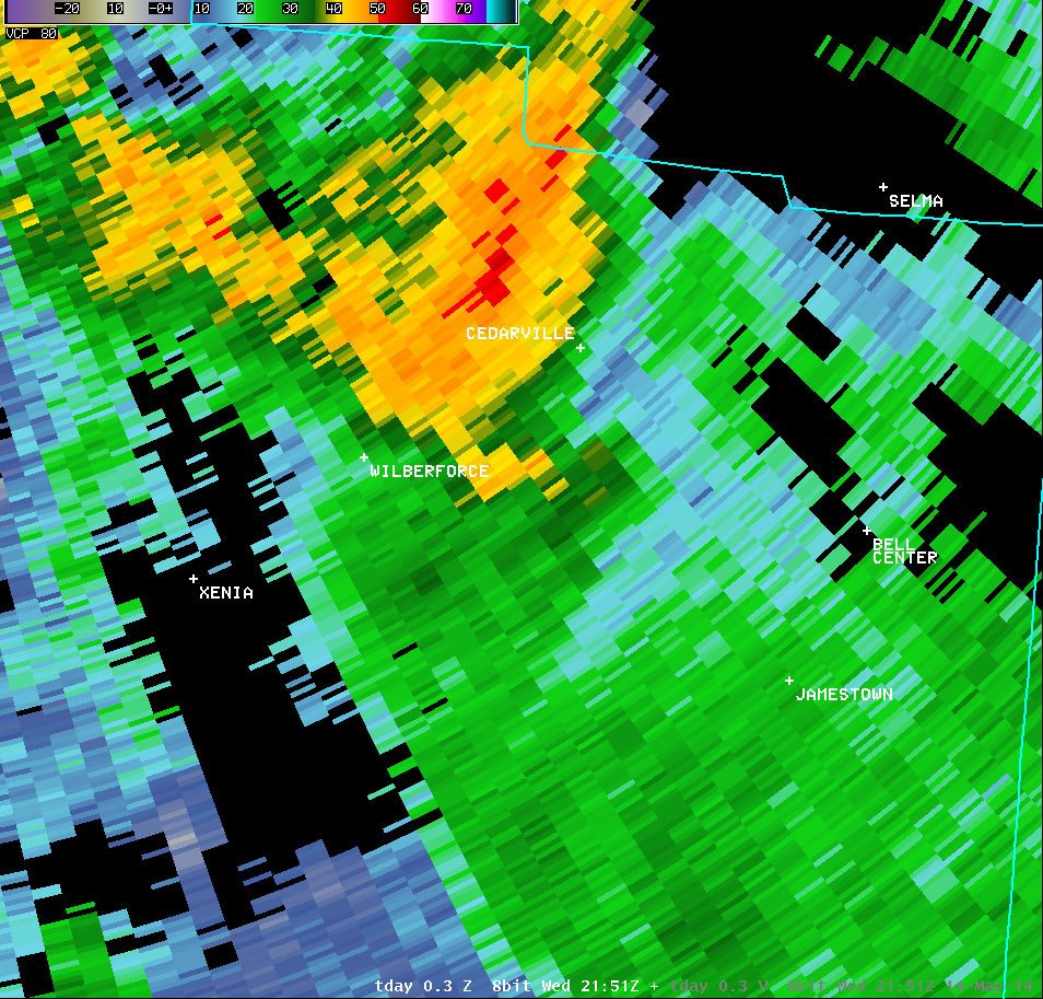
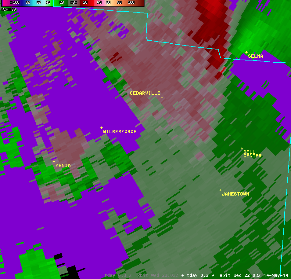
| Vertical Loop of KILN Radar Imagery (6:00 PM) |
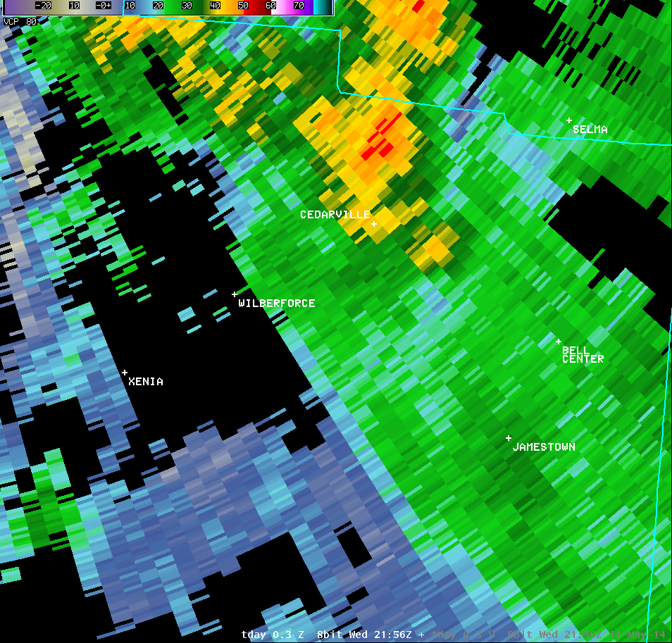
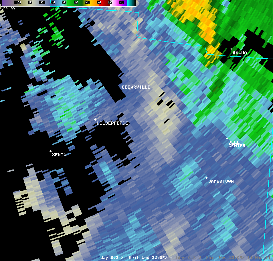
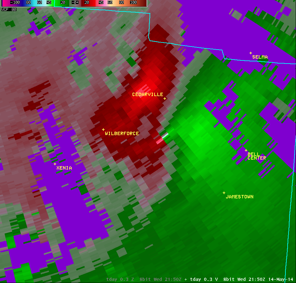
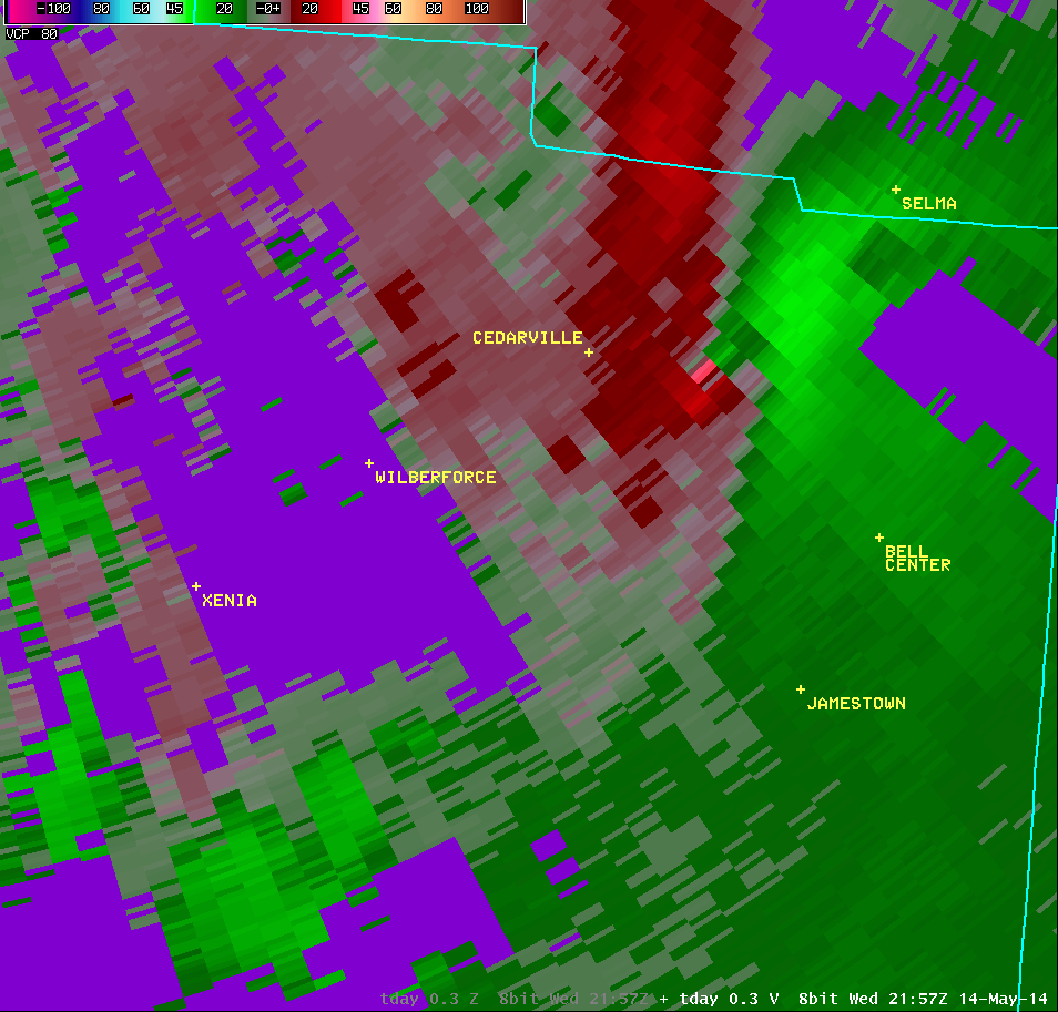
| 0.5° Reflectivity |
0.5° Storm-Relative Motion |
0.5° Correlation Coefficient |
0.5° Differential Reflectivity |
 |
 |
 |
 |
| 0.9° Reflectivity |
0.9° Storm-Relative Motion |
0.9° Correlation Coefficient |
0.9° Differential Reflectivity |
 |
 |
 |
 |
| 1.3° Reflectivity |
1.3° Storm-Relative Motion |
1.3° Correlation Coefficient |
1.3° Differential Reflectivity |
 |
 |
 |
 |
| 2.4° Reflectivity |
2.4° Storm-Relative Motion |
2.4° Correlation Coefficient |
2.4° Differential Reflectivity |
 |
 |
 |
 |
| 4.0° Reflectivity |
4.0° Storm-Relative Motion |
4.0° Correlation Coefficient |
|
 |
 |
 |
| Vertical Loop of KILN Radar Imagery (6:05 PM) |
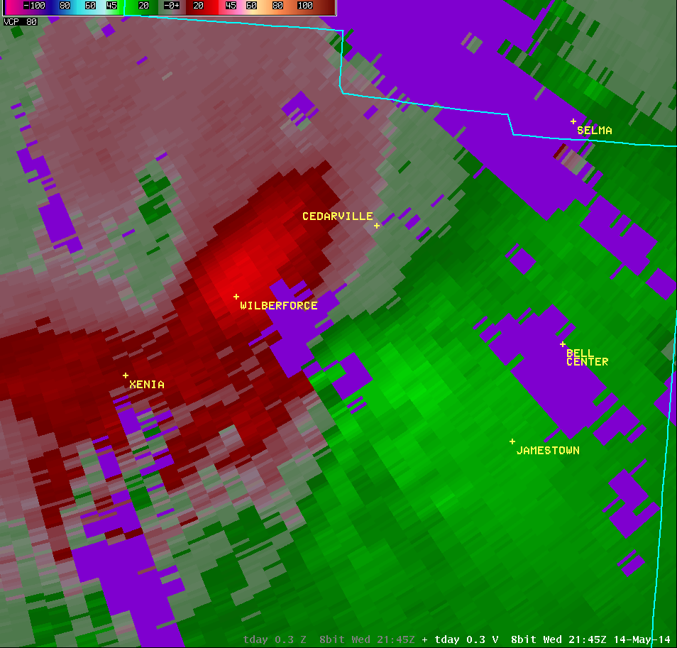
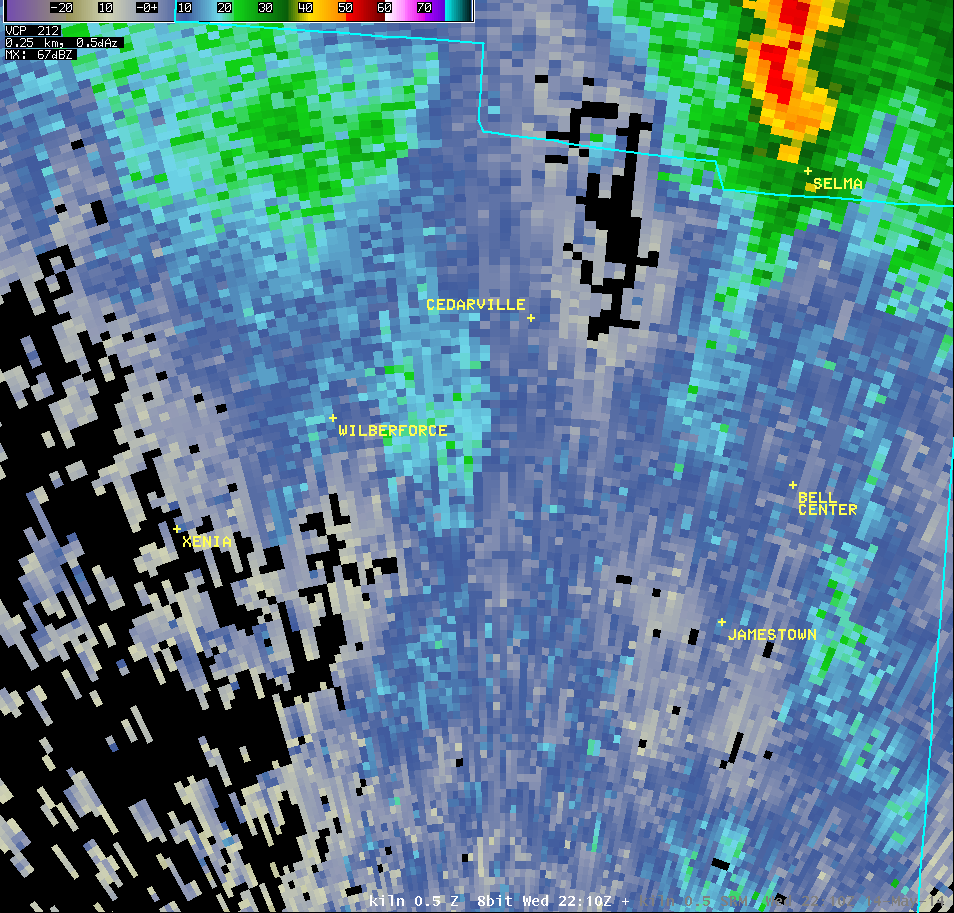
| 0.5° Reflectivity |
0.5° Storm-Relative Motion |
0.5° Correlation Coefficient |
0.5° Differential Reflectivity |
 |
 |
 |
 |
| 0.9° Reflectivity |
0.9° Storm-Relative Motion |
0.9° Correlation Coefficient |
0.9° Differential Reflectivity |
 |
 |
 |
 |
| 1.3° Reflectivity |
1.3° Storm-Relative Motion |
1.3° Correlation Coefficient |
1.3° Differential Reflectivity |
 |
 |
 |
 |
| 2.4° Reflectivity |
2.4° Storm-Relative Motion |
2.4° Correlation Coefficient |
2.4° Differential Reflectivity |
 |
 |
 |
 |
| 4.0° Reflectivity |
4.0° Storm-Relative Motion |
4.0° Correlation Coefficient |
|
 |
 |
 |


