|
Tornado near New Carlisle, OH |
| NWS Wilmington OH (KILN) | ||
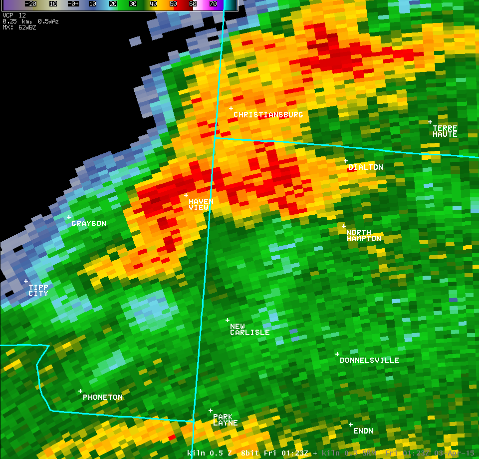
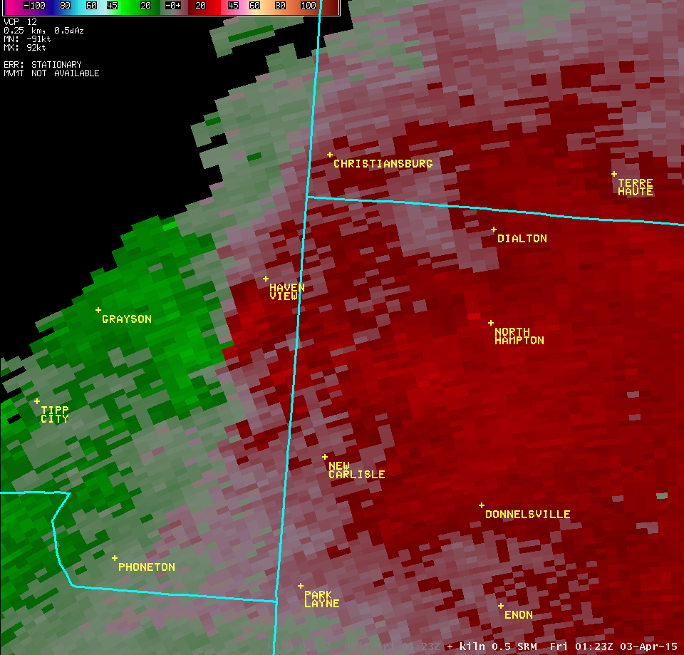
| 0.5° Z -- 9:23 PM | 0.5° SRM -- 9:23 PM | |
 |
 |
|
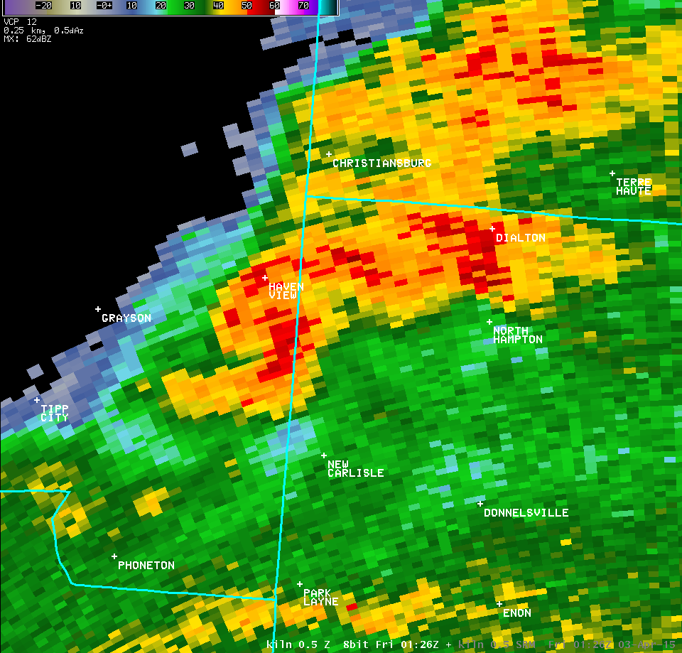
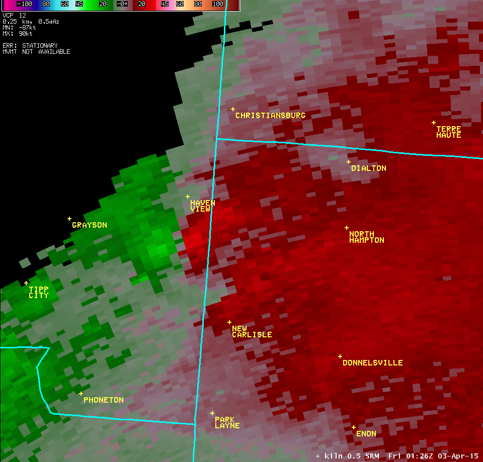
| 0.5° Z -- 9:26 PM | 0.5° SRM -- 9:26 PM | |
 |
 |
|
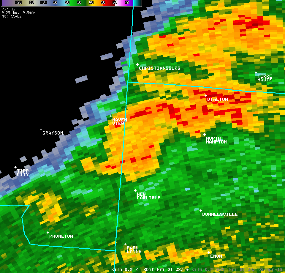
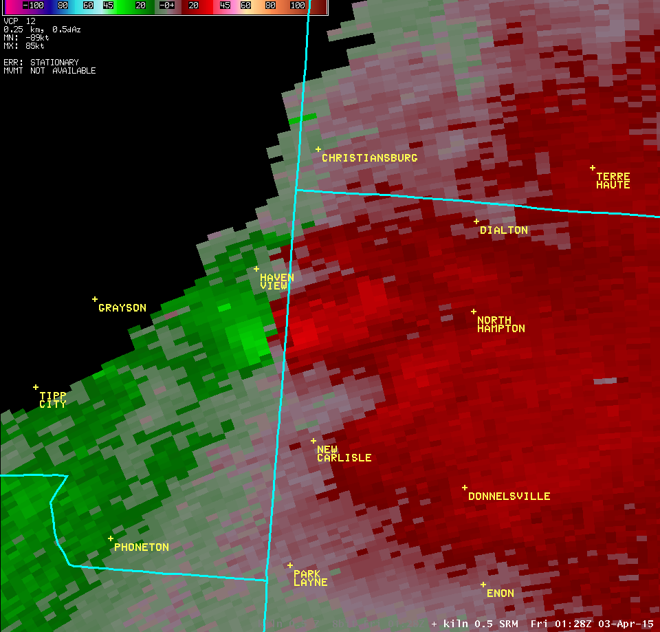
| 0.5° Z -- 9:28 PM | 0.5° SRM -- 9:28 PM | |
 |
 |
|
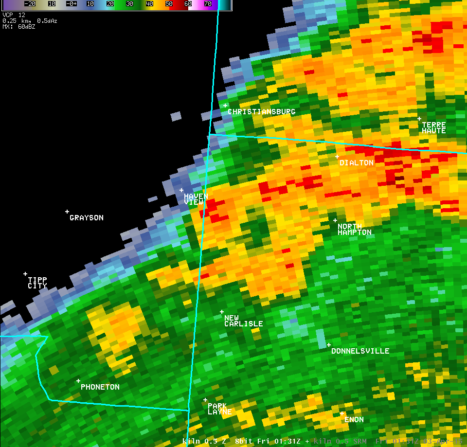
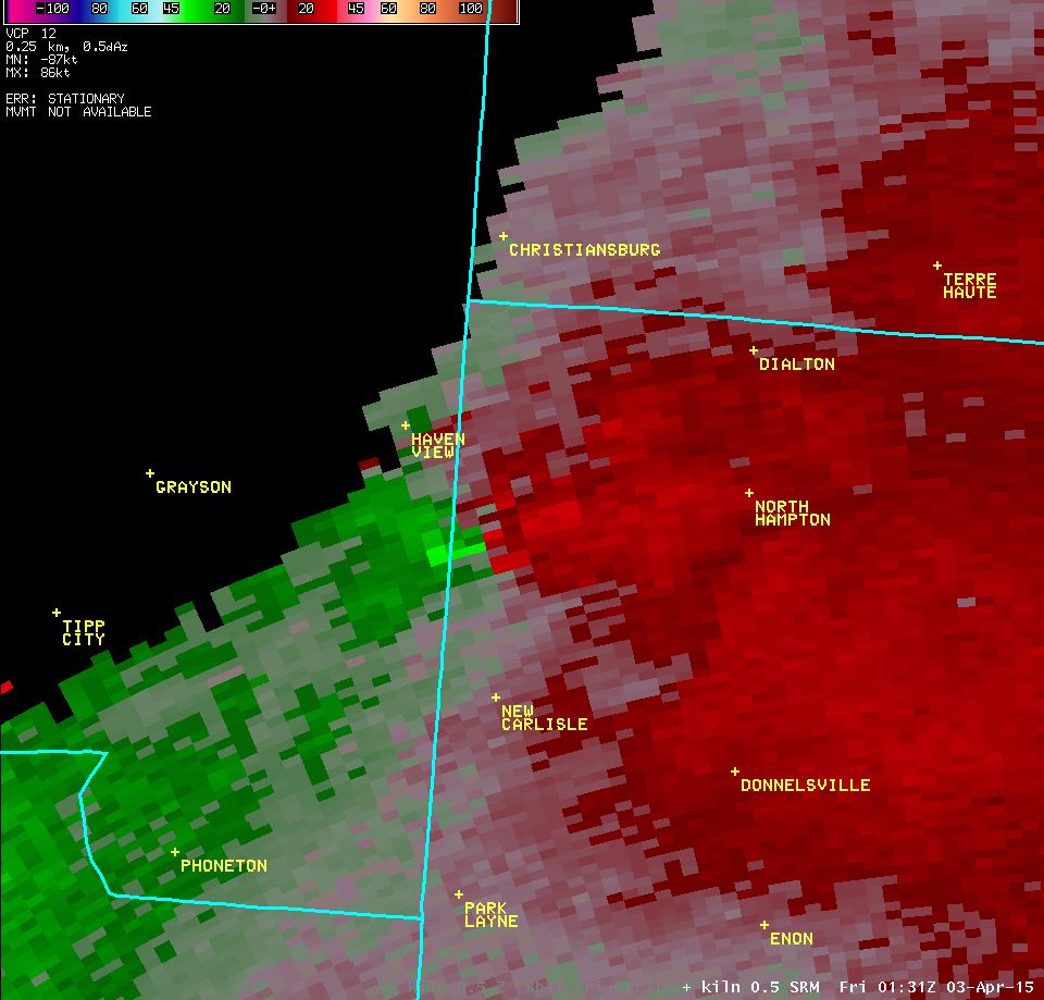
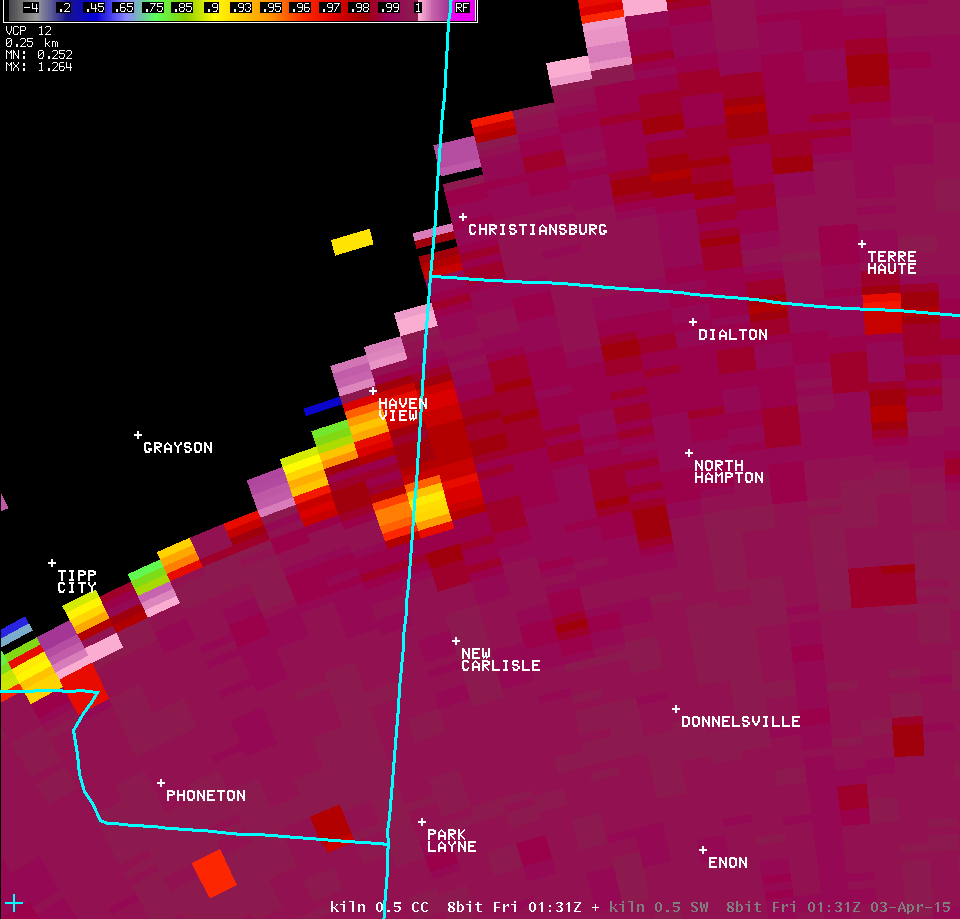
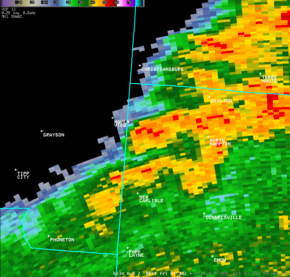
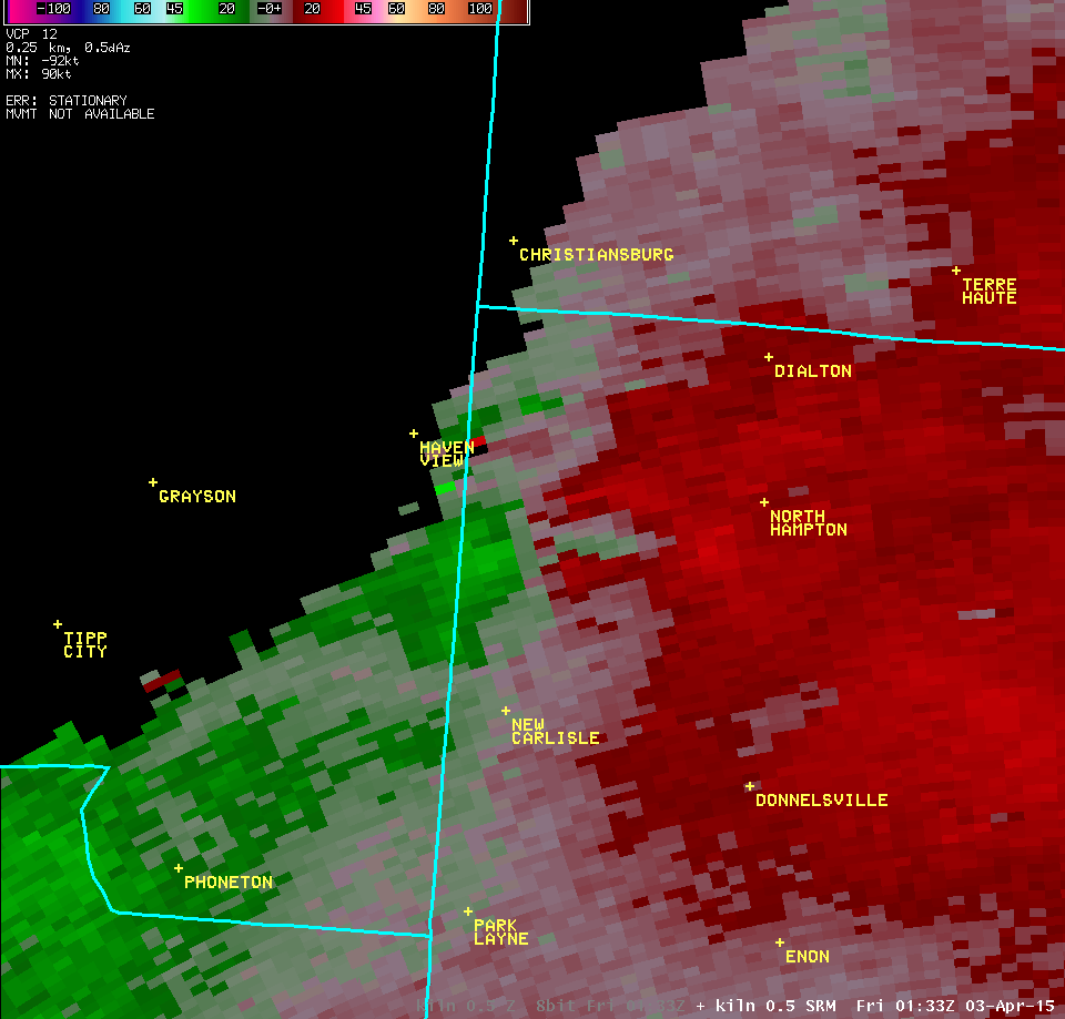
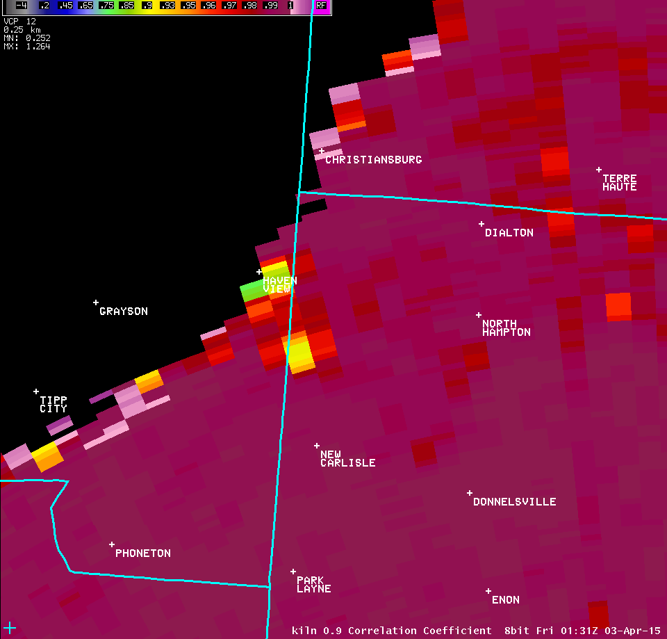
| 0.5° Z -- 9:31 PM | 0.5° SRM -- 9:31 PM | 0.5° CC -- 9:31 PM |
 |
 |
 |
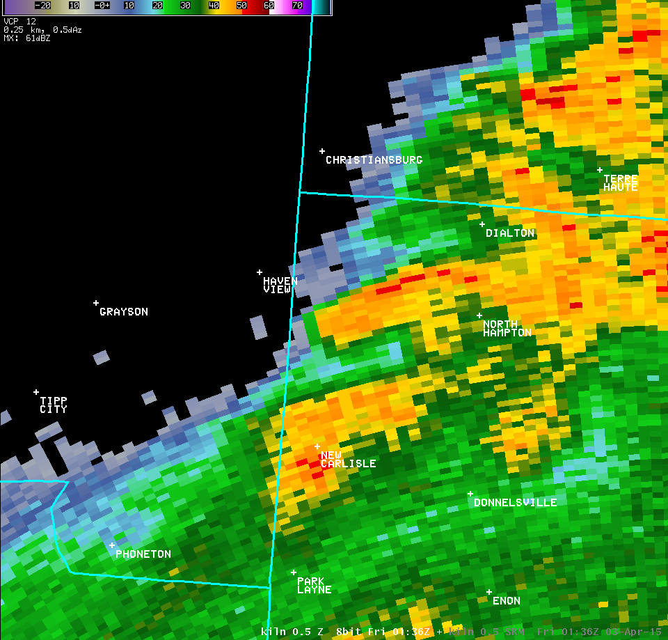
| 0.5° Z -- 9:33 PM | 0.5° SRM -- 9:33 PM | |
 |
 |
|
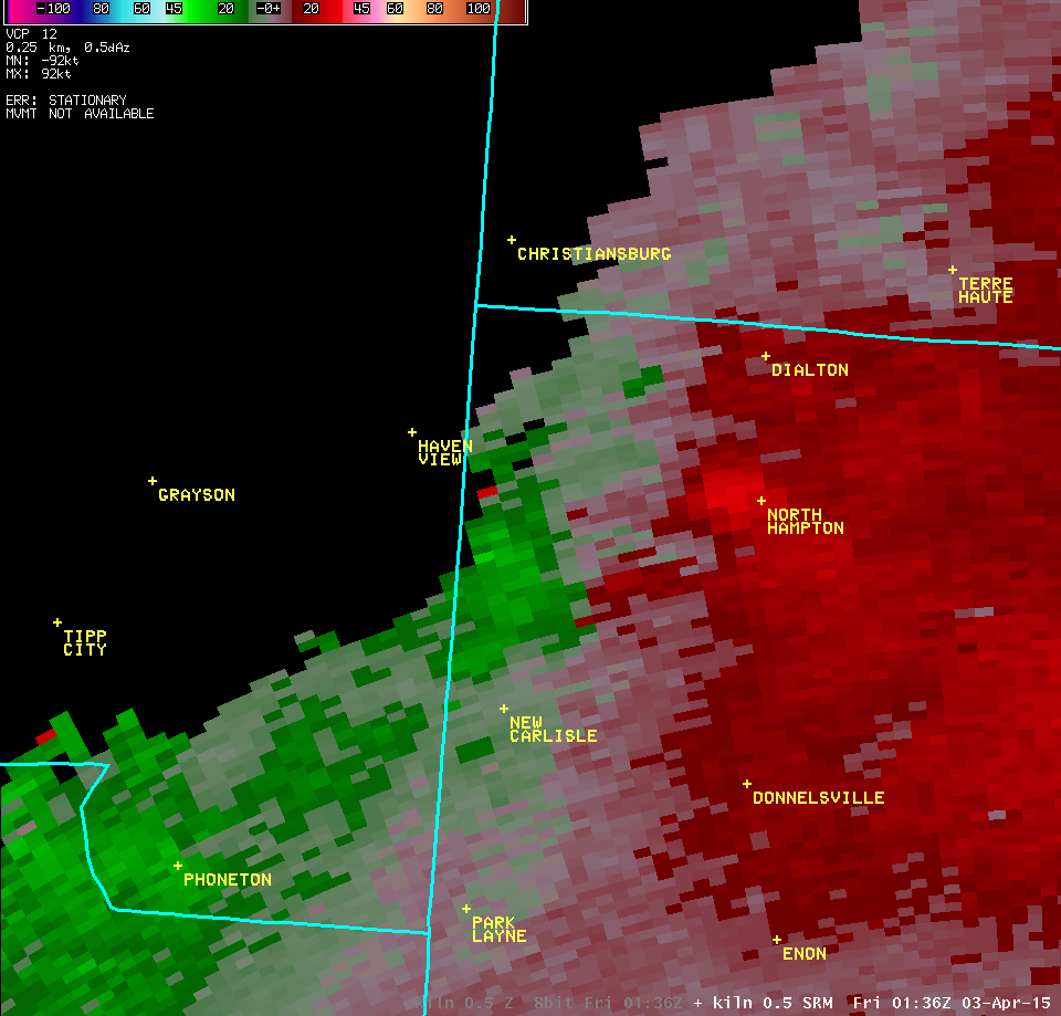
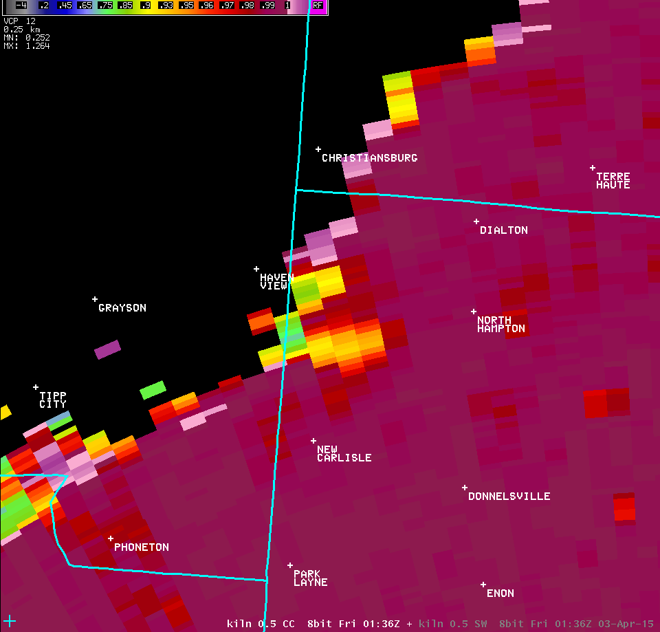
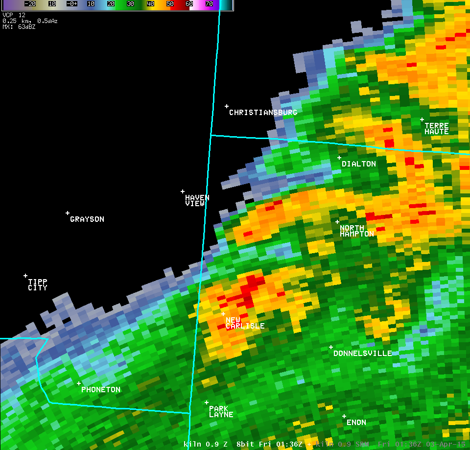
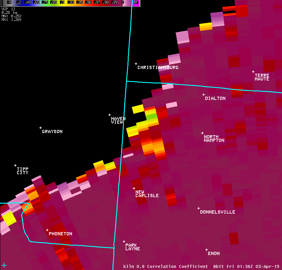
| 0.5° Z -- 9:36 PM | 0.5° SRM -- 9:36 PM | 0.5° CC -- 9:36 PM |
 |
 |
 |
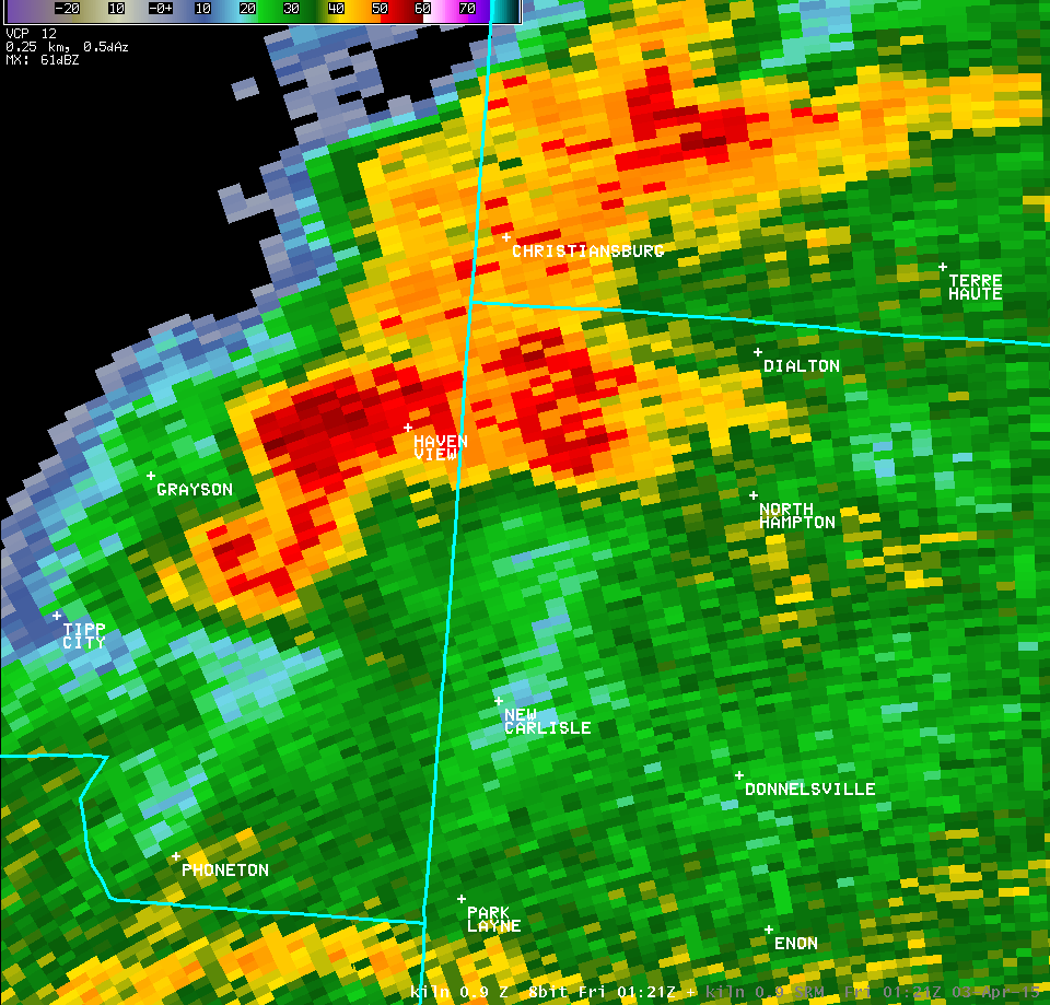
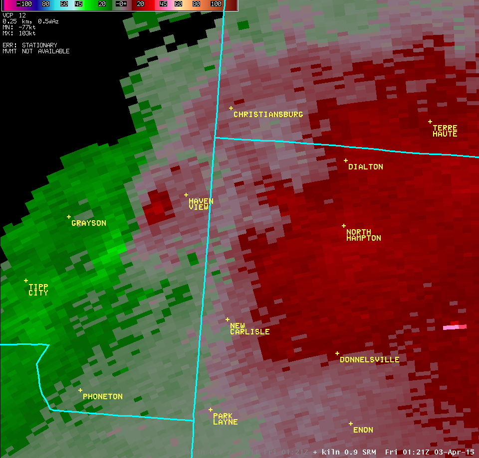
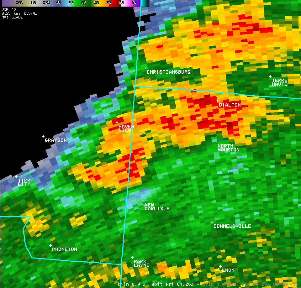
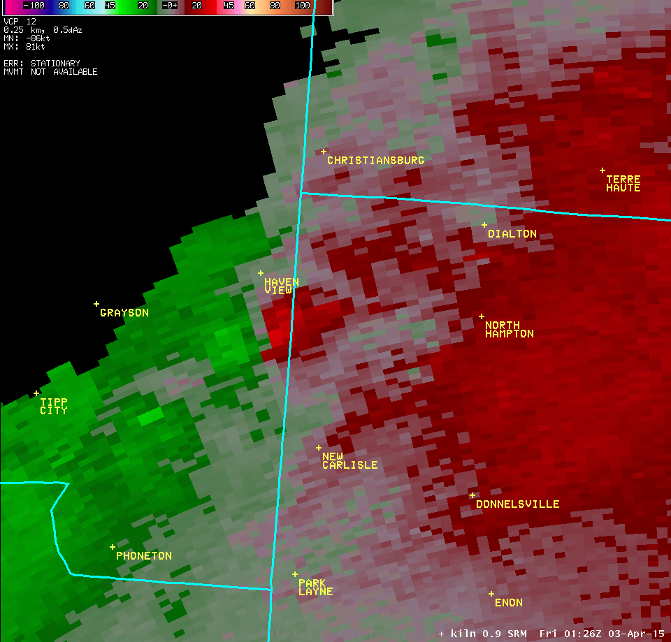
| 0.9° Z -- 9:21 PM | 0.9° SRM -- 9:21 PM | |
 |
 |
|
| 0.9° Z -- 9:26 PM | 0.9° SRM -- 9:26 PM | |
 |
 |
|
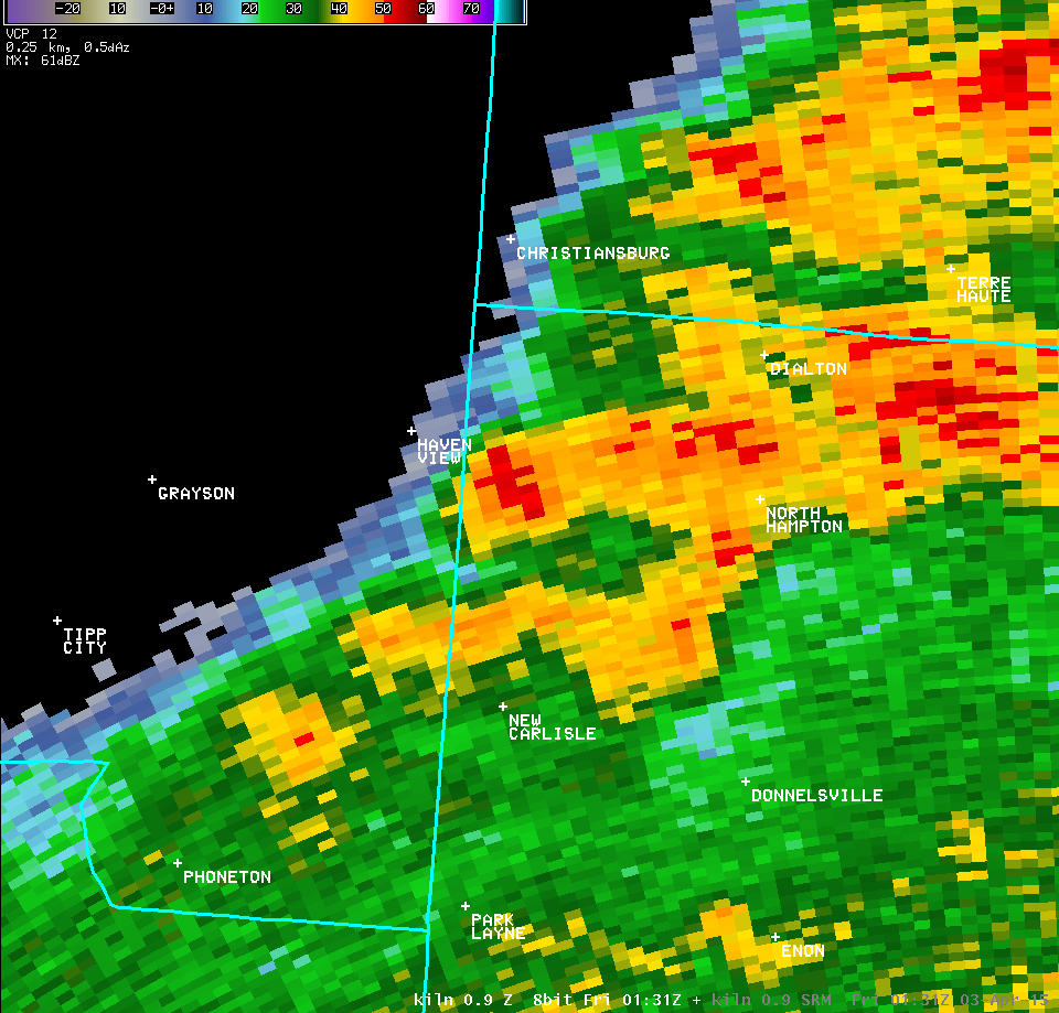
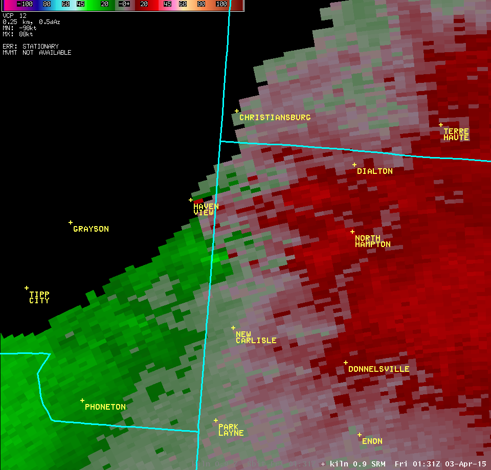
| 0.9° Z -- 9:31 PM | 0.9° SRM -- 9:31 PM | 0.9° CC -- 9:31 PM |
 |
 |
 |
| 0.9° Z -- 9:36 PM | 0.9° SRM -- 9:36 PM | 0.9° CC -- 9:36 PM |
 |
 |
 |
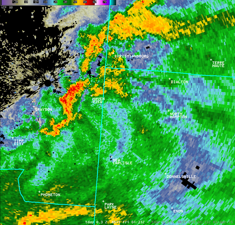
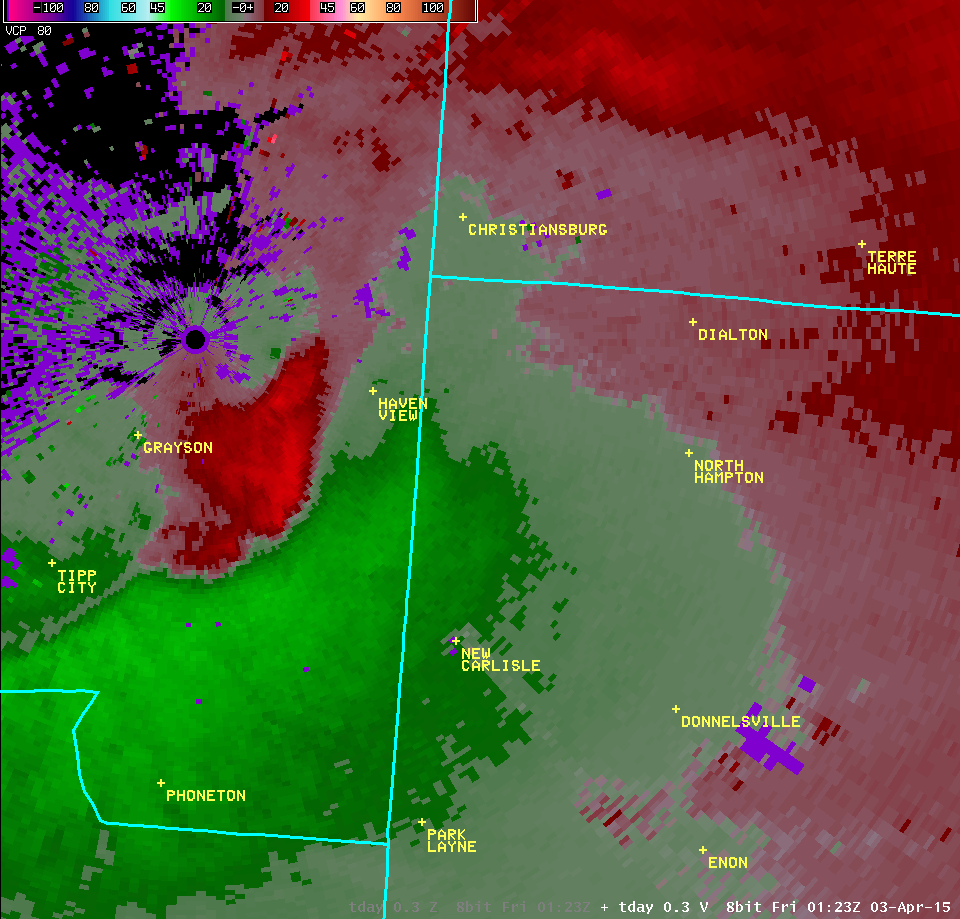
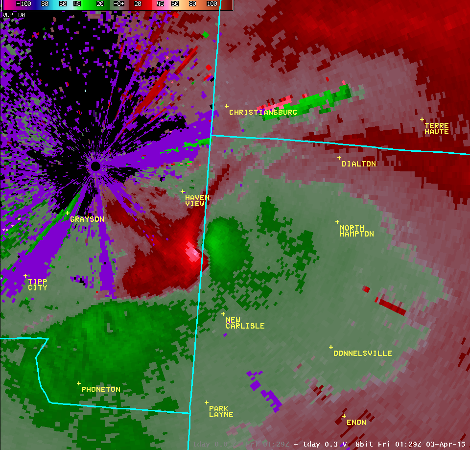
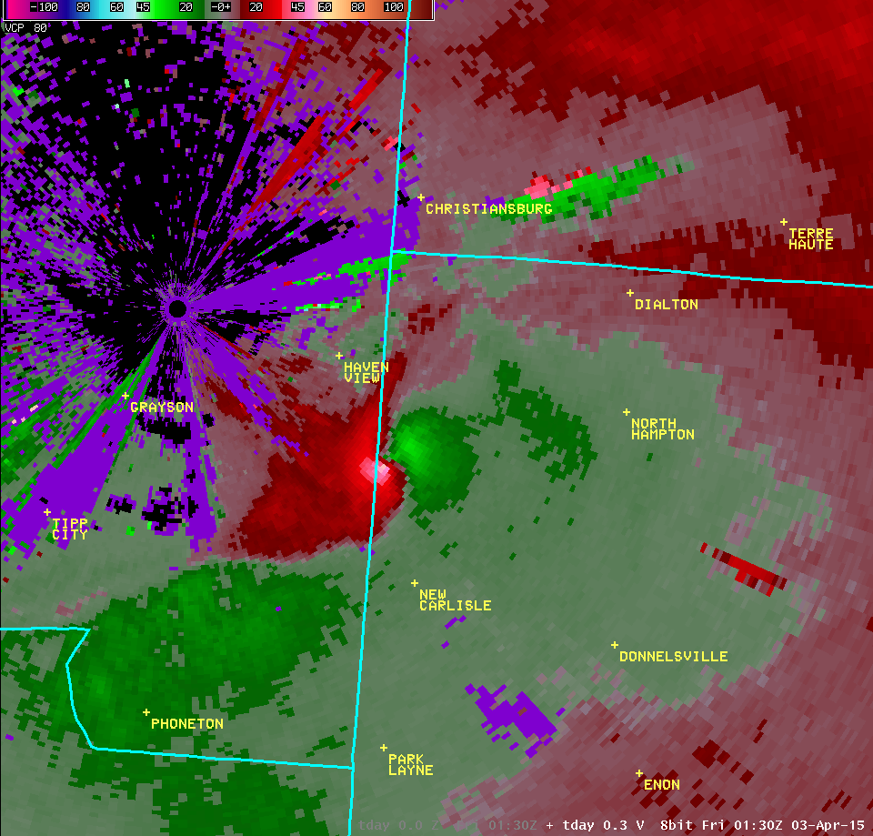
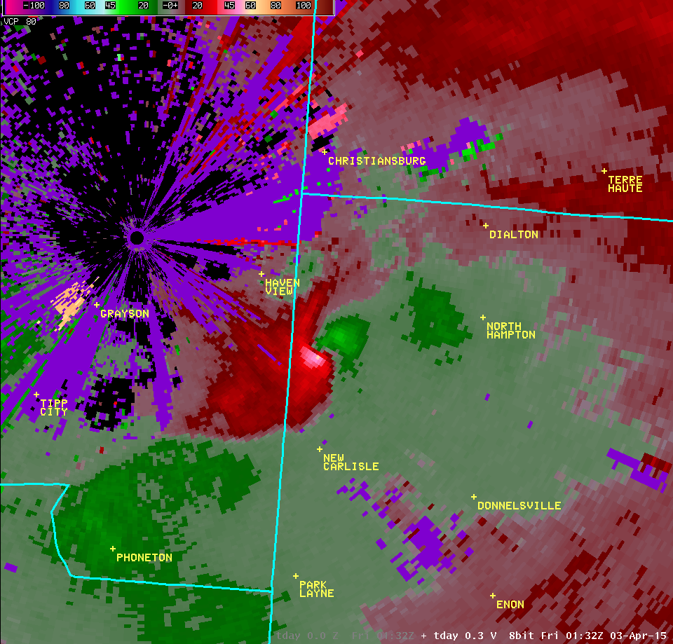
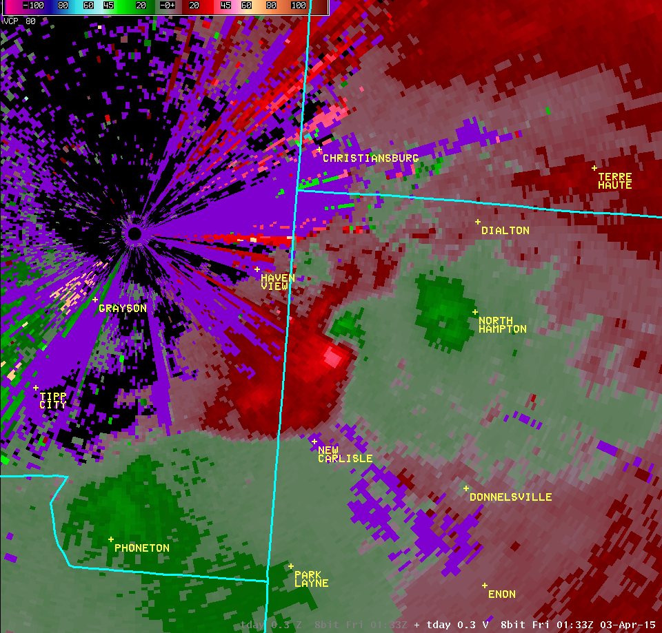
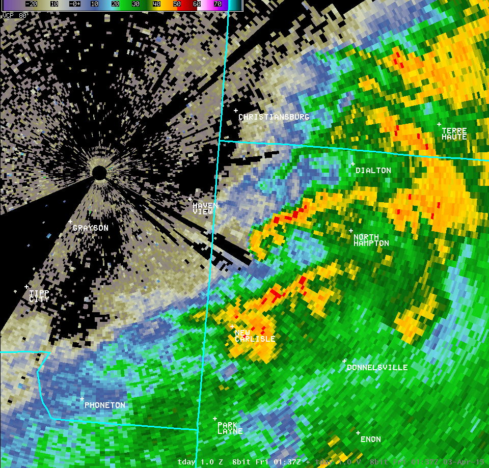
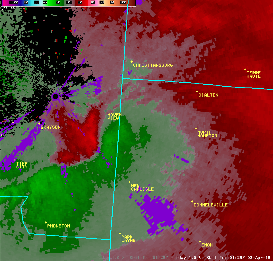
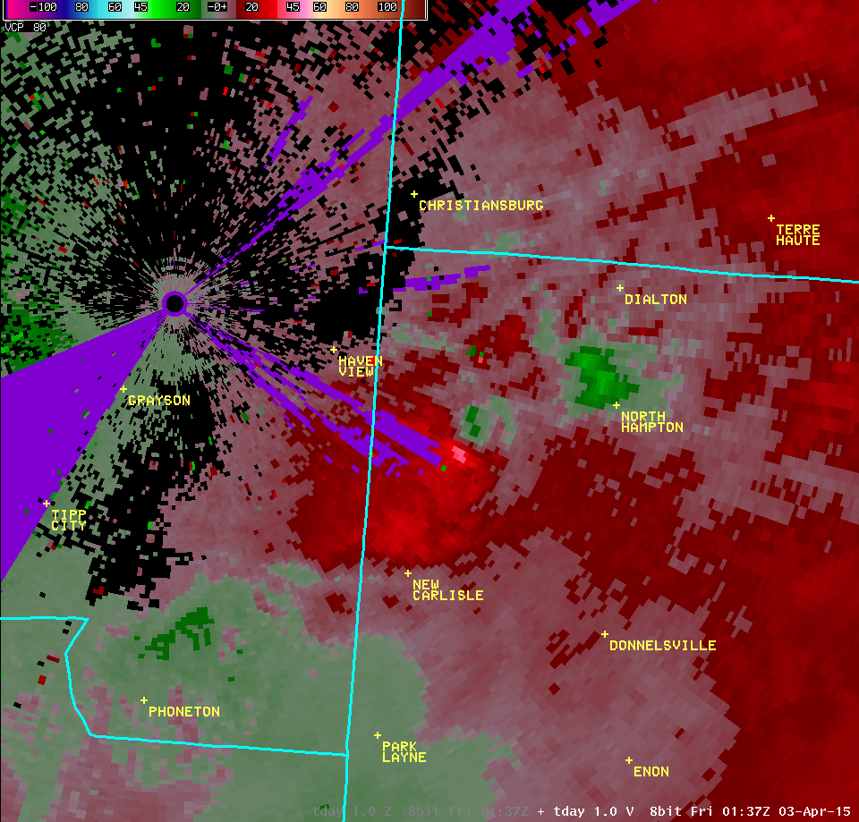
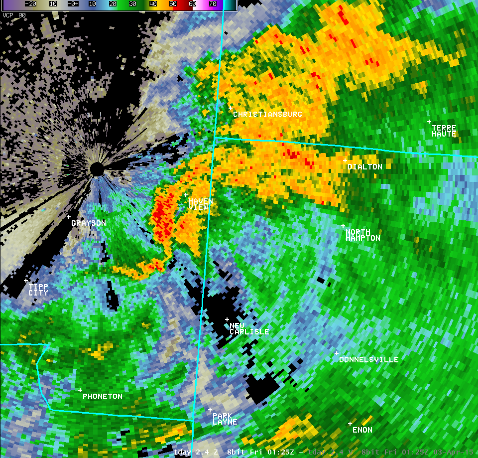
| Vertical Loop of TDAY Radar Imagery (9:31 PM) | |||
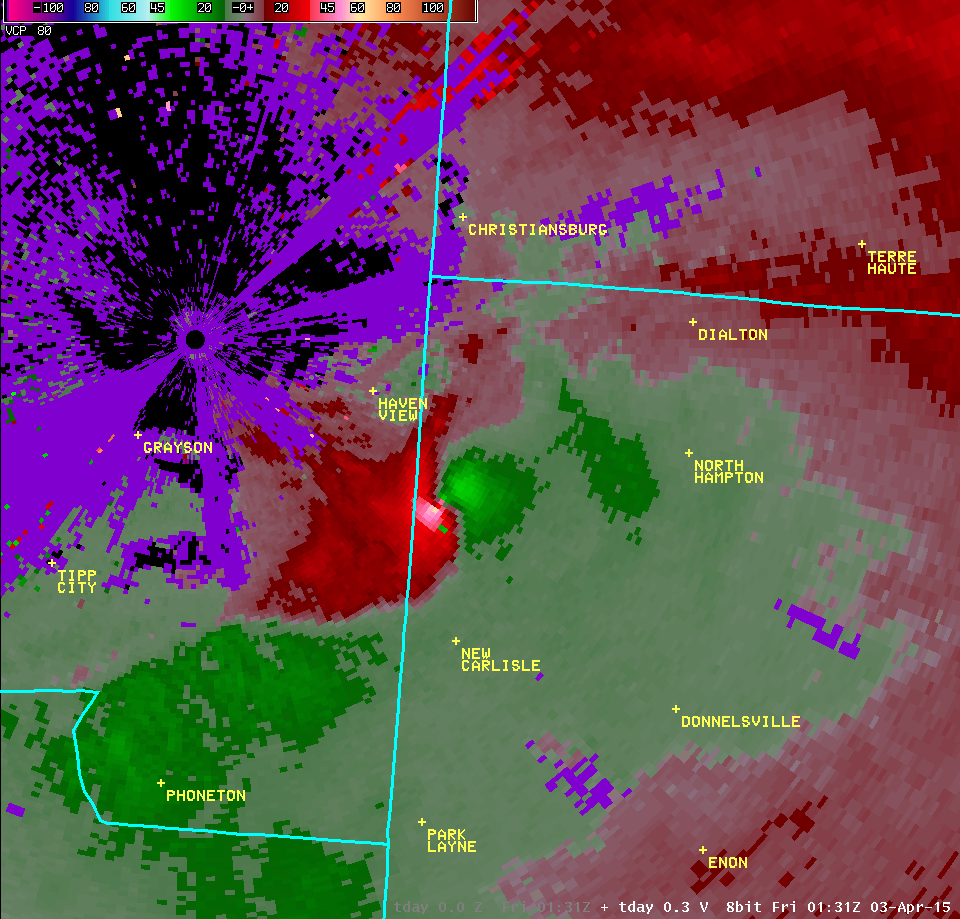
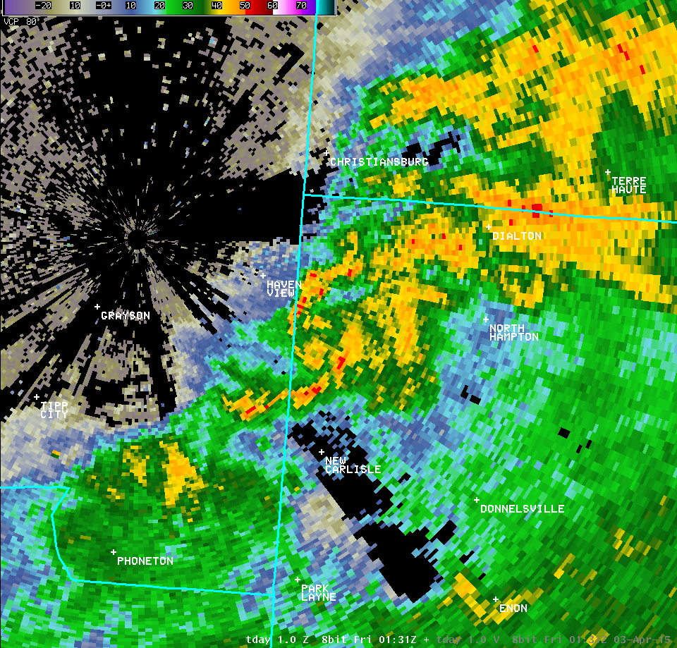
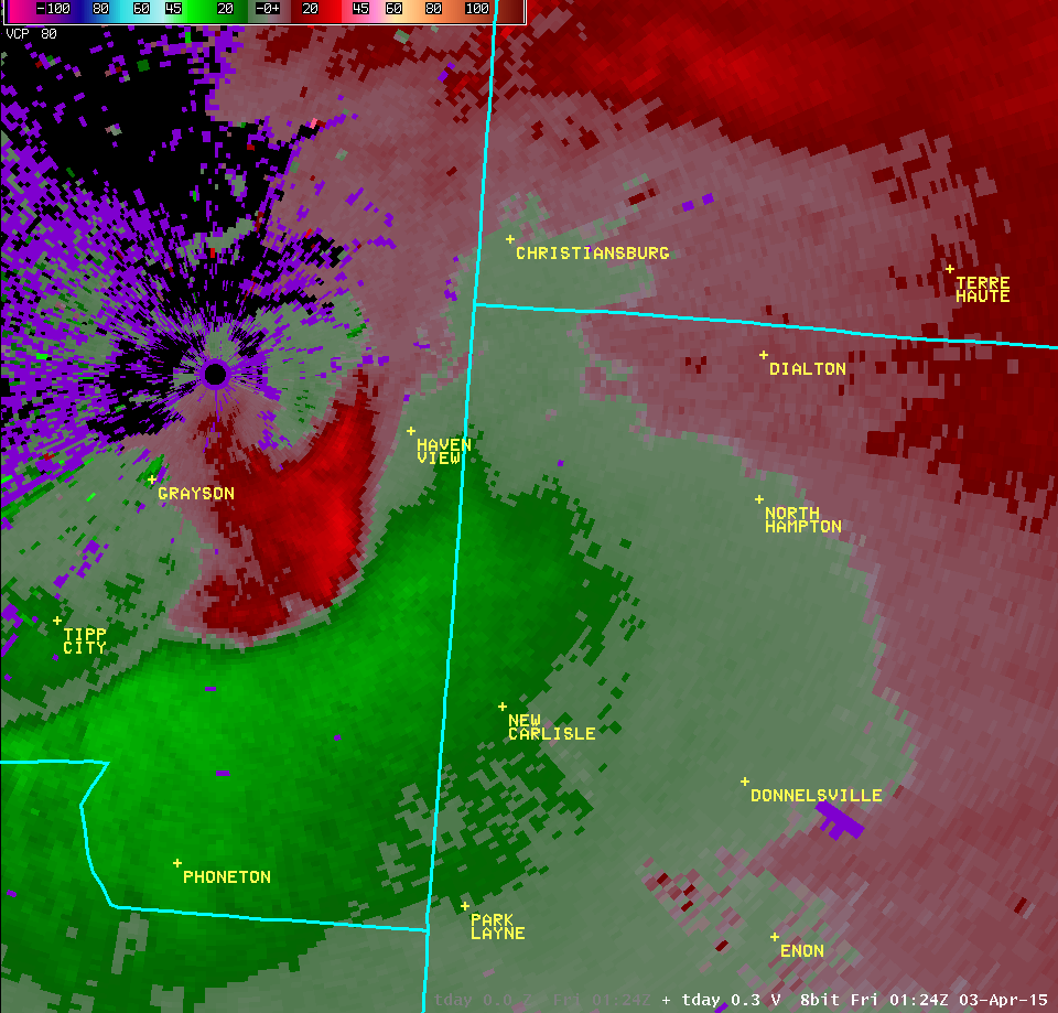
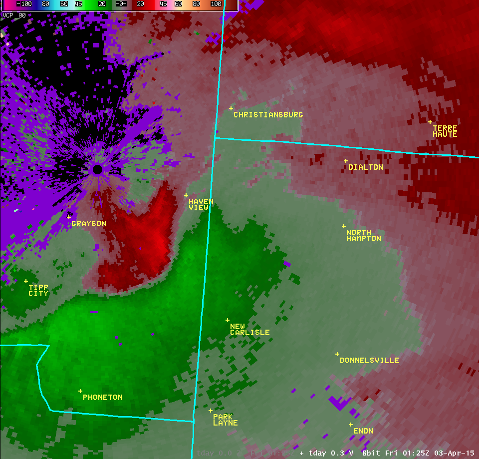
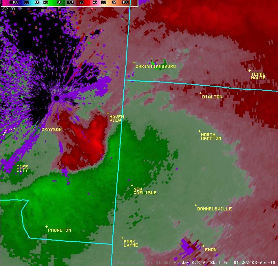
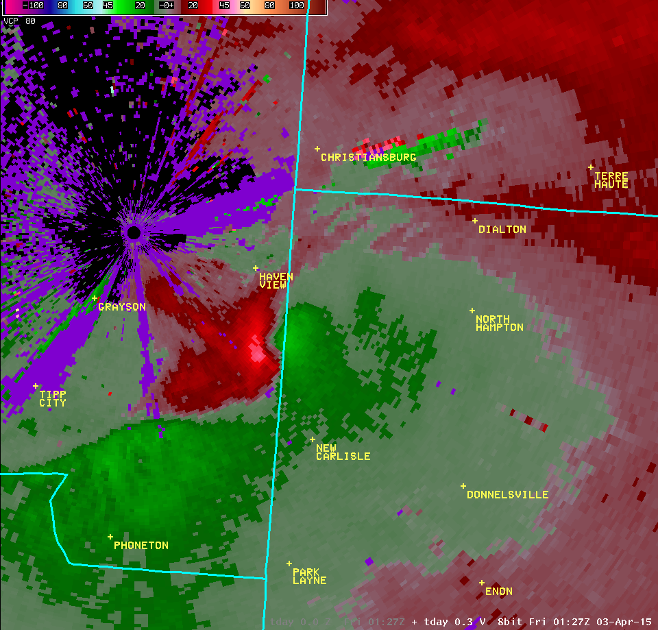
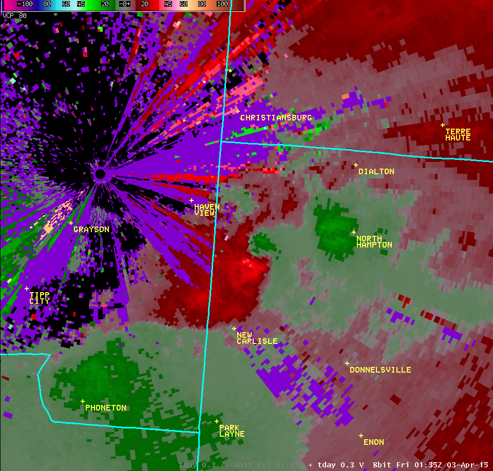
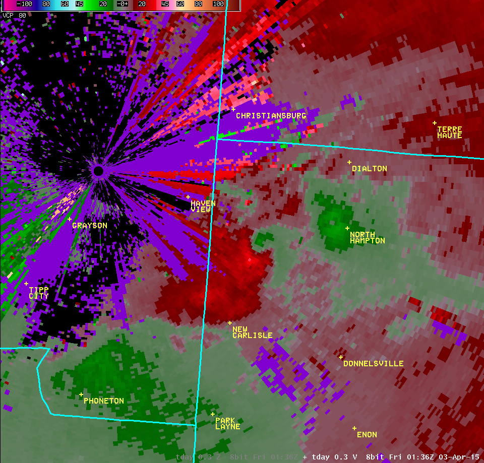
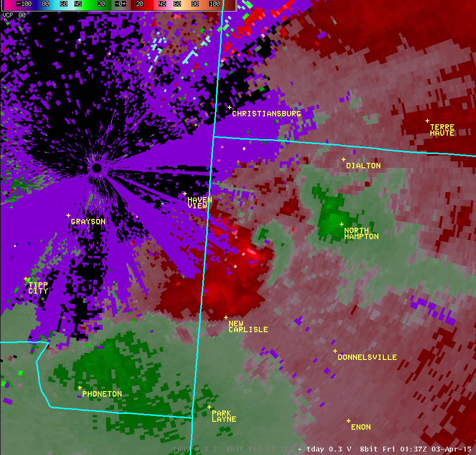
| 0.3° Reflectivity | 0.3° Velocity | ||
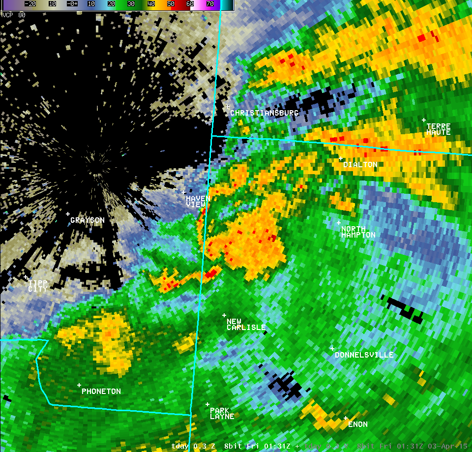 |
 | ||
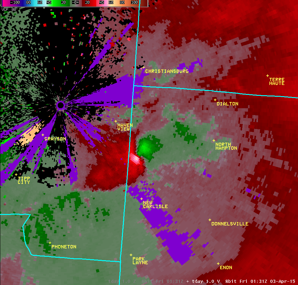
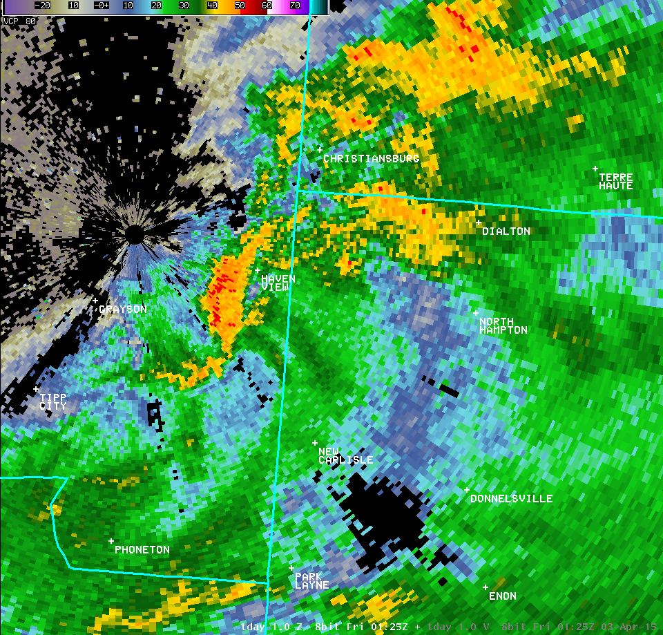
| 1.0° Reflectivity | 1.0° Velocity | ||
 |
 | ||
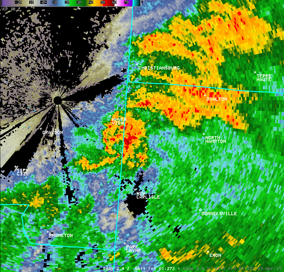
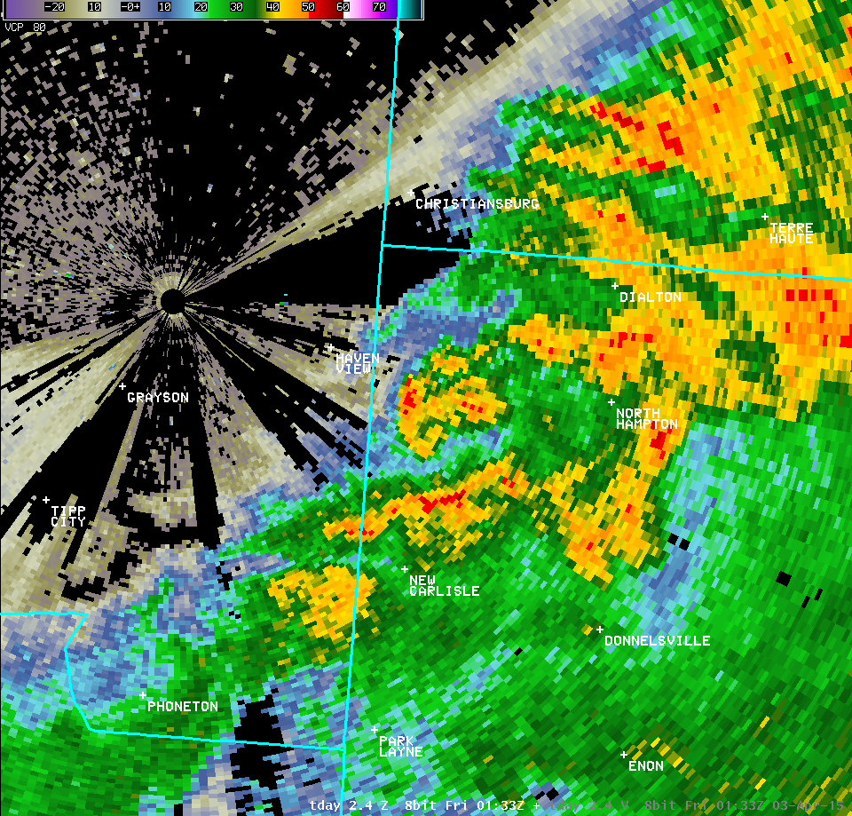
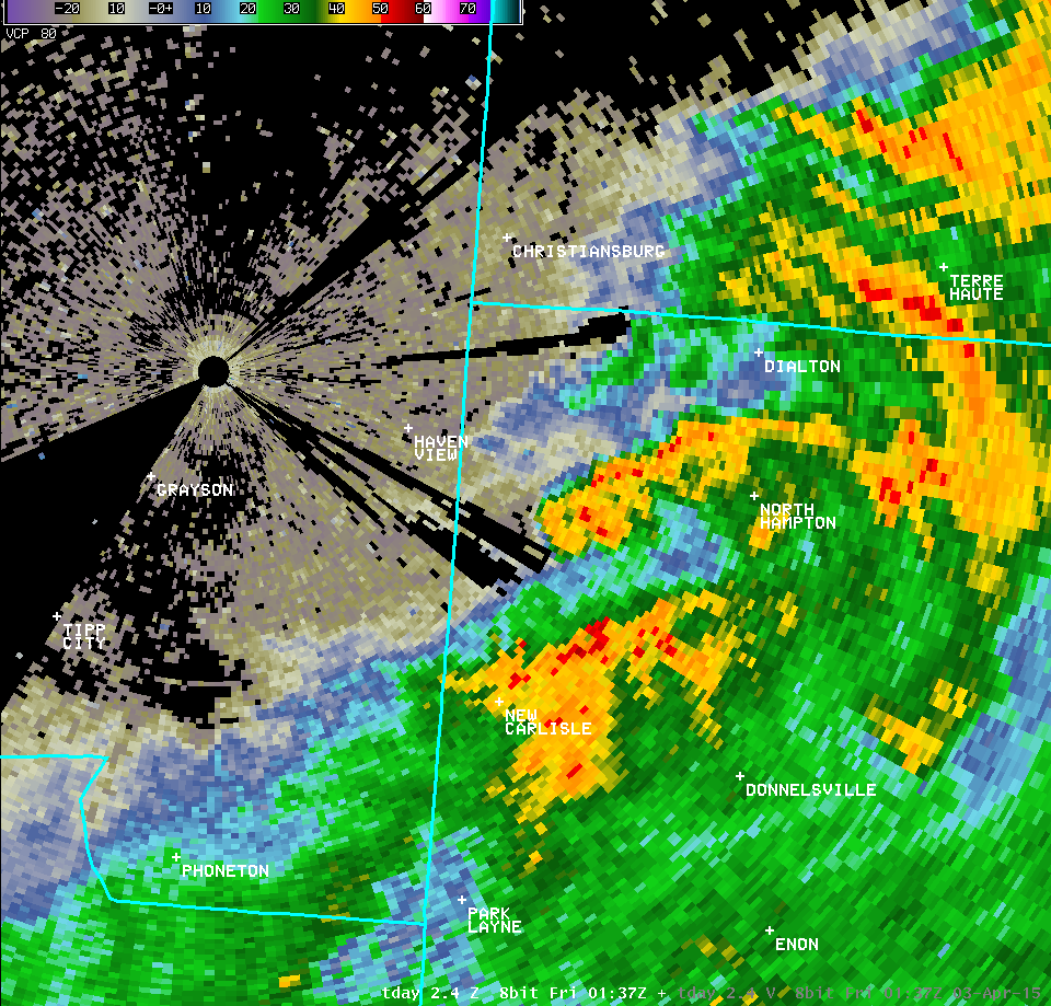
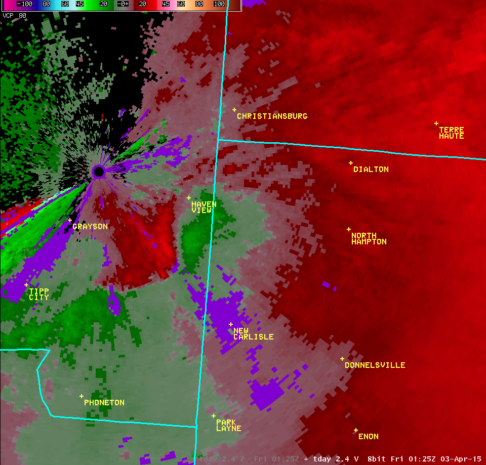
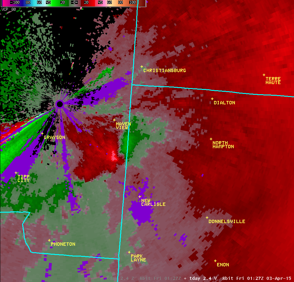
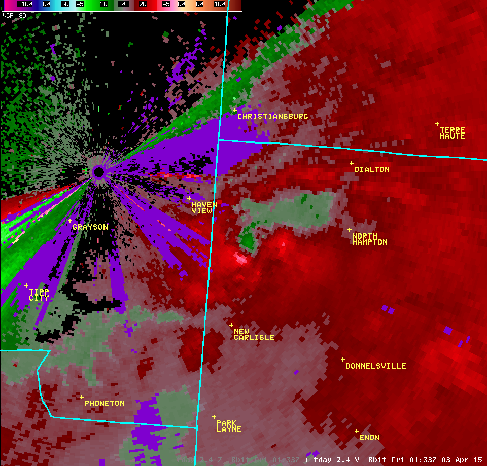
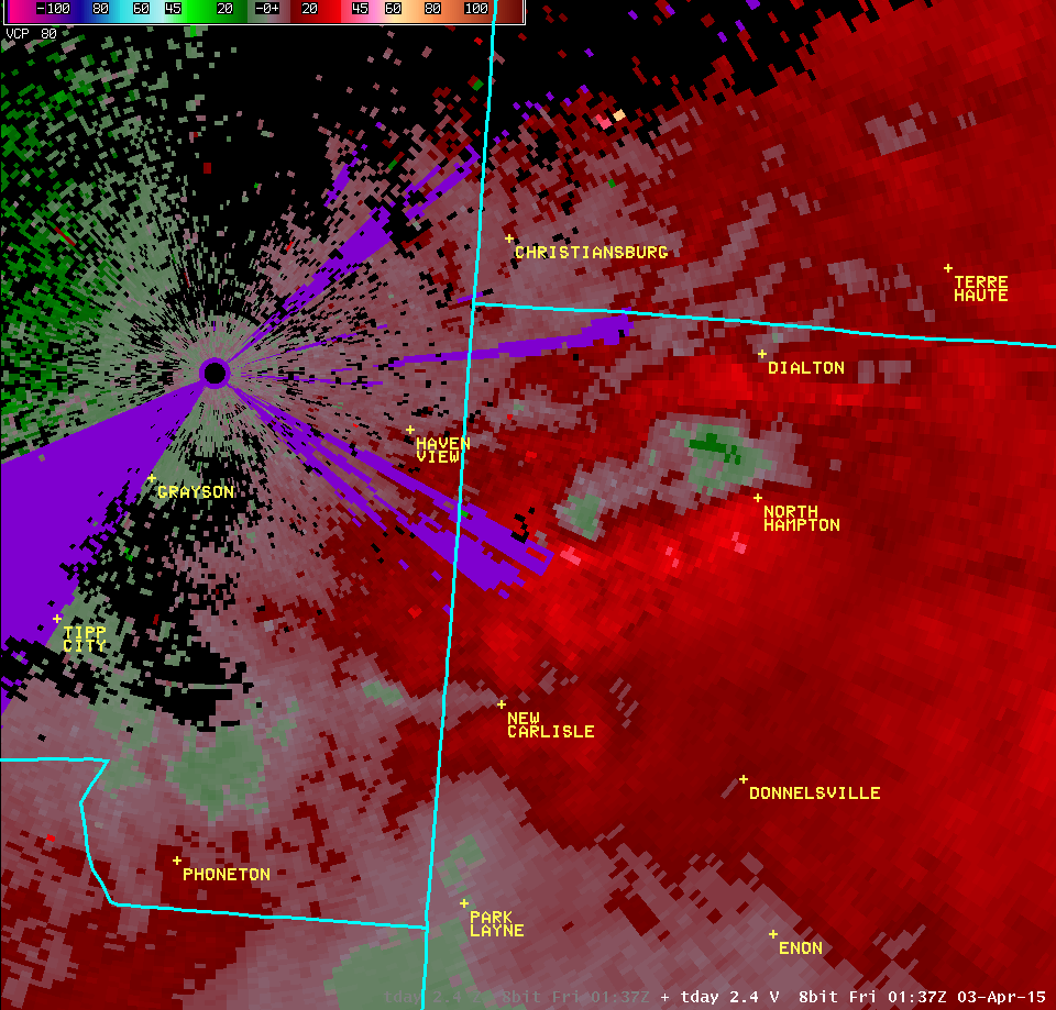
| 2.4° Reflectivity | 2.4° Velocity | ||
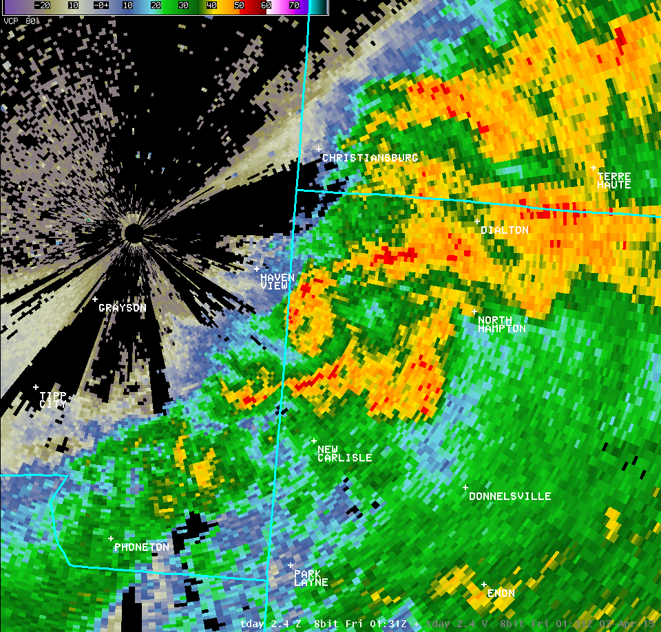 |
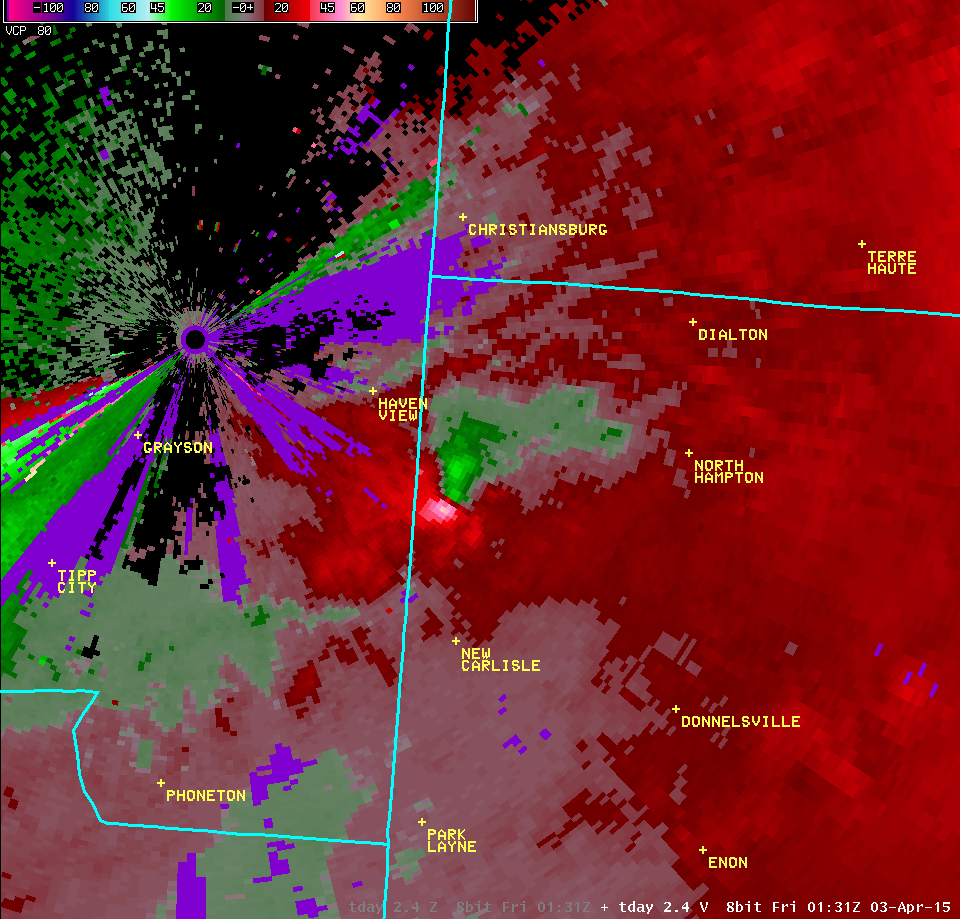 | ||
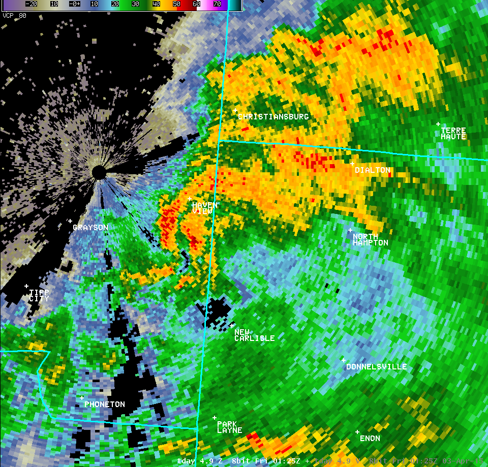
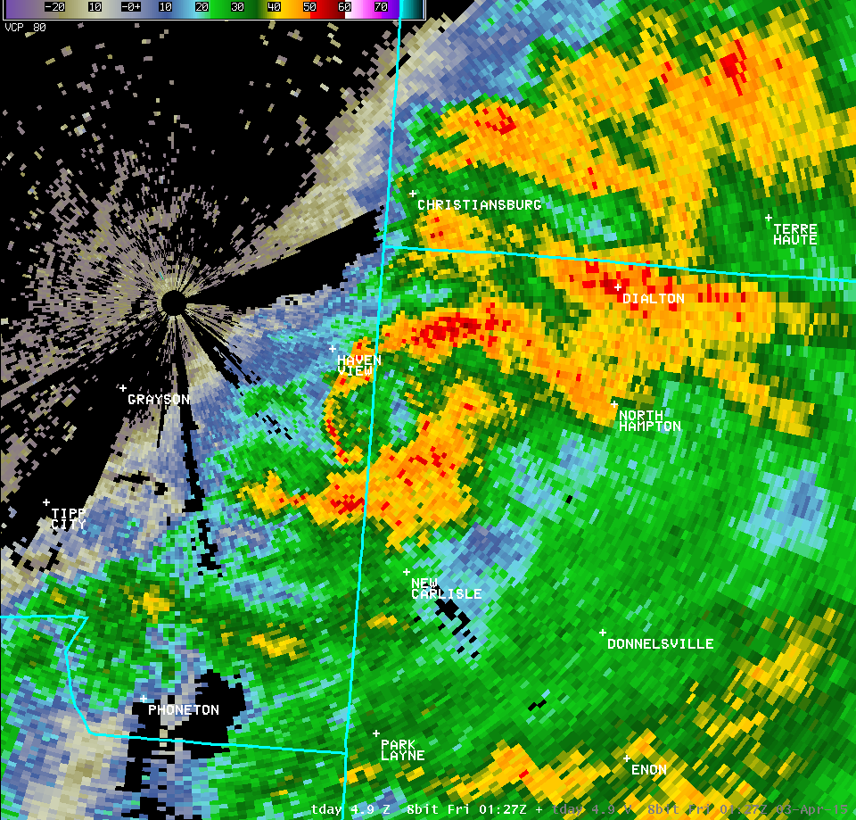
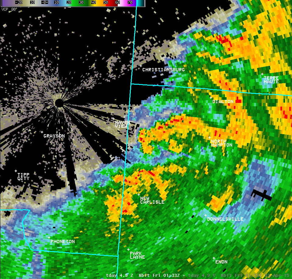
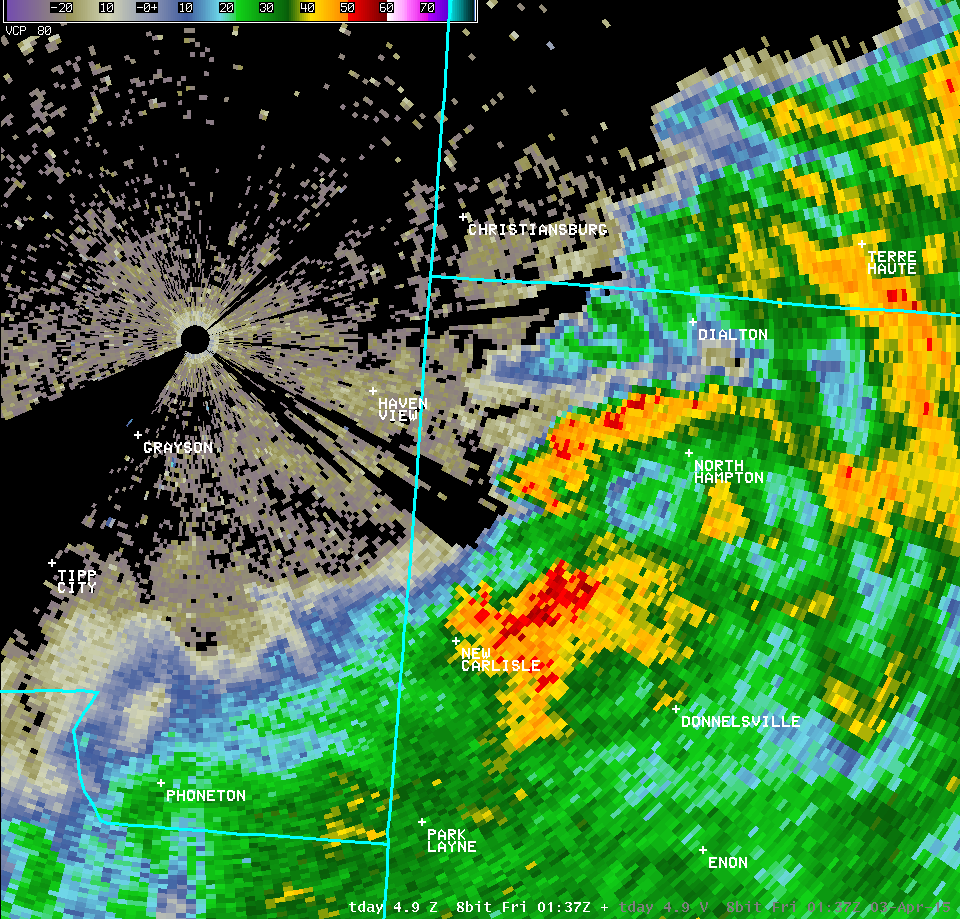
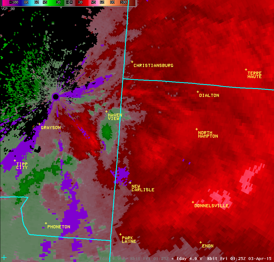
| 4.9° Reflectivity | 4.9° Velocity | ||
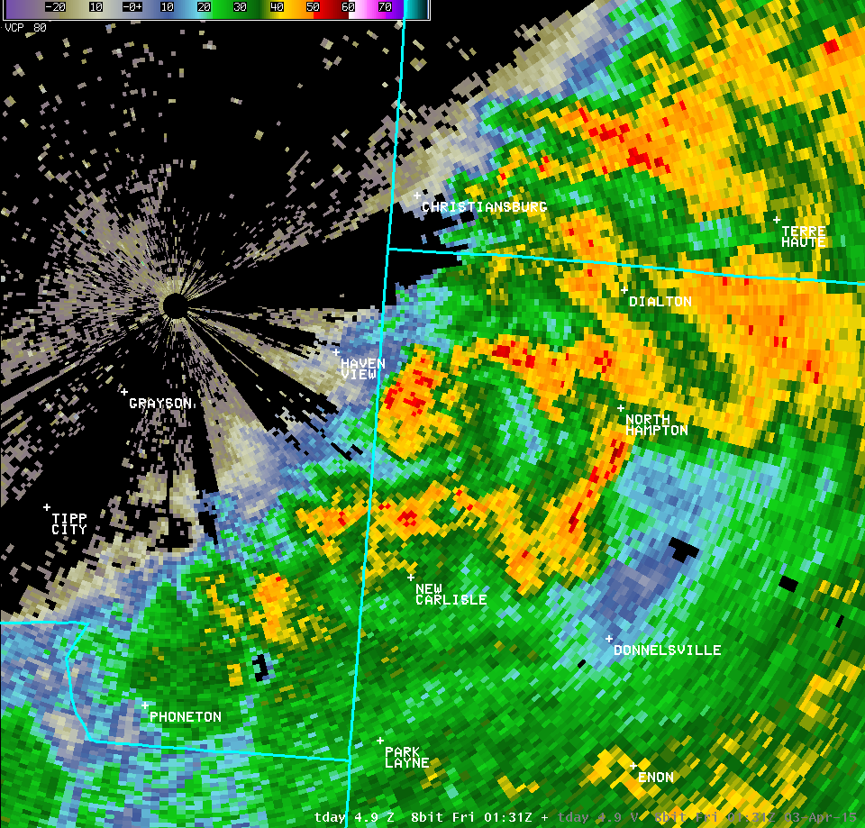 |
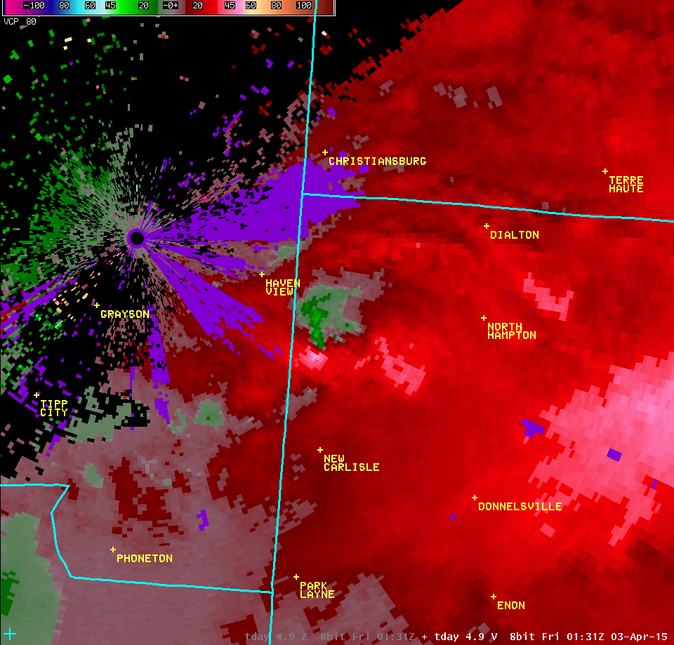 | ||
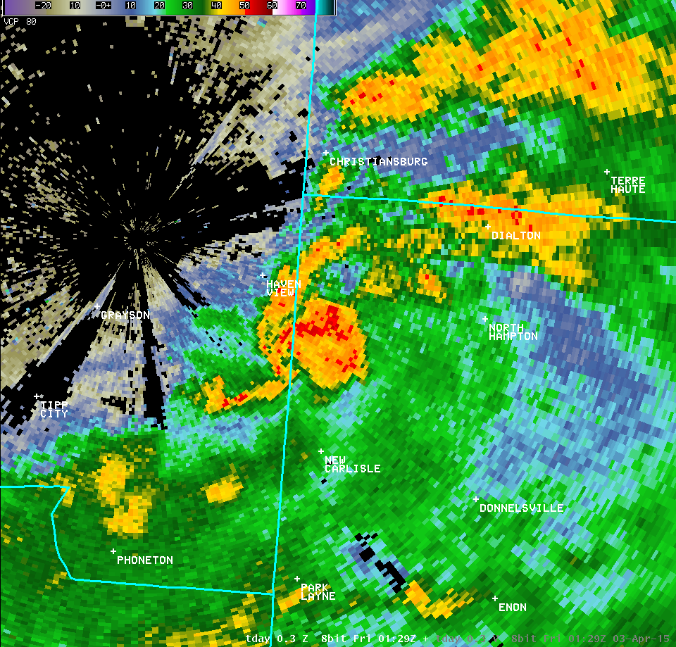
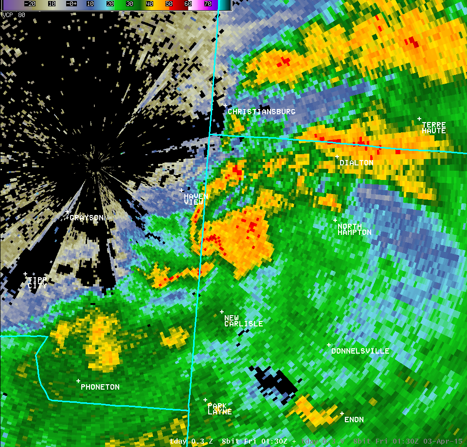
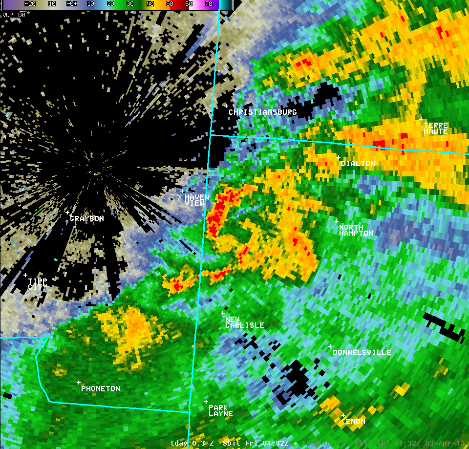
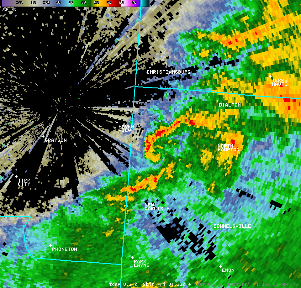
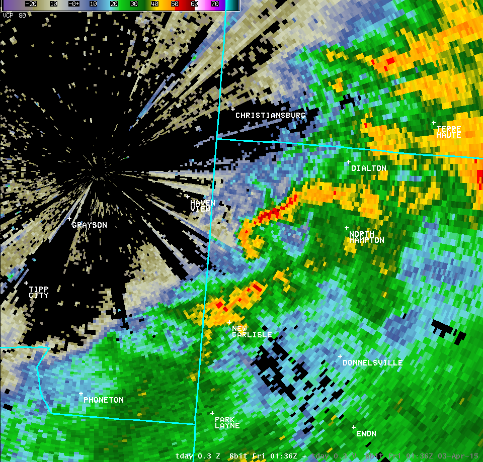
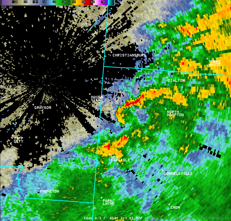
| Full Radar Loops from the Dayton Terminal Doppler Weather Radar (9:23 PM - 9:37 PM) | |
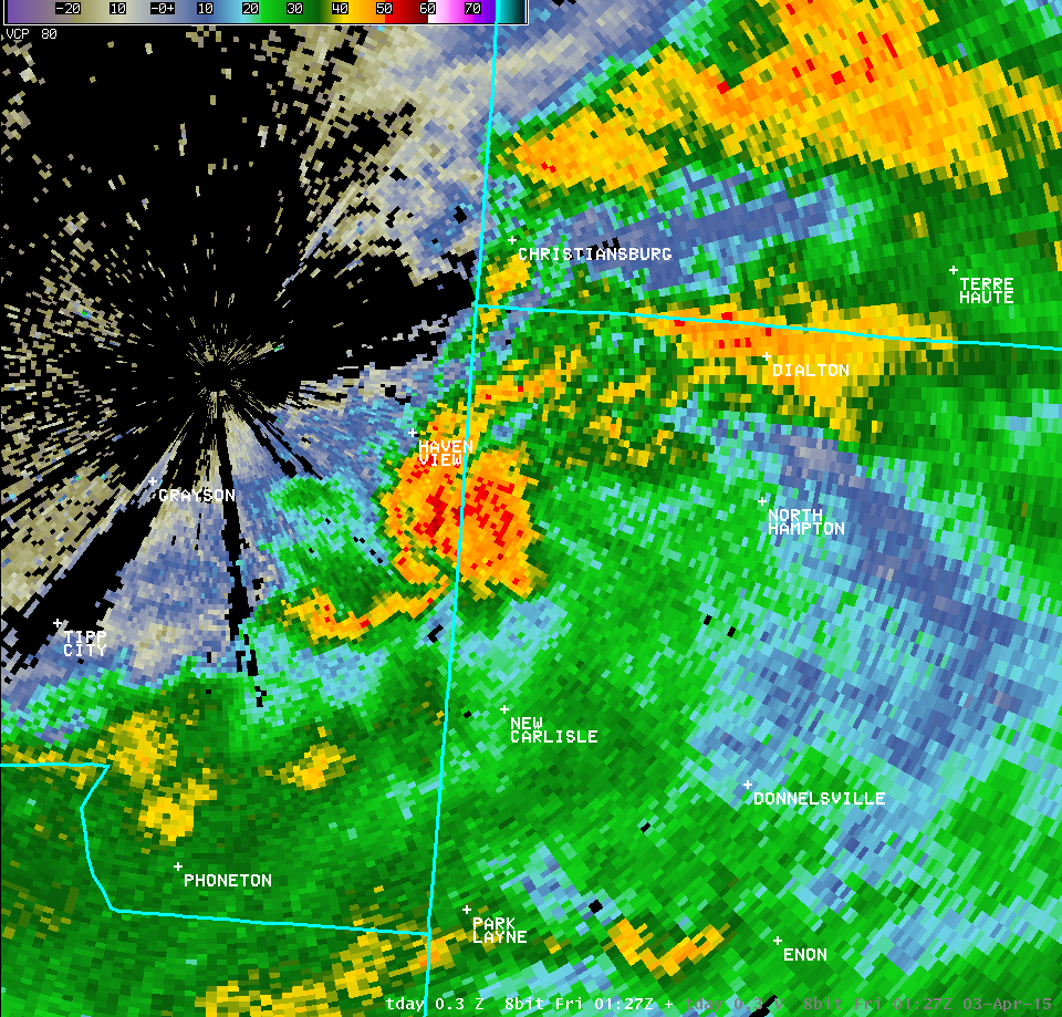
| TDAY 0.3° Reflectivity (200-300 feet AGL) | TDAY 0.3° Velocity (200-300 feet AGL) |
| 1 2 3 4 5 6 7 8 9 10 11 12 13 | Animation | 1 2 3 4 5 6 7 8 9 10 11 12 13 | Animation |
| TDAY 1.0° Reflectivity (600-800 feet AGL) | TDAY 1.0° Velocity (600-800 feet AGL) |
| 1 2 3 | 1 2 3 |
| TDAY 2.4° Reflectivity (1300-1600 feet AGL) | TDAY 2.4° Velocity (1300-1600 feet AGL) |
| 1 2 3 4 5 | 1 2 3 4 5 |
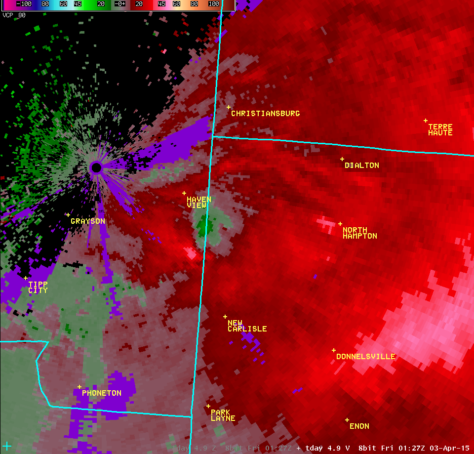
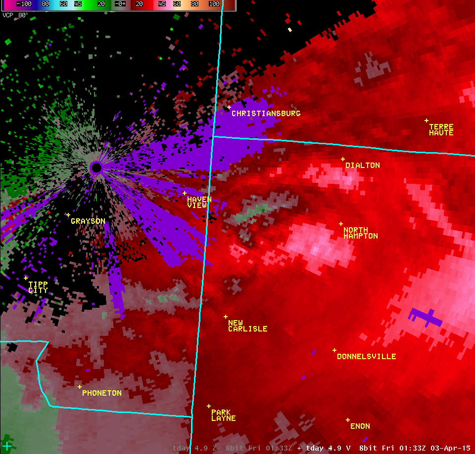
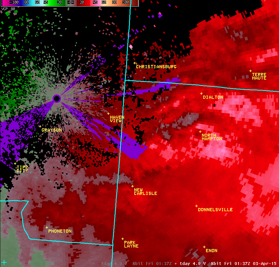
| TDAY 4.9° Reflectivity (2400-3000 feet AGL) | TDAY 4.9° Velocity (2400-3000 feet AGL) |
| 1 2 3 4 5 | 1 2 3 4 5 |

