|
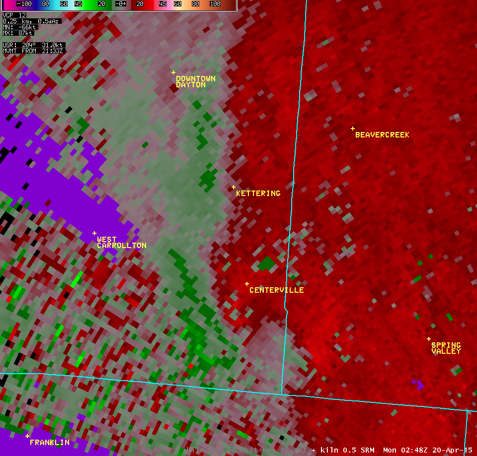
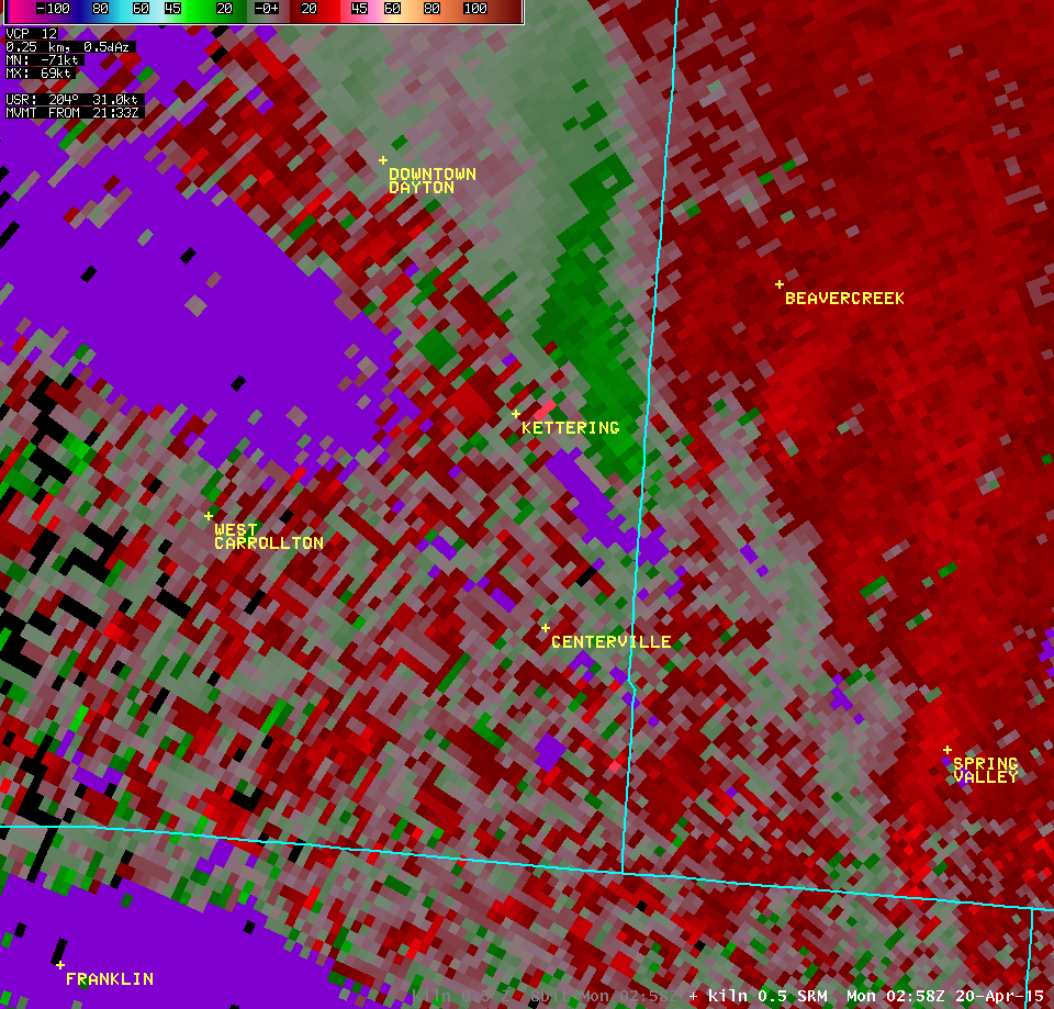
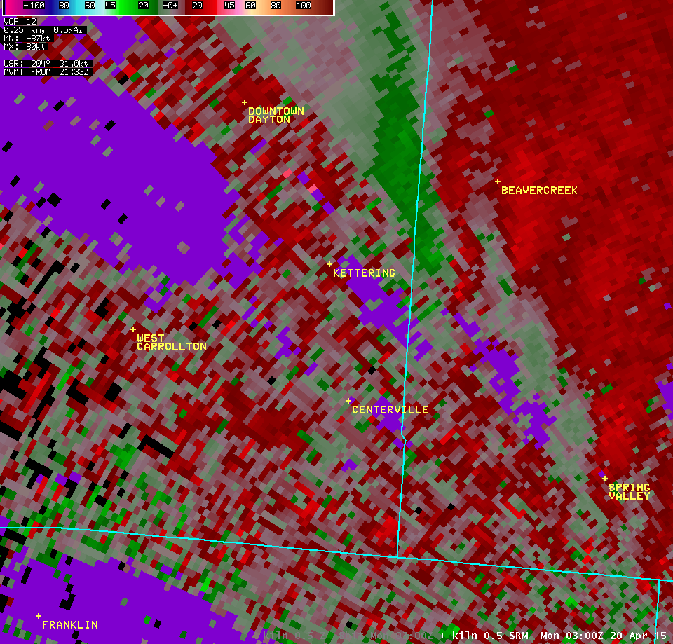
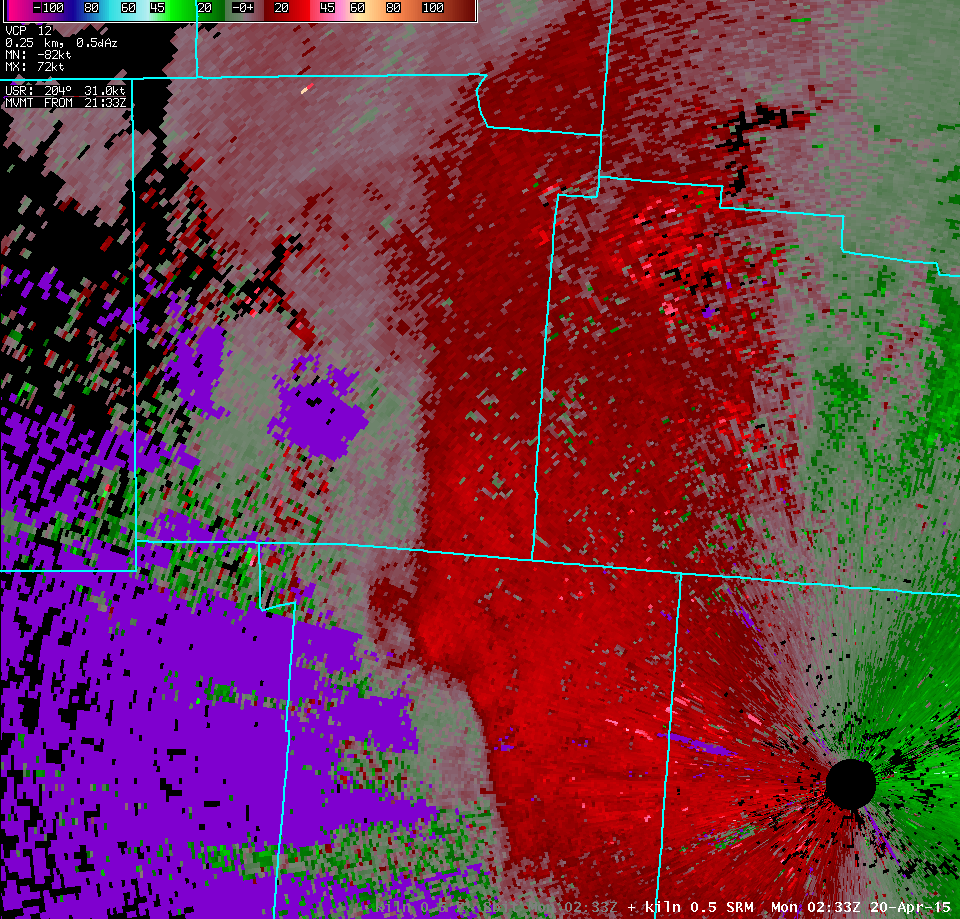
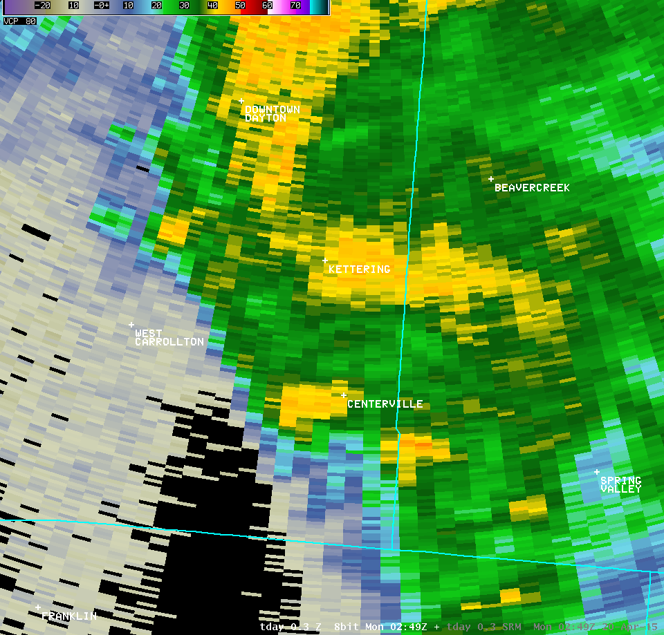
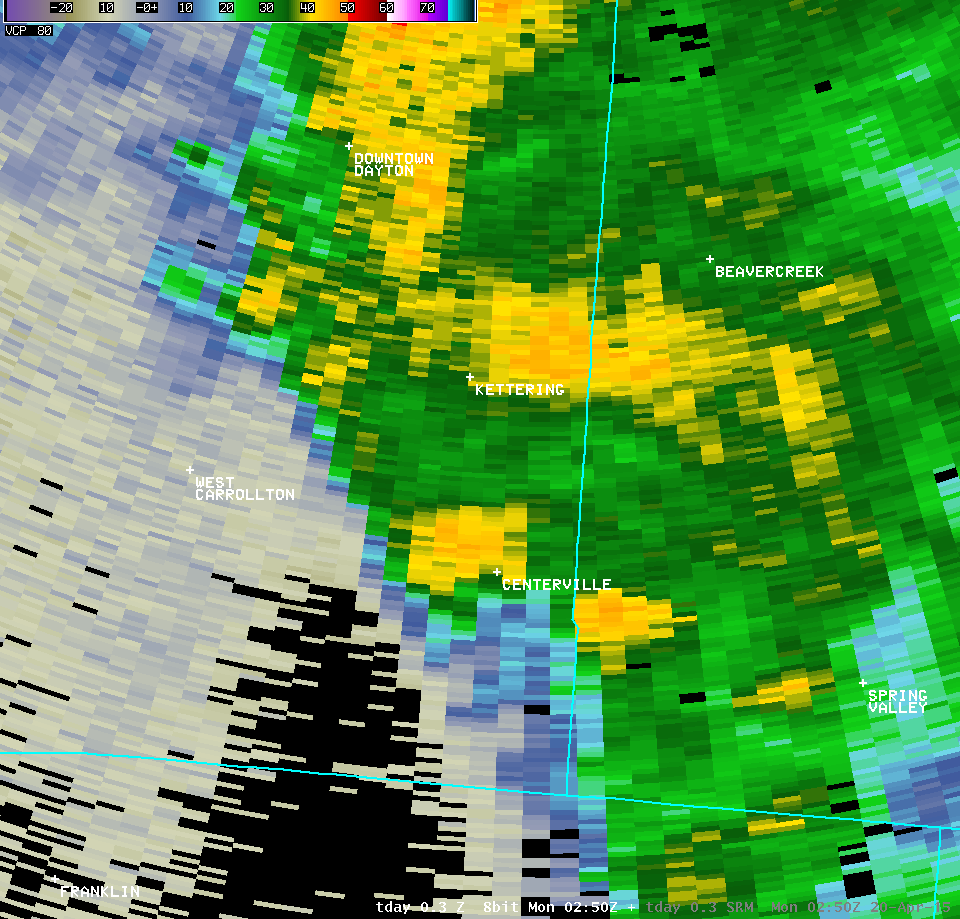
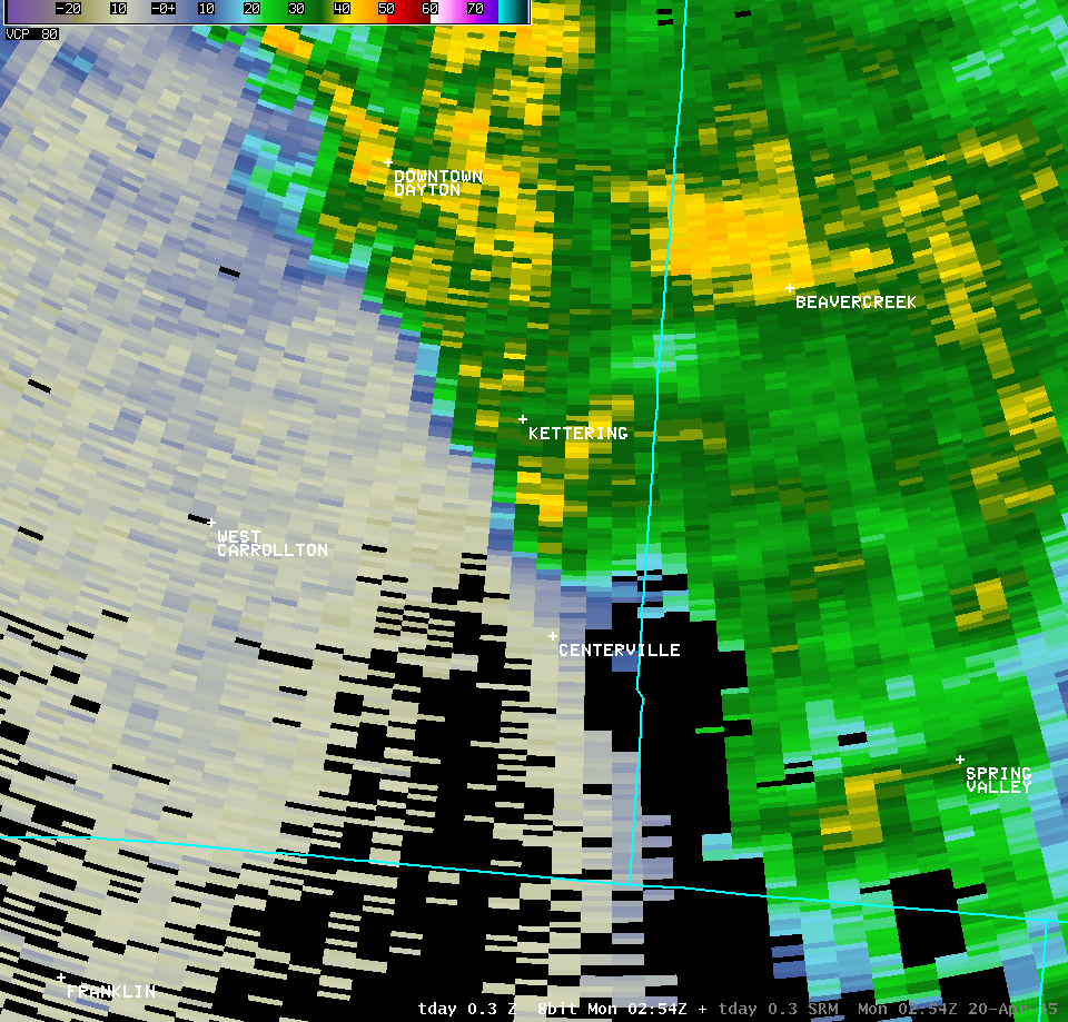
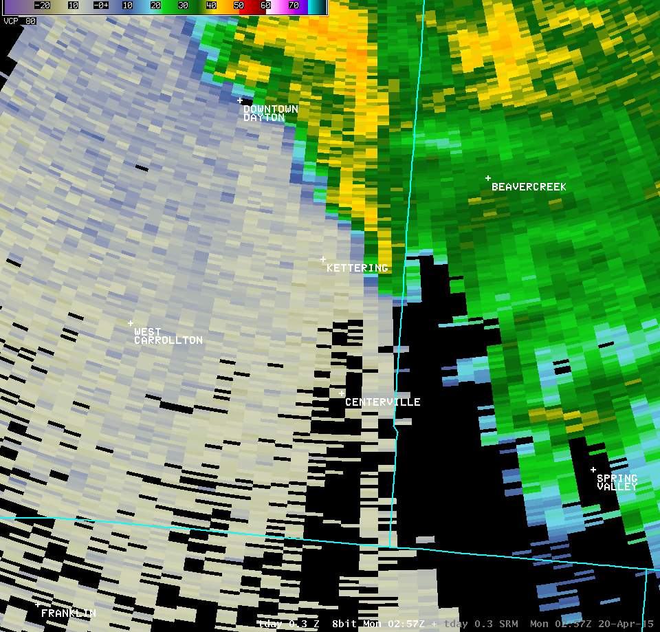
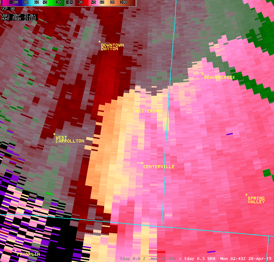
Tornado in Kettering, OH
|
|
|
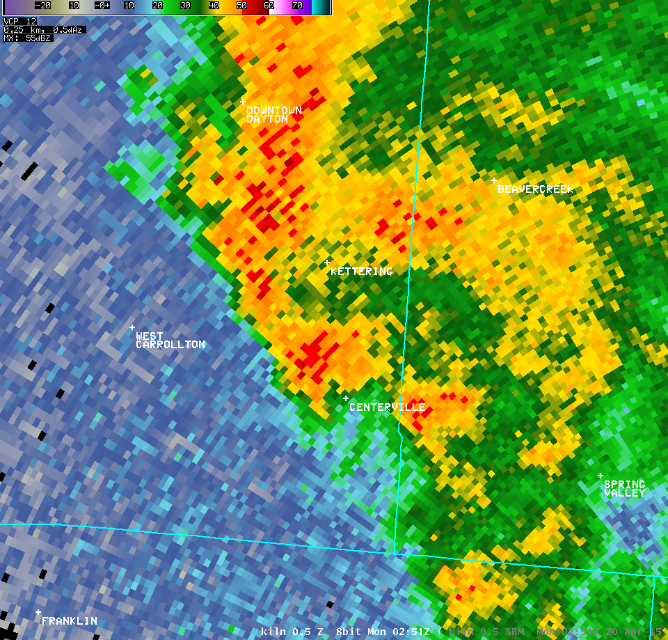
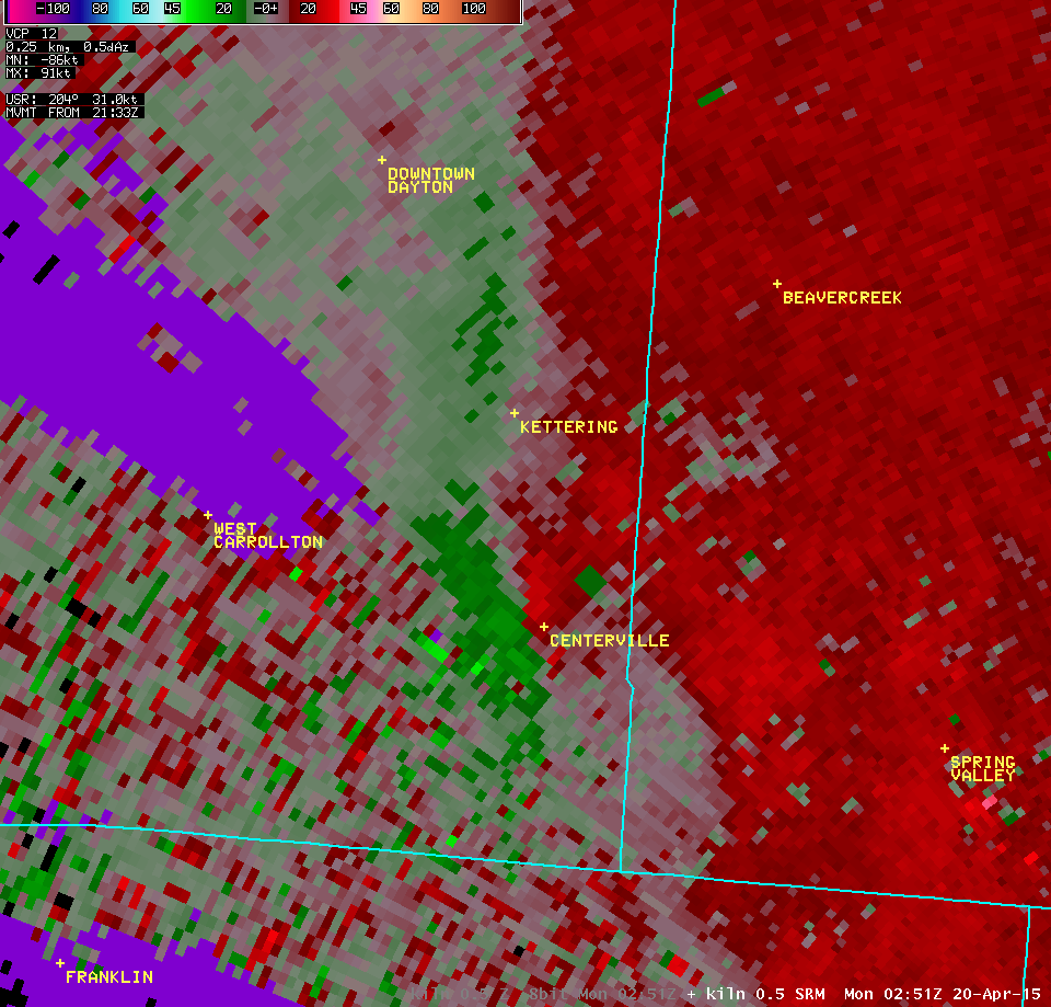
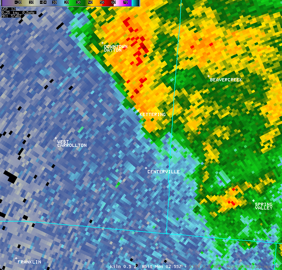
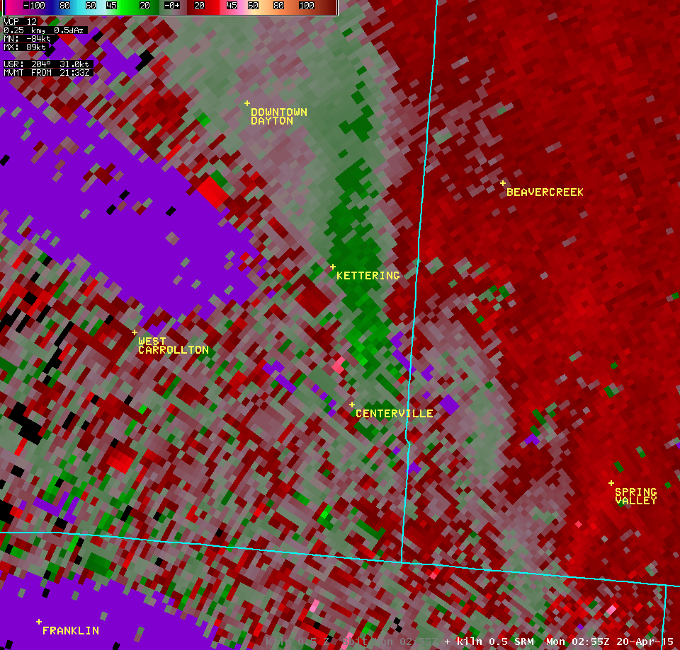
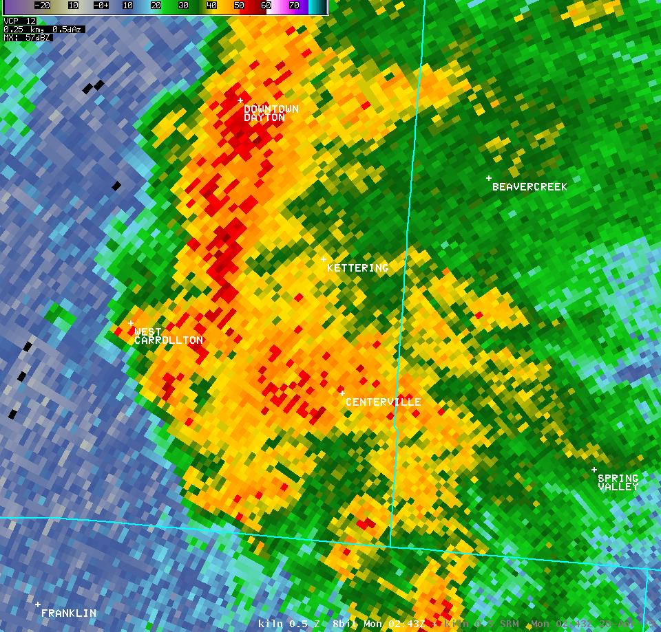
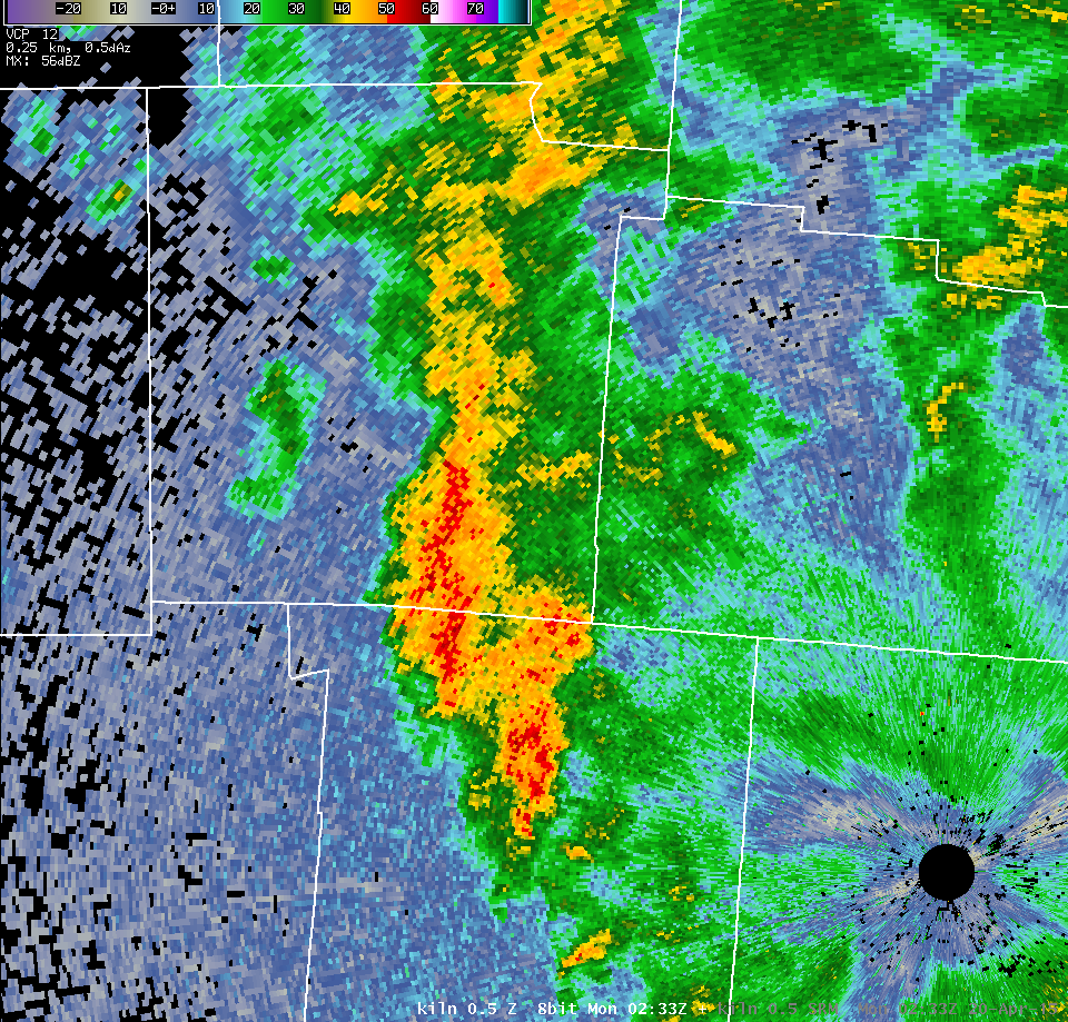
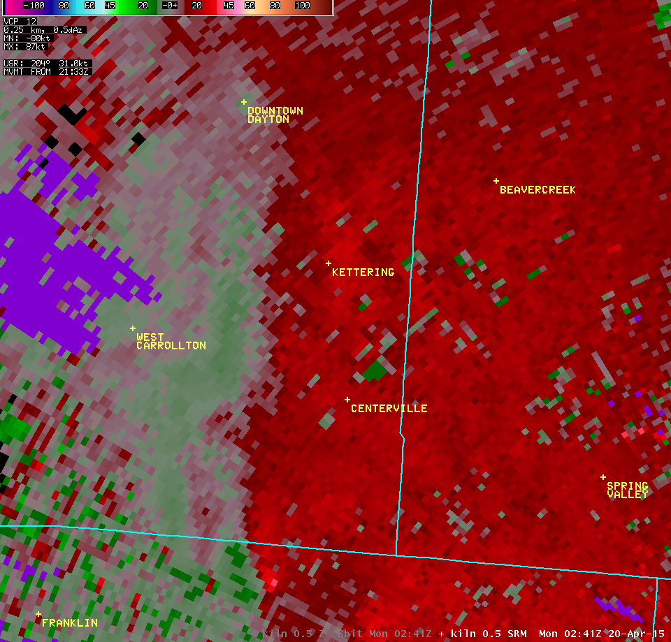
| NWS Wilmington OH (KILN) | ||
| 0.5° Z -- 10:51 PM | 0.5° SRM -- 10:51 PM | |
 |
 |
|
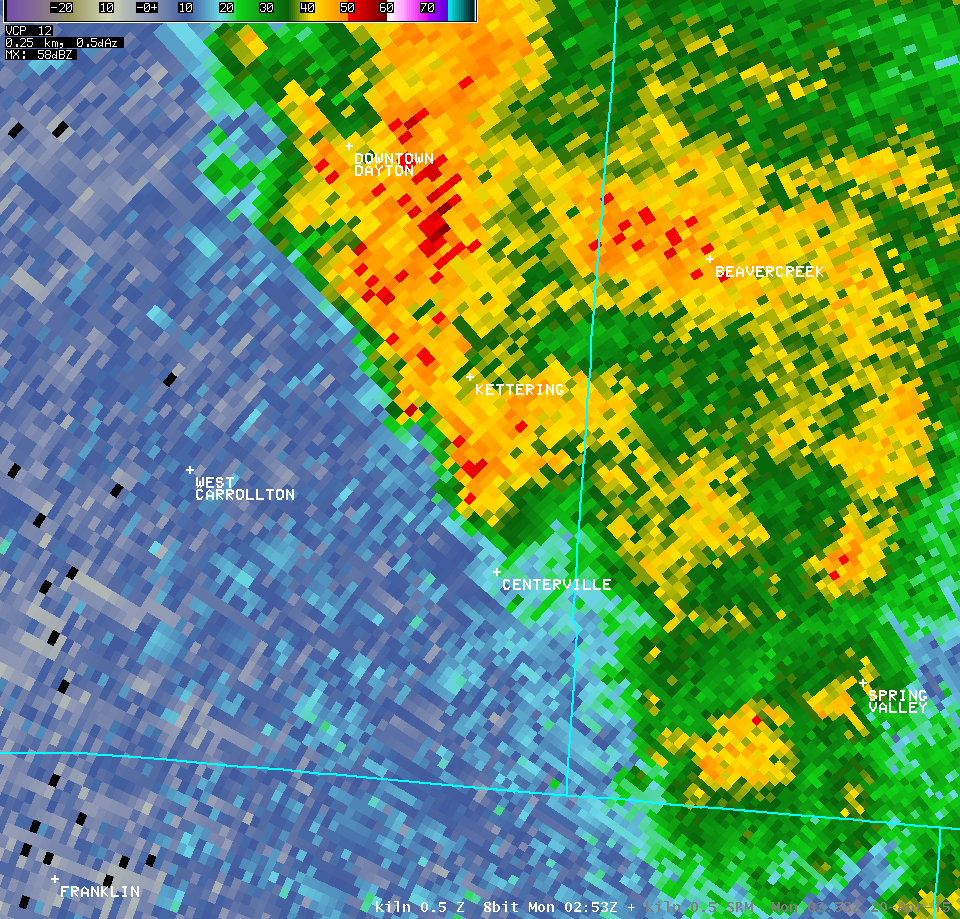
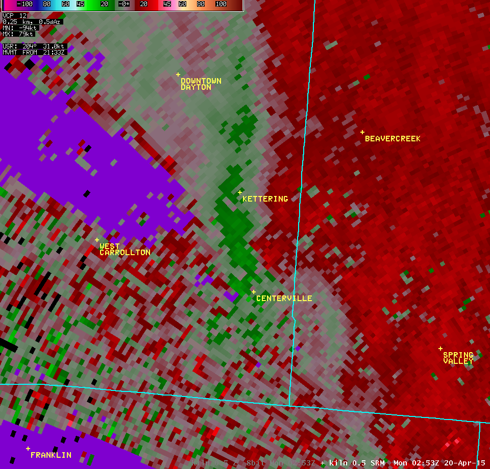
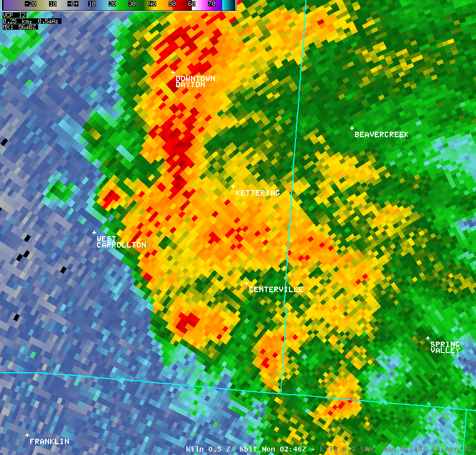
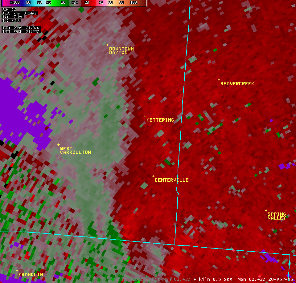
| 0.5° Z -- 10:53 PM | 0.5° SRM -- 10:53 PM | |
 |
 |
|
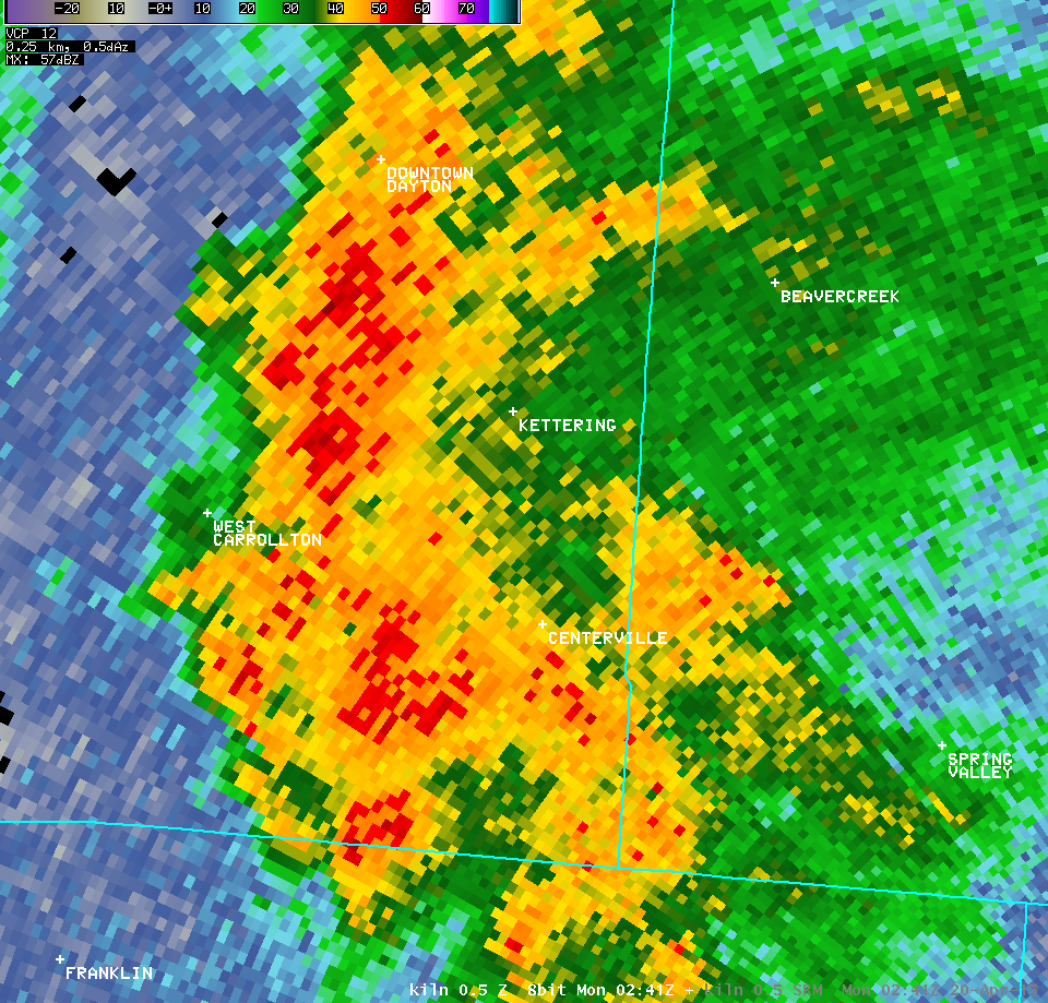
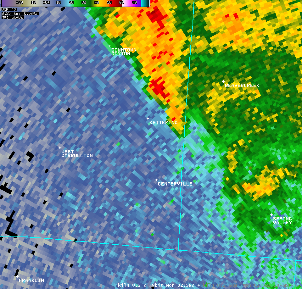
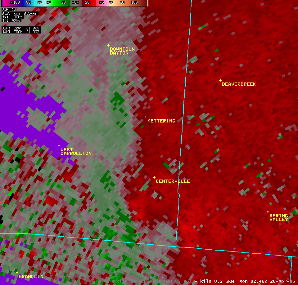
| 0.5° Z -- 10:55 PM | 0.5° SRM -- 10:55 PM | |
 |
 |
|
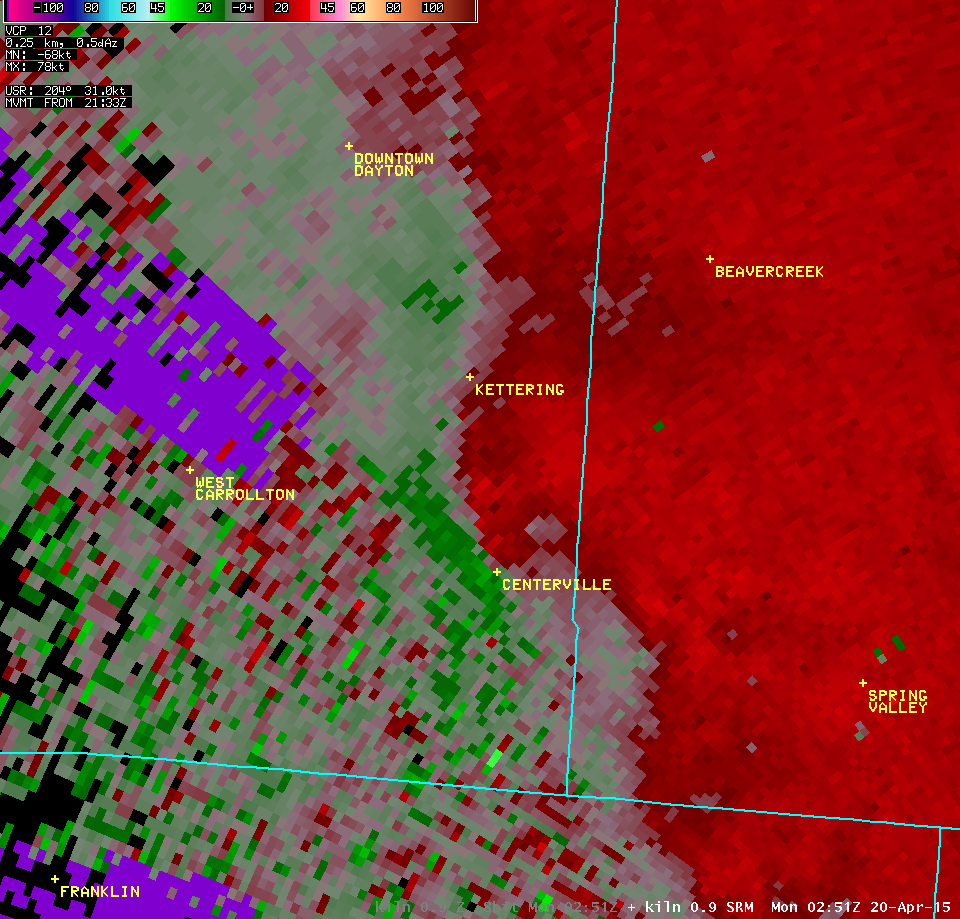
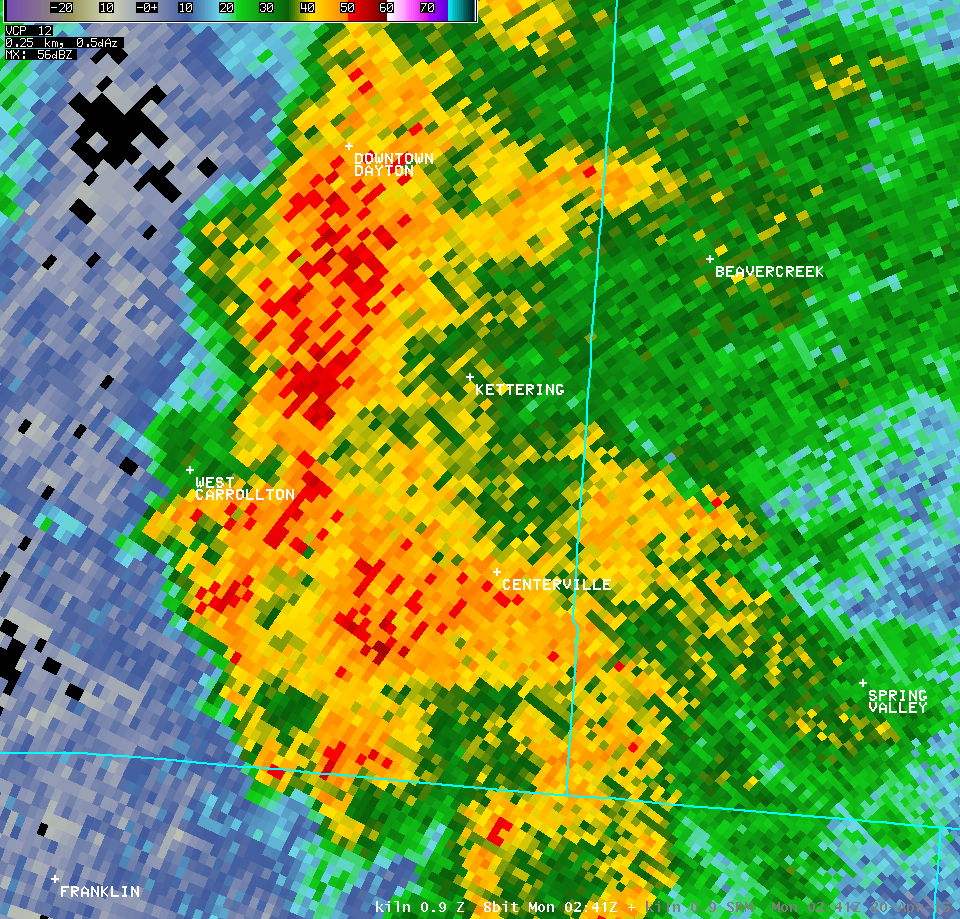
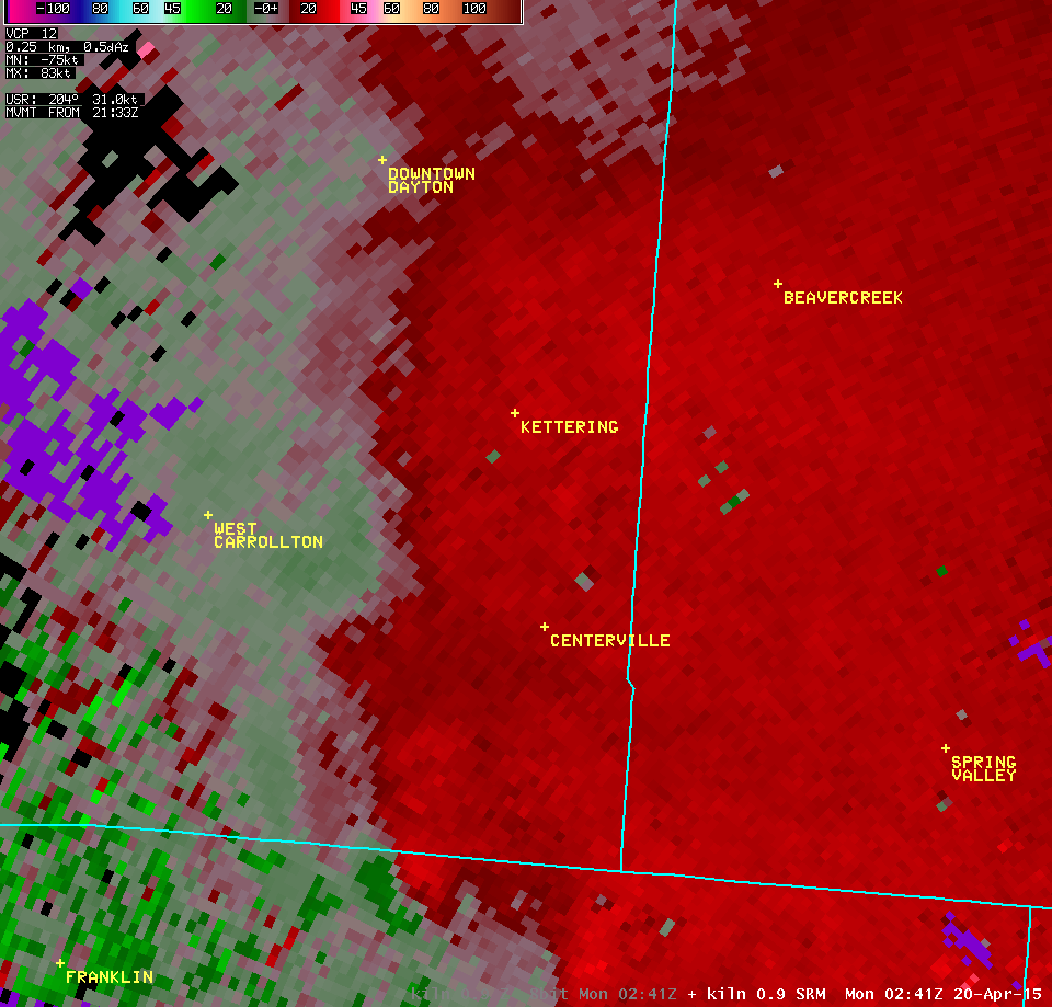
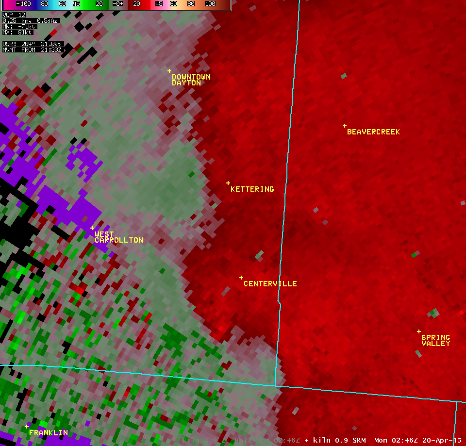
| 0.9° Z -- 10:51 PM | 0.9° SRM -- 10:51 PM | |
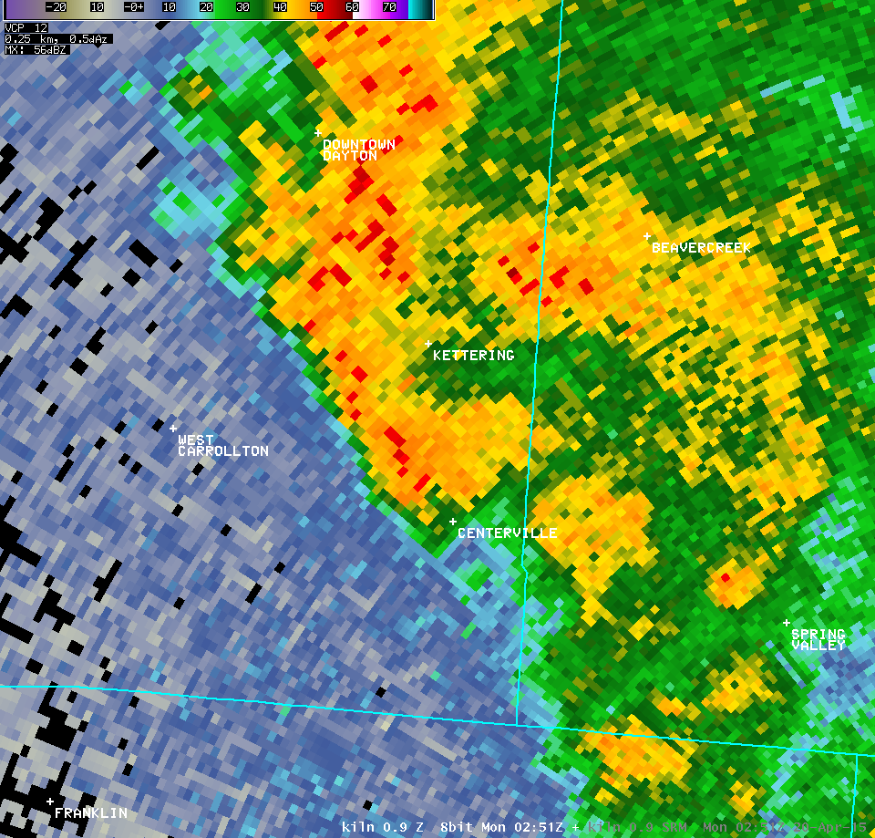 |
 |
|
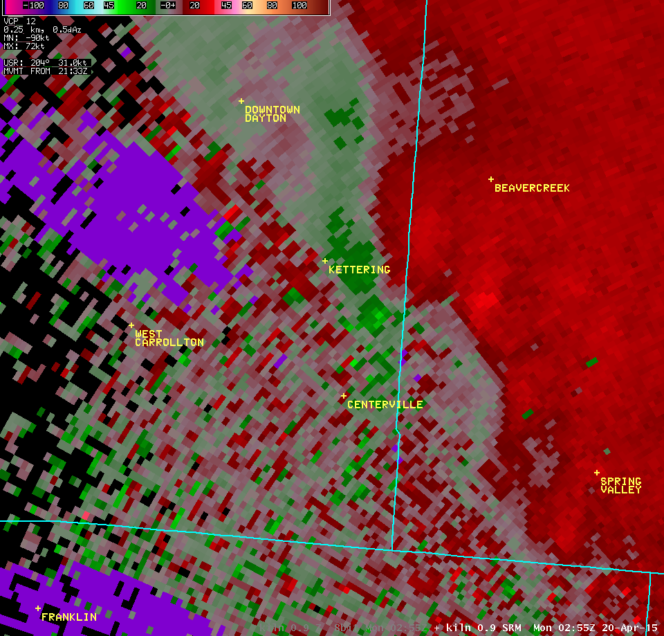
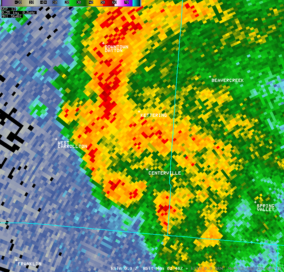
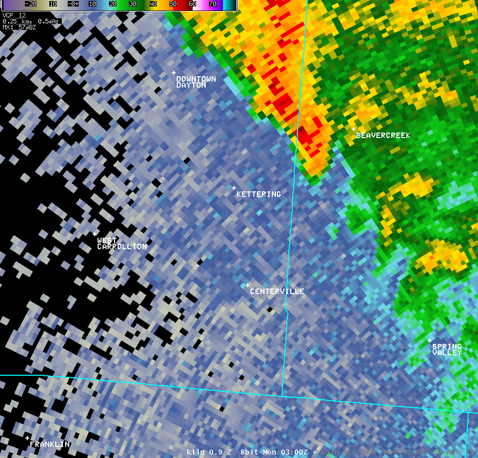
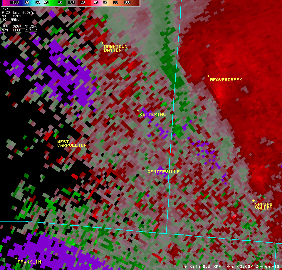
| 0.9° Z -- 10:55 PM | 0.9° SRM -- 10:55 PM | |
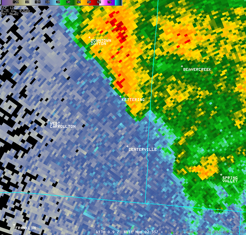 |
 |
|
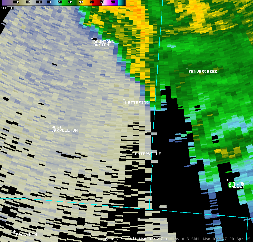
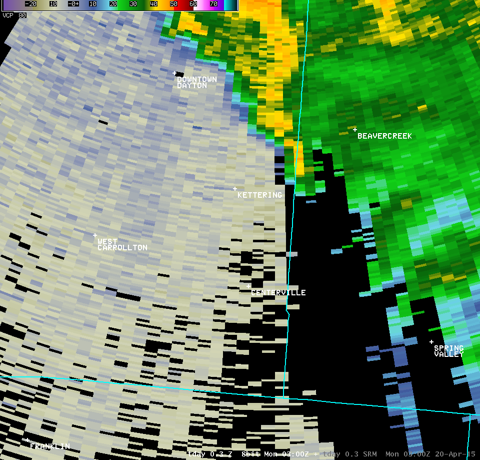
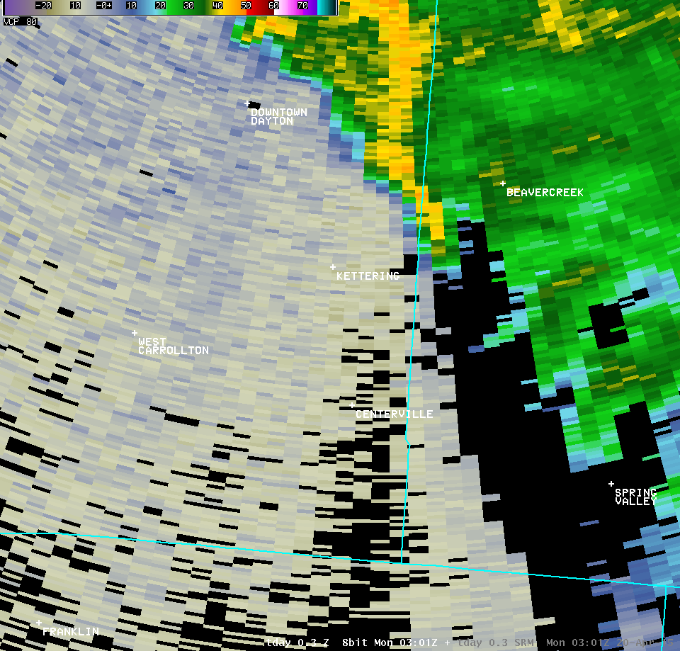
| Dayton TDWR (TDAY) | |||
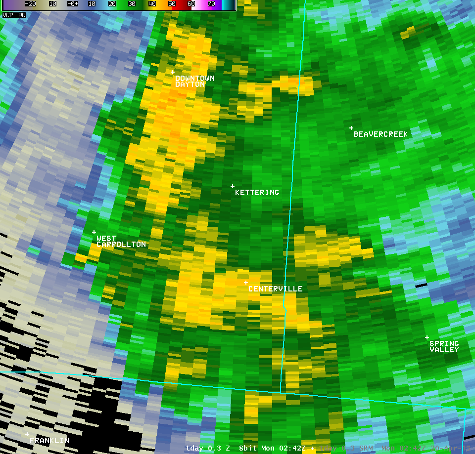
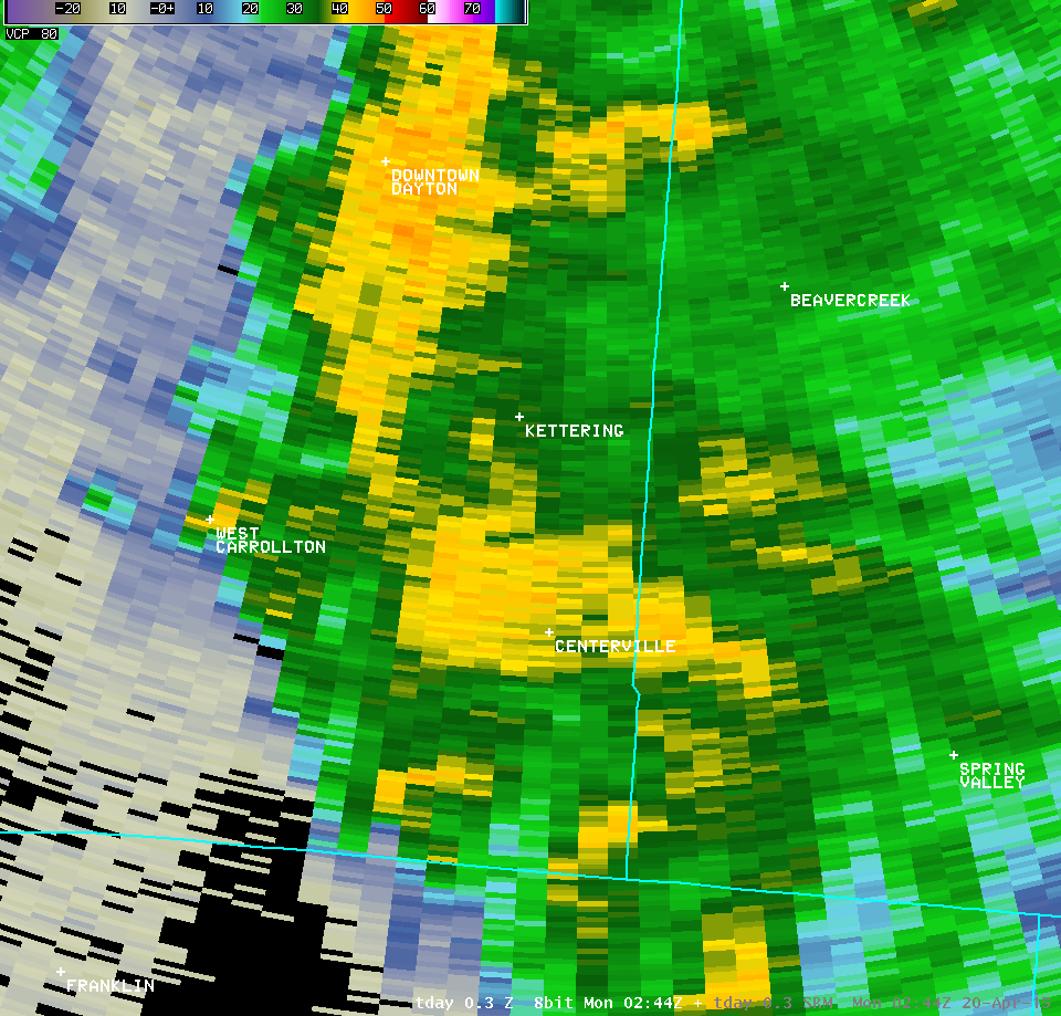
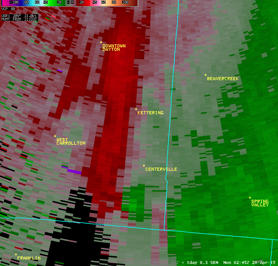
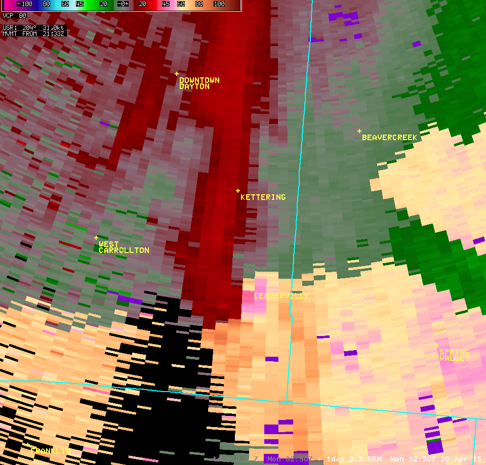
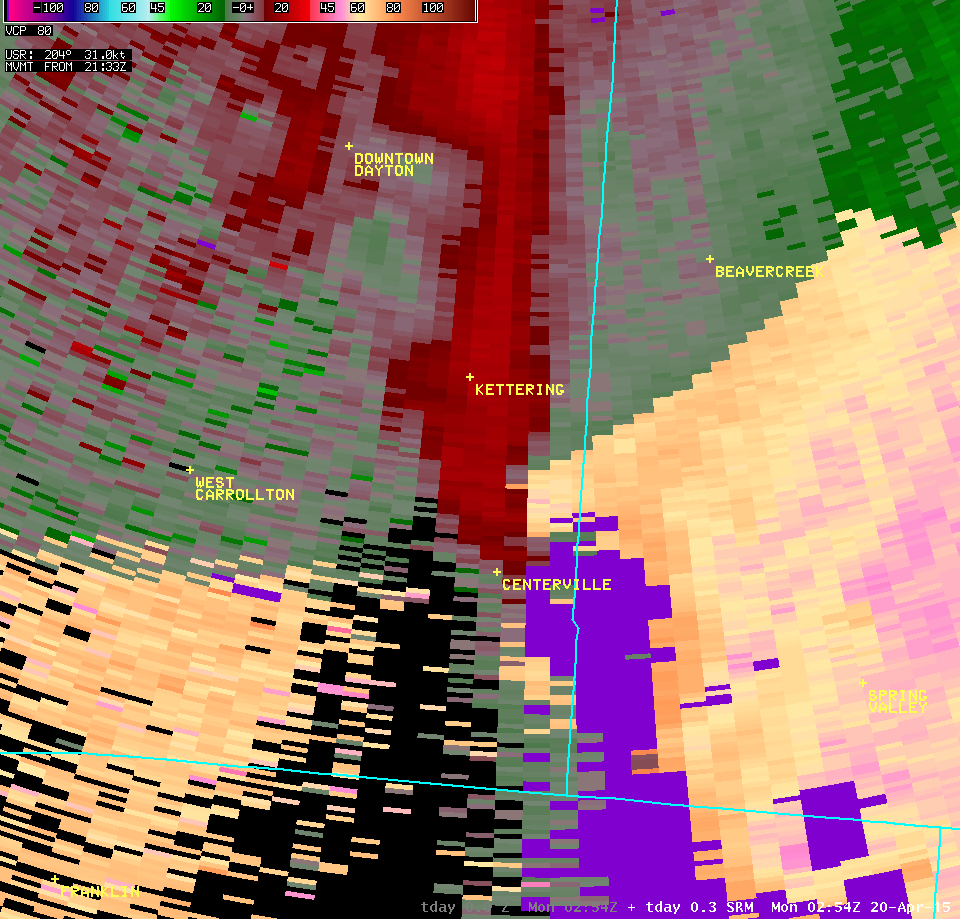
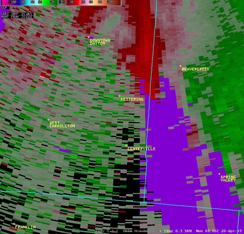
| 0.3° Z -- 10:51 PM | 0.3° SRM -- 10:51 PM | ||
 |
 |
||
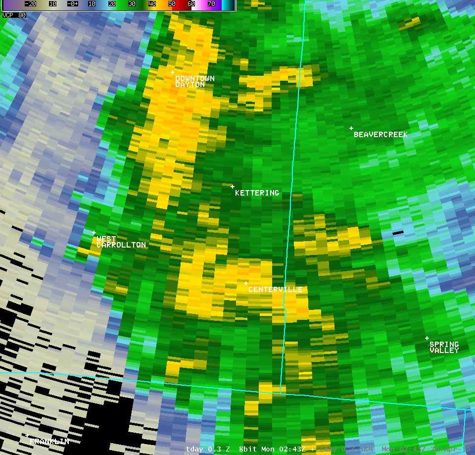
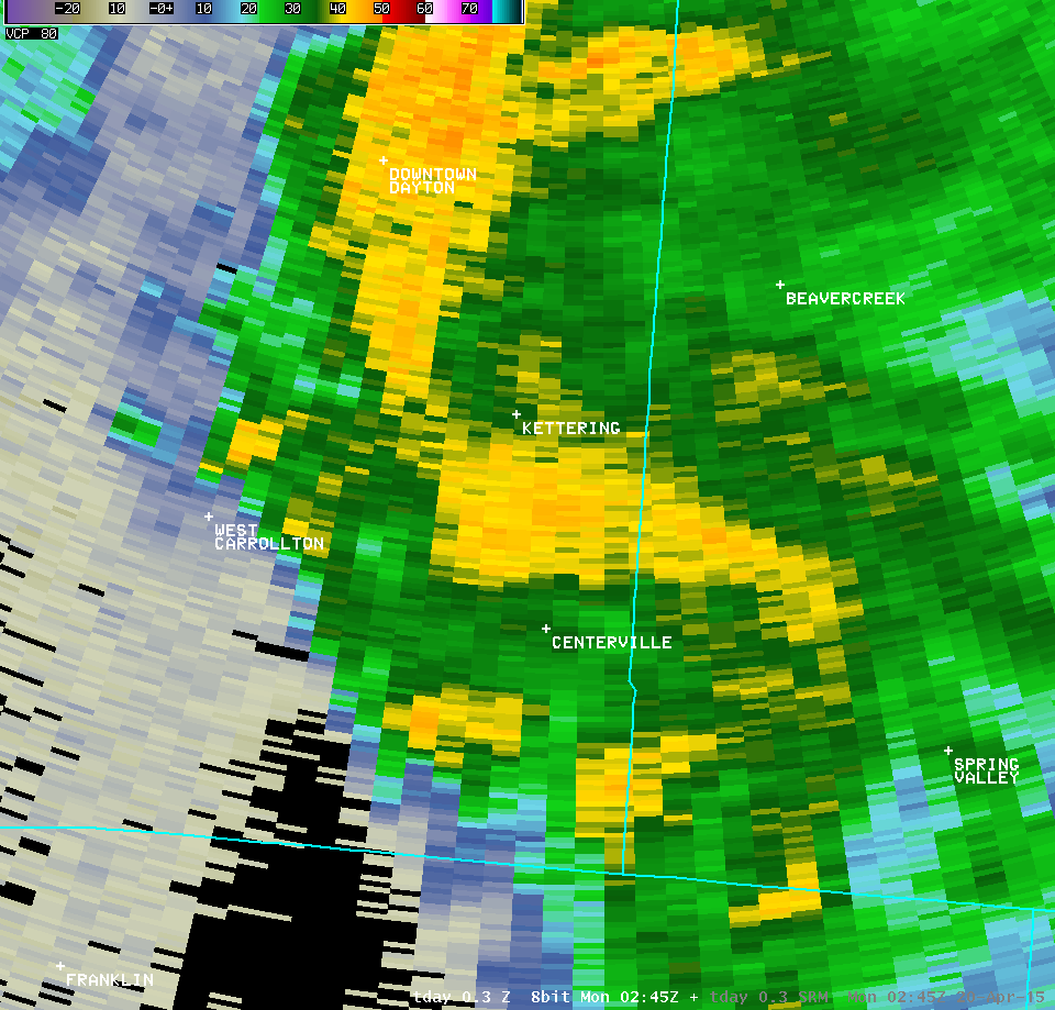
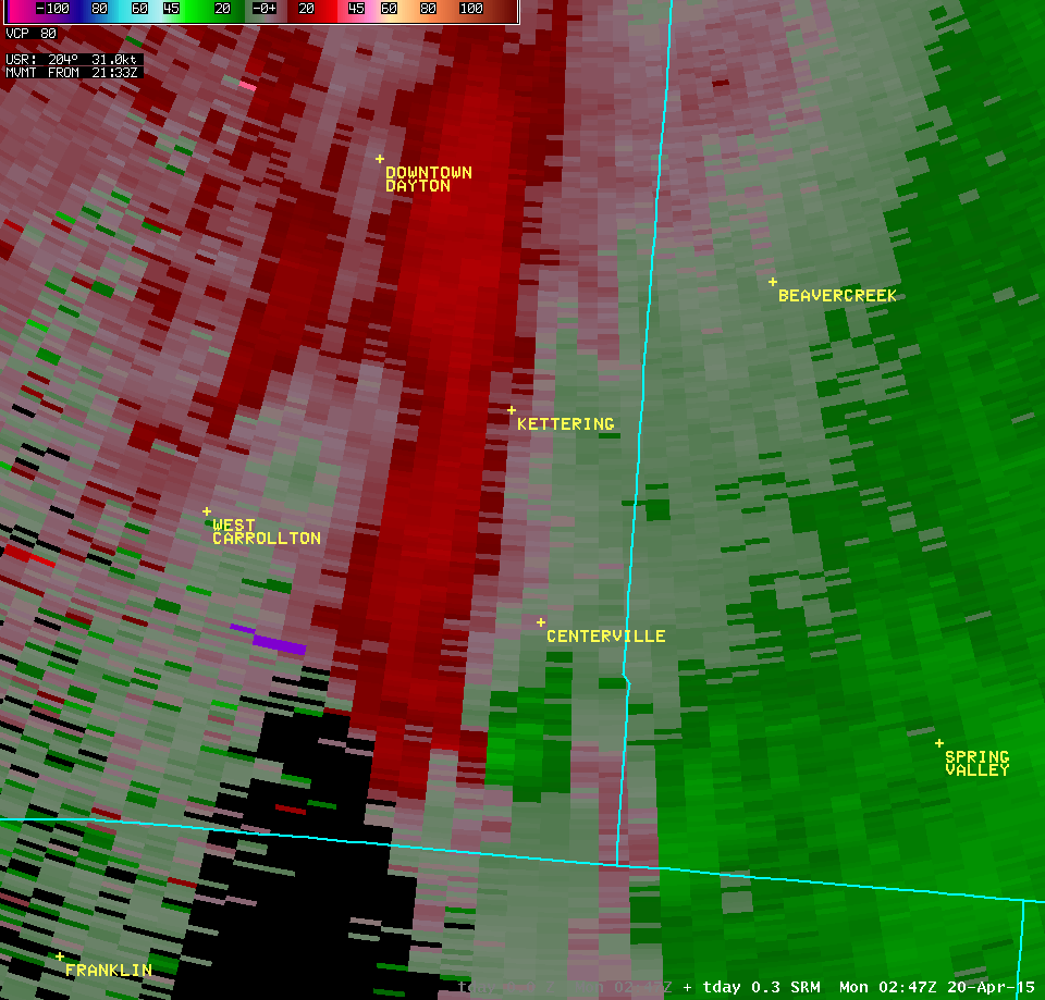
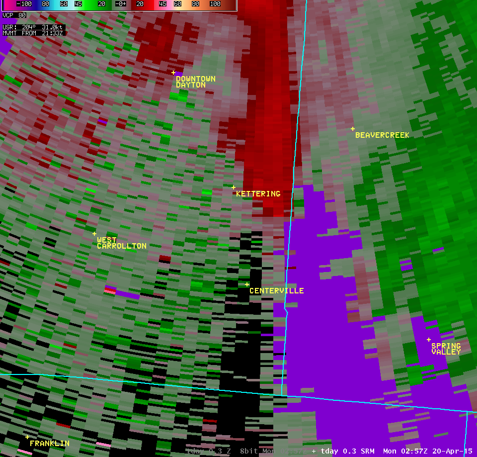
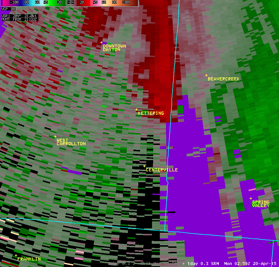
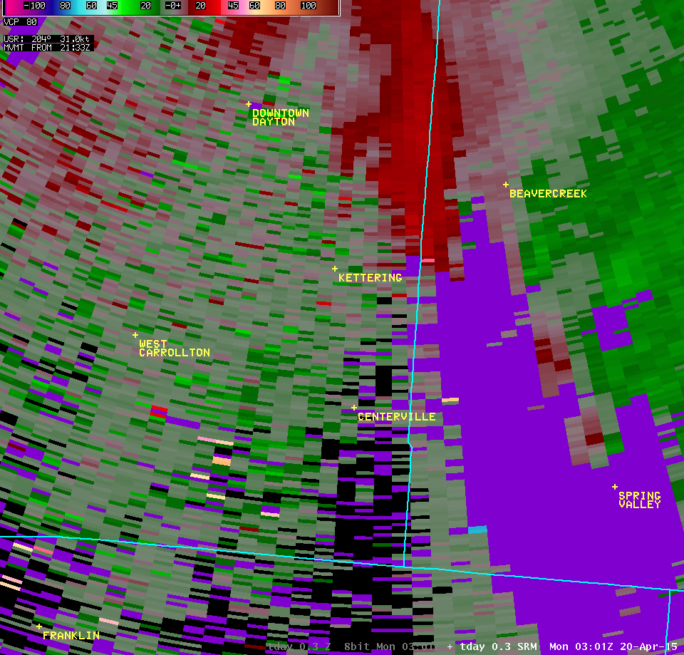
| 0.3° Z -- 10:53 PM | 0.3° SRM -- 10:53 PM | ||
 |
 |
||
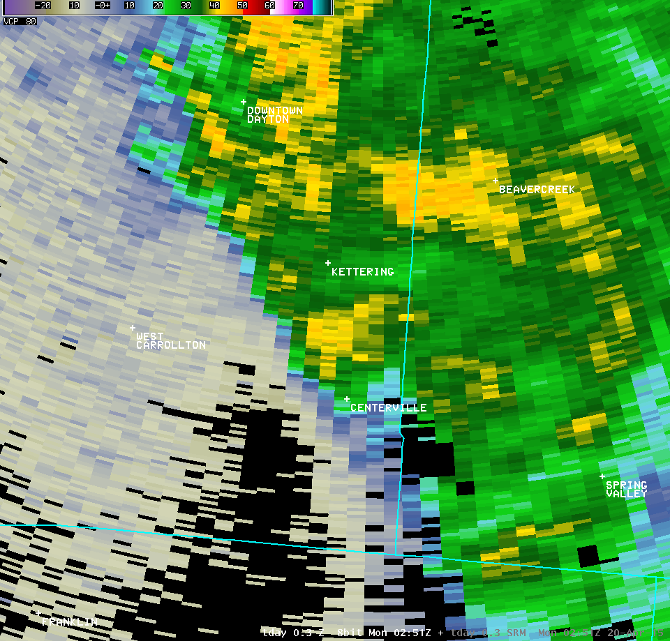
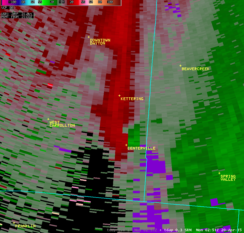
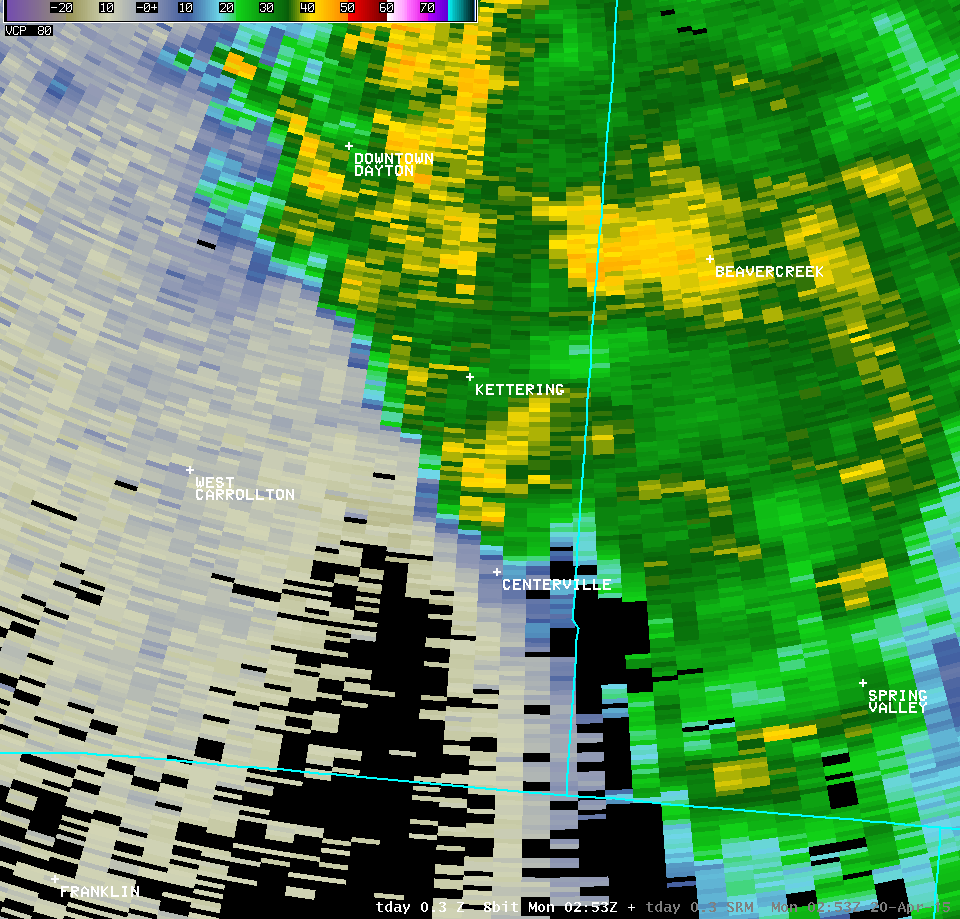
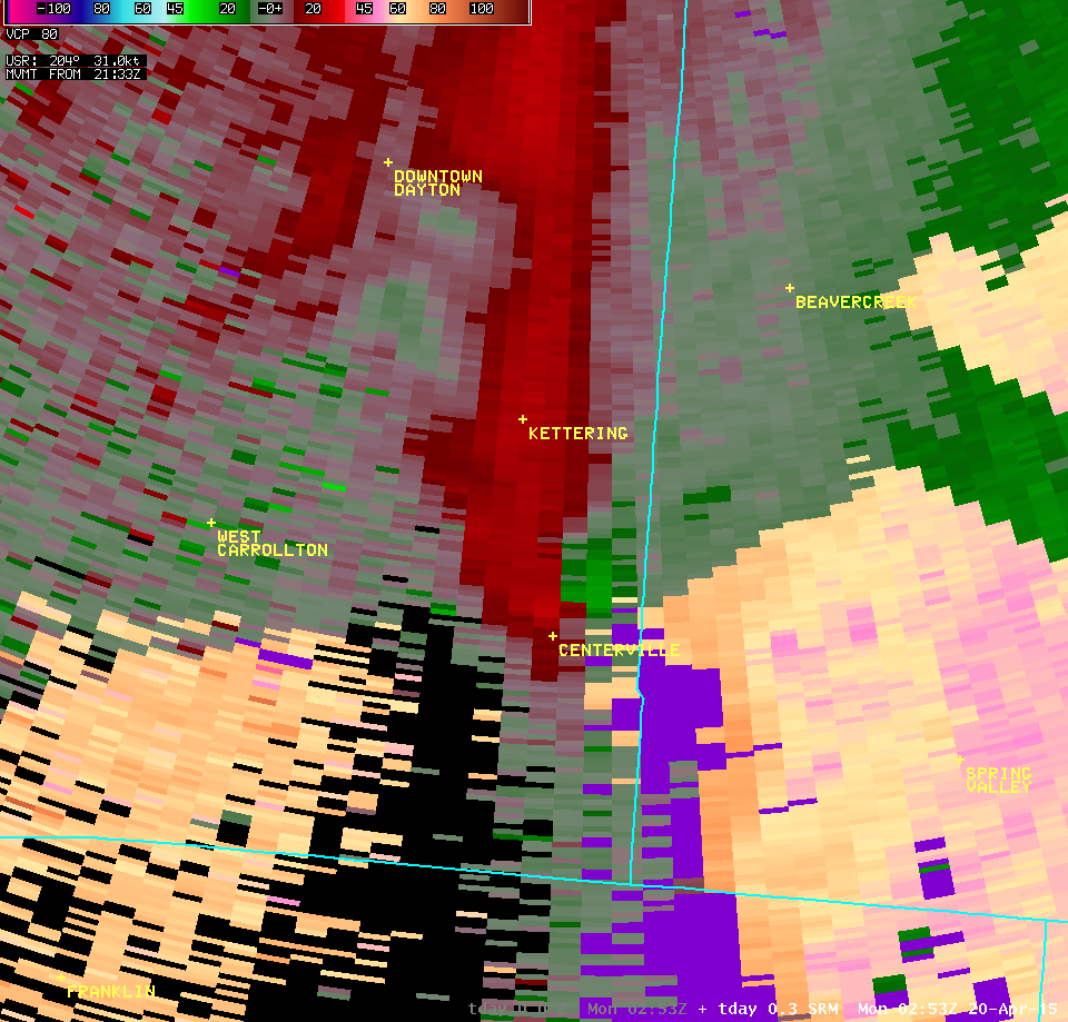
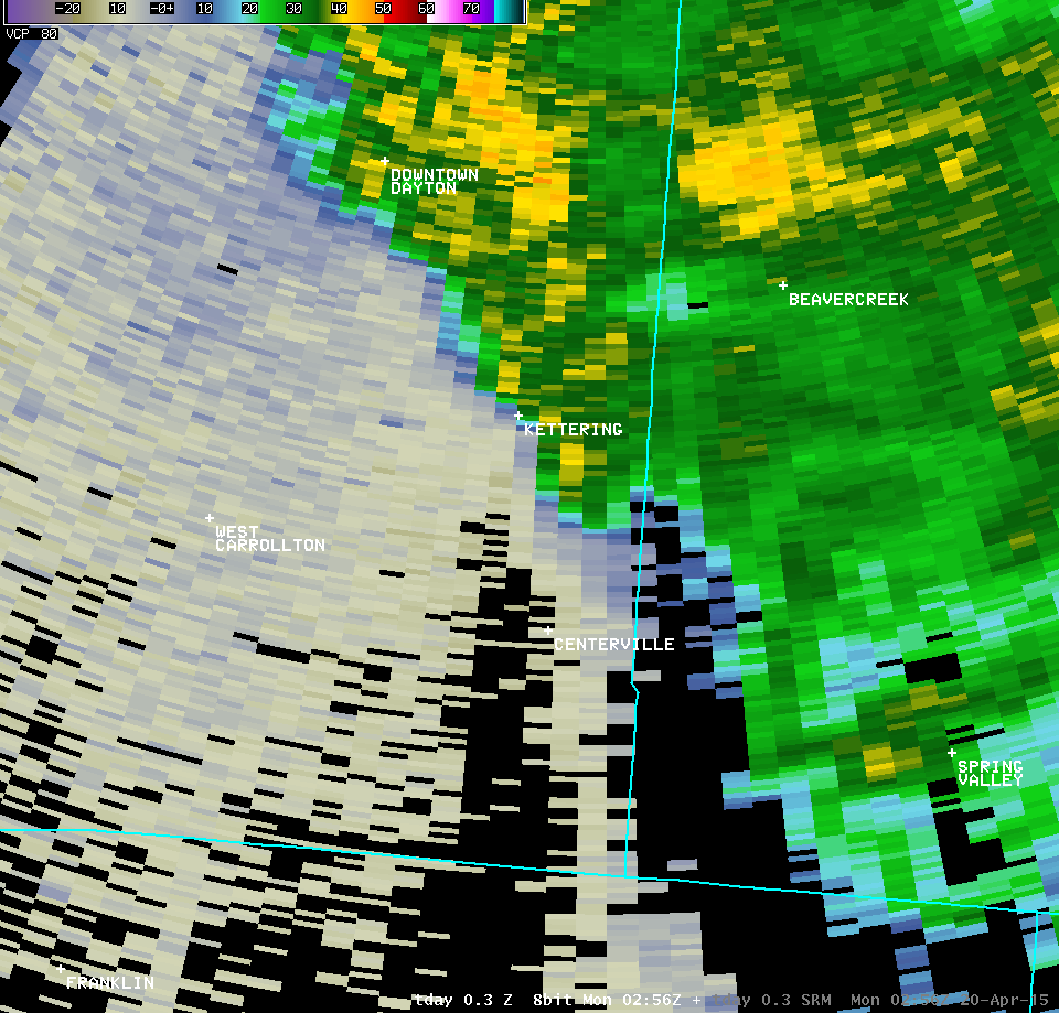
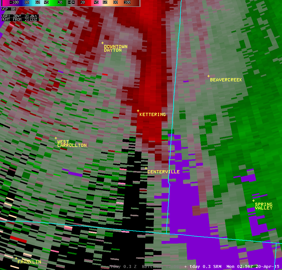
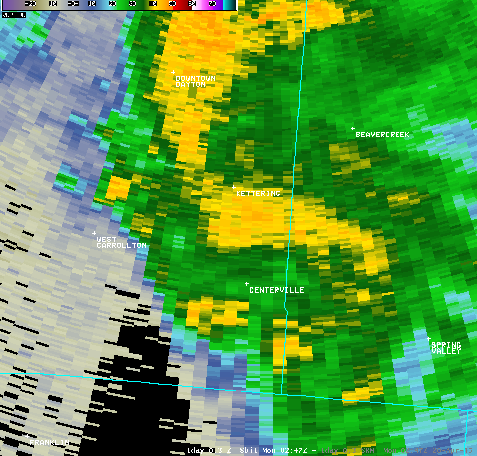
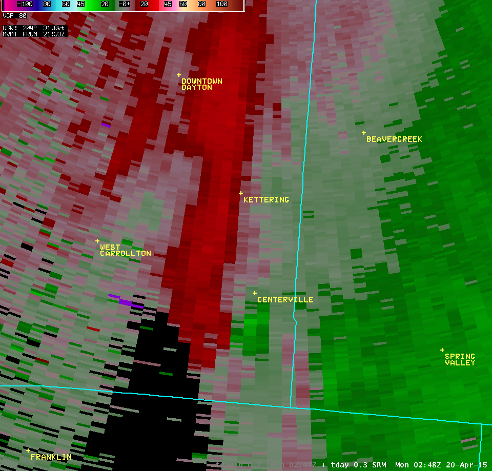
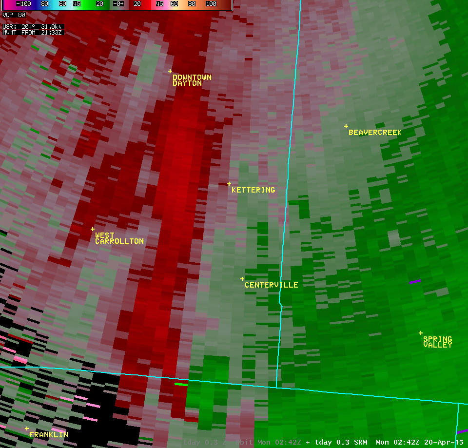
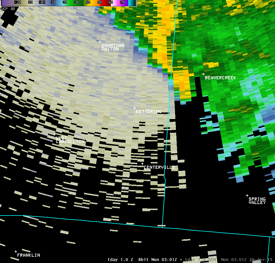
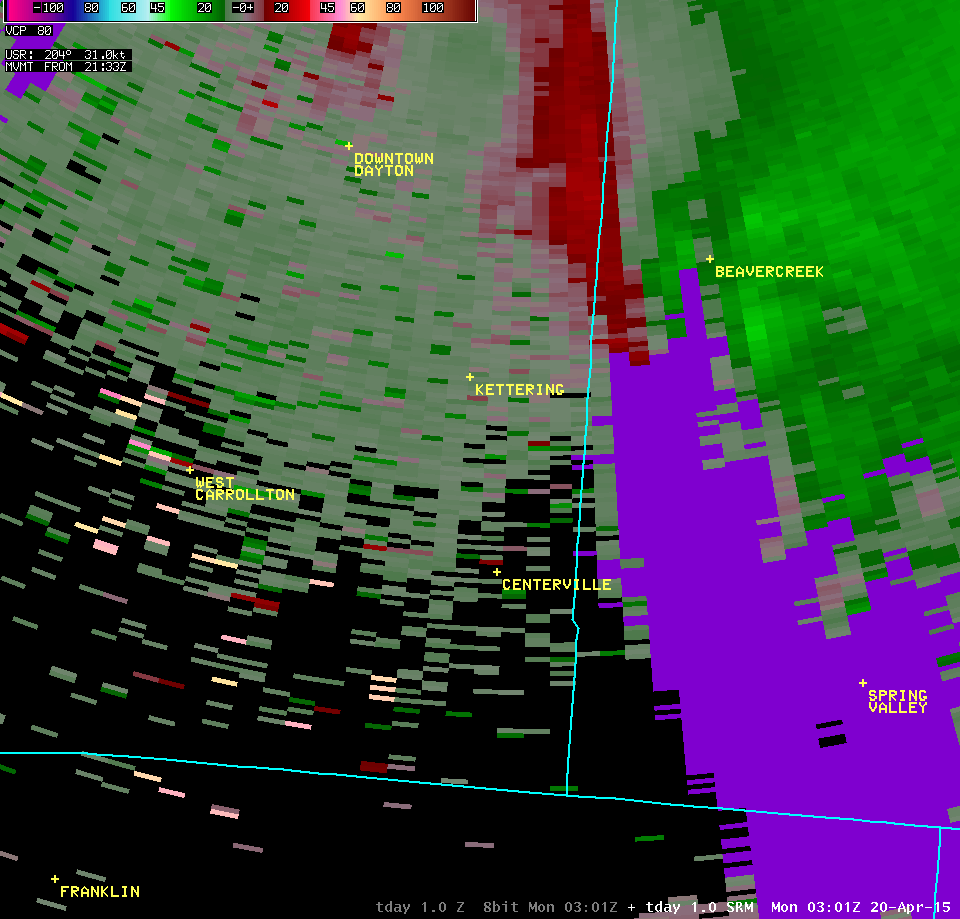
| 0.3° Z -- 10:55 PM | 0.3° SRM -- 10:55 PM | ||
 |
 |
||
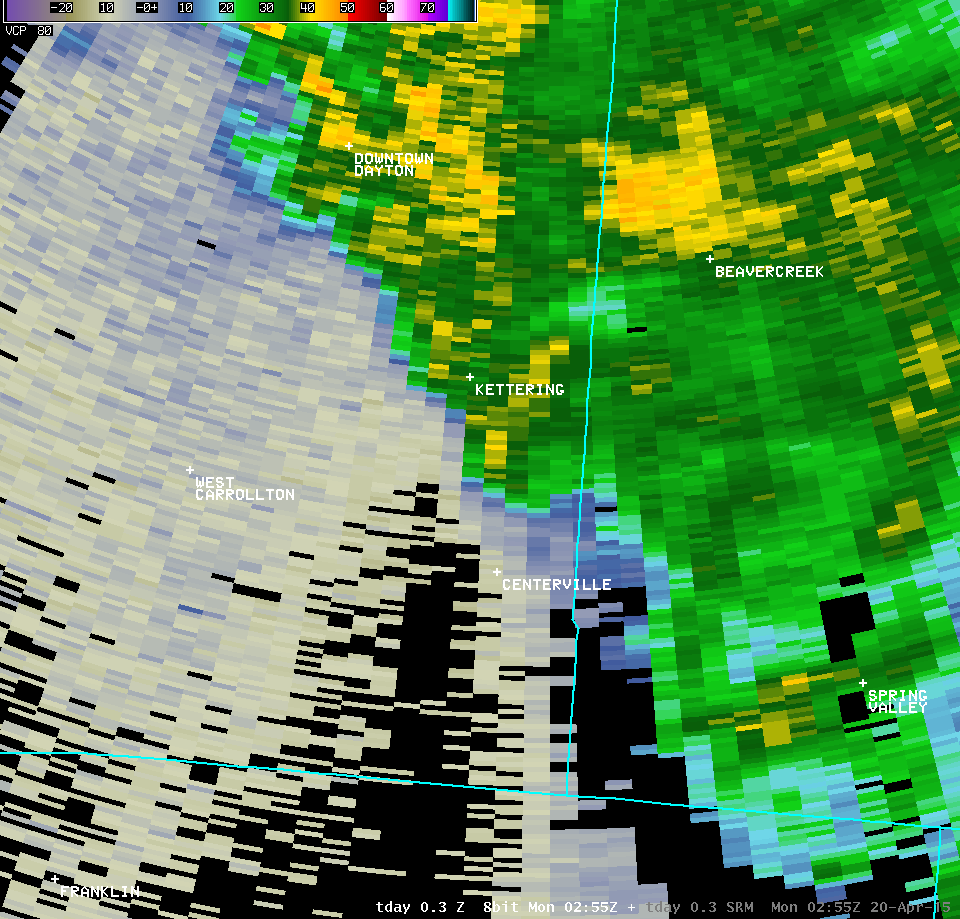
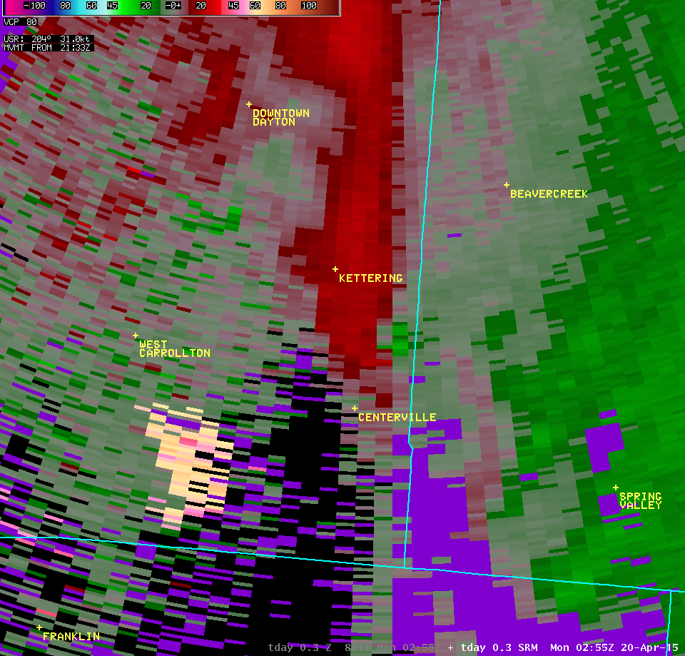
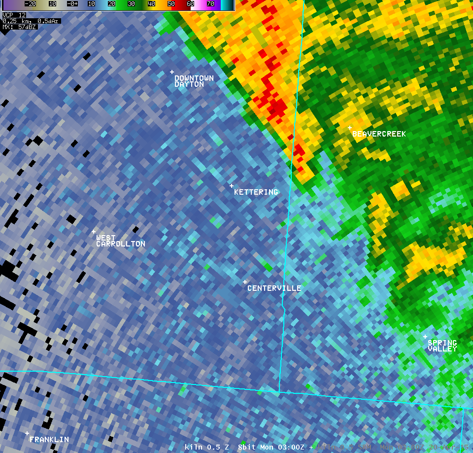
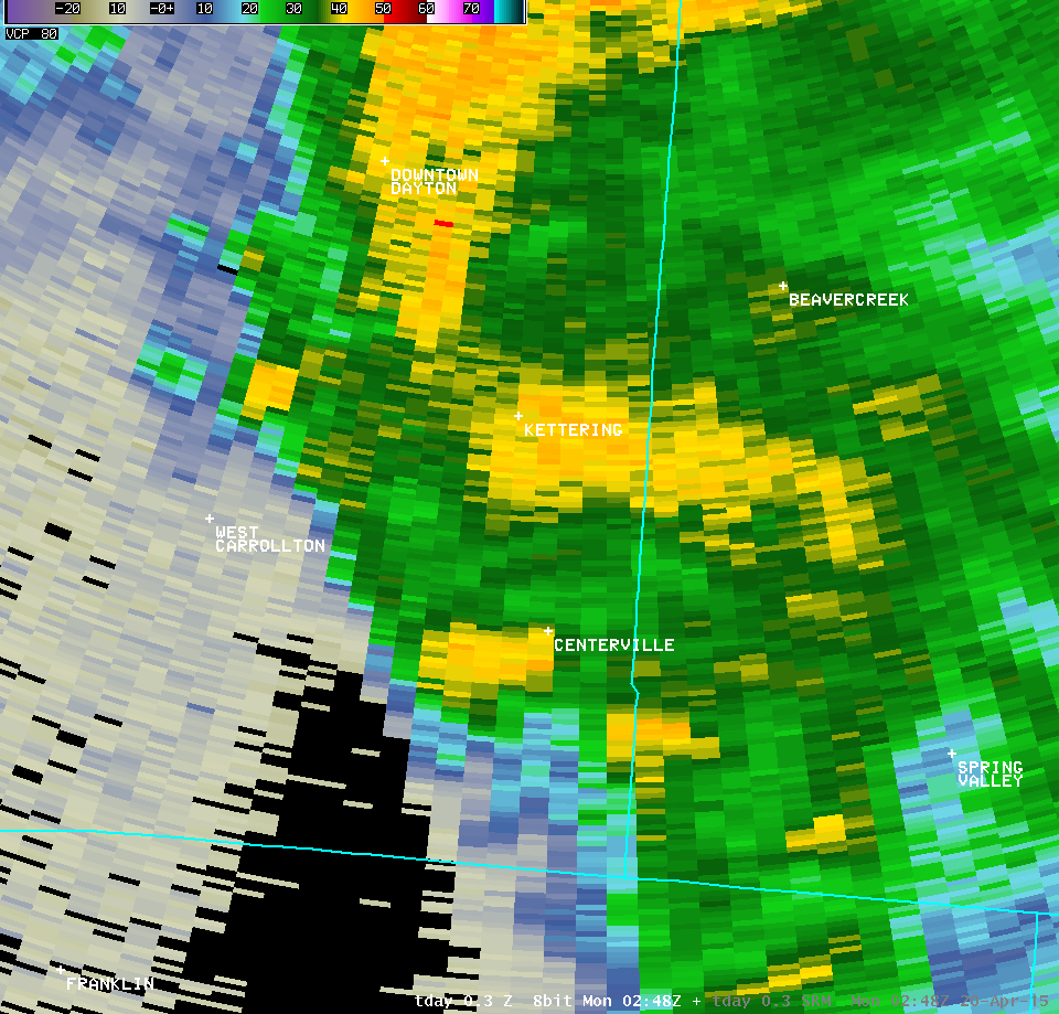
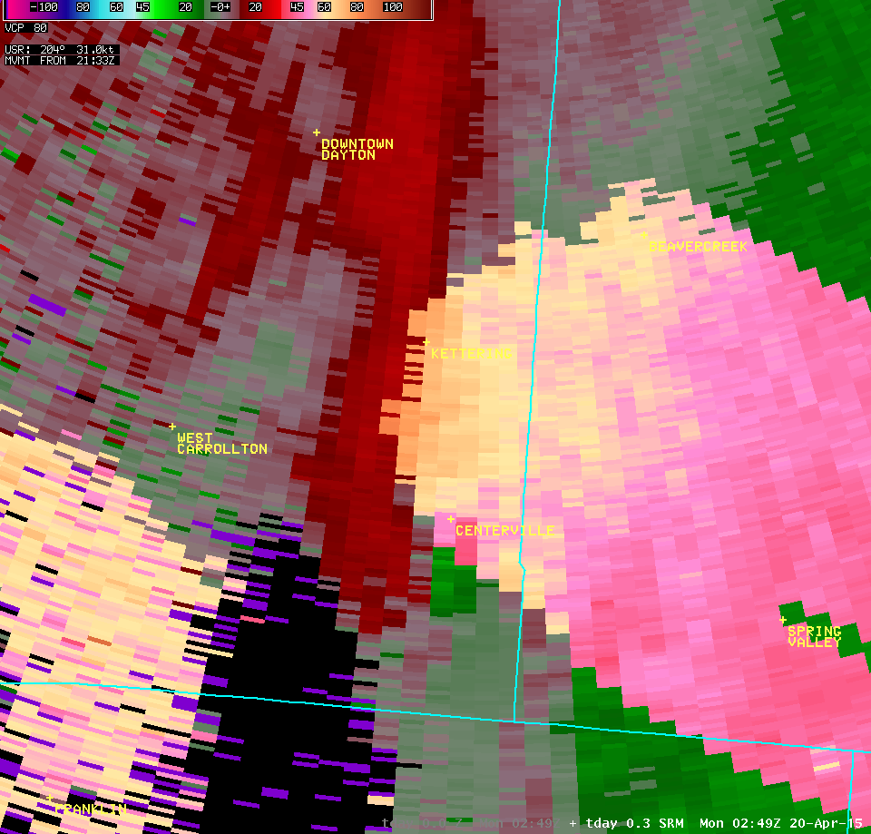
| 0.3° Z -- 10:56 PM | 0.3° SRM -- 10:56 PM | ||
 |
 |
||
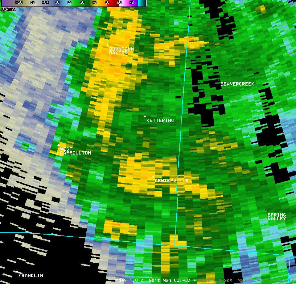
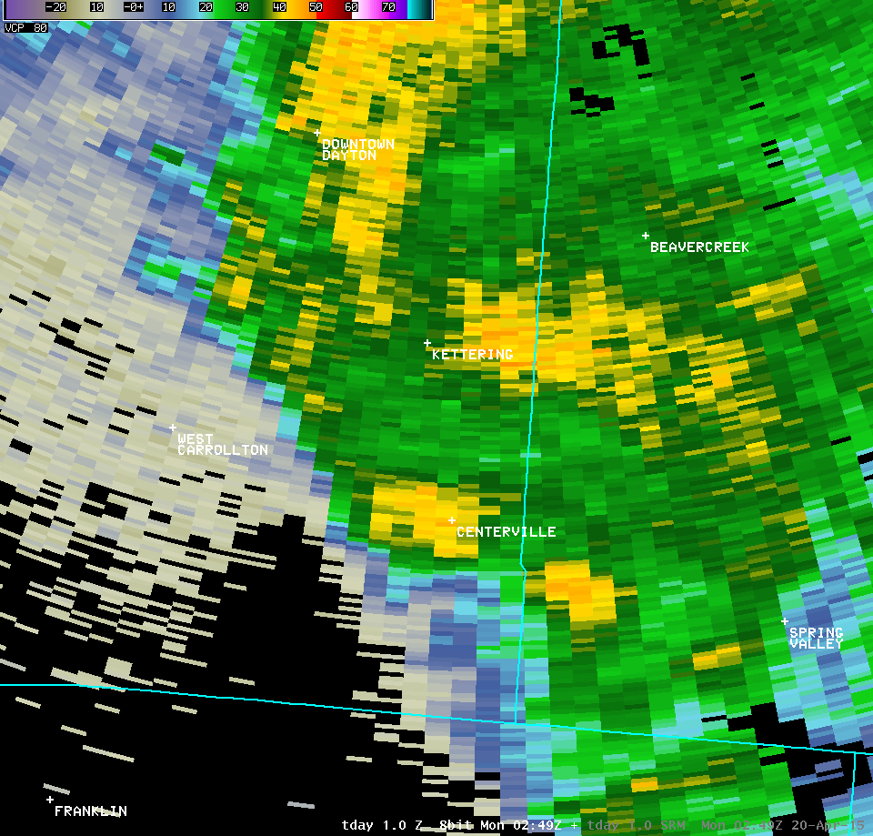
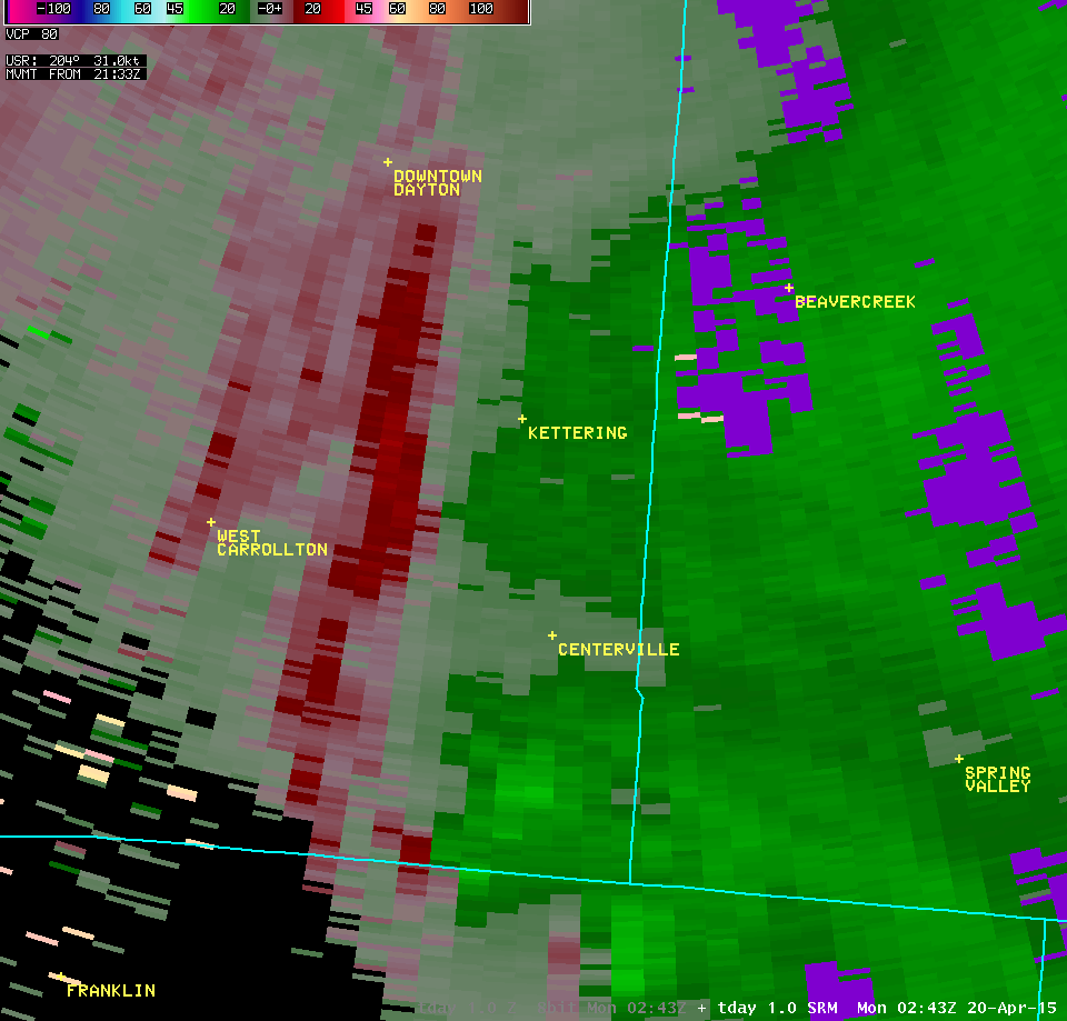
| 1.0° Z -- 10:55 PM | 1.0° SRM -- 10:55 PM | ||
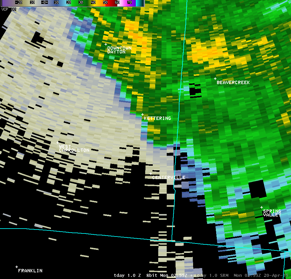 |
 |
||
| Full Radar Loops from the NWS Wilmington Ohio Radar (10:41 PM - 11:00 PM) | |
| KILN 0.5° Reflectivity (1400-1600 feet AGL) | KILN 0.5° SRM (1400-1600 feet AGL) |
| 1 2 3 4 5 6 7 8 9 | Anim | 1 2 3 4 5 6 7 8 9 | Anim |
| KILN 0.9° Reflectivity (2300-2500 feet AGL) | KILN 0.9° SRM (2300-2500 feet AGL) |
| 1 2 3 4 5 | 1 2 3 4 5 |
| Full Radar Loops from the Dayton Terminal Doppler Weather Radar (10:42 PM - 11:01 PM) | |
| TDAY 0.3° Reflectivity (900-1400 feet AGL) | TDAY 0.3° SRM (900-1400 feet AGL) |
| 1 2 3 4 5 6 7 8 9 10 11 12 13 14 15 16 17 | Anim | 1 2 3 4 5 6 7 8 9 10 11 12 13 14 15 16 17 | Anim |
| TDAY 1.0° Reflectivity (2300-3600 feet AGL) | TDAY 1.0° SRM (2300-3600 feet AGL) |
| 1 2 3 4 | 1 2 3 4 |

