|
Tornado northeast of Columbus, OH |
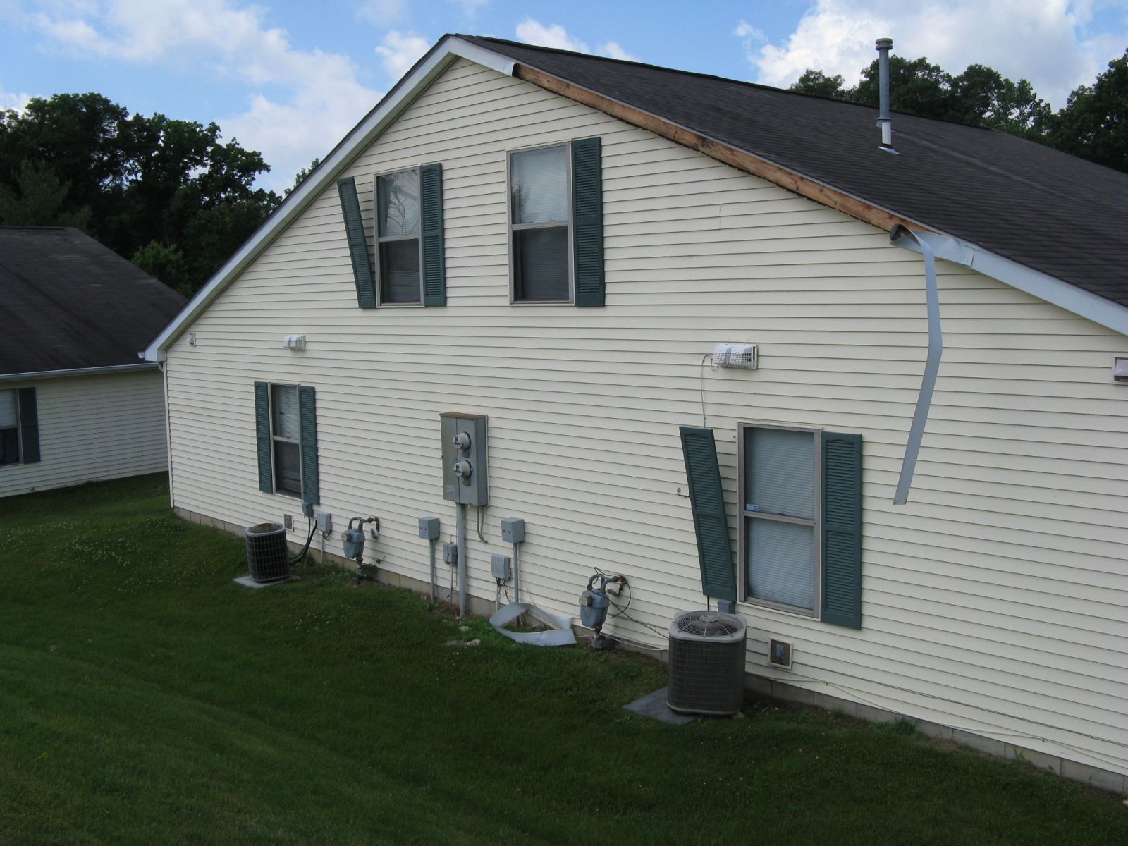
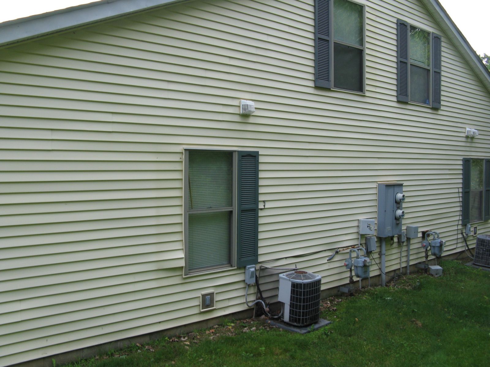
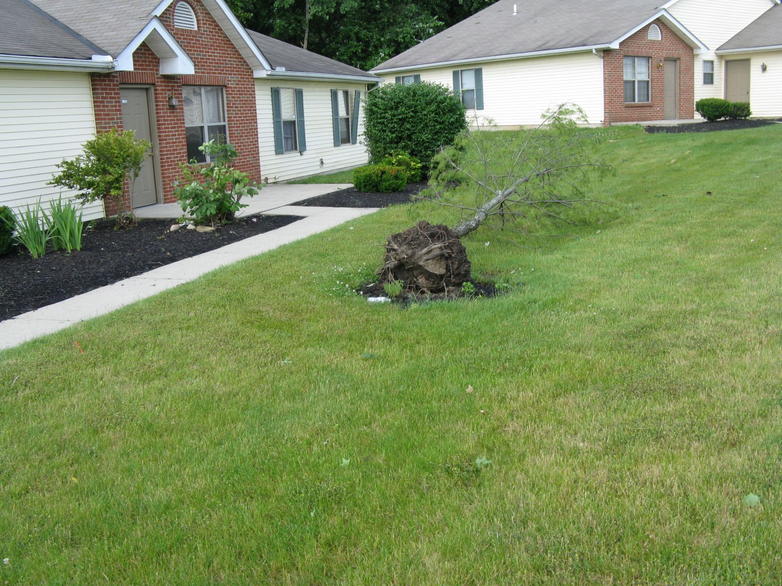
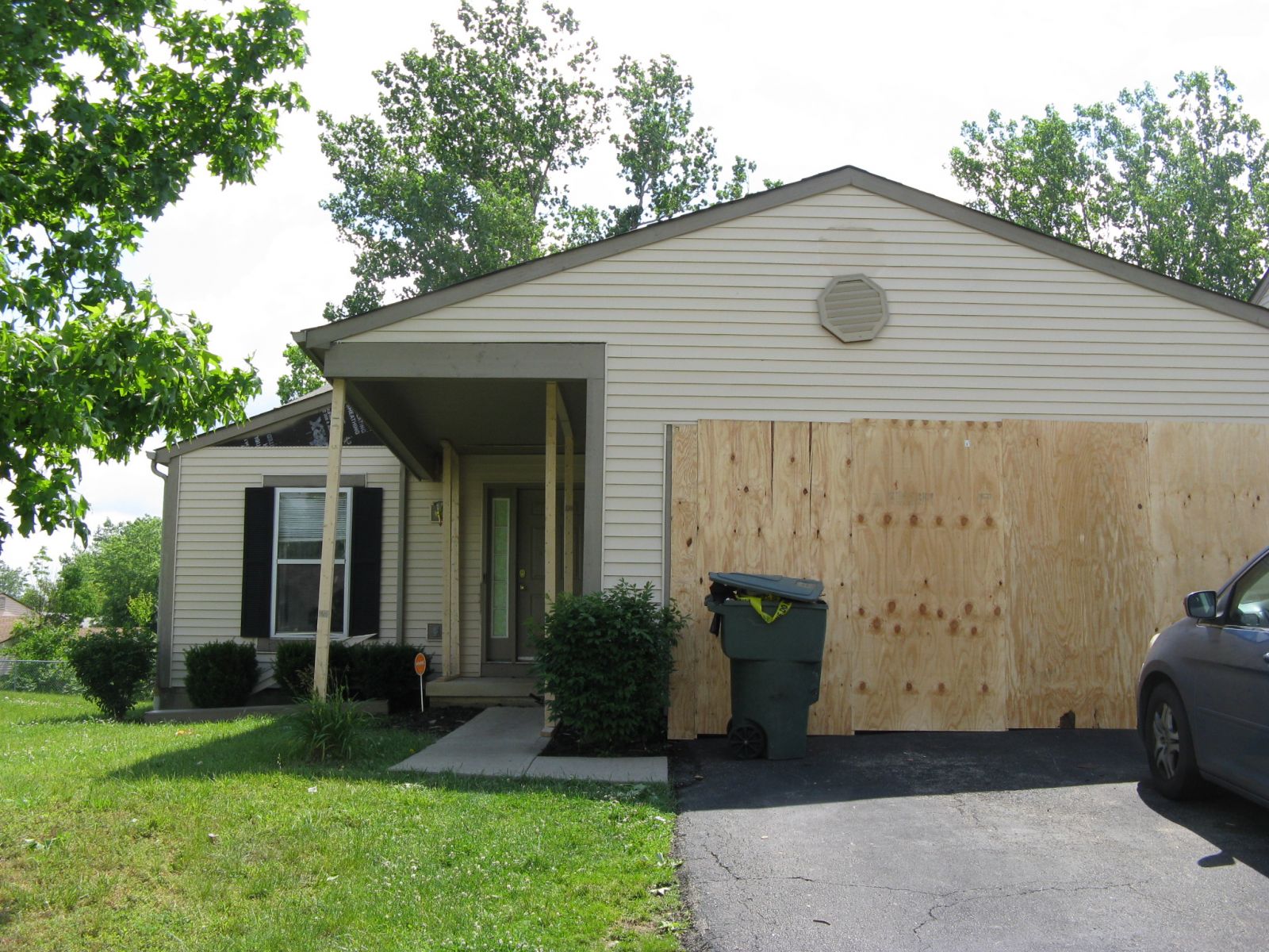
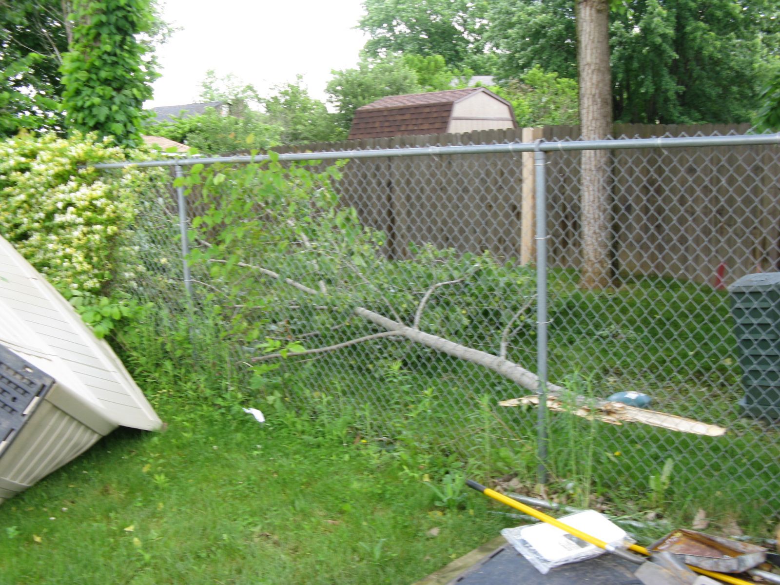
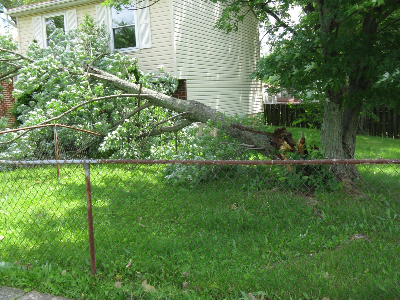
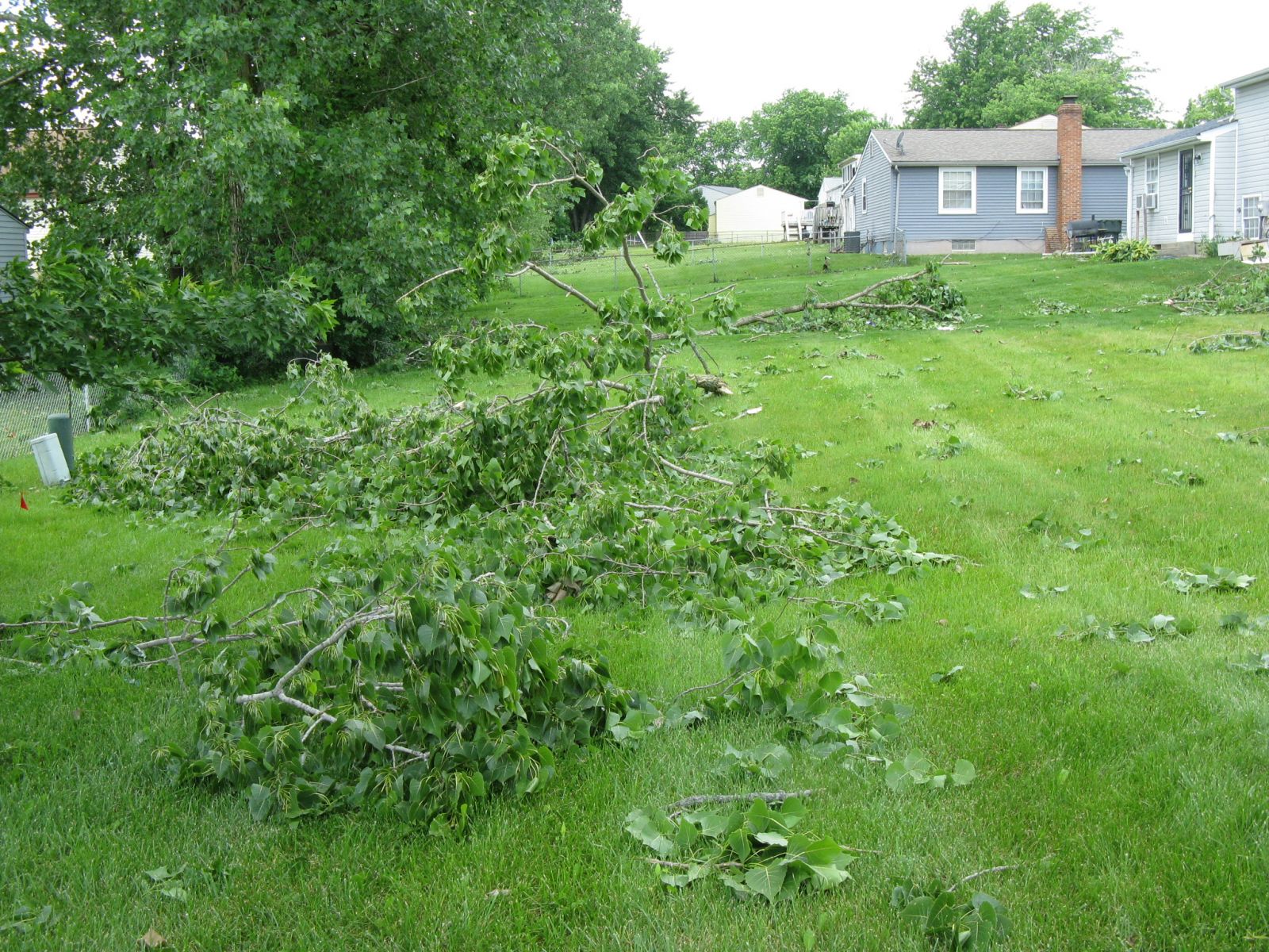
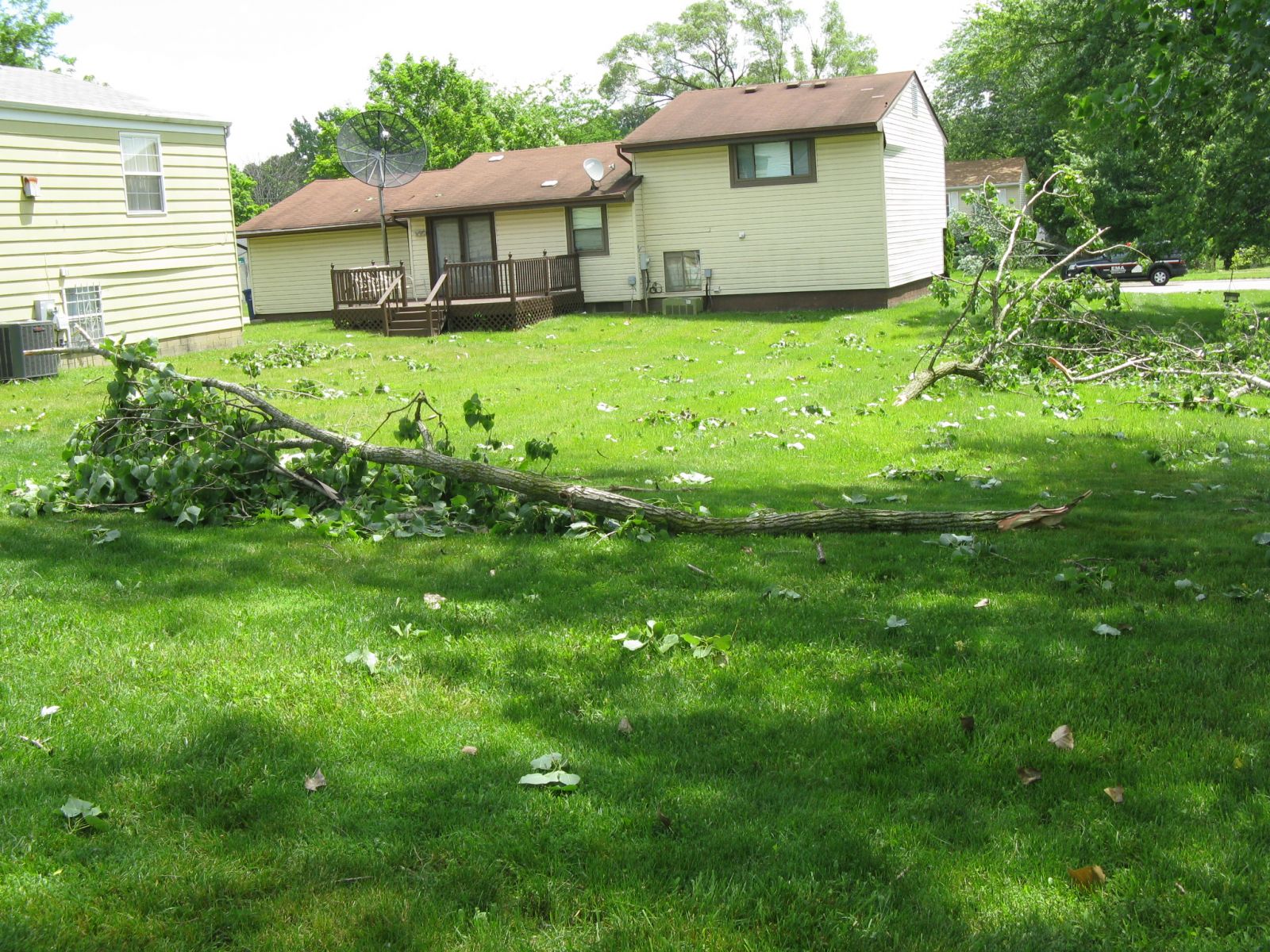
Public Information Statement National Weather Service Wilmington OH 425 PM EDT SUN JUN 5 2016 ...Tornado Confirmed Near Northeast Columbus in Franklin County Ohio... Location...Northeast Columbus in Franklin County Ohio Date...June 4 2016 Estimated Time...6:06 PM EDT Maximum EF-Scale Rating...EF0 Estimated Maximum Wind Speed...80 mph Maximum Path Width...135 yards Path Length...0.30 miles Beginning Lat/Lon...40.0336N / 82.9488W Ending Lat/Lon...40.0337N /82.9433W * Fatalities...0 * Injuries...0 * The information in this statement is preliminary and subject to change pending final review of the event(s) and publication in NWS Storm Data. ...Summary... The National Weather Service in Wilmington OH has confirmed a tornado near Northeast Columbus in Franklin County Ohio on June 4 2016. This confirmation is a result of a review of National Weather Service and Federal Aviation Administration Weather Radar and a Ground Survey conducted by the National Weather Service. Damage was first observed on Deserette Court. The west-facing side of several housing units had shutters torn off and also experienced minor siding damage. This is where it appears the tornado first touched down. On the opposite side of Deserette Court, additional shutter and siding damage was observed, and primarily affected the east-facing side of the housing units. Damage continued to the east onto Boyleston Boulevard, with the garage door of one home completely destroyed and walls of the garage experiencing significant damage. Siding and roof damage was also observed on this home, and damage is assessed to be in the EF0 category, with winds around 80 mph. An eyewitness also stated that she was looking west and saw a tornado moving toward Boyleston Boulevard. A swath of damage continued to the east, affecting homes along Niantic Drive and Hingham Lane. Much of the damage was associated with trees, where large tree branches in the back yards of several homes on both Niantic Drive and Hingham Lane were snapped. A convergent pattern was observed from 10 to 12 inch diameter tree branches. Some damage to homes was also observed, including a large portion of siding being stripped off the east-facing side of a two story home. Minor roof damage was also noted on several homes. Damage become more sparse further east along Hingham Lane and was confined to a few large hardwood tree branches being snapped off. The National Weather Service extends thanks to Franklin County Emergency Management and Homeland Security and the affected homeowners for their assistance with this storm damage survey. For reference...the Enhanced Fujita Scale classifies tornadoes into the following categories: EF0...wind speeds 65 to 85 mph. EF1...wind speeds 86 to 110 mph. EF2...wind speeds 111 to 135 mph. EF3...wind speeds 136 to 165 mph. EF4...wind speeds 166 to 200 mph. EF5...wind speeds greater than 200 mph. $$ Butner/Peloquin |
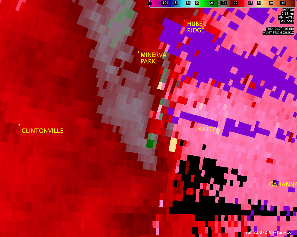
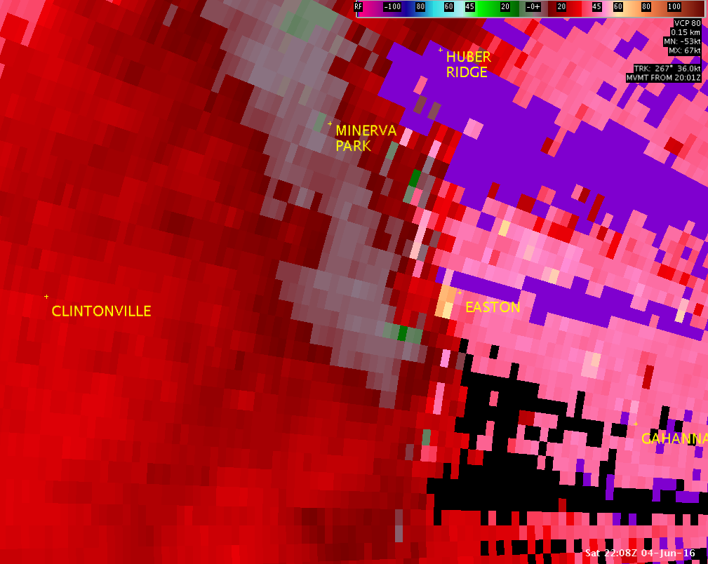
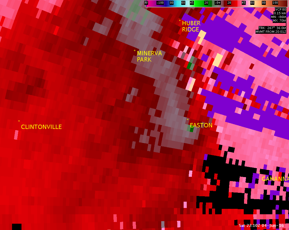
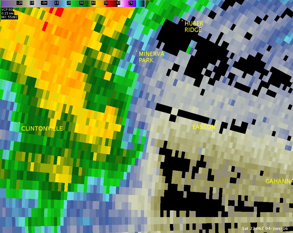
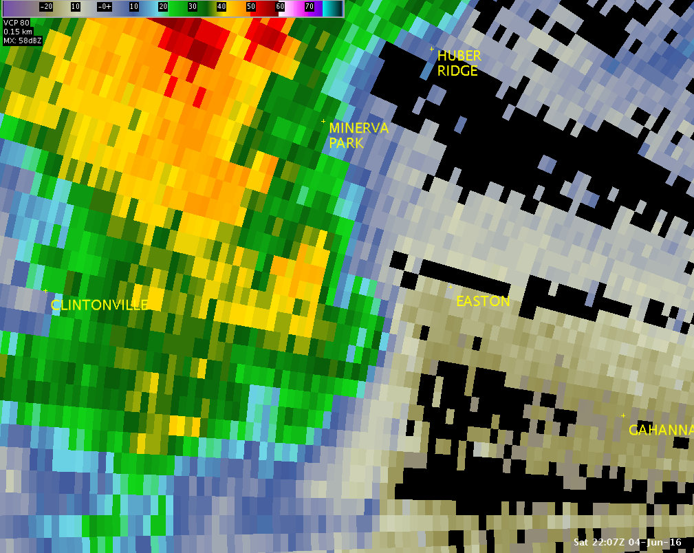
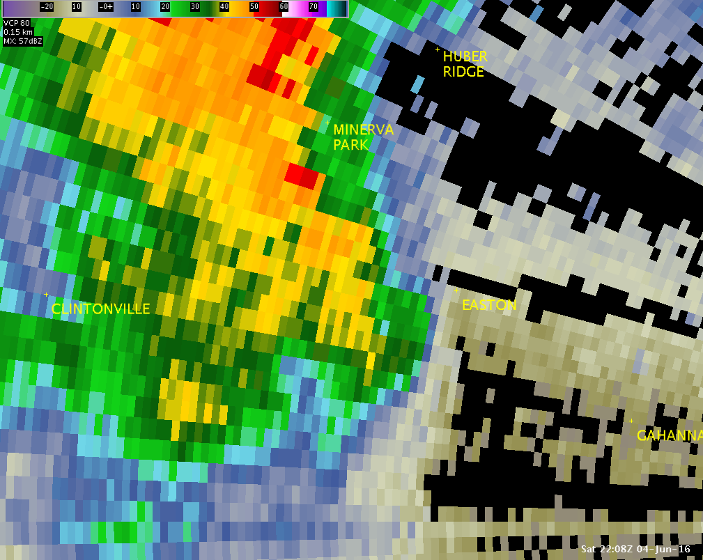
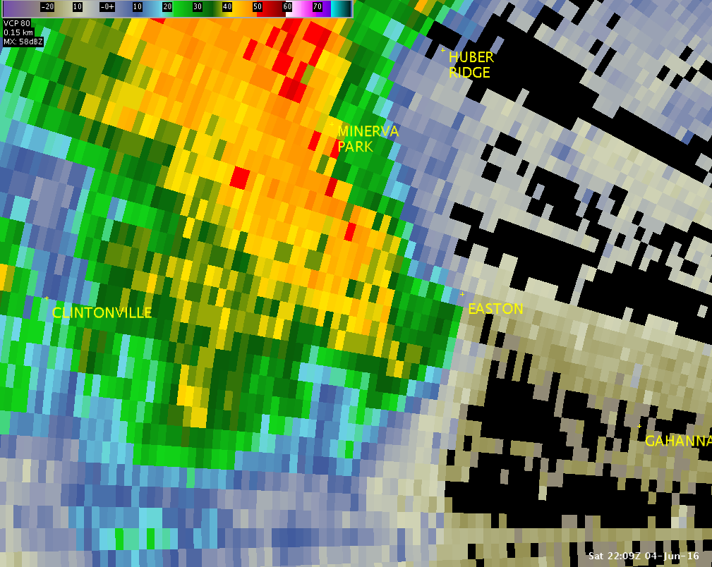
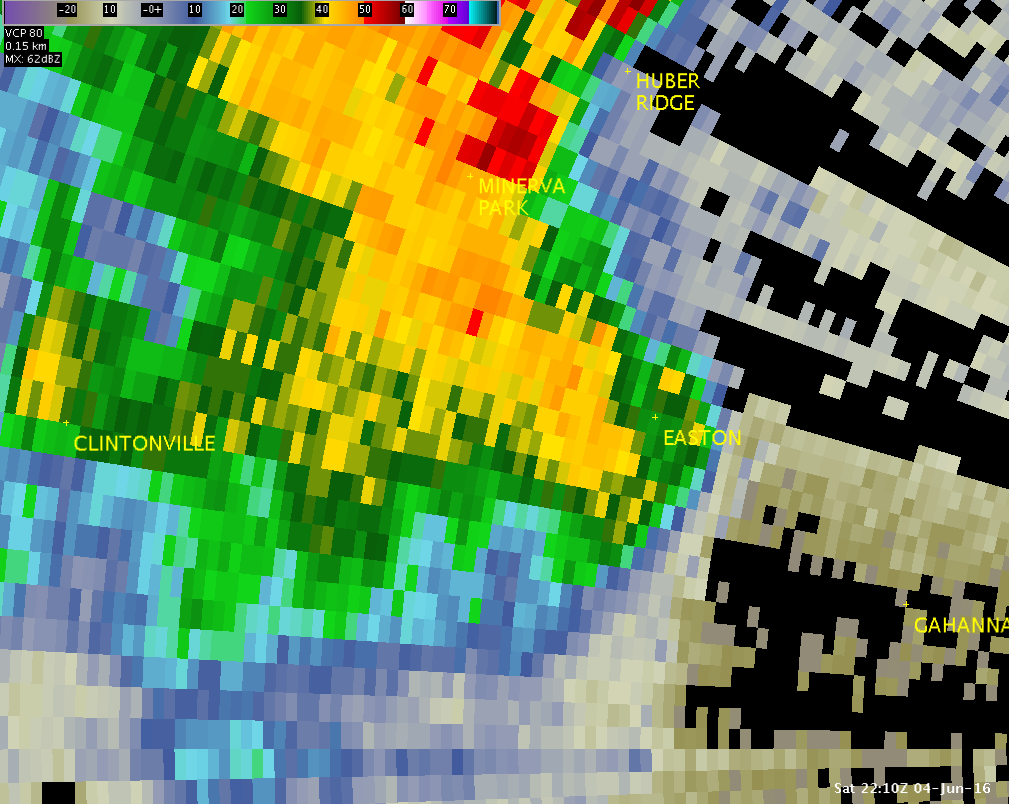
These radar images show the circulation associated with the tornado that developed northeast of Columbus, OH. The top images are from right around the time the tornado touched down, showing storm-relative motion as seen from TDWR Columbus (TCMH). The bottom images show the reflectivity as seen from TCMH.
| TCMH 0.1° SRM - 6:06PM | TCMH 0.1° SRM - 6:07PM | TCMH 0.1° SRM - 6:08PM | TCMH 0.1° SRM - 6:09PM | TCMH 0.1° SRM - 6:10PM |
 |
 |
 |
 |
 |
| TCMH 0.1° Z -- 6:06 PM | TCMH 0.1° Z -- 6:07 PM | TCMH 0.1° Z -- 6:08 PM | TCMH 0.1° Z -- 6:09 PM | TCMH 0.1° Z -- 6:10 PM |
 |
 |
 |
 |
 |
These select pictures were taken by NWS Wilmington, Ohio employees during a storm survey conducted on June 5, 2016:
 |
 |
 |
 |
 |
 |
 |
 |
 |

