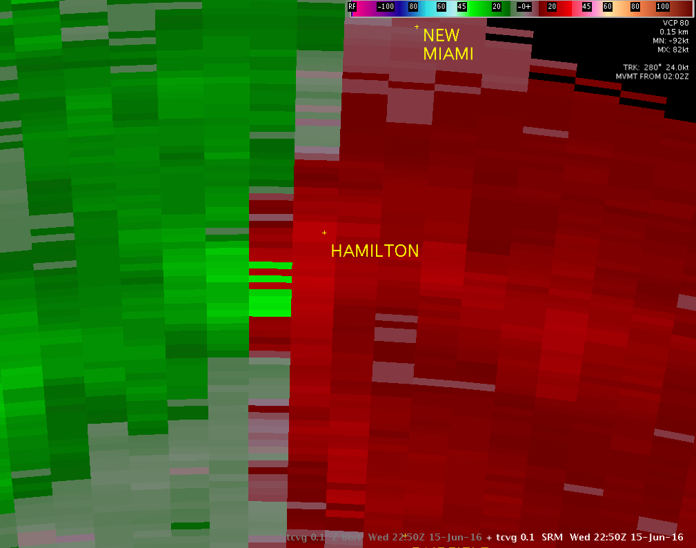
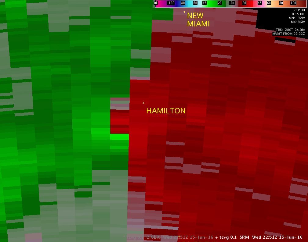
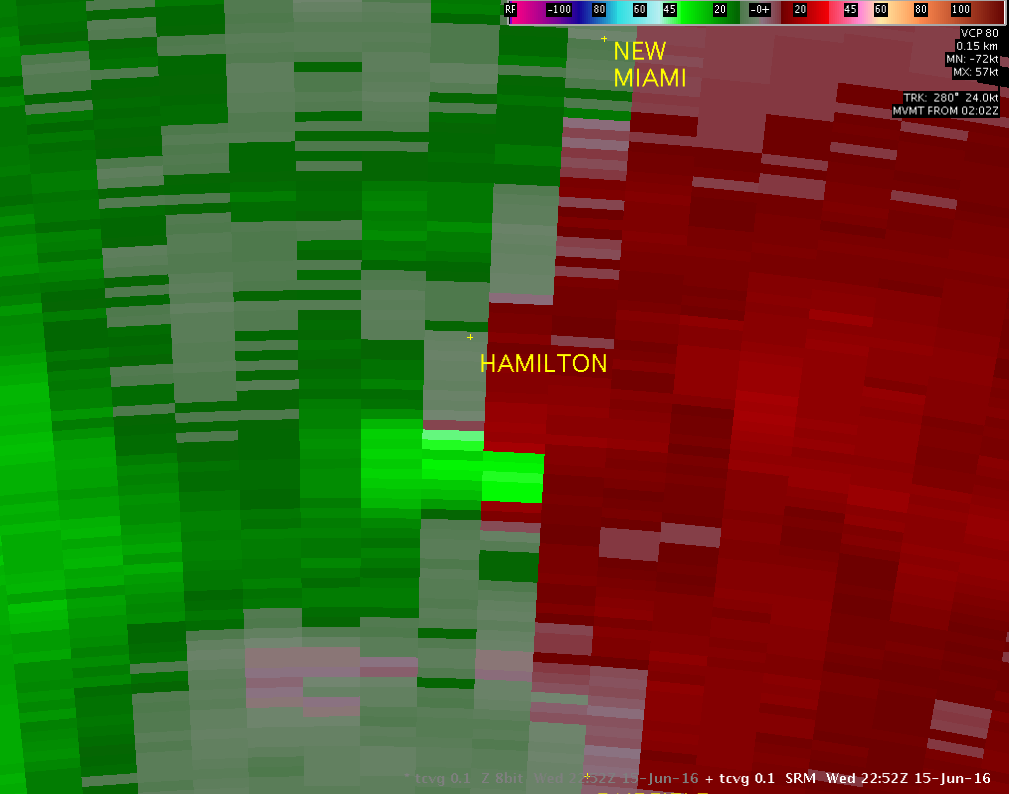
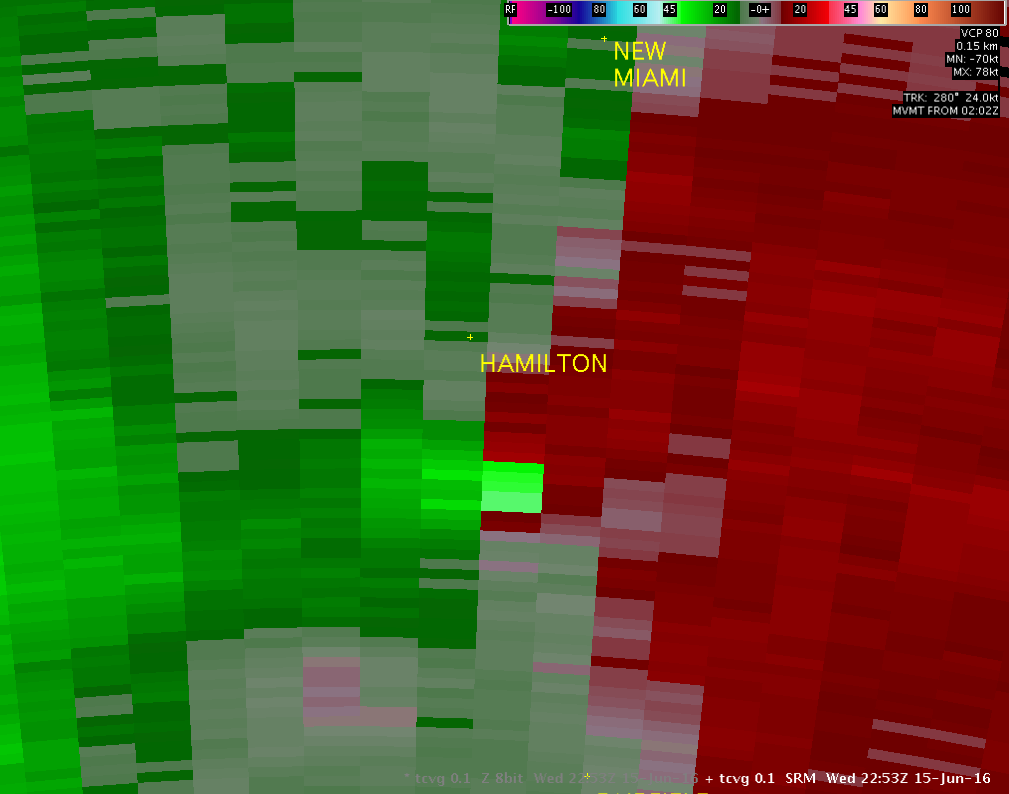
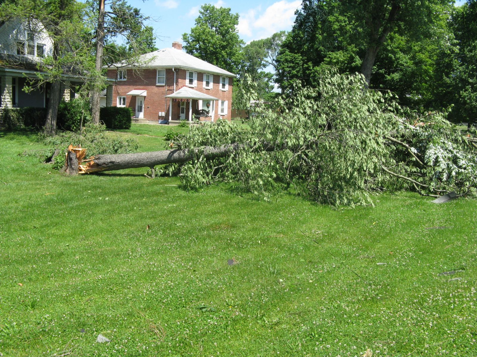
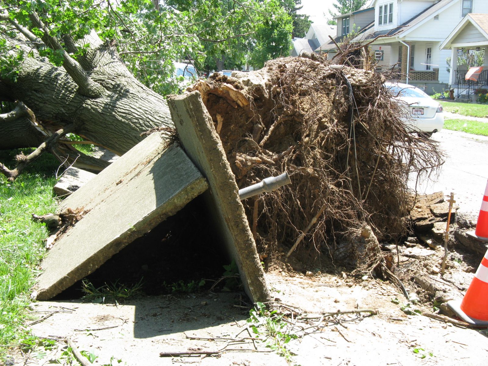
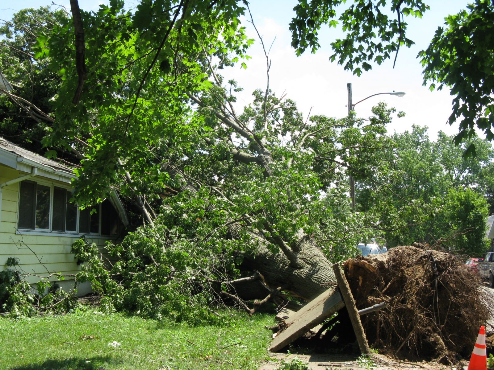
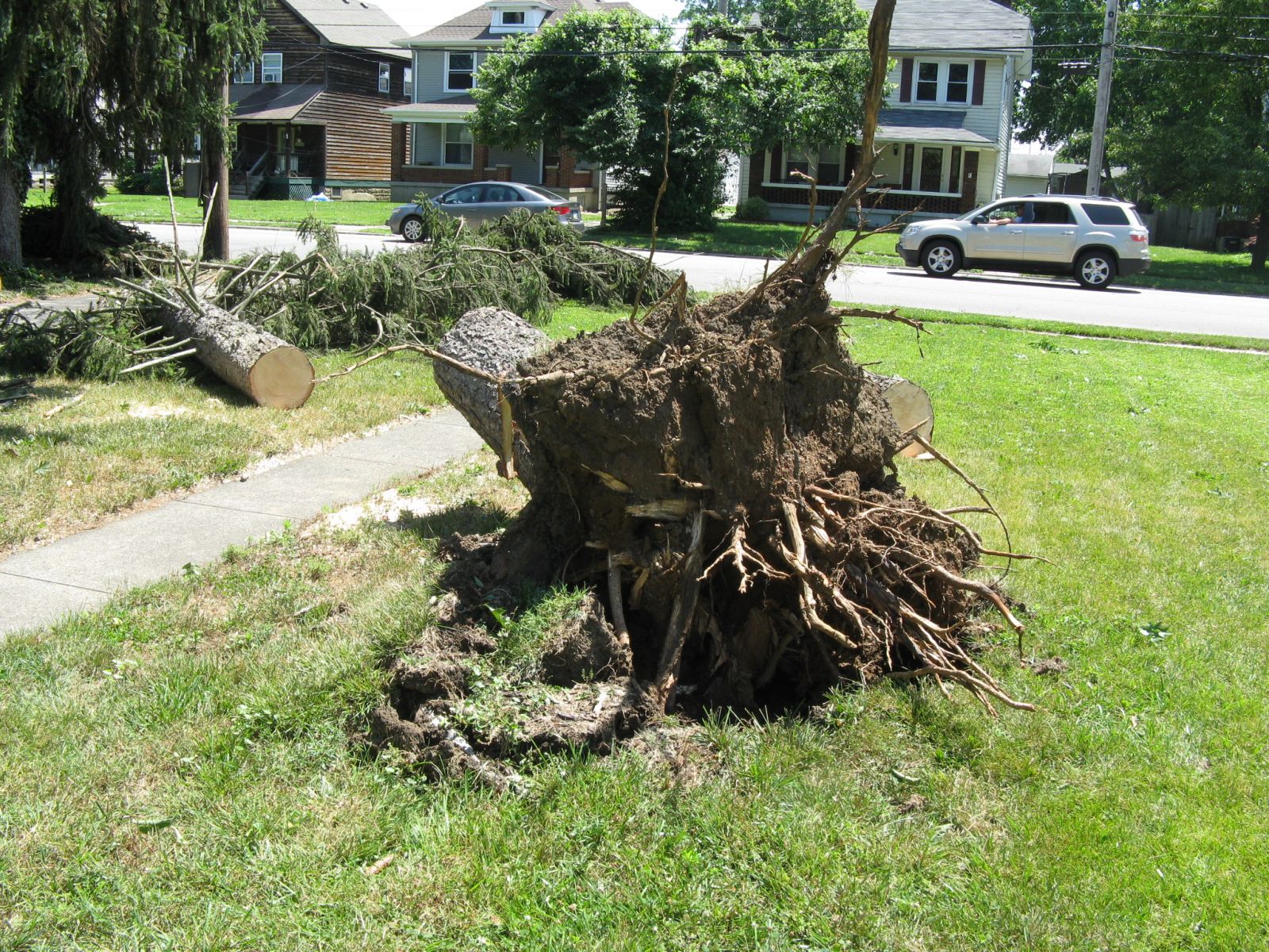
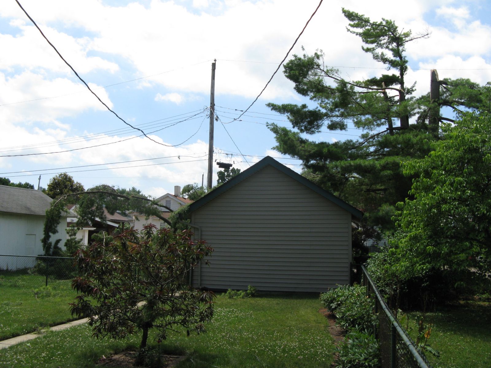
On the afternoon of June 15, 2016, storms developed in a very unstable airmass across parts of Indiana and western Kentucky. As the storms moved east into an environment with temperatures in the mid/upper 80s and dewpoints in the low/mid 70s, they merged into a broken/bowing line across parts of southeast Indiana, southwest Ohio, and northern Kentucky. These storms produced widespread winds of 50-60 MPH. Within the broken line, a microburst caused significant tree damage just south of Hamilton, Ohio, with estimated wind speeds of 80-90 MPH.
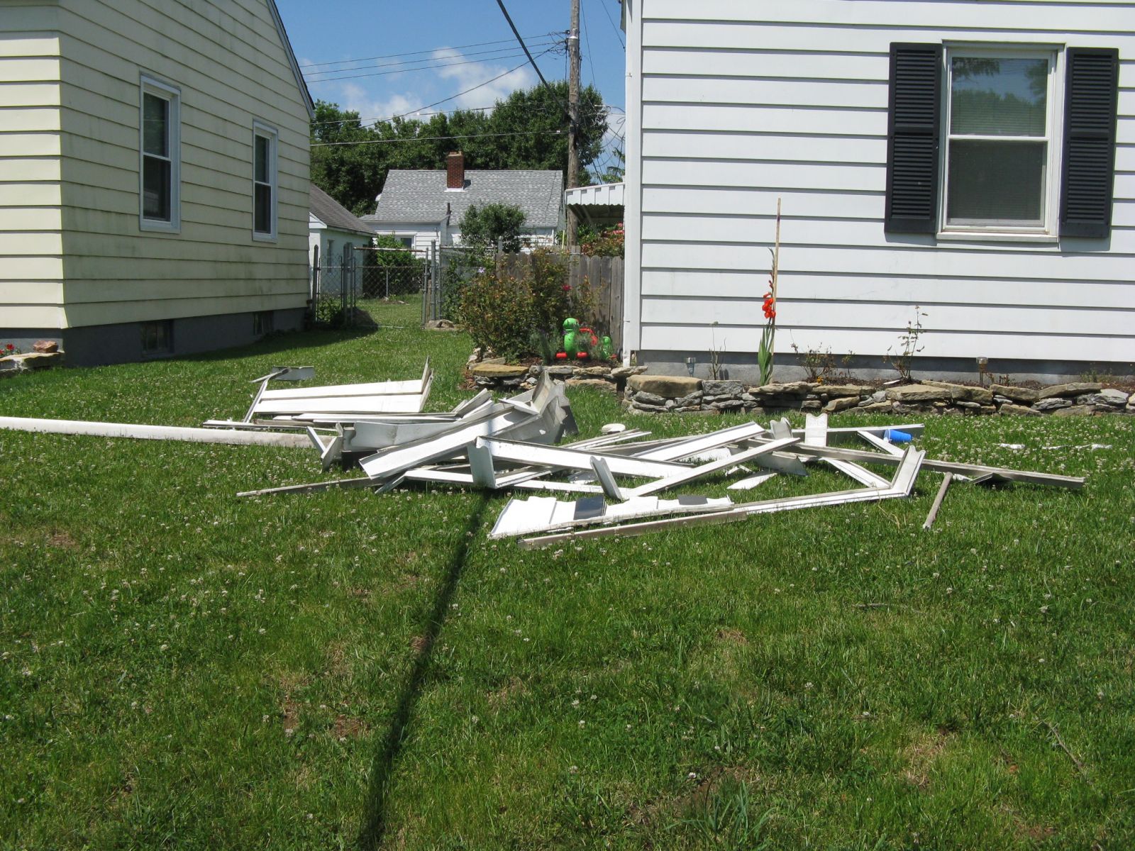
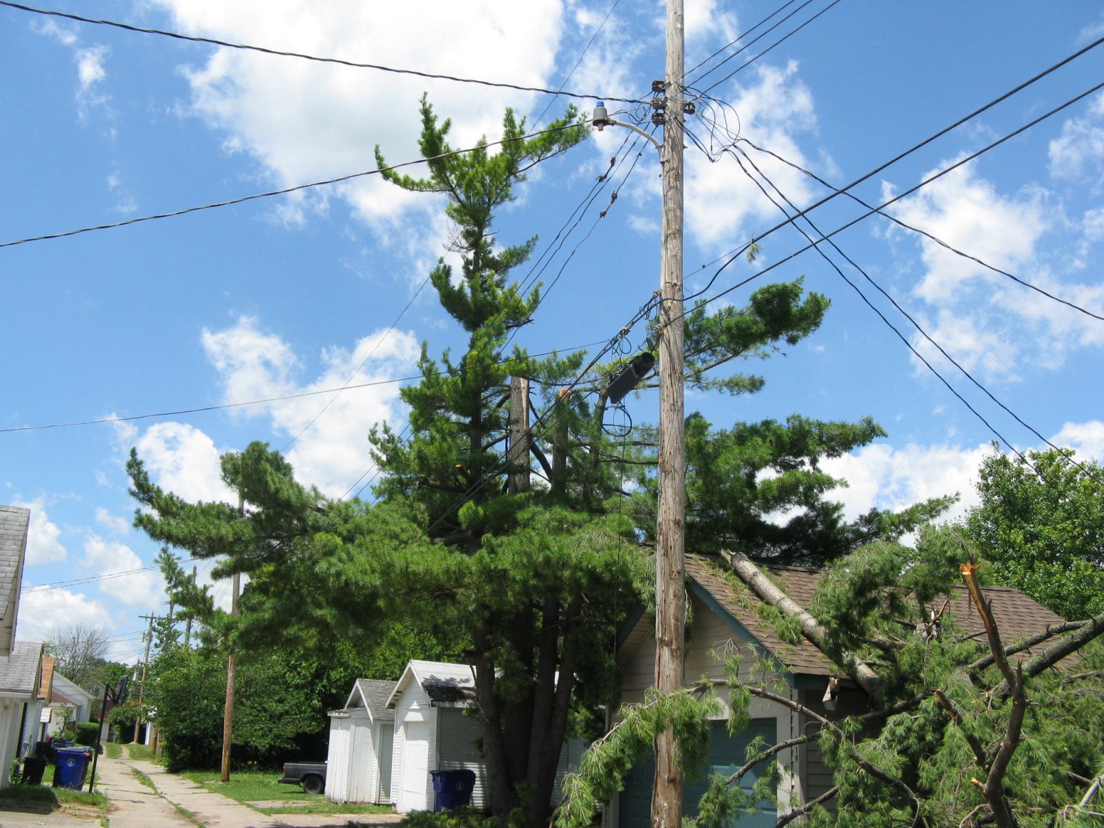
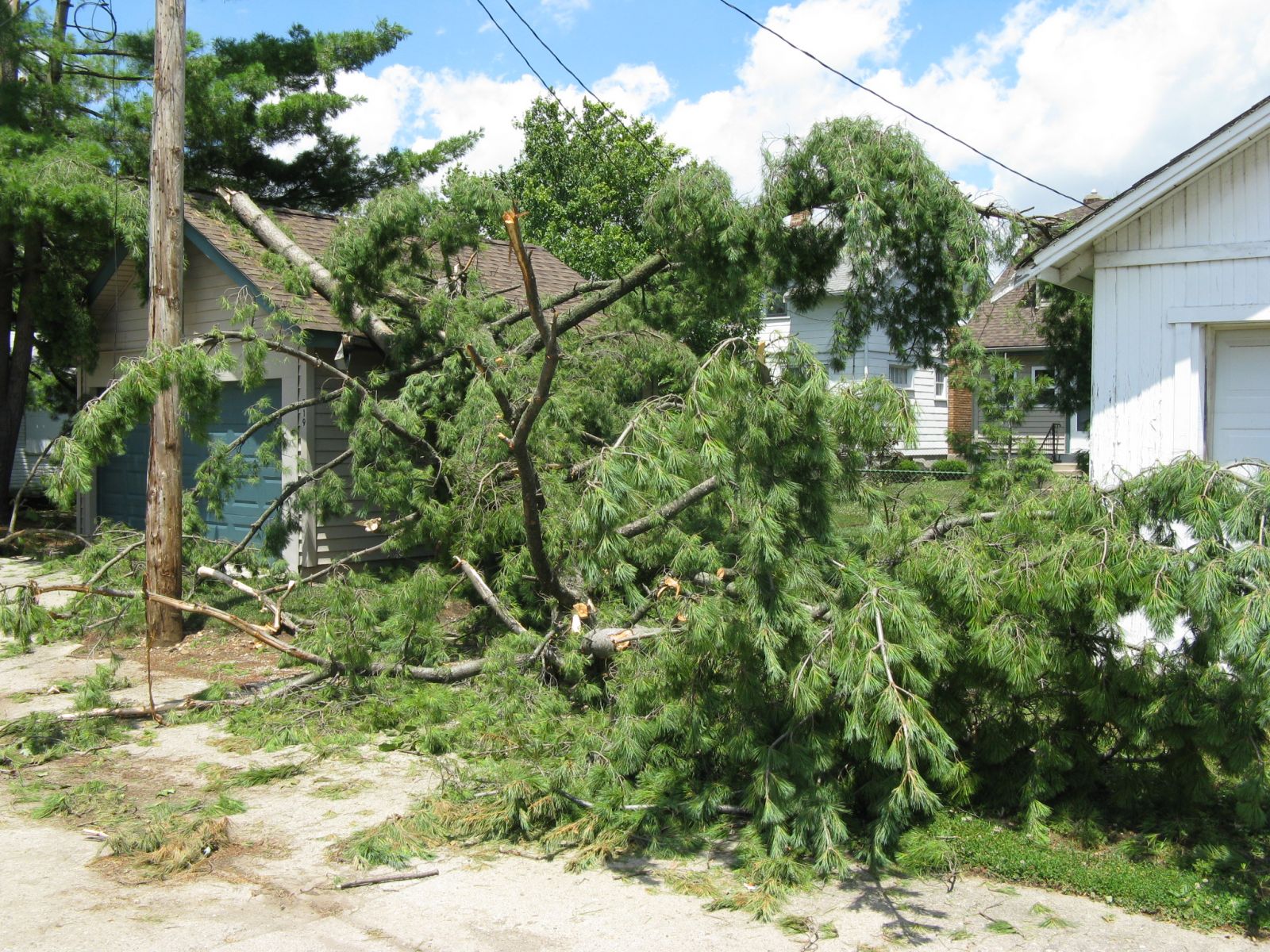
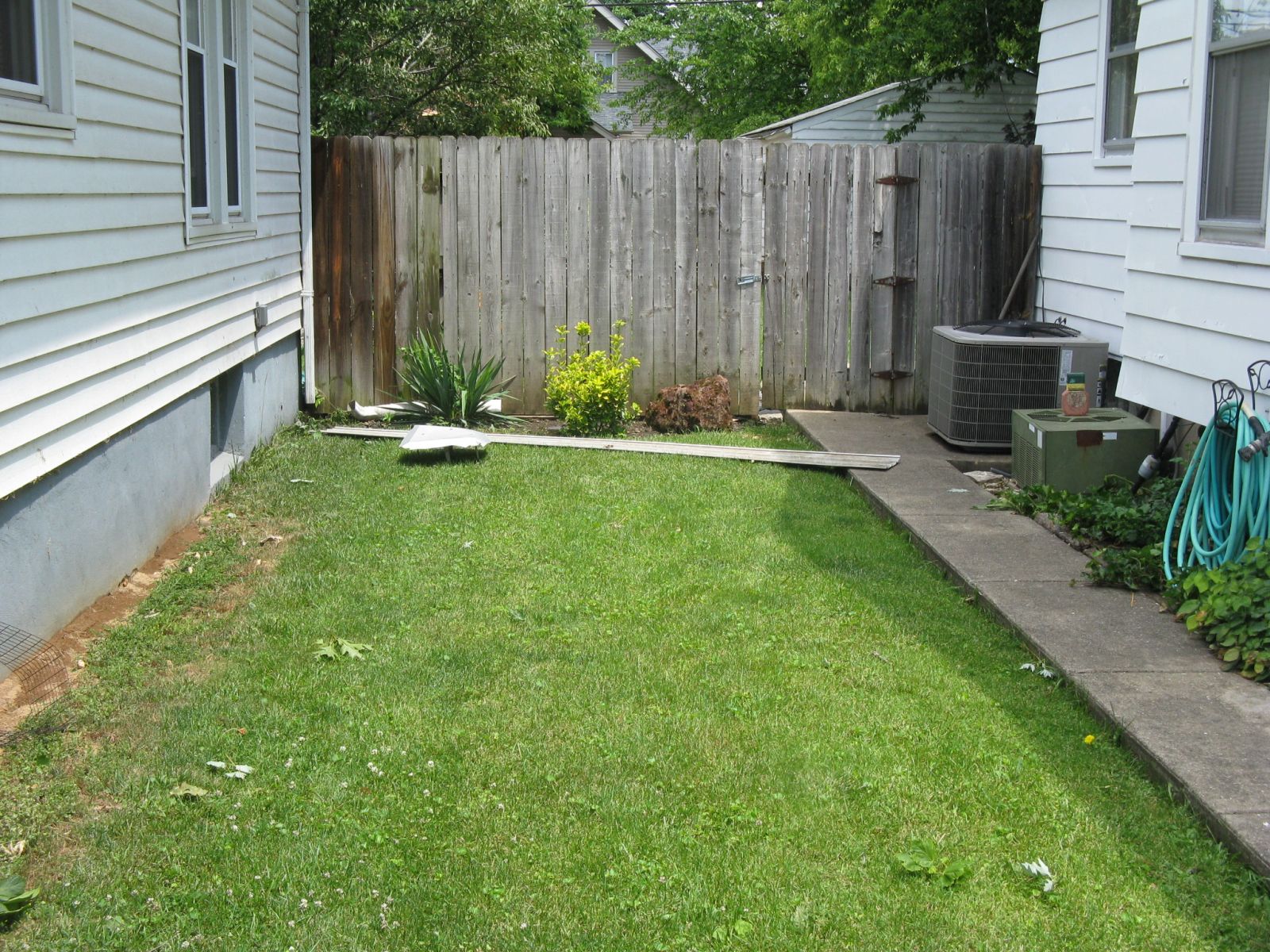
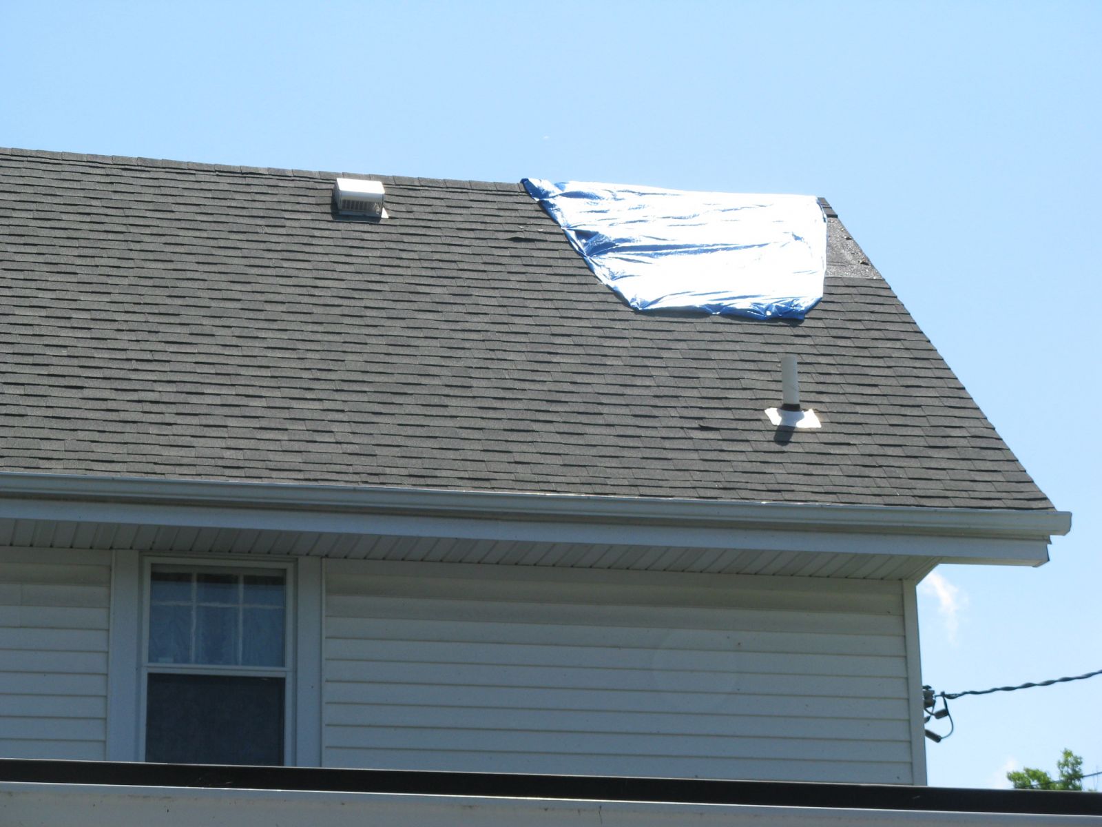
000 NOUS41 KILN 162110 PNSILN INZ050-058-059-066-073>075-080-KYZ089>100-OHZ026-034-035-042>046- 051>056-060>065-070>074-077>082-088-170115- Public Information Statement National Weather Service Wilmington OH 510 PM EDT THU JUN 16 2016 ...A microburst with straight line wind damage has been confirmed near Hamilton in Butler County Ohio... Location...Hamilton in Butler County Ohio Date...June 15 2016 Estimated Time...6:52 PM Estimated Maximum Wind Speed...90 MPH * The information in this statement is preliminary and subject to change pending final review of the event(s) and publication in NWS Storm Data. A damage survey conducted by the National Weather Service in collaboration with Butler County Emergency Management determined that thunderstorm wind damage which occurred during the evening of Wednesday 15 June 2016 was caused by a microburst with straight line winds. The first damage was observed near the corner of N Riverview Drive and Andrew Avenue. One single story home had an awning blown off, and another single story home had shingles blown off. Both the awning and shingles had been blown toward the east. Additional damage was observed to the southeast of the initial damage and was located along Pleasant Avenue. Much of the damage was from trees. Several hardwood trees were snapped and one hardwood tree was also uprooted. A two story home also had some shingles removed from its roof. Damage continued to the southeast, affecting Minor Avenue, Benninghofen Avenue and Hooven Avenue. Several more hardwood trees experienced damage. The most significant tree damage was observed from a large uprooted tree on Hooven Avenue. This tree, like others that were observed, pointed toward the east-southeast. Some structural damage was also noted. Several houses had shingles and siding blown off. A fence was also knocked down in the backyard of one house. Damage was observed on the west-facing sides of the homes. Maximum winds associated with the microburst occurred within this area, and are estimated to be up to 90 mph. The southeast extent of the damage occurred near Shuster Park, where winds had broken off 8 to 12 inch diameter limbs from trees. No additional damage was observed east-southeast of Shuster Park. The National Weather Service extends thanks to Butler County Emergency Management and the affected homeowners for their assistance with this storm damage survey. This information can also be found on our website at weather.gov/iln. For reference... A microburst is a convective downdraft with an affected outflow area of less than 2 1/2 miles wide and peak winds lasting less than 5 minutes. Microbursts may induce dangerous horizontal and vertical wind shears...which can adversely affect aircraft performance and cause property damage. Straight-line winds are generally any wind that is not associated with rotation...used mainly to differentiate them from tornadic winds. $$ Peloquin/Butner |
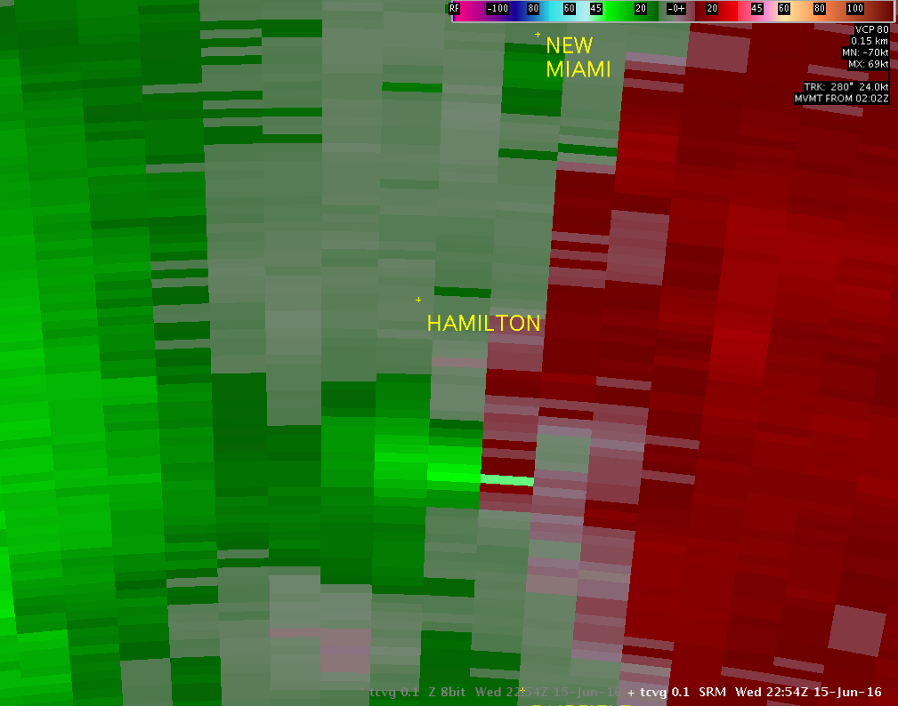
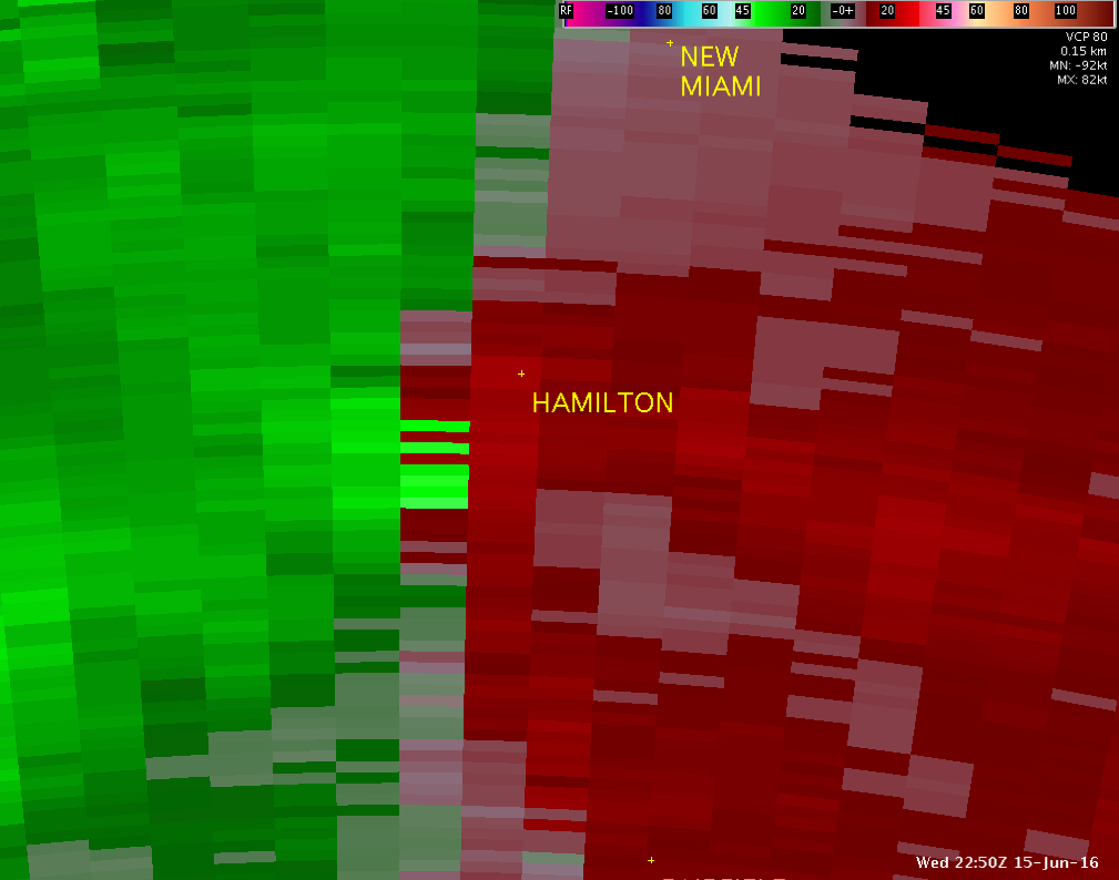
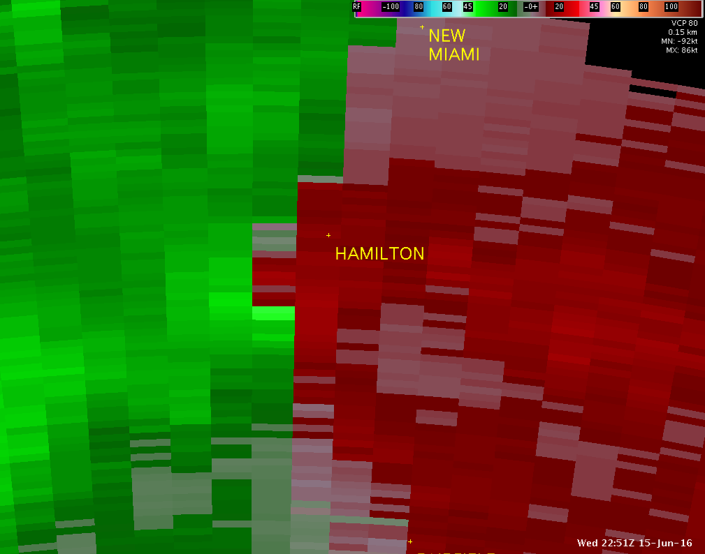
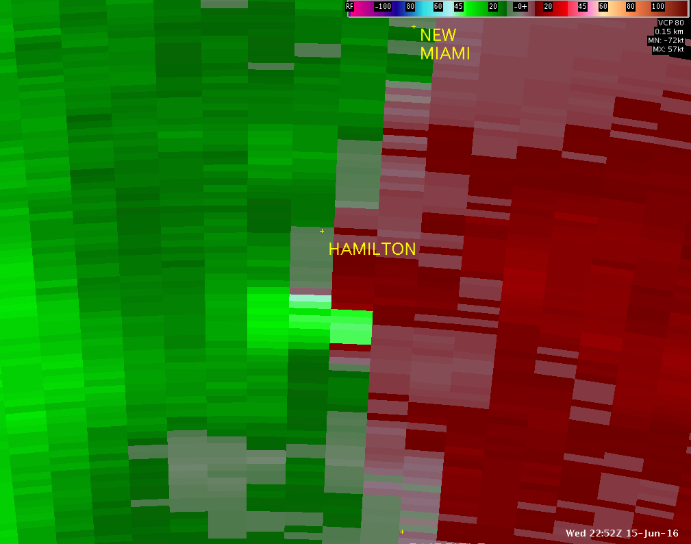
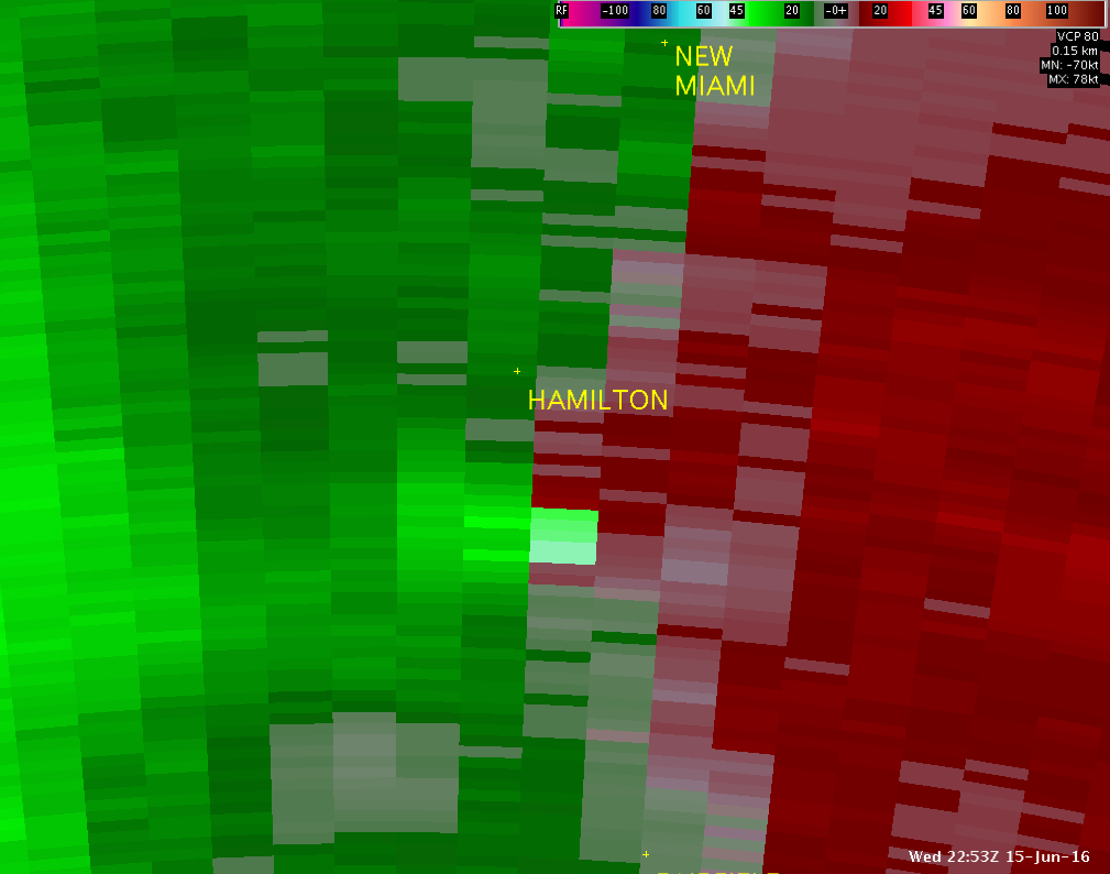
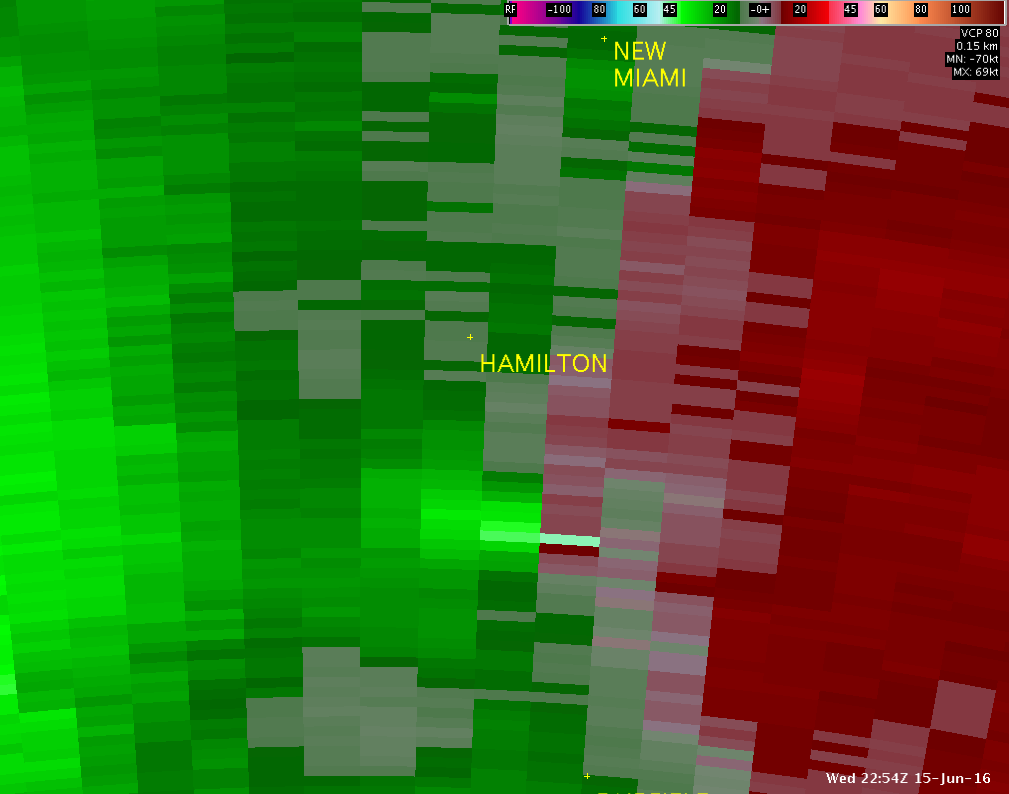
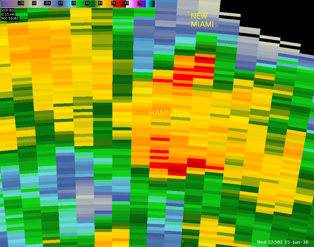
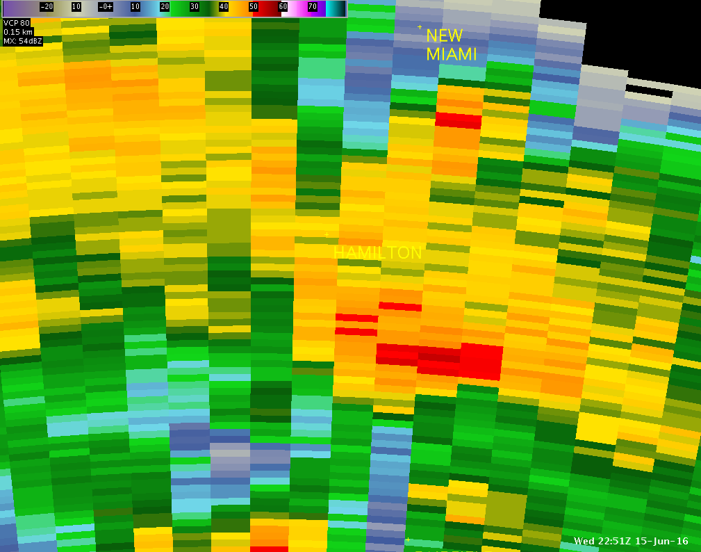
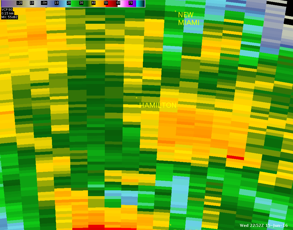
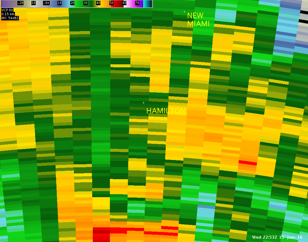
These radar images show the enhancement of wind associated with the microburst that developed near Hamilton, Ohio around 6:52 PM on June 15th. The top images show storm-relative motion (SRM) as seen from TDWR Cincinnati (TCVG). The second tier of images show the velocity (with local enhancement south of Hamilton) as seen from TCVG (bright green = strong inbound coming towards radar (to the south)). The bottom row shows the reflectivity as seen from TCVG.
| TCVG 0.1° SRM - 6:50PM | TCVG 0.1° SRM - 6:51PM | TCVG 0.1° SRM - 6:52PM | TCVG 0.1° SRM - 6:53PM | TCVG 0.1° SRM - 6:54PM |
 |
 |
 |
 |
 |
| TCVG 0.1° V -- 6:50 PM | TCVG 0.1° V -- 6:51 PM | TCVG 0.1° V -- 6:52 PM | TCVG 0.1° V -- 6:53 PM | TCVG 0.1° V -- 6:54 PM |
 |
 |
 |
 |
 |
| TCVG 0.1° Z -- 6:50 PM | TCVG 0.1° Z -- 6:51 PM | TCVG 0.1° Z -- 6:52 PM | TCVG 0.1° Z -- 6:53 PM | TCVG 0.1° Z -- 6:54 PM |
 |
 |
 |
 |
 |
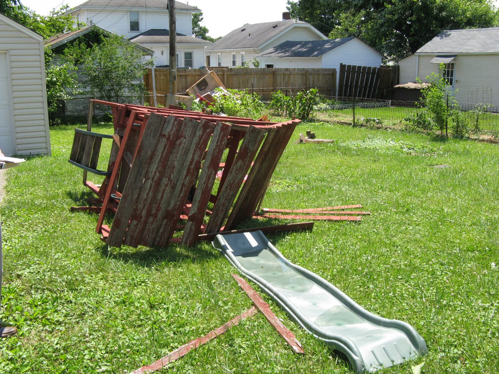
These select pictures were taken by NWS Wilmington, Ohio employees during a storm survey conducted on June 16, 2016:
 |
 |
 |
 |
 |
 |
 |
 |
 |
 |
 |
 |

