|
Tornado near Waynesville to West of Wilmington, OH |
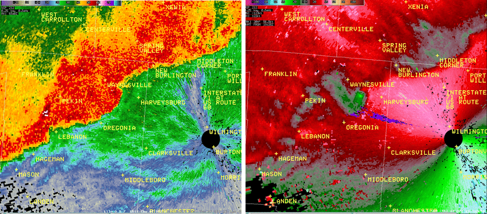
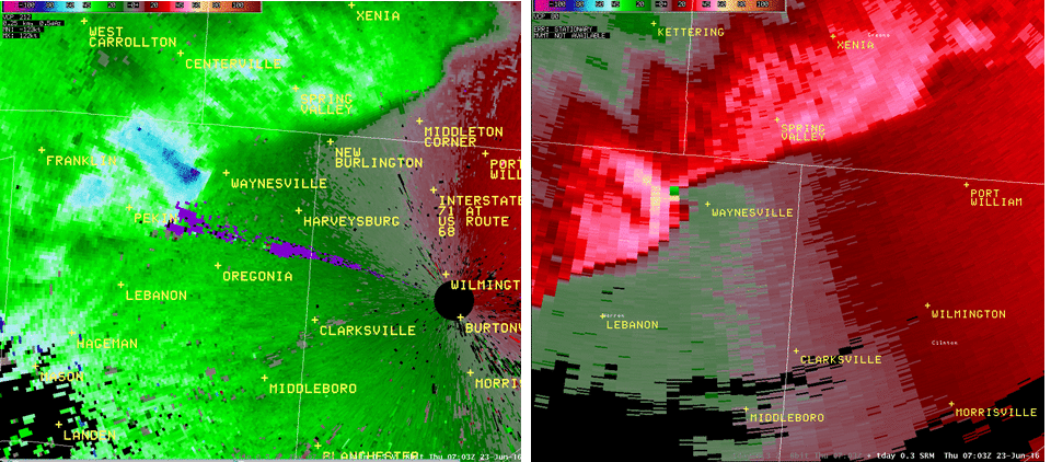
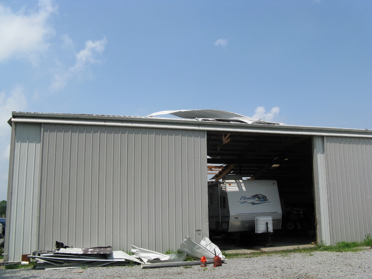
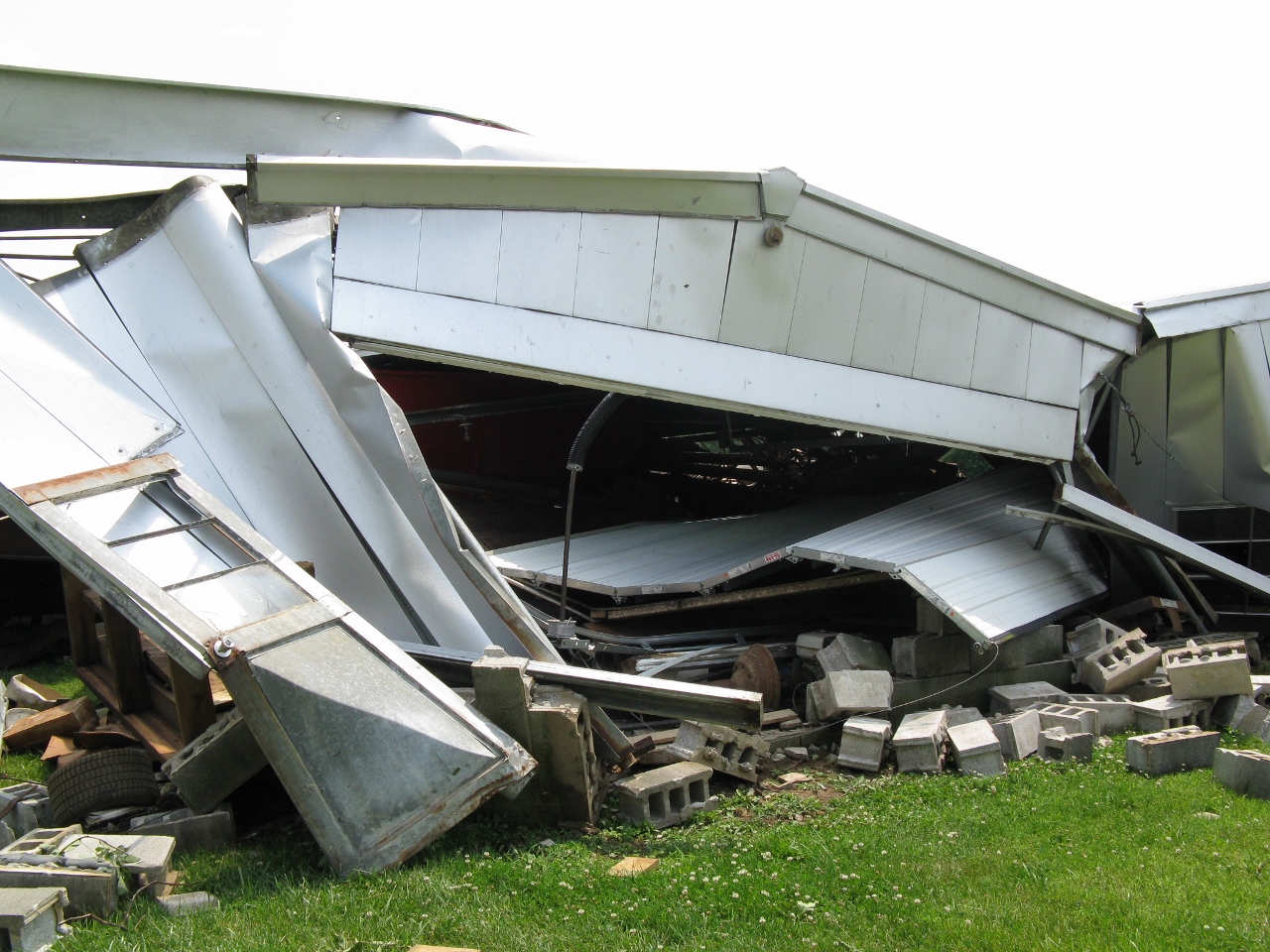
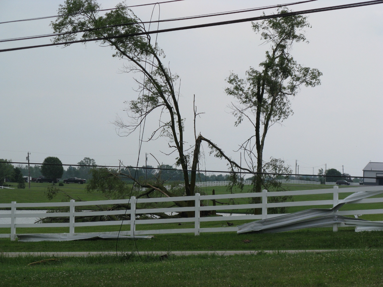
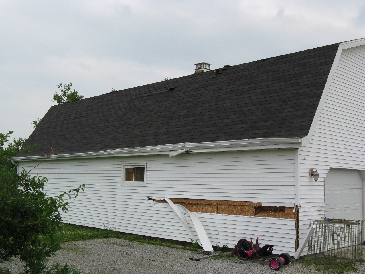
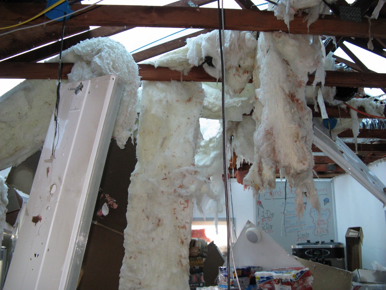
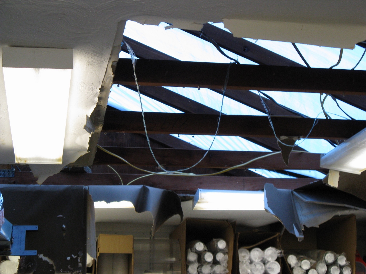
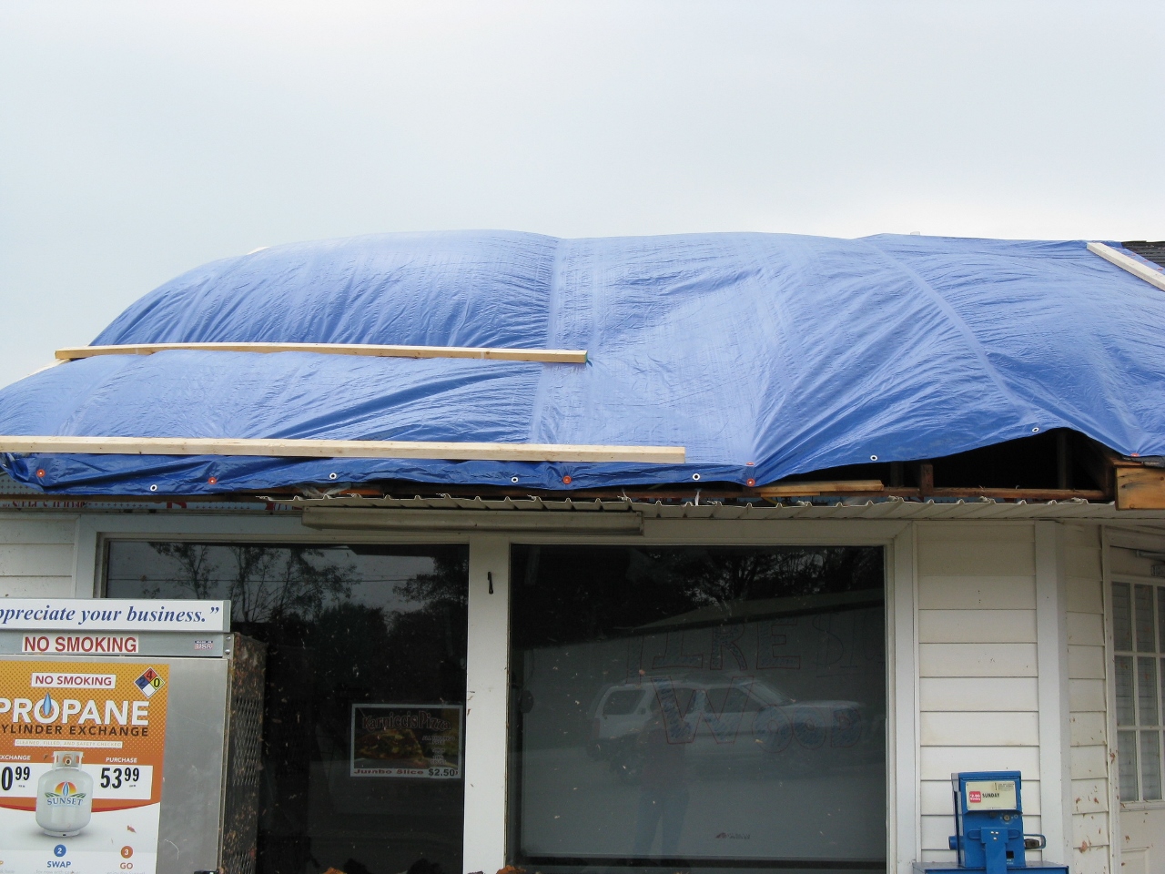
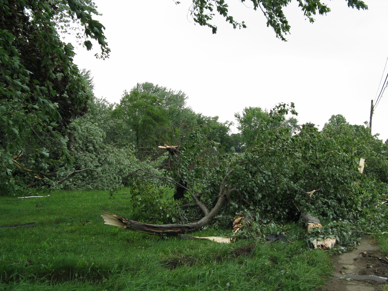
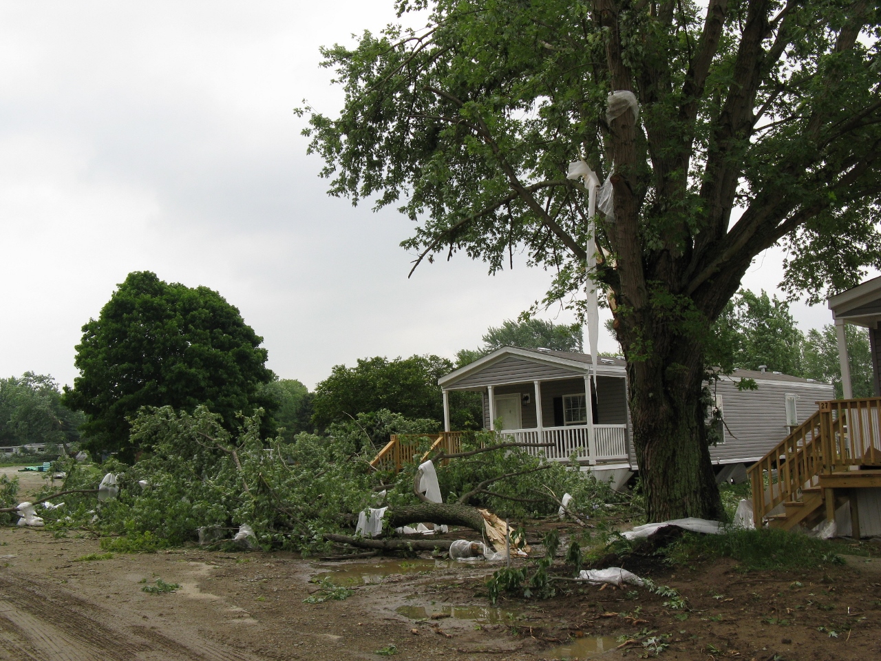
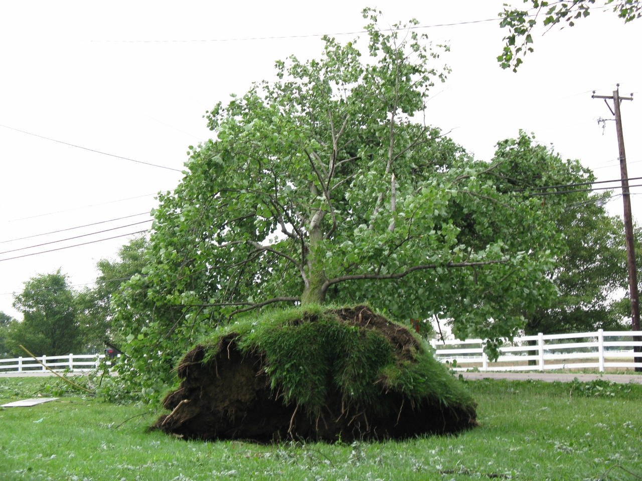
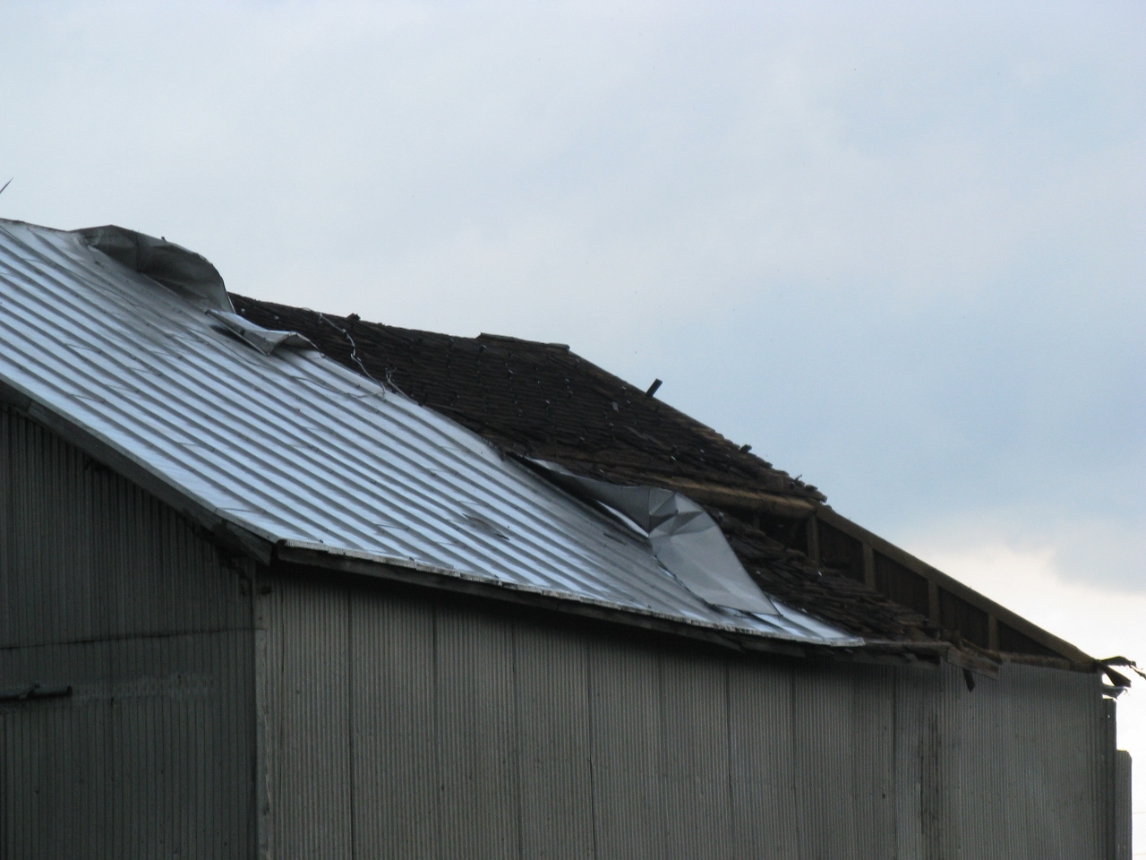
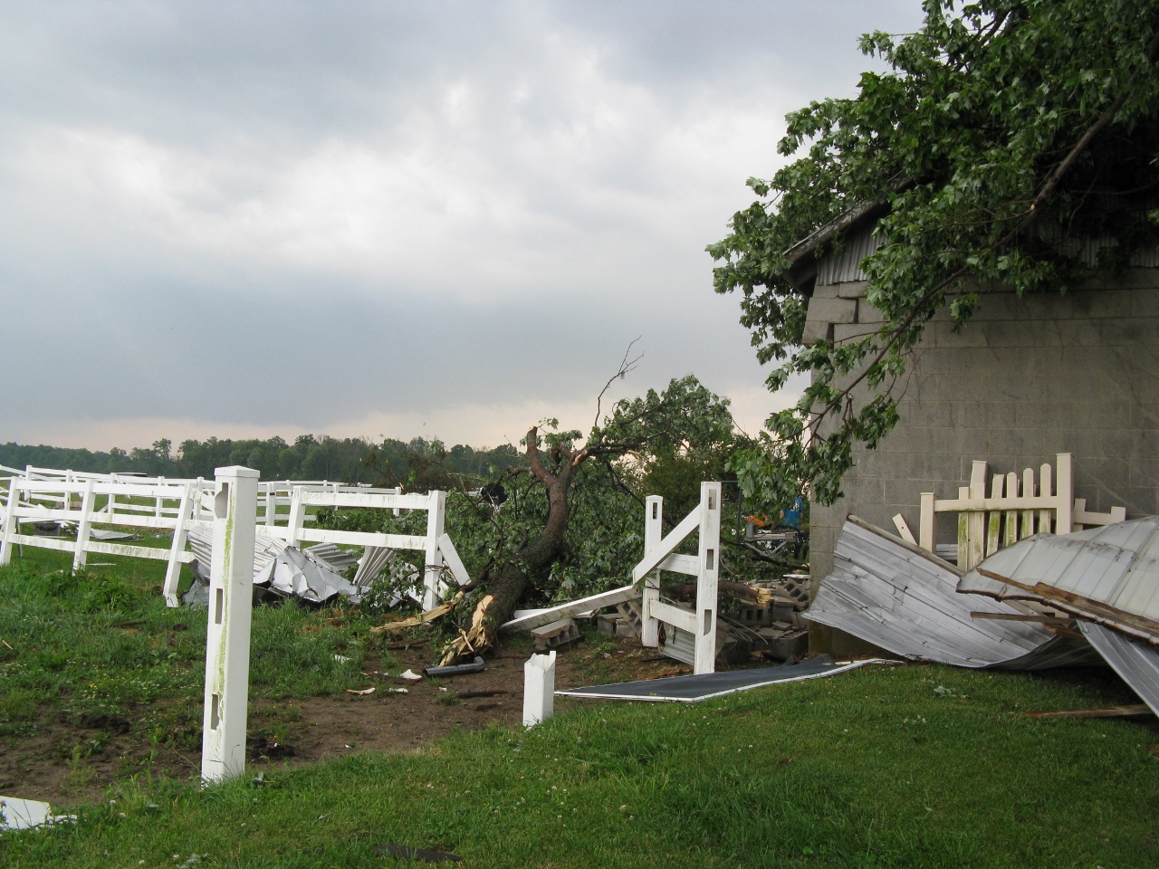
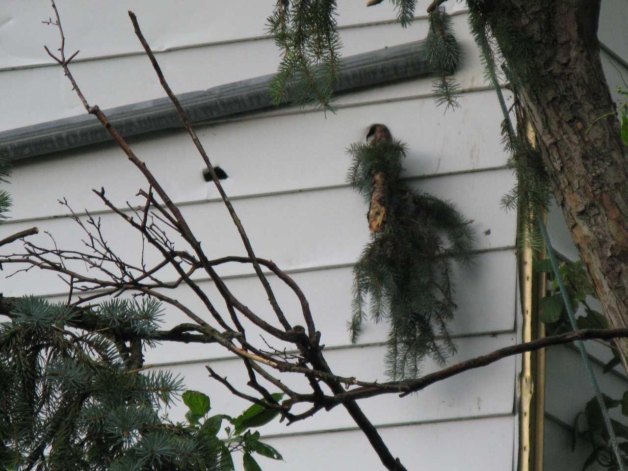
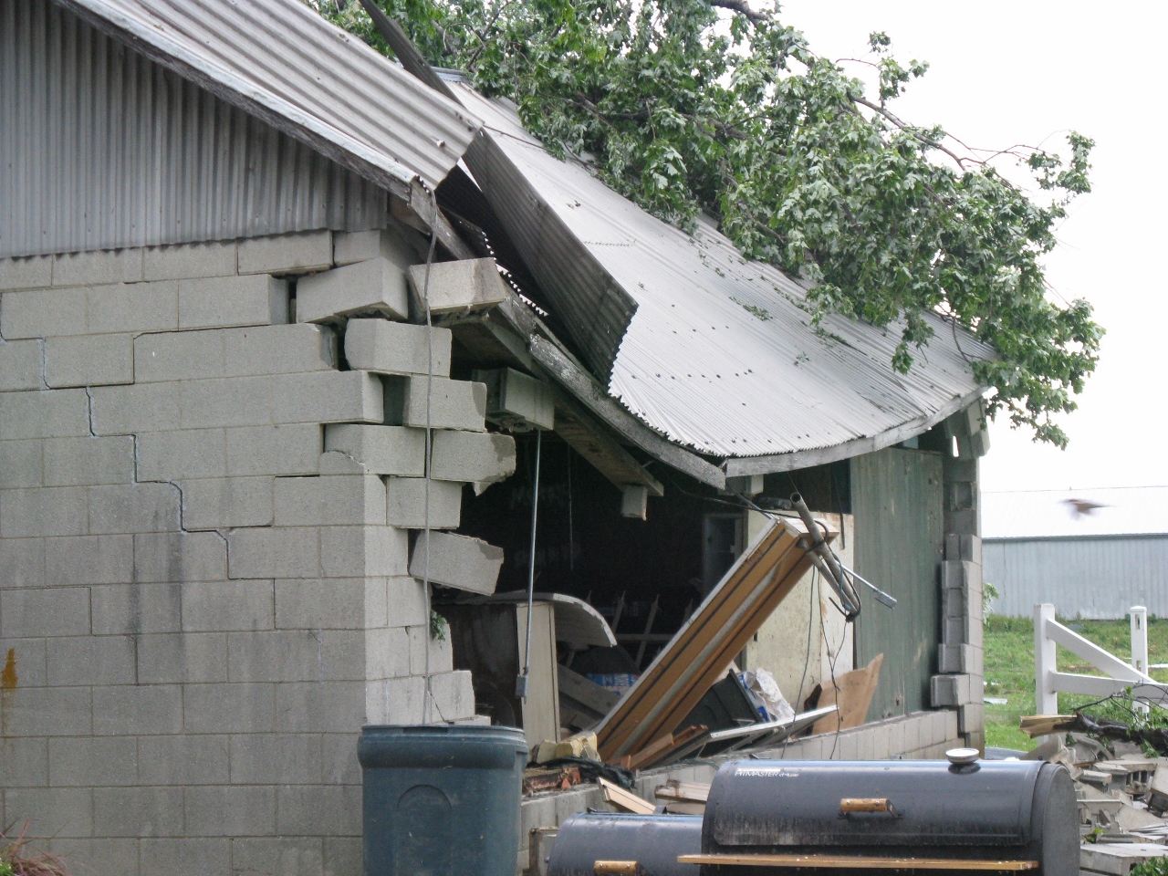
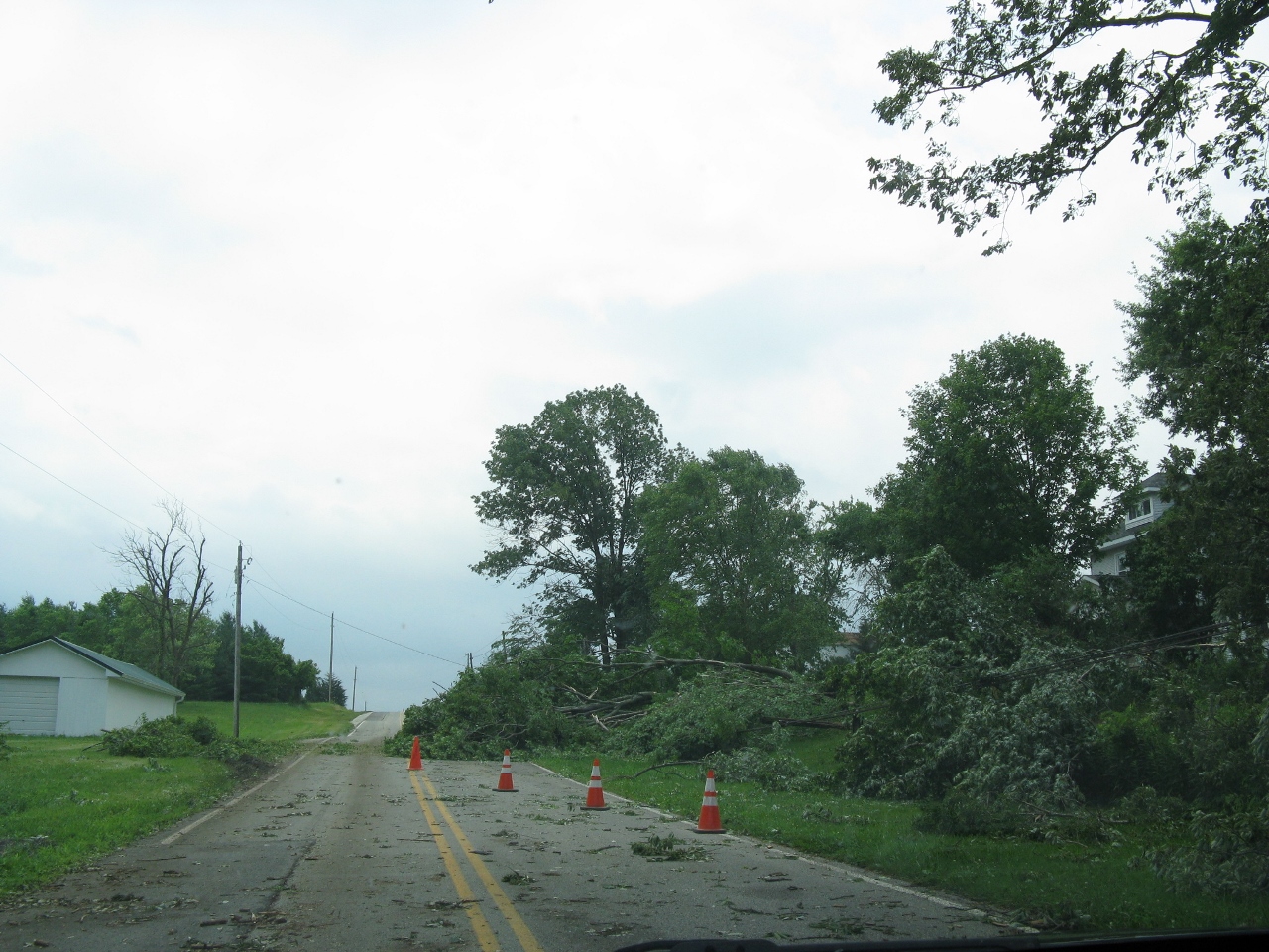
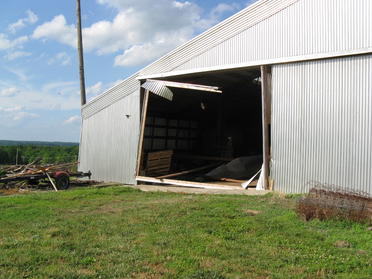
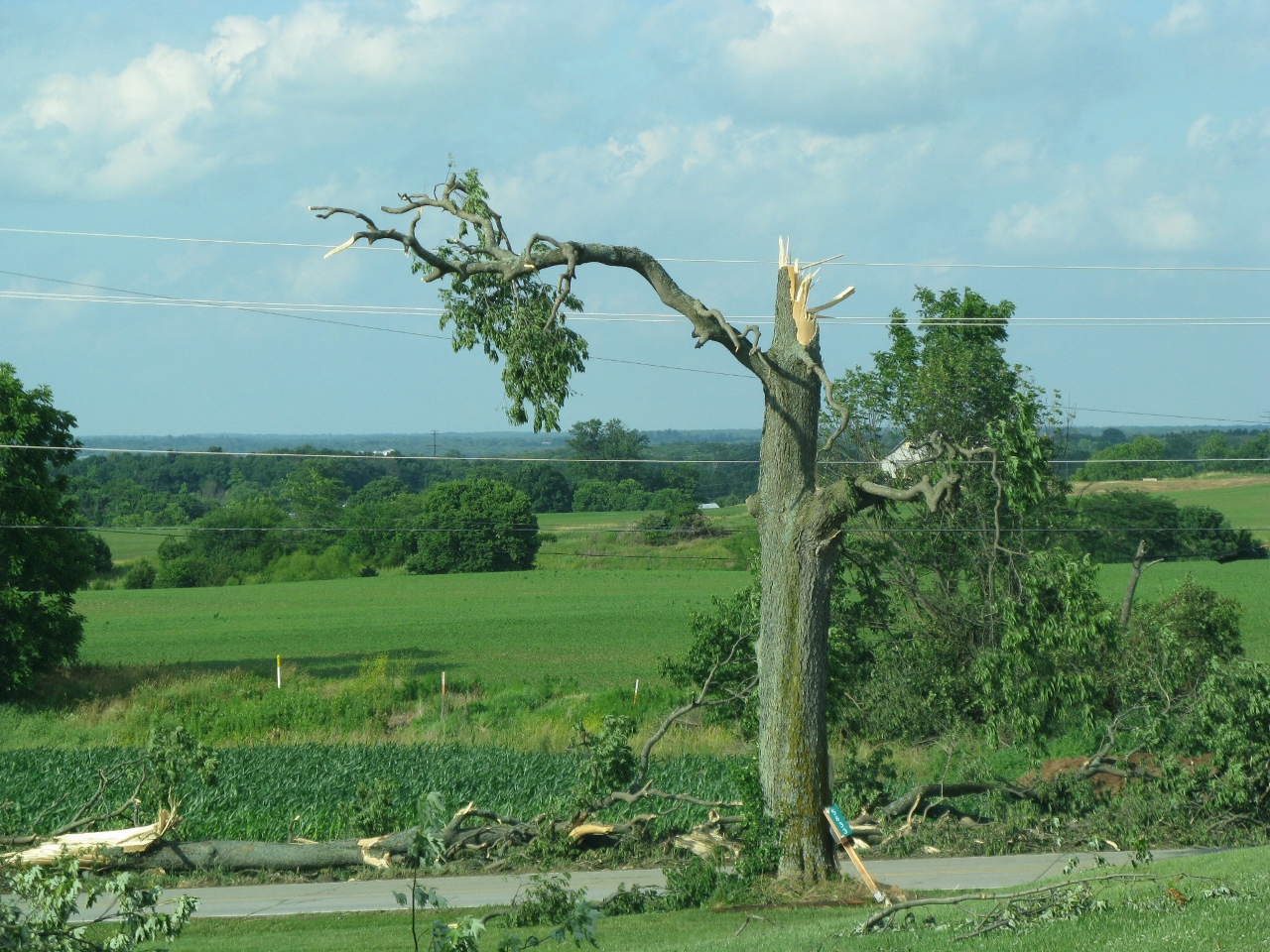
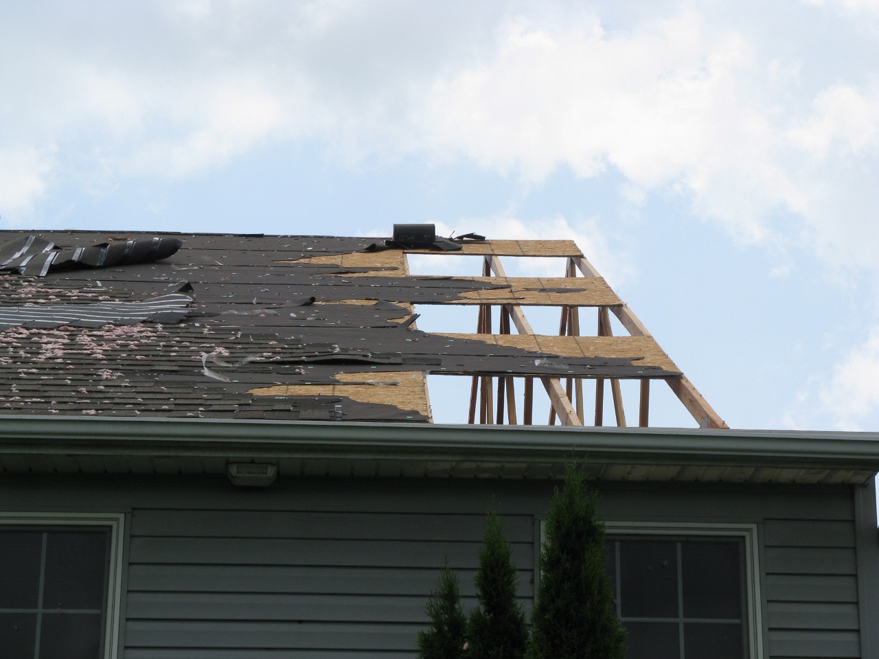
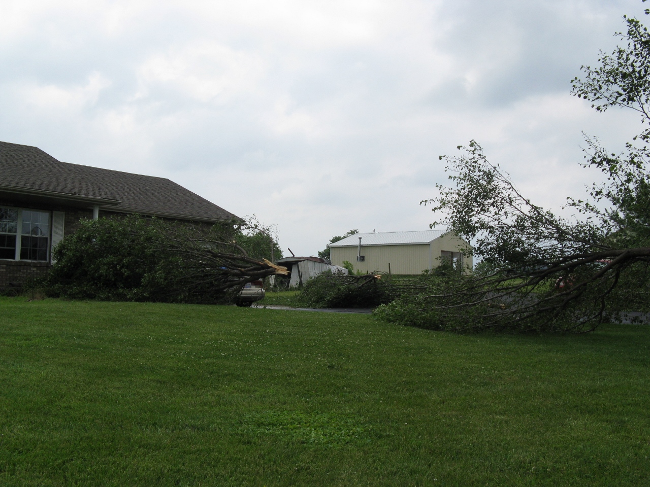
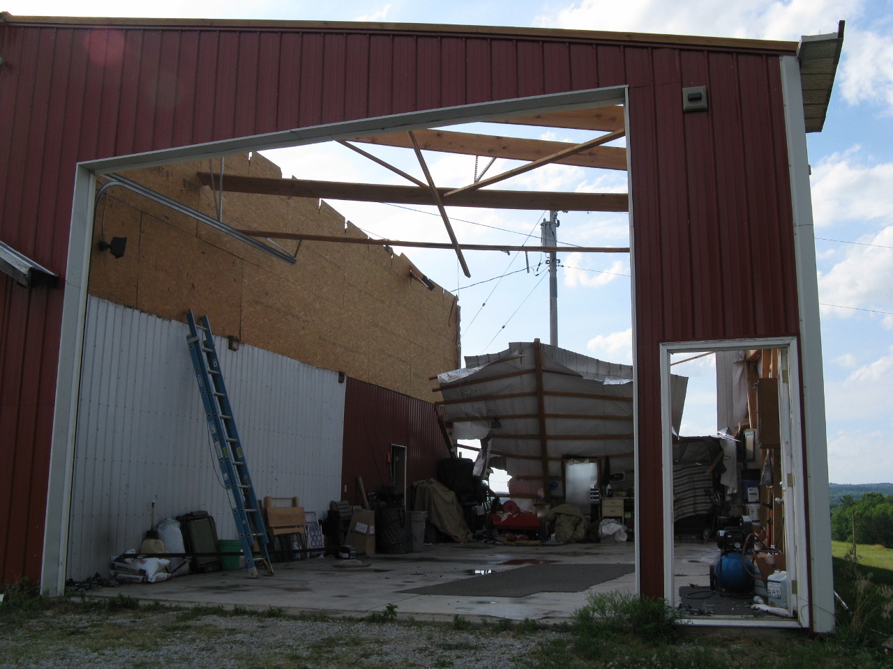
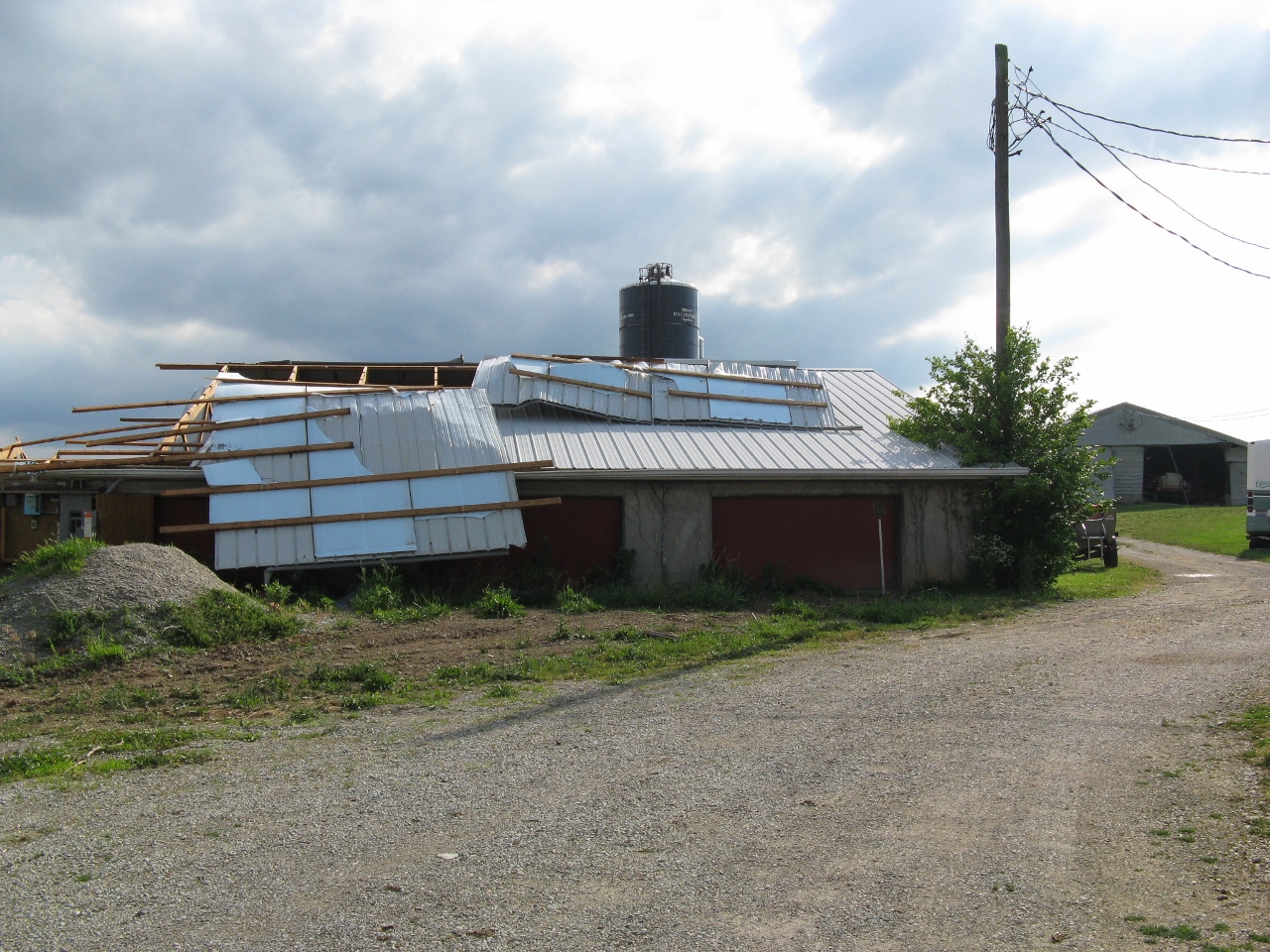
Public Information Statement...CORRECTED National Weather Service Wilmington OH 515 PM EDT FRI JUN 24 2016 ...Tornado confirmed from near Waynesville to Wilmington in Warren and Clinton Counties in Ohio... Location...Waynesville to Wilmington in Warren and Clinton Counties in Ohio Date...June 23, 2016 Estimated Time...303 AM EDT to 321 AM EDT Maximum EF-Scale Rating...EF1 Estimated Maximum Wind Speed...105 MPH Maximum Path Width...250 Yards Path Length...20.70 Miles Beginning Lat/Lon...39.534628 N / 84.114072 W Ending Lat/Lon...39.367044 N / 83.792961 W * Fatalities...0 * Injuries...0 * The information in this statement is preliminary and subject to change pending final review of the event and publication in NWS Storm Data. ...Summary... The National Weather Service in Wilmington, Ohio has confirmed a tornado from near Waynesville to Wilmington in Warren and Clinton Counties in Ohio on June 22, 2016. Previous public information statements had listed this as separate tornadoes, however additional information has led to the conclusion that a single tornado occurred from near Waynesville to near Wilmington. Although there were subtle indications that the tornado may have lifted at times during the path, any indications of this are short lived. The tornado first touched down at a campground on State Route 73 near Waynesville. Trees were snapped, platform tents were damaged, mattresses were thrown, and there was evidence of a tornadic circulation in the grass. Evidence of the path continued southeast across U.S. Route 42 south of Waynesville with snapped trees. Barn damage occurred at a residence off of North Clarksville Road. Large sections of metal roofing were uplifted. Barn doors also were blown in. Trees were snapped and were facing in a convergent pattern. Tree damage continued on further down North Clarksville Road. Additional trees were snapped near Caesar Creek Lake south of Harveysburg and also on Harveysburg Road. Southeast of Interstate 71 on Doster Road two homes sustained damage. There was loss of roofing material and also the winds had made one side of the house bulge outwards. Debris splatter was present on several sides of a home. Trees were uprooted and snapped in this area. The brick wall of a barn collapsed. Sections of roof were uplifted from barns. Further southeast tree damage occurred along Hadley Road and South Clarksville Road. In the Ogden area off of Ogden Road, several trees were snapped. A tree also fell on a home in this area. There was again evidence of a tornadic signature with leaf debris on all sides of a barn. Trees and power lines were down along the path on Linkhart Road. Off of State Route 730 damage occurred to mobile homes. There were several trees snapped in this area and an uprooted tree. In addition, there was a convenience store that sustained loss of roofing materials with only some of the wooden beams remaining on part of the structure. Insulation was plastered to all sides of the building. A house lost portions of the metal roof in this vicinity. Damage to siding occurred on a barn. Multiple homes sustained damaged on Mcguinn Road. One home had extensive siding damage and partial loss of a wall. The roof also sustained damage at this house. Insulation was plastered against several sides of the building. A small shed was destroyed. Debris was tossed into a nearby field. The foundation of one garage was shifted slightly. The garage door was pushed in at a residence and there was also collapse of the attached garage. Two of the three sides of the garage were gone with the garage door pushed in and collapsed on a third side. There were some subtle indications that damage continued into the crops in the field. A large shed lost half of the roof in this area. Fence damage occurred to a nearby property. Trees and power poles were damaged along U.S. Route 68 south of Wilmington. Tree damage continued on East Dalton Road, Cuba Road, Ireland Road, and Berlin Road. Also on Berlin Road a house lost a portion of the roof and a garage door was pushed inward. Damage occurred to another home on Leslie Drive. There was partial loss of the roof and insulation was plastered against the house on all sides. On Brown Road a tree was uprooted and part of the roof of a barn was uplifted. On State Route 134 a shed was blown and tossed off of the foundation. Items from this location were tossed far into a field. At another residence there was evidence of tornadic circulation in the grass. Multiple barns sustained damage including damage to the roofs and walls. Silos were also tossed into a field. The house had glass that was broken sticking into an interior wall of the house. Damage was sustained to part of the roof. Trees were also snapped at this location. At the end of the path off of Crouse Road a barn was destroyed and a silo was damaged. Tree damage was observed in a field. For reference...the Enhanced Fujita Scale classifies tornadoes into the following categories: EF0...wind speeds 65 to 85 mph. EF1...wind speeds 86 to 110 mph. EF2...wind speeds 111 to 135 mph. EF3...wind speeds 136 to 165 mph. EF4...wind speeds 166 to 200 mph. EF5...wind speeds greater than 200 mph. $$ Novak |
 |
 |
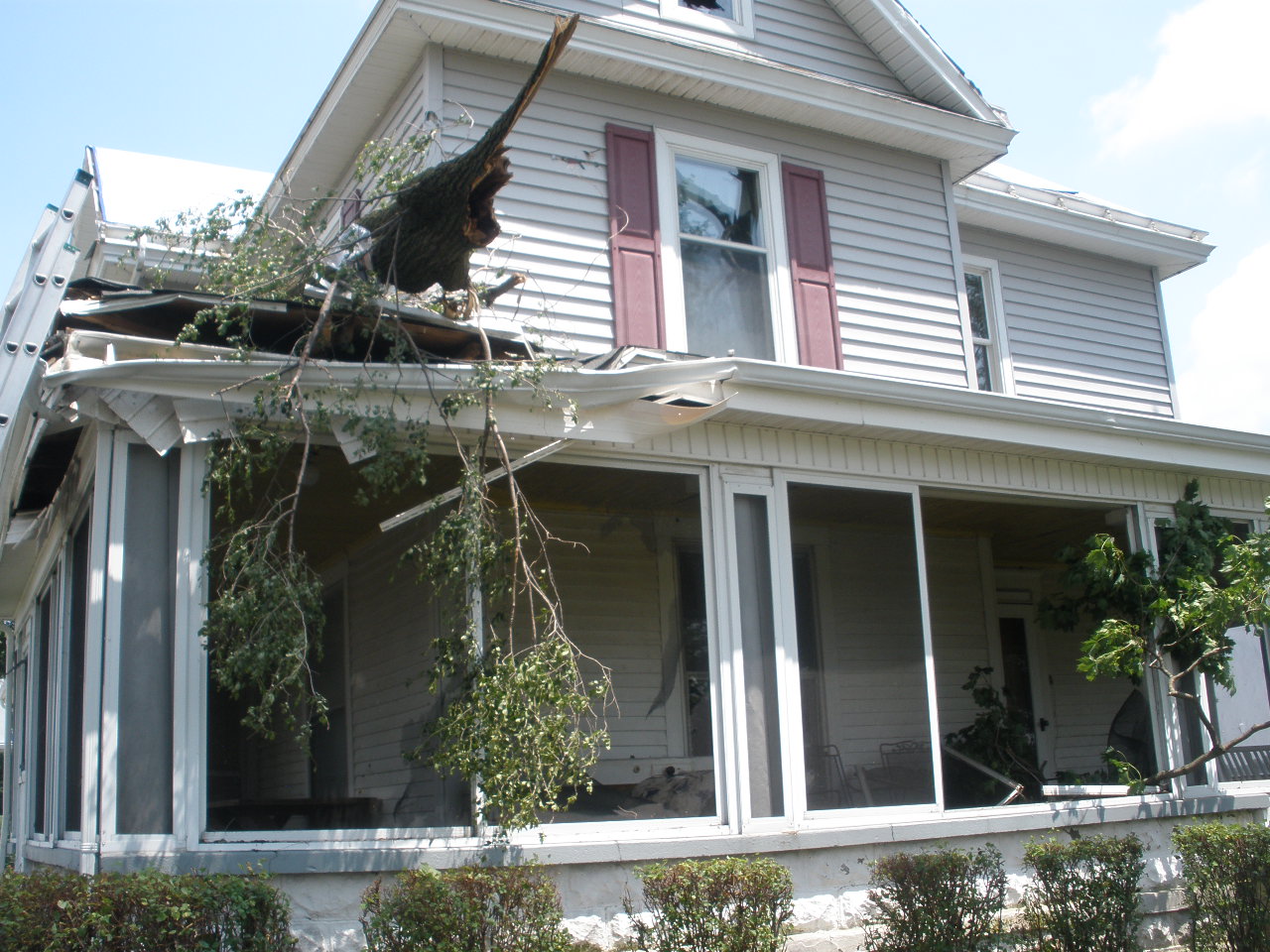
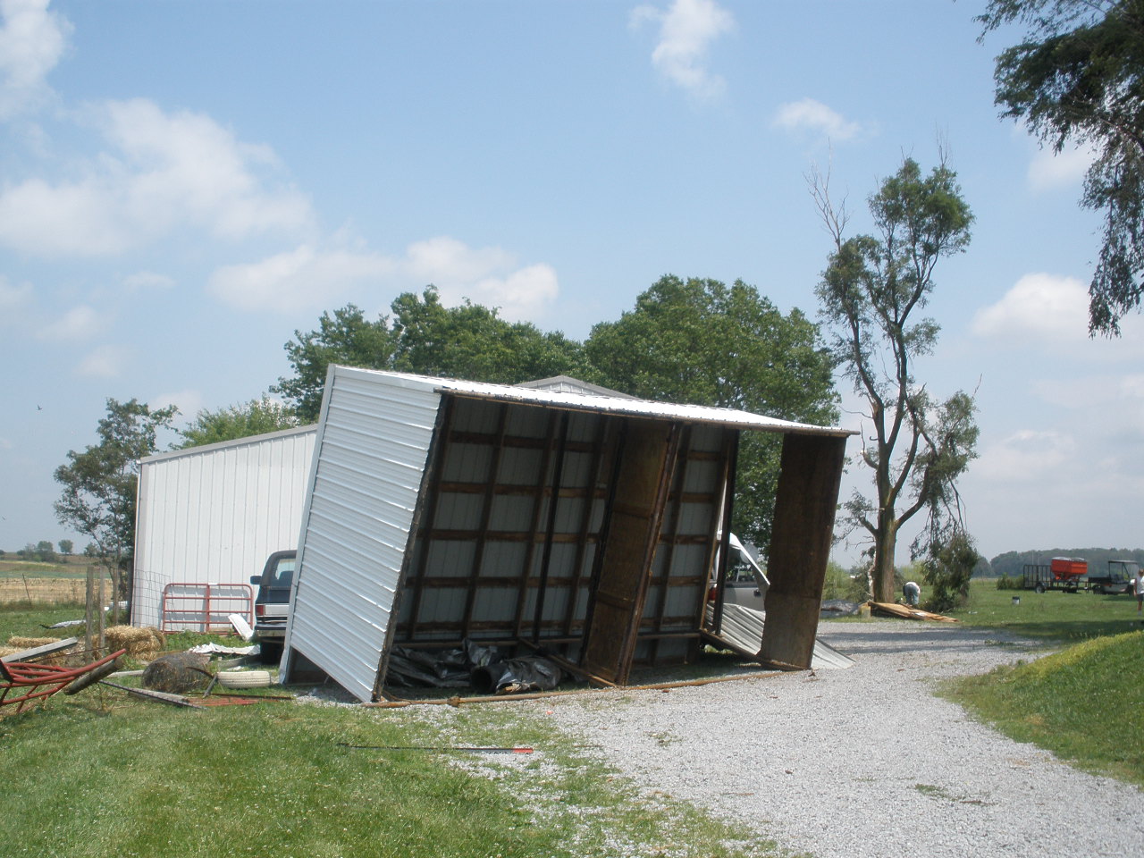
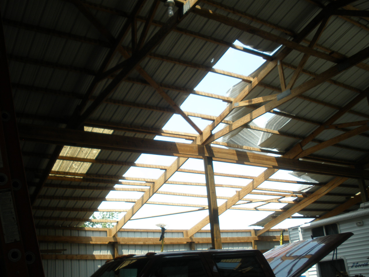
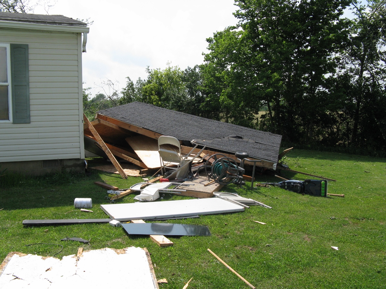
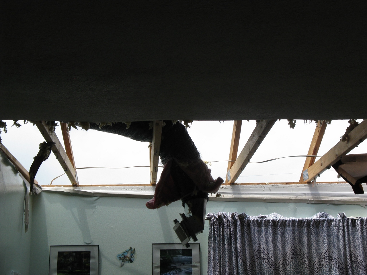
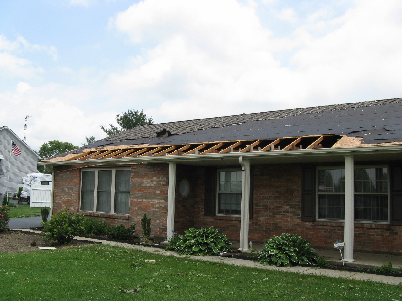
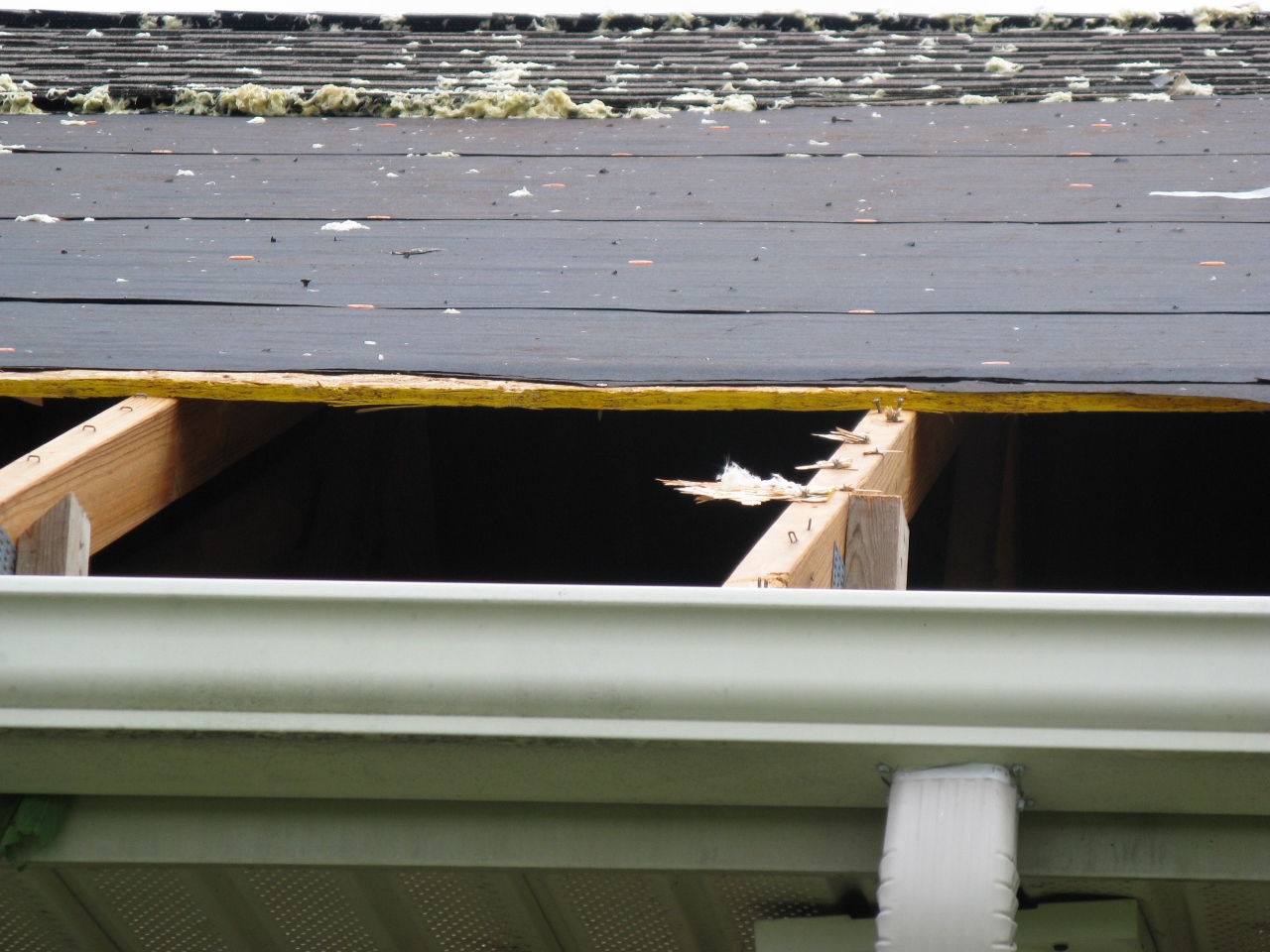
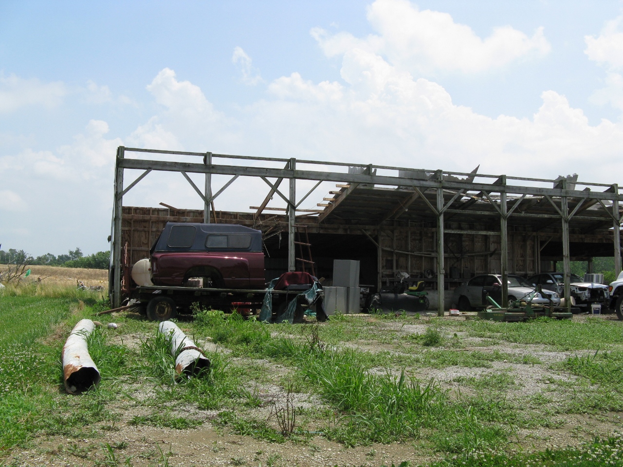
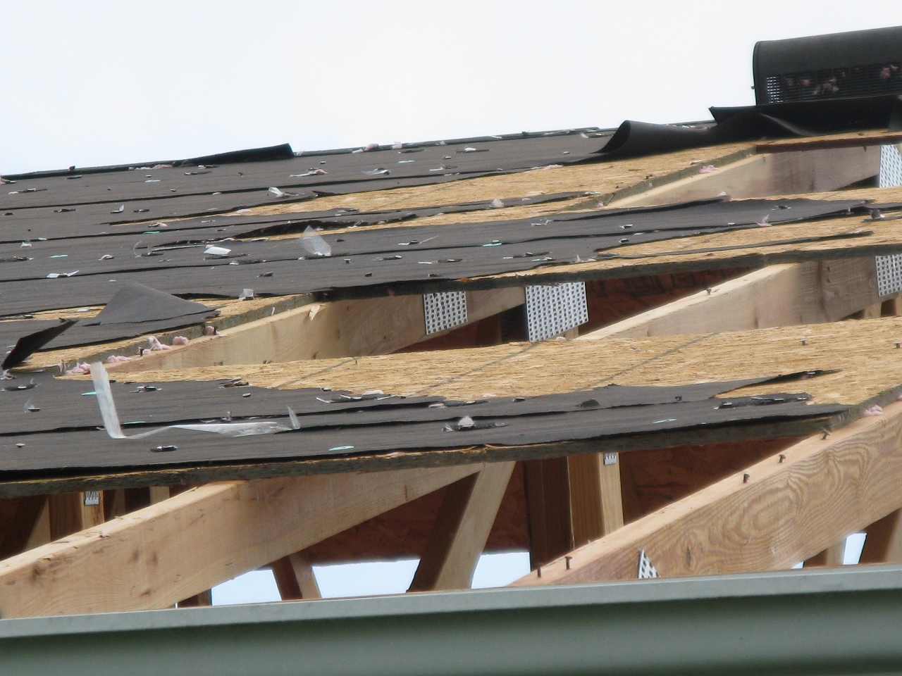
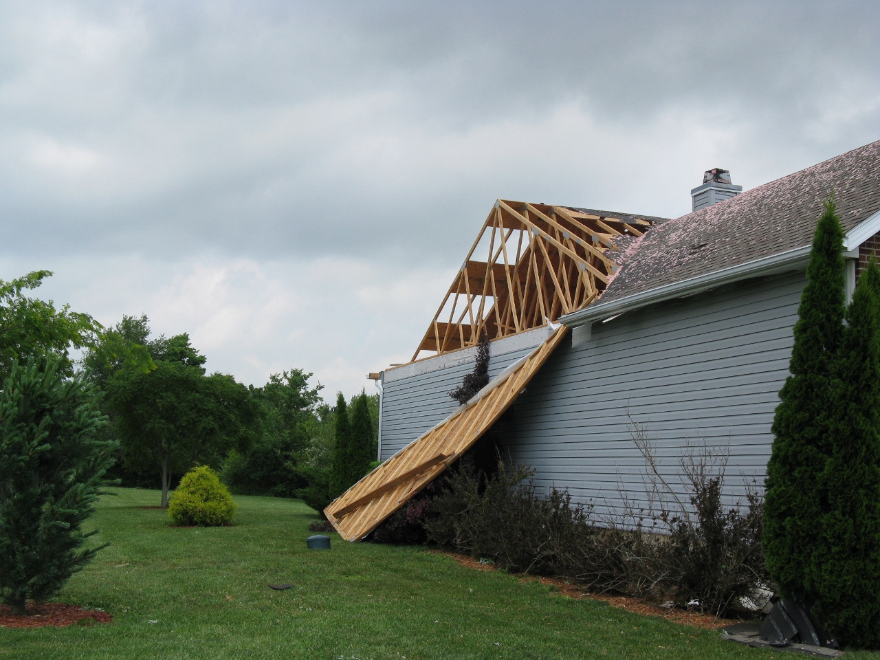
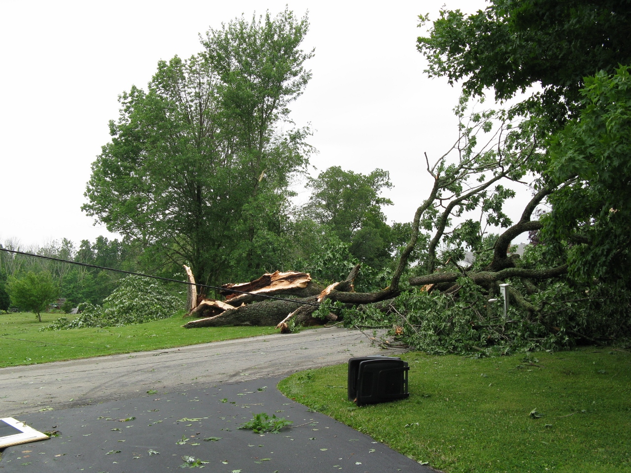
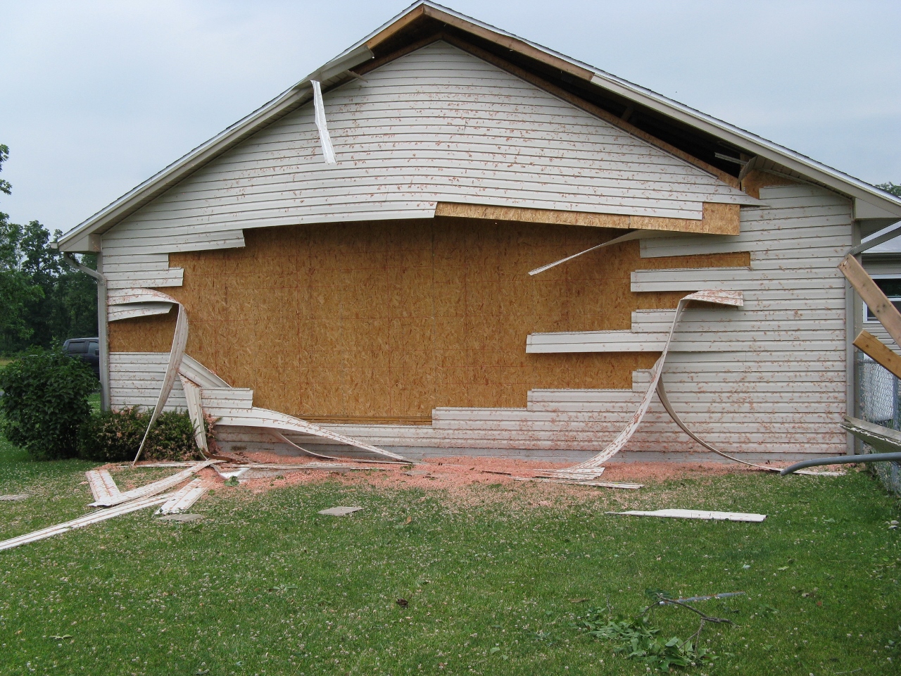
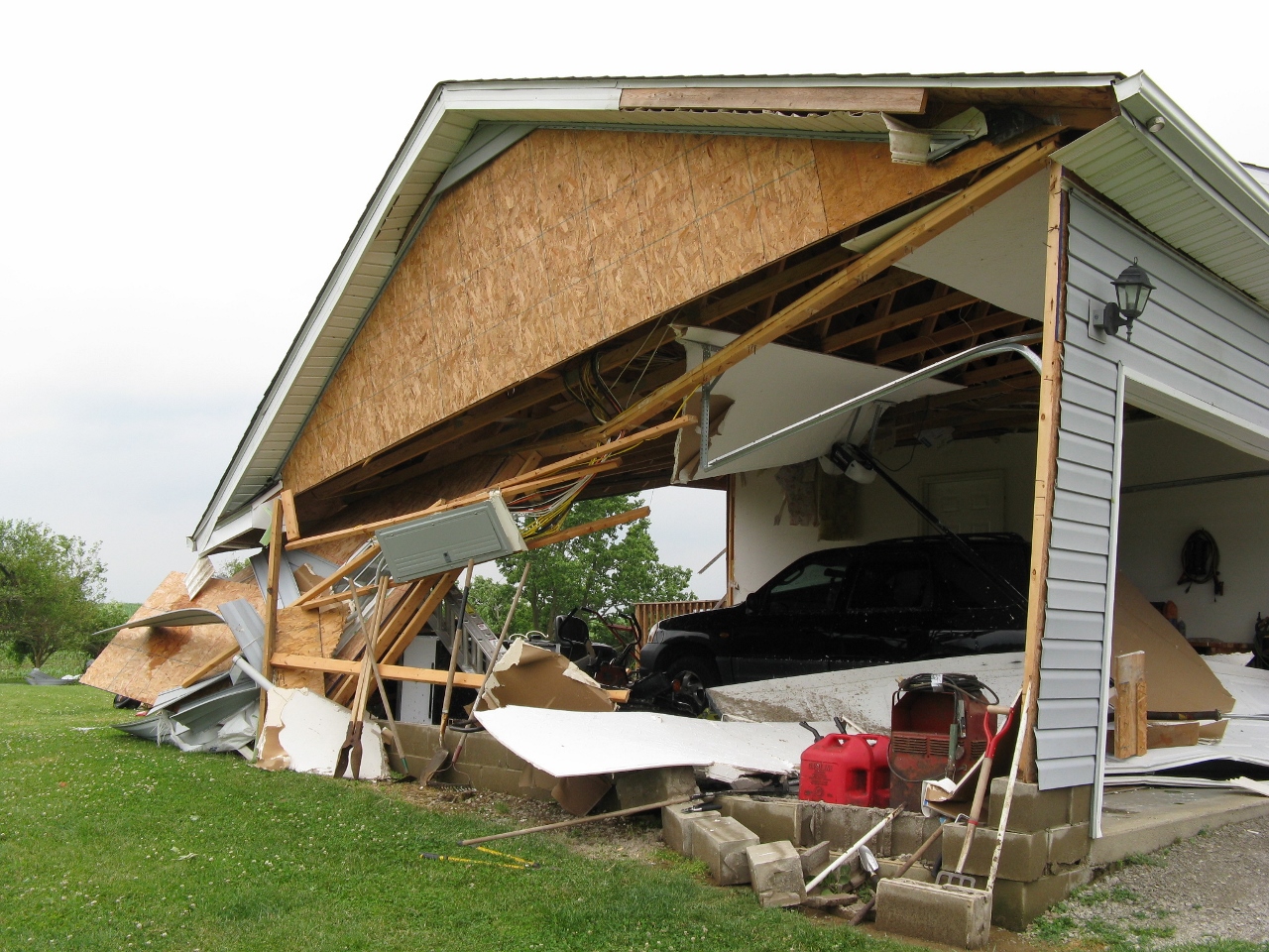
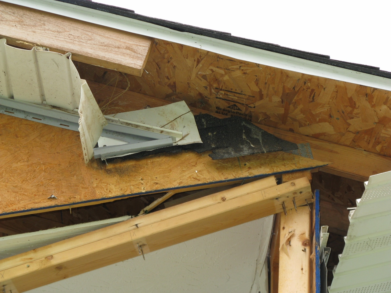
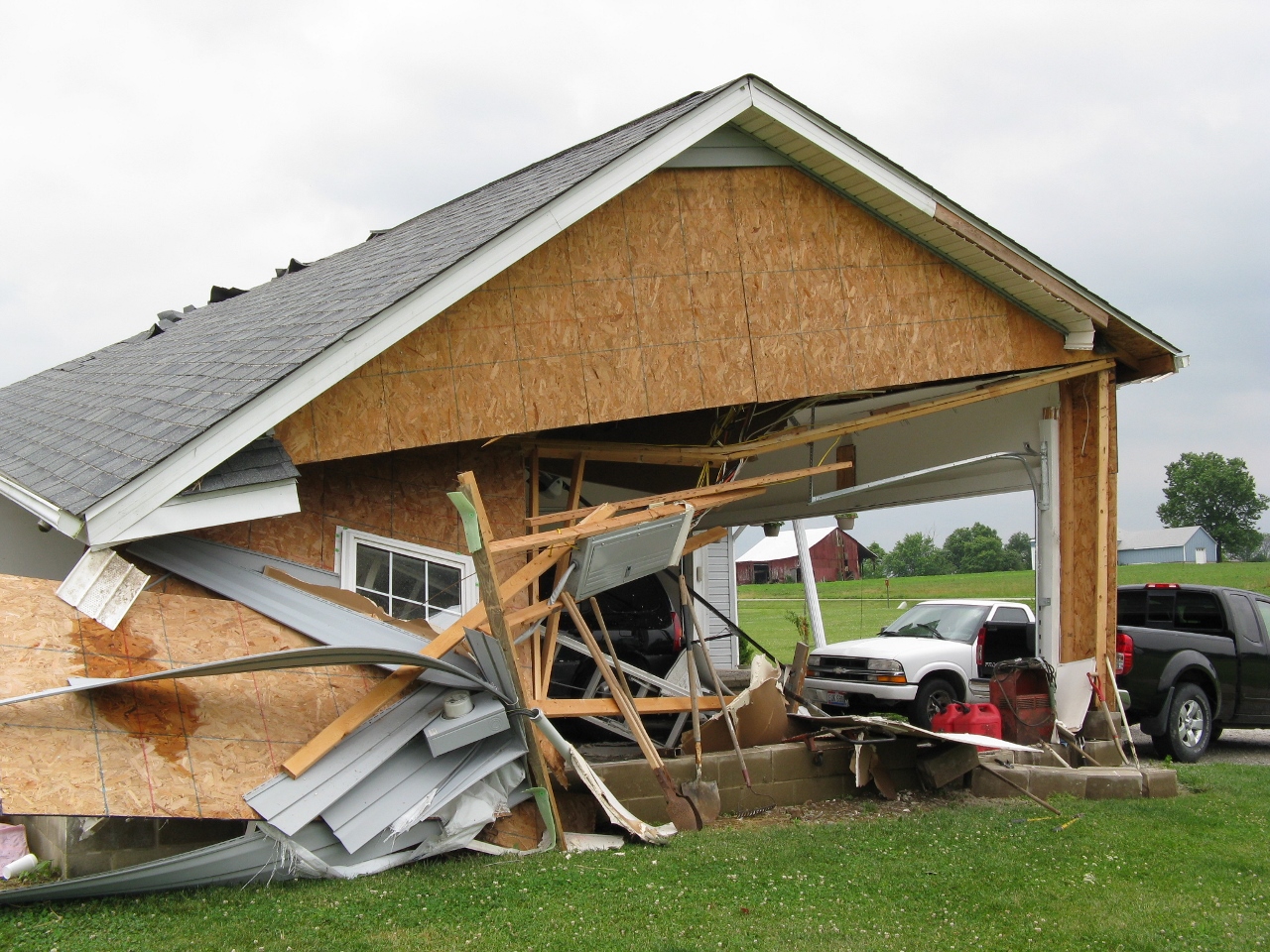
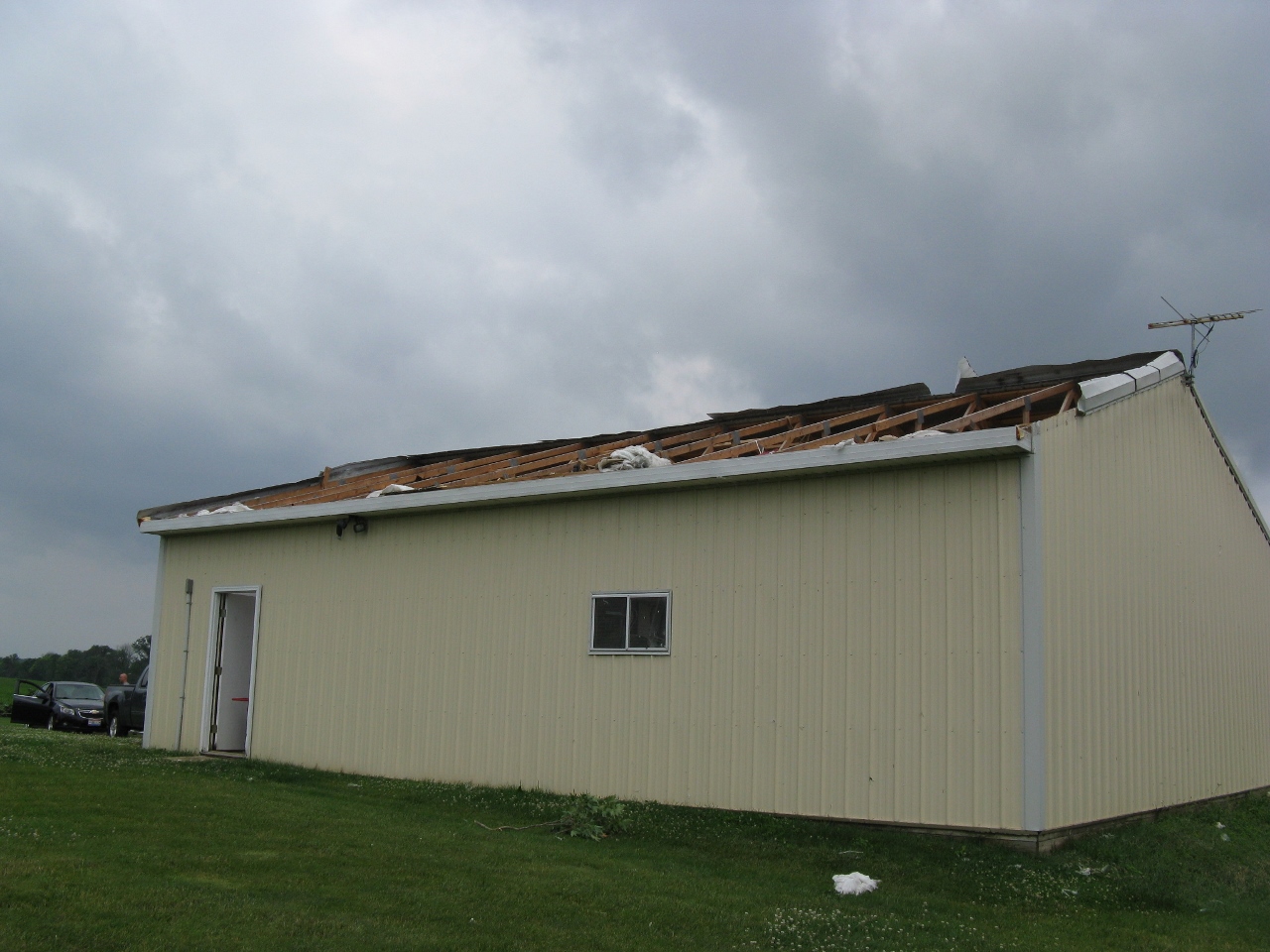
These select pictures were taken by NWS Wilmington, Ohio employees during a storm survey conducted on June 23, 2016:
 |
 |
 |
 |
 |
 |
 |
 |
 |
 |
 |
 |
 |
 |
 |
 |
 |
 |
 |
 |
 |
 |
 |
 |
 |
 |
 |
 |
 |
 |
 |
 |
 |
 |
 |
 |
 |
|
 |
 |
 |
 |
 |
 |
 |
 |
 |
 |
 |
 |
 |
 |
 |
 |
 |
 |
 |
 |
 |
 |
 |
 |
 |
 |
 |
 |
 |
 |
 |

