|
Tornado near Westwood and Straight-Line Winds Near Clifton |
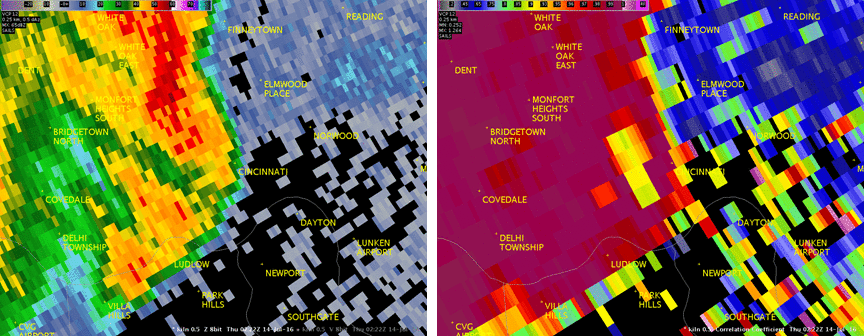
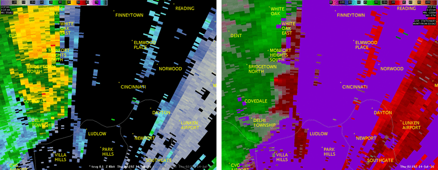
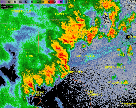
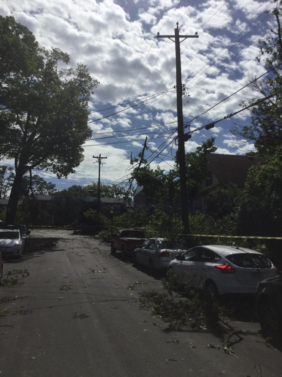
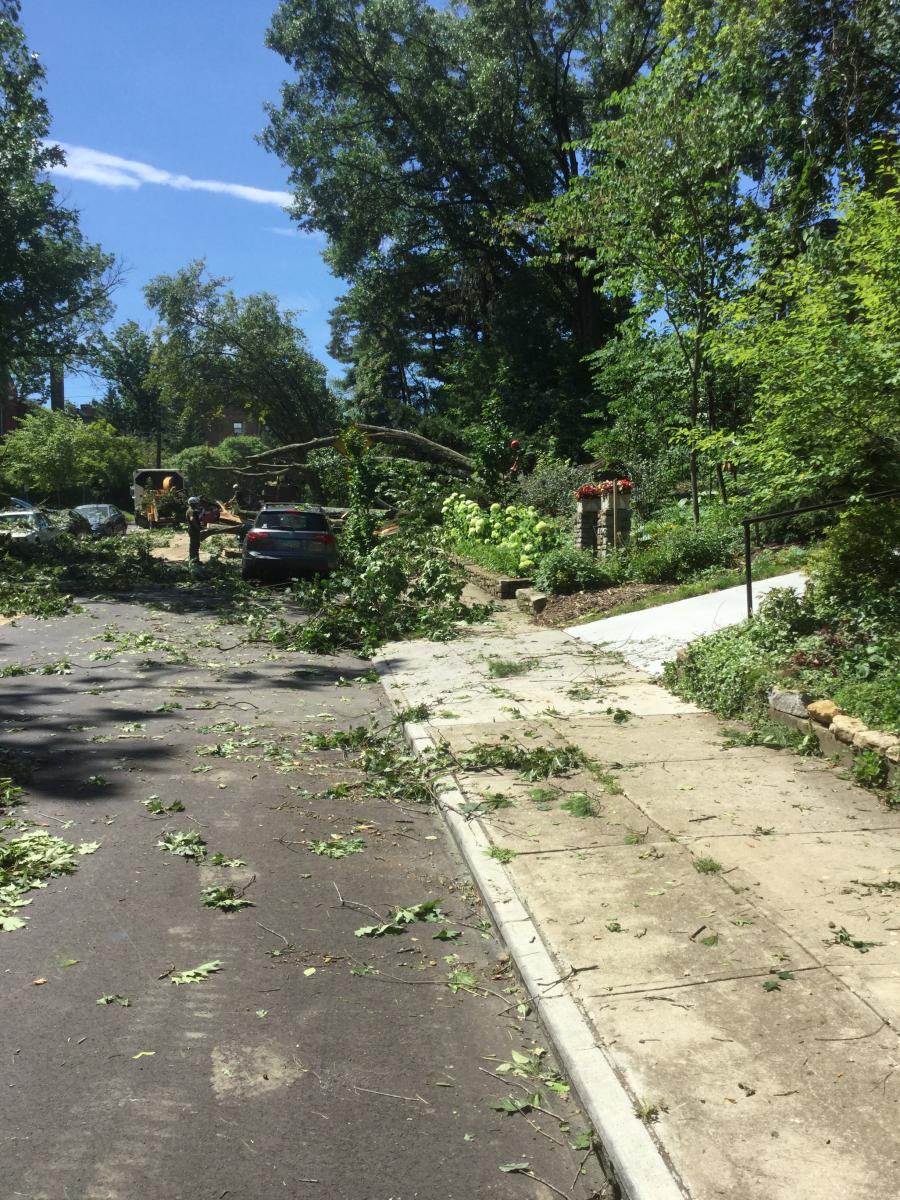
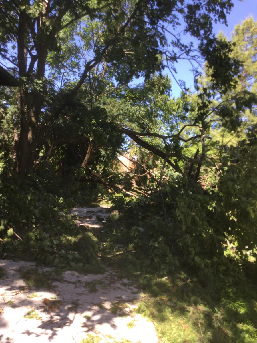
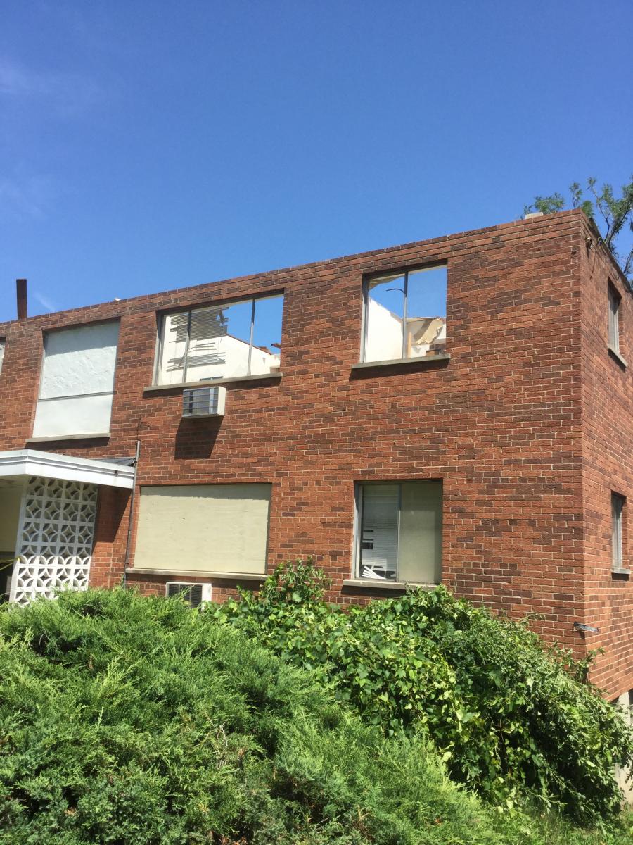
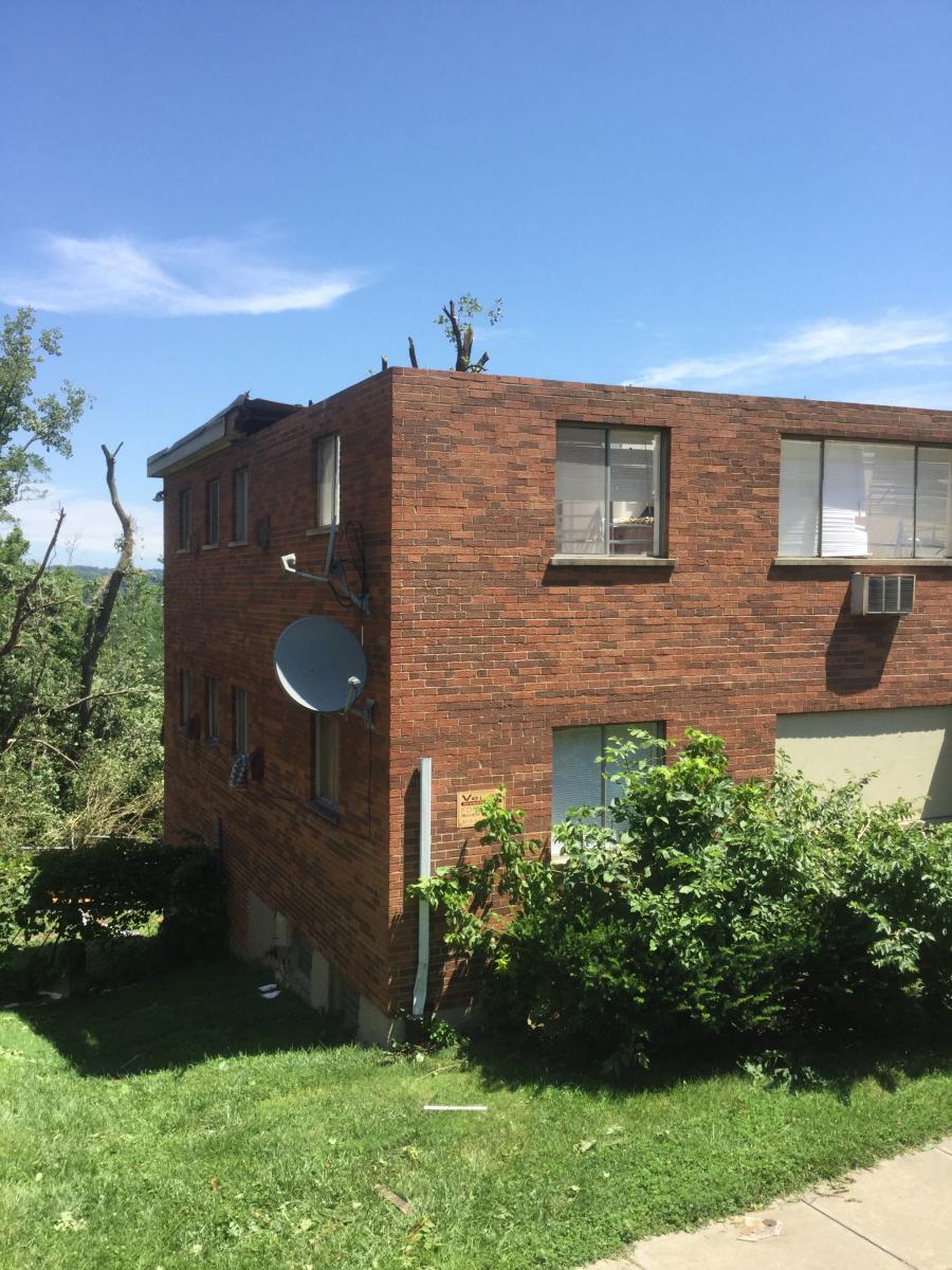
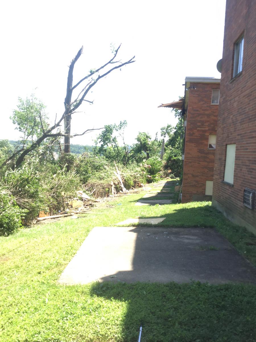
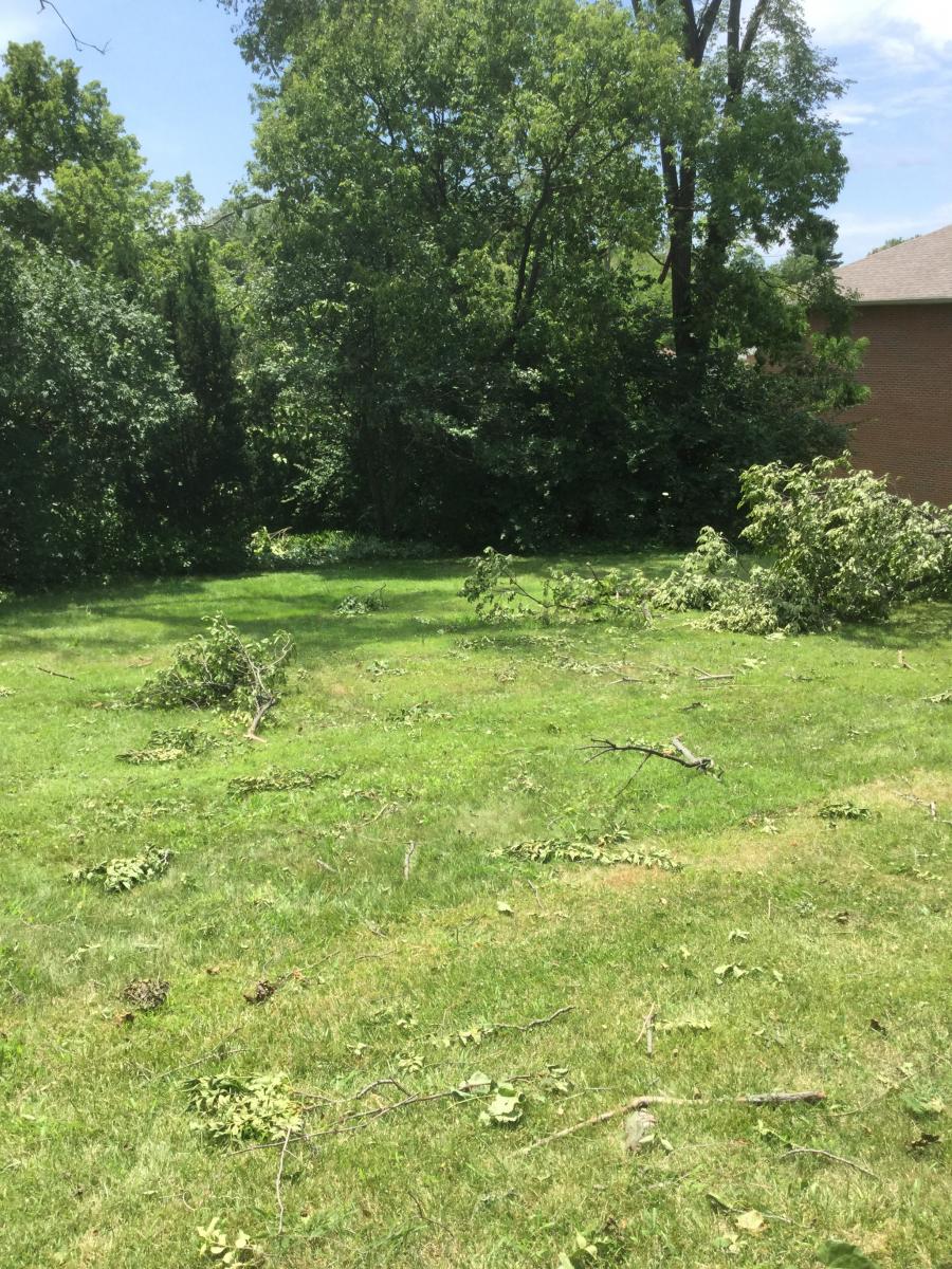
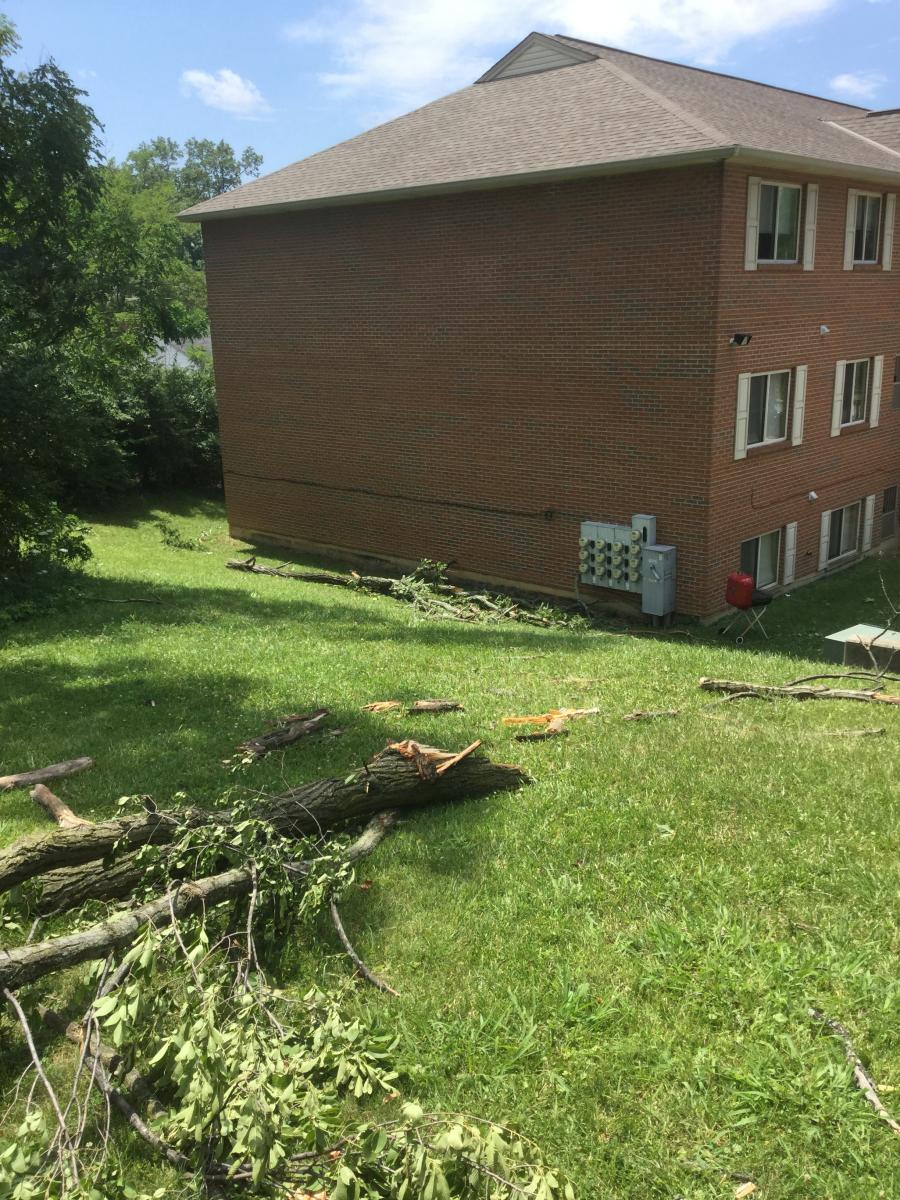
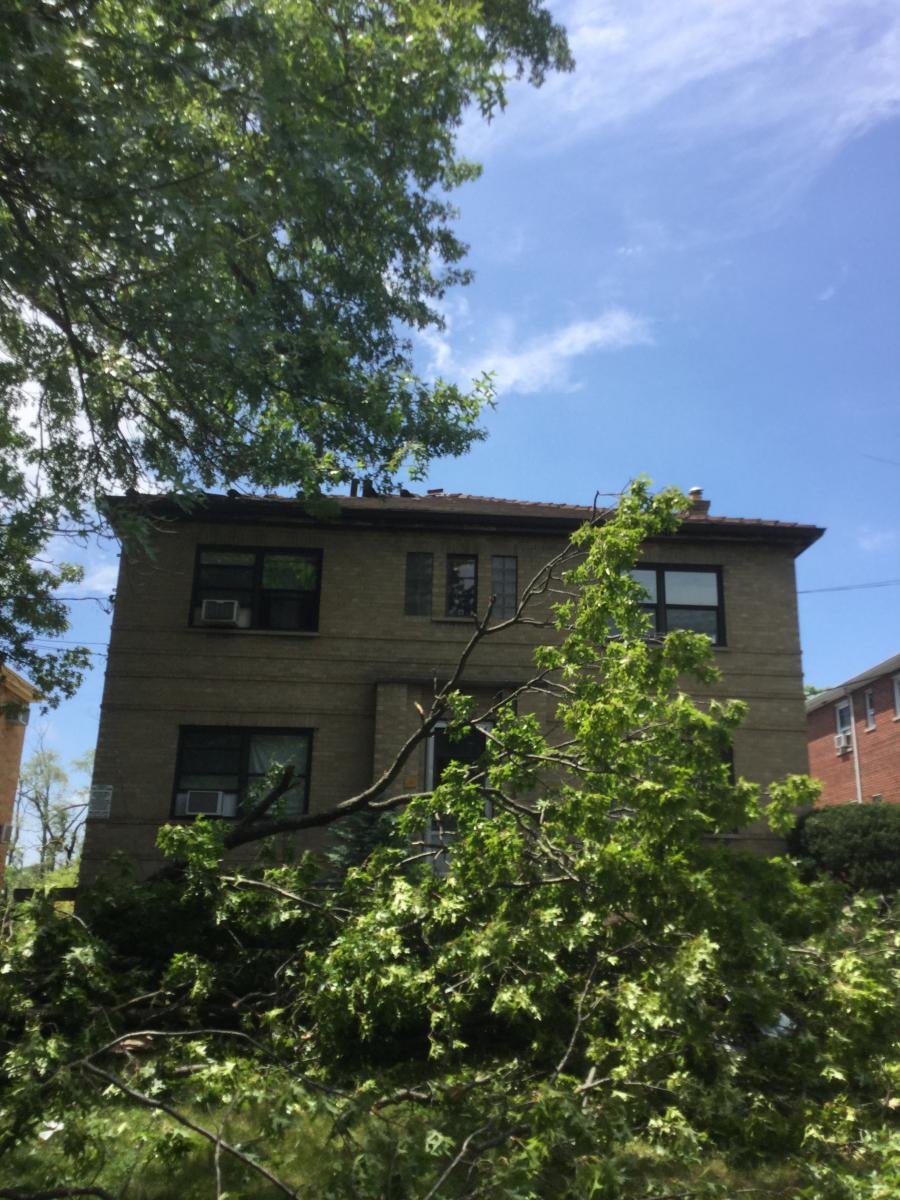
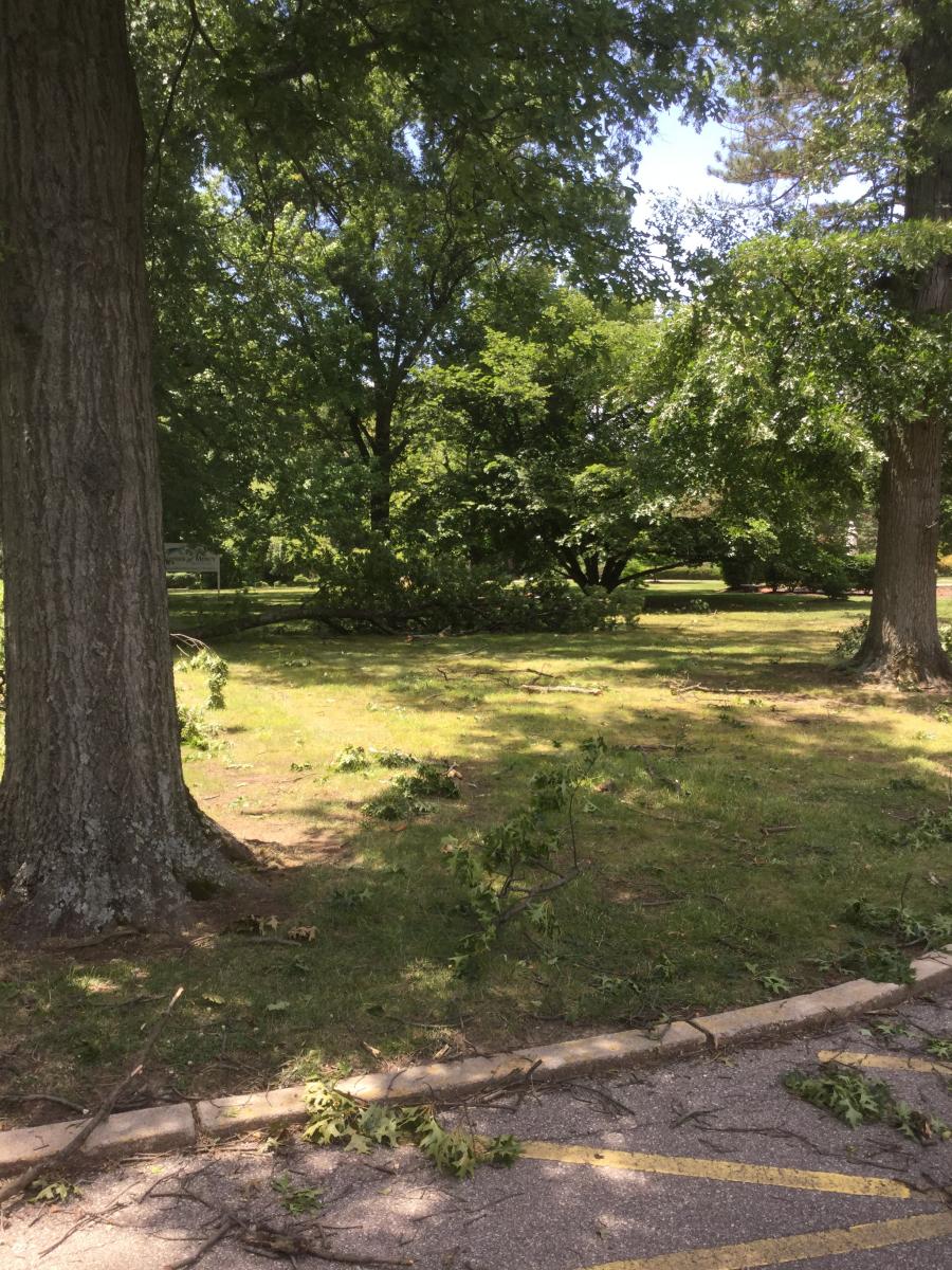
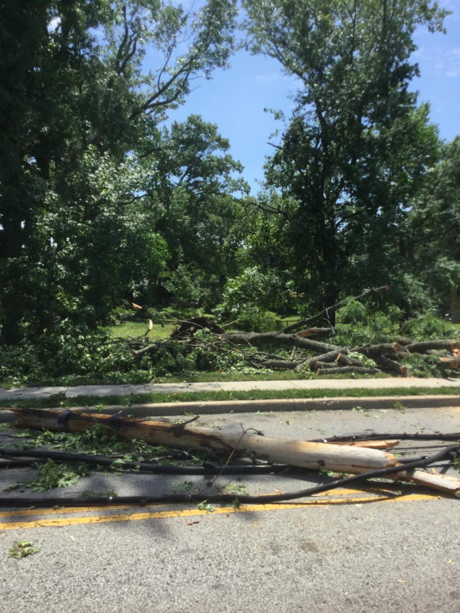
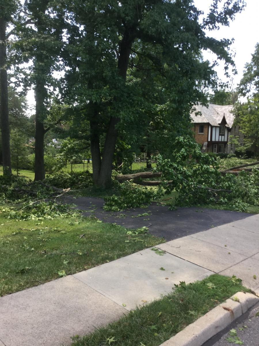
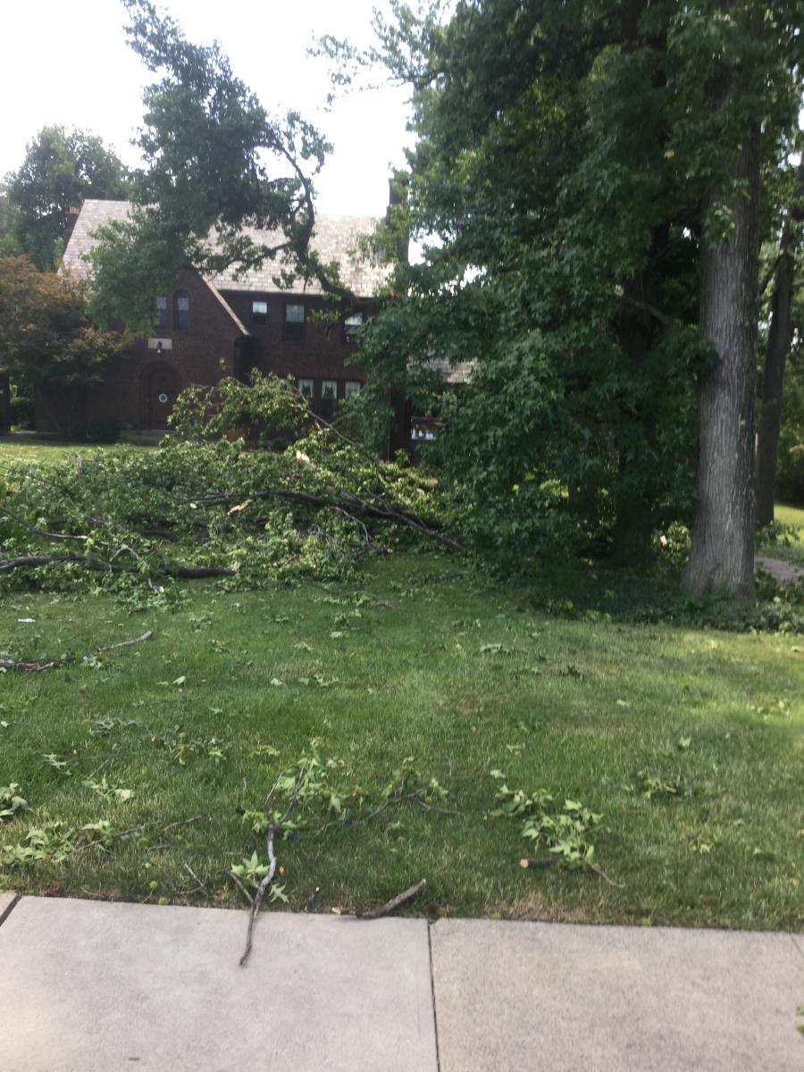
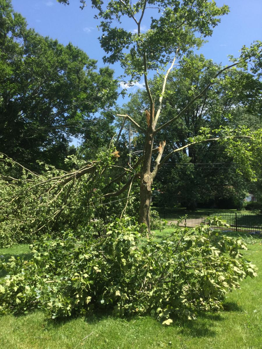
Public Information Statement National Weather Service Wilmington OH 334 PM EDT FRI JUL 15 2016 ...Tornado Confirmed Near Westwood in Hamilton County Ohio... Location...Westwood in Hamilton County Ohio Date...July 13, 2016 Estimated Time...10:18 PM EDT to 10:19 PM EDT Maximum EF-Scale Rating...EF0 Estimated Maximum Wind Speed...80 MPH Maximum Path Width...150 yards Path Length...0.75 miles Beginning Lat/Lon...39.1394N/84.6097W Ending lat/Lon...39.1403N/84.5956W * Fatalities...0 * Injuries...0 * The information in this statement is preliminary and subject to change pending final review of the event(s) and publication in NWS Storm Data. ...Summary... The National Weather Service in Wilmington OH confirmed a tornado near Westwood in Hamilton County Ohio on July 13, 2016. This statement provides more details than what was provided in the previously issued statements. The first sign of tornadic damage was observed at a pair of two story apartment buildings along the intersection of Queen City Avenue and Westbrook Drive. Roof shingles and siding were removed from multiple sides of the buildings, and large tree branches were knocked down on a nearby tree. Tornadic damage continued between Werk Road and Westbrook Drive, with the most significant damage occurring along the 3000 block of Boudinot Avenue and along the 3000 block of Werk Road. Numerous 10 to 12 inch diameter or greater tree branches were knocked down, with the branches pointing in multiple directions along this stretch. Several hardwood trees were also blown down. Power poles and wires were also knocked down, particularly along Werk Road. Minor structural damage was observed to several two story residences along Boudinot Avenue, much of that consisting of roof shingles and siding being removed from multiple sides of the homes. Additional large tree branches were down along Ferguson Road between Werk Road and Westbrook Drive. The last evidence of tornadic damage was observed along Werk Road near the intersection of McKinley Avenue, and that also consisted of large tree branches knocked down and pointing in opposing directions. Damage was EF0 in nature along the track of the tornado, with maximum winds around 80 mph. Further east into the east Westwood and Clifton areas, tree damage and some structural damage was noted. Damage in this area was determined a result of straight-line winds. Some of the most significant damage from straight-line winds occurred in East Westwood along Westwood Northern Boulevard. Two brick two story apartment buildings were damaged. Much of the roof of one building was removed and a significant portion of the other was blown off and thrown behind the buildings. Some debris from the second level of the buildings was also tossed behind both buildings. In addition, several large tree branches were knocked down, and these branches were generally pointing toward the same direction. To the east of Interstate 75 in the Clifton area, additional damage was surveyed. Much of the damage consisted of large healthy tree limbs being knocked down and a few evergreen trees being uprooted, particularly along Senator Avenue. Chimney damage was also noted on one home and a portion of the roof of a church on Clifton Avenue was also removed. Damage in the Clifton area exhibited a pattern consistent with straight-line winds which likely were in the 90 to 100 mph range. The National Weather Service extends thanks to Hamilton County OH Emergency Management and the affected homeowners for their assistance with this damage survey. For reference...the Enhanced Fujita Scale classifies tornadoes into the following categories: EF0...wind speeds 65 to 85 mph. EF1...wind speeds 86 to 110 mph. EF2...wind speeds 111 to 135 mph. EF3...wind speeds 136 to 165 mph. EF4...wind speeds 166 to 200 mph. EF5...wind speeds greater than 200 mph. $$ BPP/KH |
 |
 |
 |
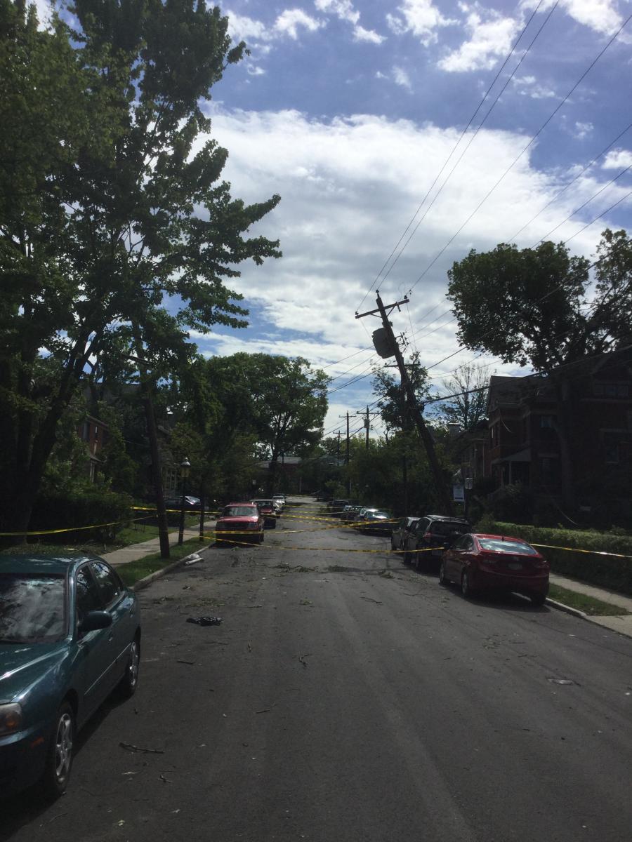
These select pictures were taken by NWS Wilmington, Ohio employees during a storm survey conducted on July 14, 2016. These pictures include damage from both the EF0 tornado and straight-line winds.
 |
 |
 |
 |
 |
 |
 |
 |
 |
 |
 |
 |
 |
 |
 |

