
Record setting heat is expected over the next several days from the Intermountain West through the northern Plains. Furthermore, fire weather concerns increase with dry and breezy conditions. Meanwhile, heavy rainfall and severe thunderstorm threats for the Ohio/Tennessee Valleys, central Appalachians and Southeast today. The threat shifts to central Gulf Coast and across central Texas this week. Read More >
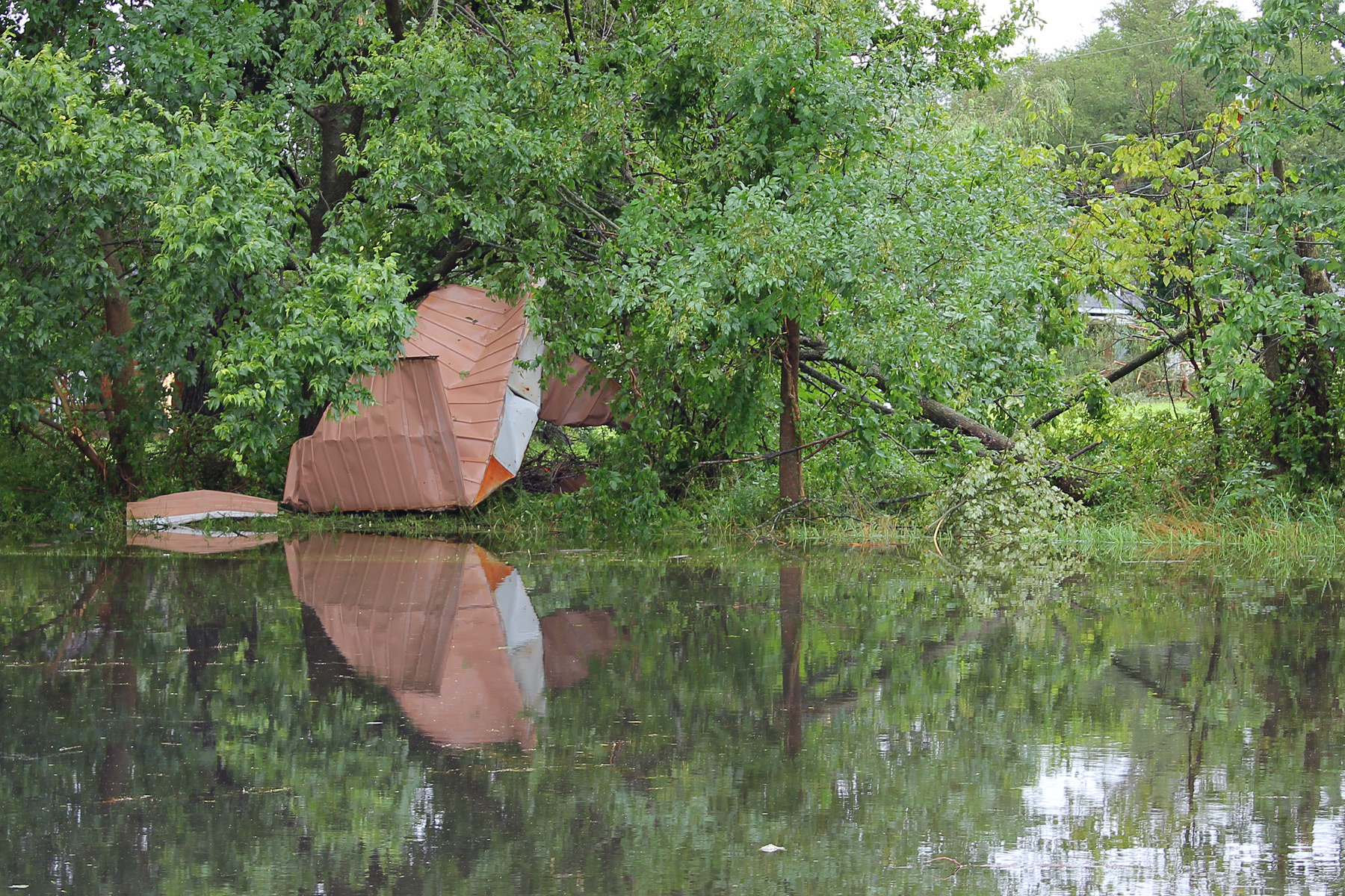
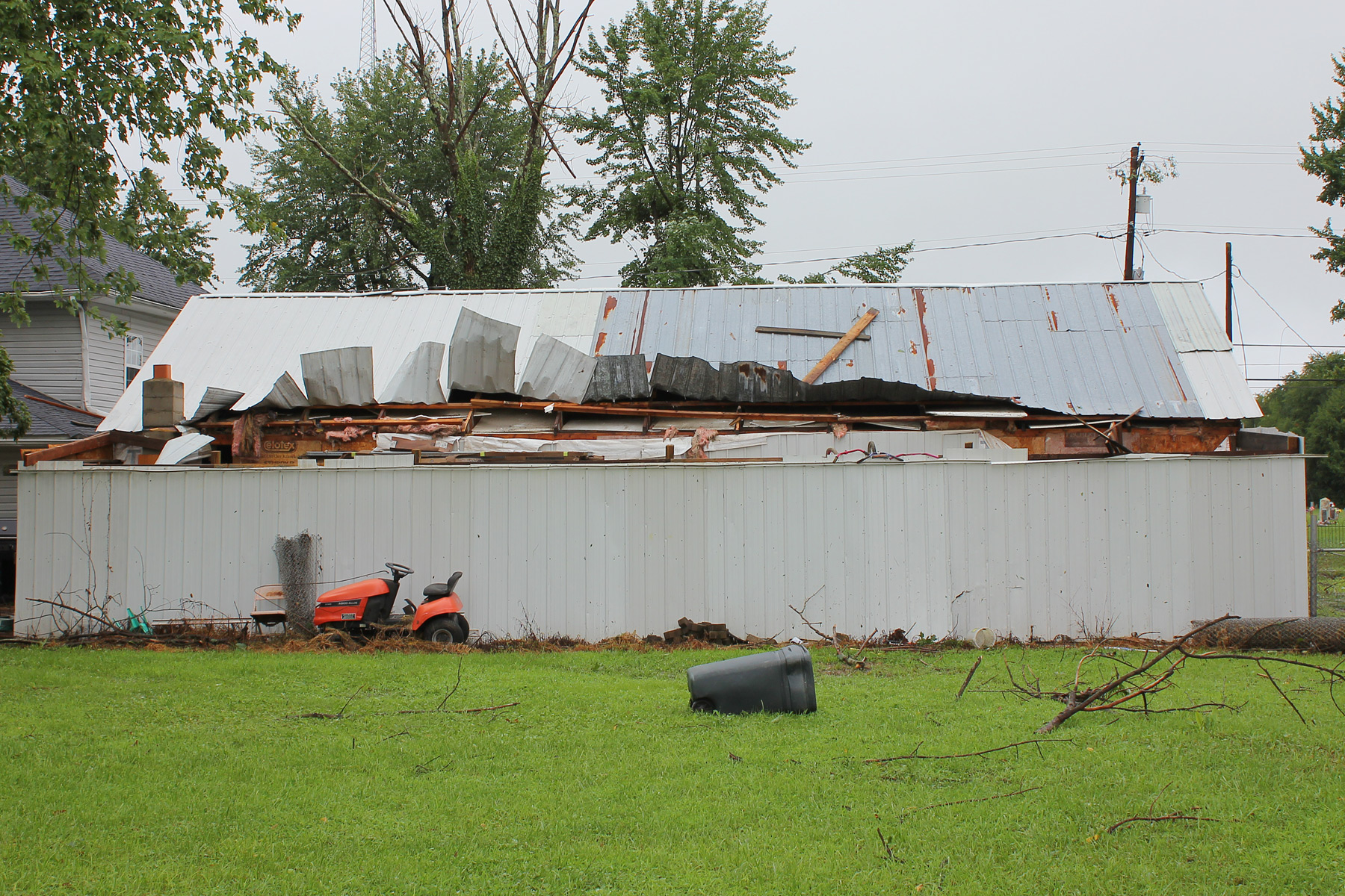
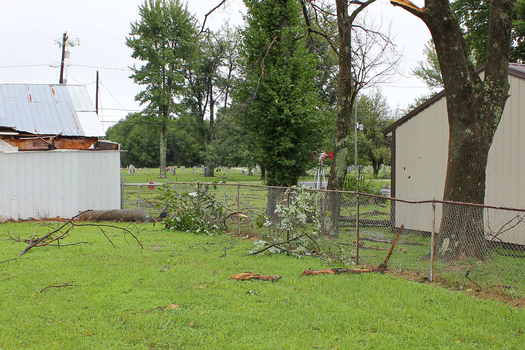
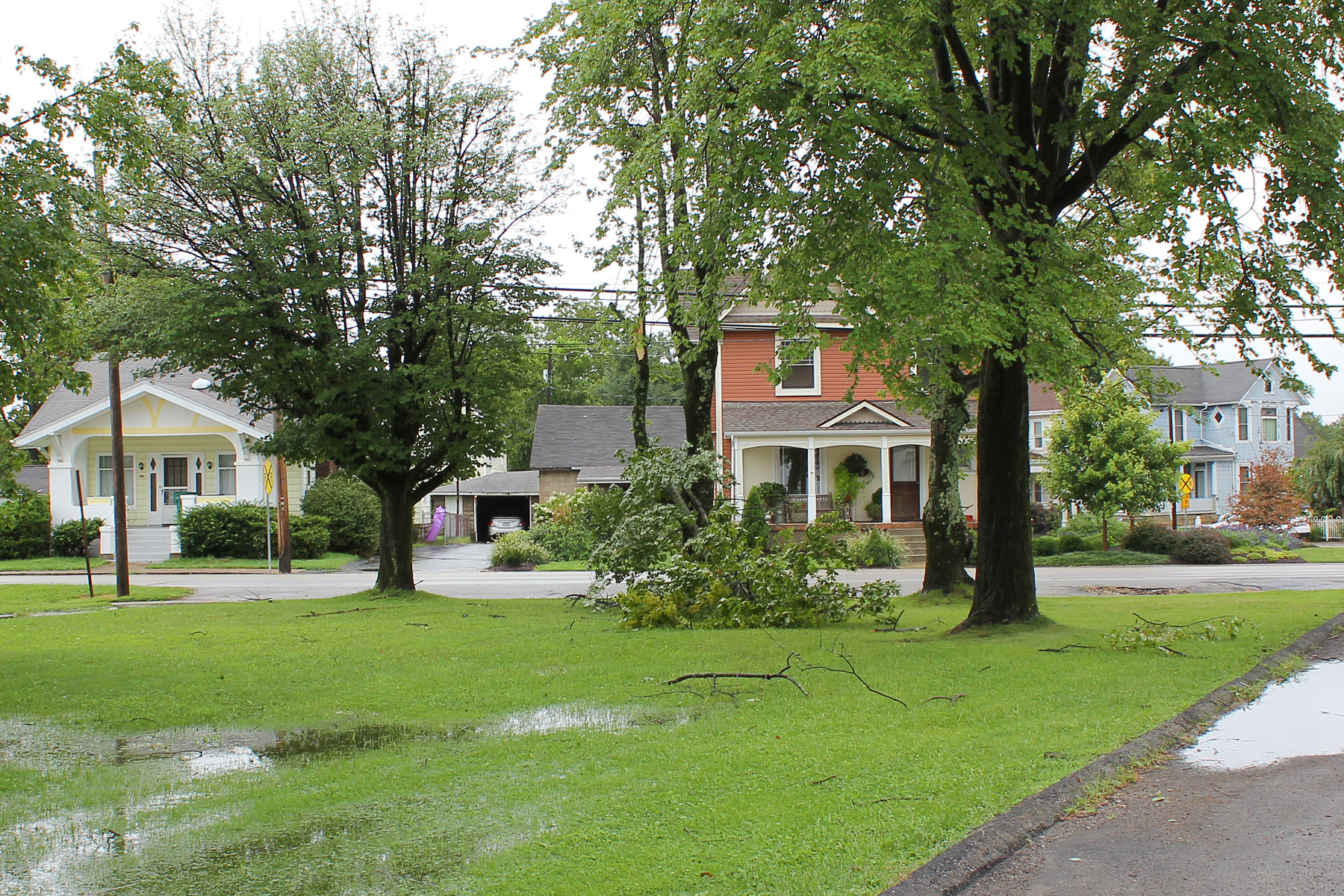
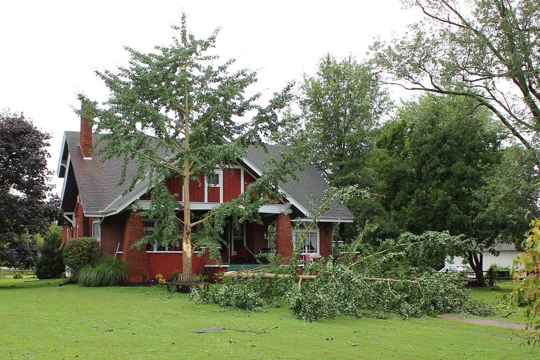
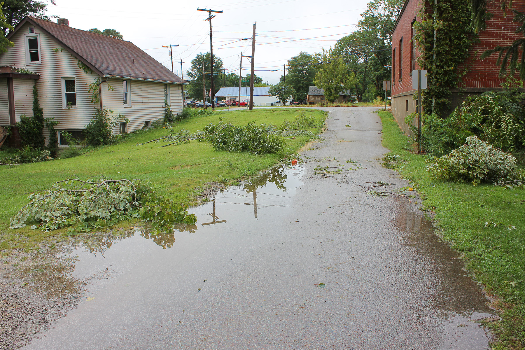
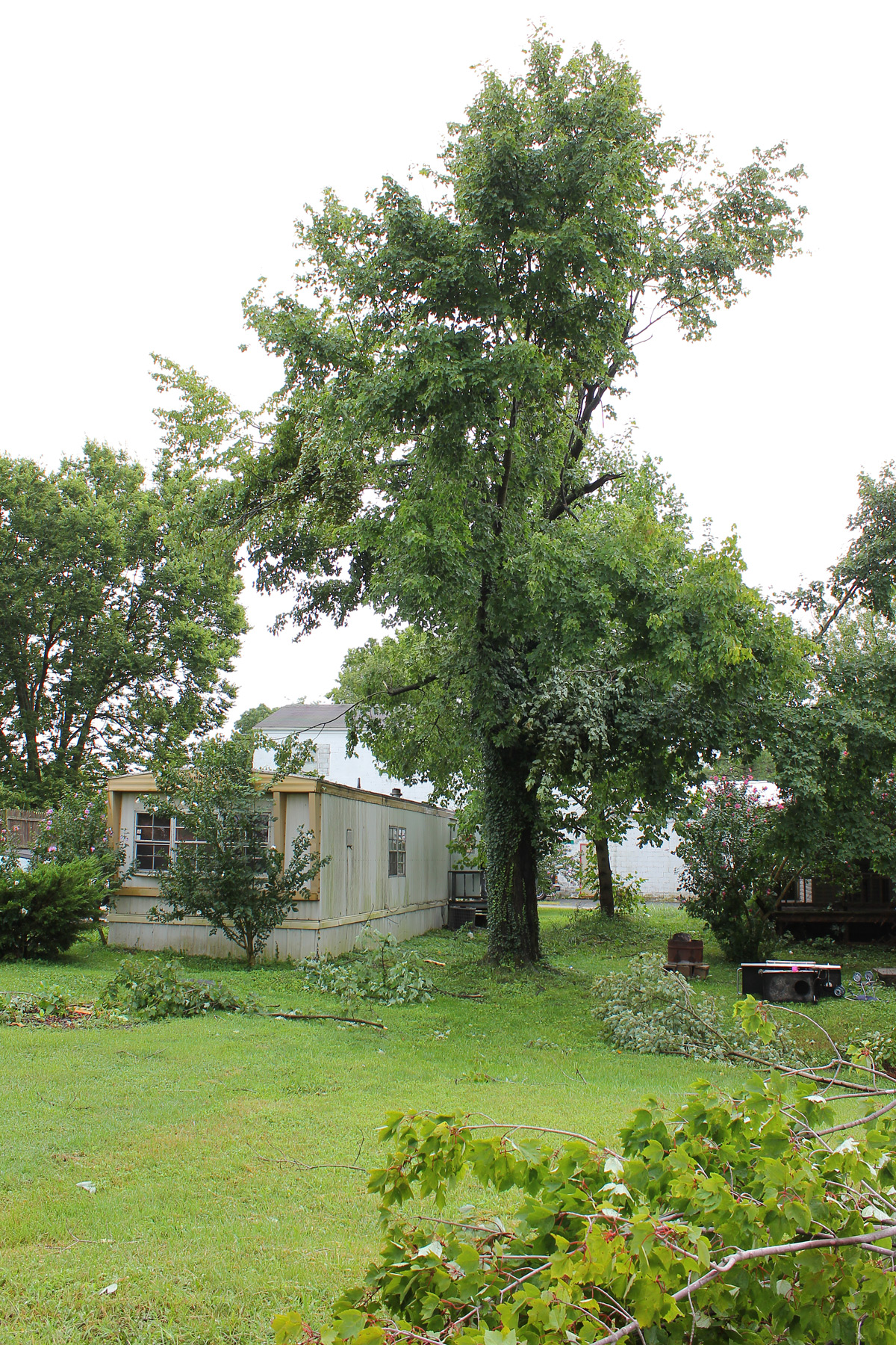
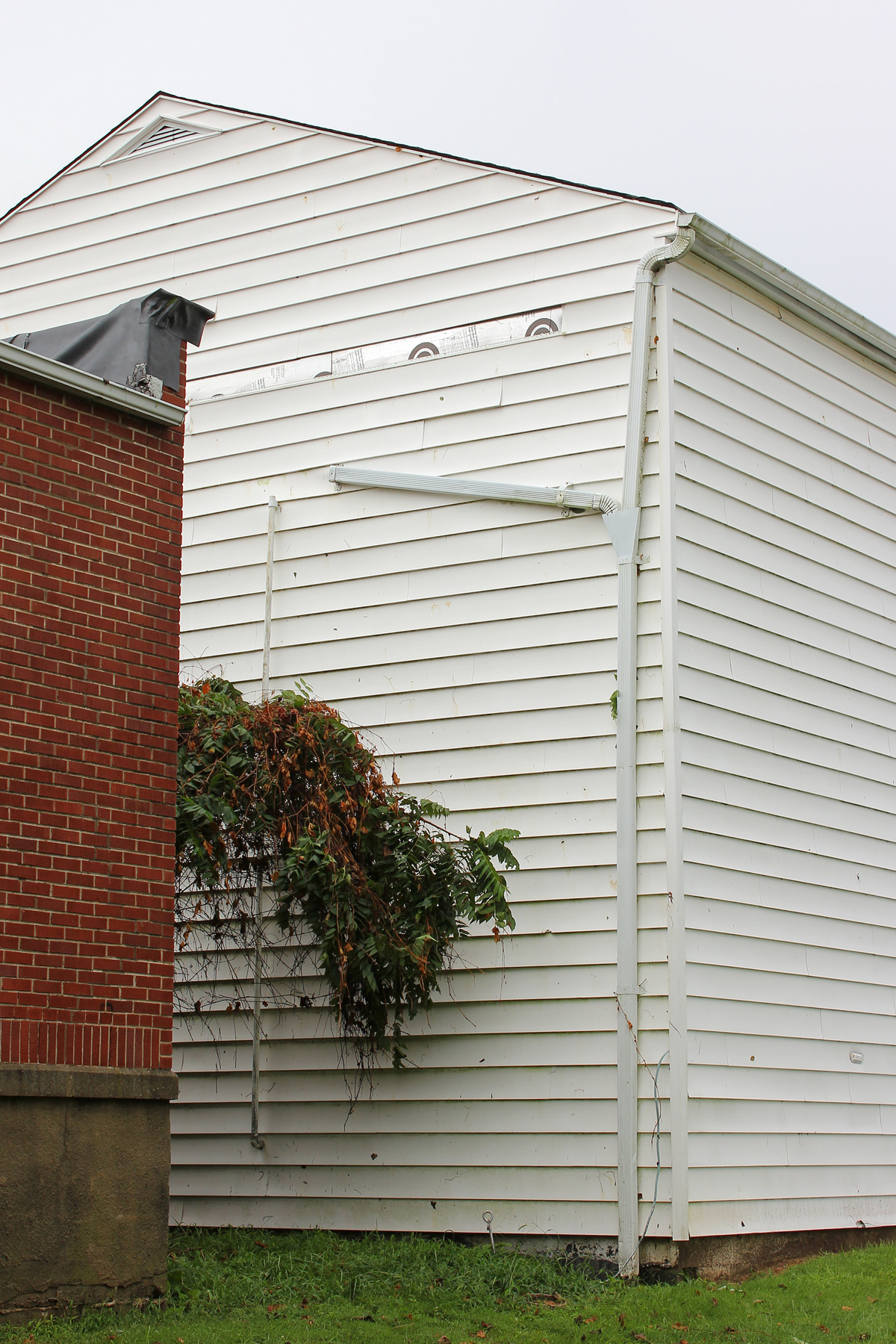
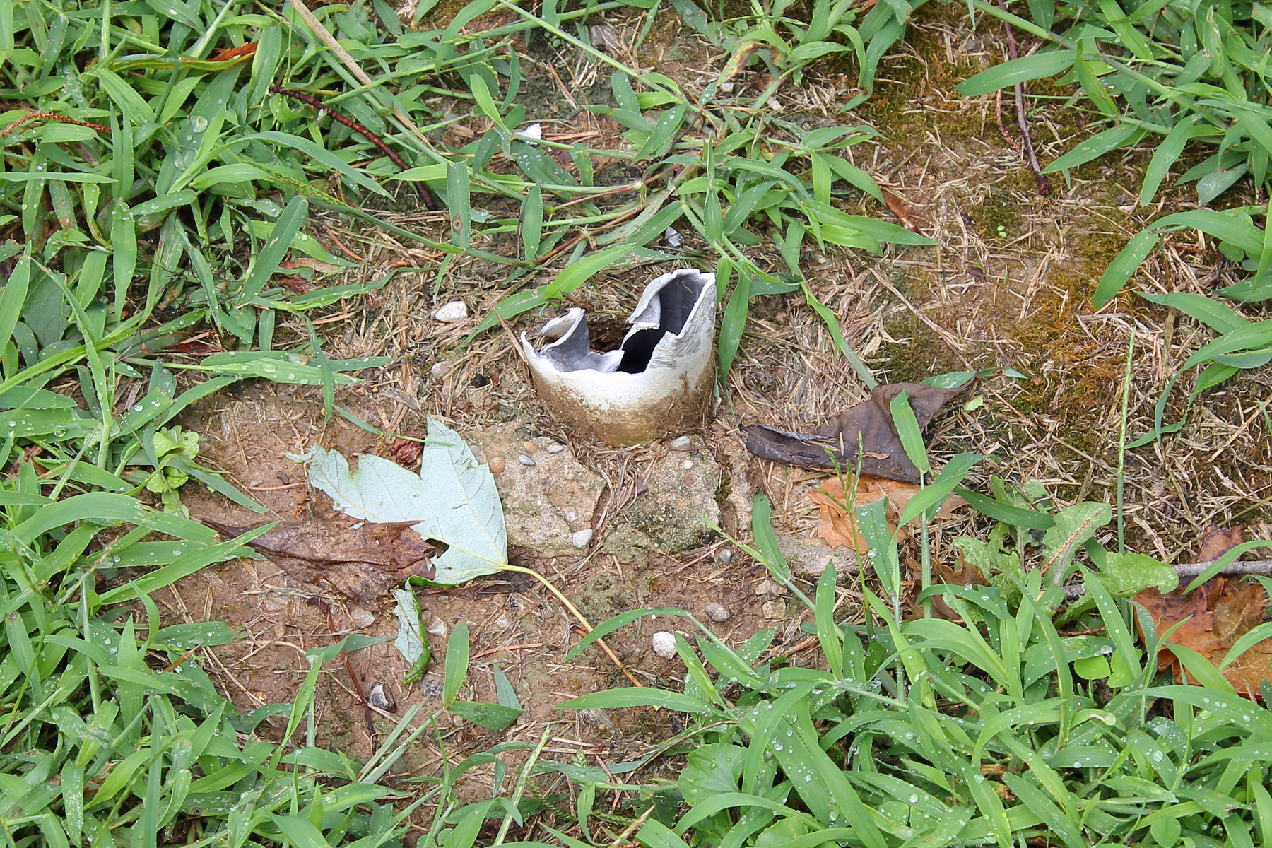
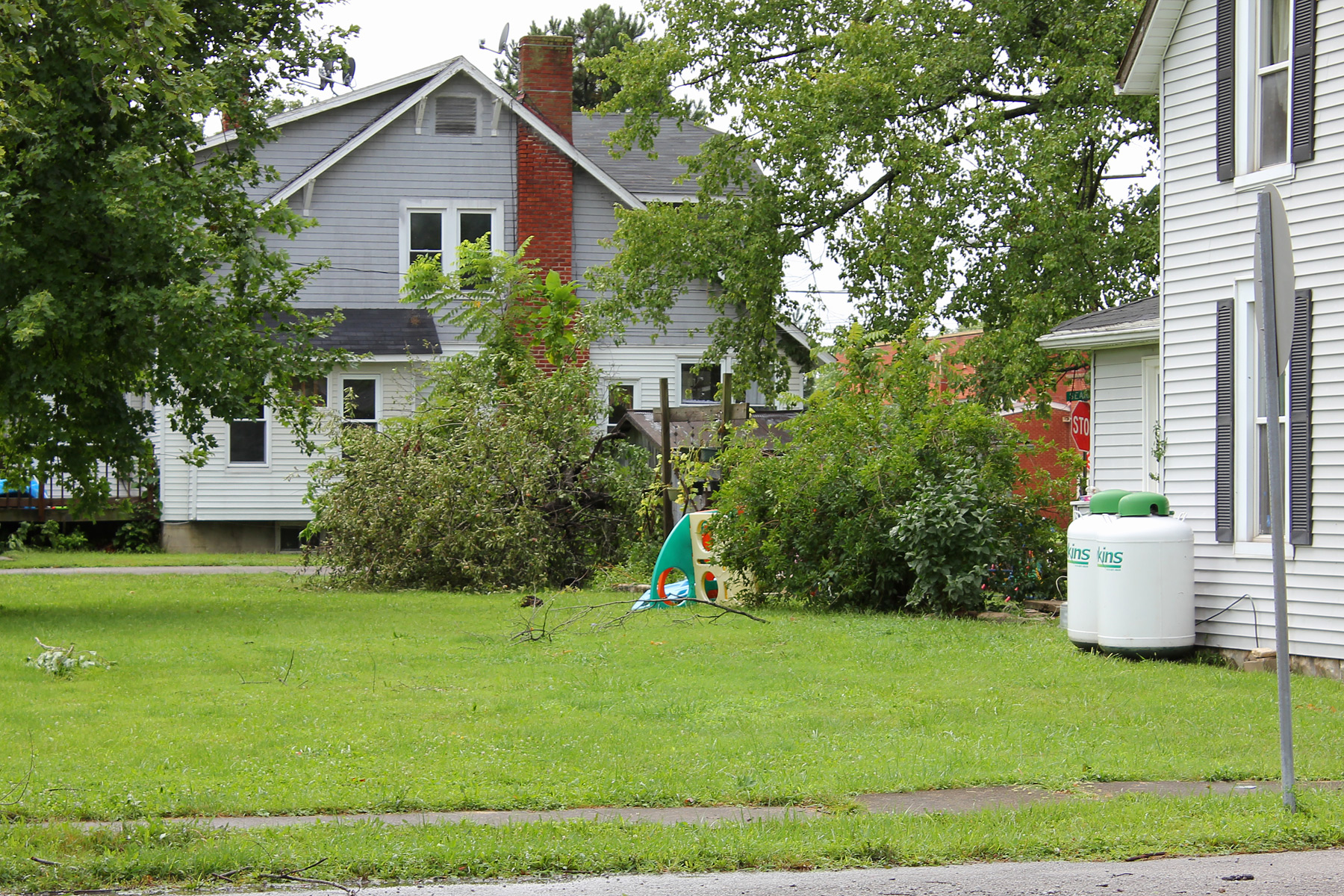
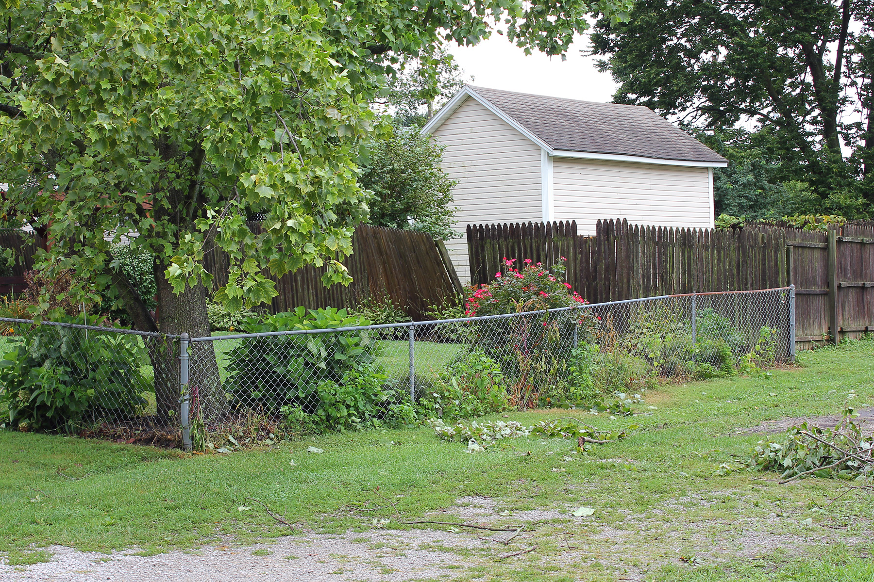
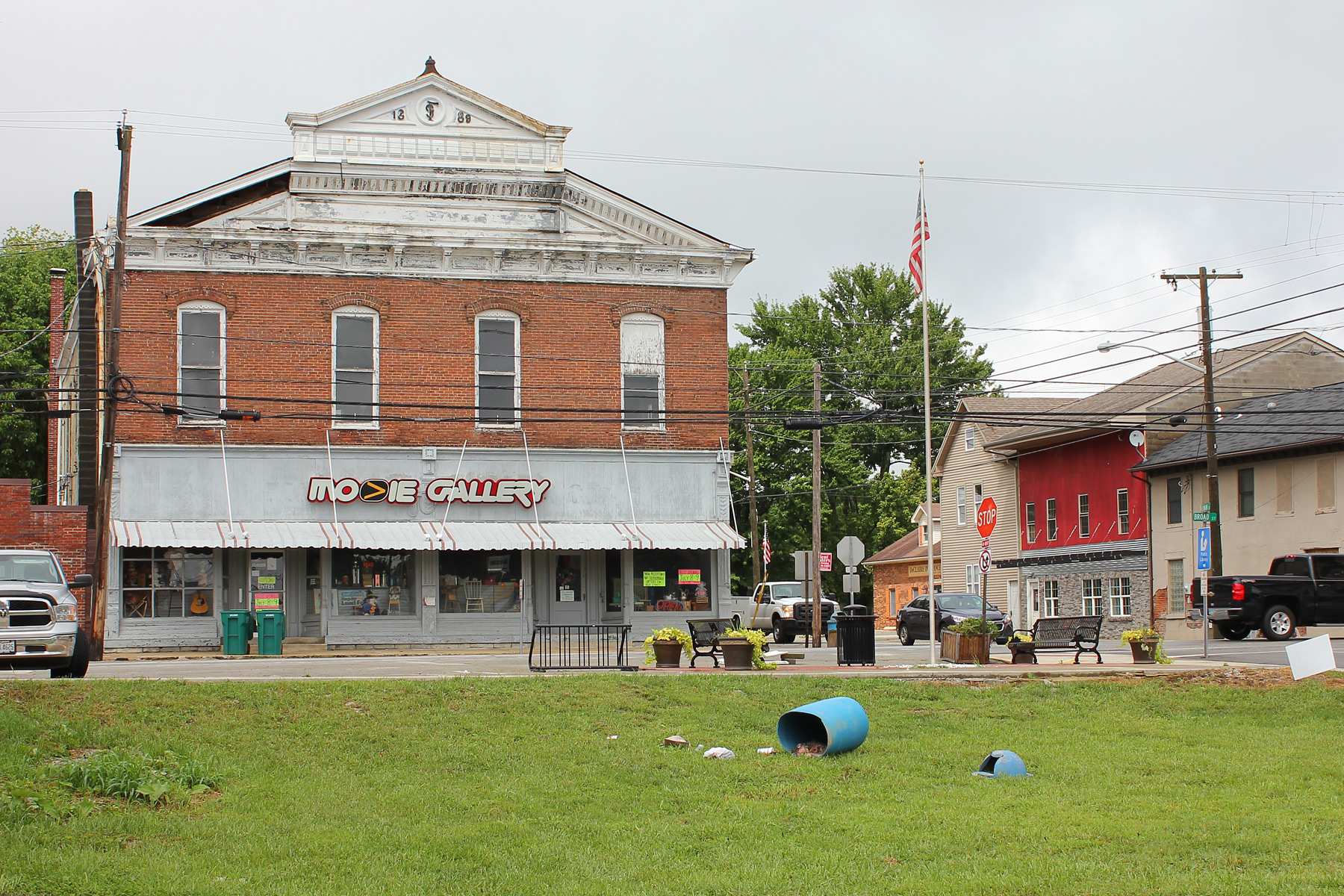
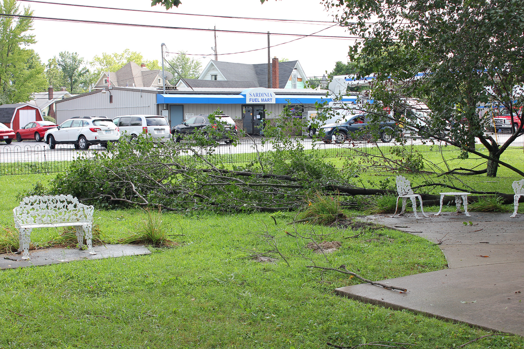
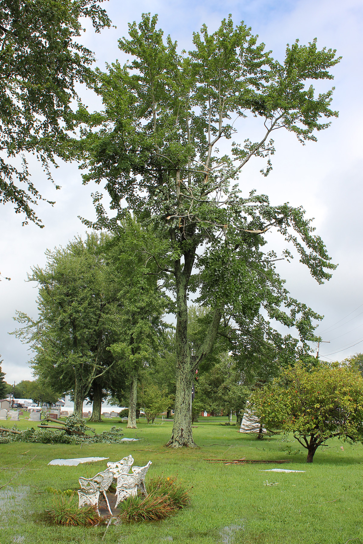
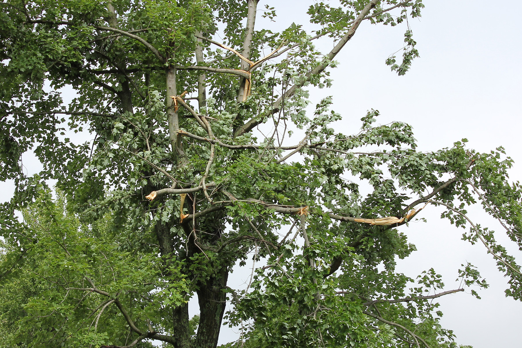
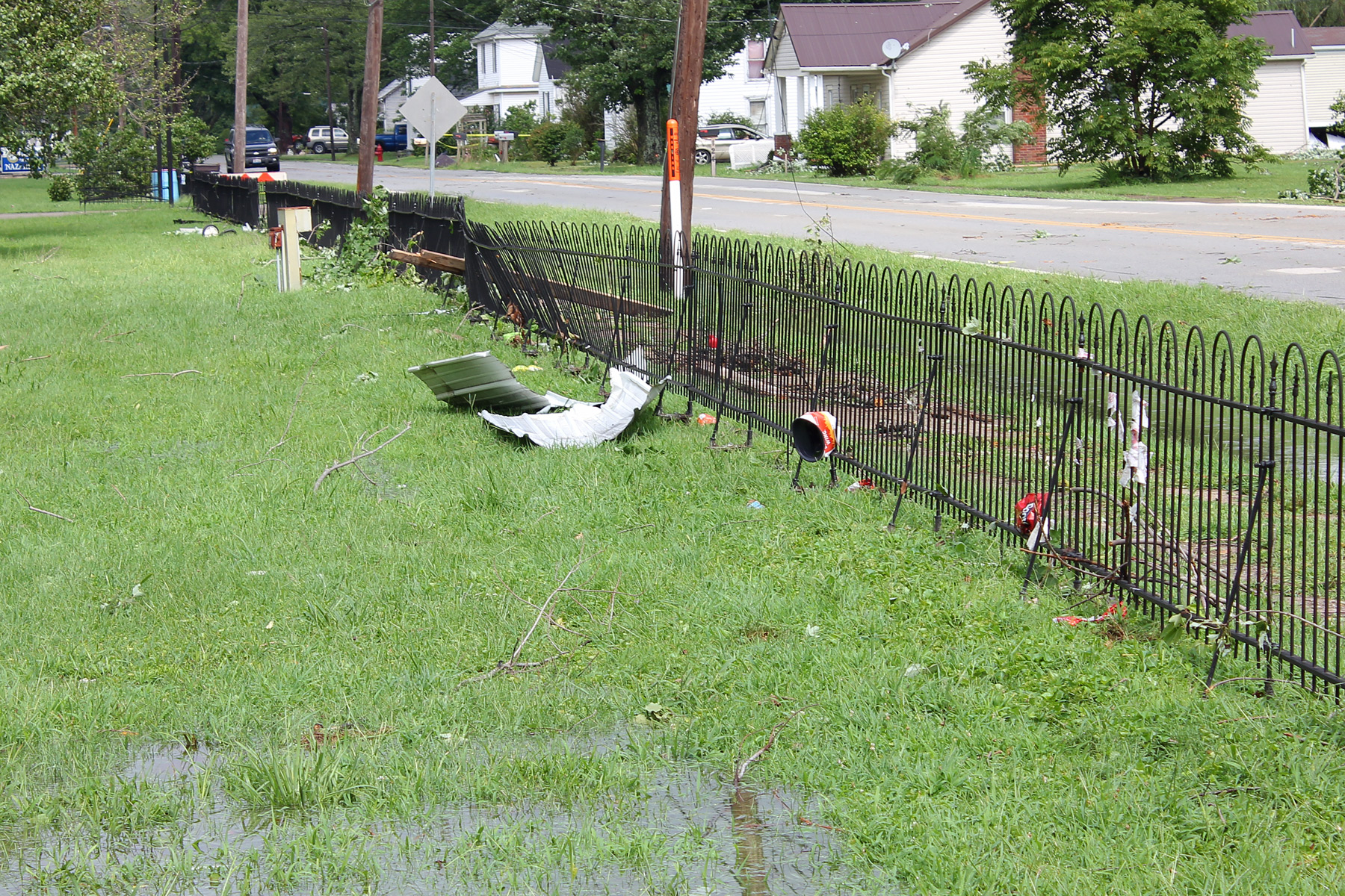
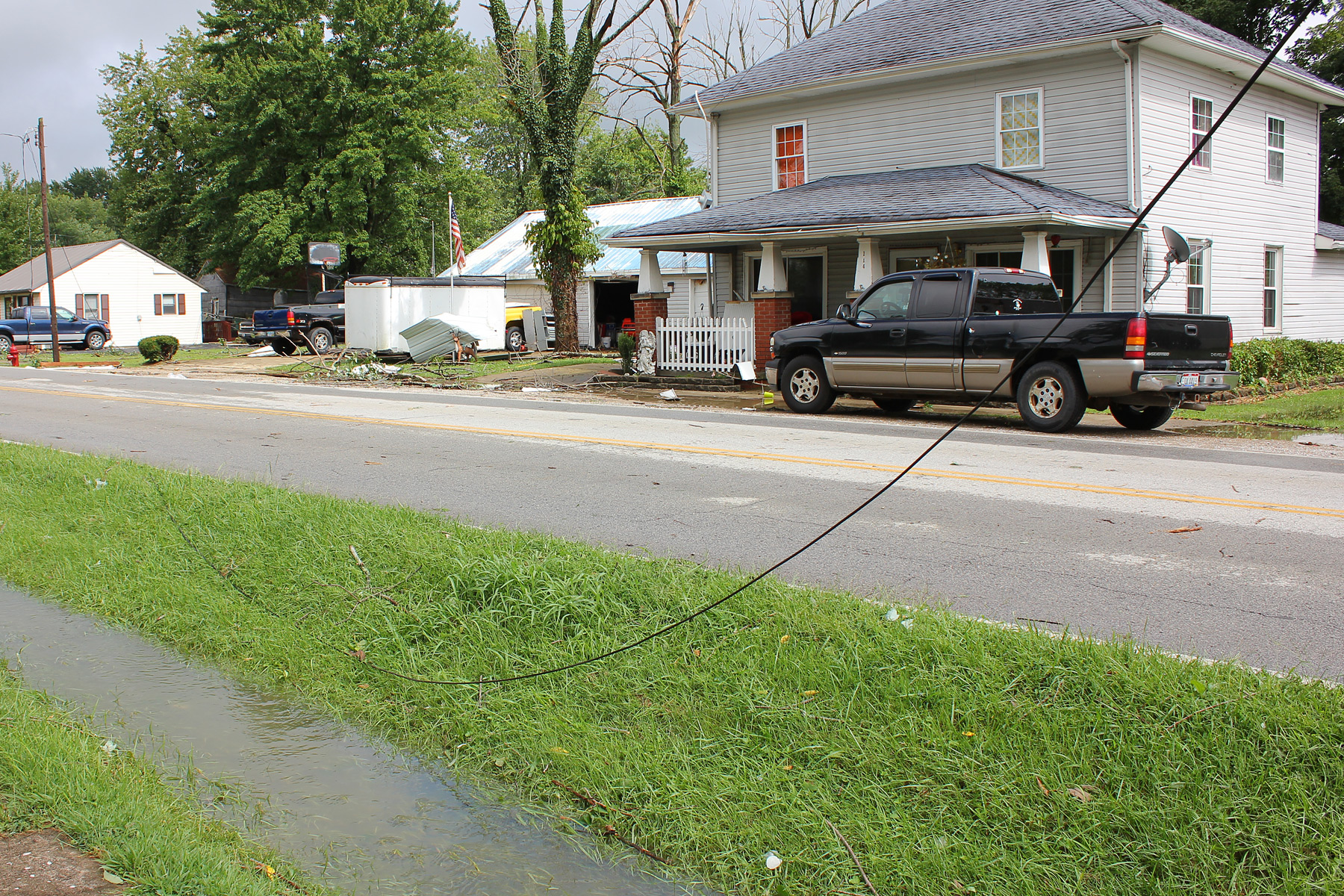
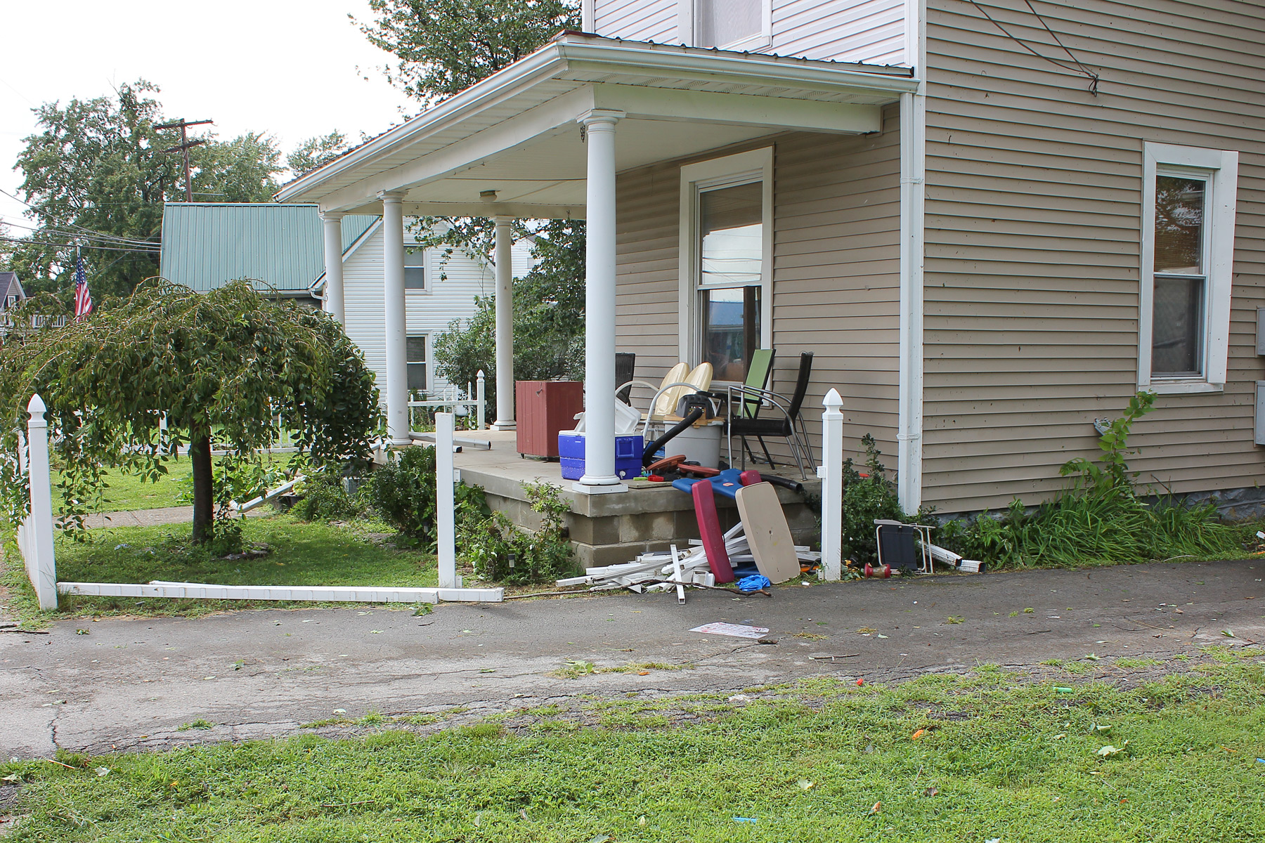
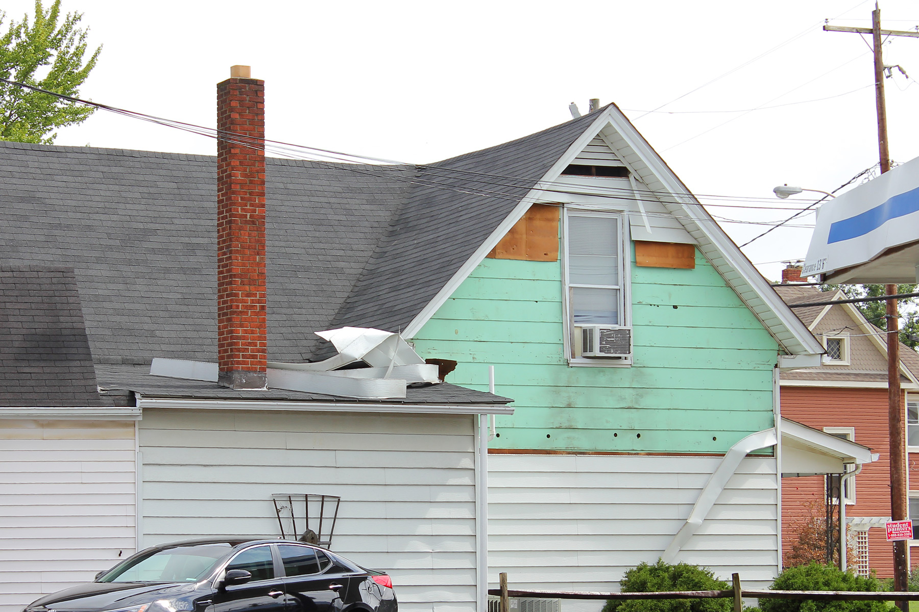
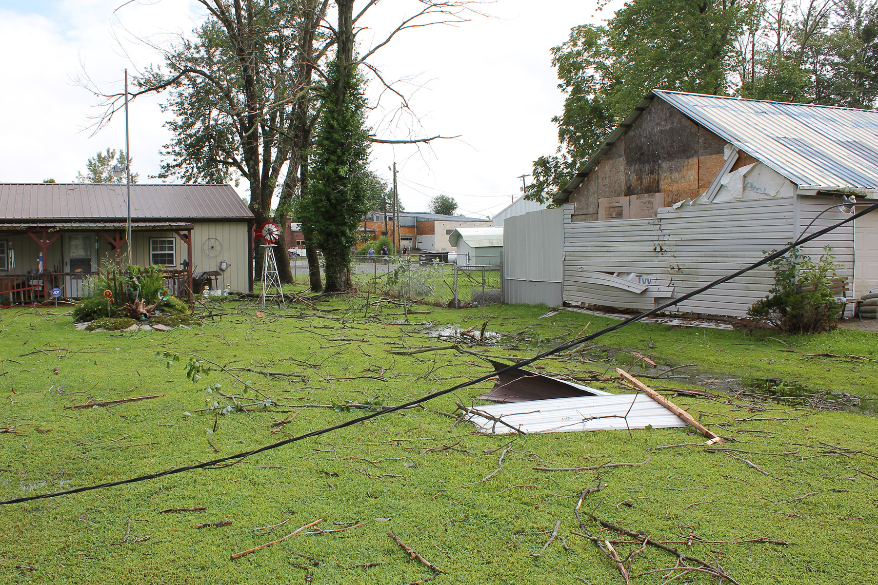
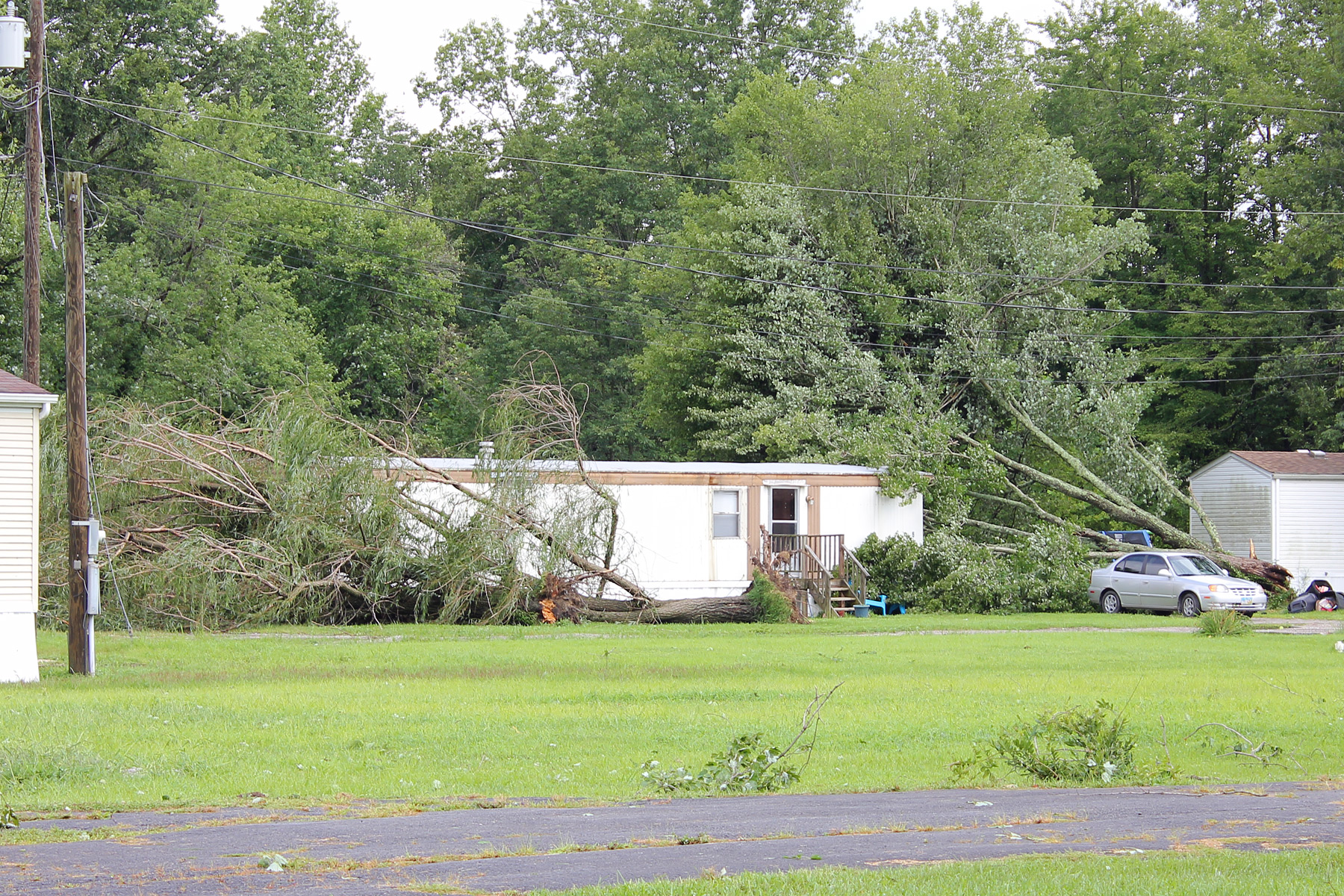
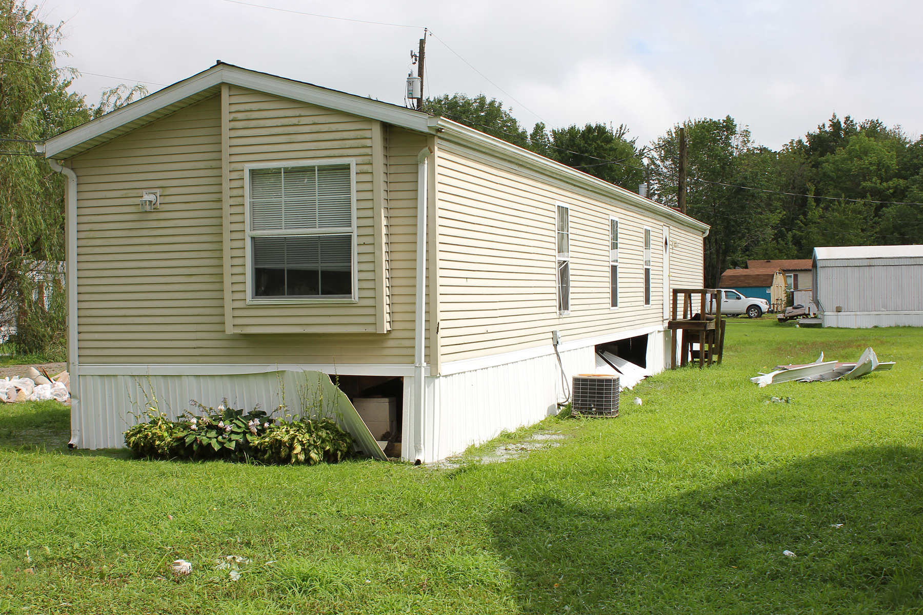
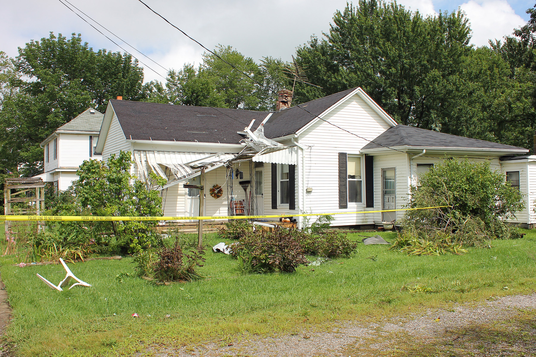
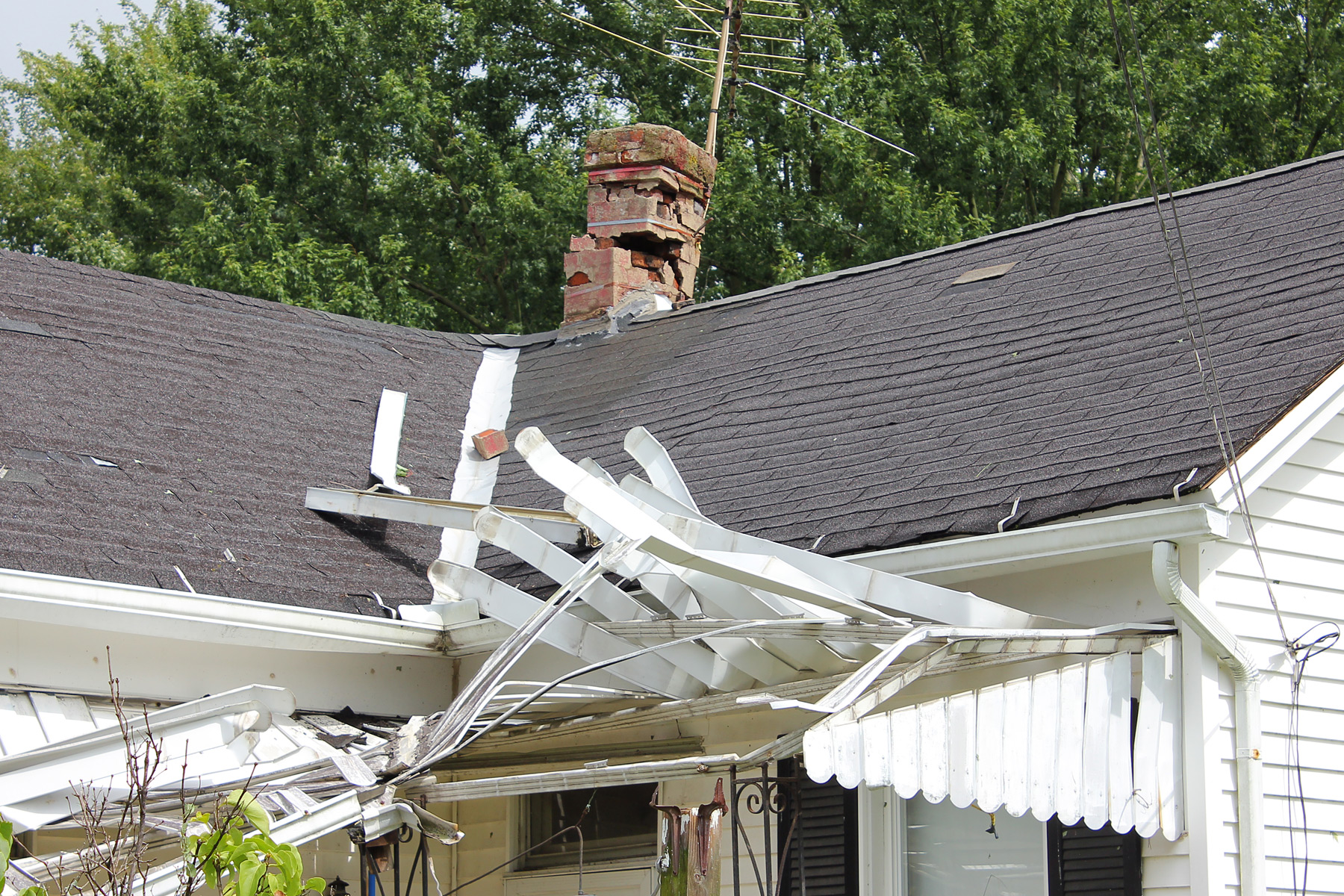
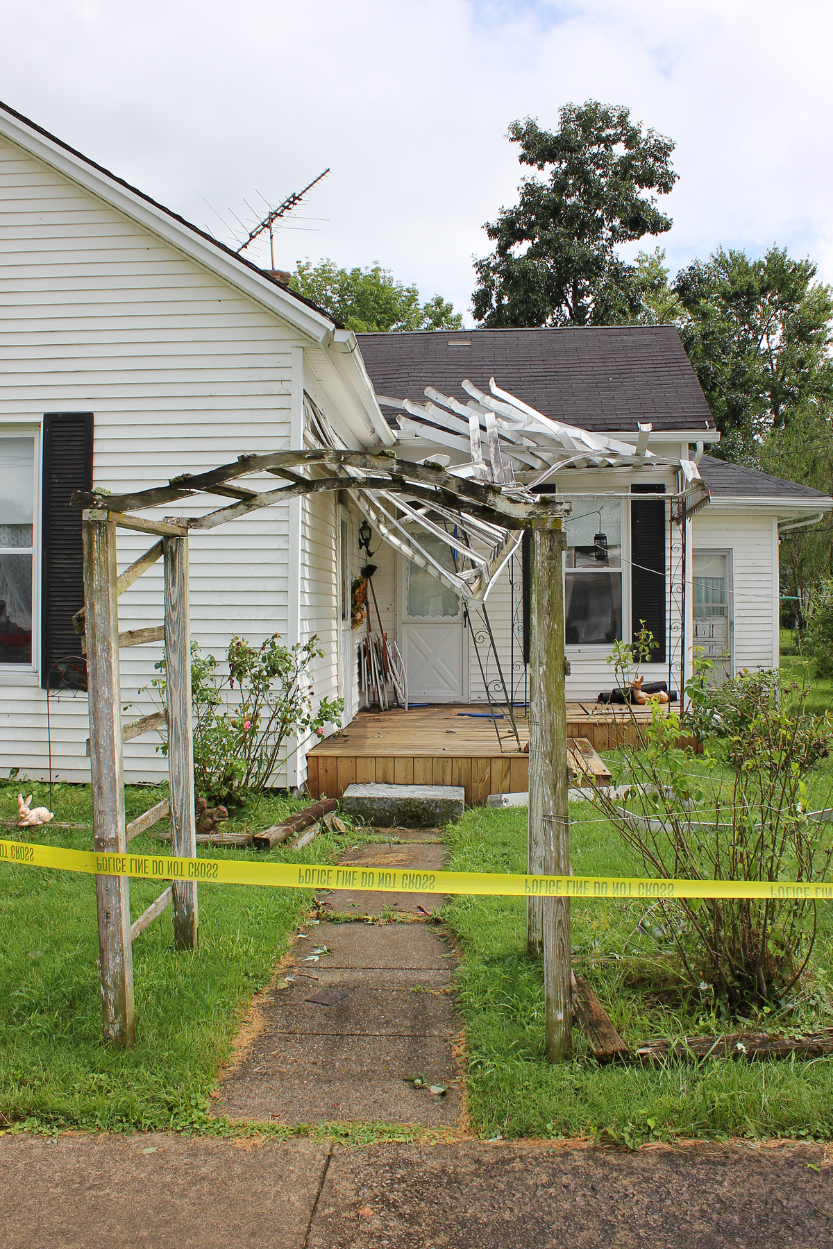
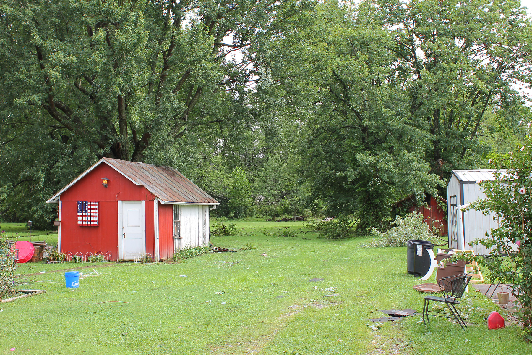
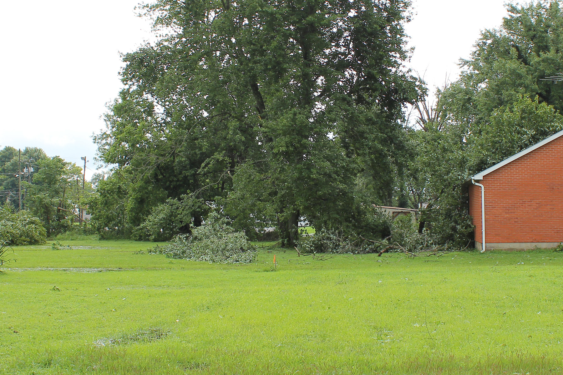
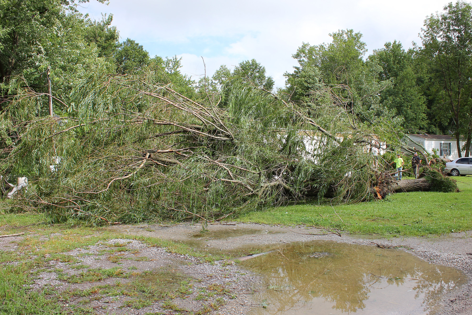
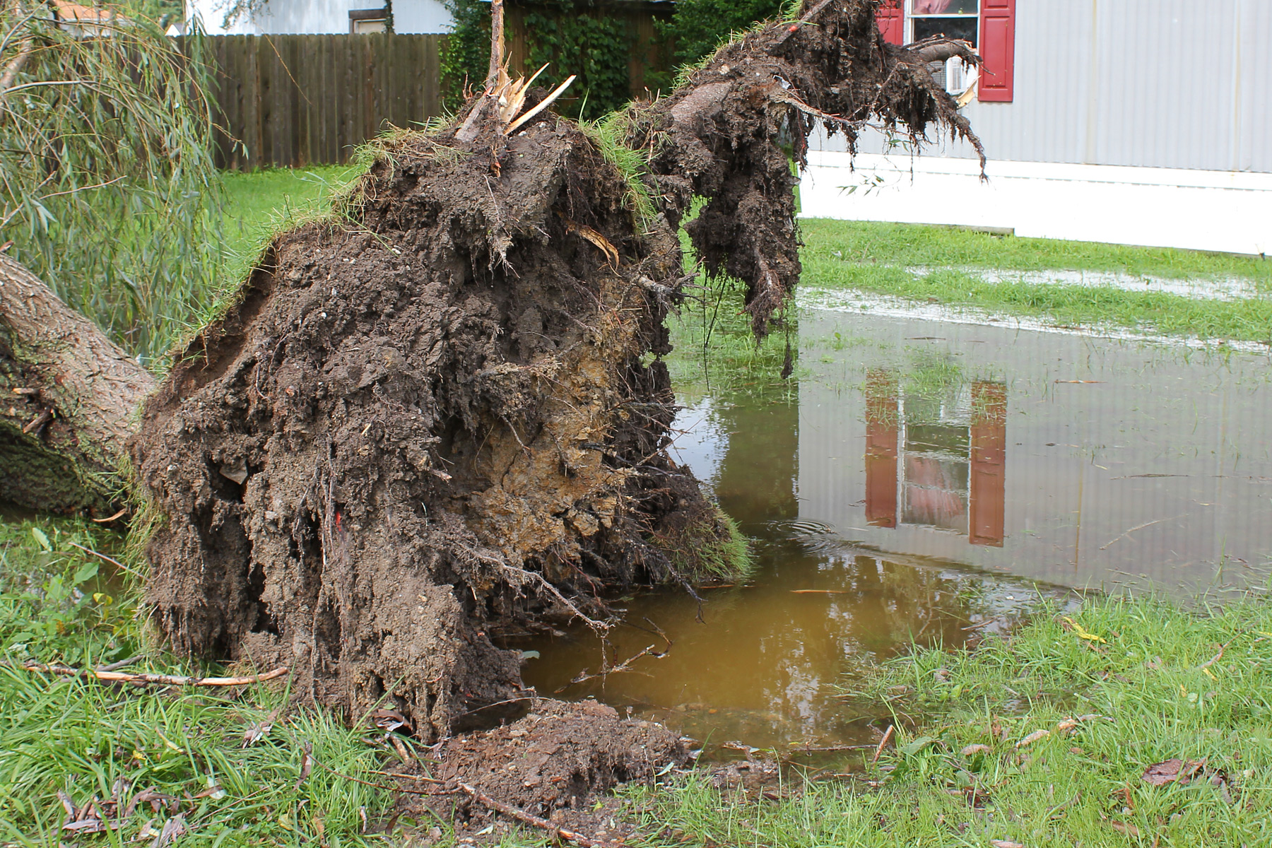
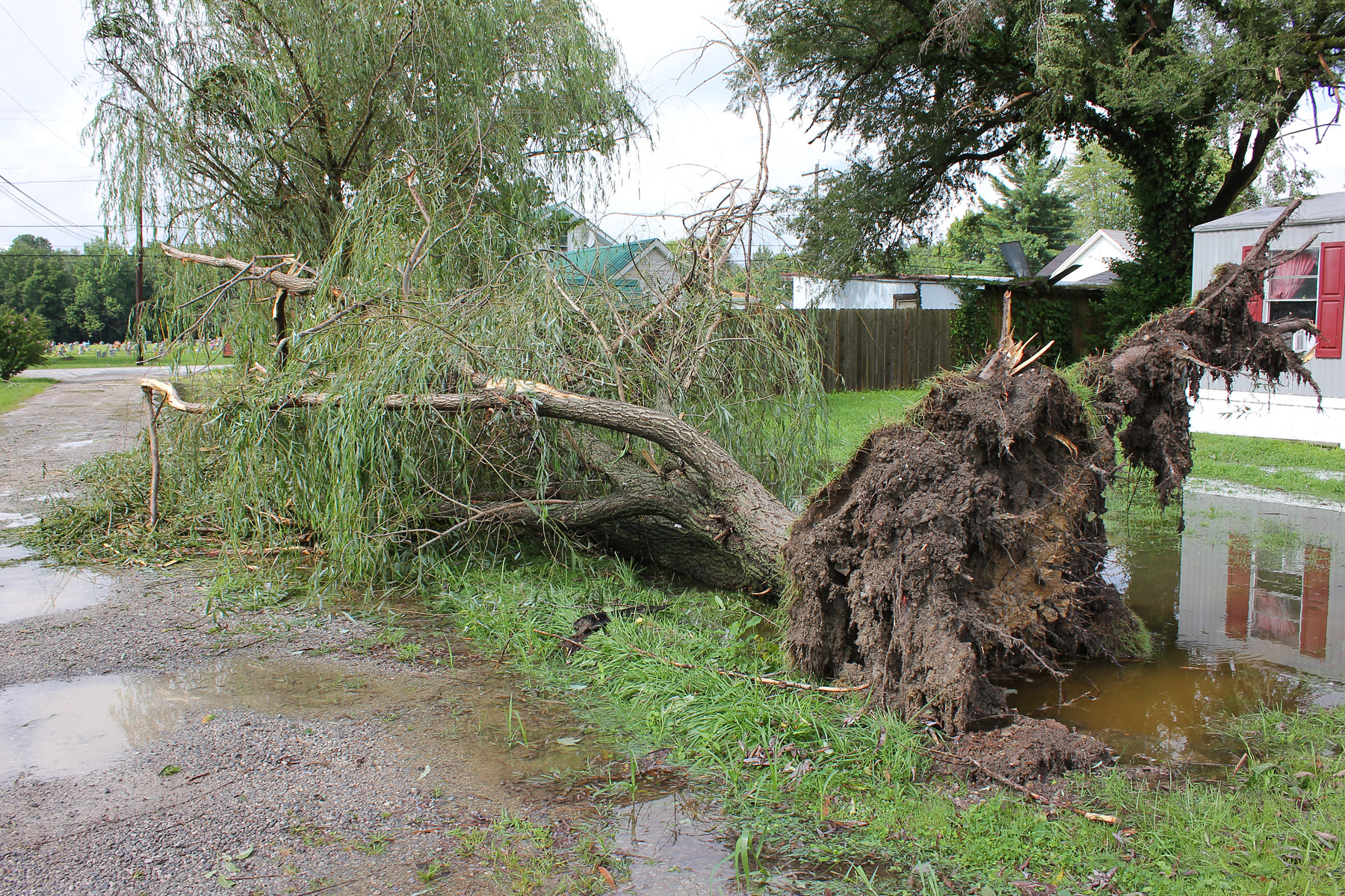
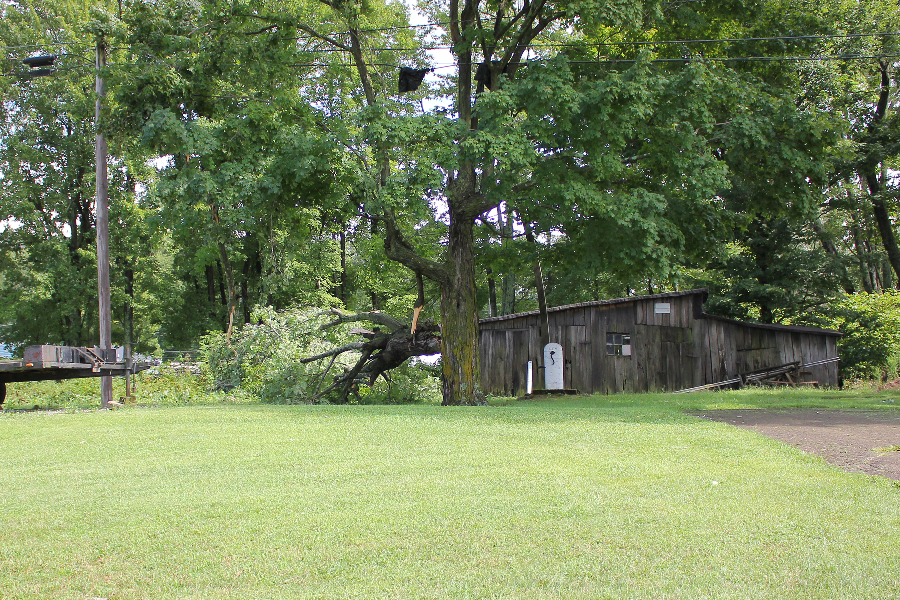
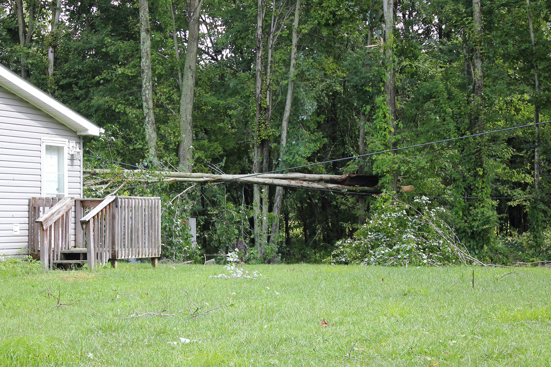
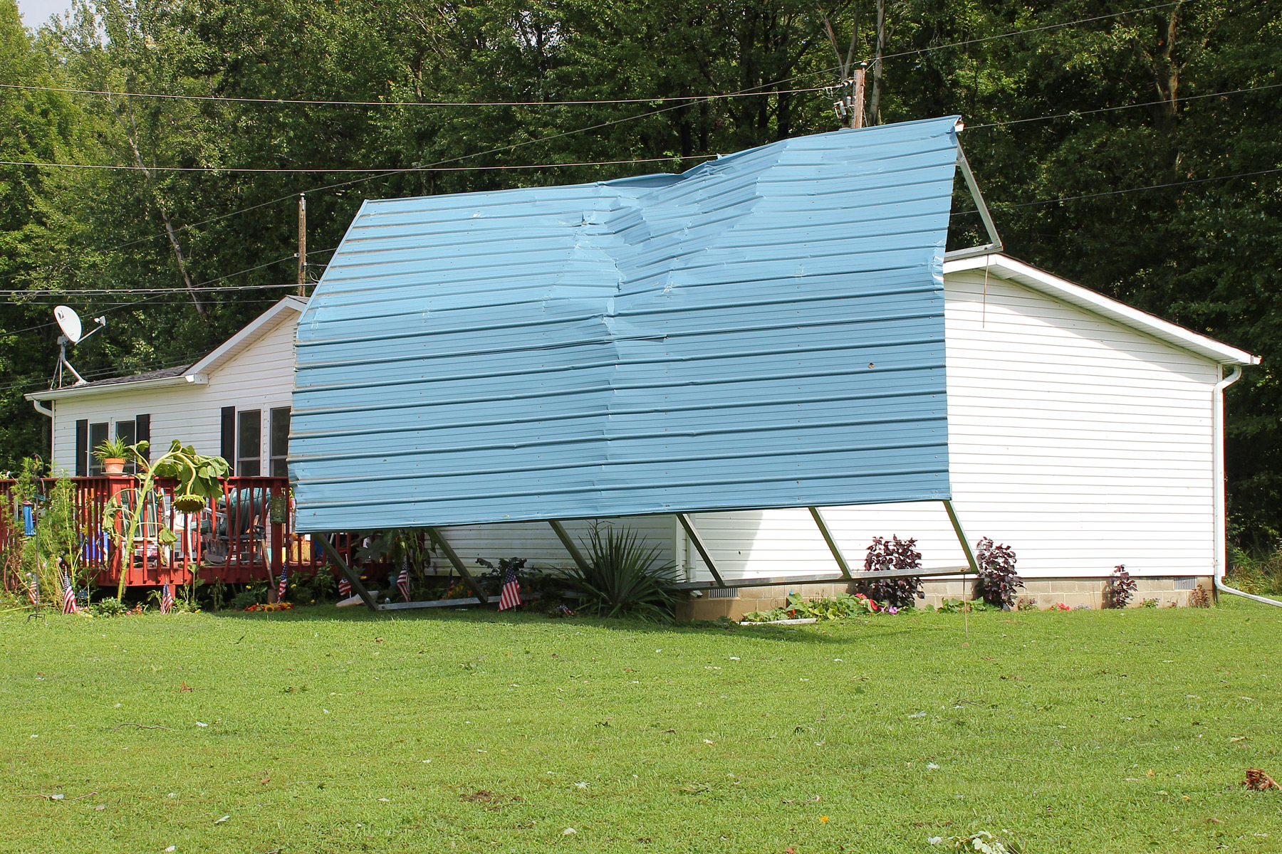
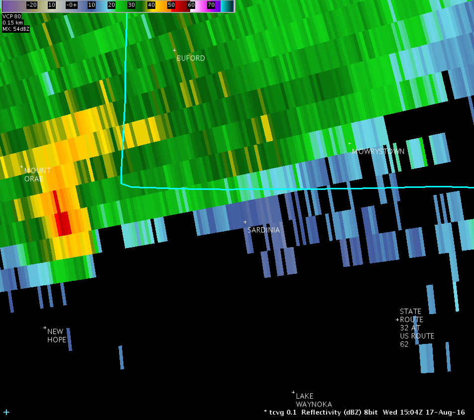
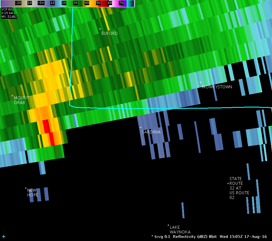
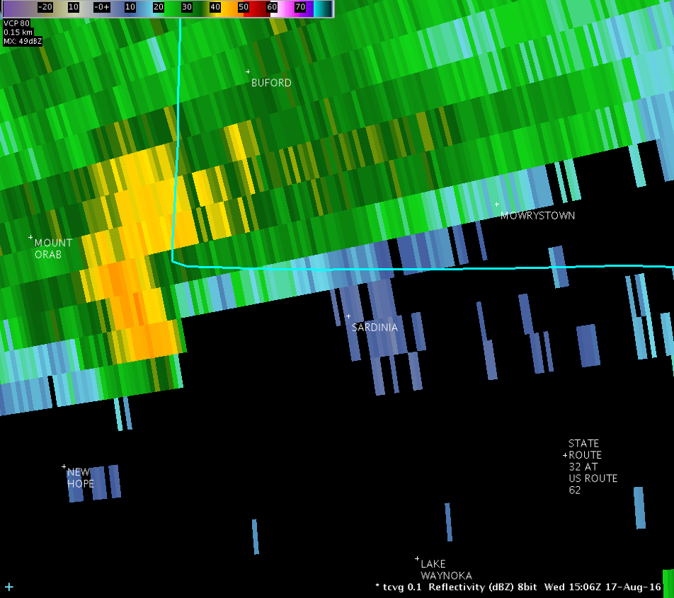
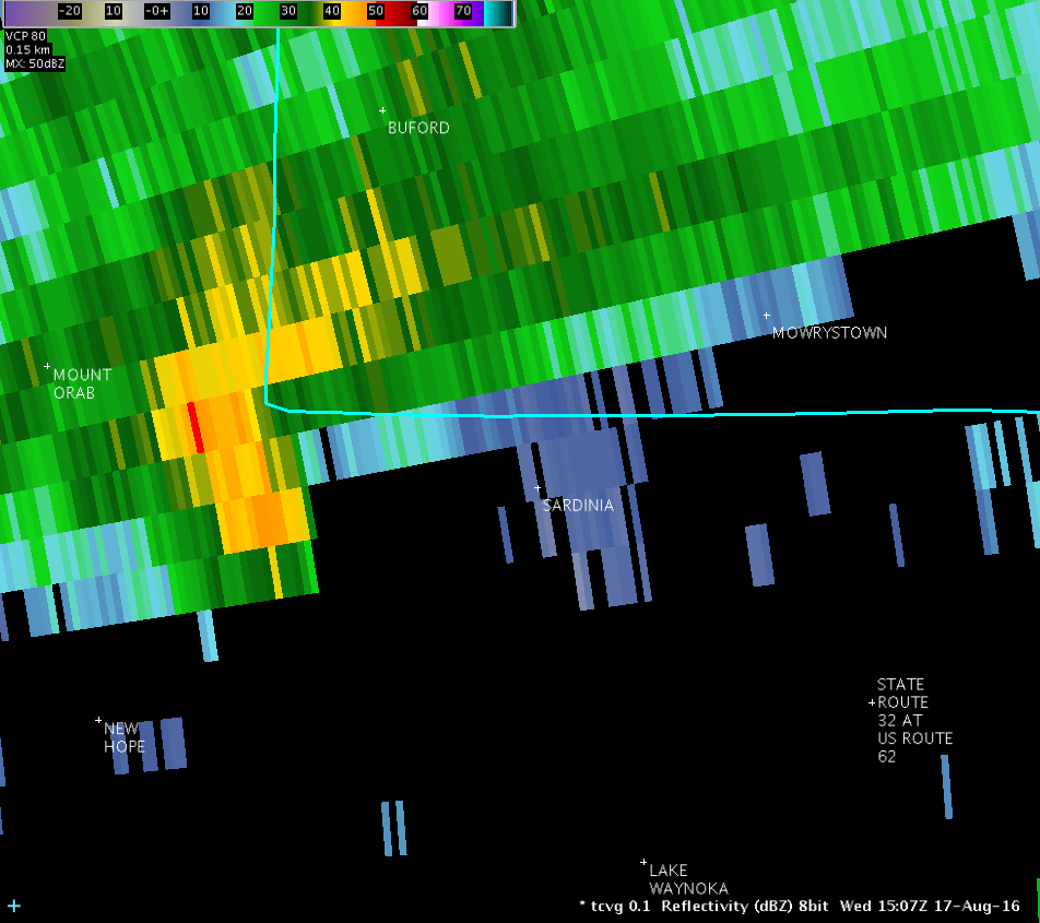
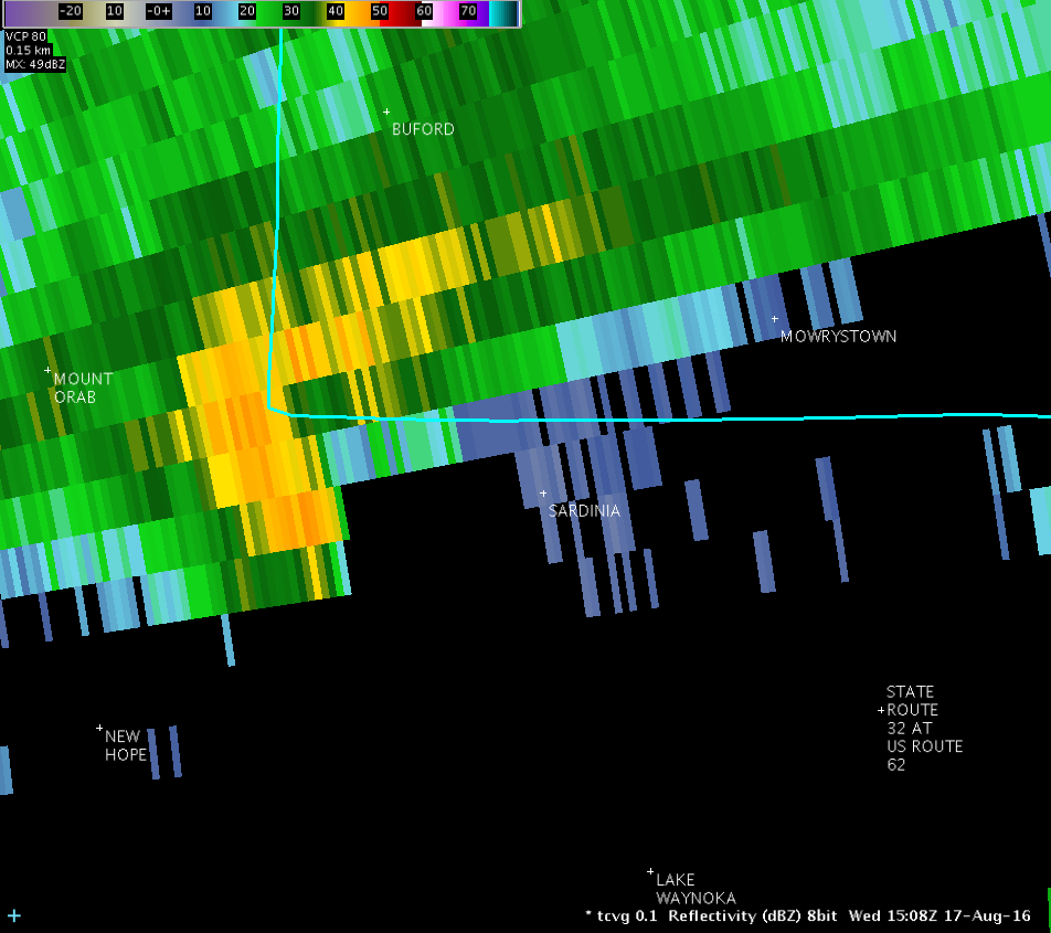
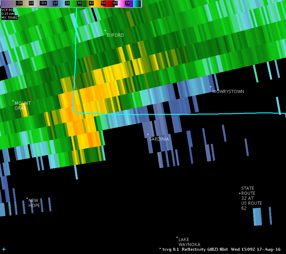
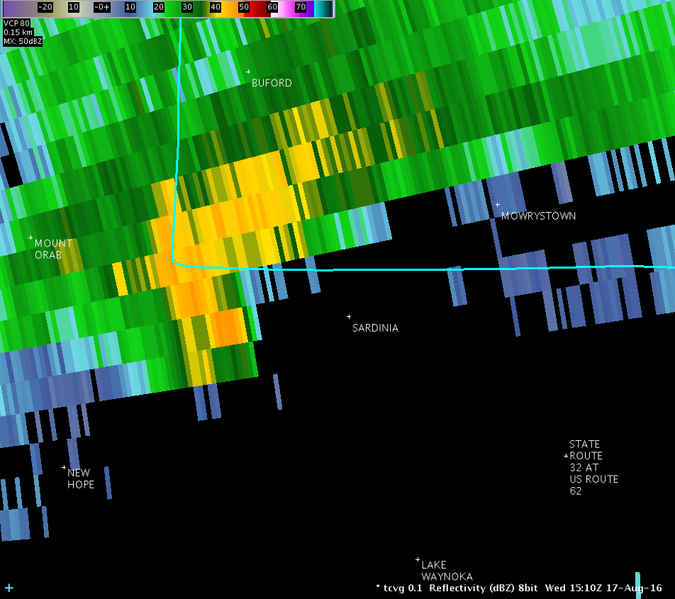
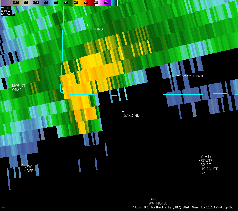
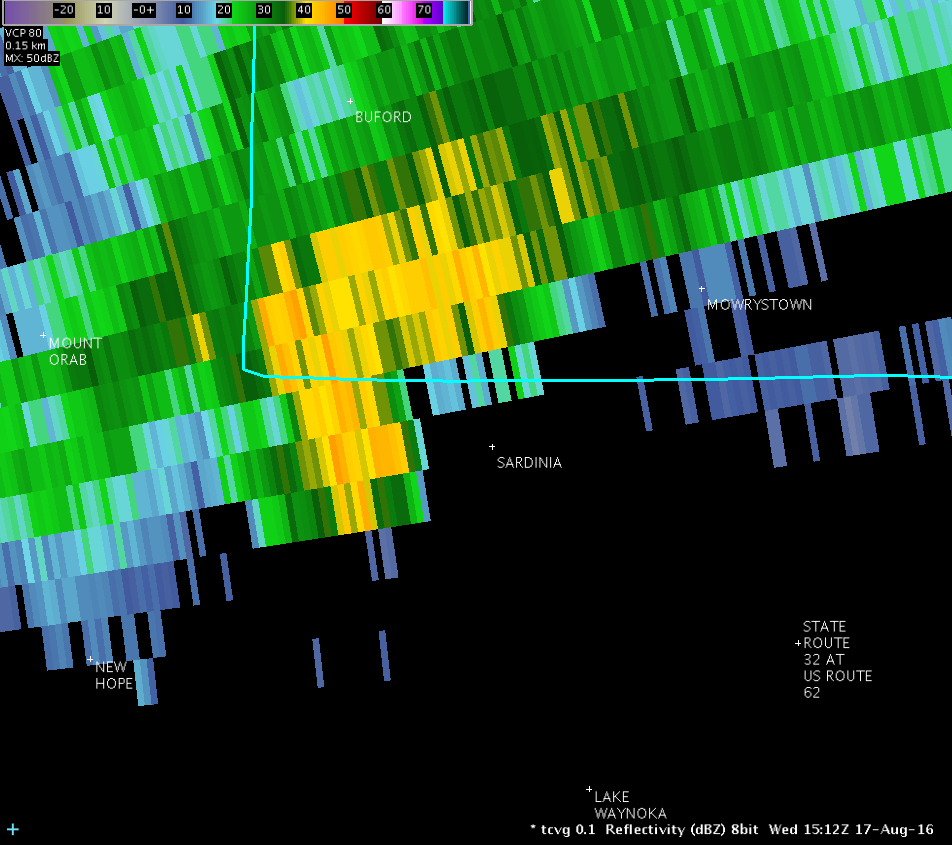
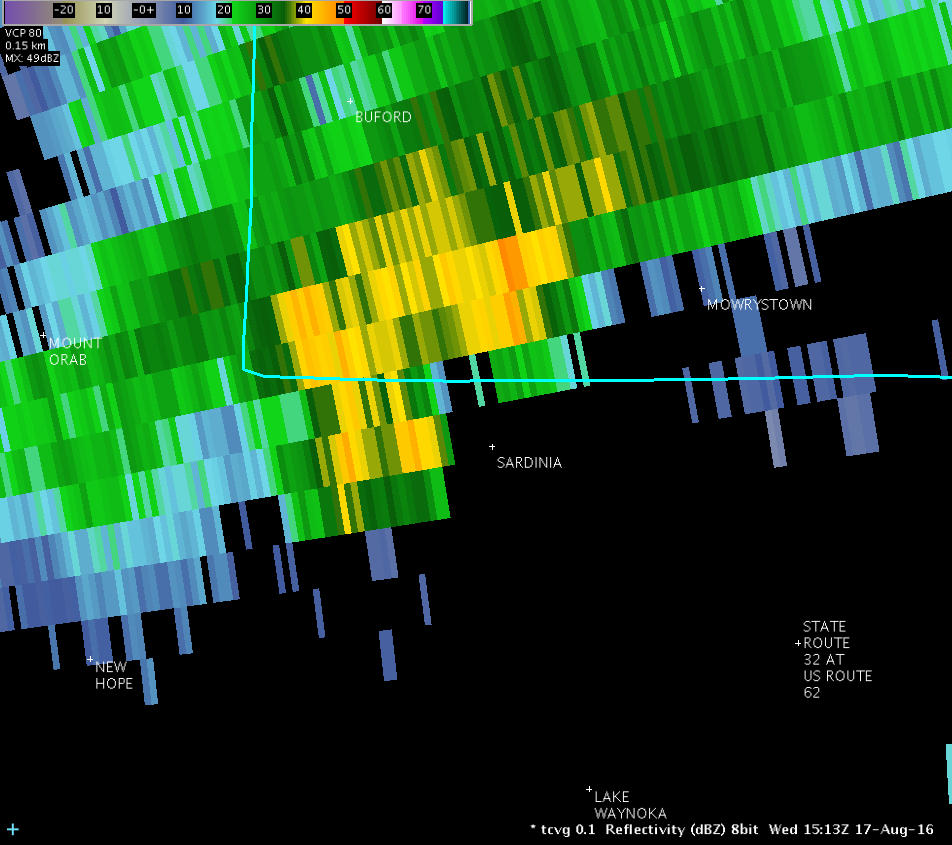
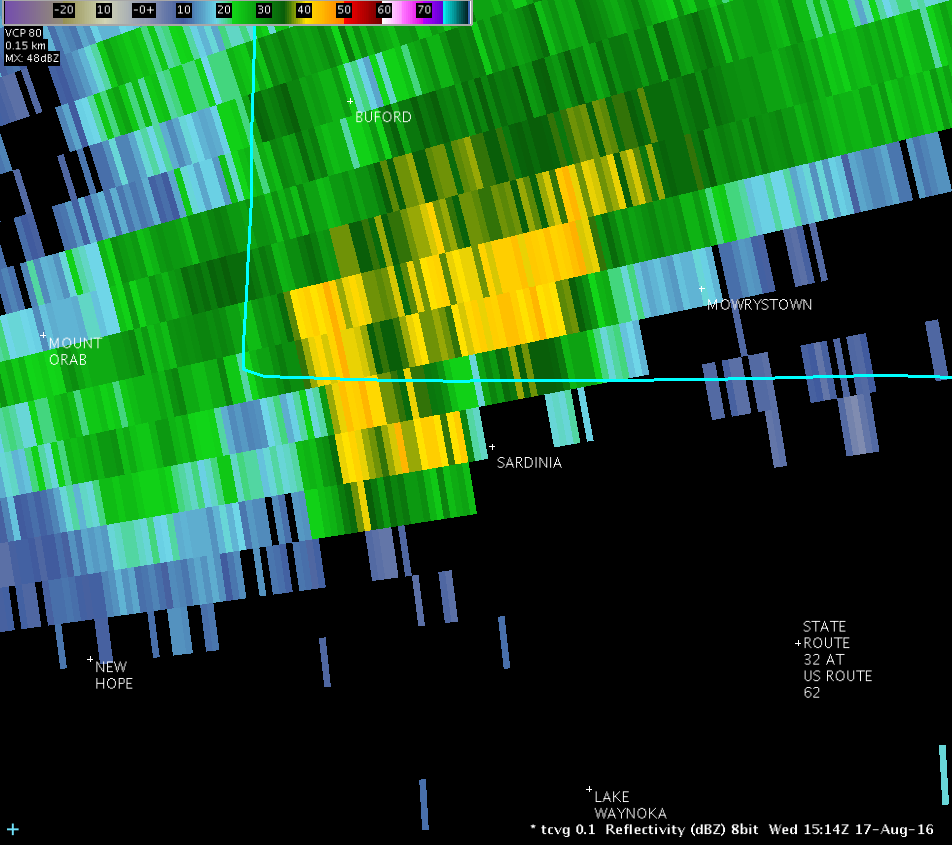
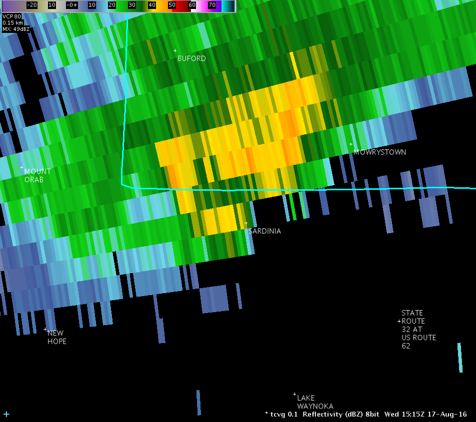
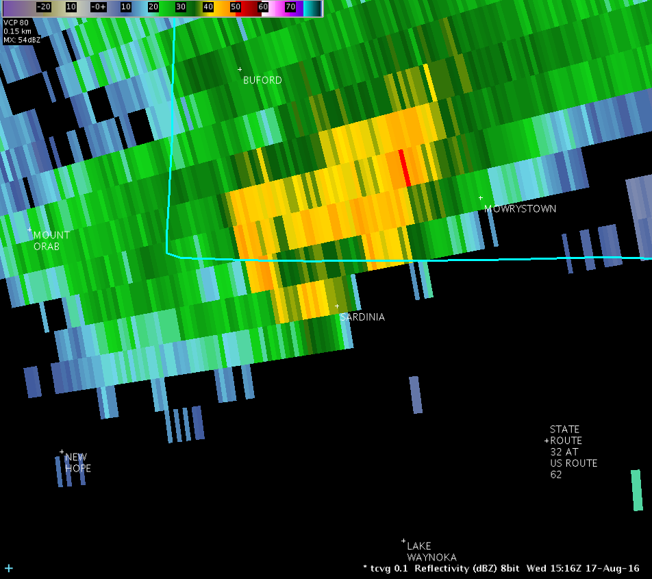
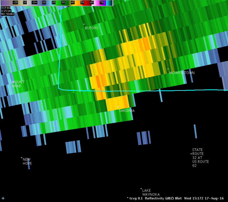
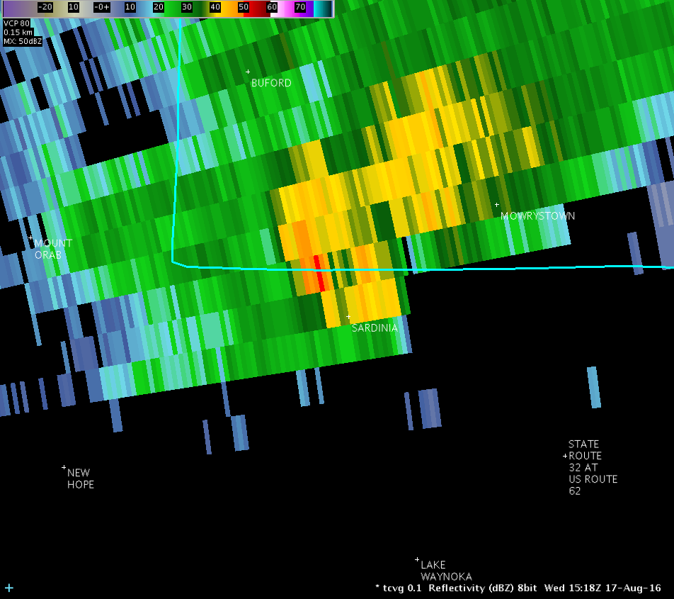
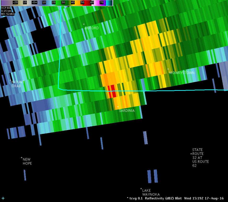
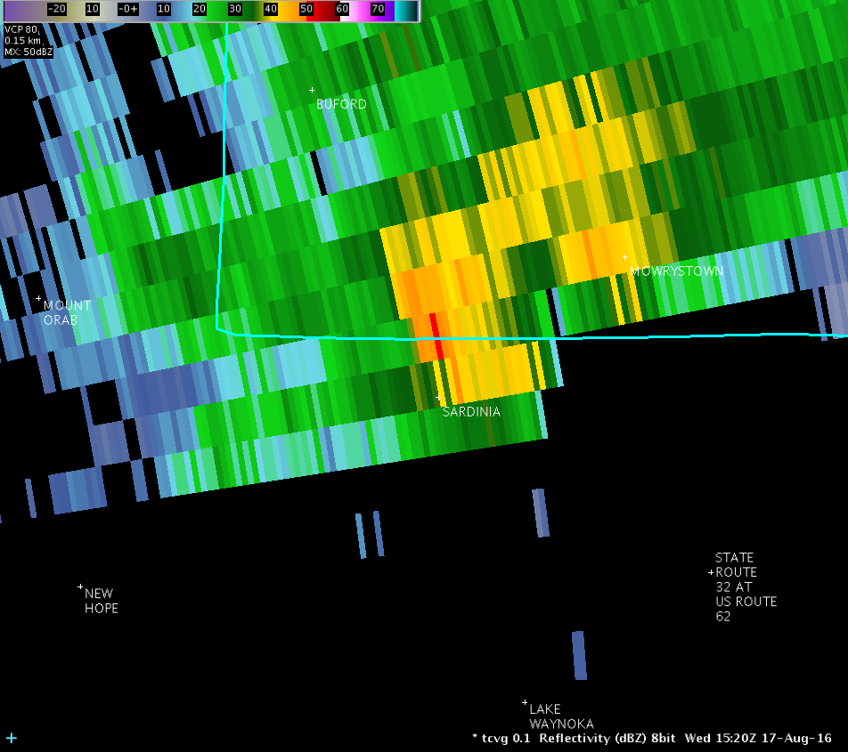
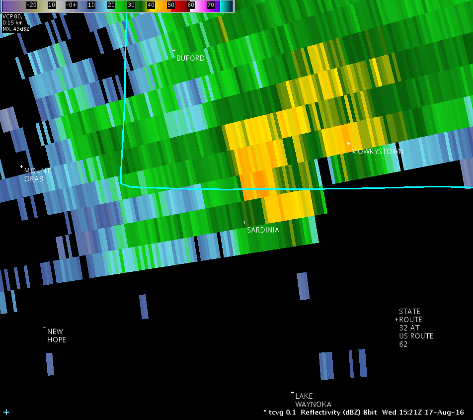
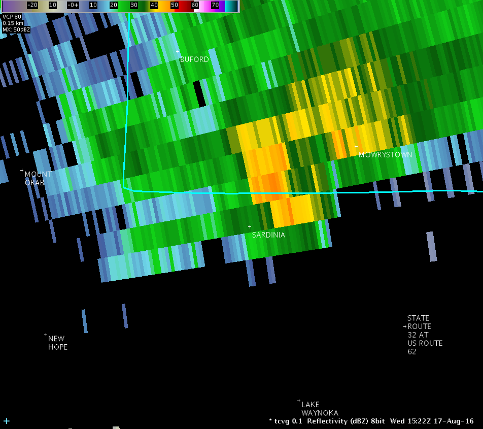
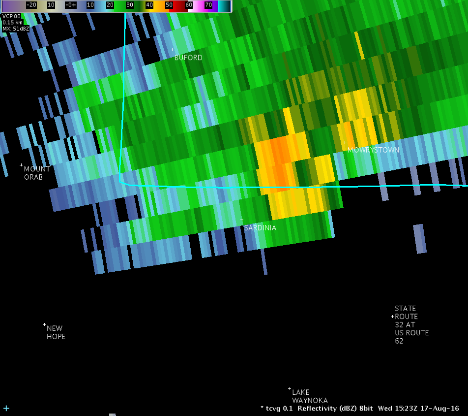
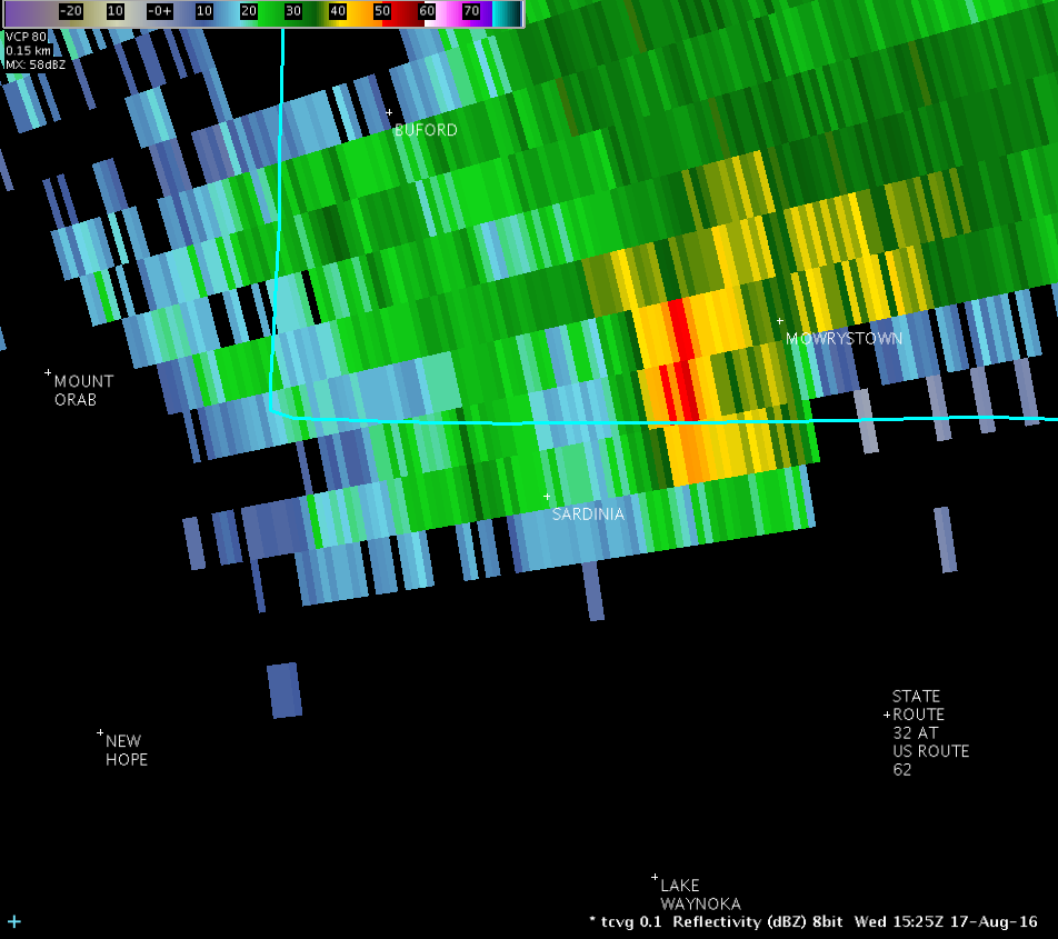
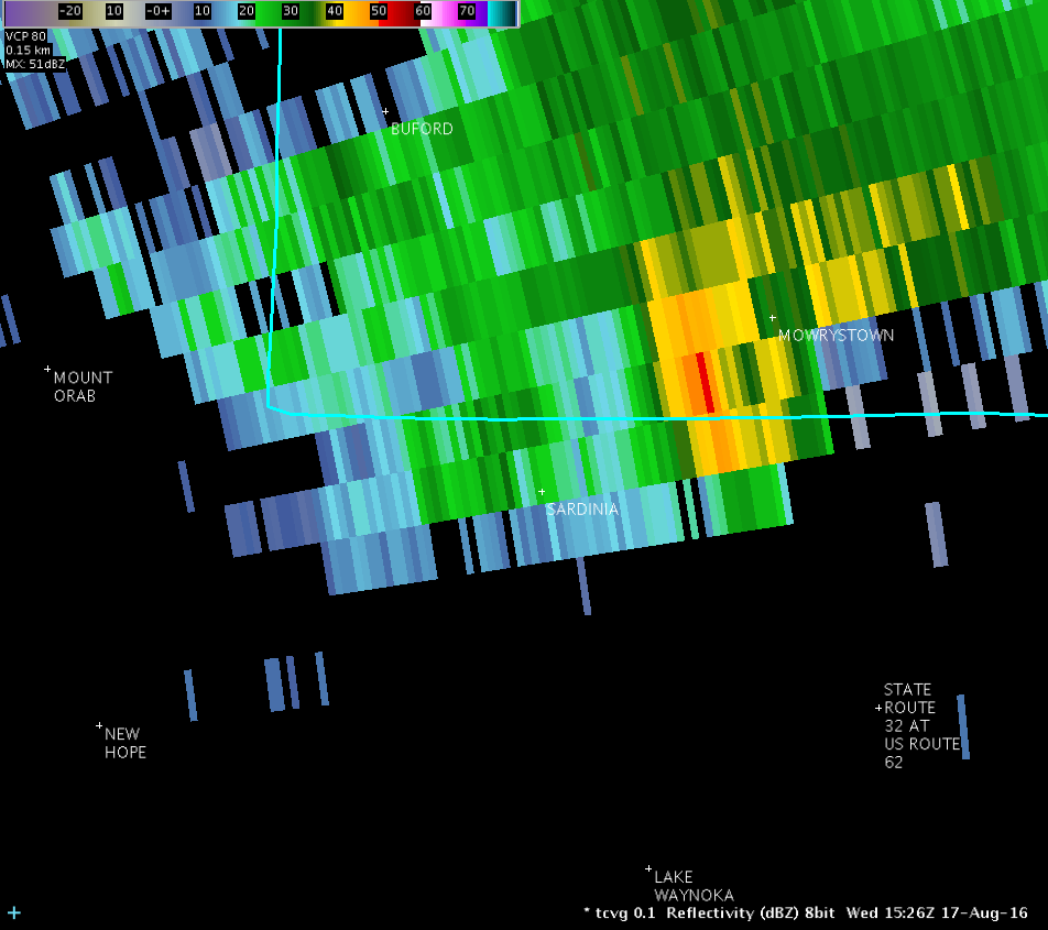
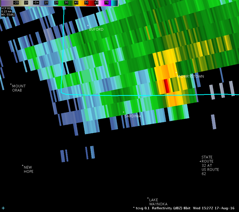
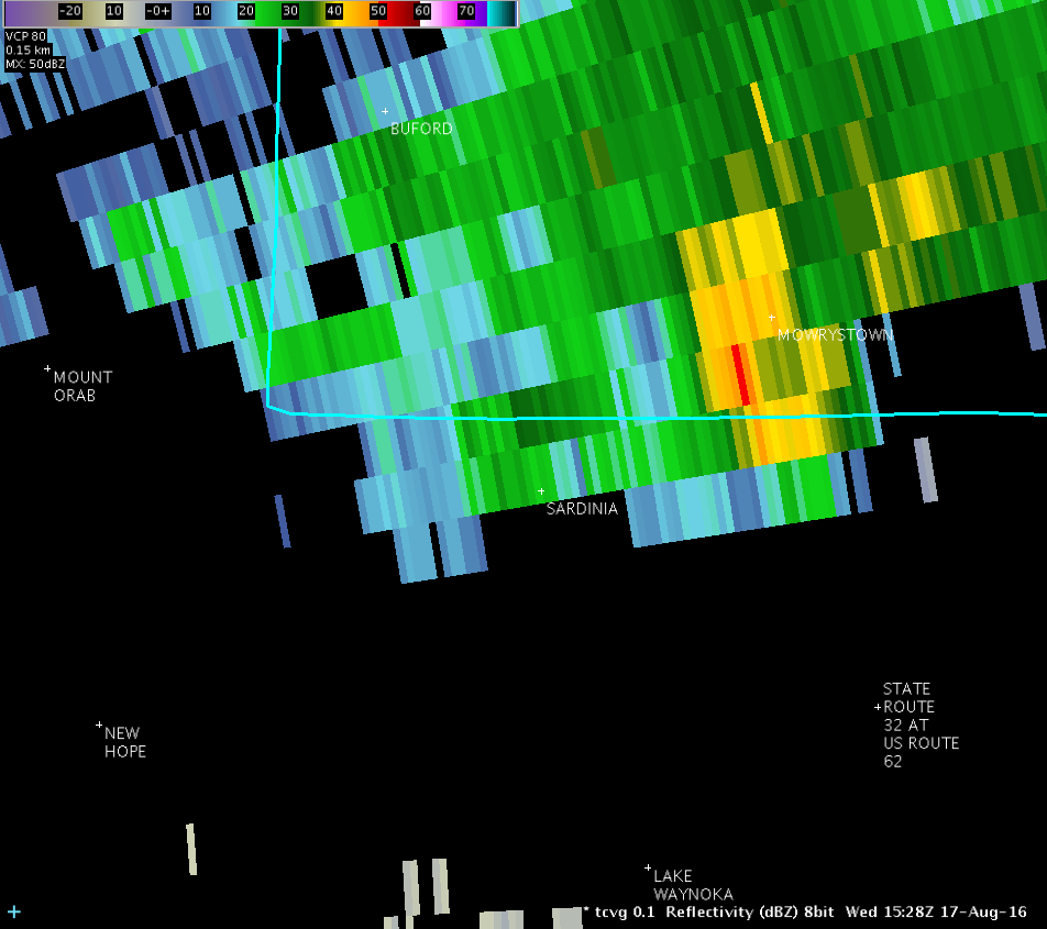
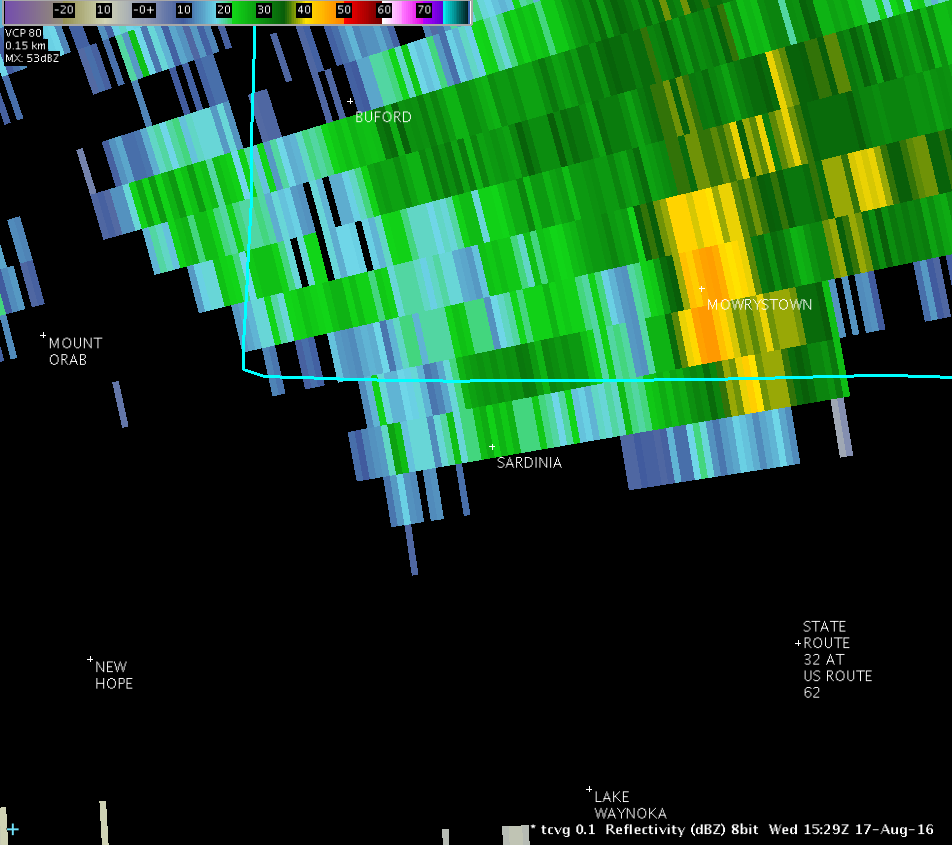
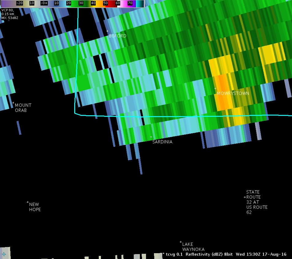
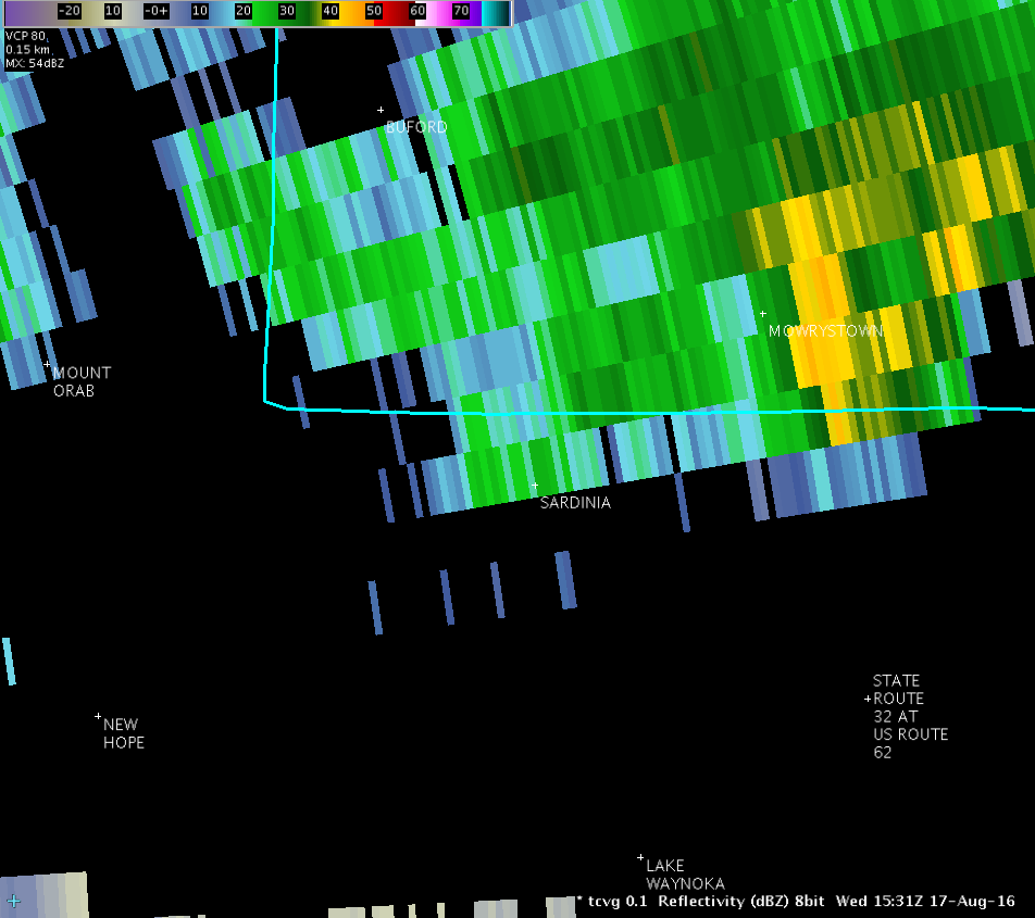
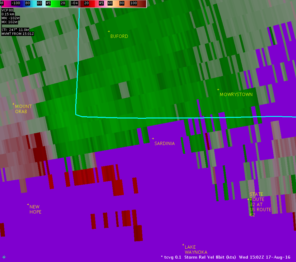
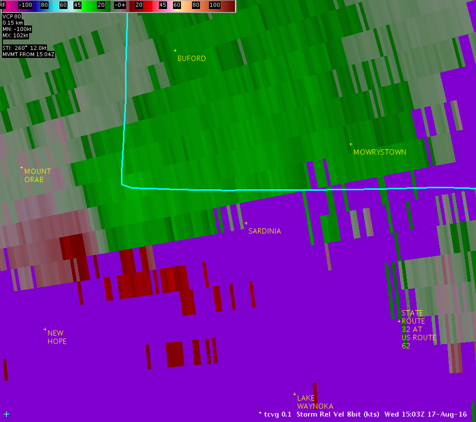
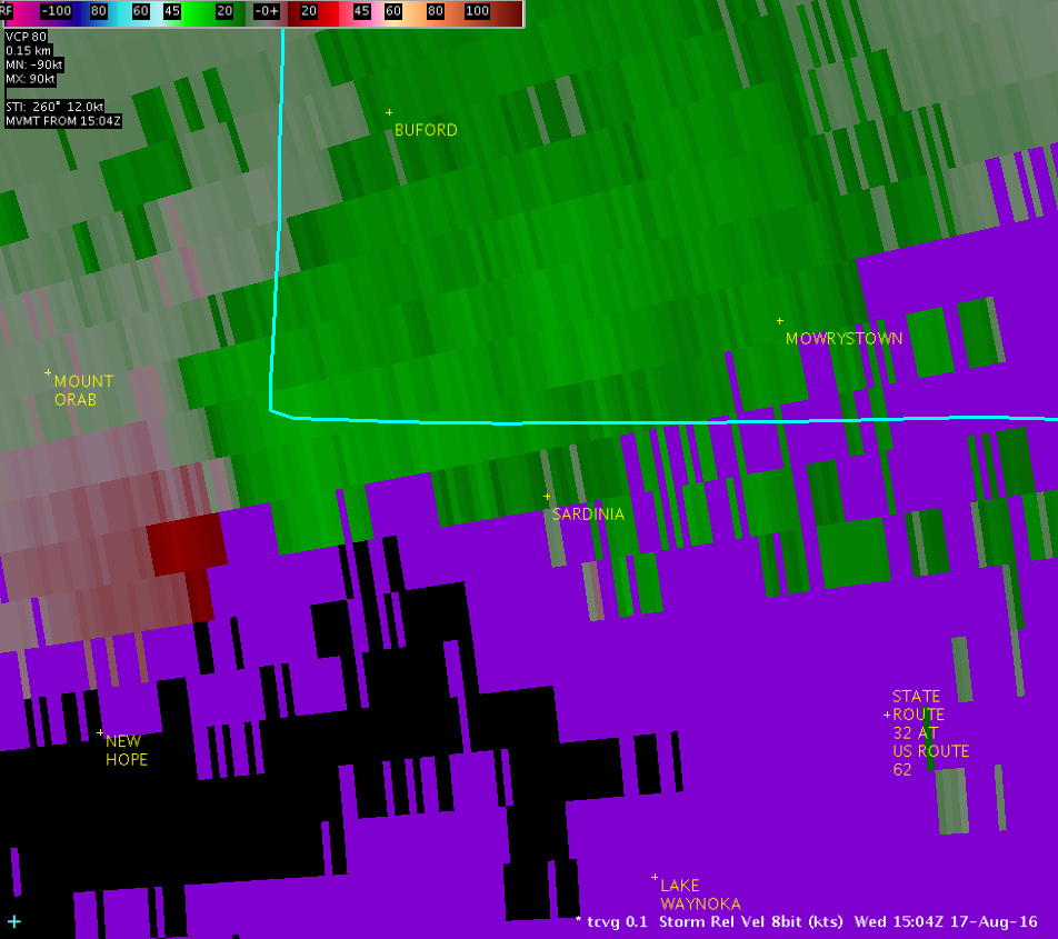
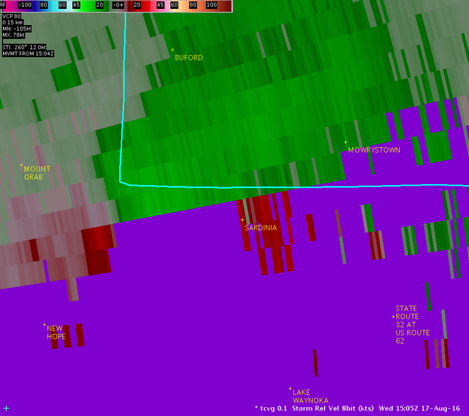
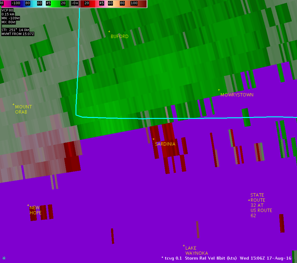
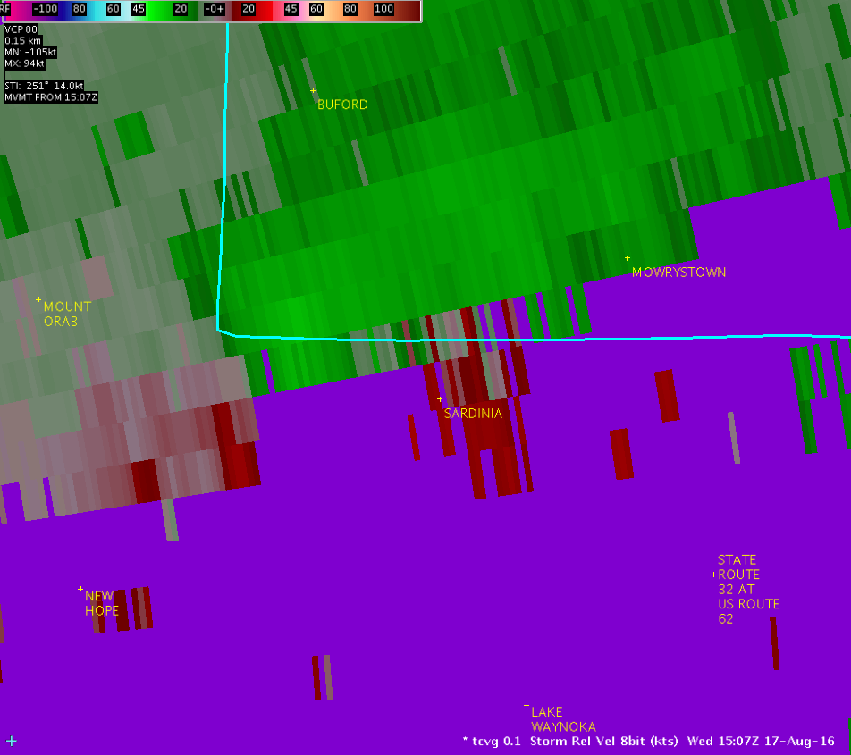
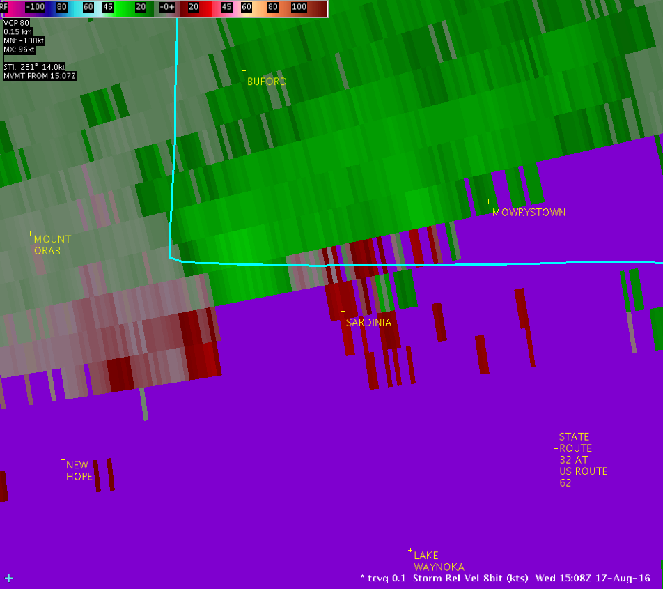
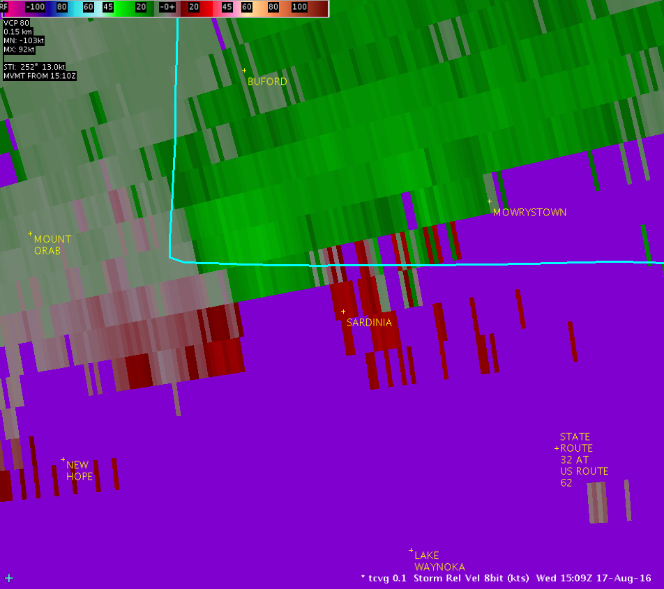
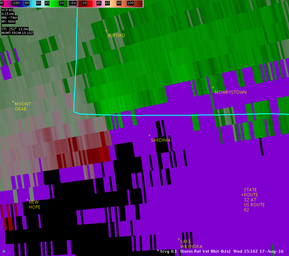
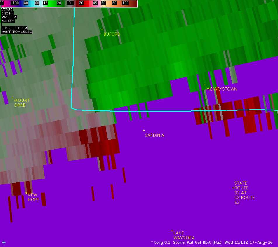
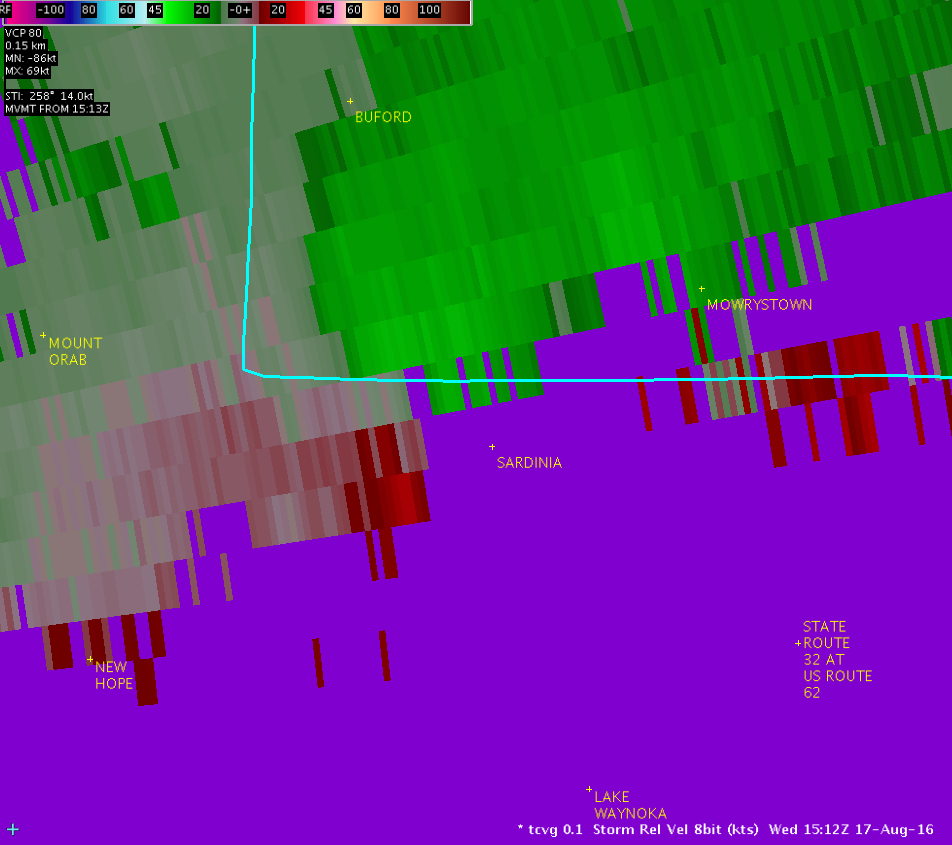
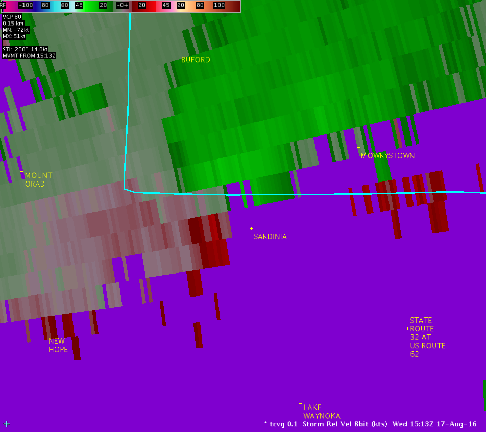
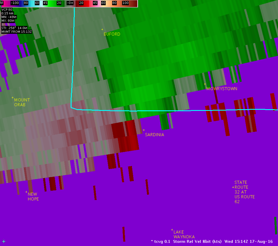
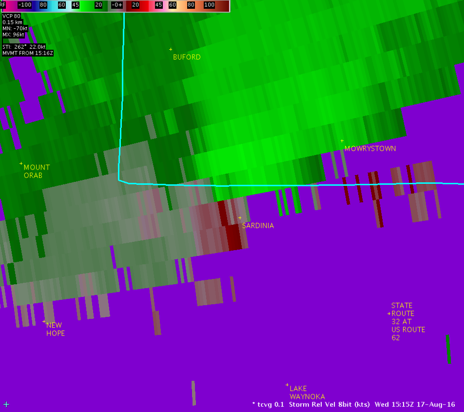
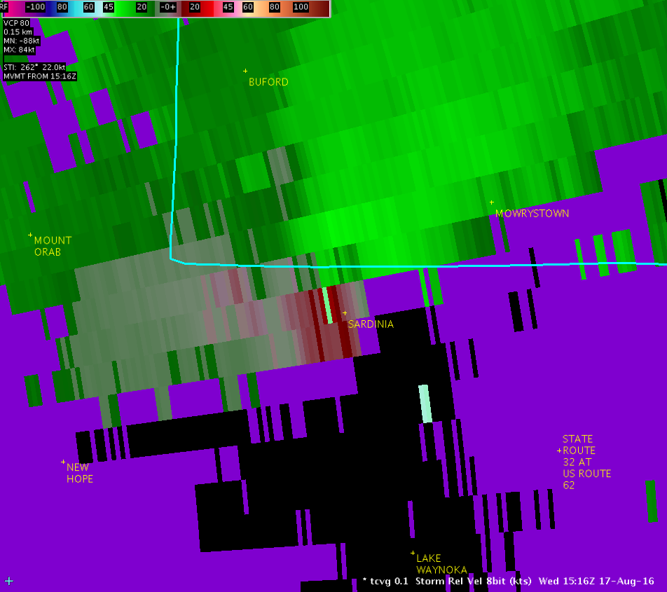
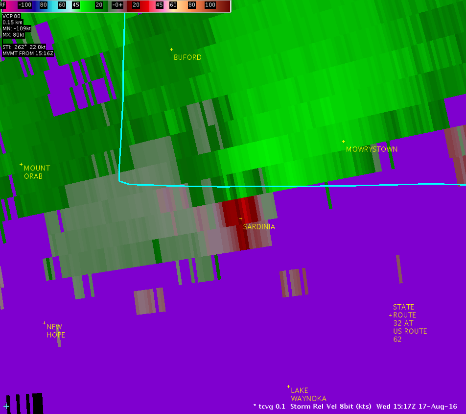
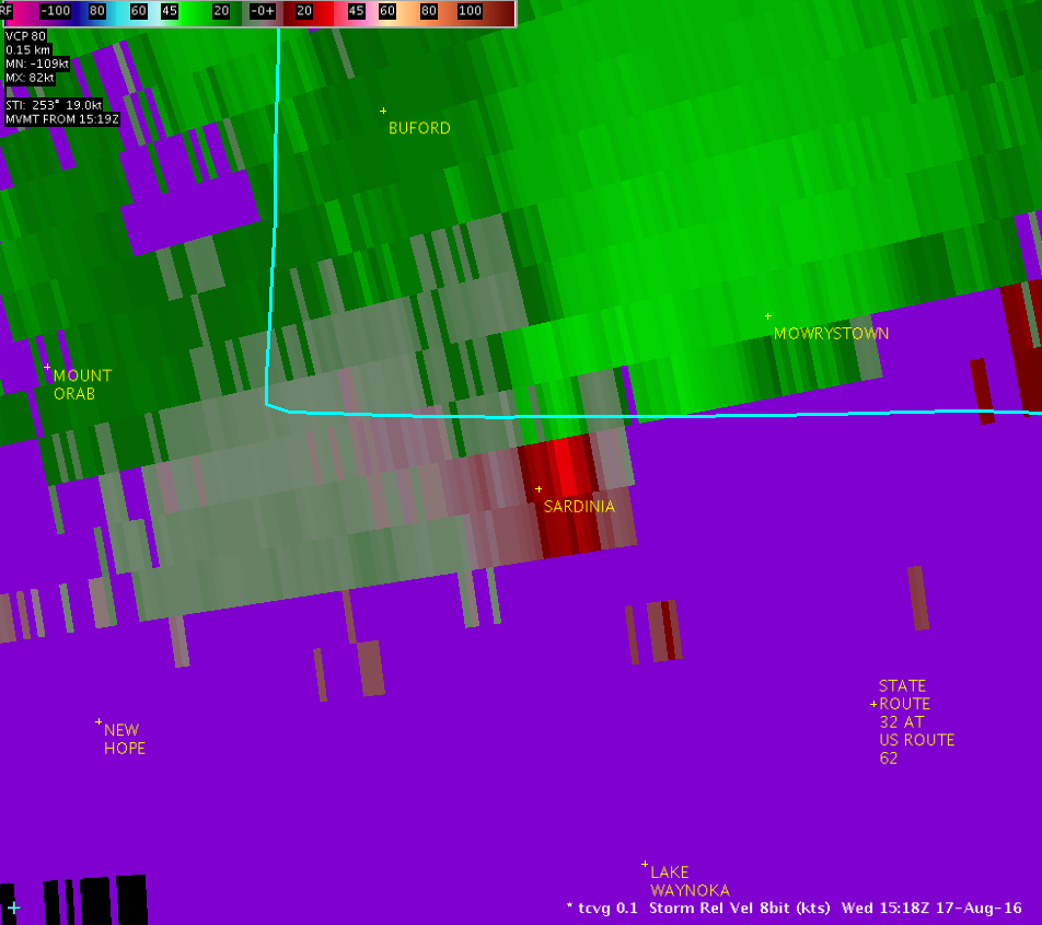
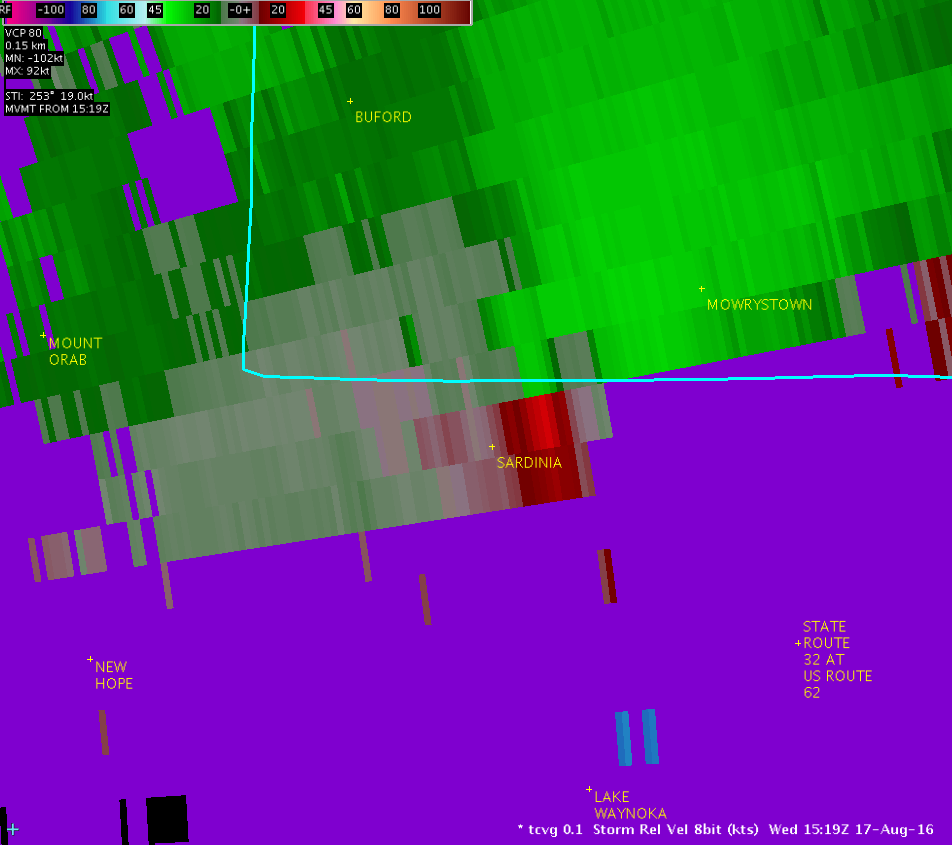
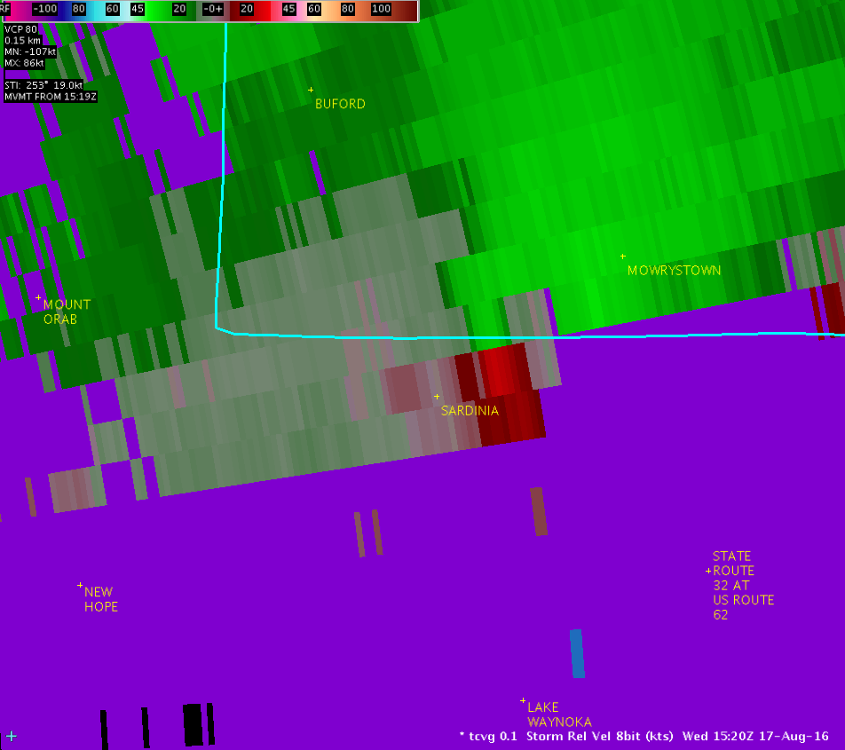
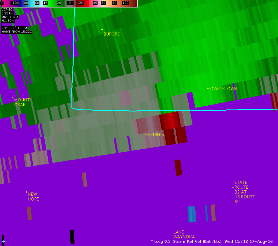
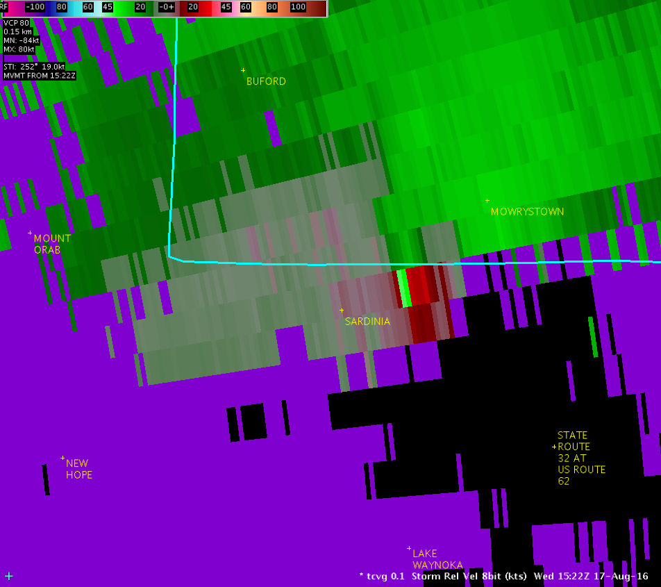
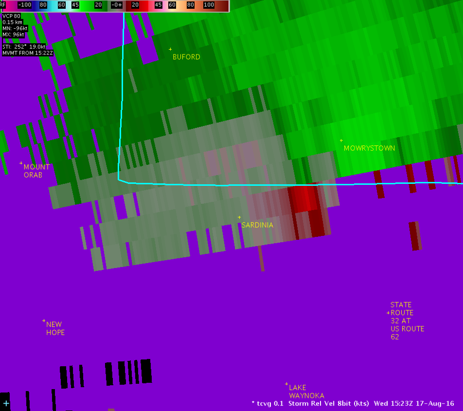
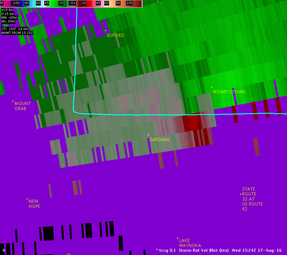
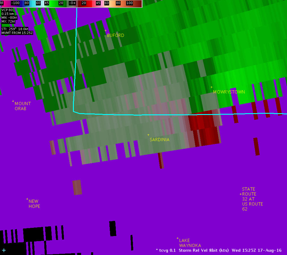
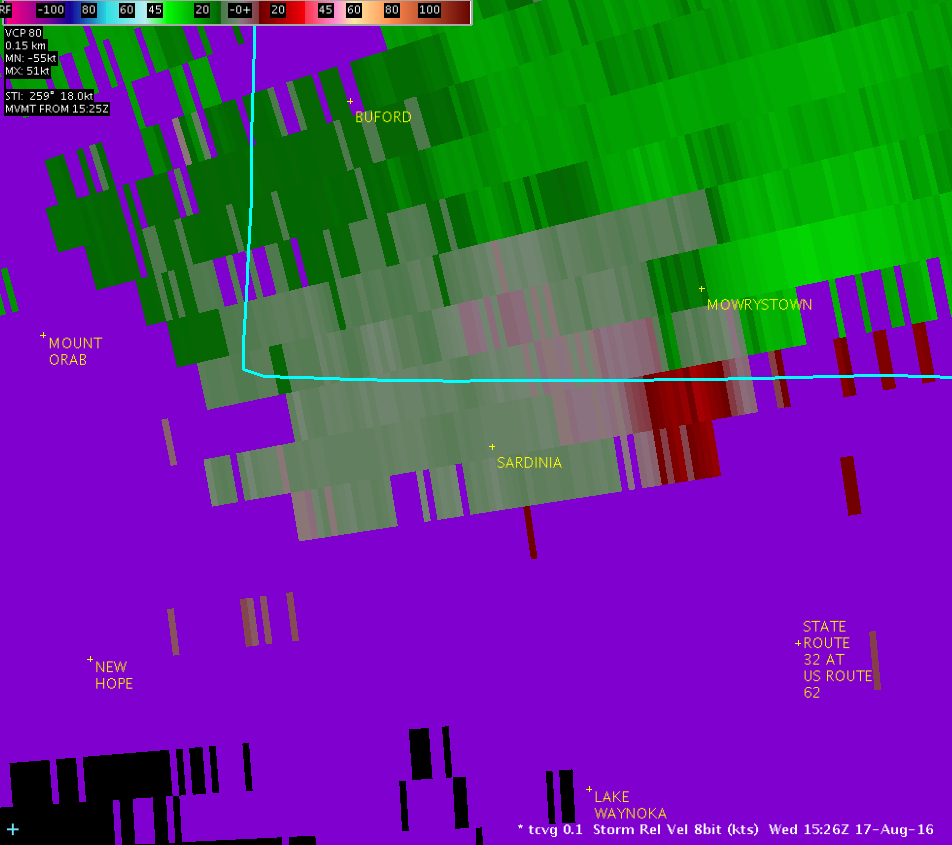
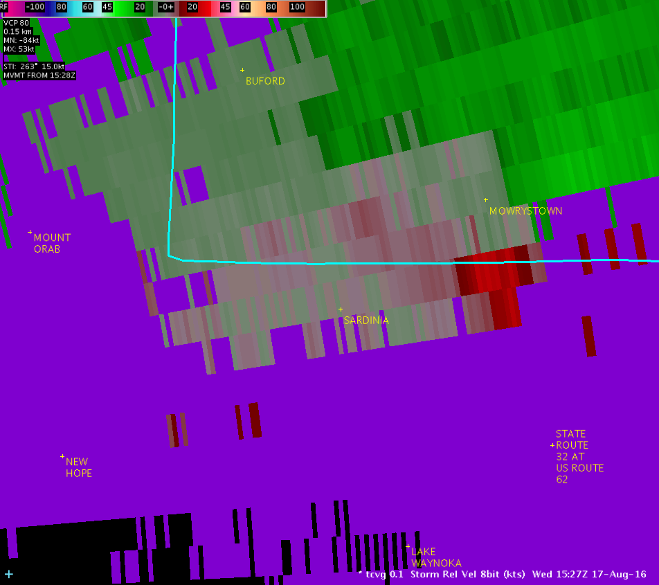
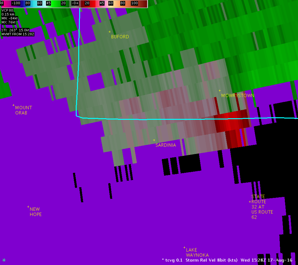
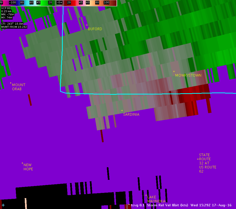
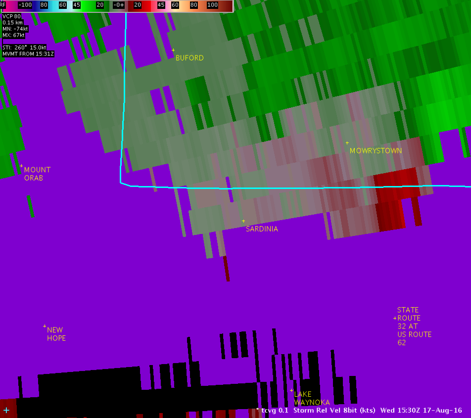
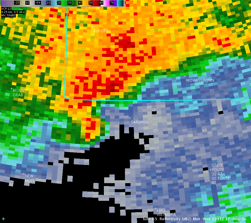
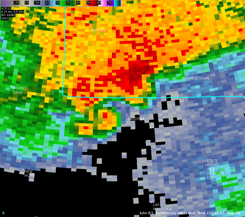
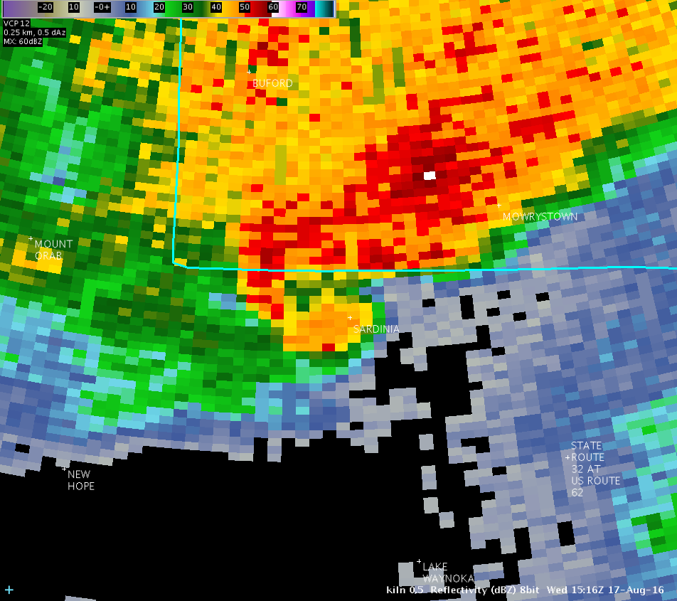
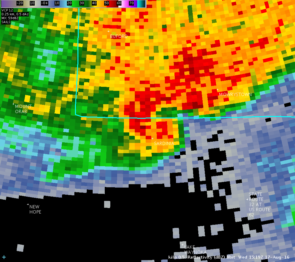
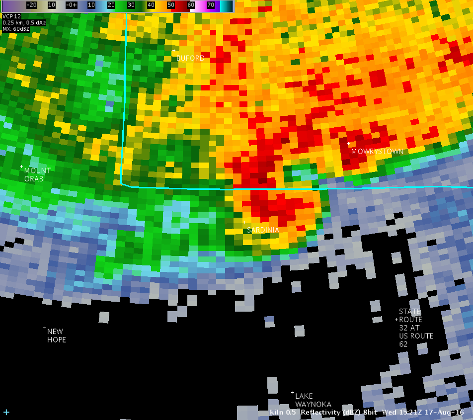
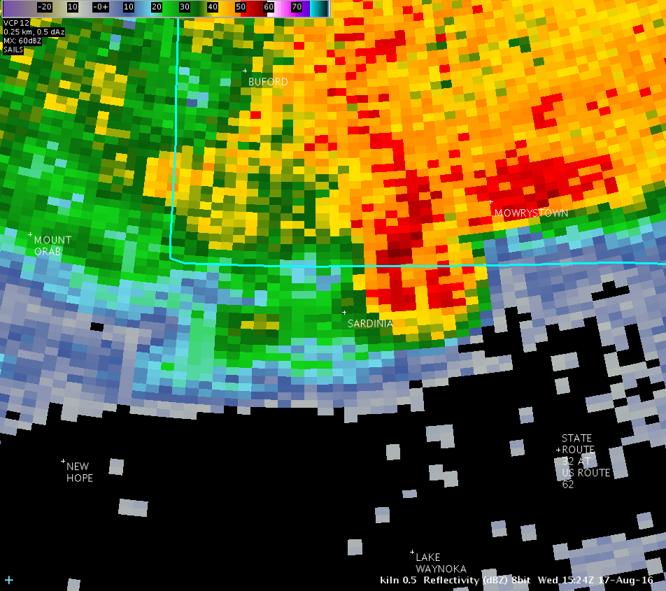
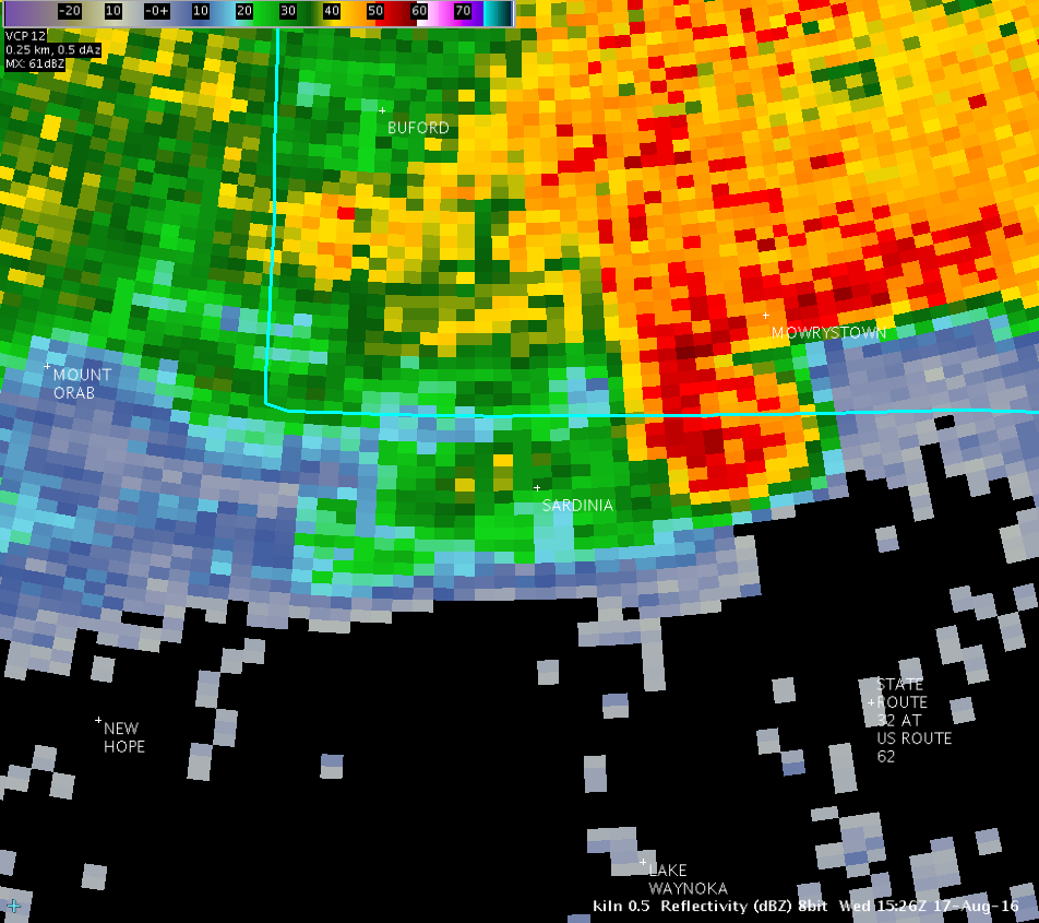
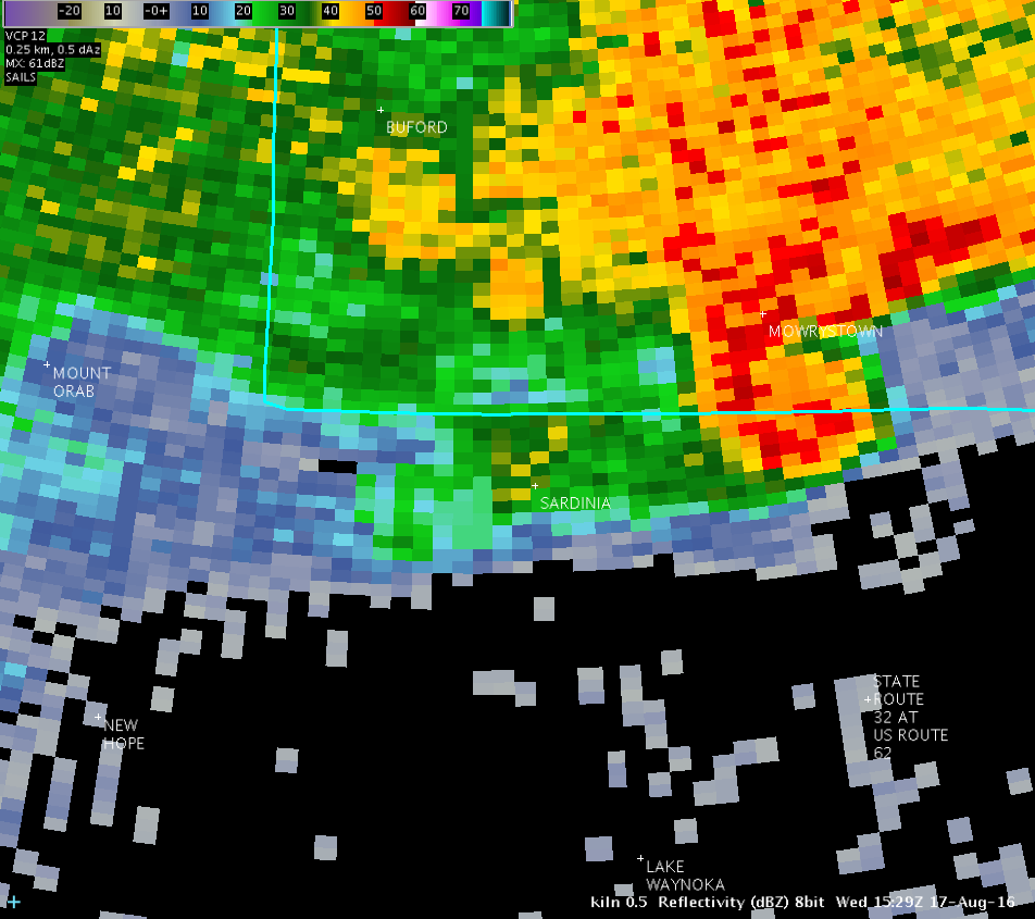
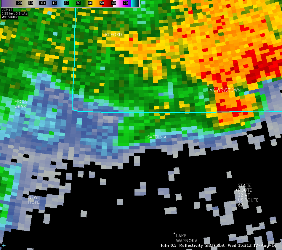
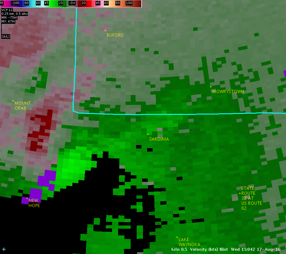
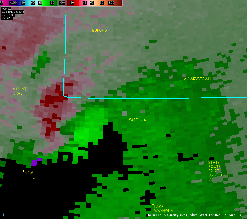
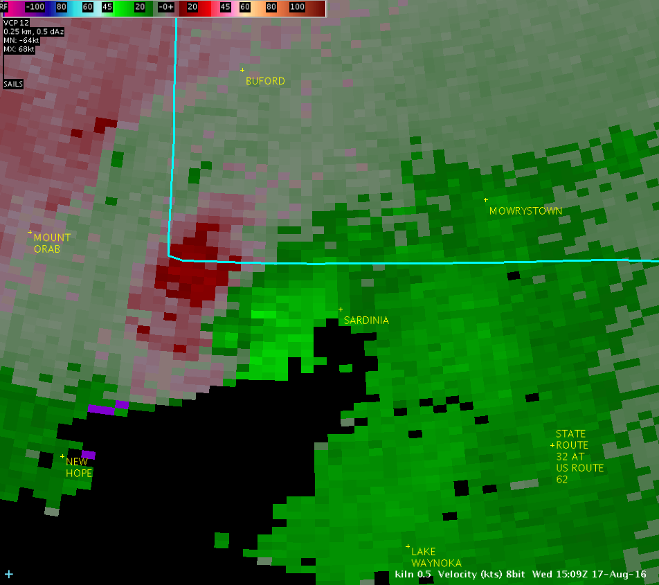
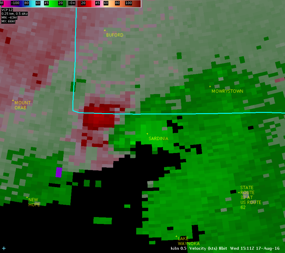
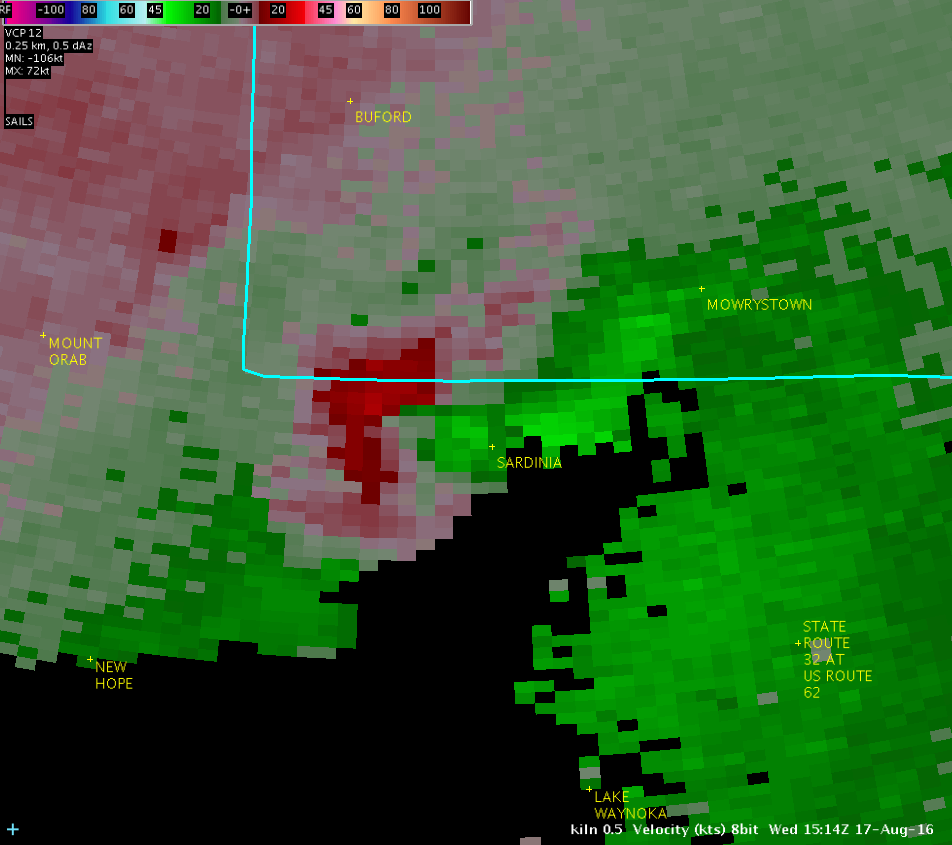
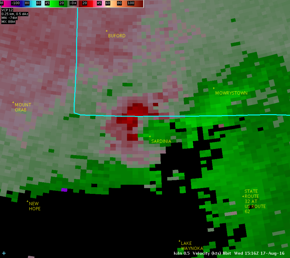
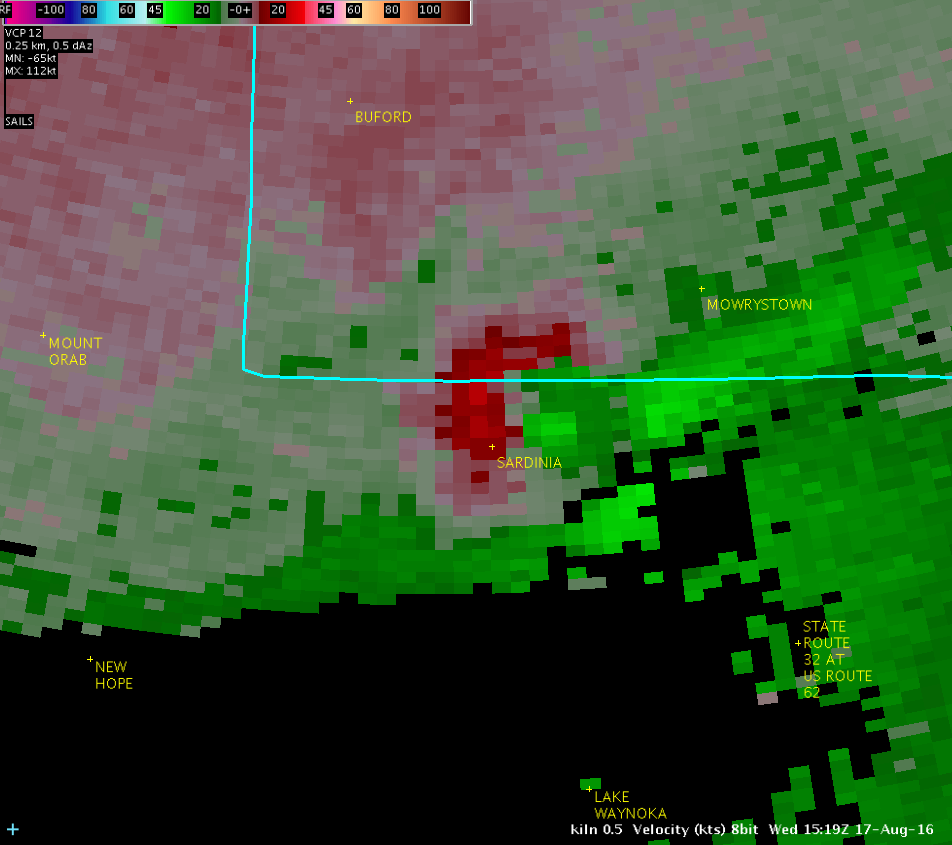
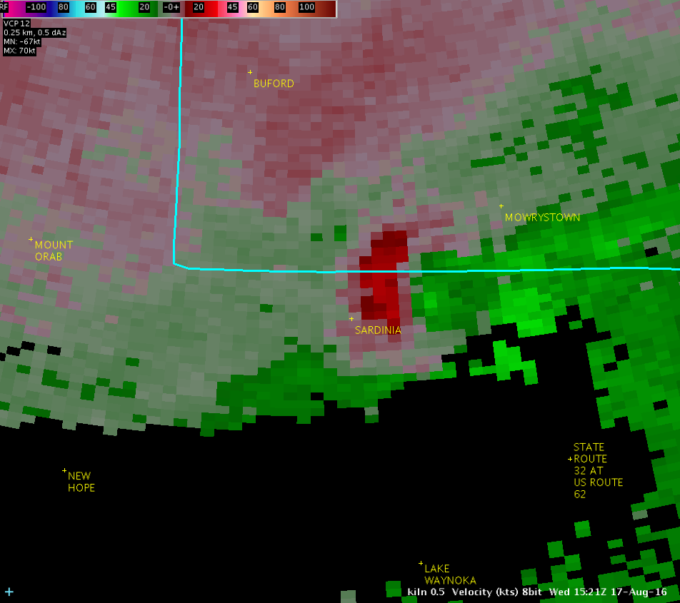
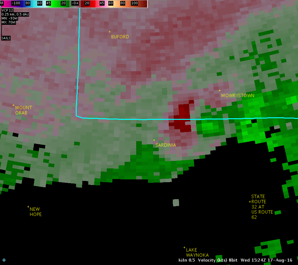
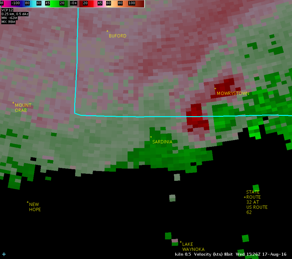
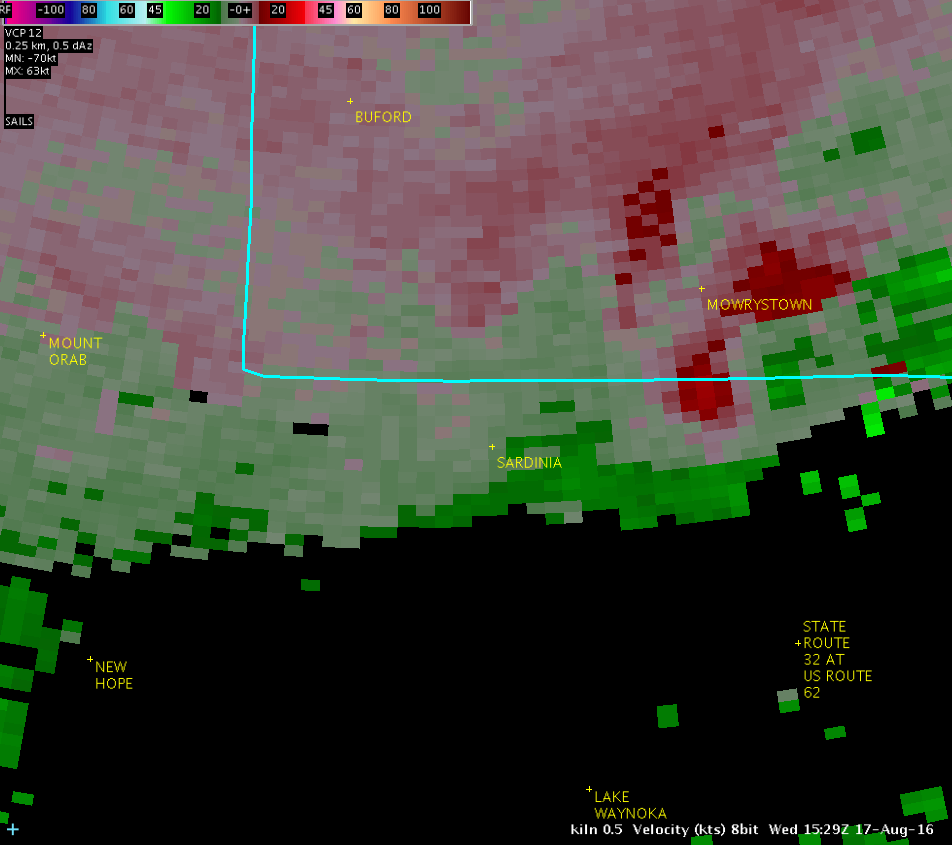
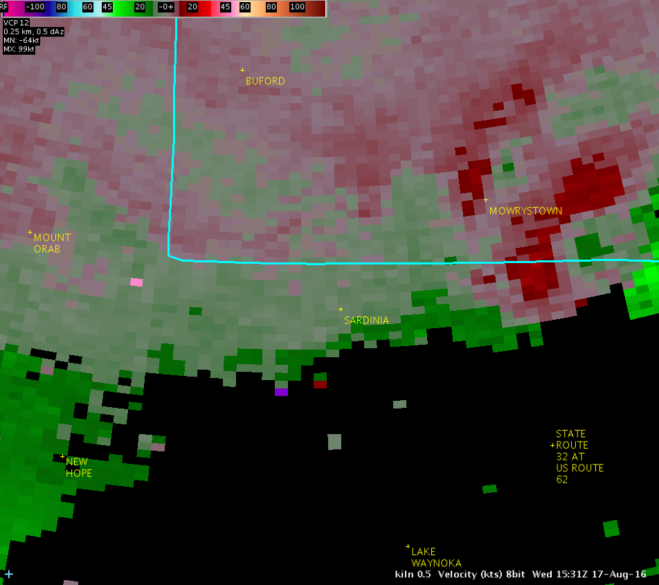
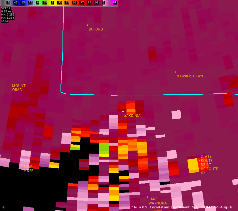
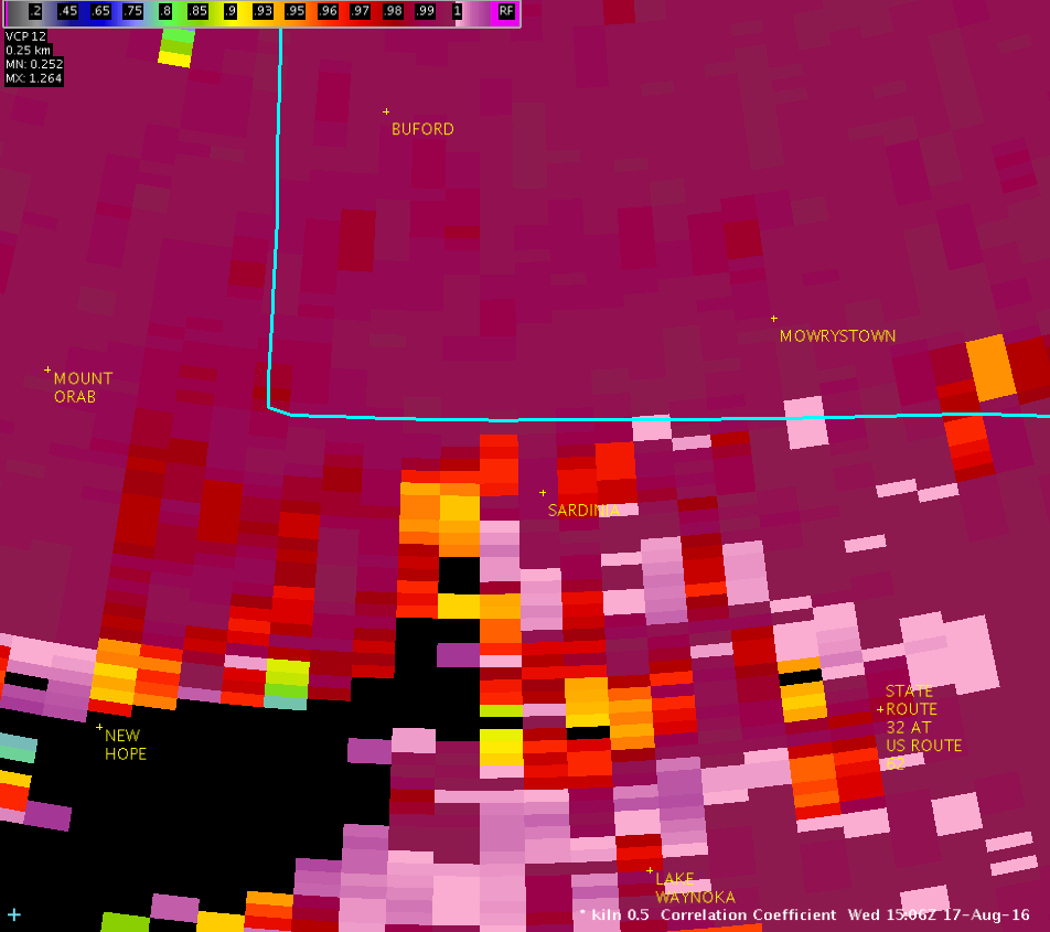
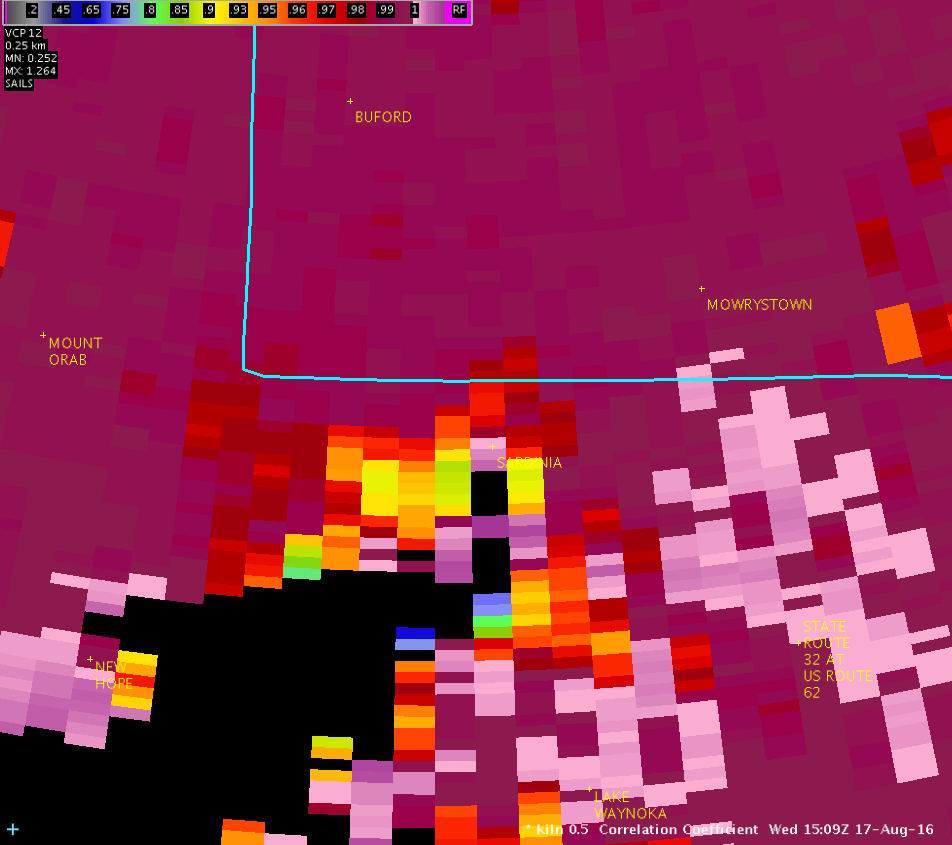
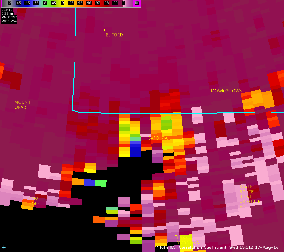
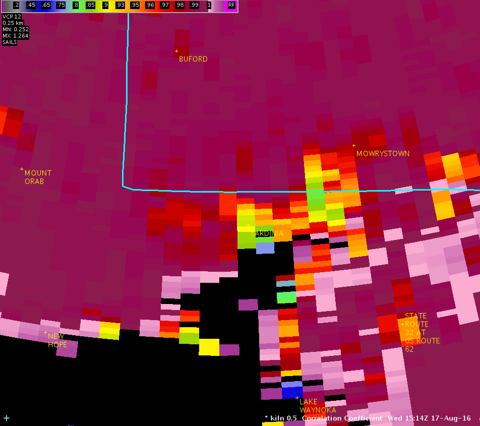
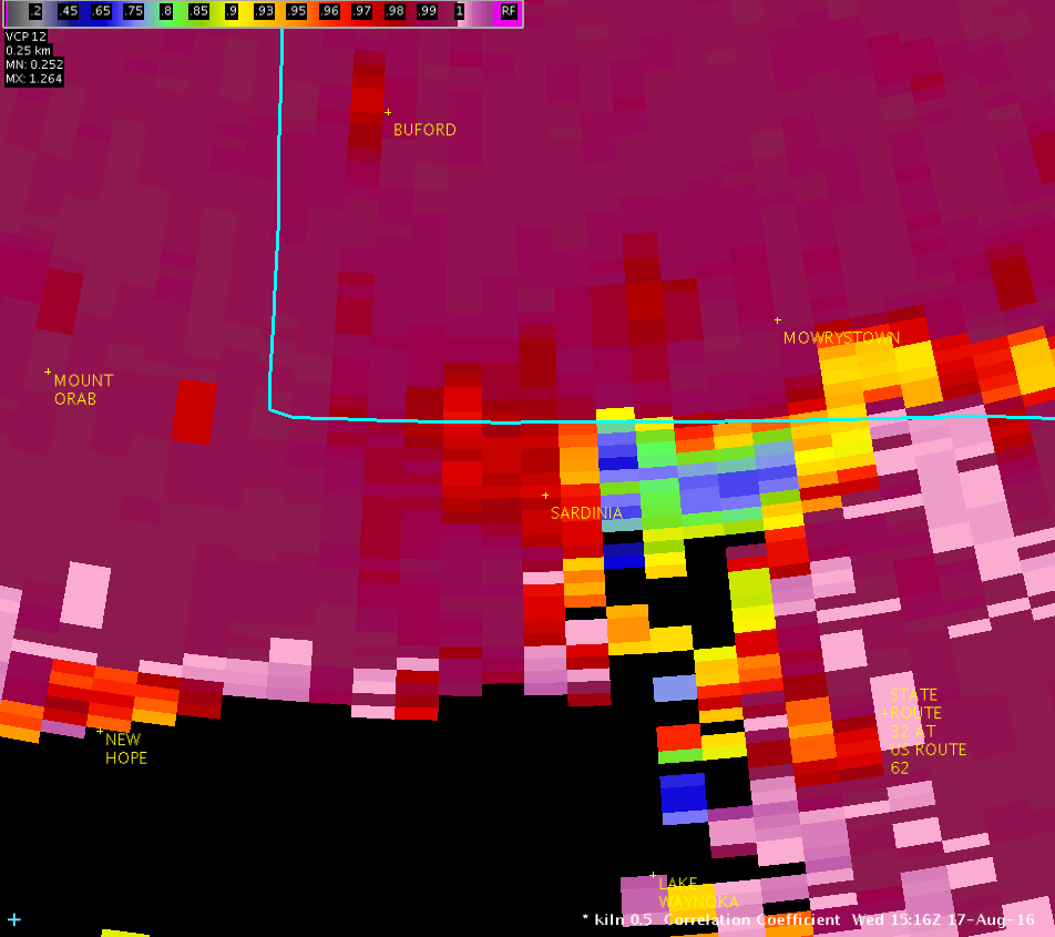
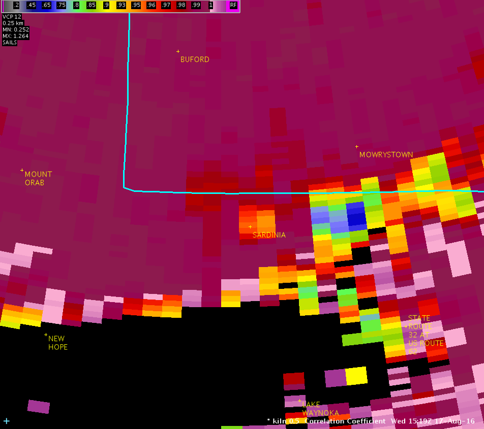
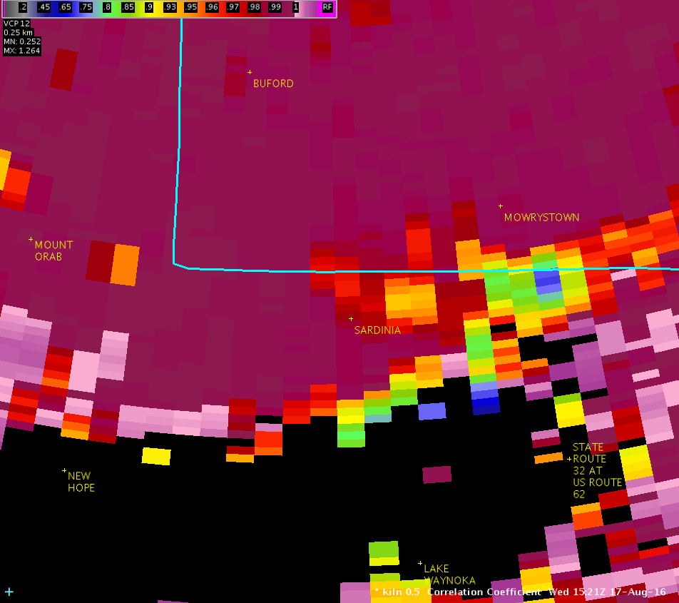
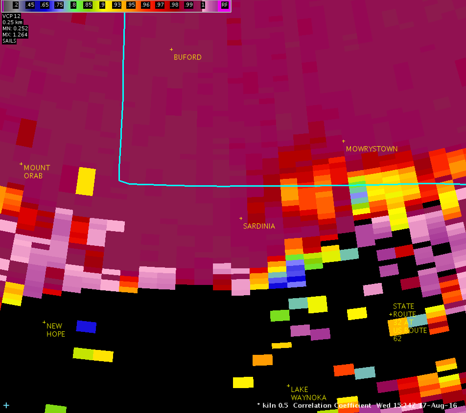
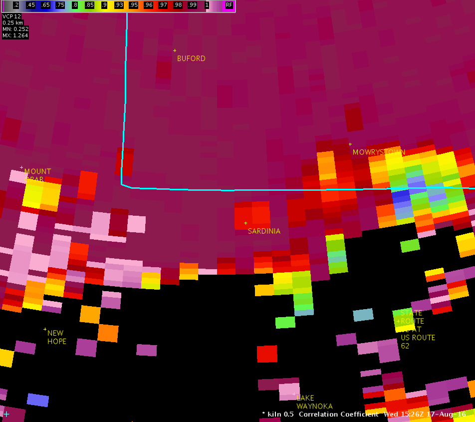
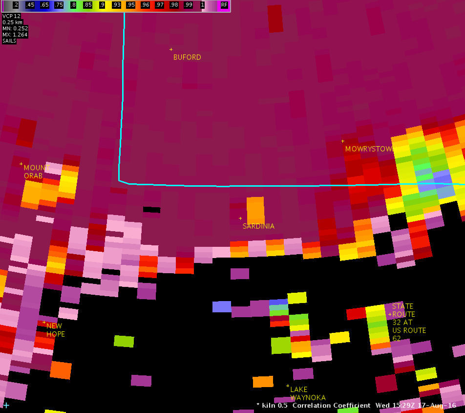
Public Information Statement National Weather Service Wilmington OH 901 PM EDT WED AUG 17 2016 ...Updated Information for Tornado Confirmed in Sardinia in Brown County Ohio... Location...Sardinia in Brown County Ohio Date...August 17th 2016 Estimated Start Time...1116 AM Estimated End Time...1119 AM Maximum EF-Scale Rating...EF0 Estimated Maximum Wind Speed...75 mph Maximum Path Width...100 yards Path Length...1.0 mile Beginning Lat/Lon...39.0068N / 83.8128W Ending Lat/Lon...39.0105N / 83.7957W * Fatalities...0 * Injuries...0 * The information in this statement is preliminary and subject to change pending final review of the event(s) and publication in NWS Storm Data. ...Summary... The National Weather Service in Wilmington OH has confirmed a tornado in Sardinia in Brown County Ohio on August 17th 2016. A weak tornado touched down on the west side of Sardinia near Highway 24B /Maple Ave/ and moved east-northeast through the village ending on the northeast side of town near Highway 32 /Appalachian Highway/. The beginning of the tornado track was marked by scattered broken tree branches generally 3-6 inches in diameter. These branches tended to fall in a narrow corridor indicating convergence along the track. This was the primary damage observed near Maple Ave as it entered the western portion of Sardinia up to just south of the intersection with Broad Street. A few slightly larger branches up to approximately 8 inches in diameter were broken as the tornado moved just south of Winchester Street. Wind speeds of approximately 60-70 mph likely caused much of this damage. The tornado appeared to strengthen and widen as it continued to move near and just south of Sardinia-Mowrystown Road in Sardinia. Minor structural damage became more evident in this area and larger trees were broken. A gas station pump was dislodged from its base near the intersection with Winchester Street, and a section of roofing approximately 45 feet by 10 feet was partially removed from a storage barn 100 yards to the east-northeast. Tree limbs 4-7 inches in diameter were broken across the street in the cemetery and fell south toward the center line of the track. Three large trees approximately 12-18 inches in diameter were uprooted and oriented toward the northeast on the south side of Sardinia-Mowrystown Road, near the intersection with Kelly Street. Wind speeds of 65-75 mph likely brought down these trees, though wet soils also contributed. A brick chimney was also partially destroyed on a nearby house. An overall convergent debris pattern was evident in this area, especially with the tree damage. The tornado then started to weaken just before dissipating east of Brookfield Place near Highway 32 /Appalachian Highway/. A metal carport approximately 20 feet by 12 feet was lifted from the north side of Brookfield Place near the intersection with Meadow View, carried across Brookfield Place, and dropped on the south side of the road. Leaf spatter was also observed on the west-facing side of a motor home near where the carport was dropped. An eyewitness at this location described a column of rotating debris associated with the tornado. Minor tree damage was noted at the east end of Brookfield Place, after which the tornado dissipated. Wind speeds in this area were likely 60-70 mph. The National Weather Service extends thanks to Brown County Emergency Management and the affected homeowners for their assistance and eyewitness accounts during this survey. For reference...the Enhanced Fujita Scale classifies tornadoes into the following categories: EF0...wind speeds 65 to 85 mph. EF1...wind speeds 86 to 110 mph. EF2...wind speeds 111 to 135 mph. EF3...wind speeds 136 to 165 mph. EF4...wind speeds 166 to 200 mph. EF5...wind speeds greater than 200 mph. $$ BINAU/SHOBE2/HATZOS/GIBSON |
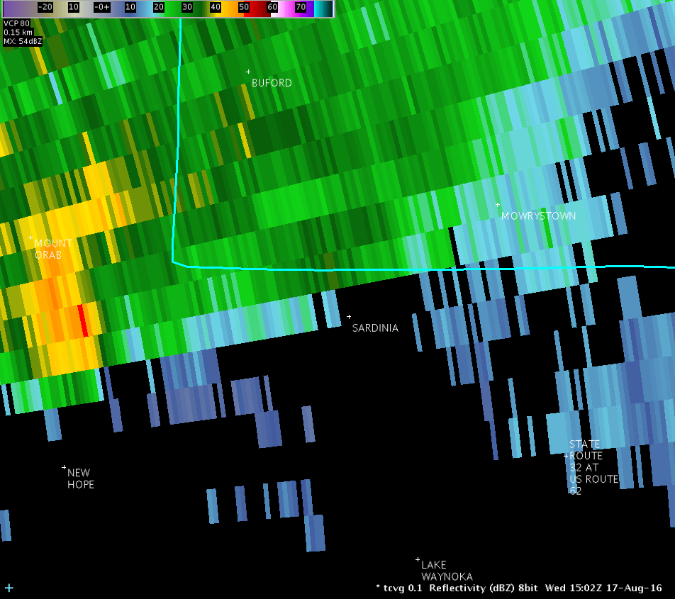
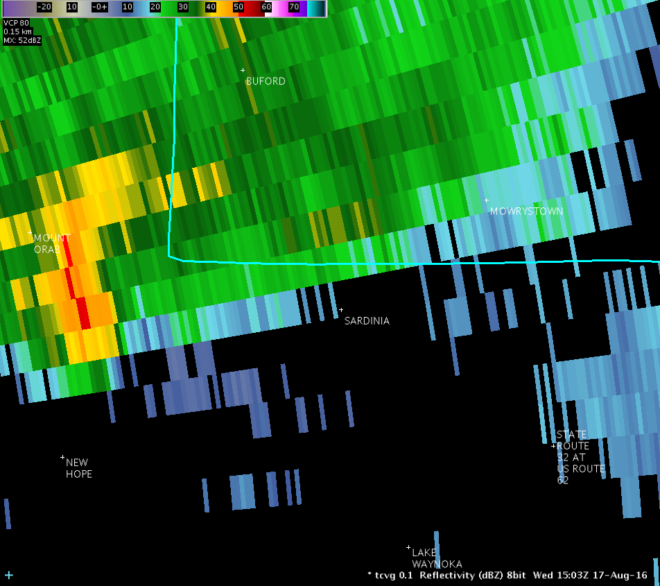
| Full Radar Loops from the Cincinnati Terminal Doppler Weather Radar (11:02 AM - 11:31 AM) | |
| TCVG 0.1° Reflectivity (1300-1600 feet AGL) | |
| 1 2 3 4 5 6 7 8 9 10 11 12 13 14 15 16 17 18 19 20 21 22 23 24 25 26 27 28 29 30 Loop | |
| TCVG 0.1° Storm-Relative Motion (1300-1600 feet AGL) | |
| 1 2 3 4 5 6 7 8 9 10 11 12 13 14 15 16 17 18 19 20 21 22 23 24 25 26 27 28 29 30 Loop | |
| Full Radar Loops from NWS Wilmington Ohio (11:04 AM - 11:31 AM) | |
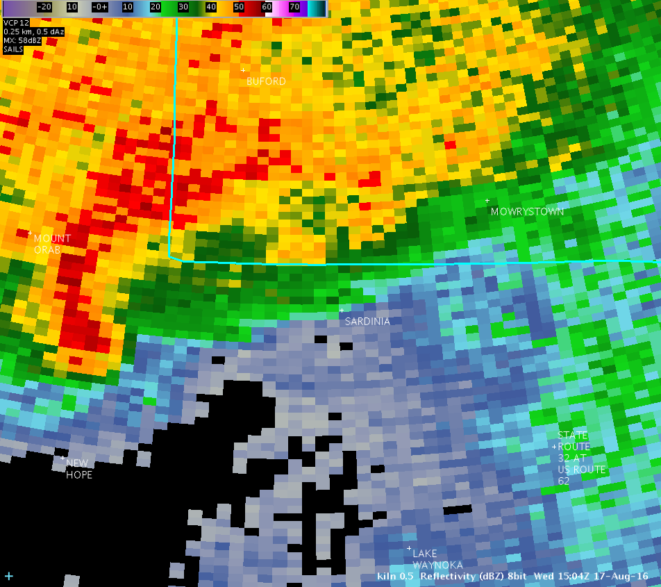
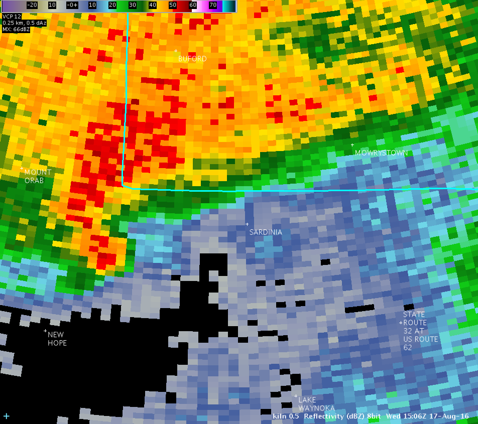
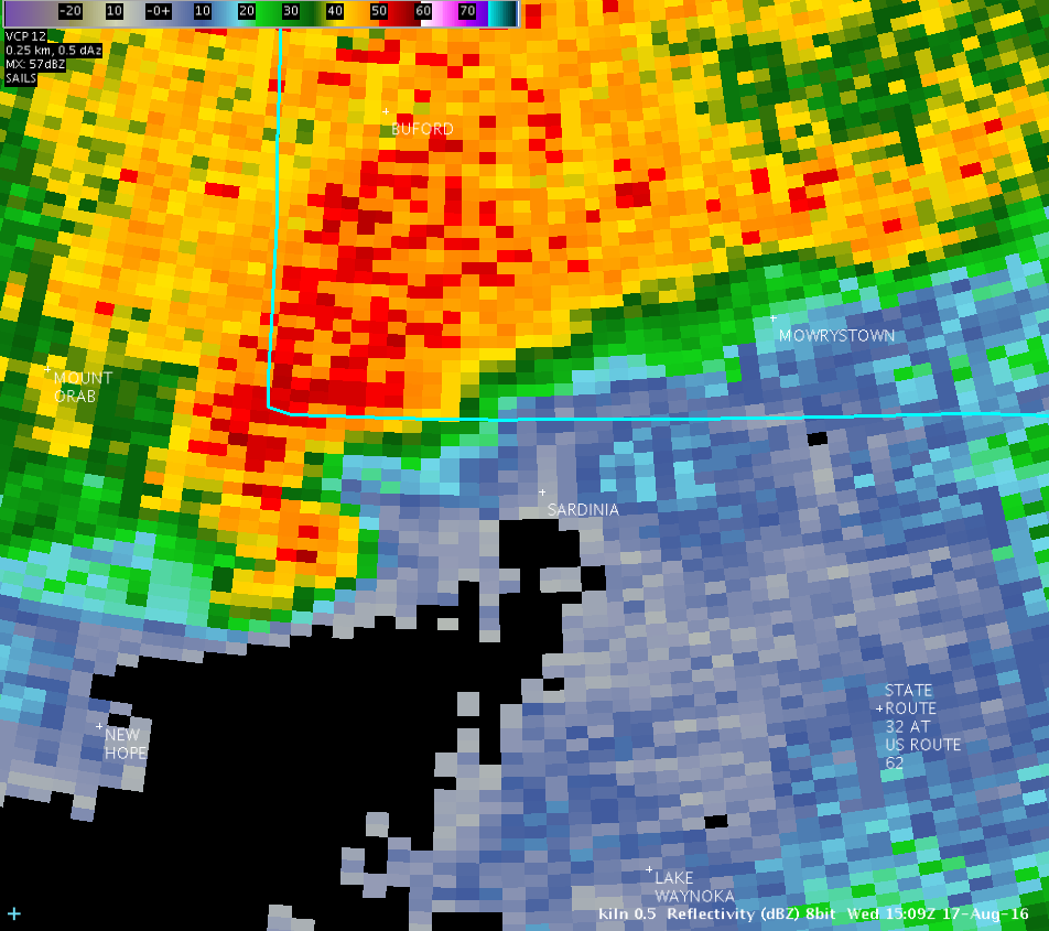
| KILN 0.5° Reflectivity (1900-2100 feet AGL) | |
| 1 2 3 4 5 6 7 8 9 10 11 12 Loop | |
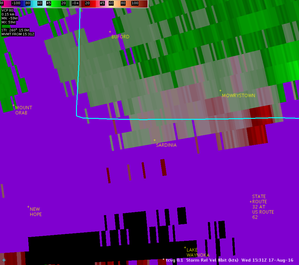
| KILN 0.5° Velocity (1900-2100 feet AGL) | |
| 1 2 3 4 5 6 7 8 9 10 11 12 Loop | |
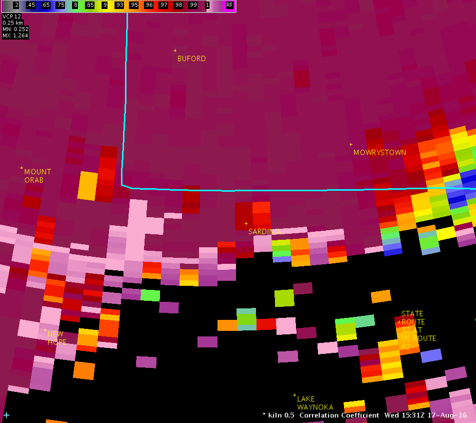
| KILN 0.5° Correlation Coefficient (1900-2100 feet AGL) | |
| 1 2 3 4 5 6 7 8 9 10 11 12 Loop | |
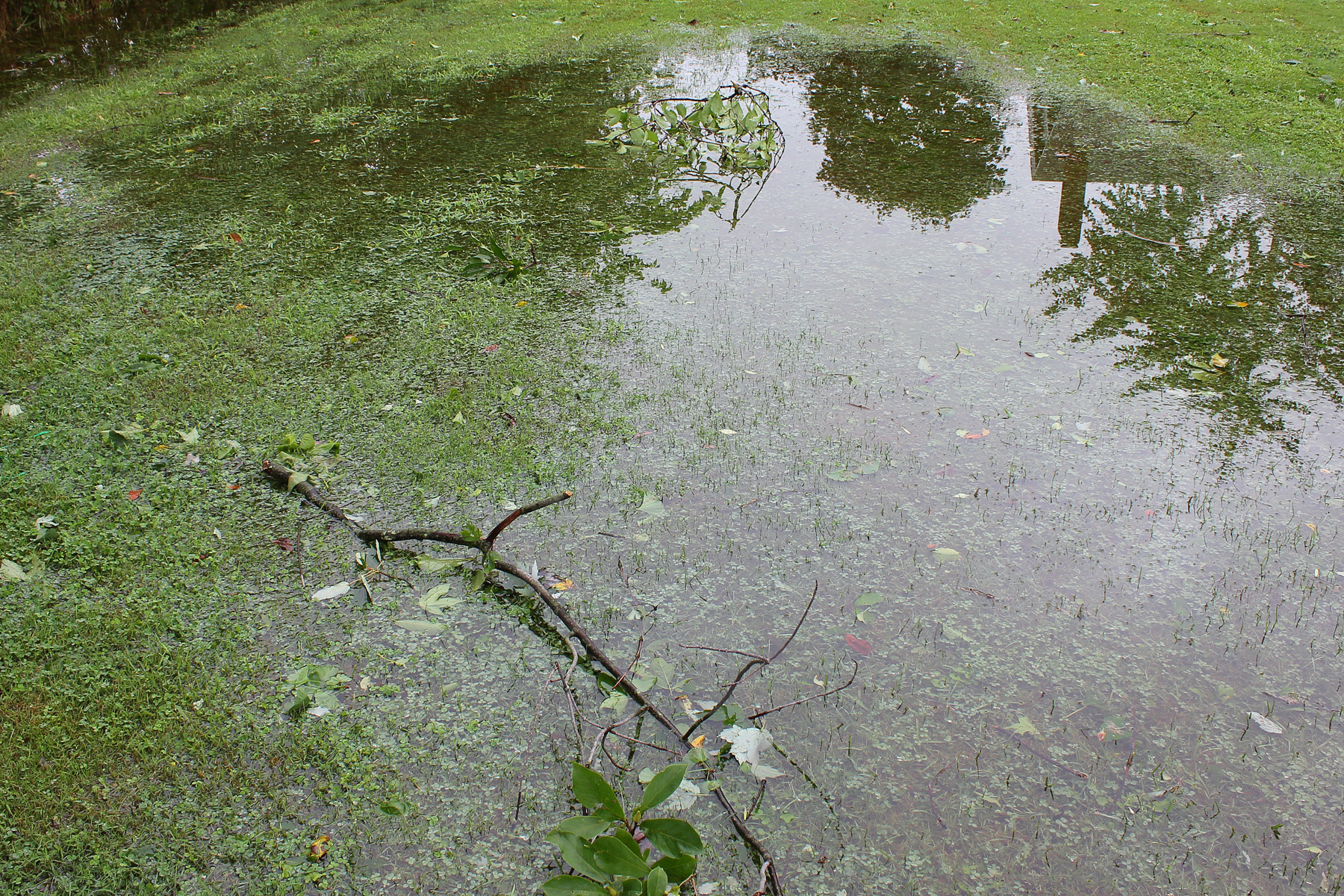
| Pictures from the storm survey: | |||
 |
 |
 |
 |
 |
 |
 |
 |
 |
 |
 |
 |
 |
 |
 |
 |
 |
 |
 |
 |
 |
 |
 |
 |
 |
 |
 |
 |
 |
 |
 |
 |
 |
 |
||

