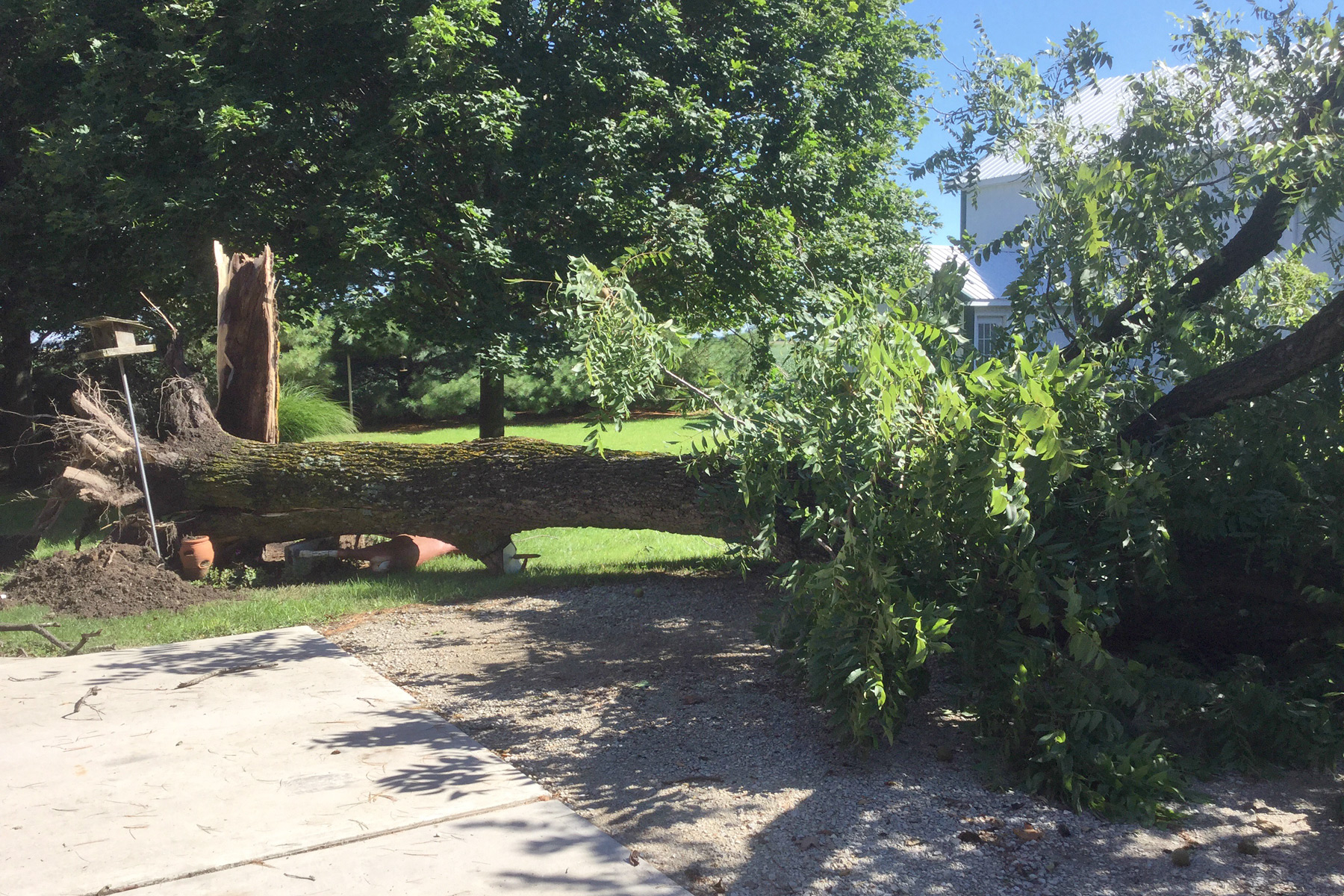
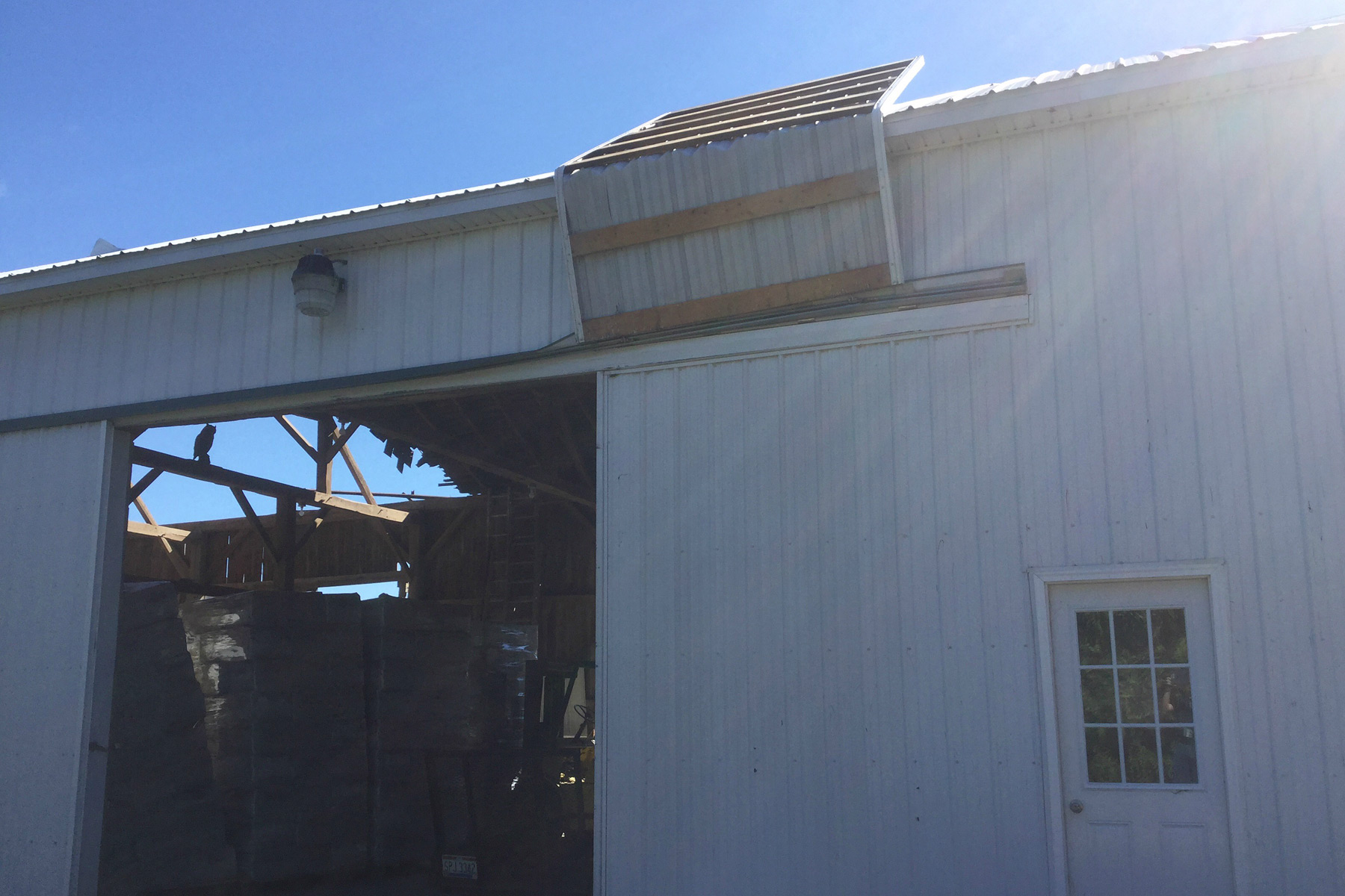
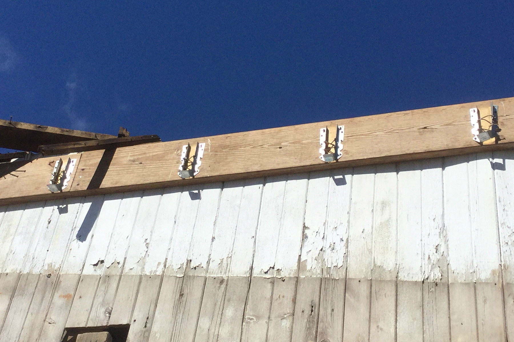
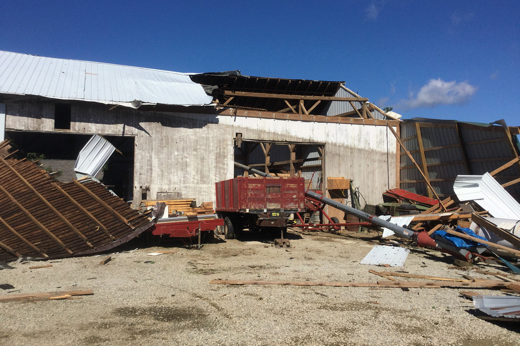
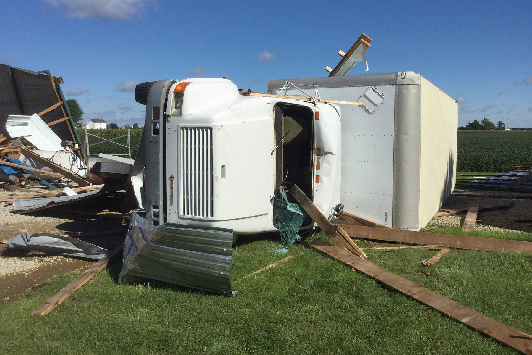
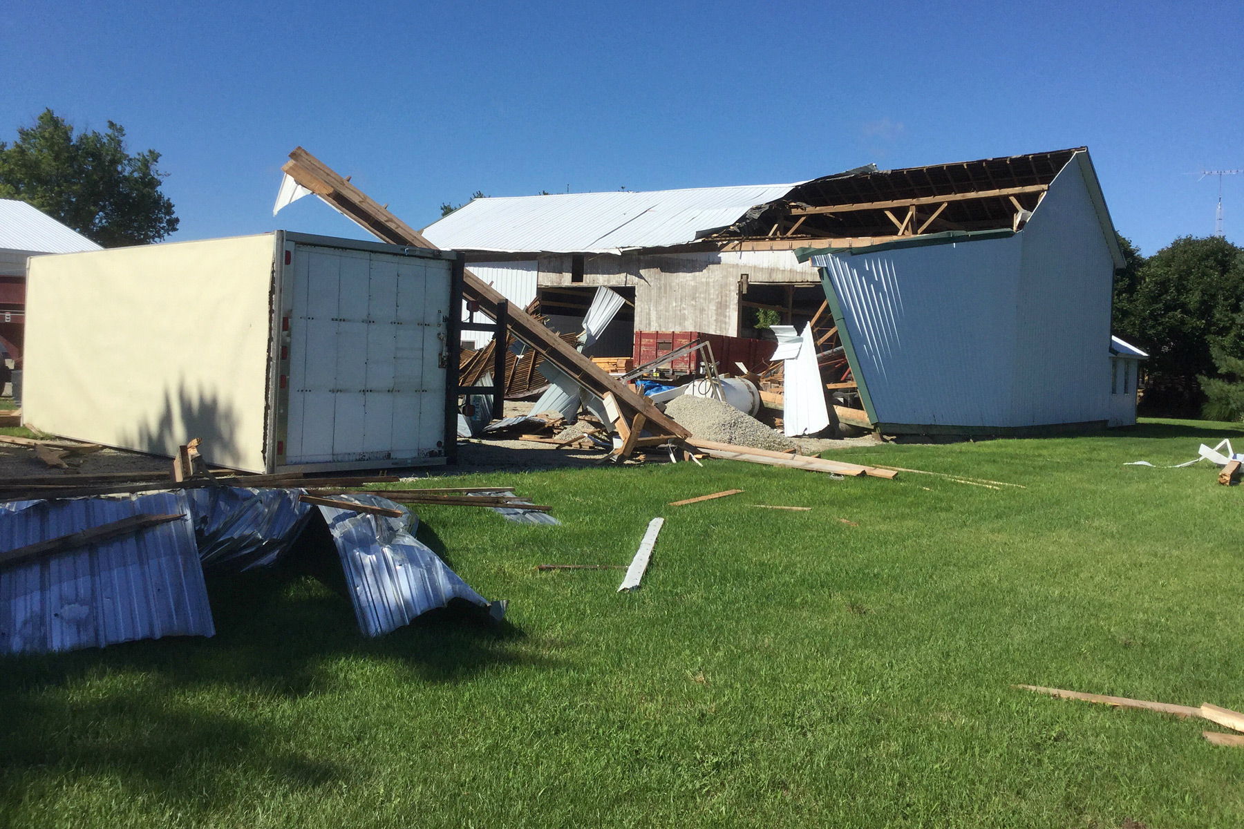
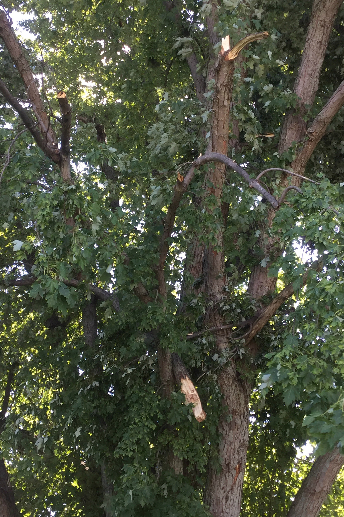
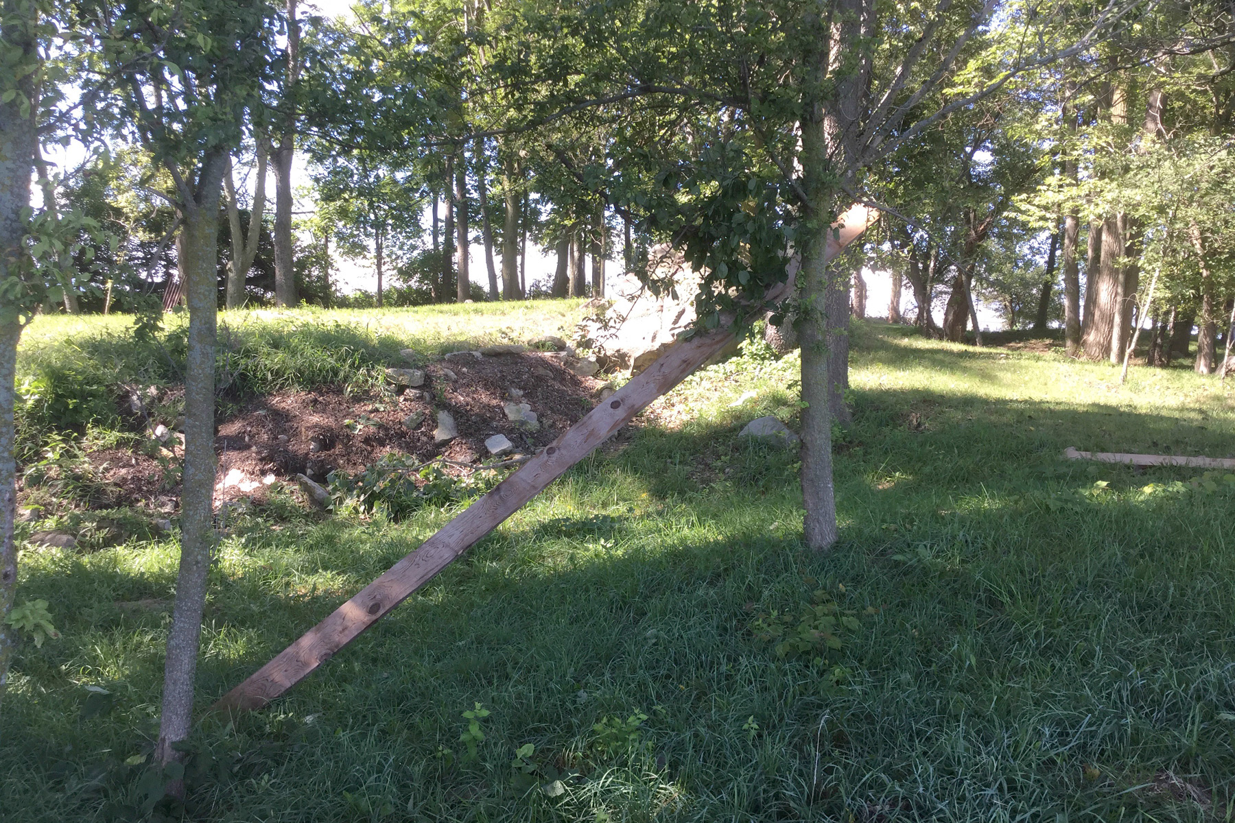
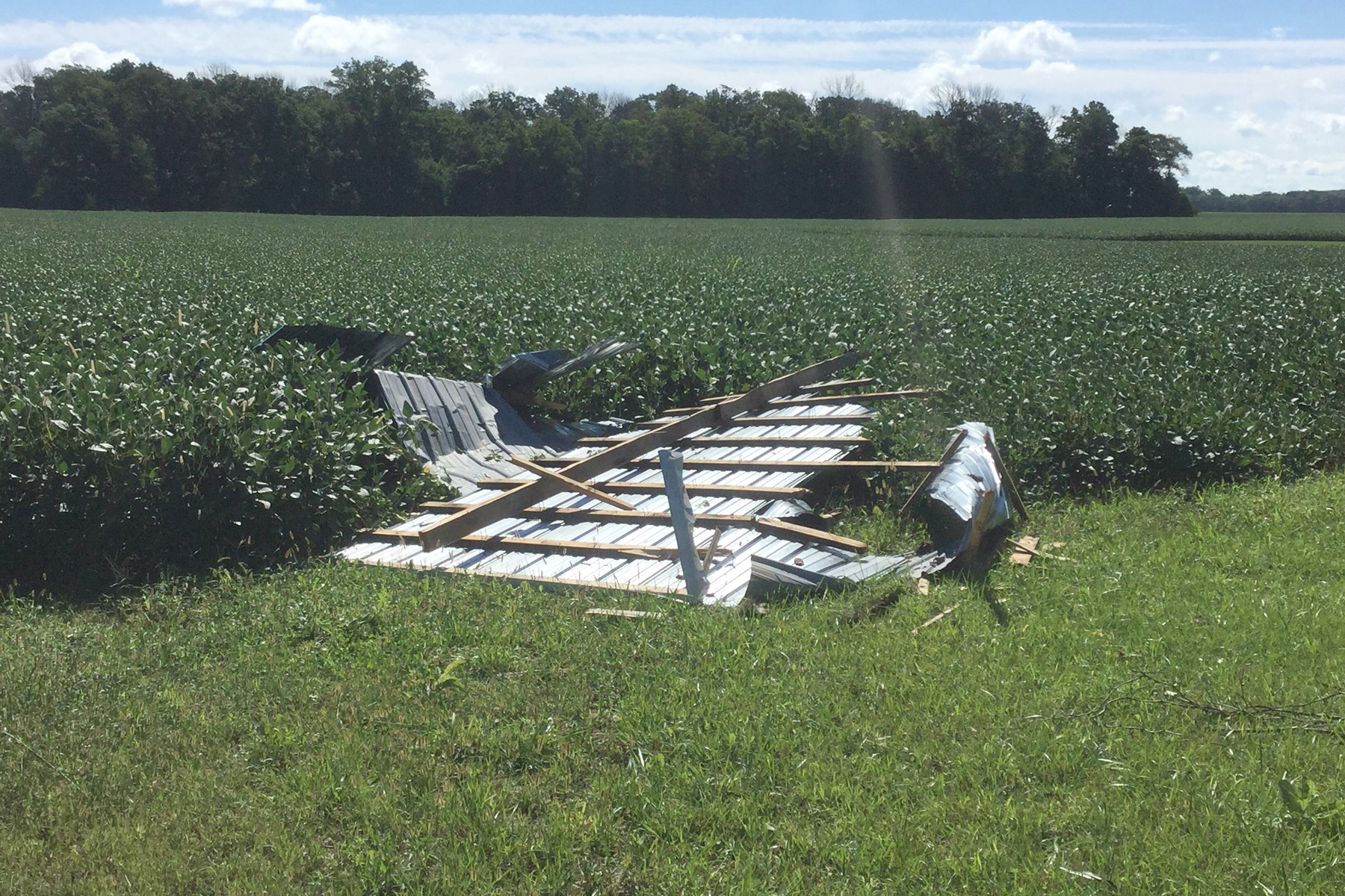
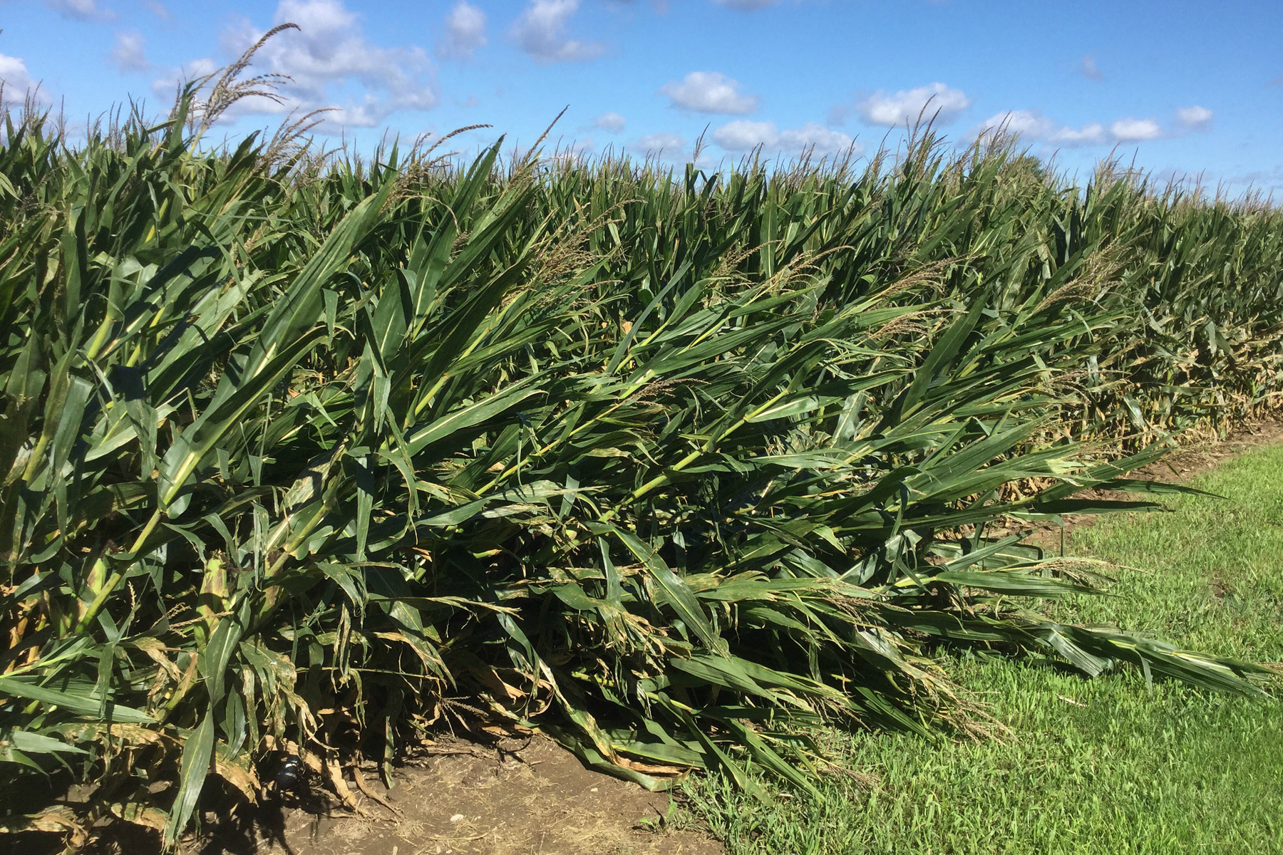
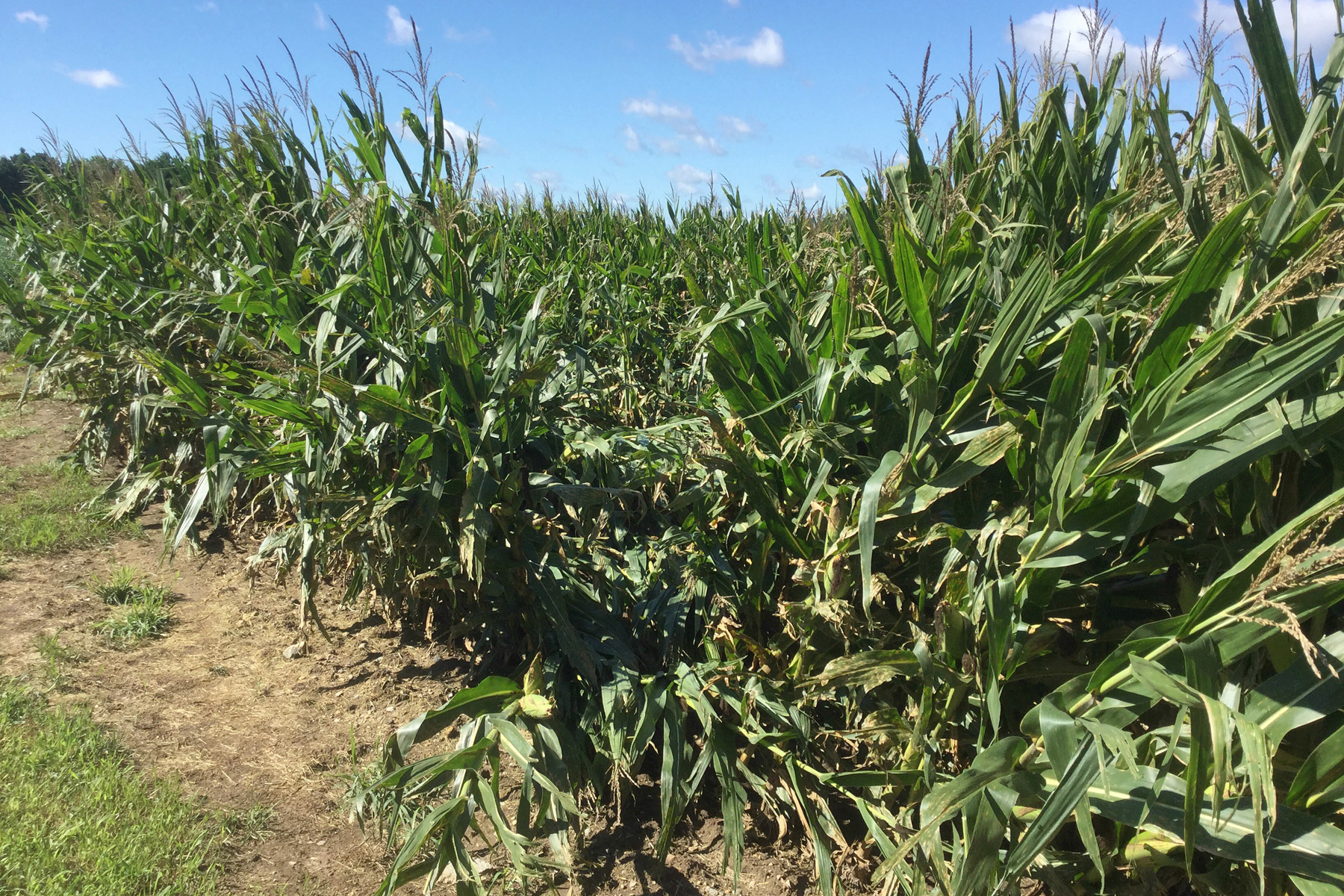
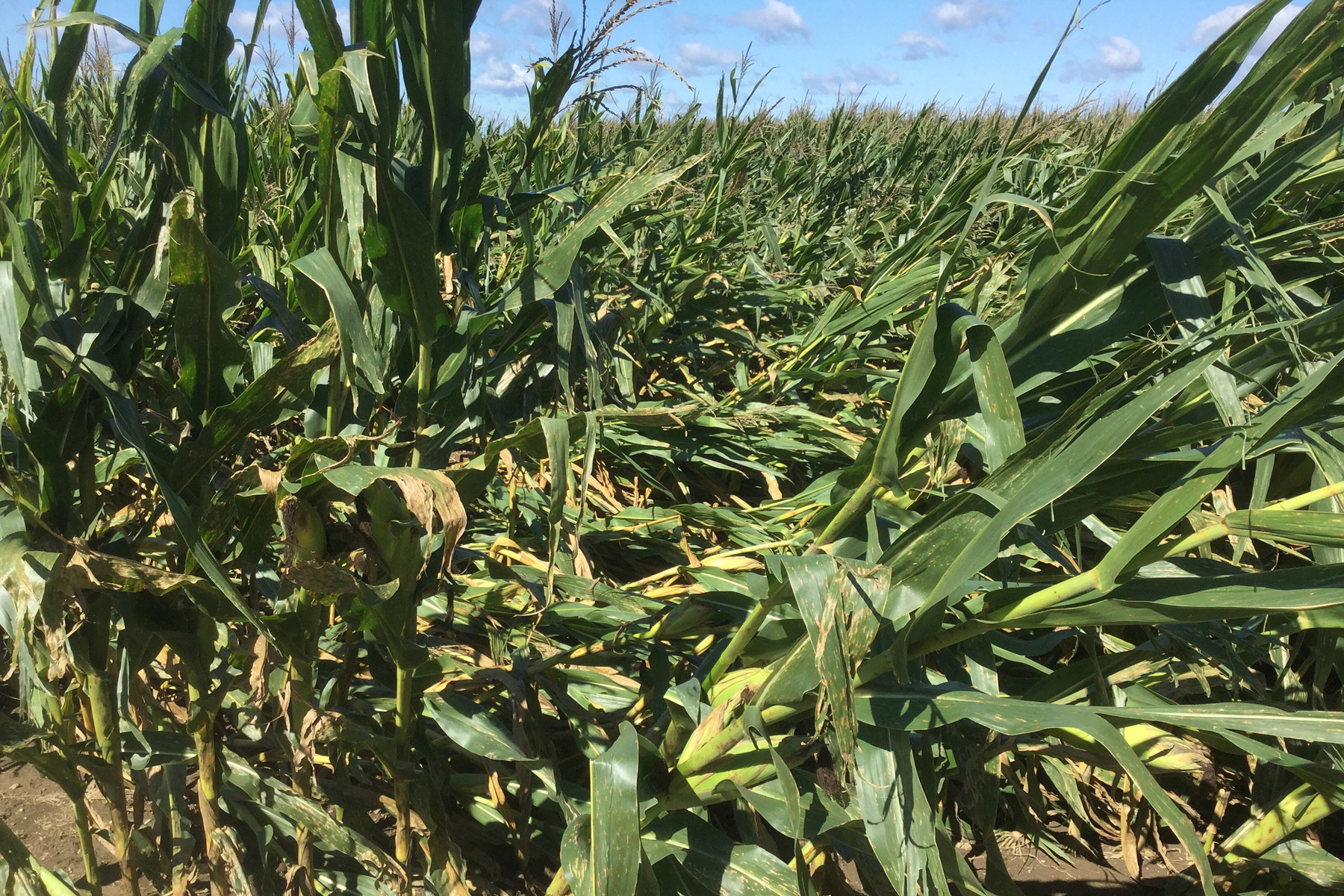
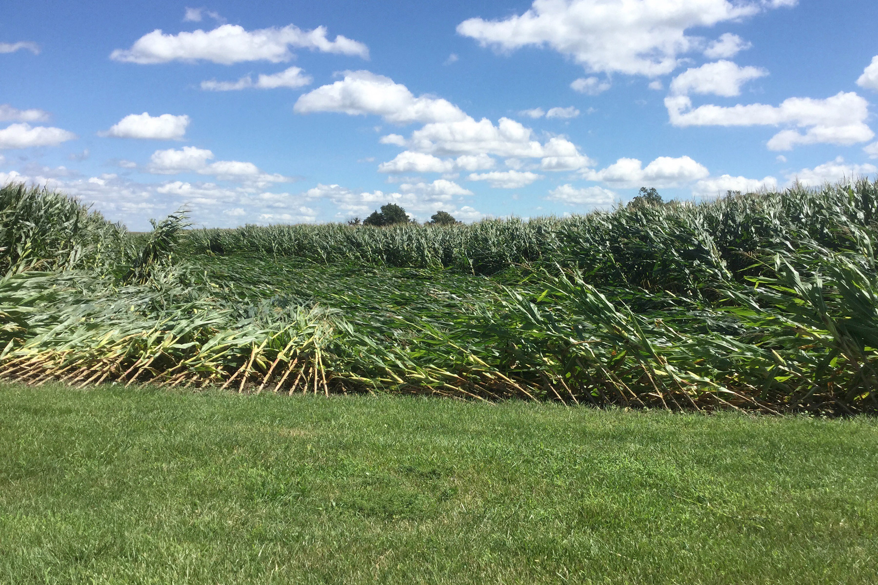
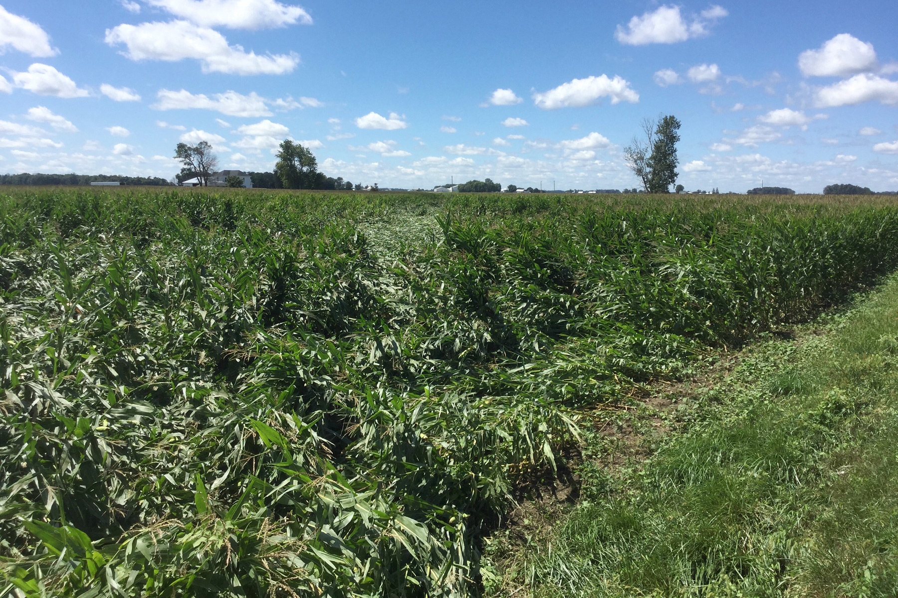
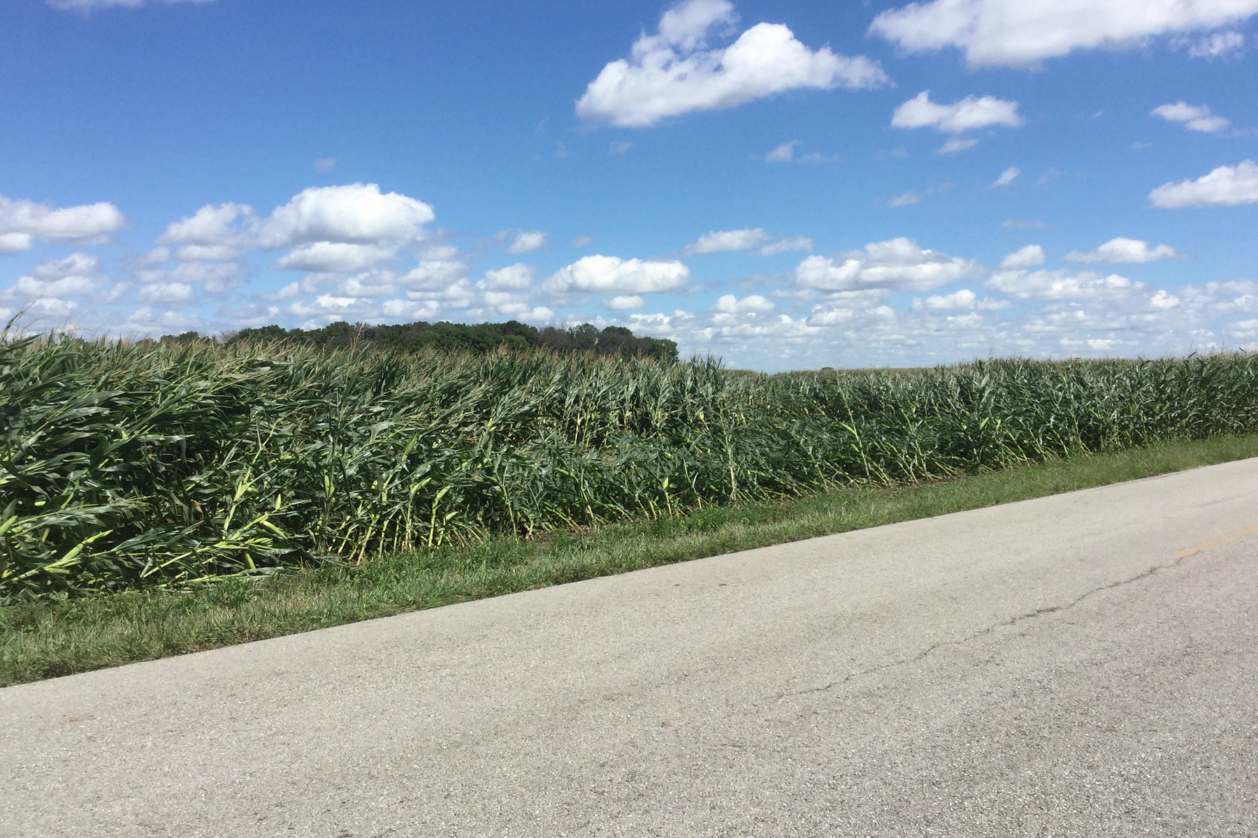
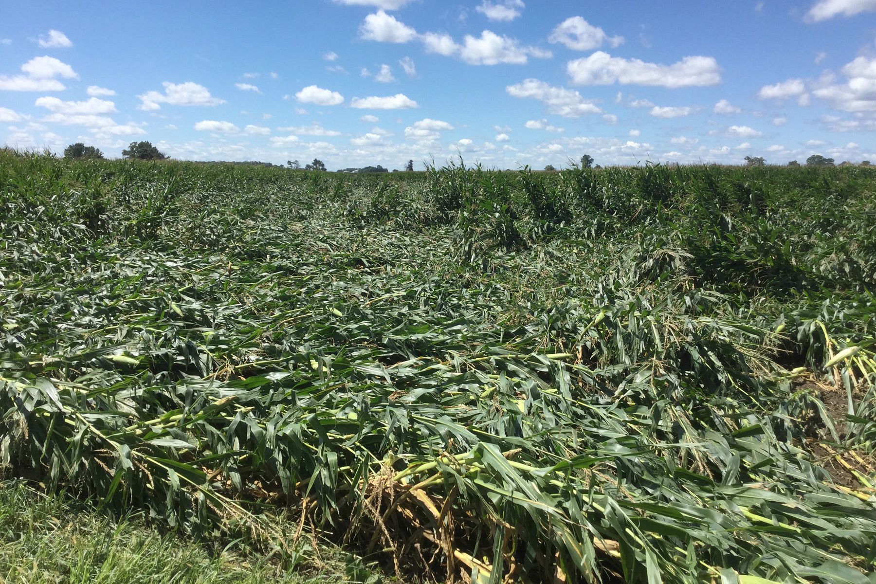
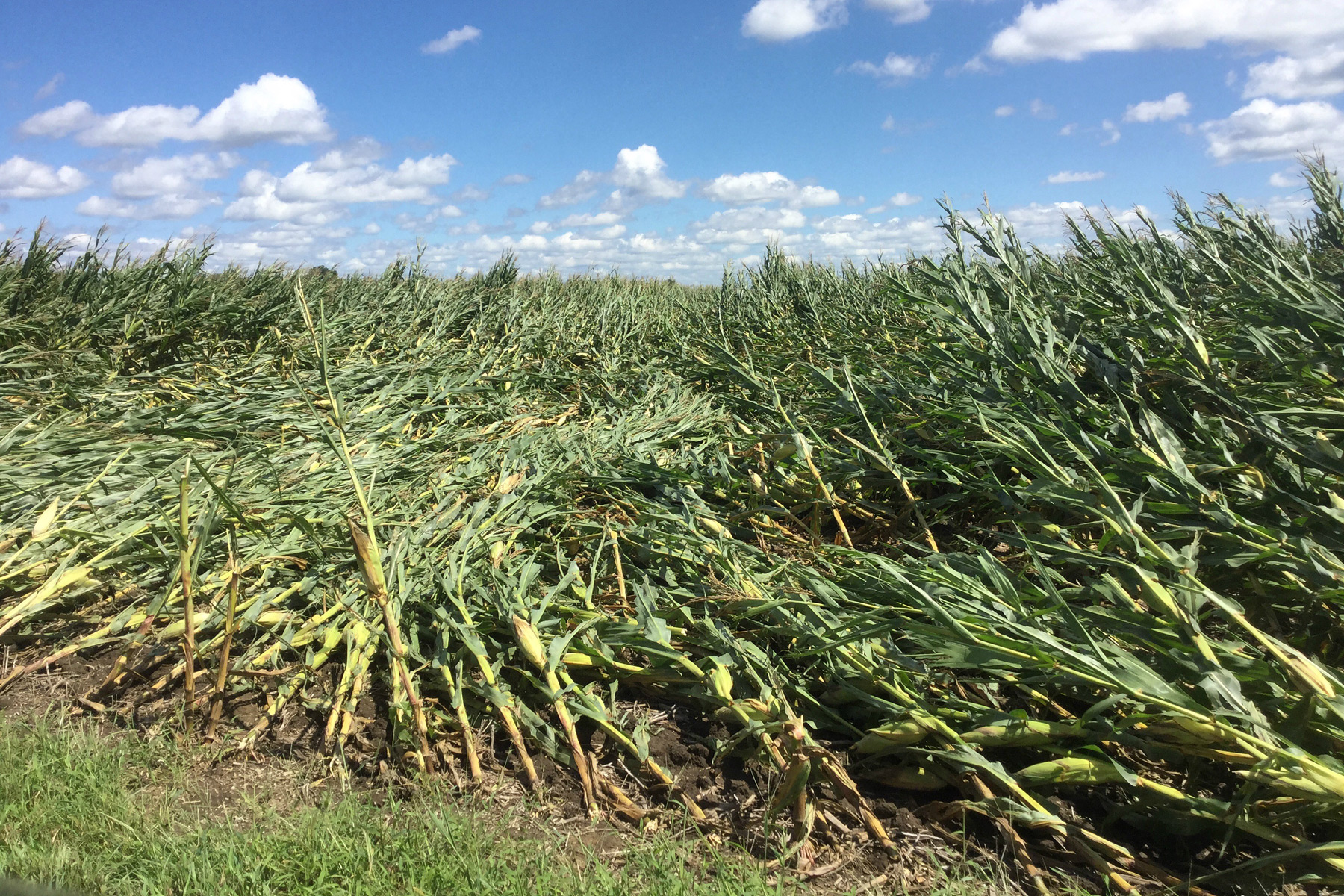
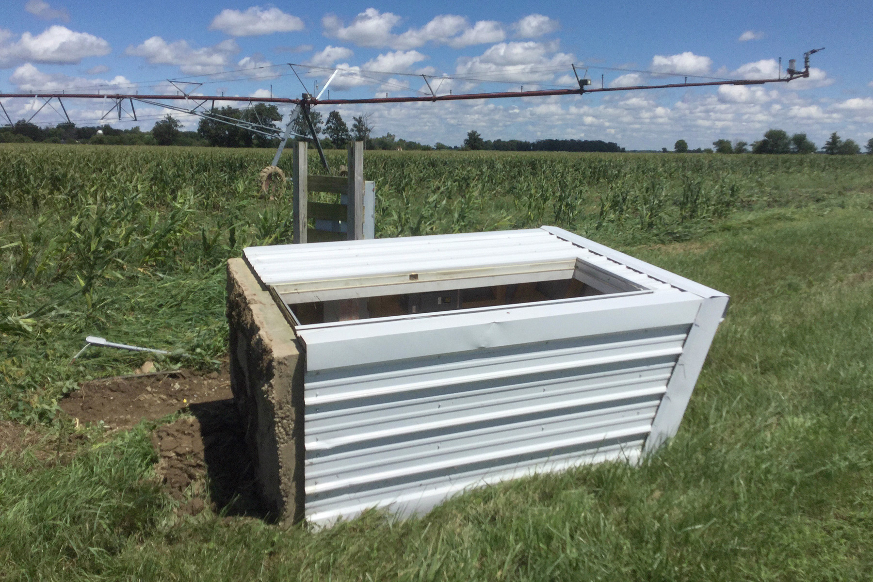
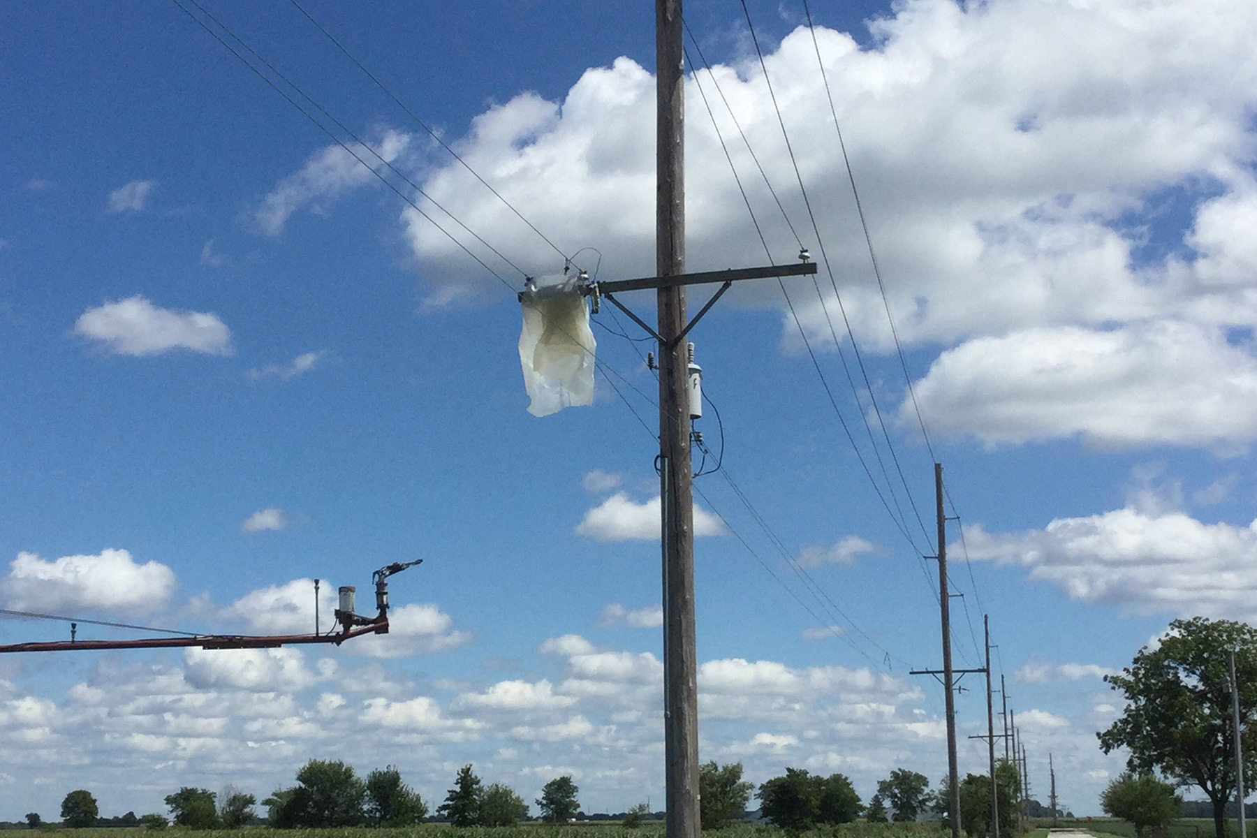
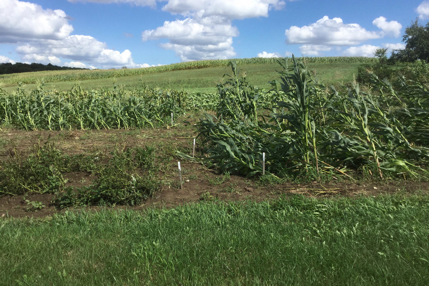
Public Information Statement National Weather Service Wilmington OH 1138 AM EDT MON AUG 22 2016 ...Tornado Confirmed 3 S Gettysburg in Darke County Ohio... Location...3 S Gettysburg in Darke County Ohio Date...August 20th 2016 Estimated Start Time...615 PM EDT Estimated End Time: 626 PM EDT Maximum EF-Scale Rating...EF0 Estimated Maximum Wind Speed...76 MPH Maximum Path Width...50 yards Path Length...4.7 miles Beginning Lat/Lon...40.0649/ -84.5053 Ending lat/Lon...40.0980/-84.4255 * Fatalities...0 * Injuries...0 * The information in this statement is preliminary and subject to change pending final review of the event(s) and publication in NWS Storm Data. ...Summary... The National Weather Service in Wilmington OH has confirmed a tornado 3 miles south of Gettysburg in Darke County Ohio on August 20th 2016. The tornado touched down in a corn field north of Neff Road and continued northeast across the 5200 block of Gettysburg-Pitsburg Road, leaving a home untouched but knocking down a rotted tree just behind it. A barn behind the home sustained significant damage, losing a quarter of its roof and the entire overhang attached to the back of the barn. The sliding front door of the barn was also flipped up over the roof. A small tractor trailer parked behind the barn was flipped onto its side and was damaged by flying debris. Debris from the barn was found strewn about 200 yards east into a soybean field behind the farm. A few large branches were found snapped off a tree behind the barn. Drone footage shared by the Darke County Sheriff showed a continuous tornado path through soybean and corn fields stretching a few miles northeast of the initial touchdown location. As the tornado tracked northeast from the damaged farm, it passed just about 300 feet north of a residence on Yount Road. Downstream crop damage revealed the tornado crossed Byreley Road, Red River-West Grove Road, and Grise Road. The tornado path ended in a soybean field just east of the Darke/Miami county line after crossing State Route 721. For reference...the Enhanced Fujita Scale classifies tornadoes into the following categories: EF0...wind speeds 65 to 85 mph. EF1...wind speeds 86 to 110 mph. EF2...wind speeds 111 to 135 mph. EF3...wind speeds 136 to 165 mph. EF4...wind speeds 166 to 200 mph. EF5...wind speeds greater than 200 mph. $$ Kurz/Haines |
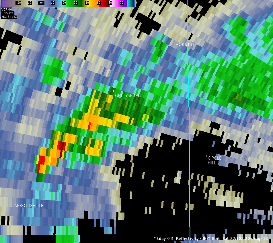
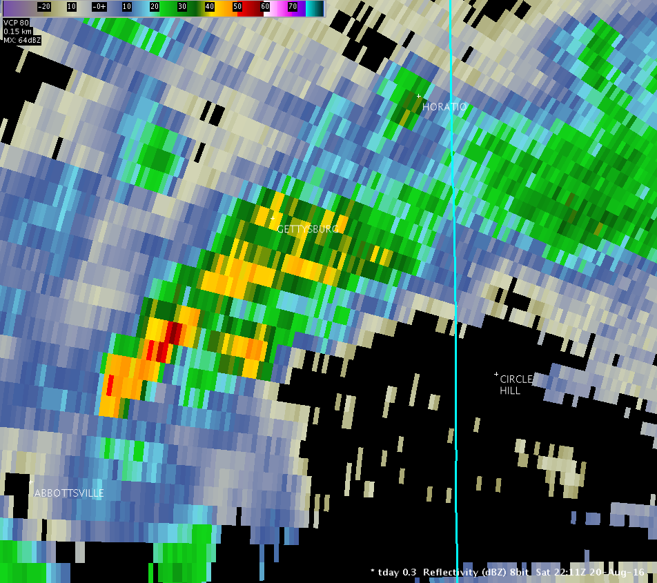
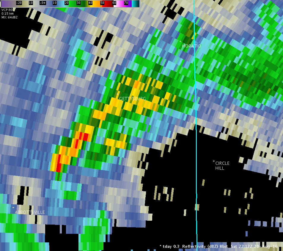
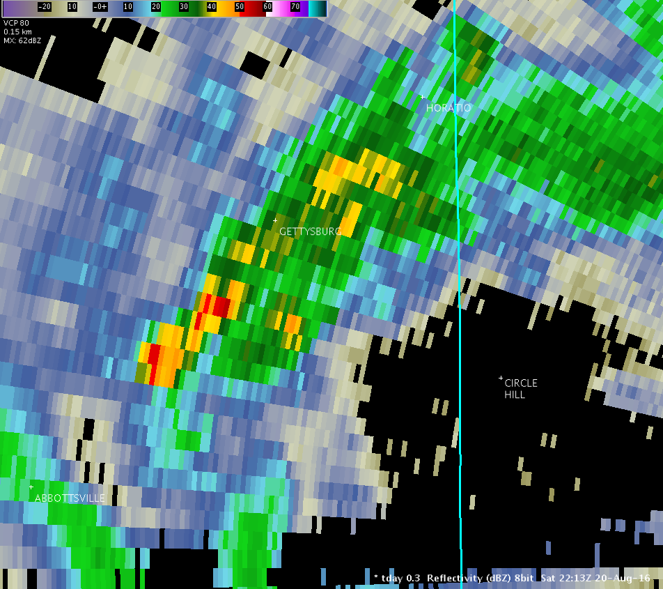
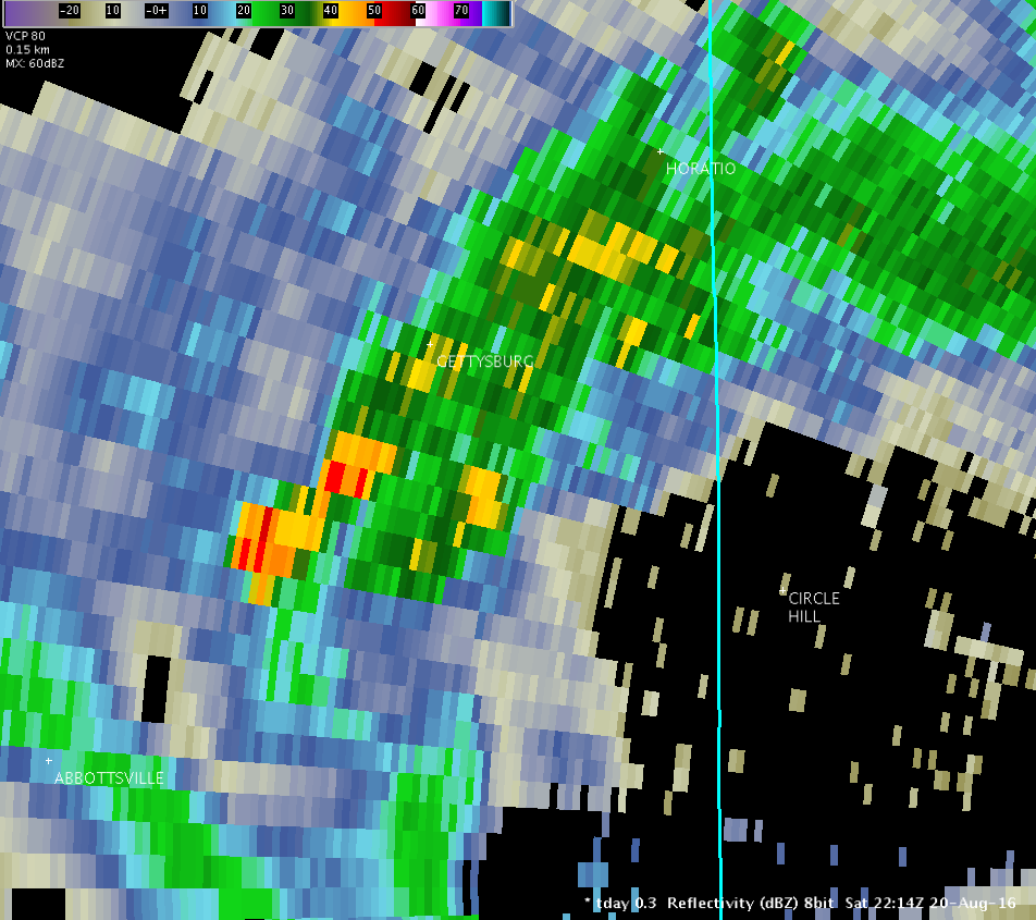
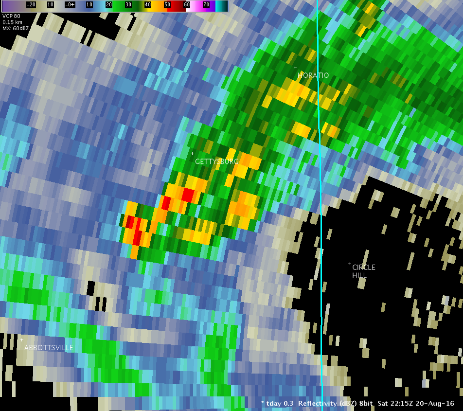
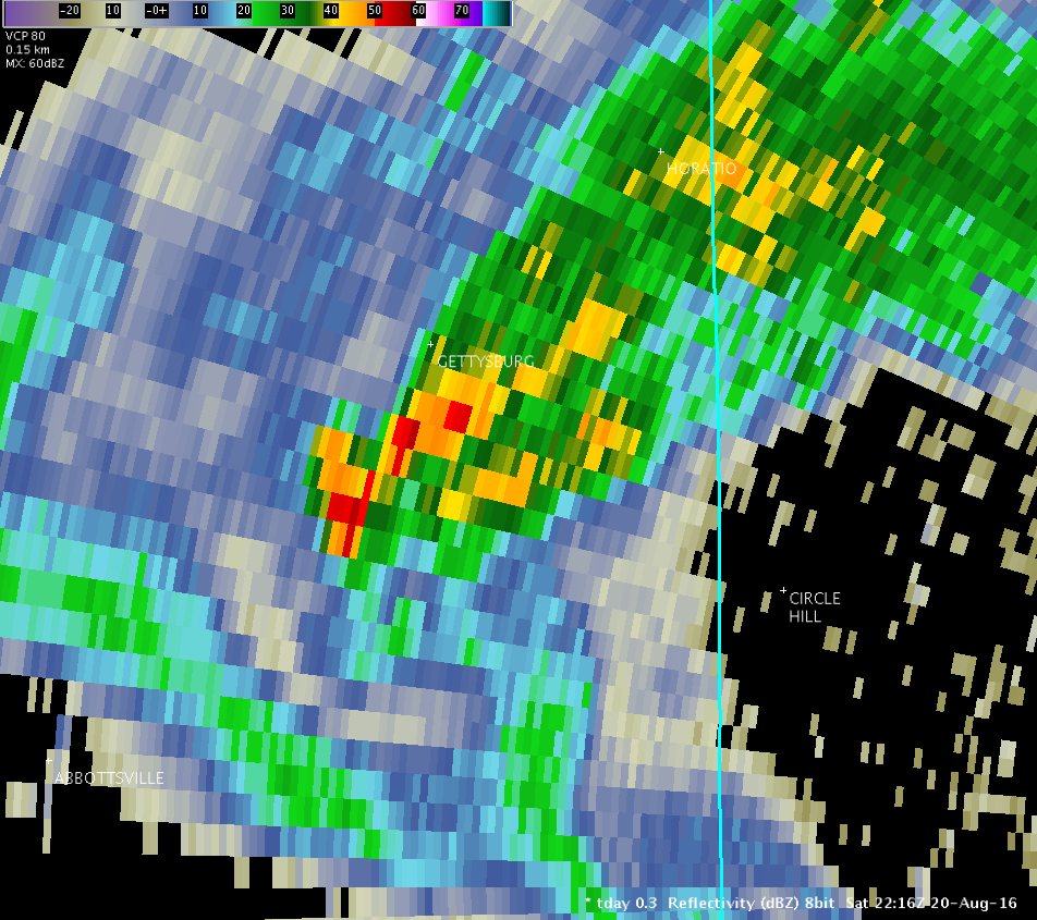
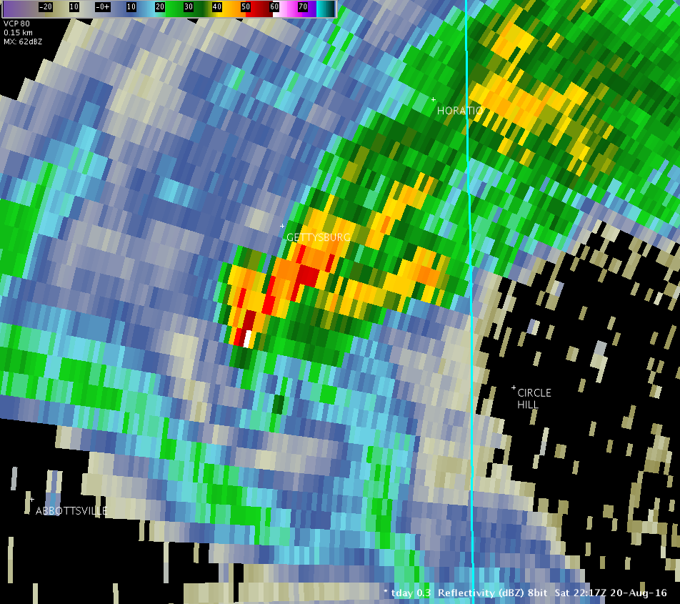
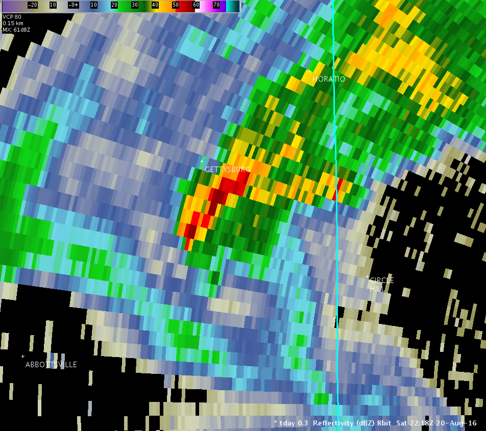
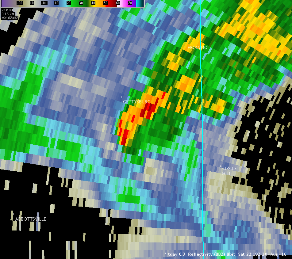
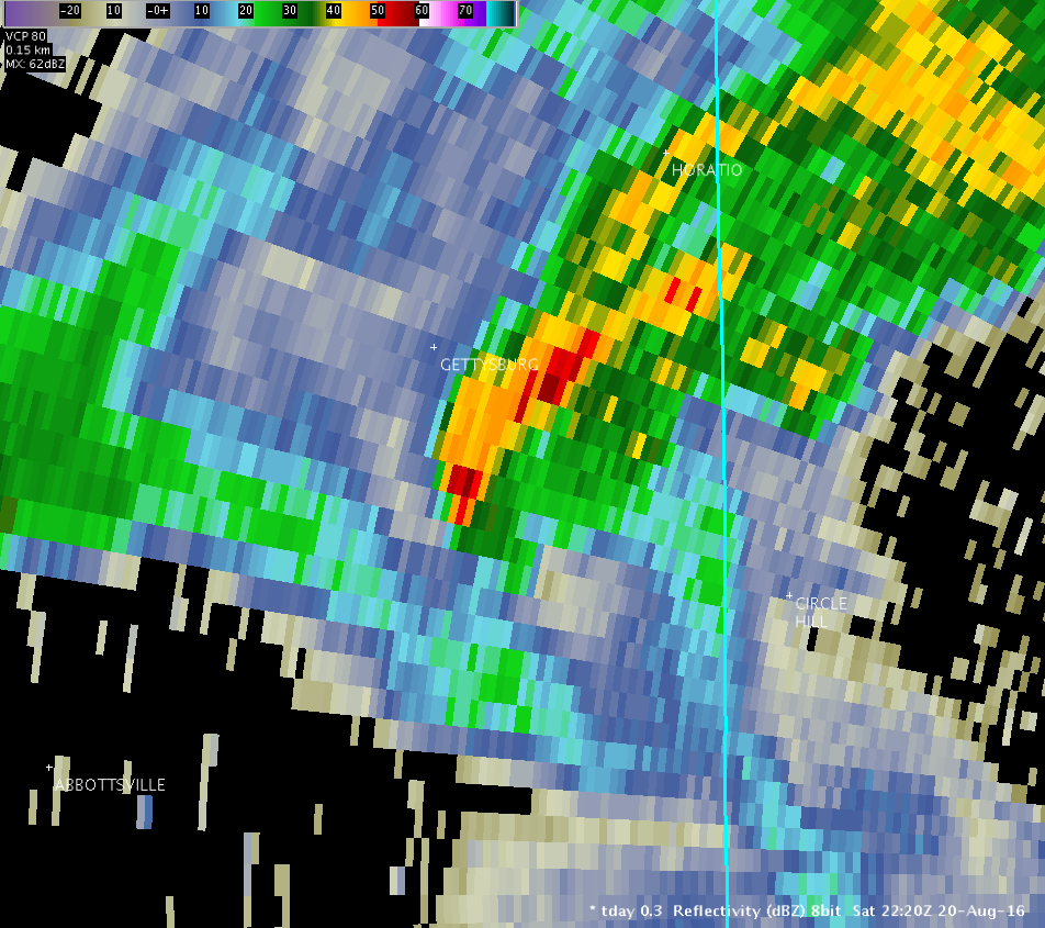
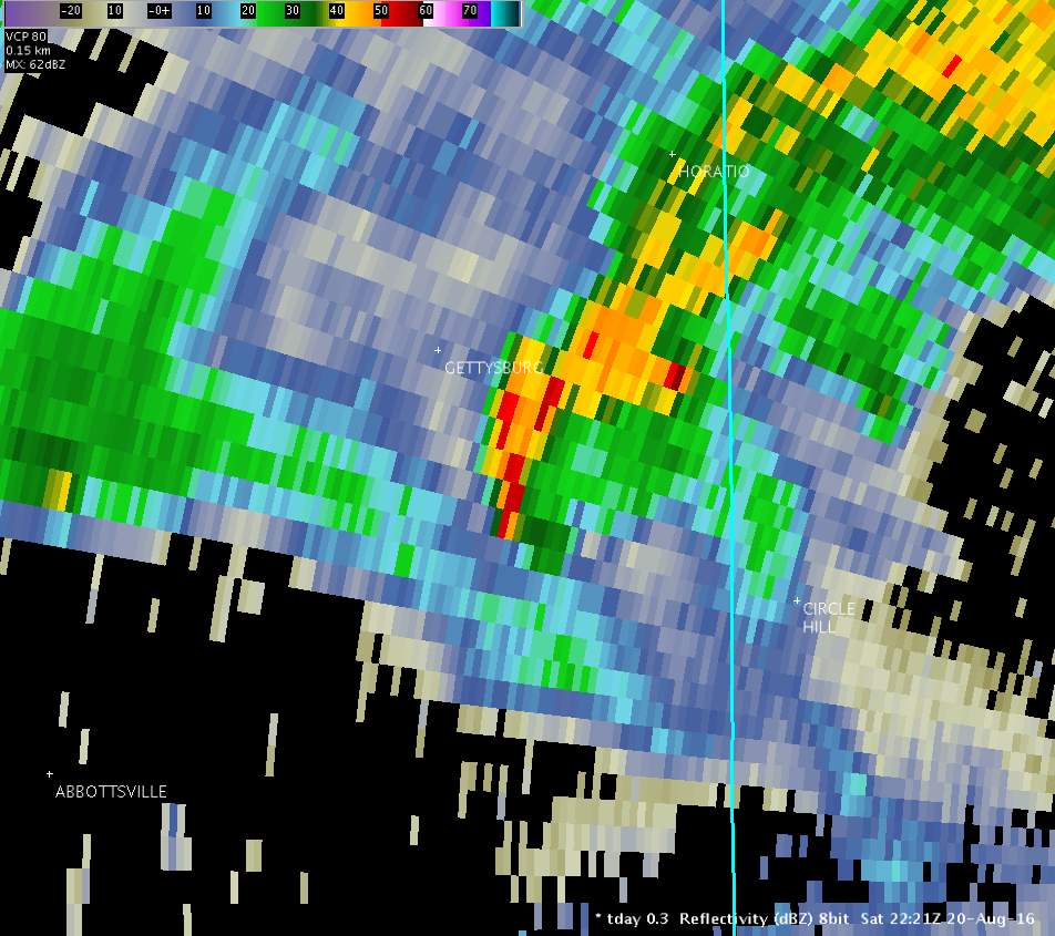
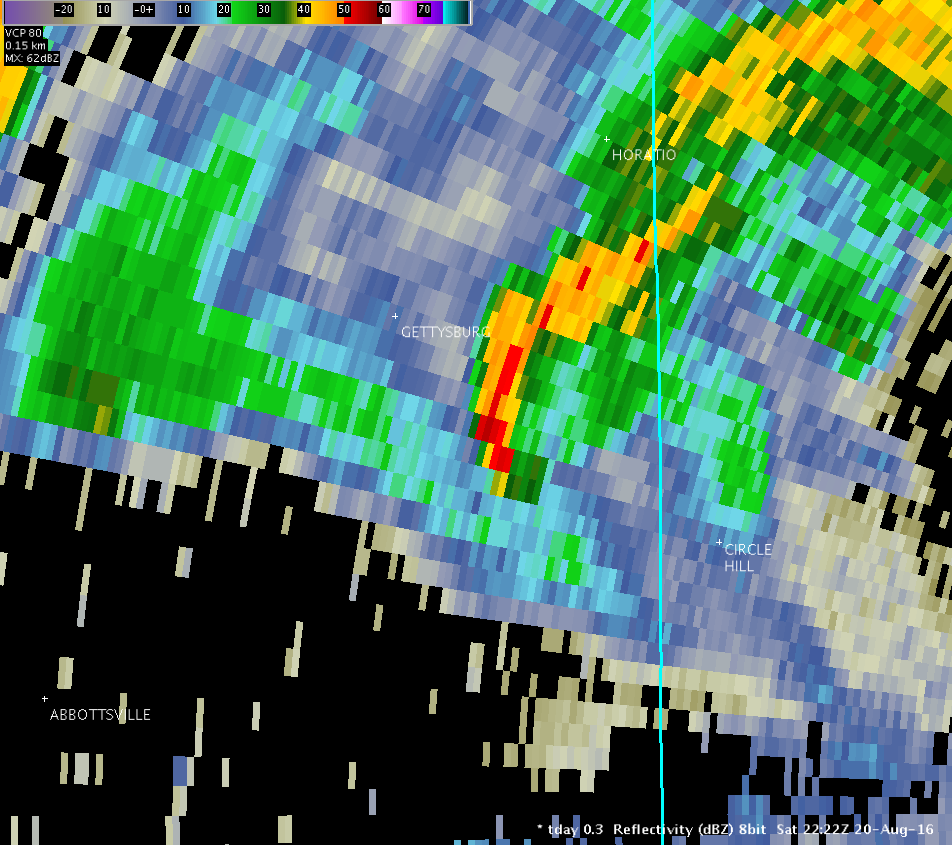
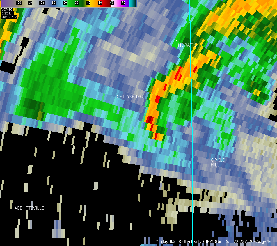
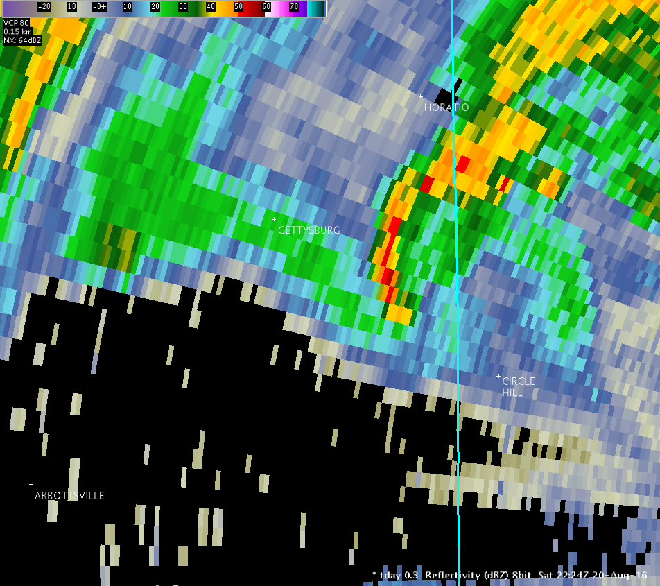
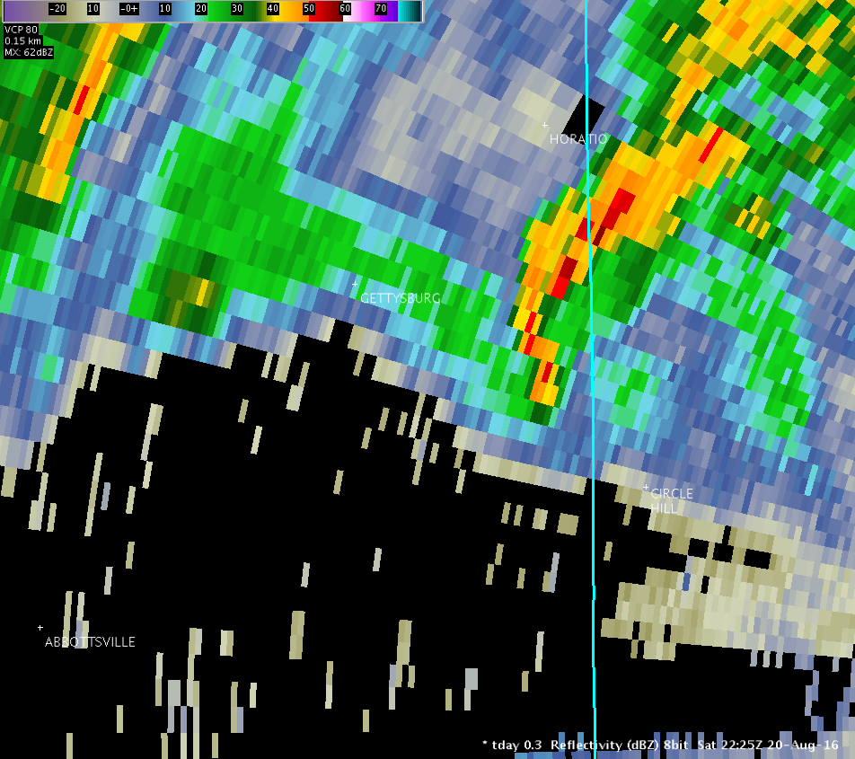
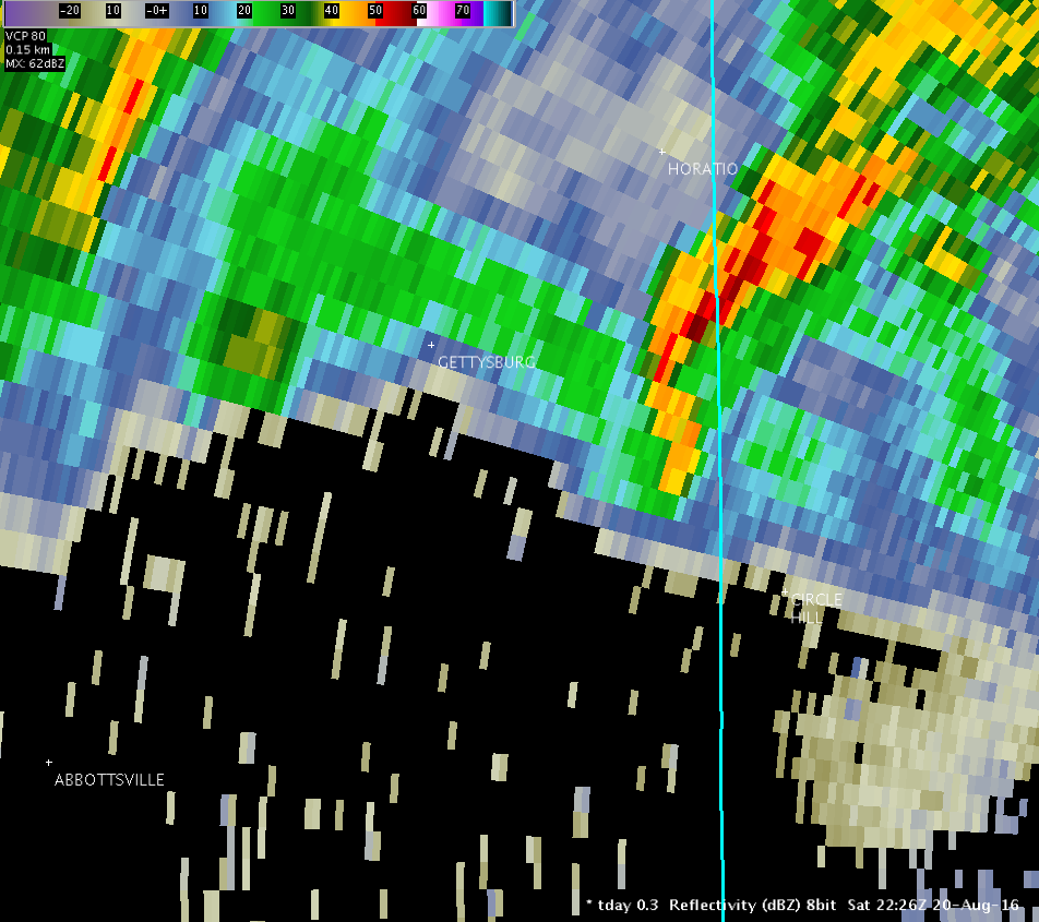
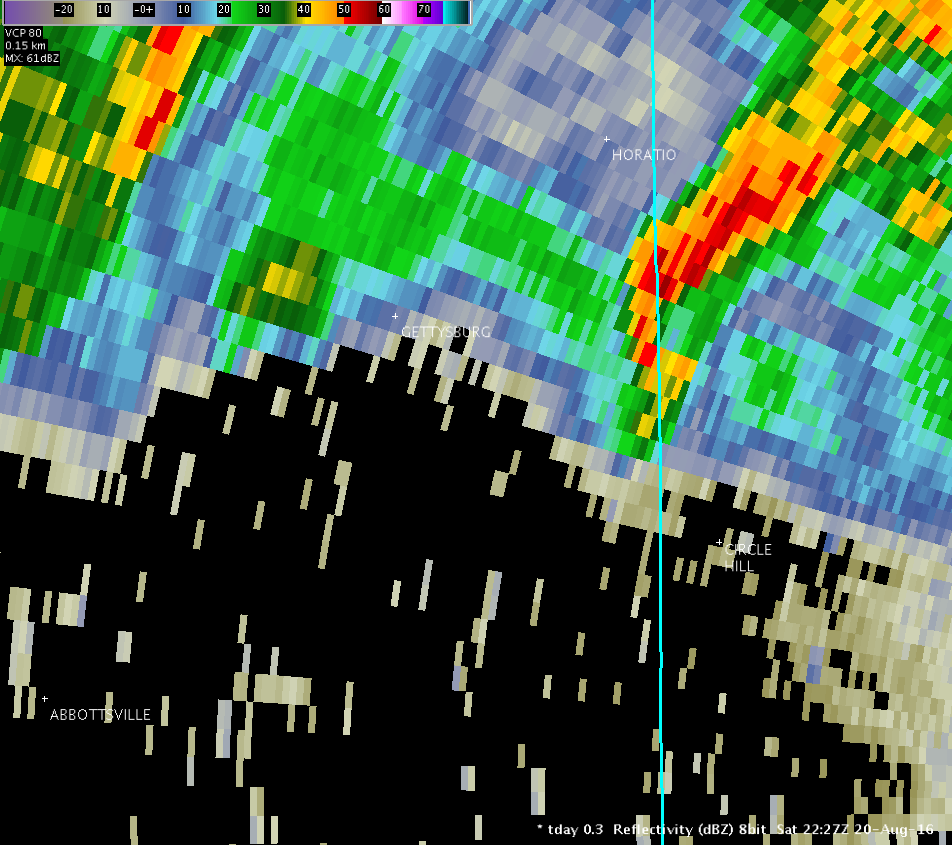
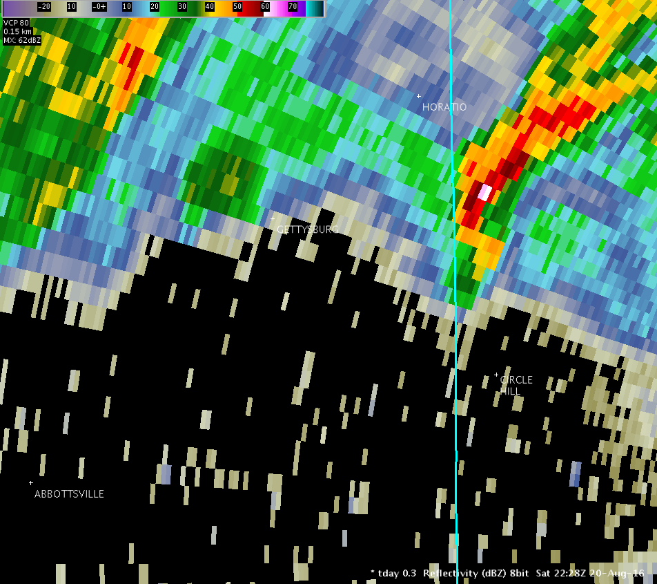
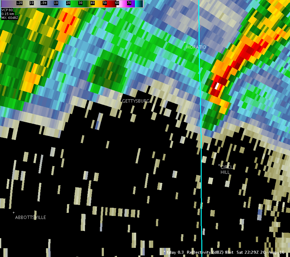
| Full Radar Loops from the Dayton Terminal Doppler Weather Radar (6:10 PM - 6:29 PM) |
| TDAY 0.3° Reflectivity (600-800 feet AGL) |
| 1 2 3 4 5 6 7 8 9 10 11 12 13 14 15 16 17 18 19 20 | Loop |
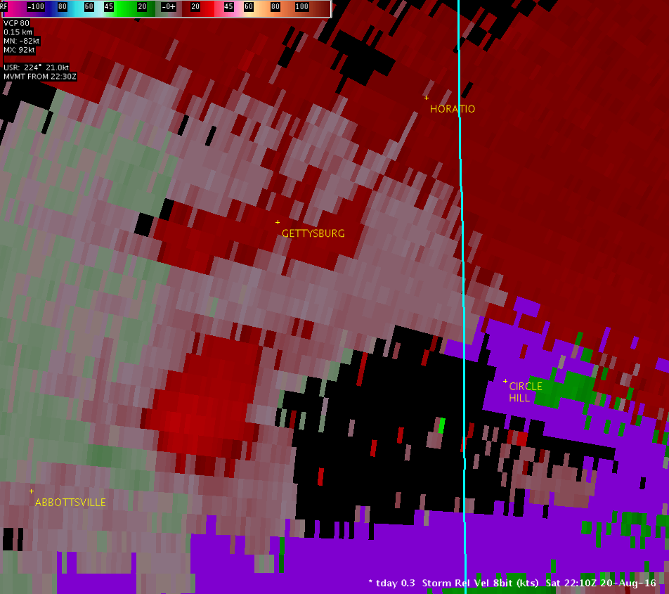
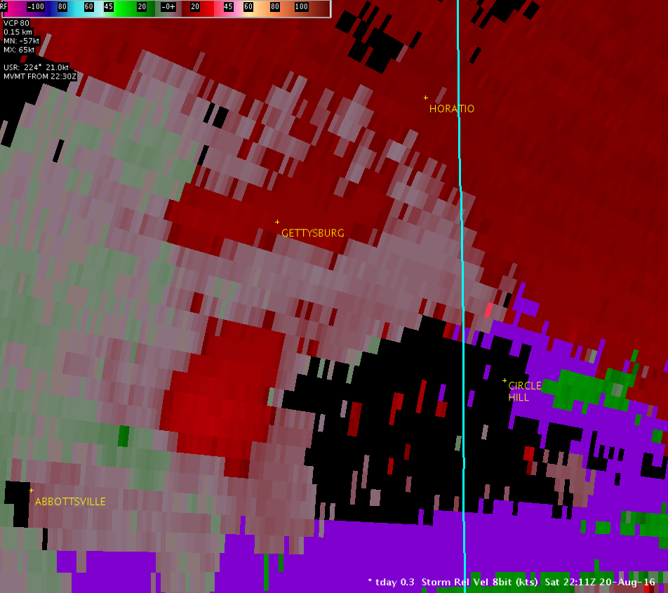
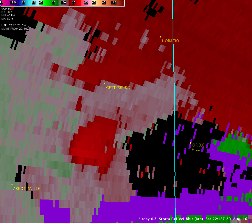
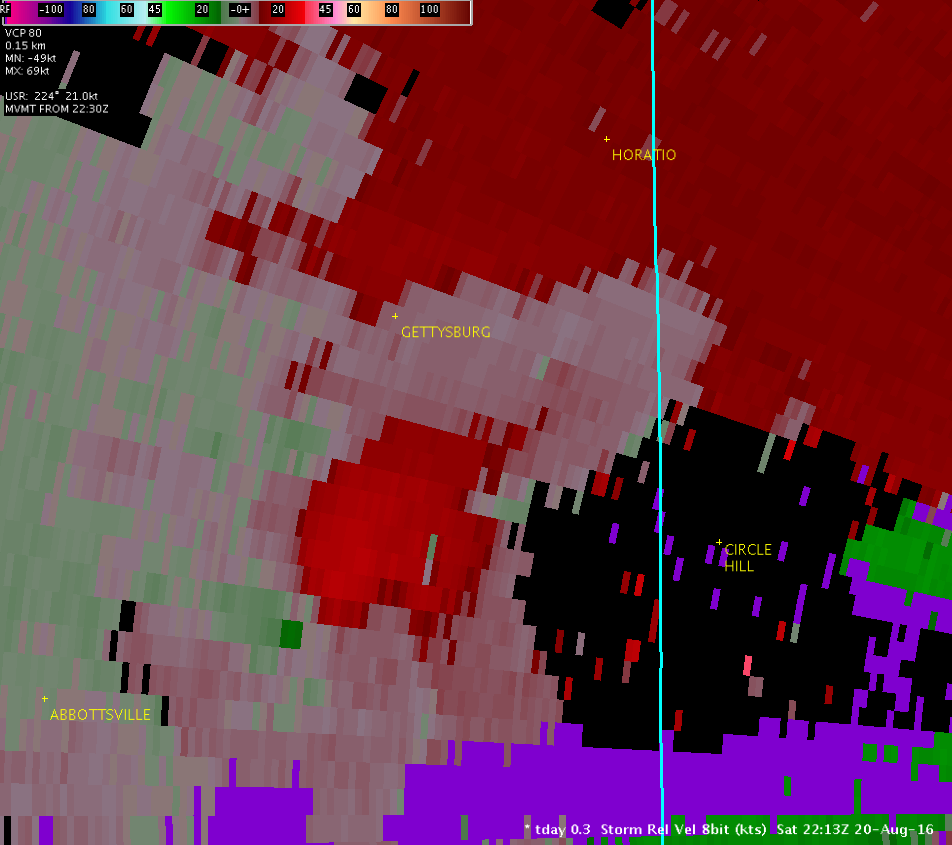
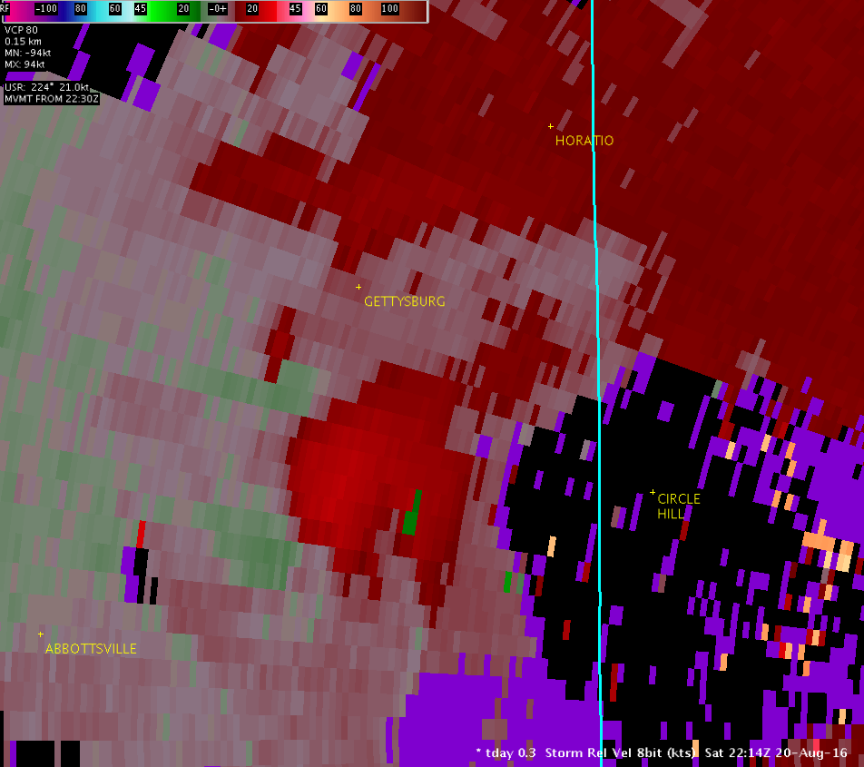
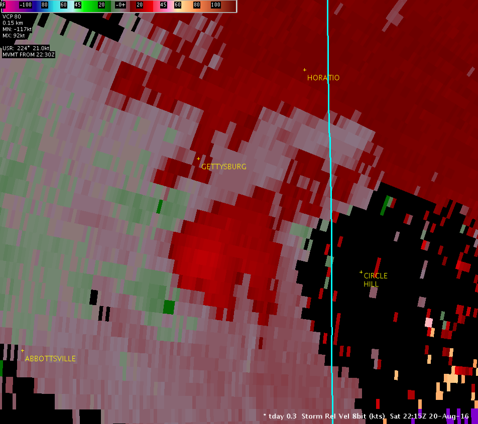
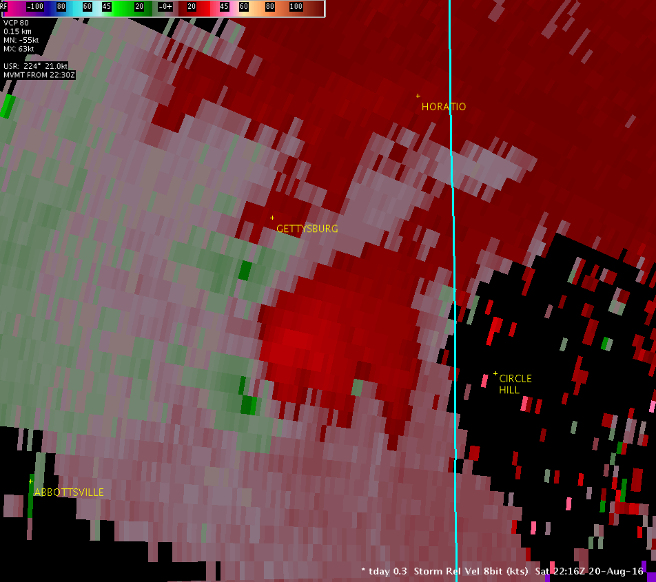
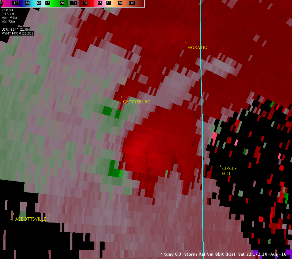
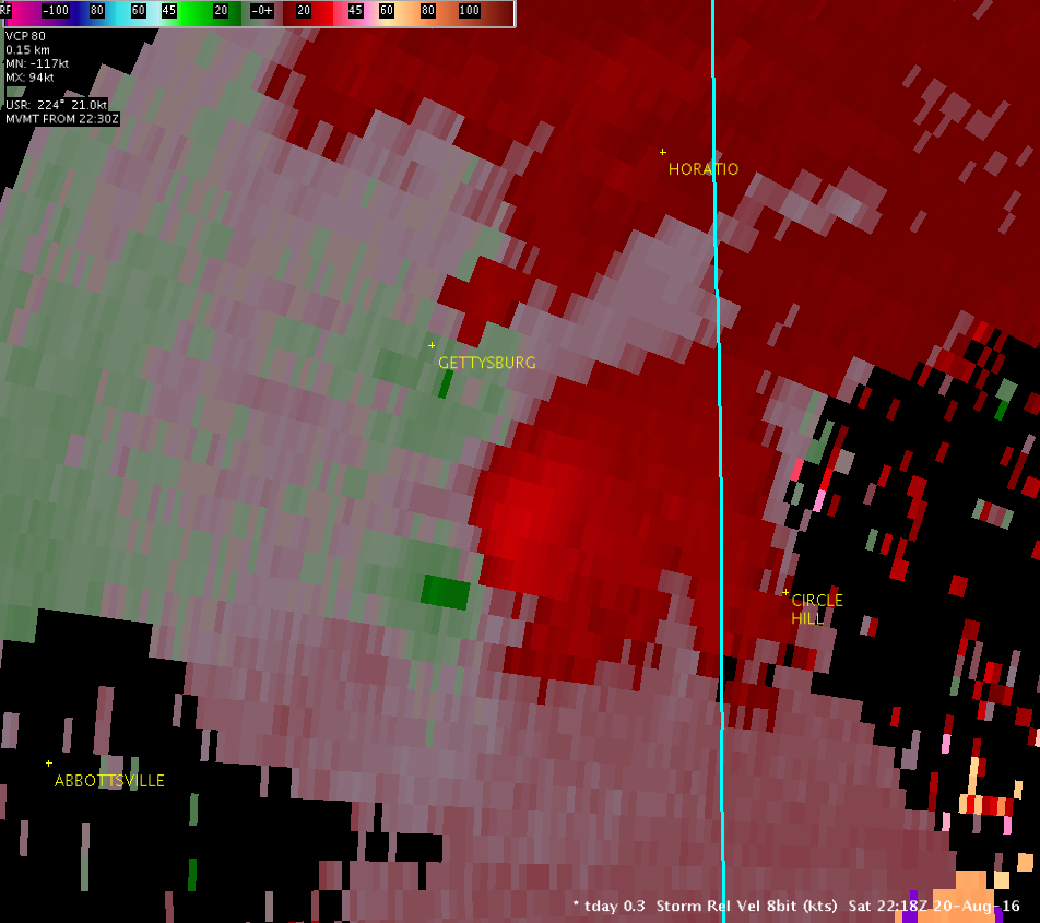
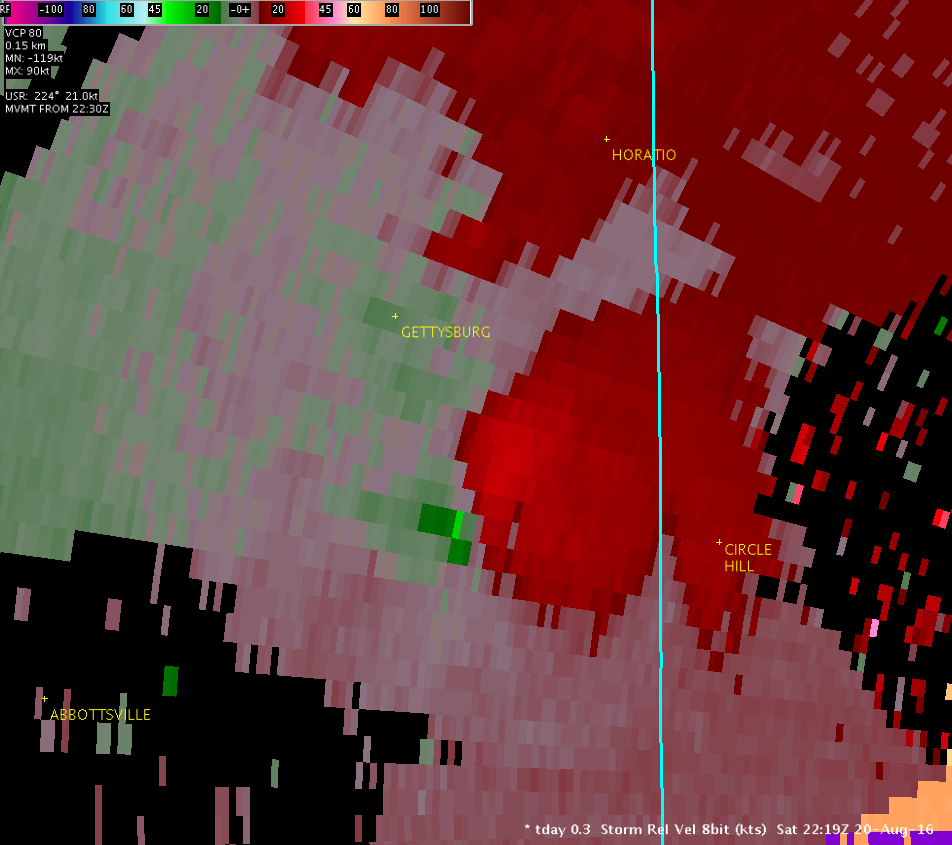
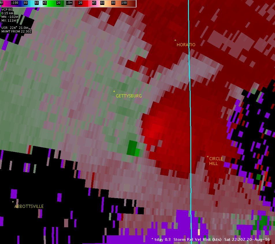
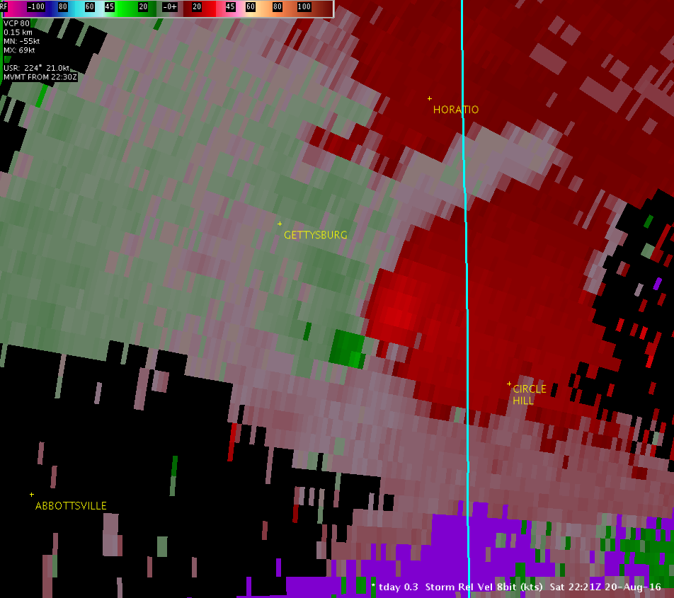
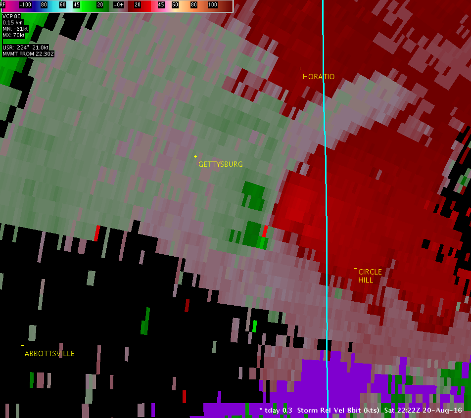
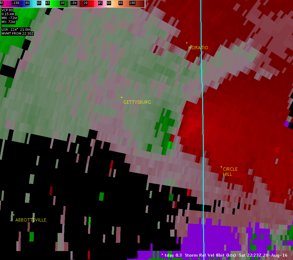
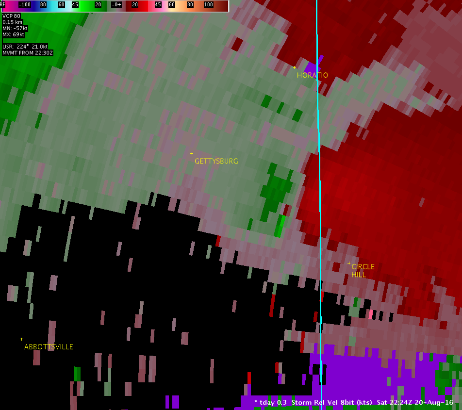
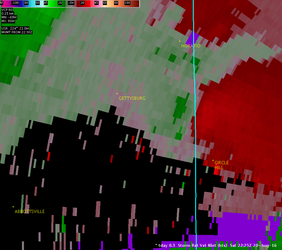
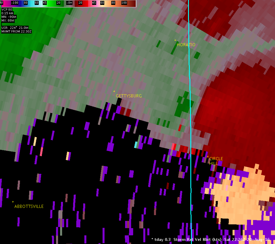
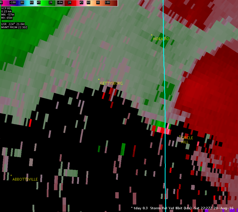
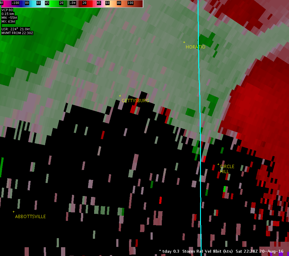
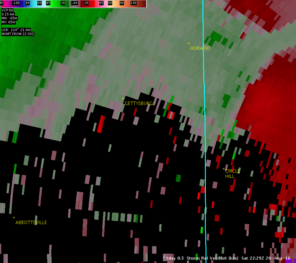
| TDAY 0.3° Storm-Relative Motion (600-800 feet AGL) |
| 1 2 3 4 5 6 7 8 9 10 11 12 13 14 15 16 17 18 19 20 | Loop |
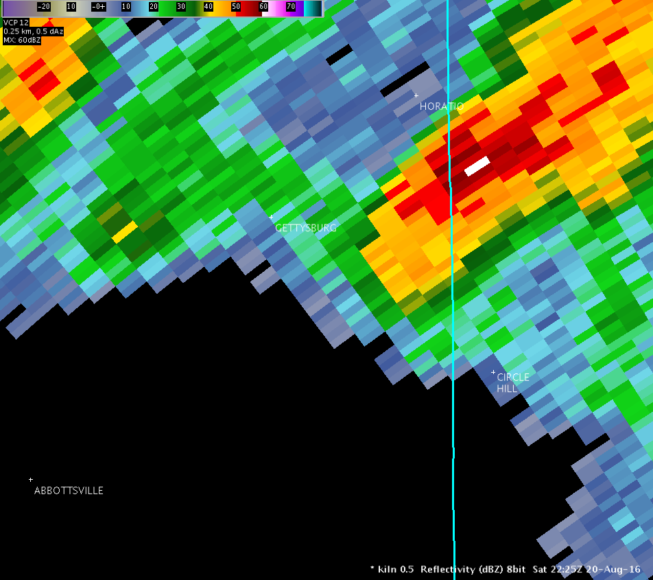
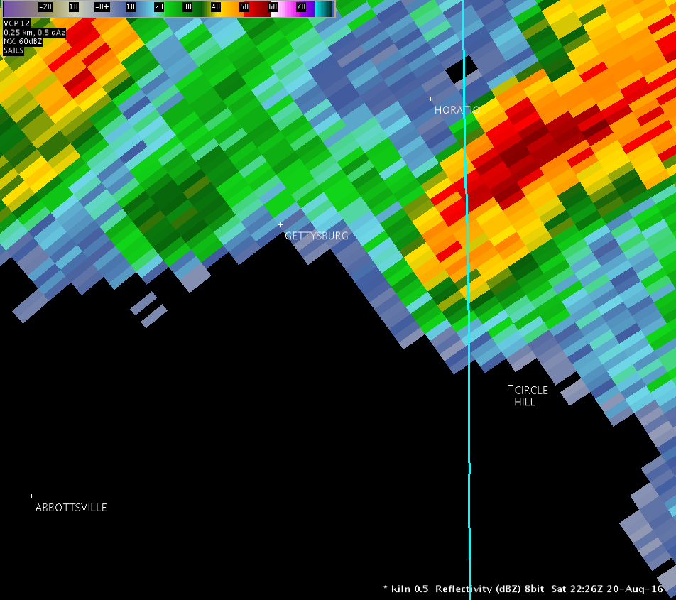
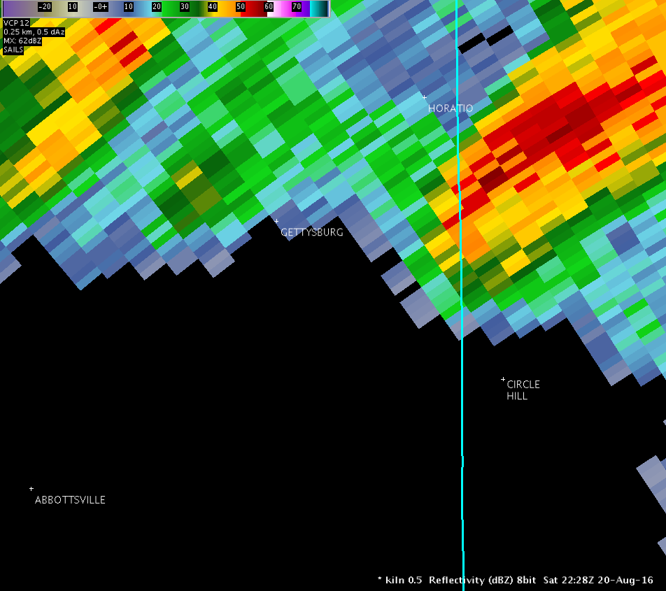
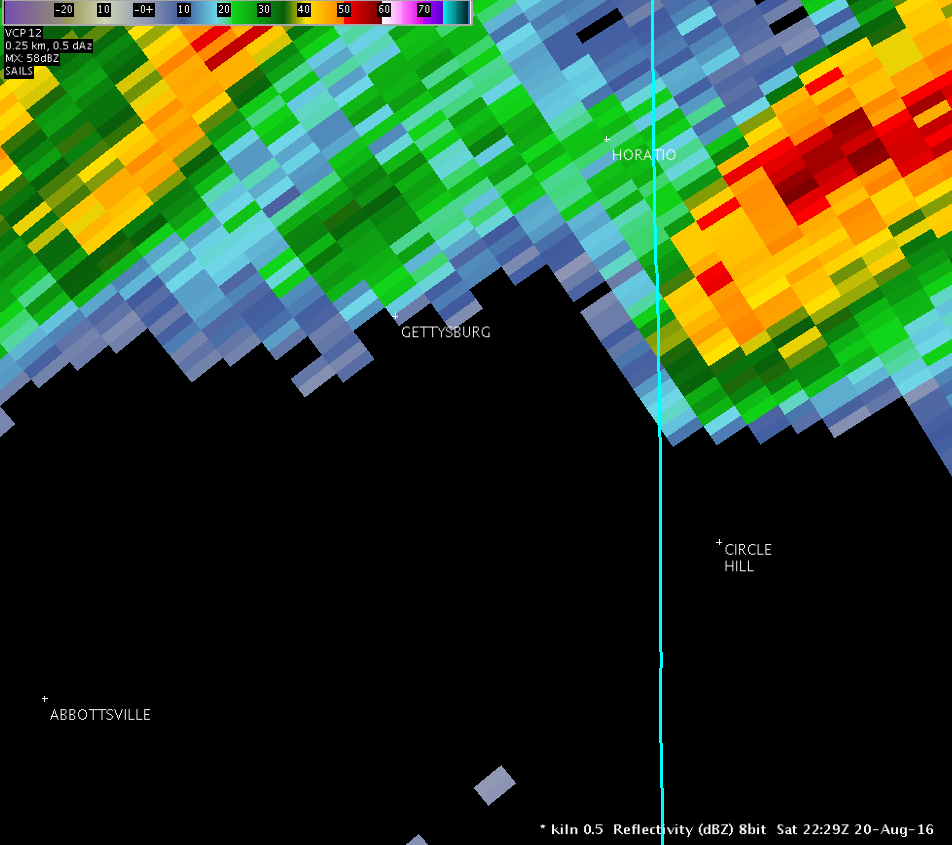
| Full Radar Loops from NWS Wilmington Ohio (6:12 PM - 6:29 PM) |
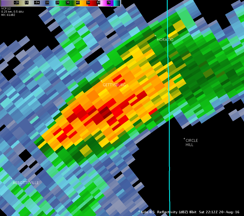
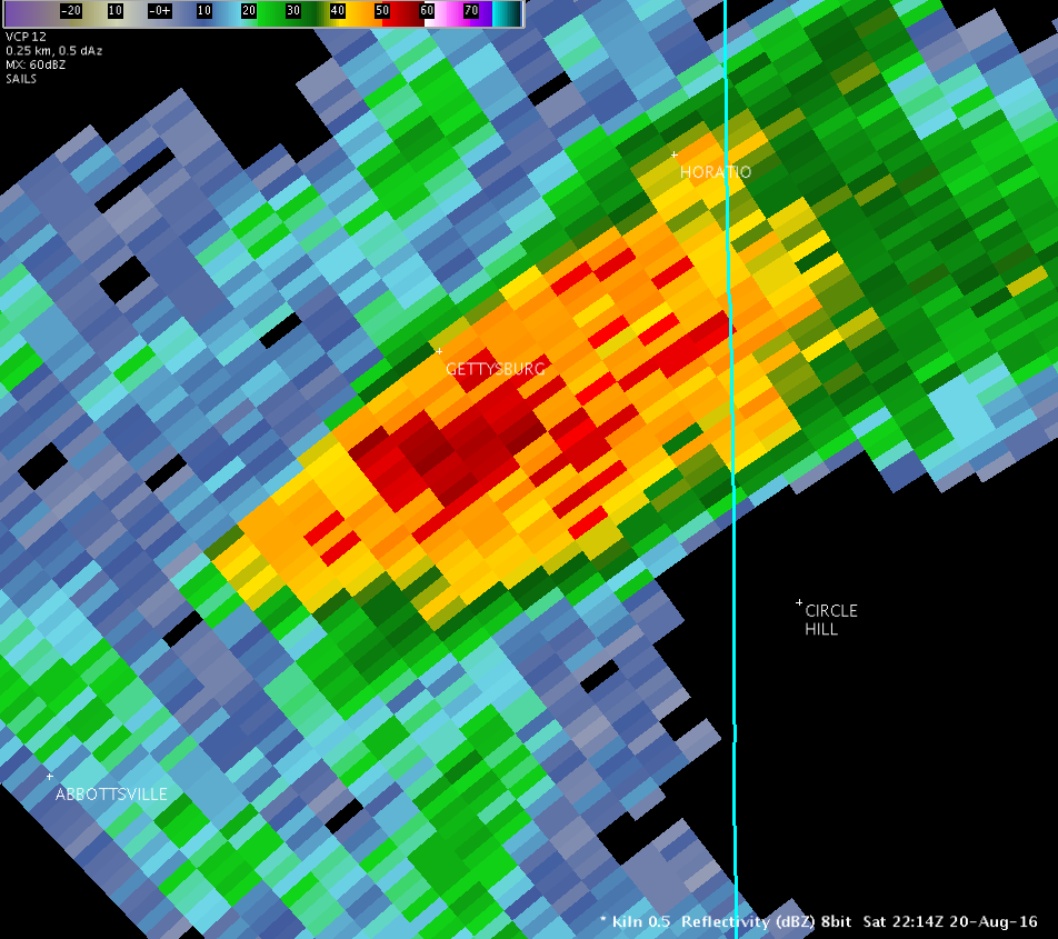
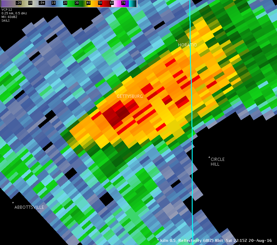
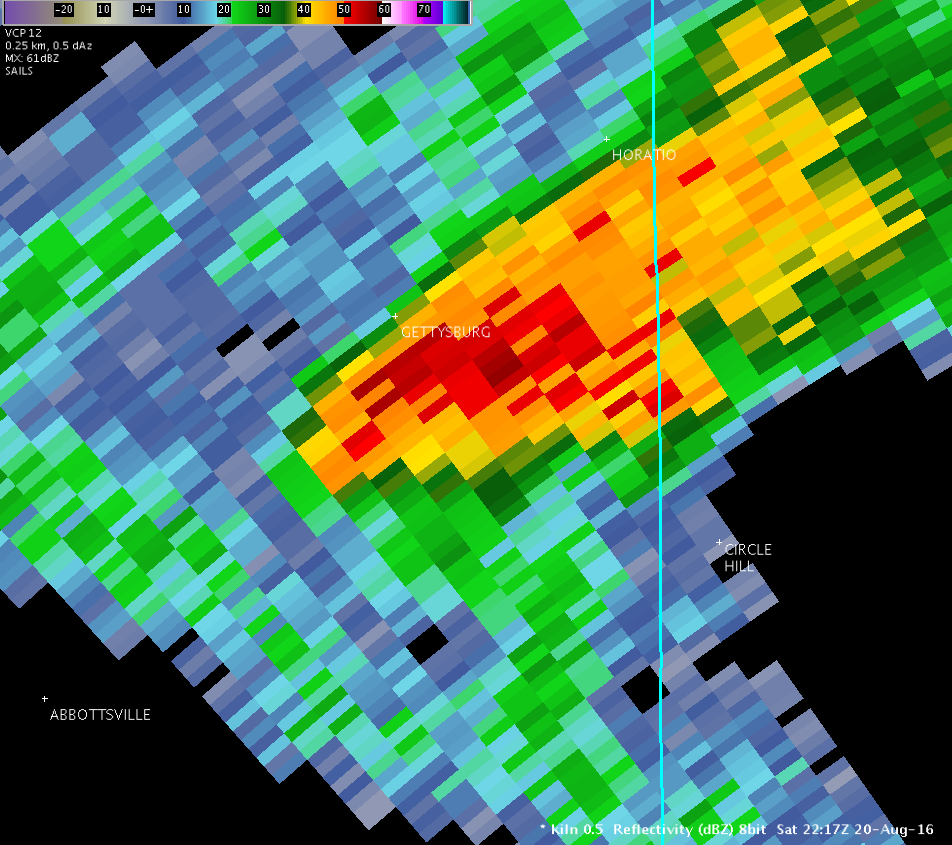
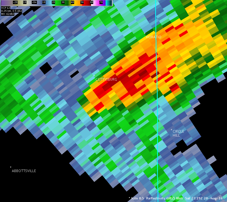
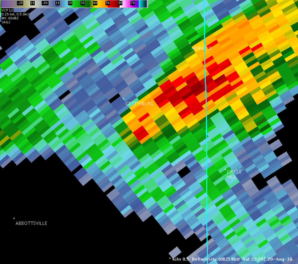
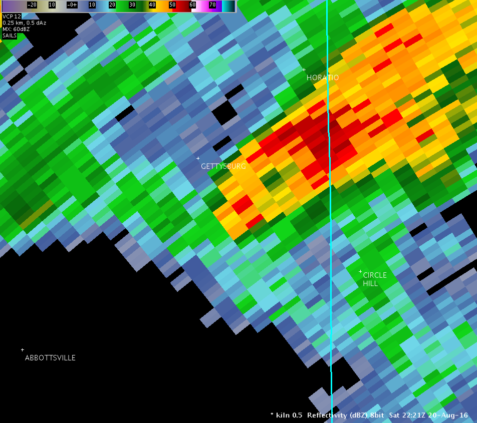
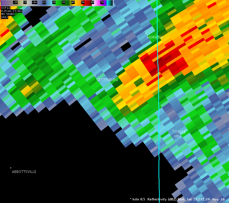
| KILN 0.5° Reflectivity (4400-4600 feet AGL) |
| 1 2 3 4 5 6 7 8 9 10 11 12 | Loop |
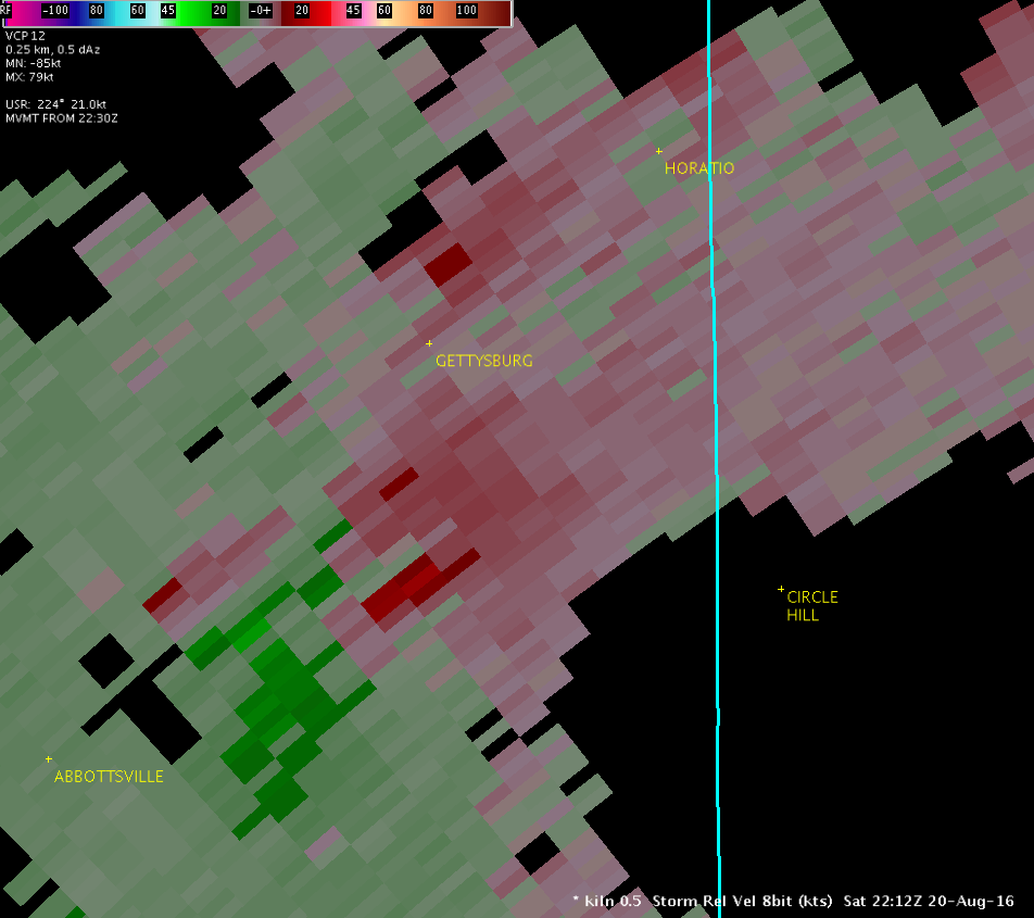
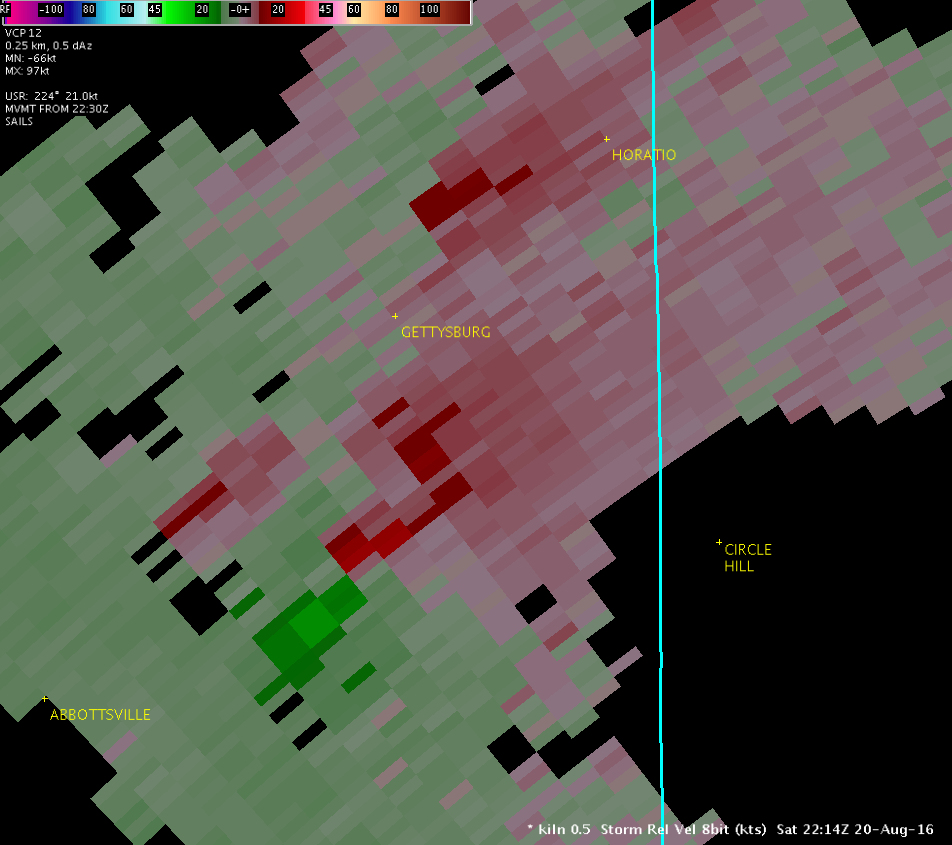
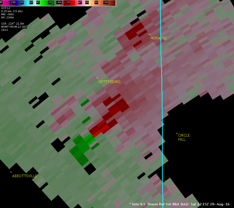
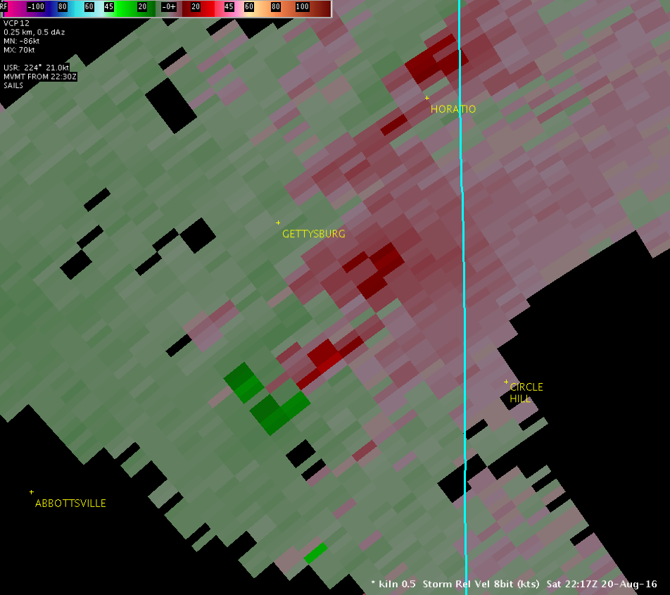
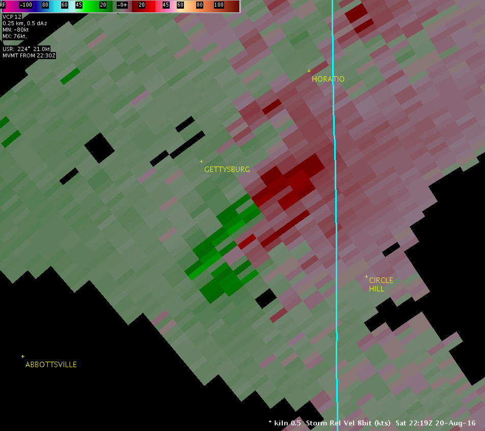
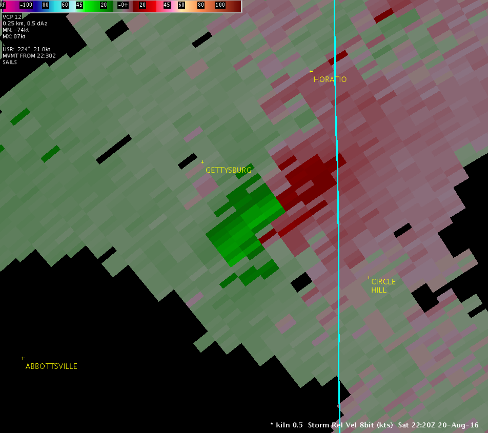
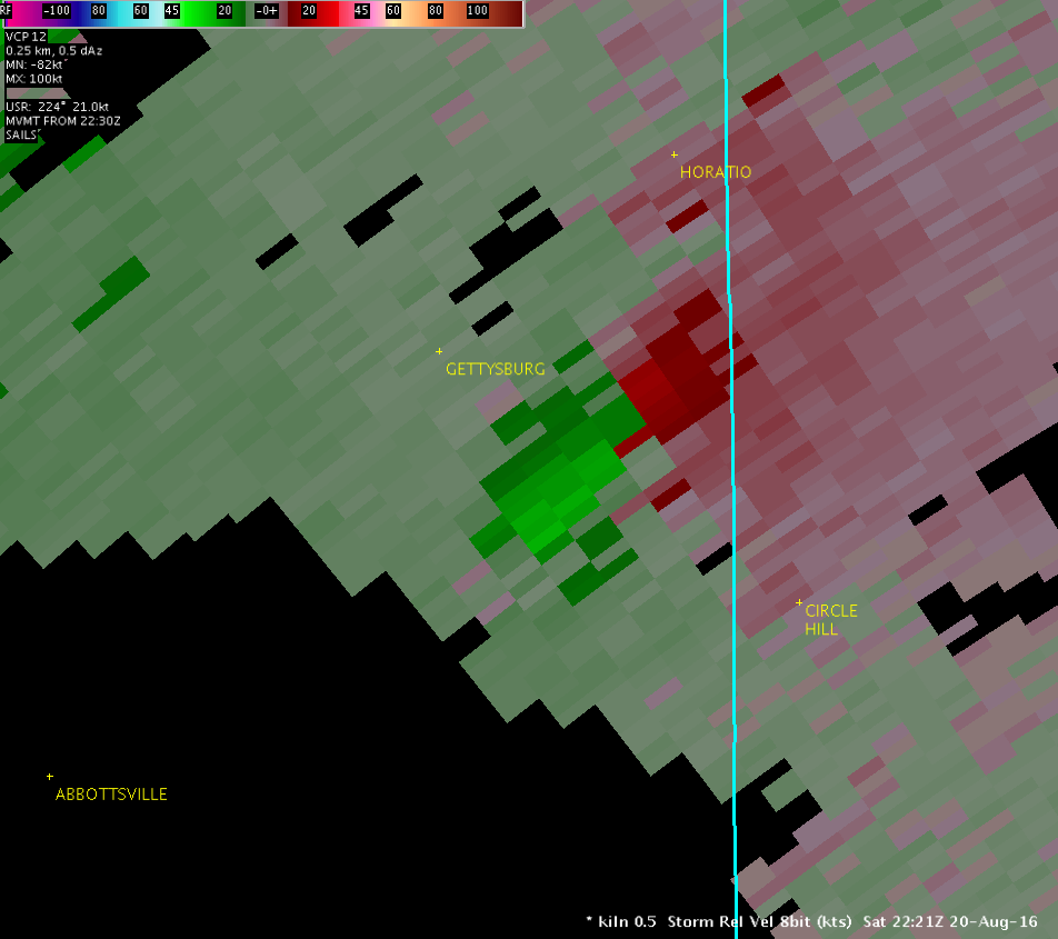
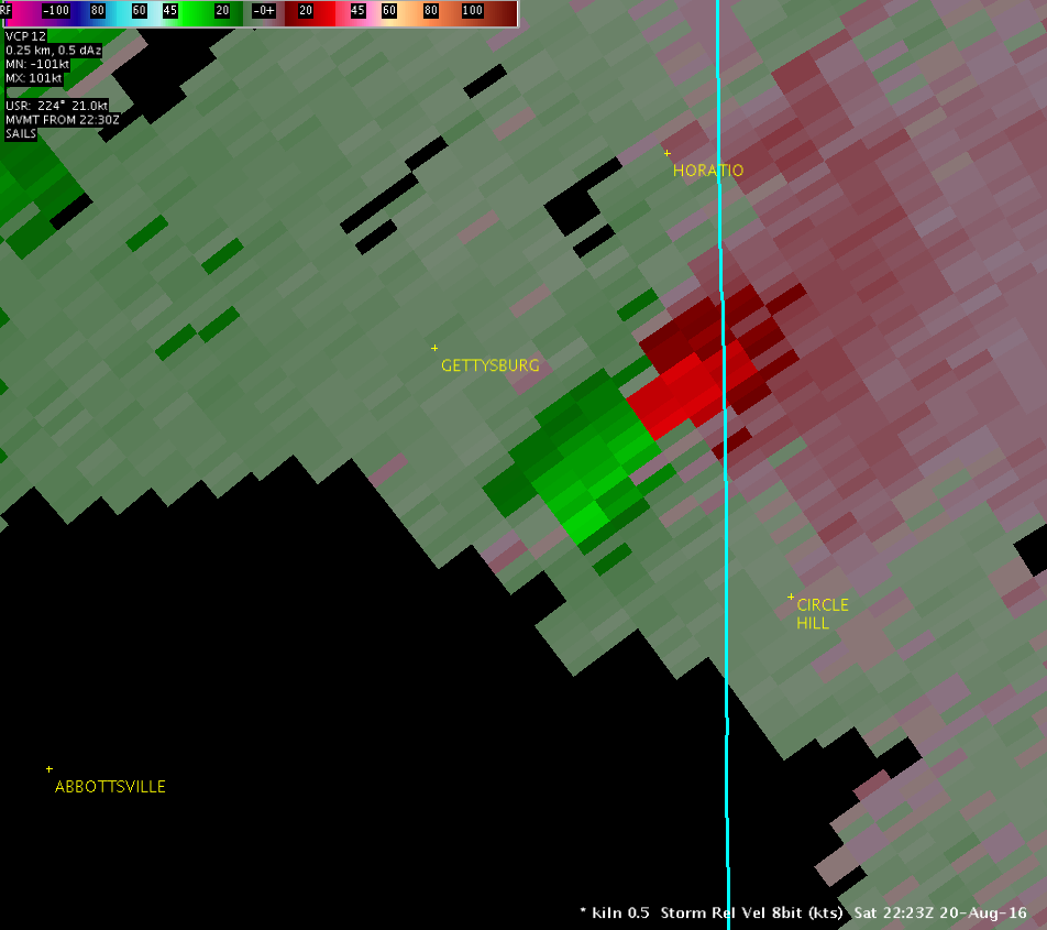
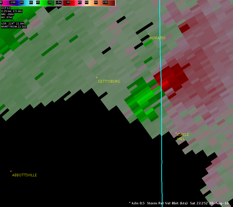
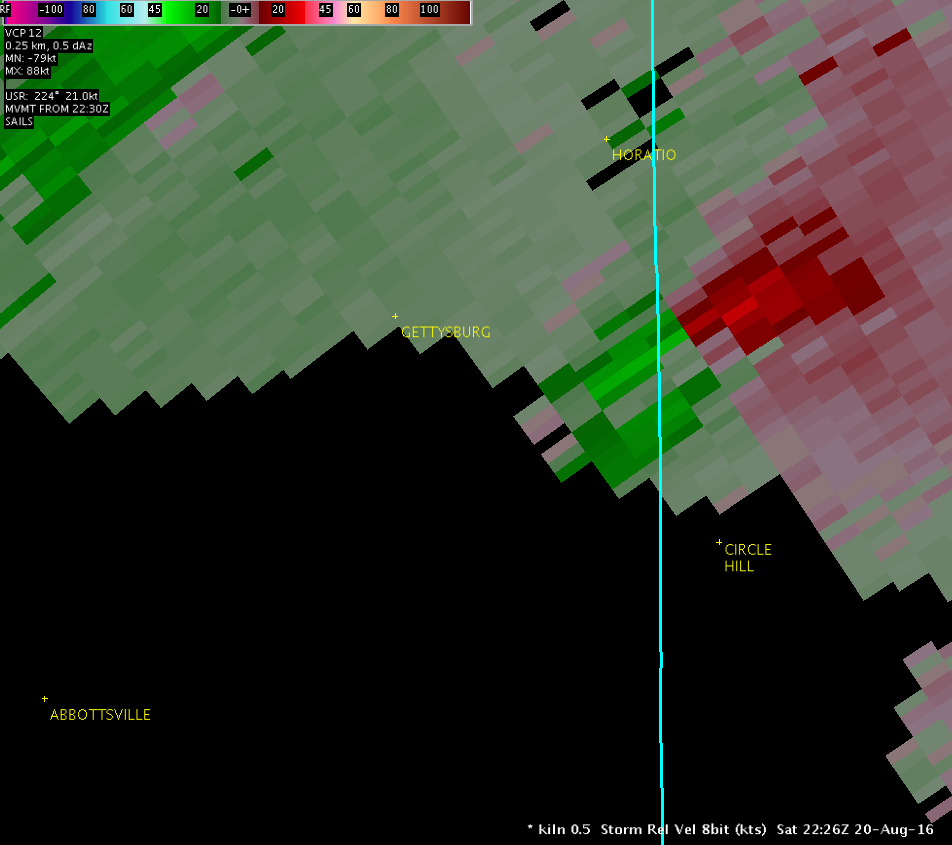
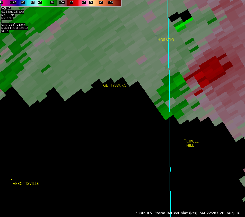
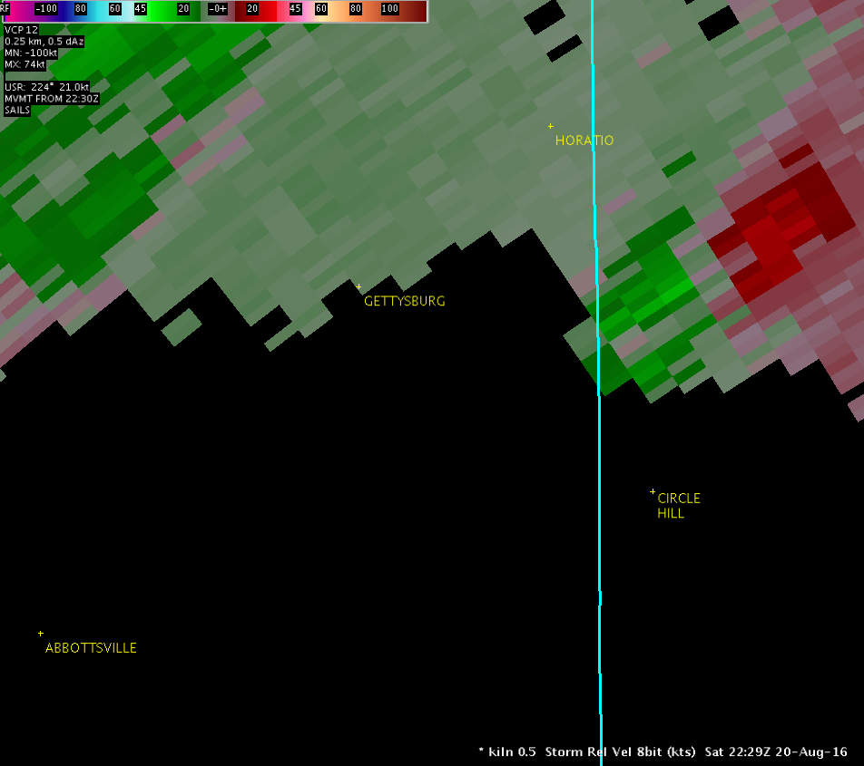
| KILN 0.5° Storm-Relative Motion (4400-4600 feet AGL) |
| 1 2 3 4 5 6 7 8 9 10 11 12 | Loop |
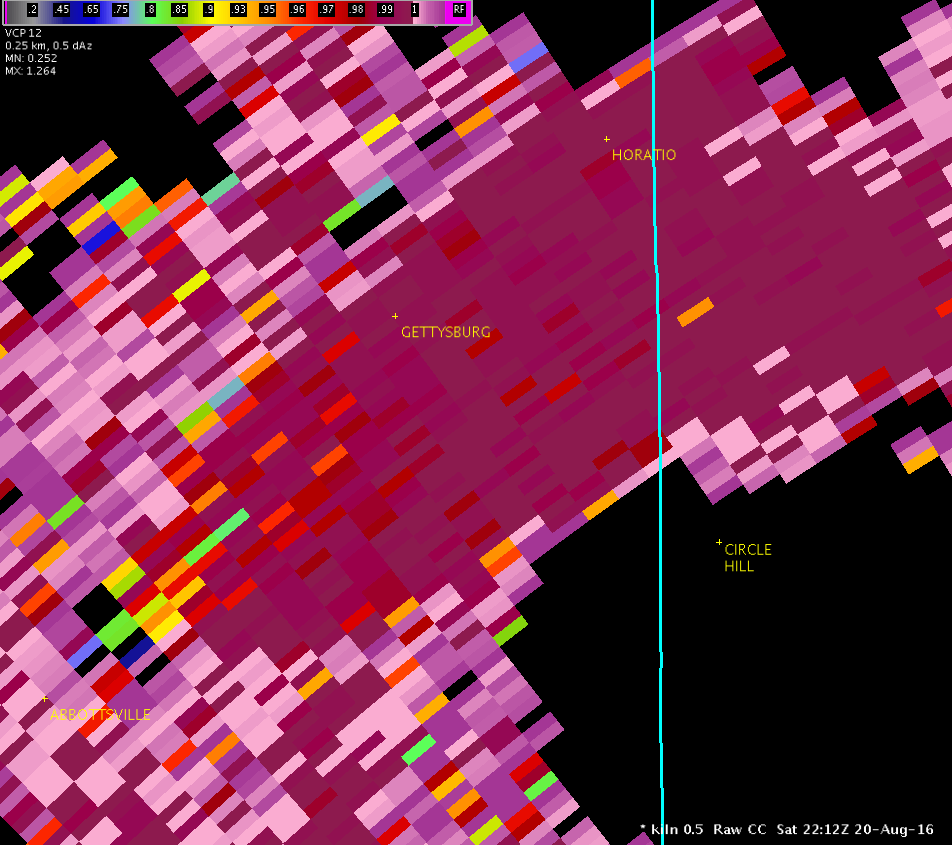
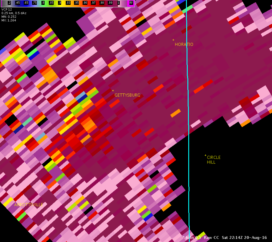
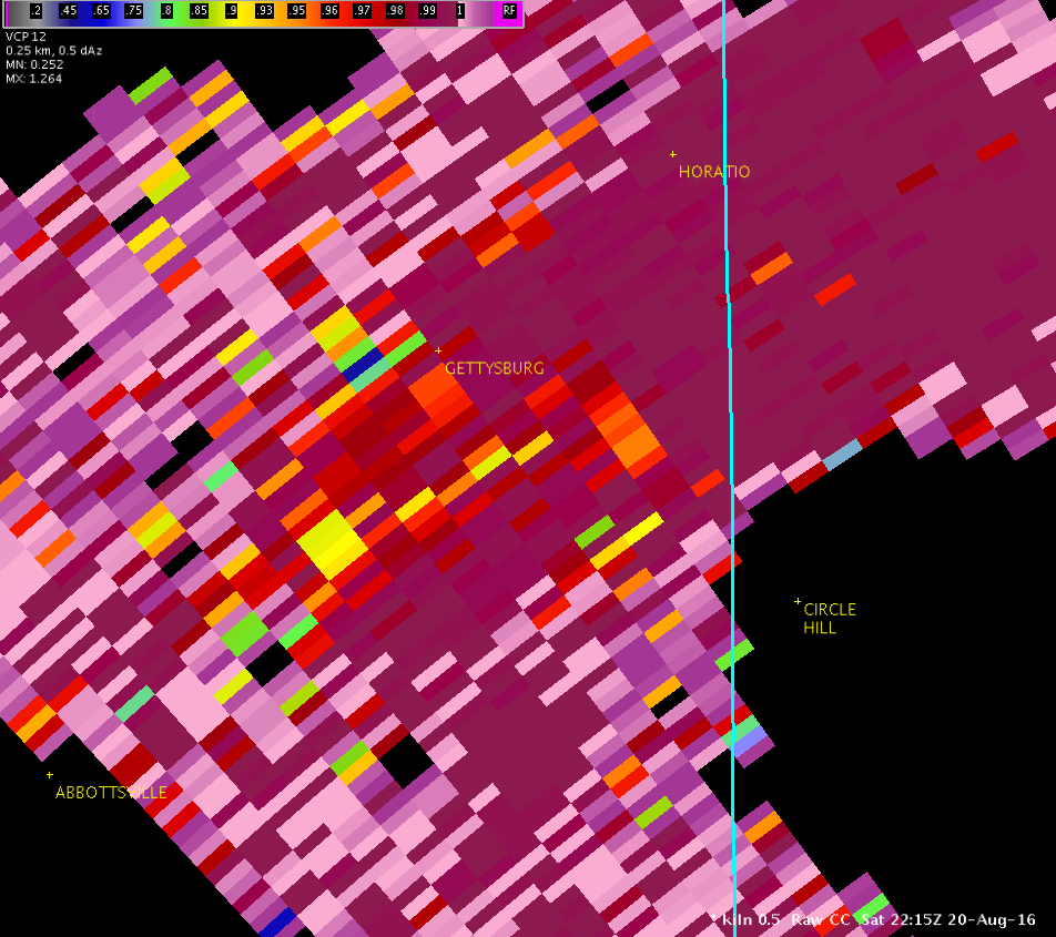
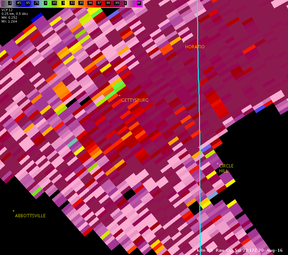
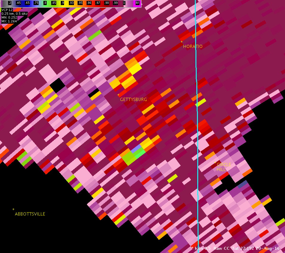
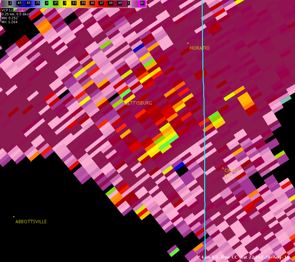
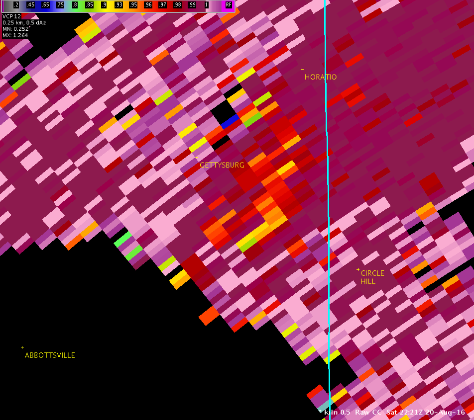
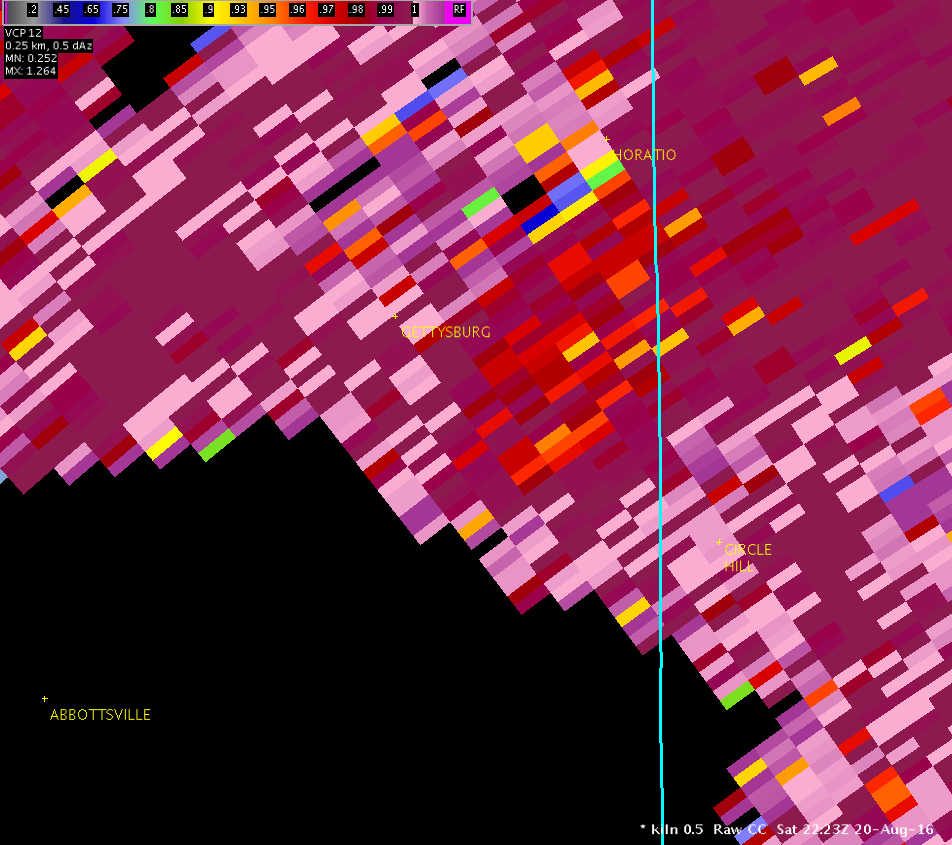
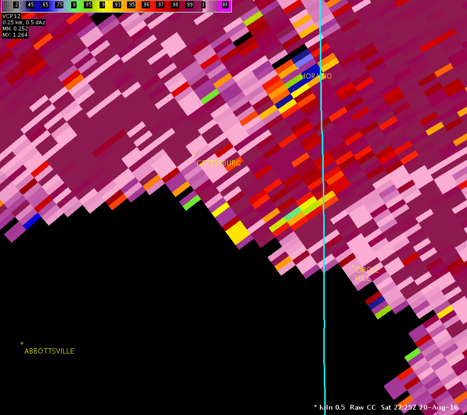
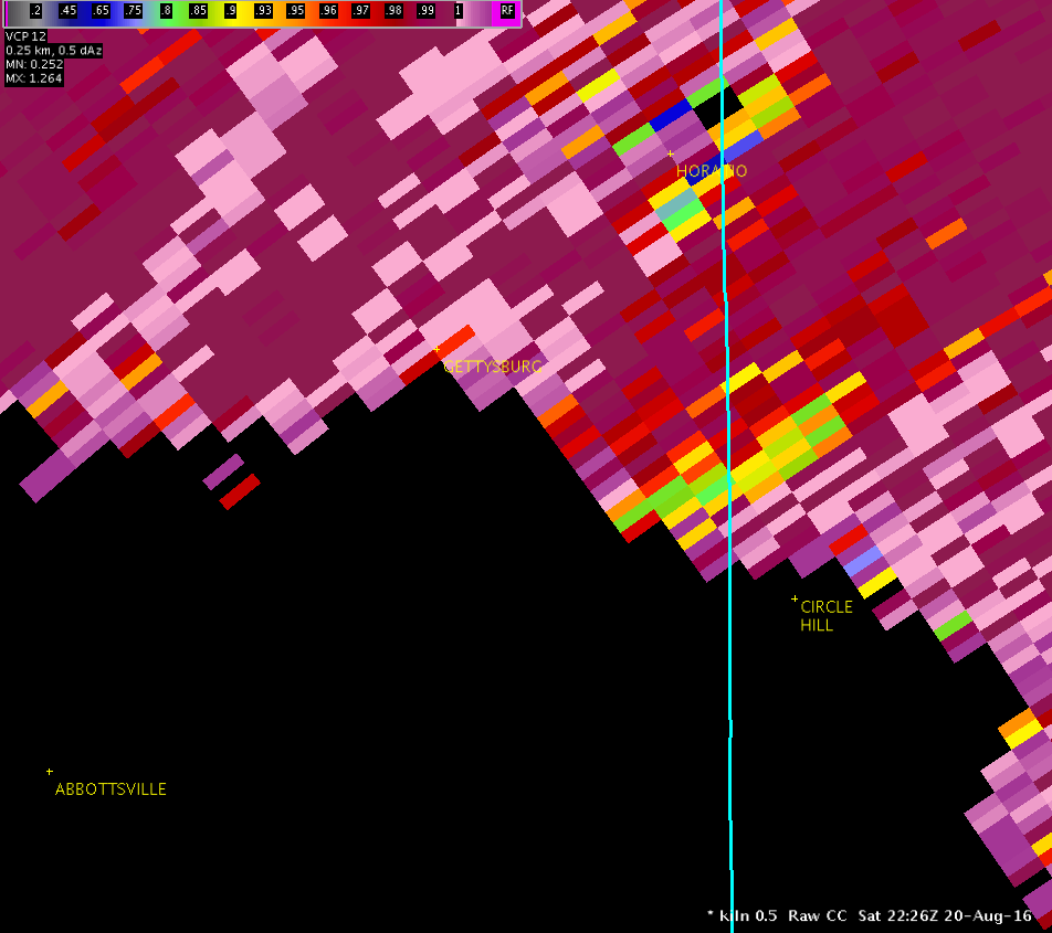
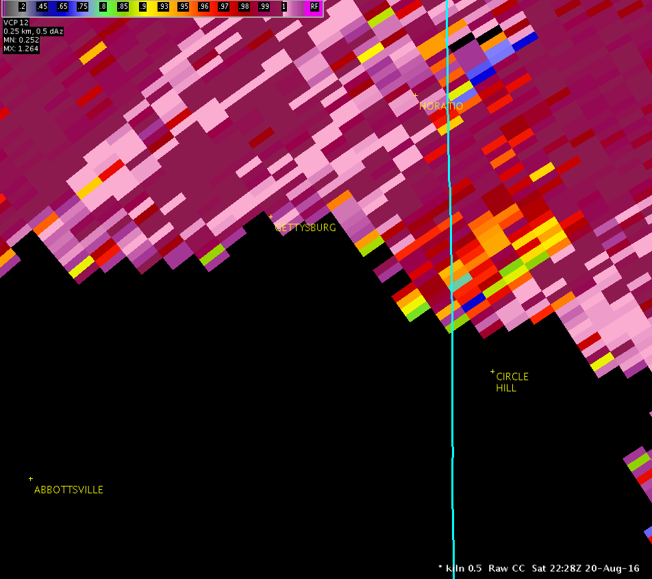
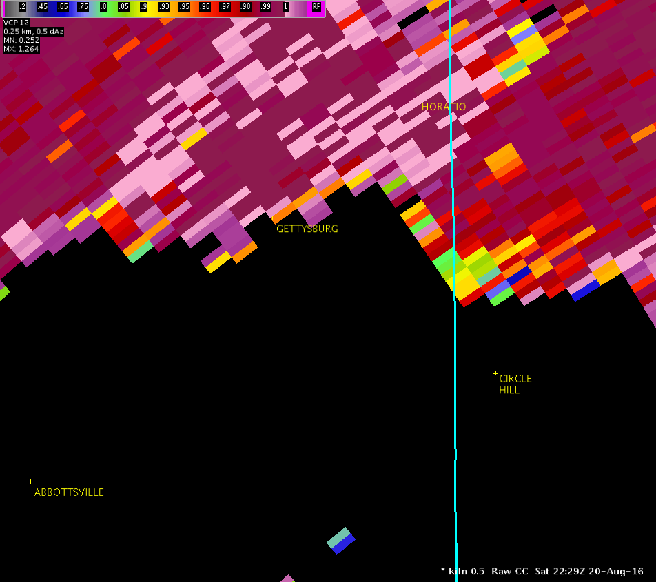
| KILN 0.5° Correlation Coefficient (4400-4600 feet AGL) |
| 1 2 3 4 5 6 7 8 9 10 11 12 | Loop |
| Pictures from the storm survey: | |||
 |
 |
 |
 |
 |
 |
 |
 |
 |
 |
 |
 |
 |
 |
 |
 |
 |
 |
 |
 |
 |
 |
||

