|
Tornado near Casstown / Piqua, OH |
UPDATED INFORMATION
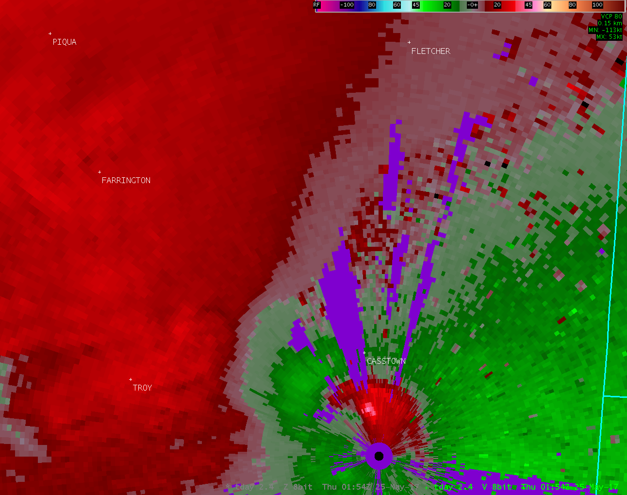
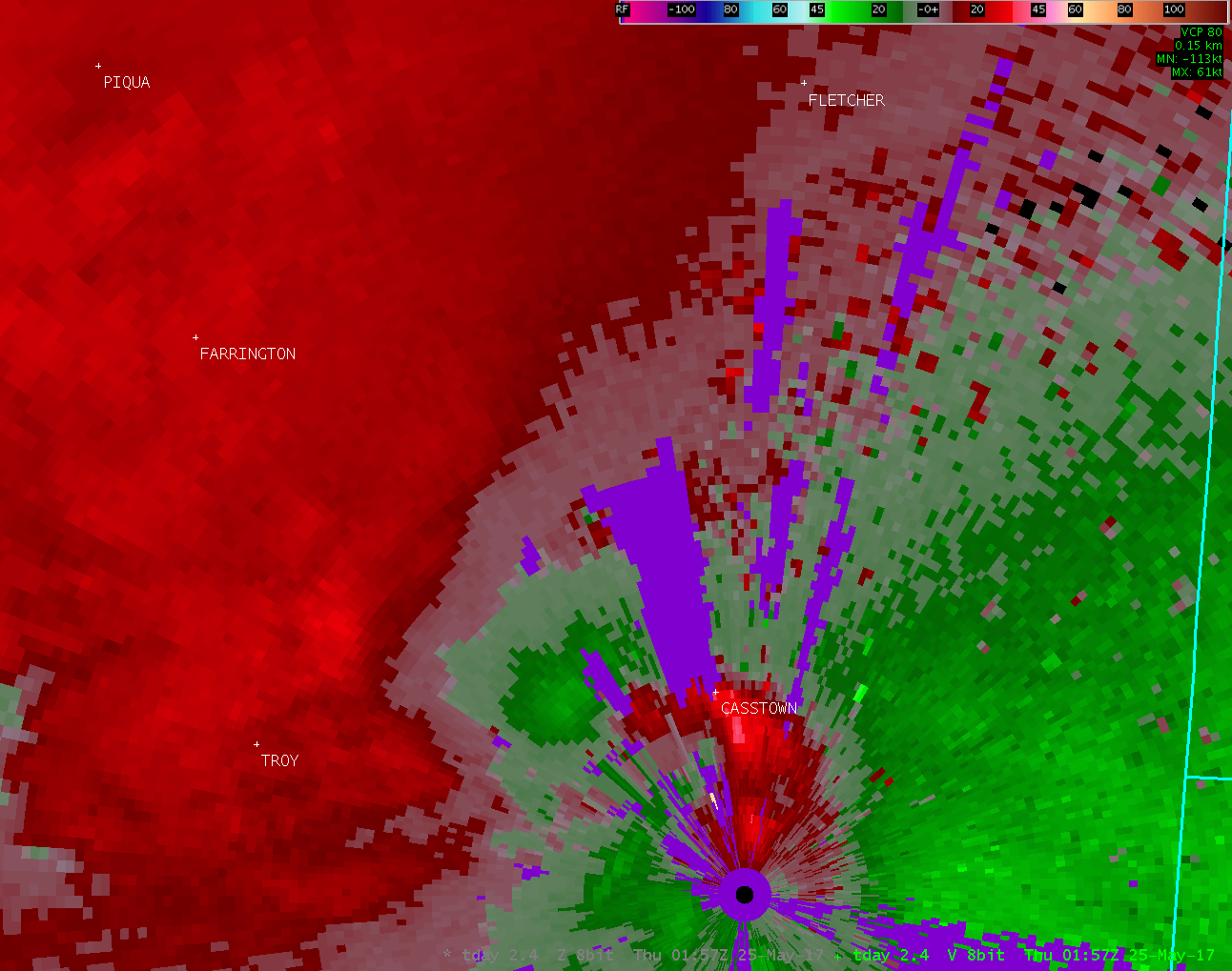
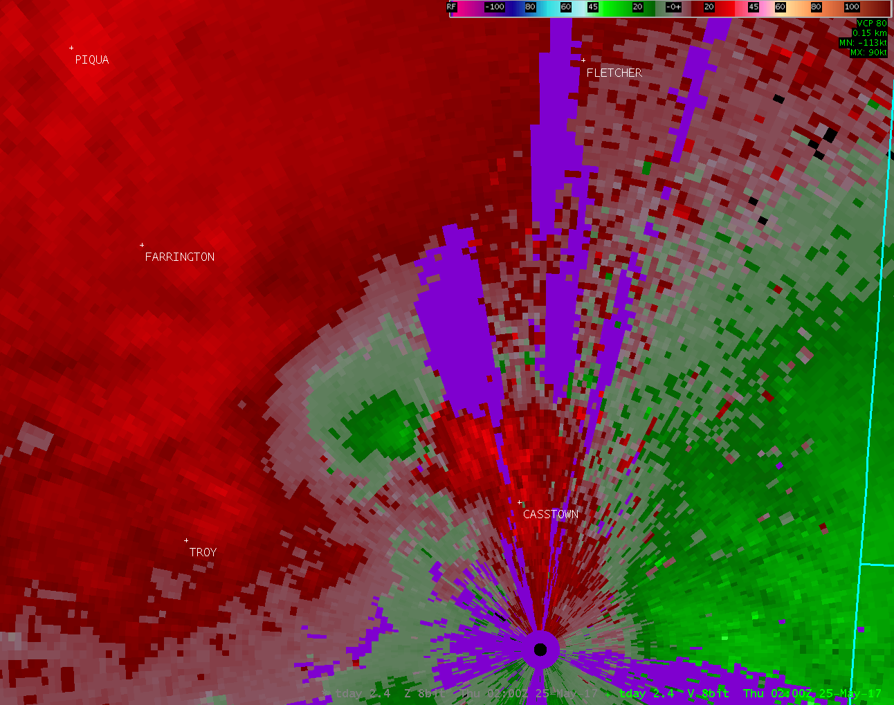
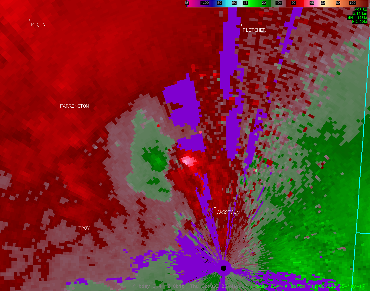
Location...5 miles southeast of Piqua in Miami County Ohio Date...05/24/2017 Estimated Start Time...10:03 PM EDT Estimated End Time...10:10 PM EDT Maximum EF-Scale Rating...EF1 Estimated Maximum Wind Speed...90 MPH Maximum Path Width...160 Yards Path Length...1.9 Miles Beginning Lat/Lon...40.0788N / 84.1539W Ending lat/Lon...40.1023N / 84.1728W * Fatalities...0 * Injuries...0 Based on radar data, video evidence and eyewitness reports, the tornado is estimated to have touched down in a field north of the intersection of Polecat Road and Troy Urbana Road. |
ORIGINAL STATEMENT
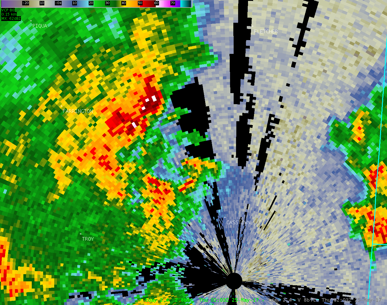
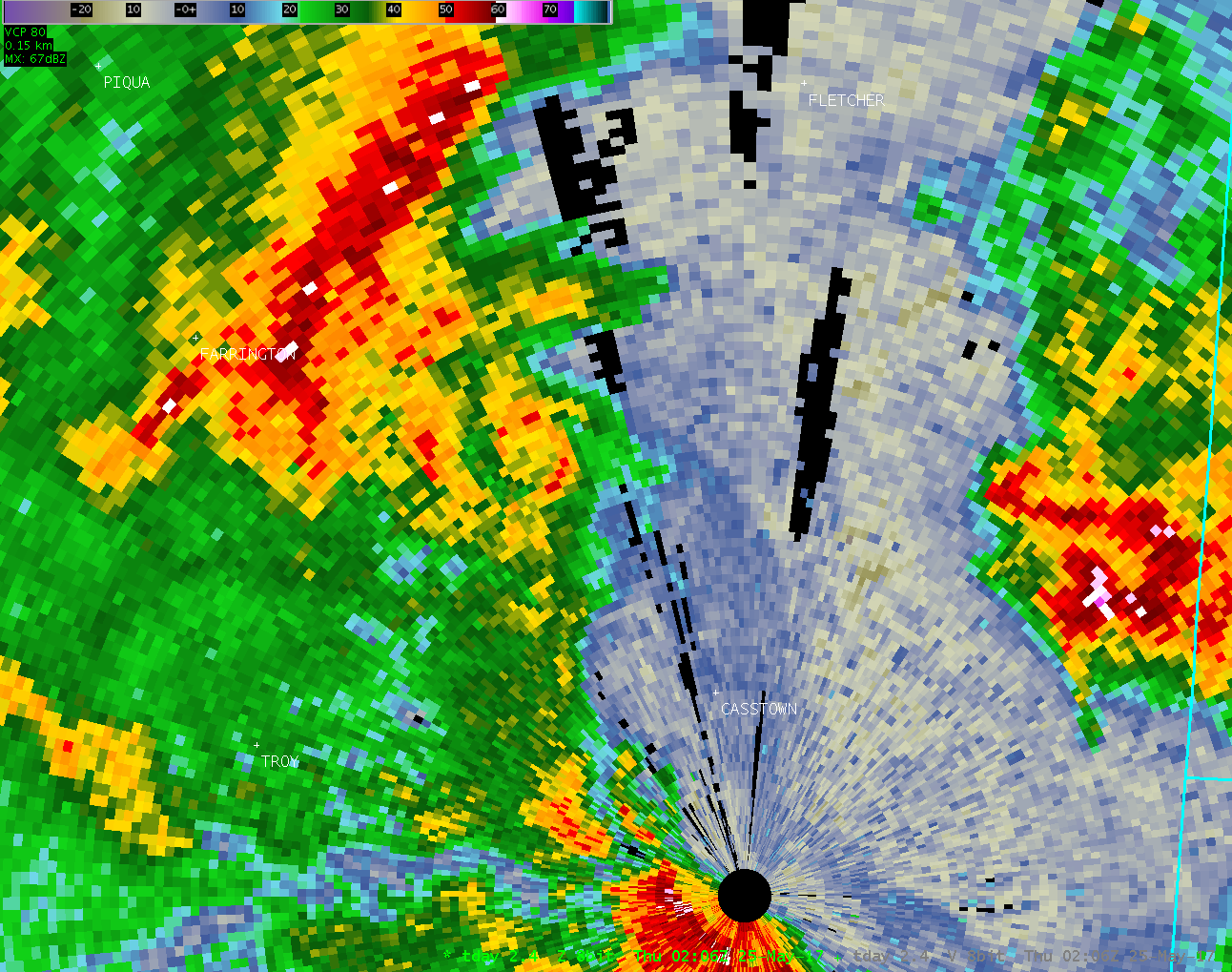
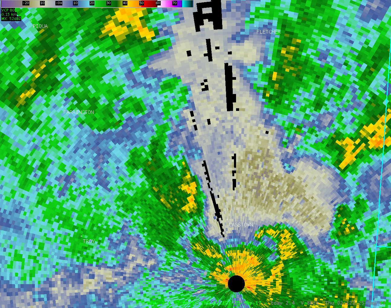
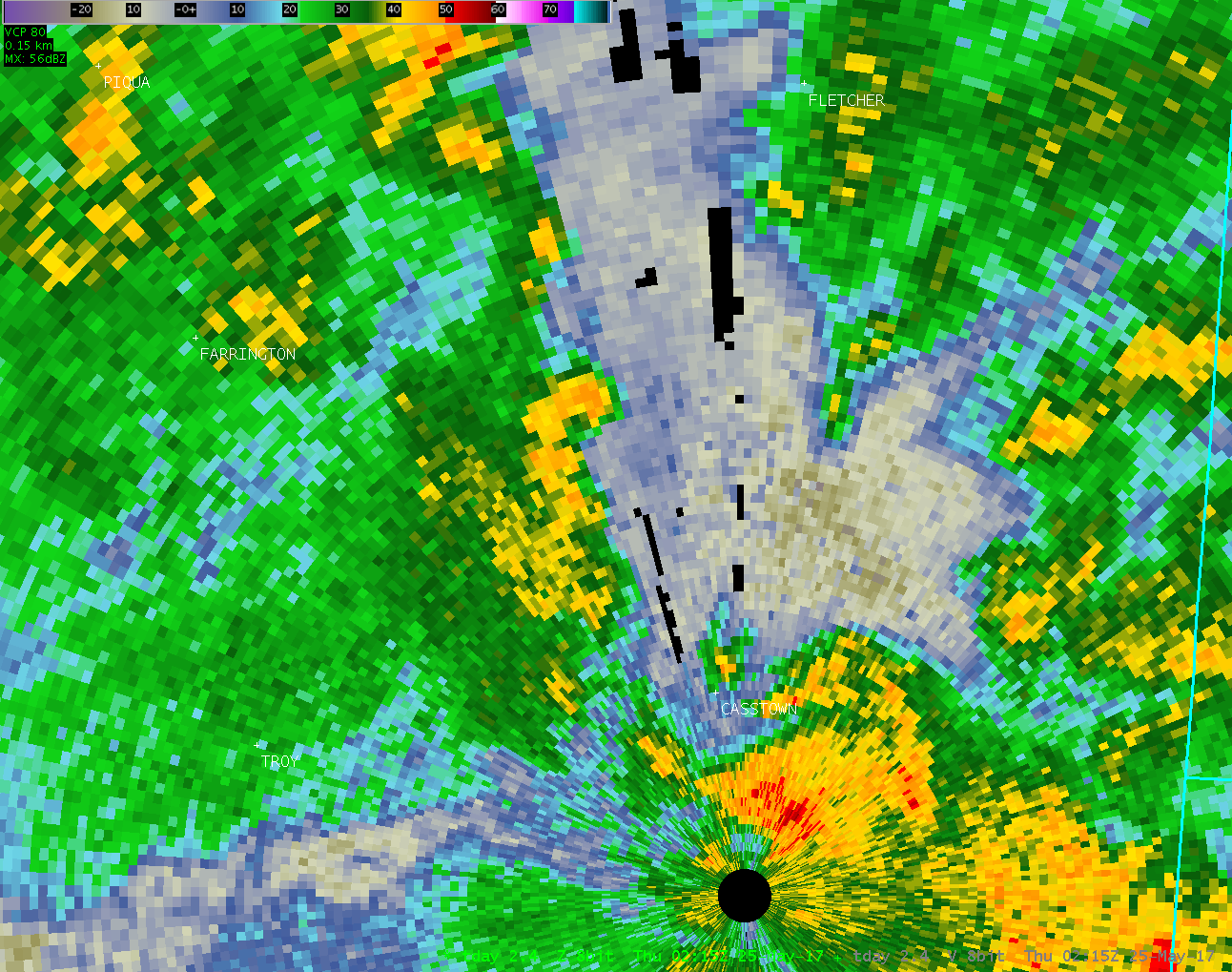
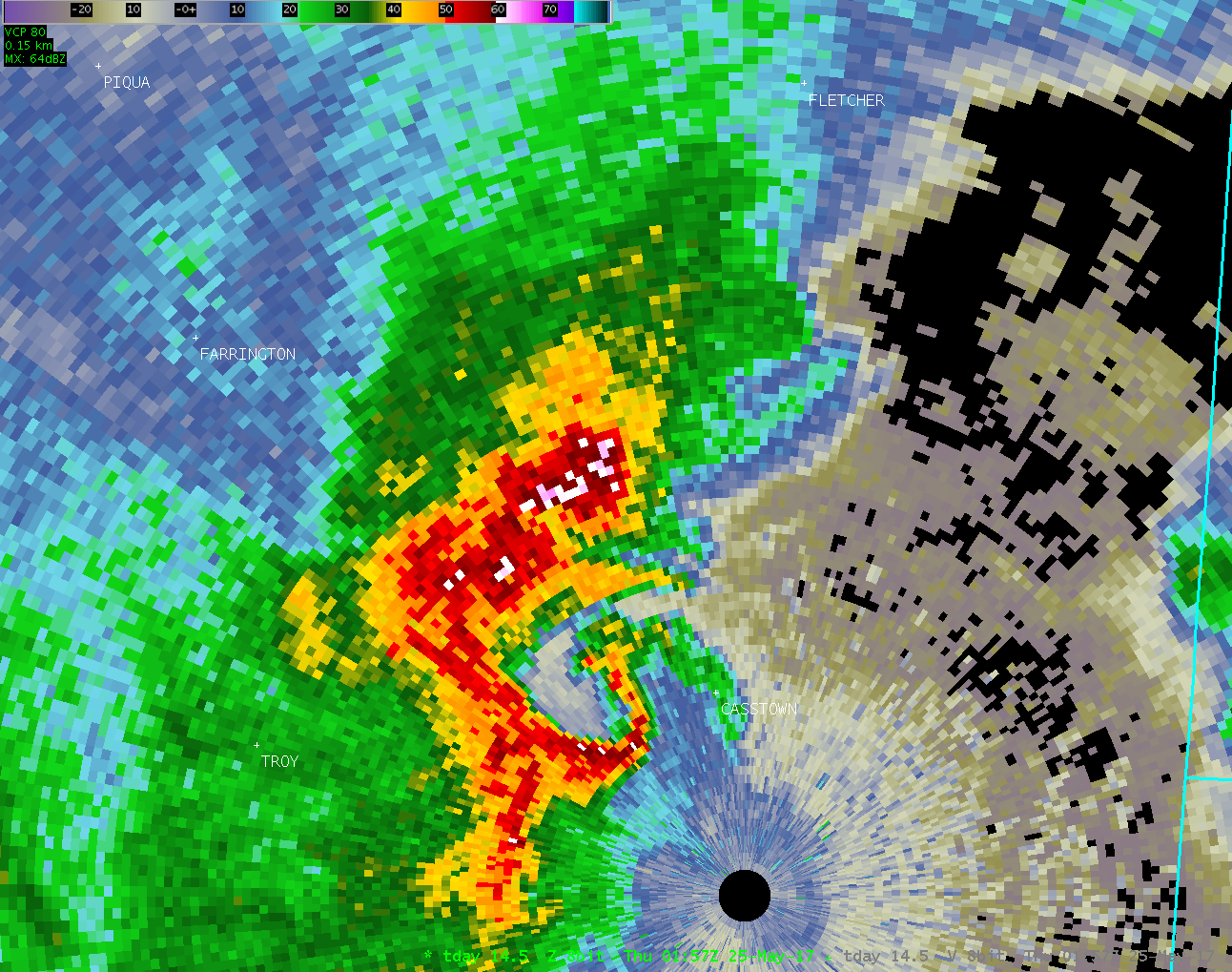
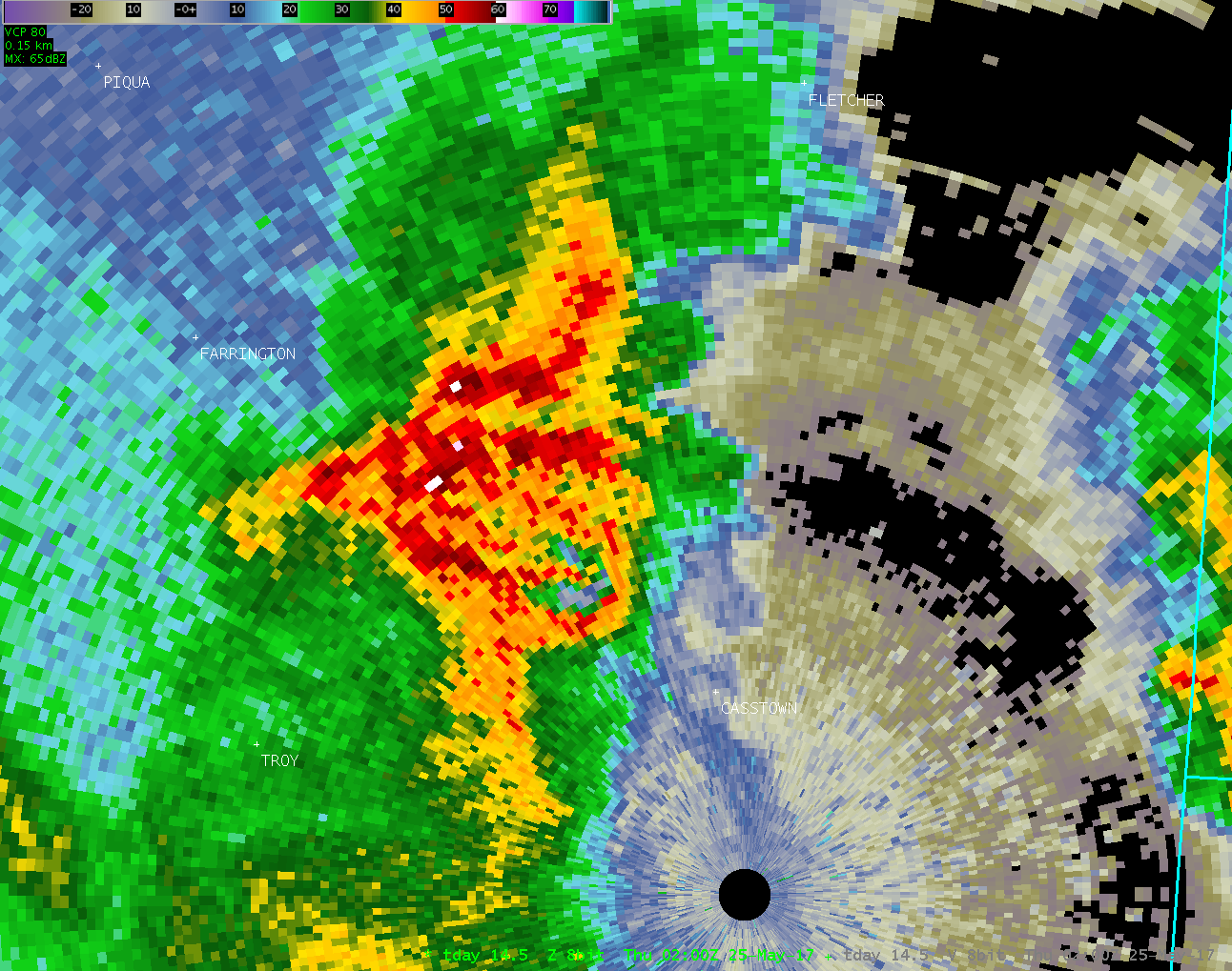
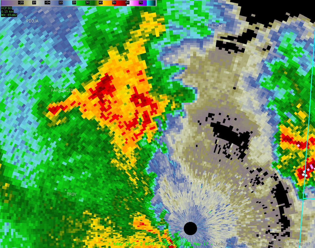
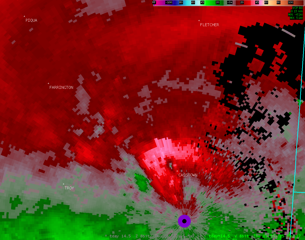
Public Information Statement National Weather Service Wilmington OH 734 PM EDT Thu May 25 2017 ...EF1 TORNADO CONFIRMED NEAR 5 MILES SOUTHEAST OF PIQUA IN MIAMI COUNTY OHIO... Location...5 miles southeast of Piqua in Miami County Ohio Date...05/24/2017 Estimated Start Time...10:09 PM EDT Estimated End Time...10:10 PM EDT Maximum EF-Scale Rating...EF1 Estimated Maximum Wind Speed...90 MPH Maximum Path Width...160 Yards Path Length...0.35 Miles Beginning Lat/Lon...40.0976N/84.1708W Ending lat/Lon...40.1023N/84.1728W * Fatalities...0 * Injuries...0 * The information in this statement is preliminary and subject to change pending final review of the event(s) and publication in NWS Storm Data. ...Summary... The National Weather Service in Wilmington OH has confirmed a tornado near 5 miles southeast of Piqua in Miami County Ohio on 05/24/2017. The information below is updated from an earlier issuance at 344 PM EDT today. The tornado touched down along Deweese Road approximately one-half mile north of the intersection with East Rusk Road. Tree branches generally 4 inches in diameter or smaller were broken immediately west of Deweese Road at the start of the tornado track. More signicant damage occurred less than one-tenth of a mile north where several maple trees up to 18 inches in diamater were snapped. This is where the tornado was believed to be at peak intensity with winds estimated near 90 mph. There was also a large barn immediately east that was moved several inches off its foundation. This movement was likely caused by winds approaching 90 mph while flowing into the circulation. The tornado then started to weaken as it moved north- northwest near Deweese Road to a point approximately two-tenths of a mile southwest of the intersection with East Peterson Rd. Tree damage was generally less significant in this area with estimated wind speeds of 60-75 mph. The tornado appears to have lifted at this point, and no further damage was observed farther northwest. Damage along this path was oriented in convergent and semi-circular patterns consistent with the presence of a tornado. The National Weather Service would like to thank the Miami County Emergency Management Agency, the State of Ohio Emergency Management Agency and the affected property owners for their assistance during this survey. For reference: the Enhanced Fujita Scale classifies tornadoes into the following categories: EF0...wind speeds 65 to 85 mph. EF1...wind speeds 86 to 110 mph. EF2...wind speeds 111 to 135 mph. EF3...wind speeds 136 to 165 mph. EF4...wind speeds 166 to 200 mph. EF5...wind speeds greater than 200 mph. $$ SHOBE2 |
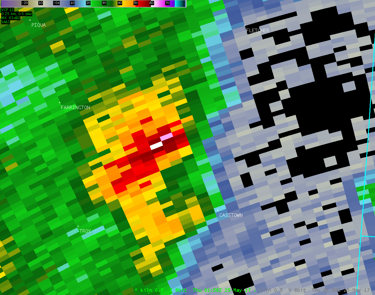
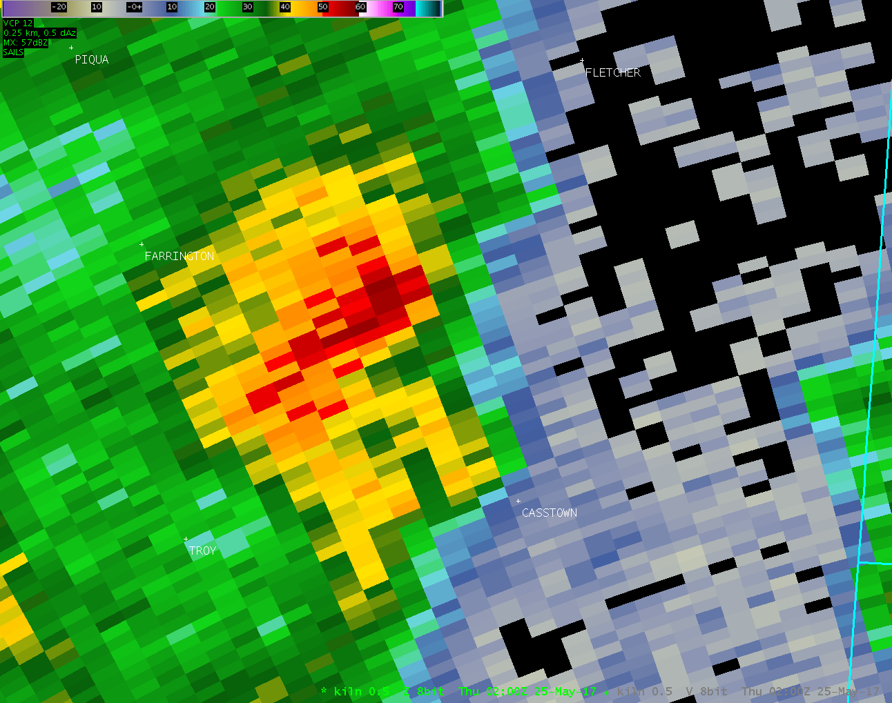
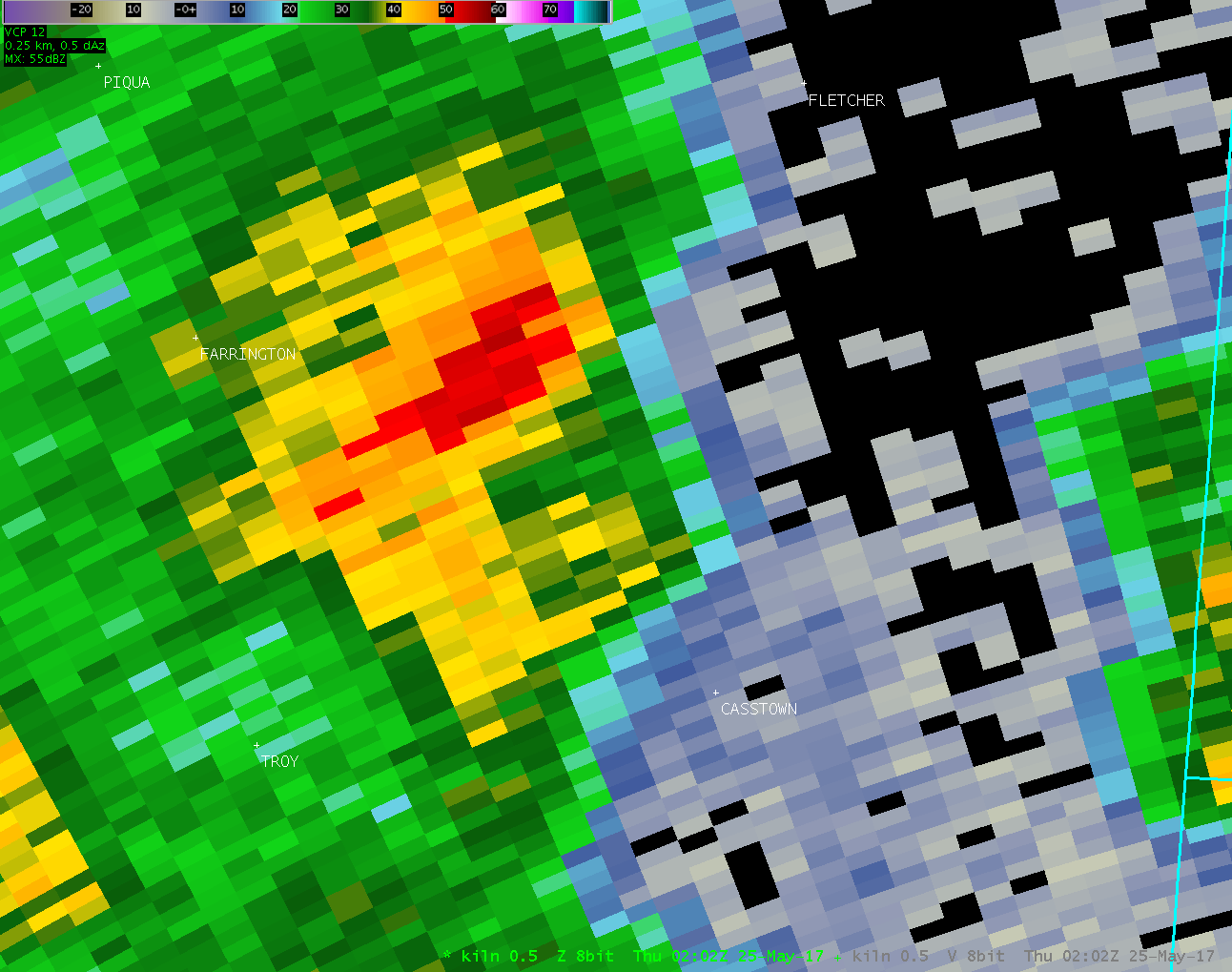
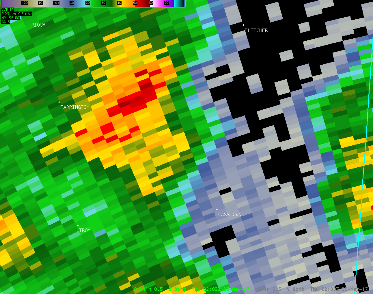
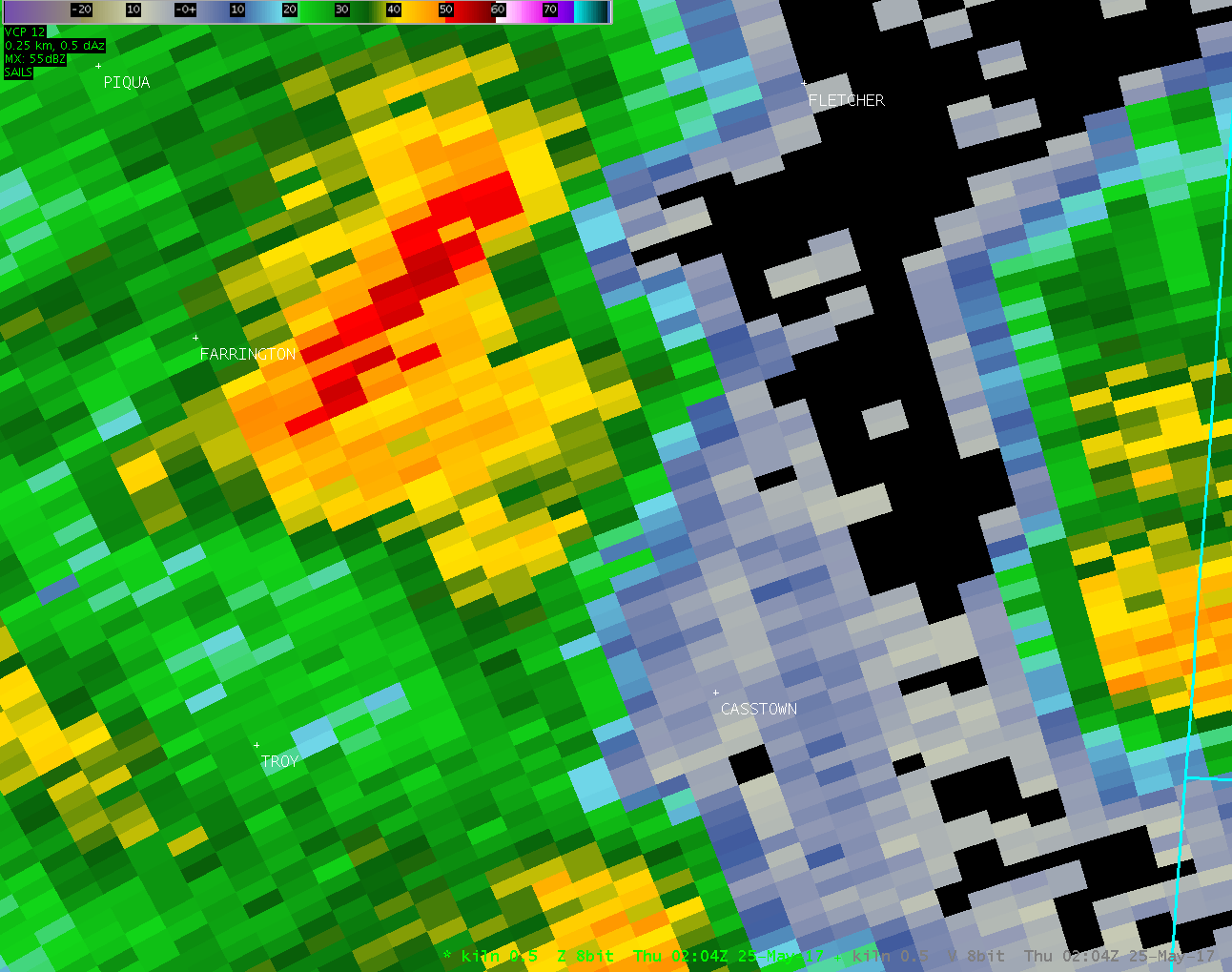
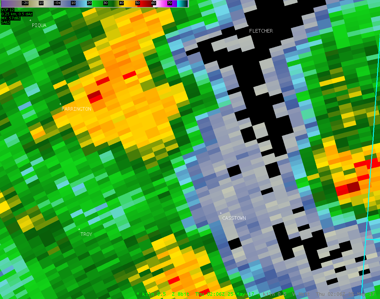
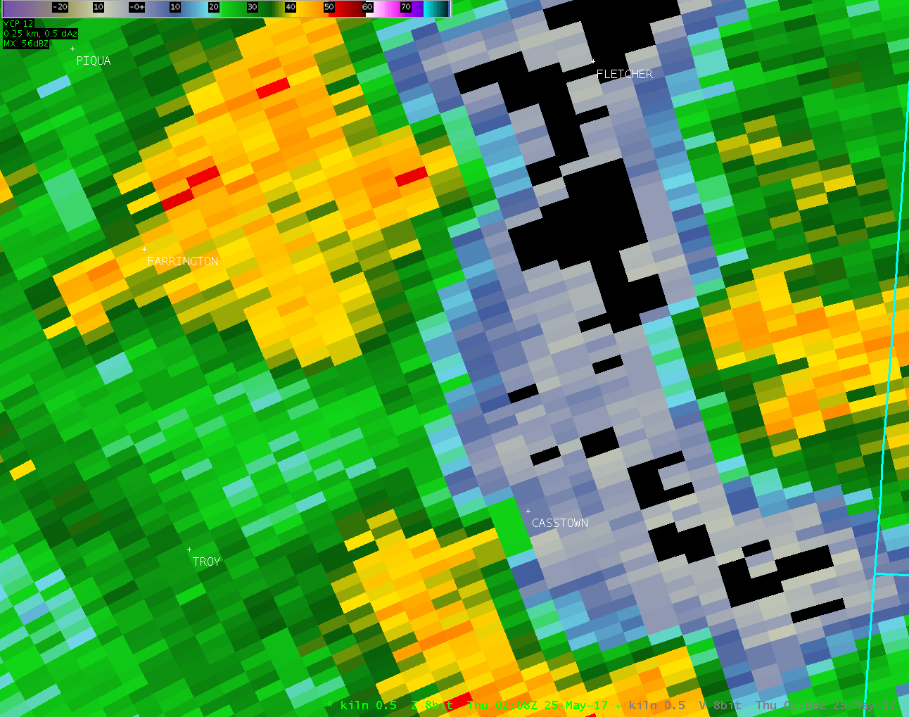
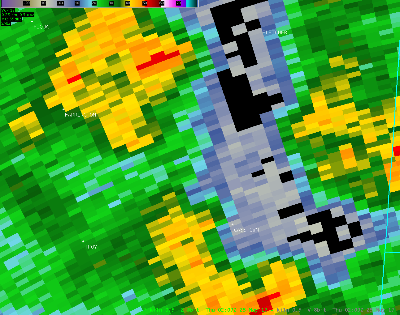
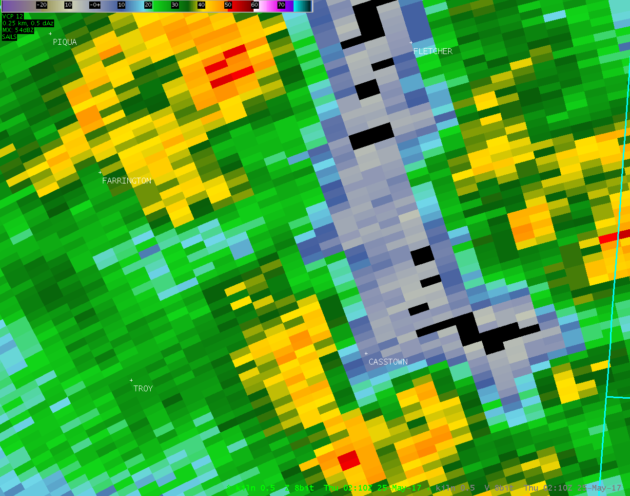
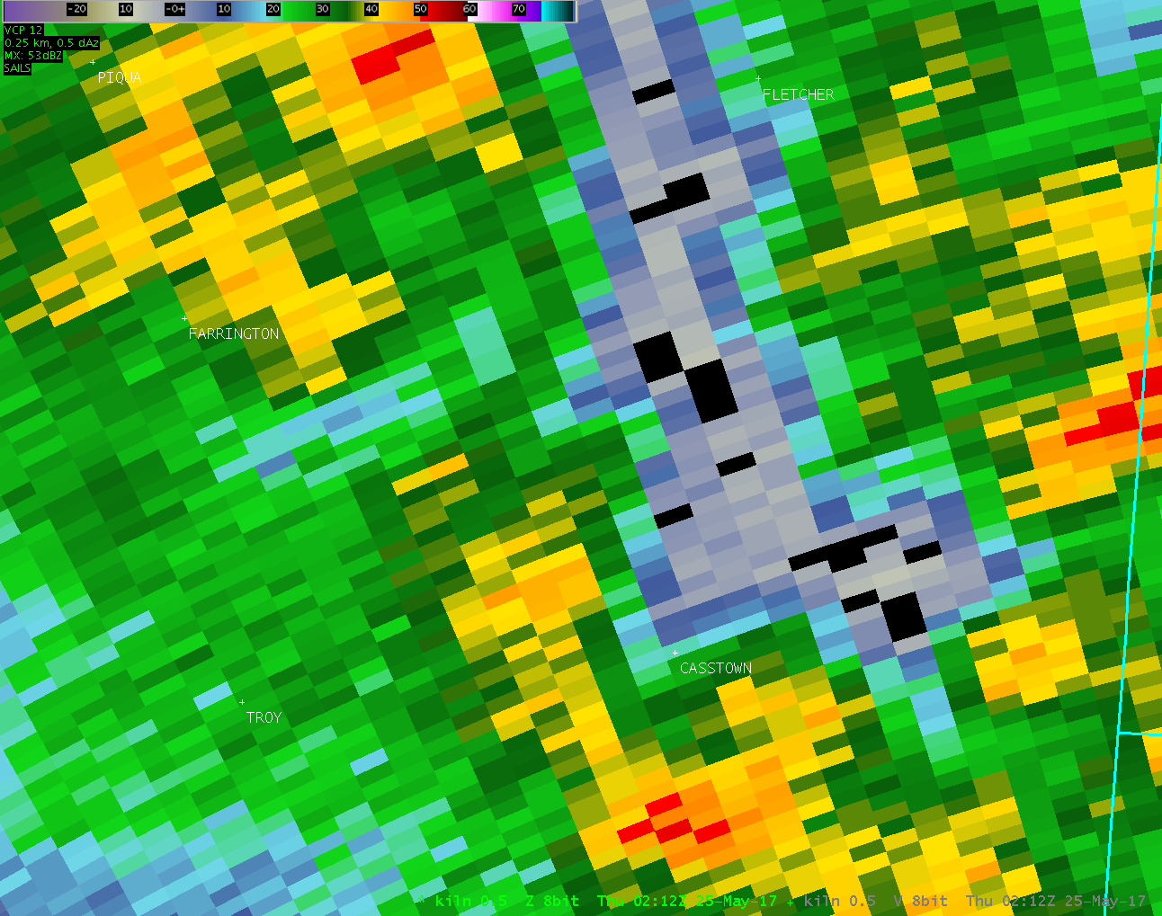
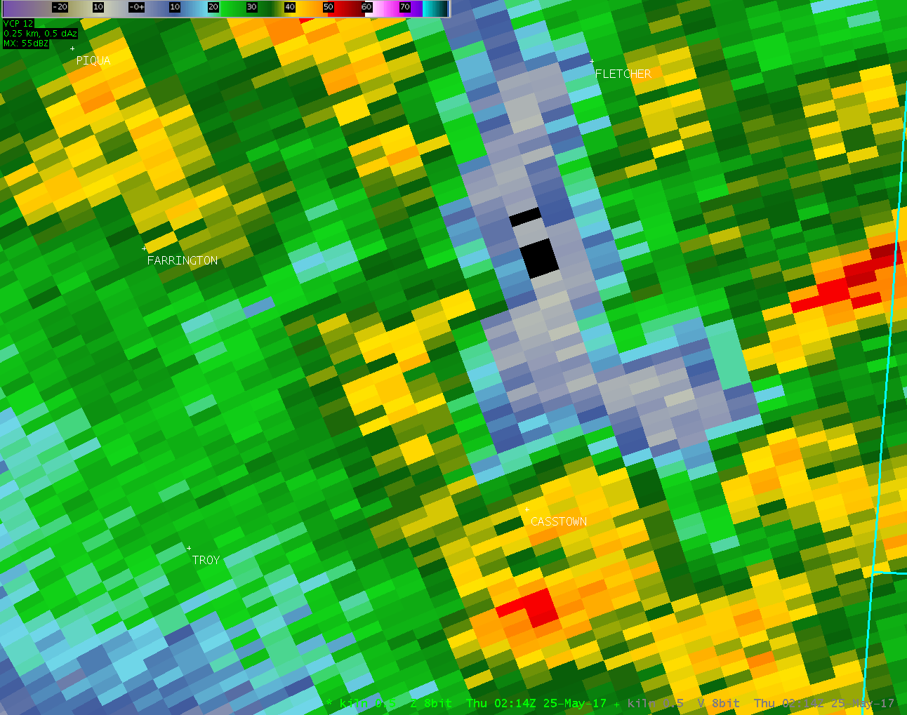
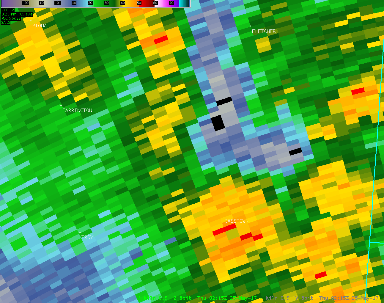
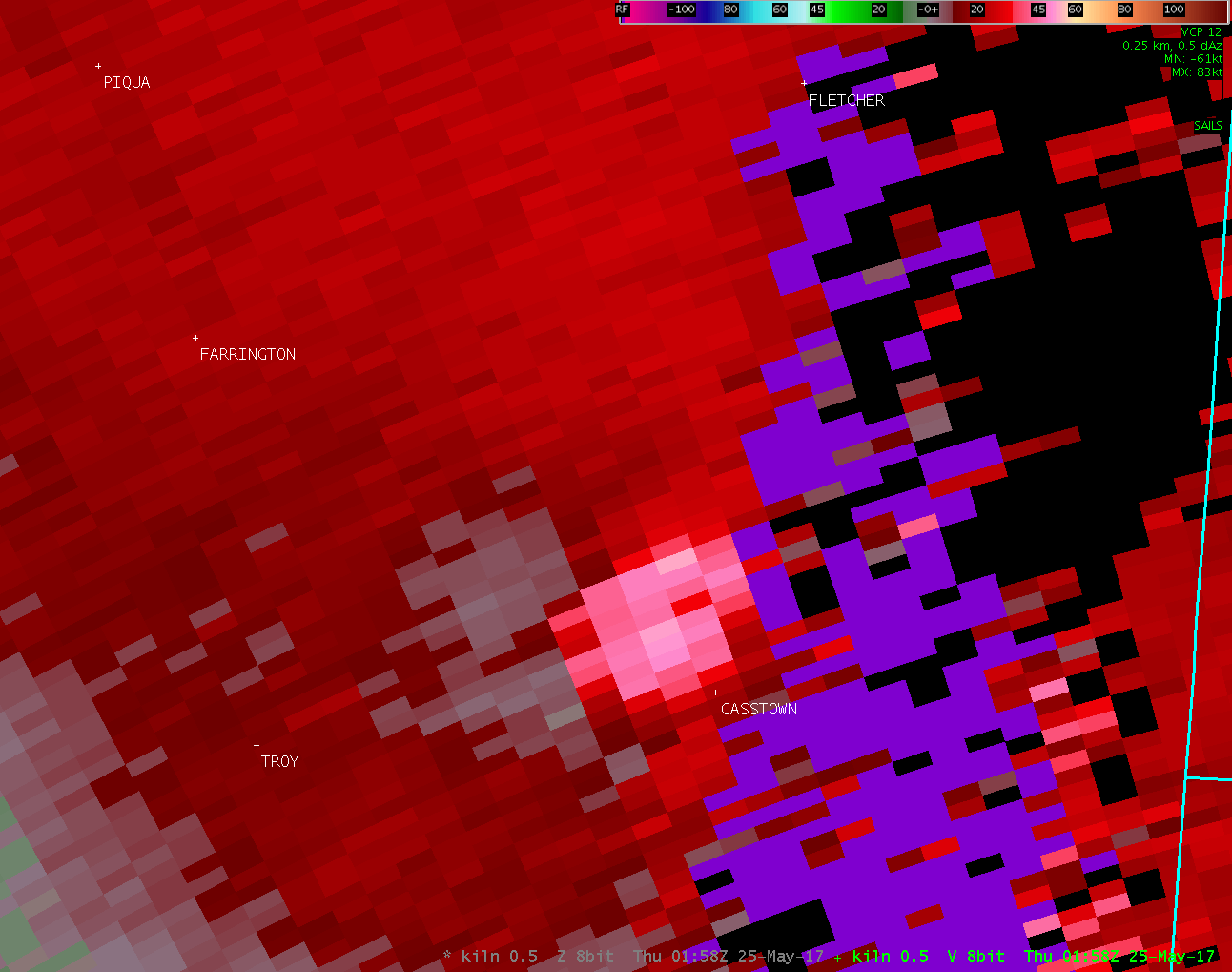
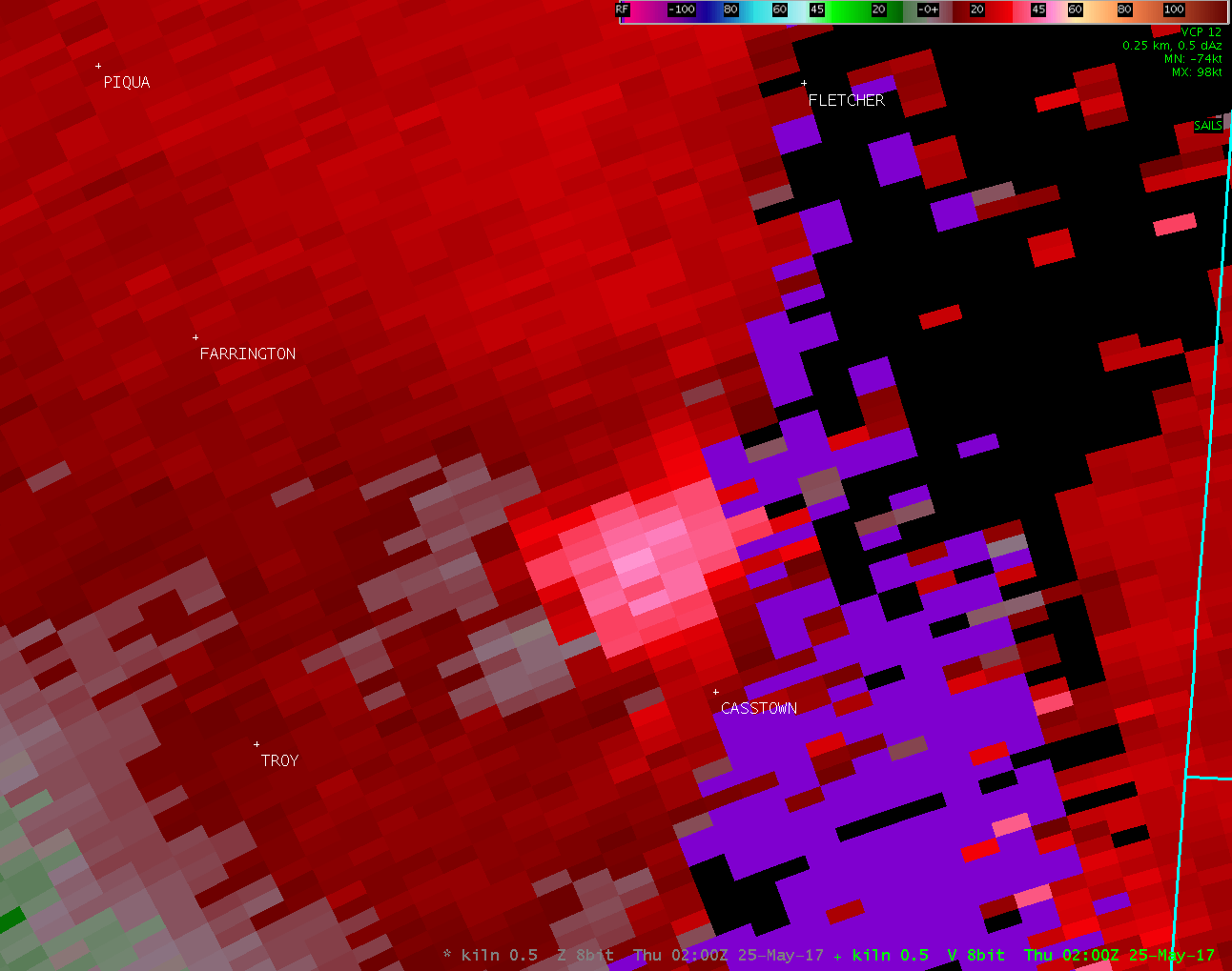
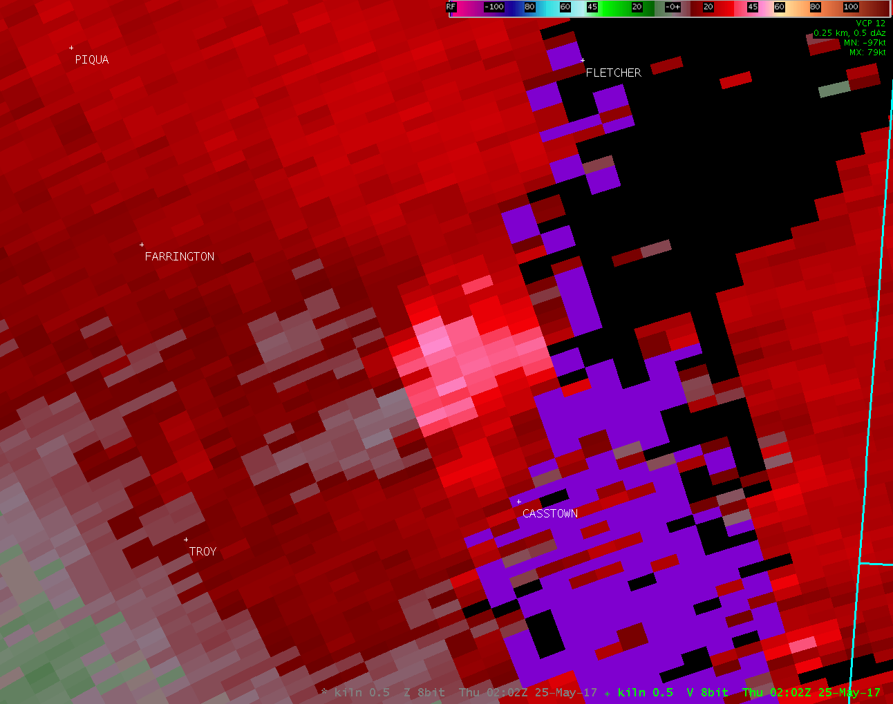
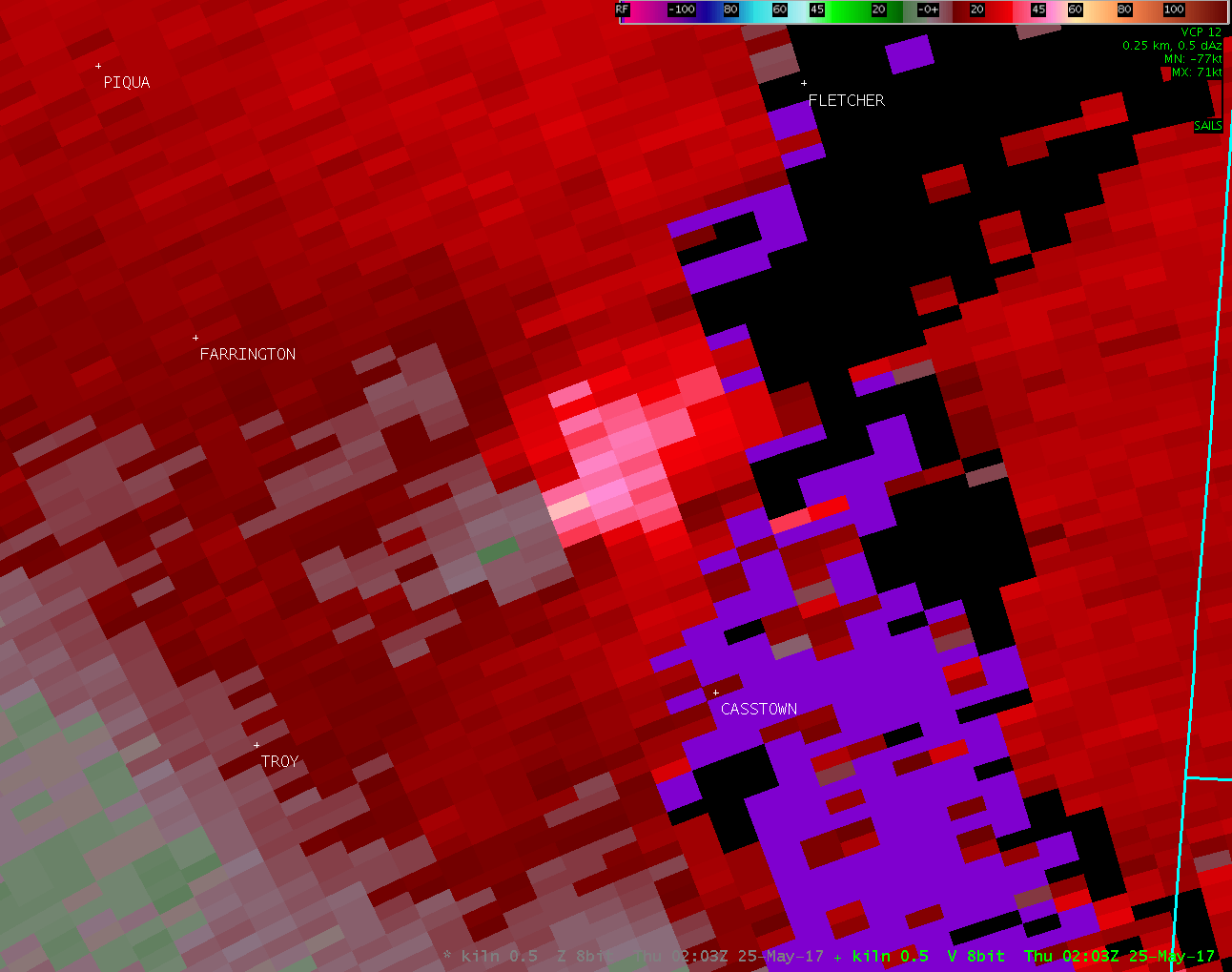
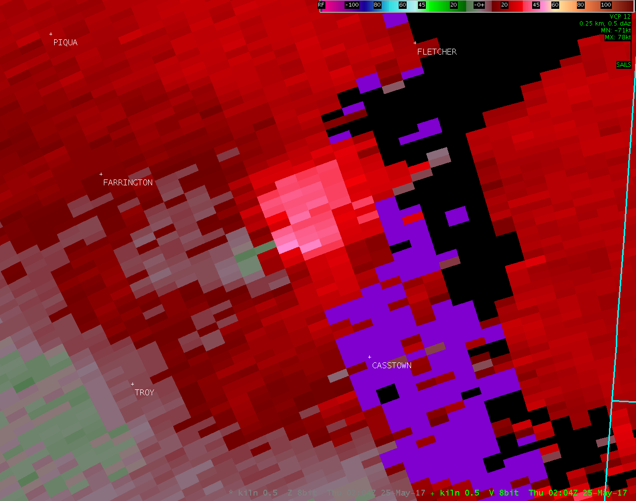
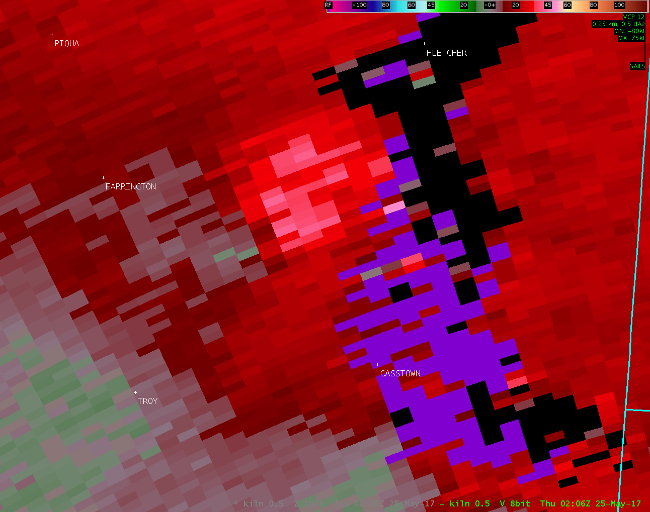
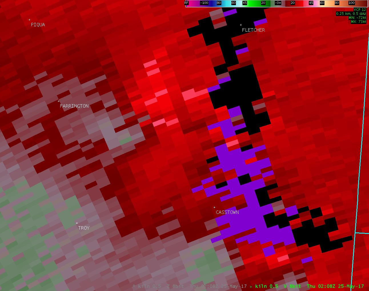
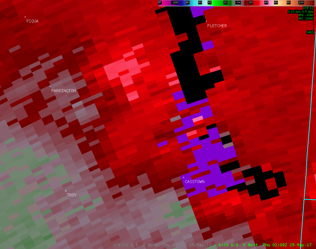
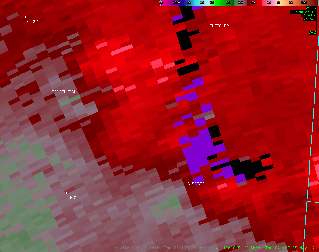
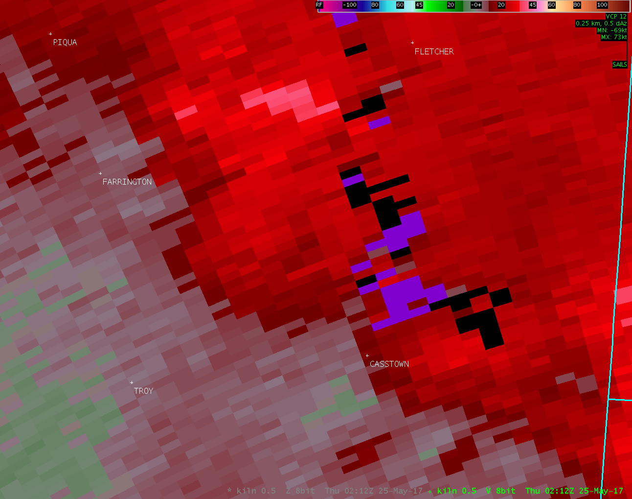
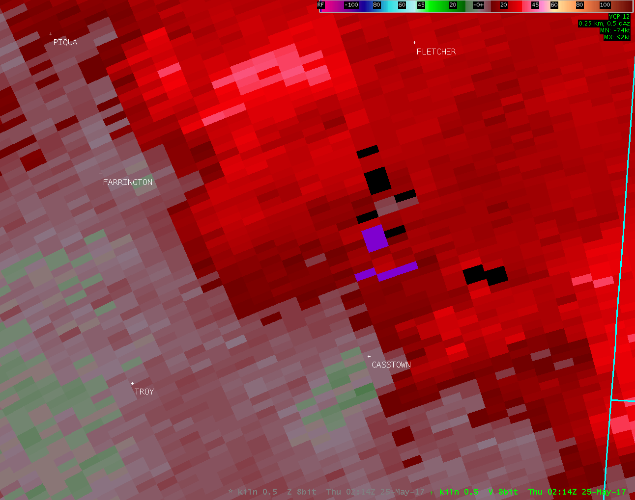
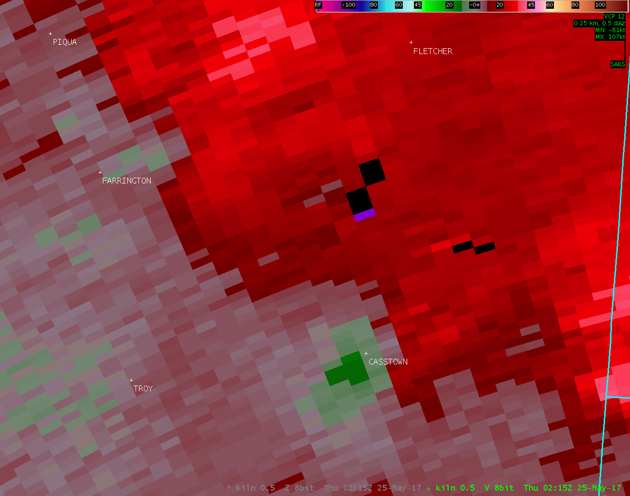
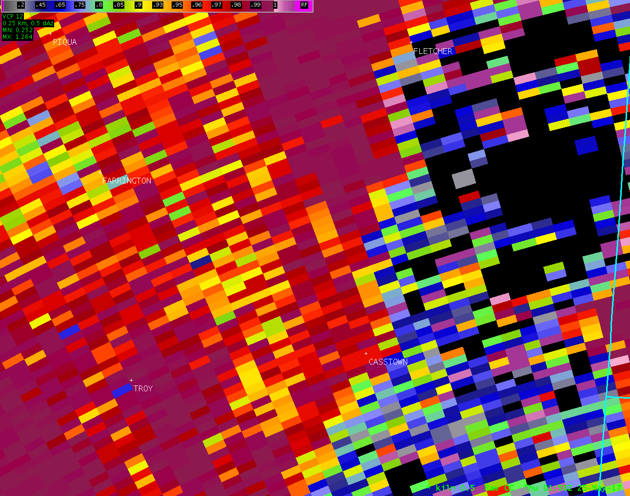
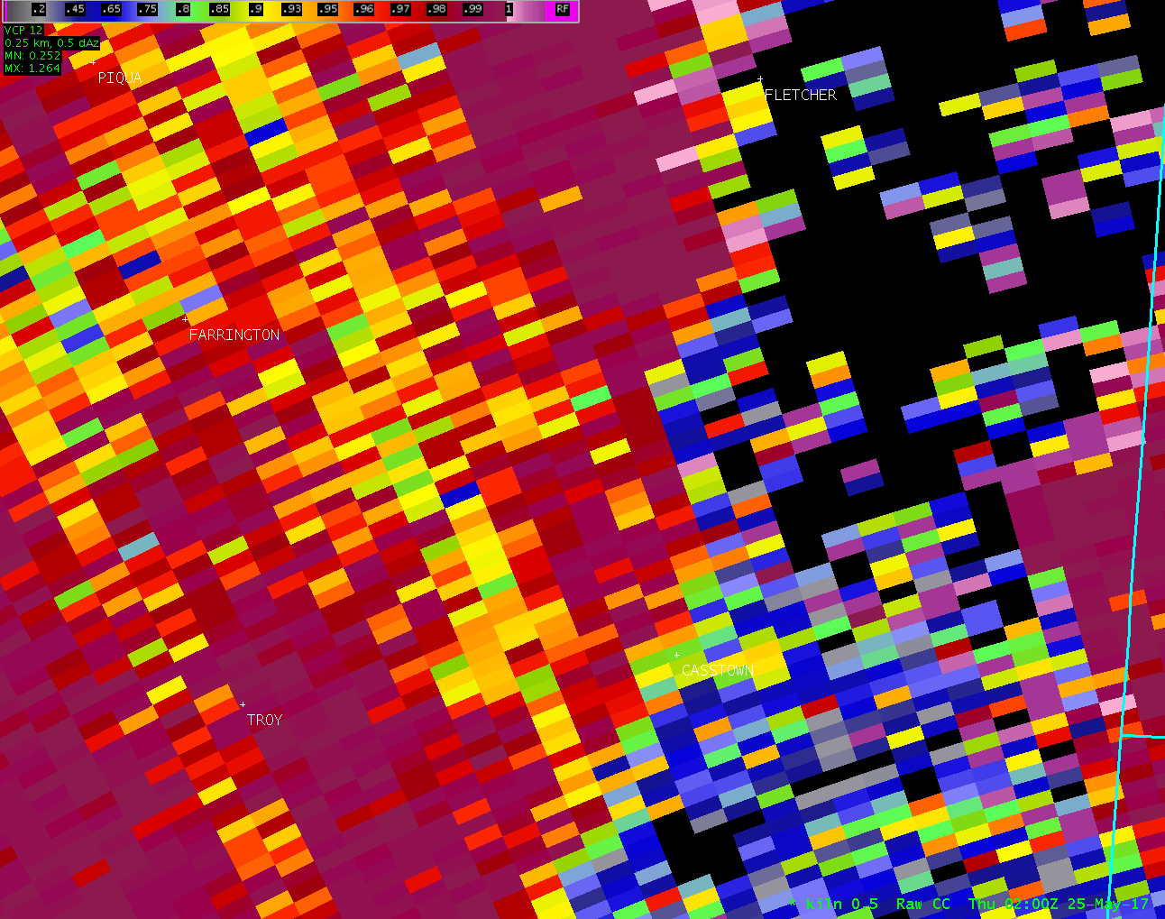
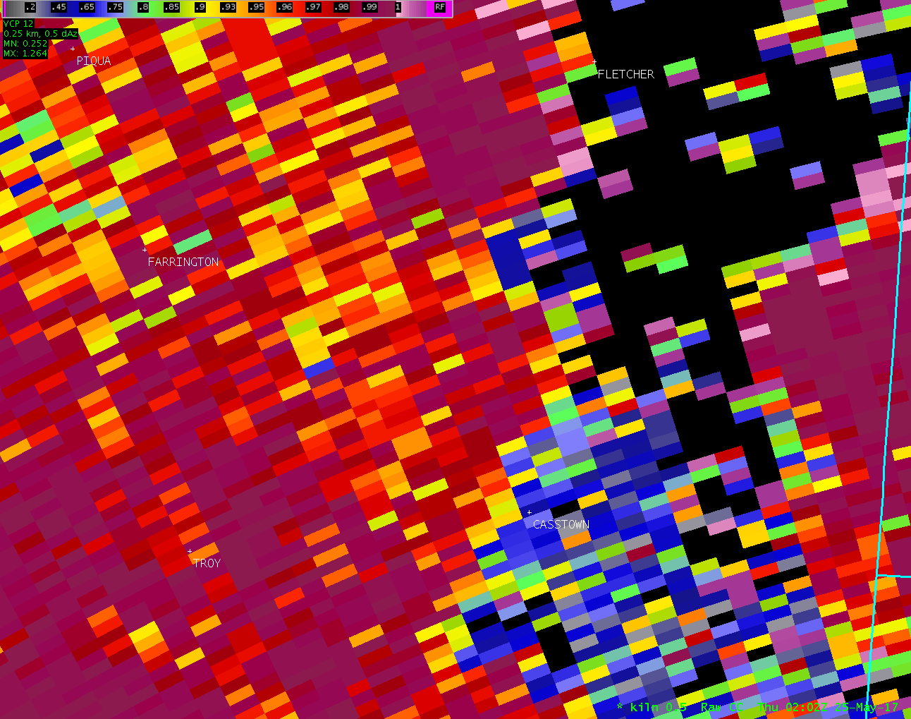
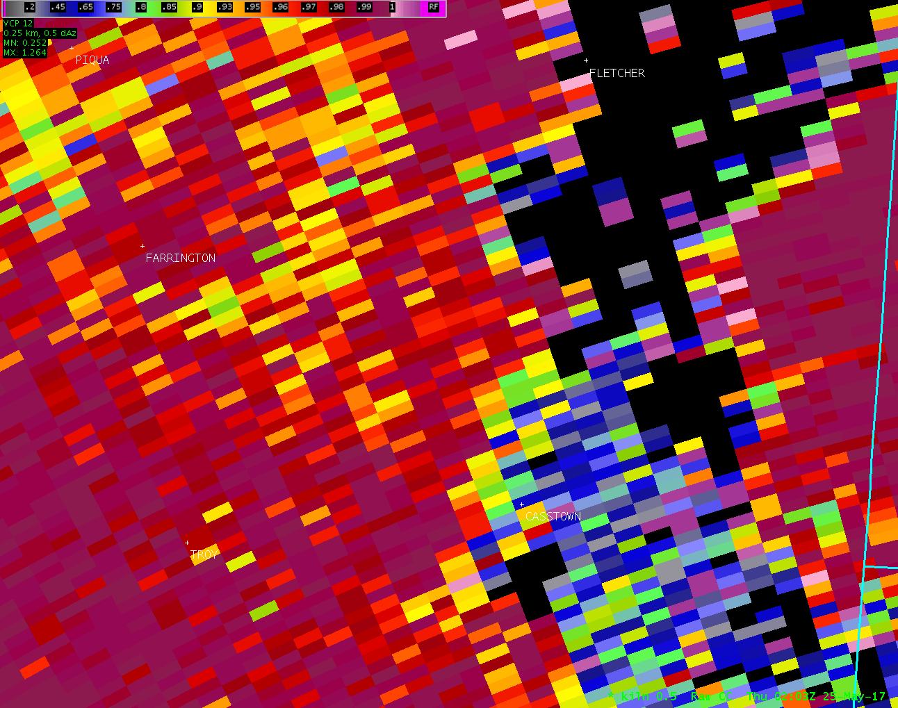
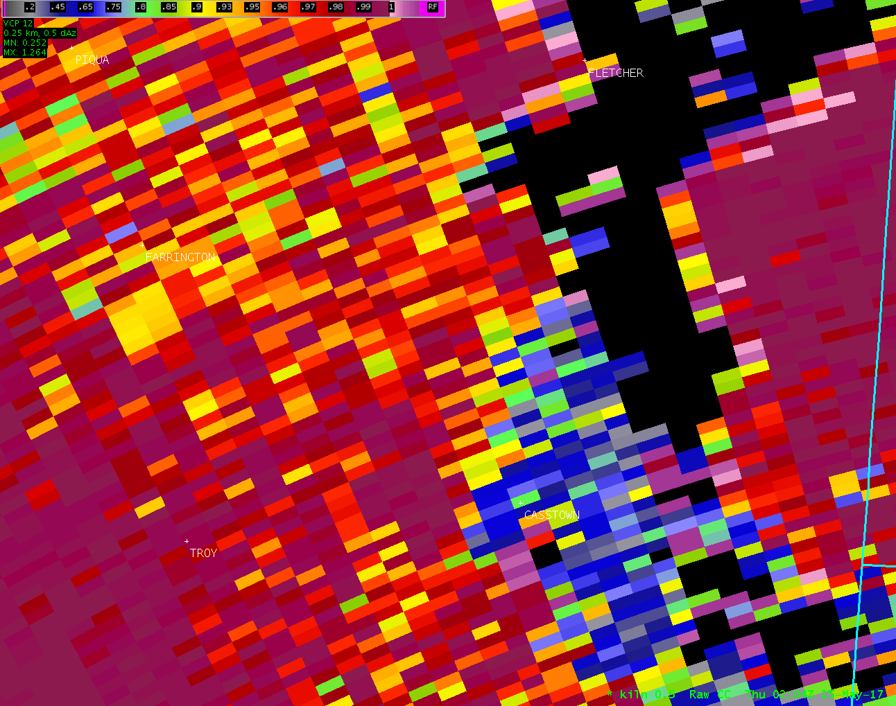
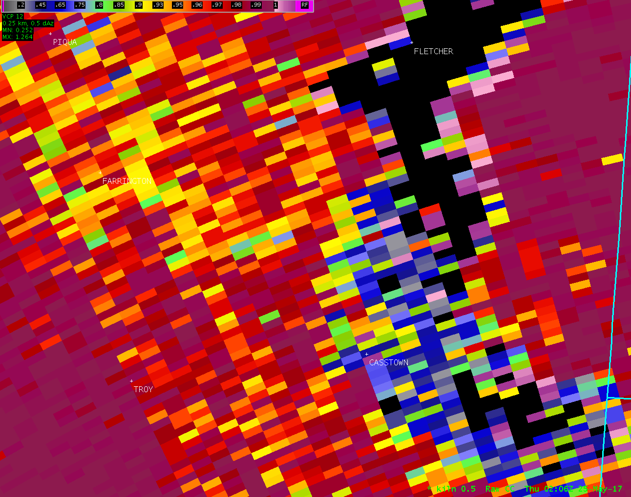
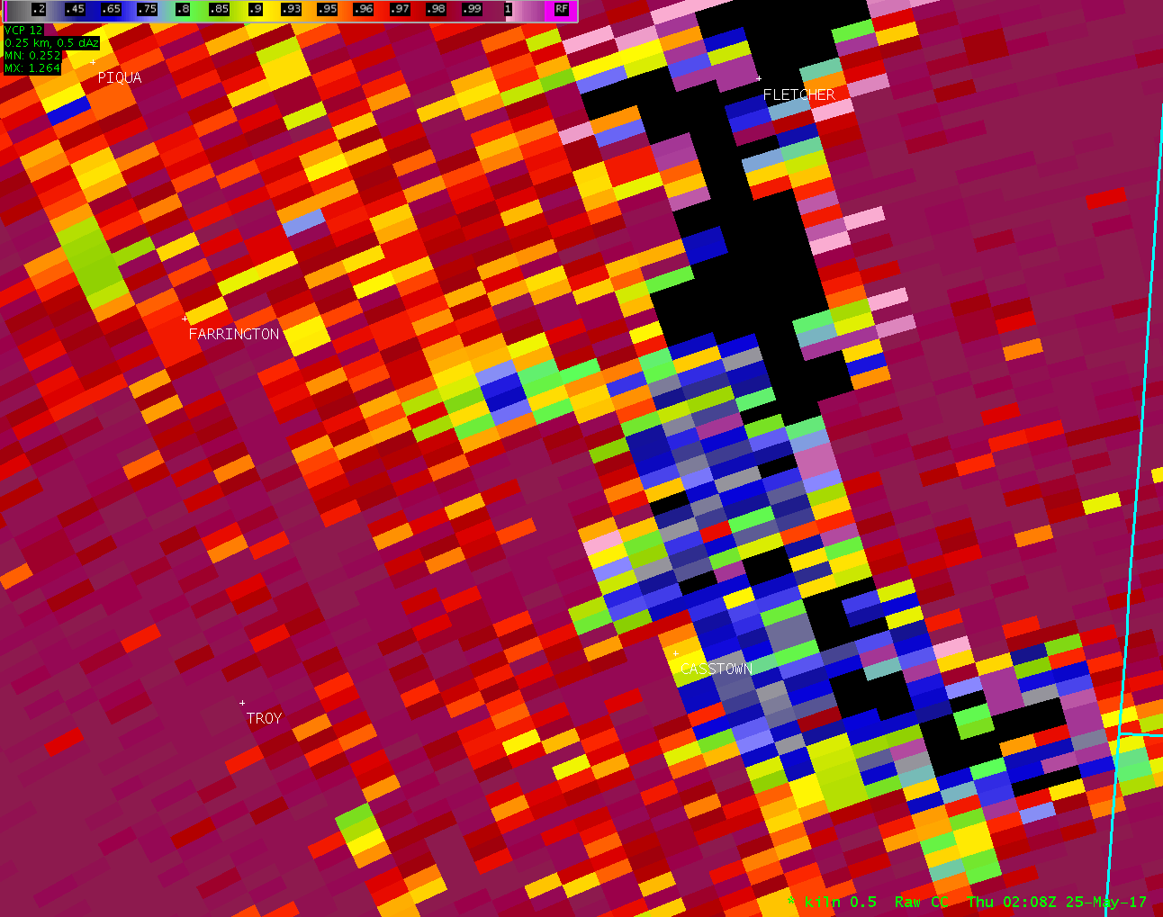
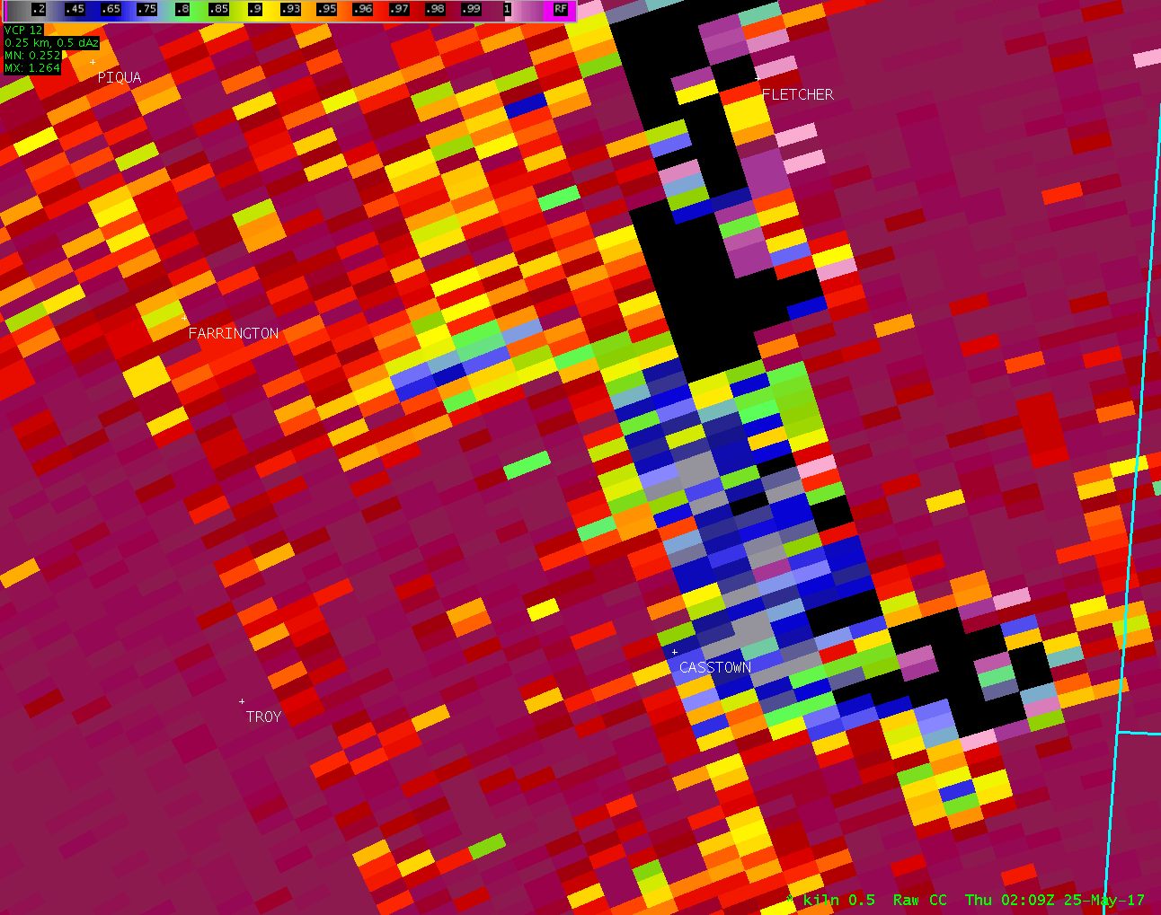
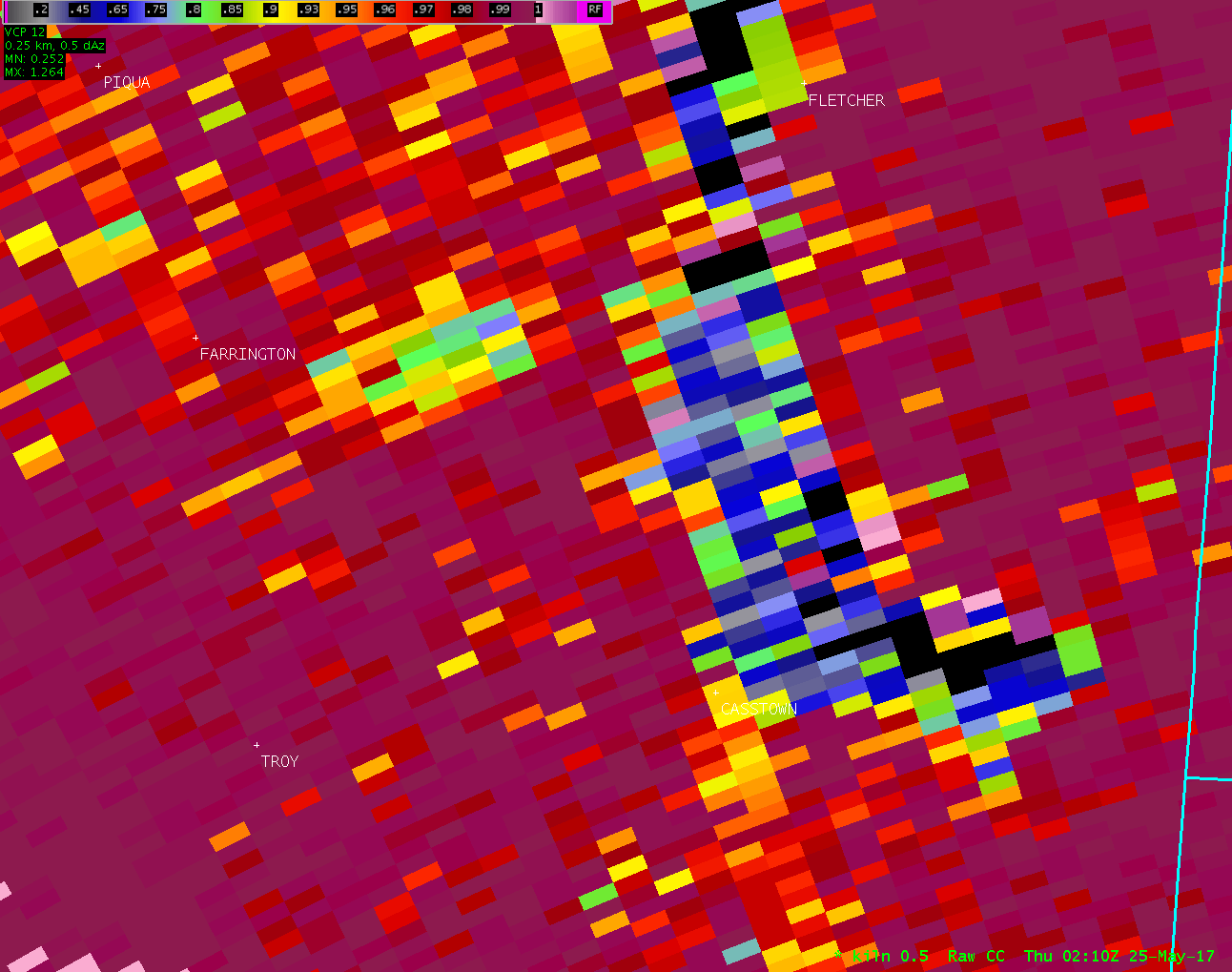
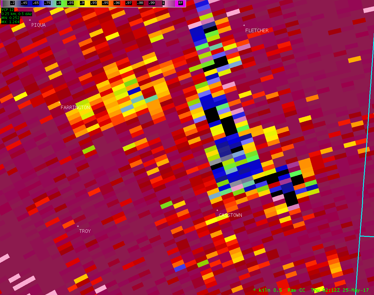
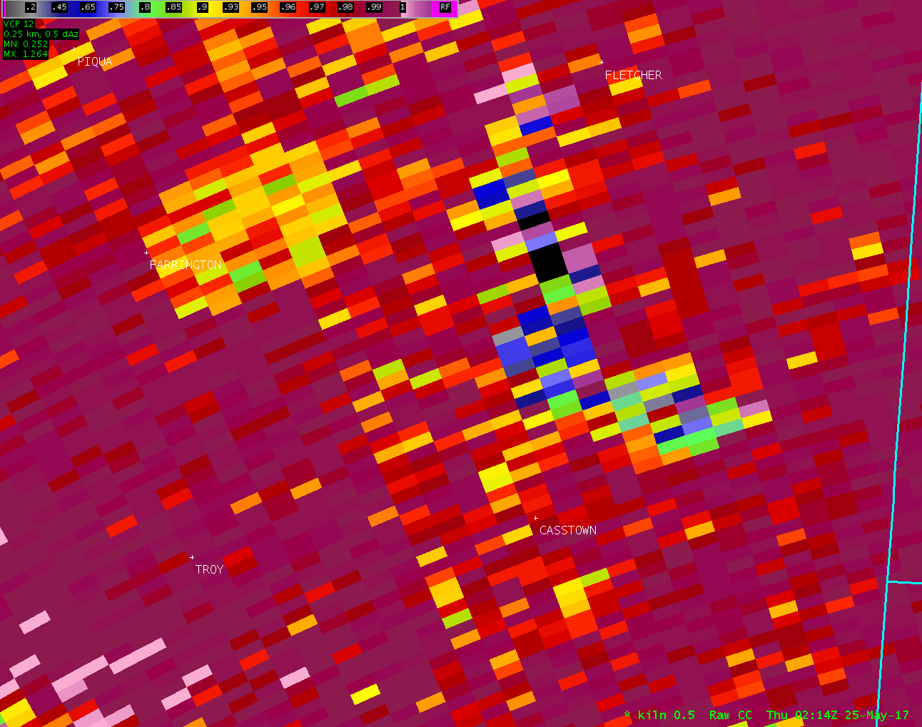
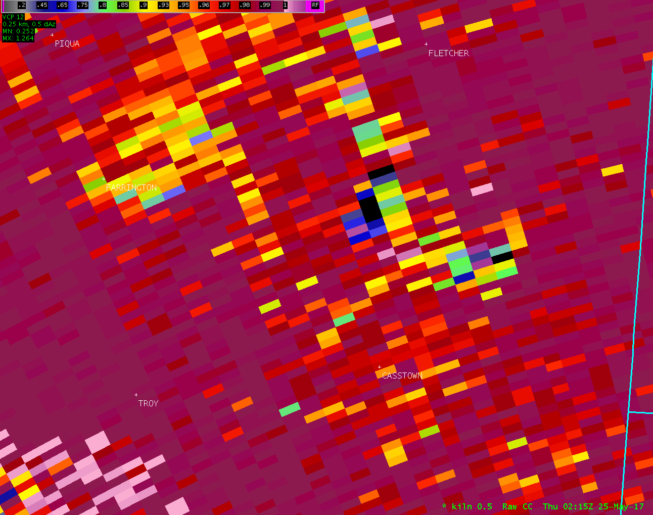
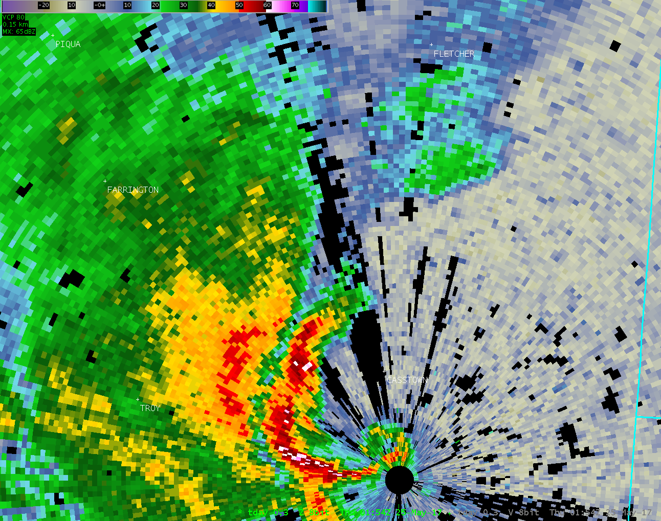
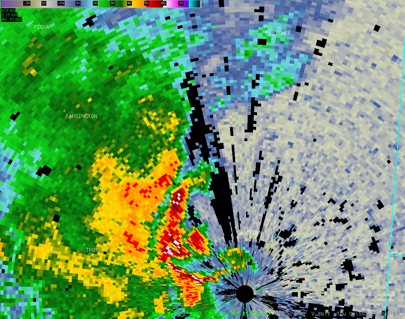
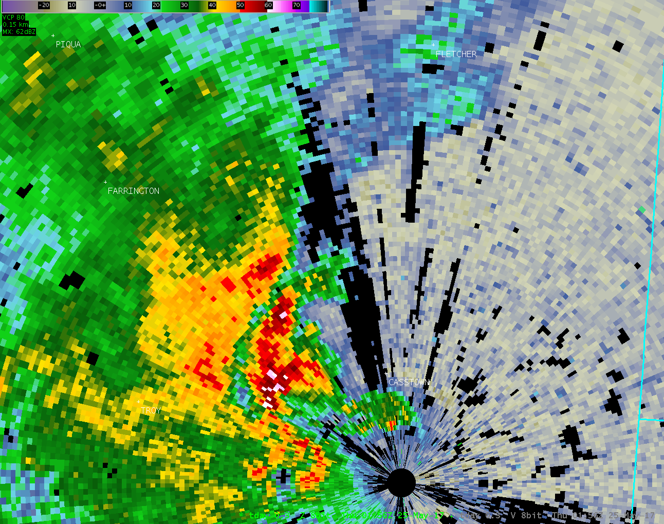
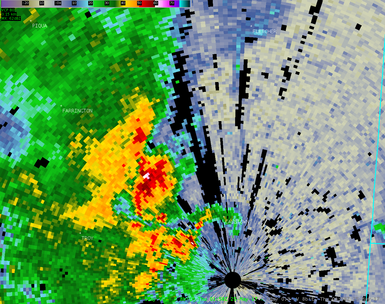
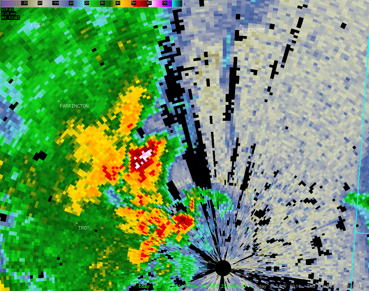
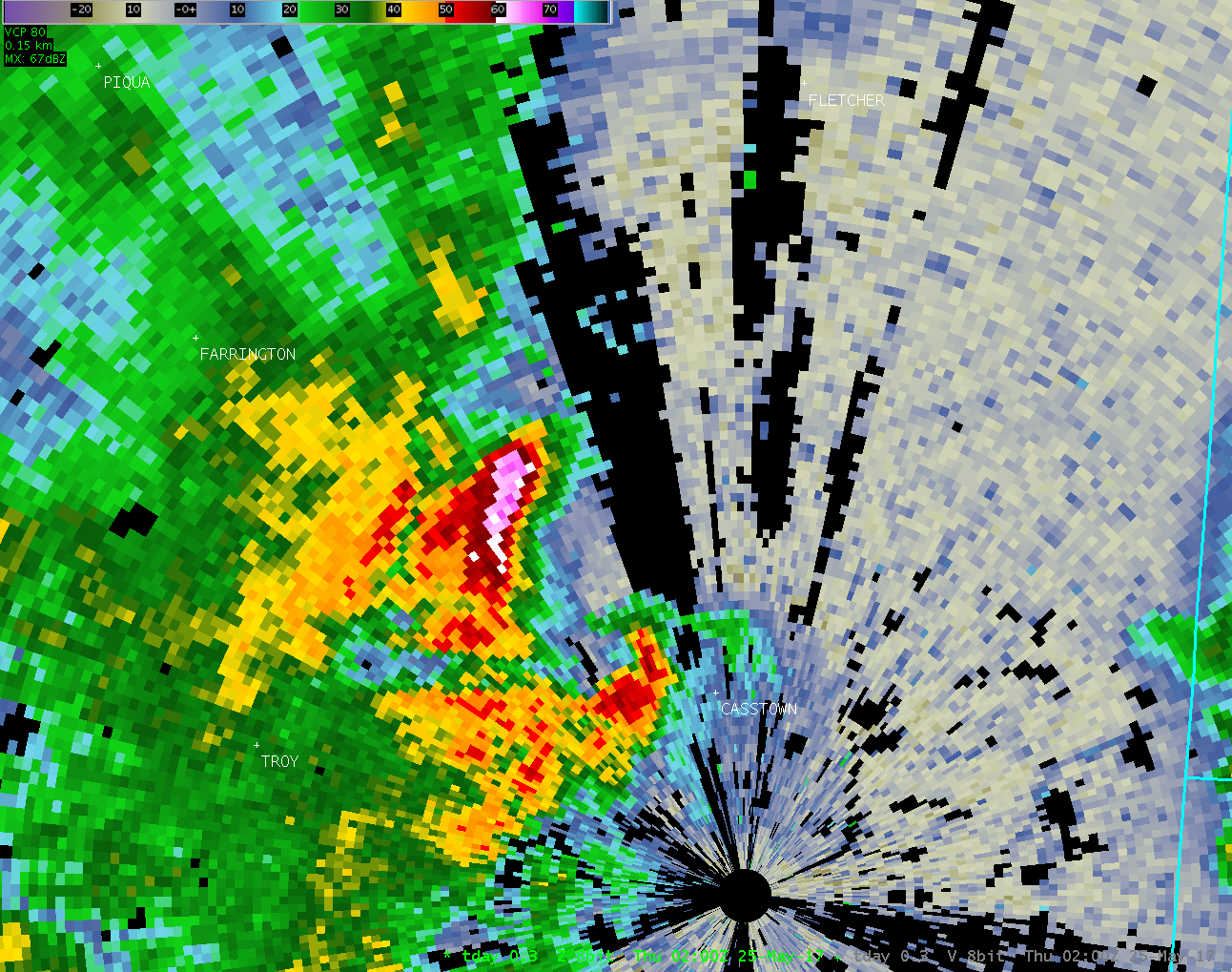
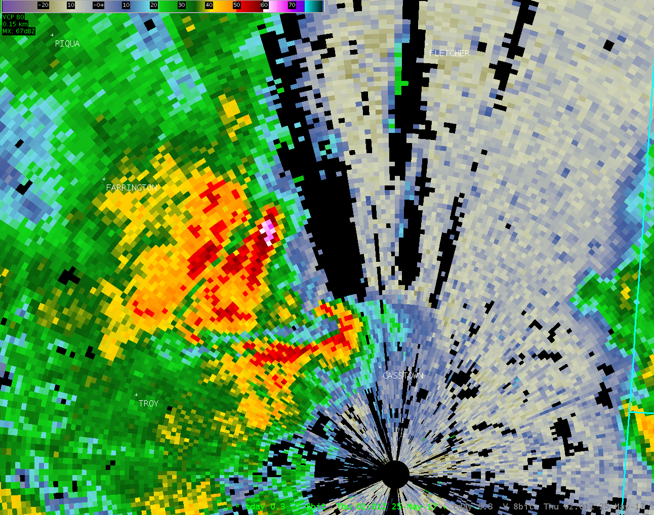
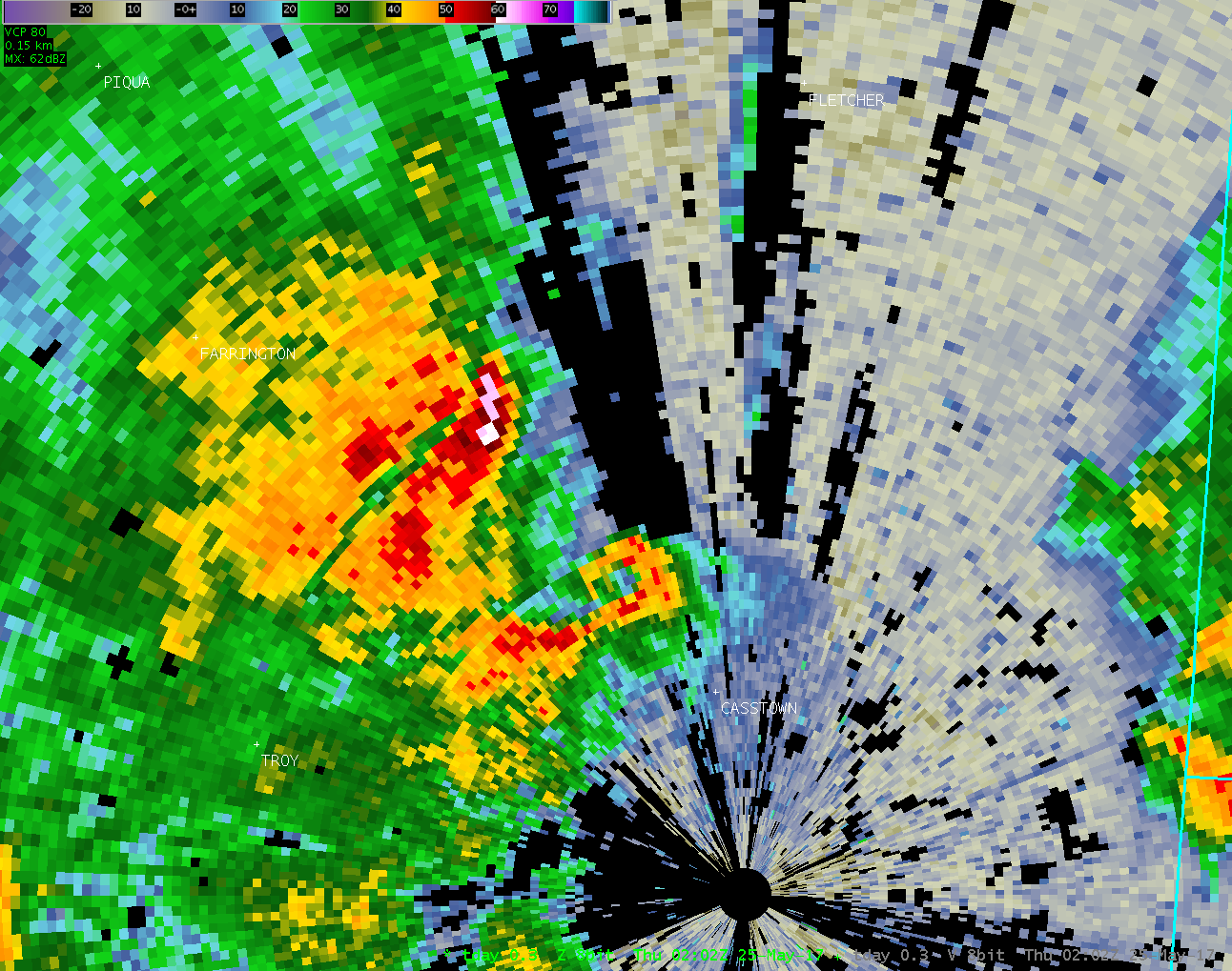
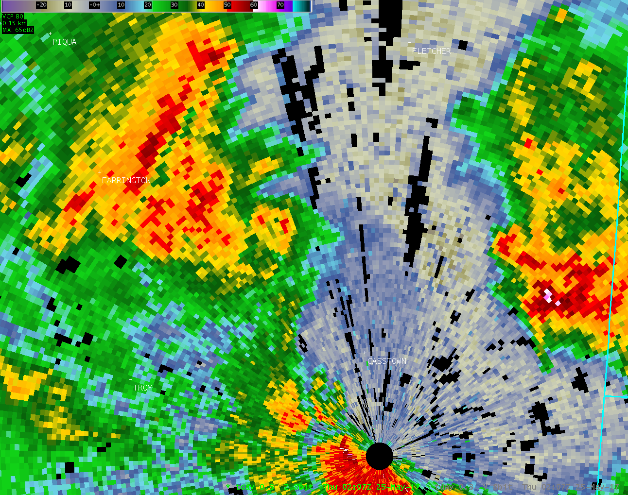
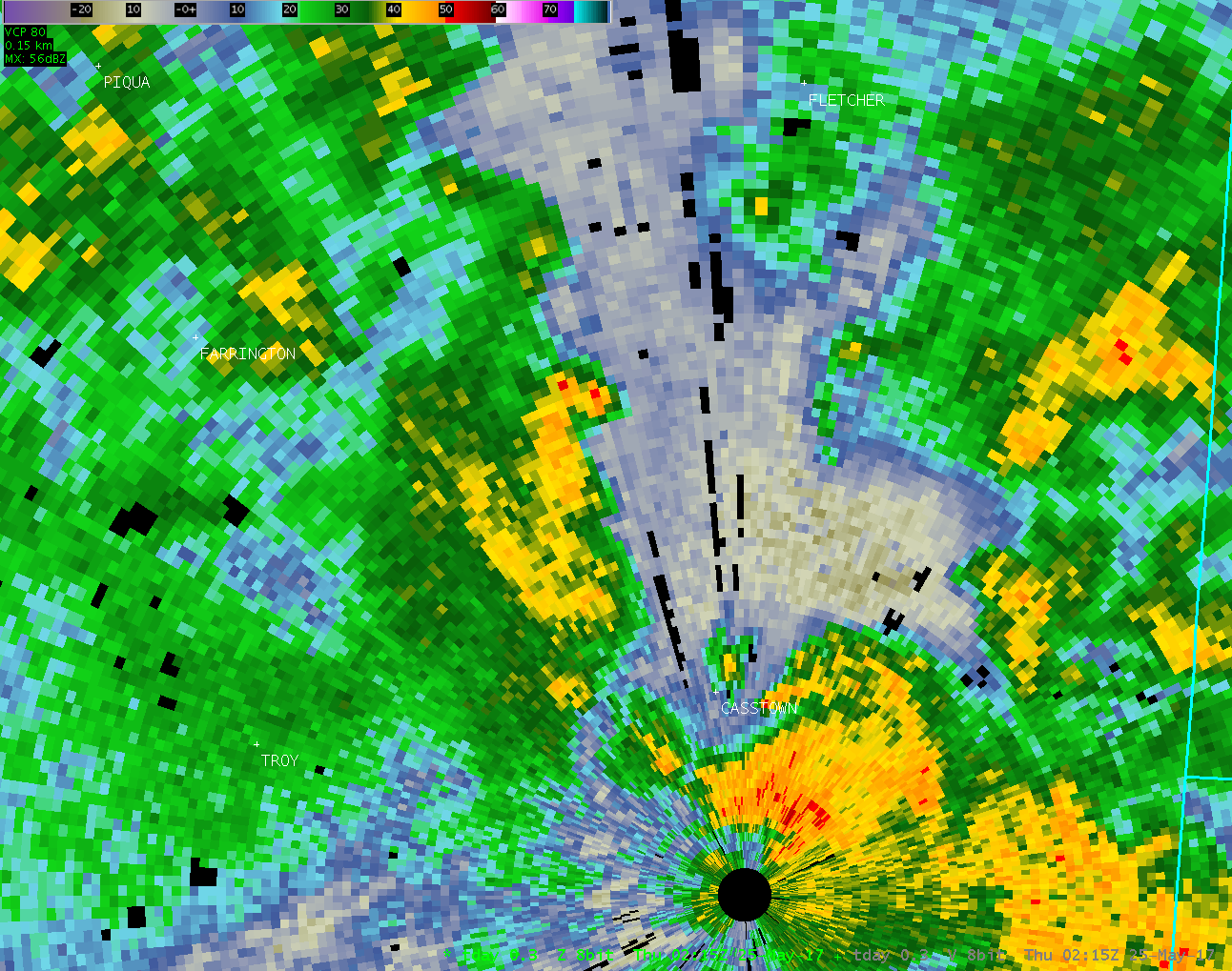
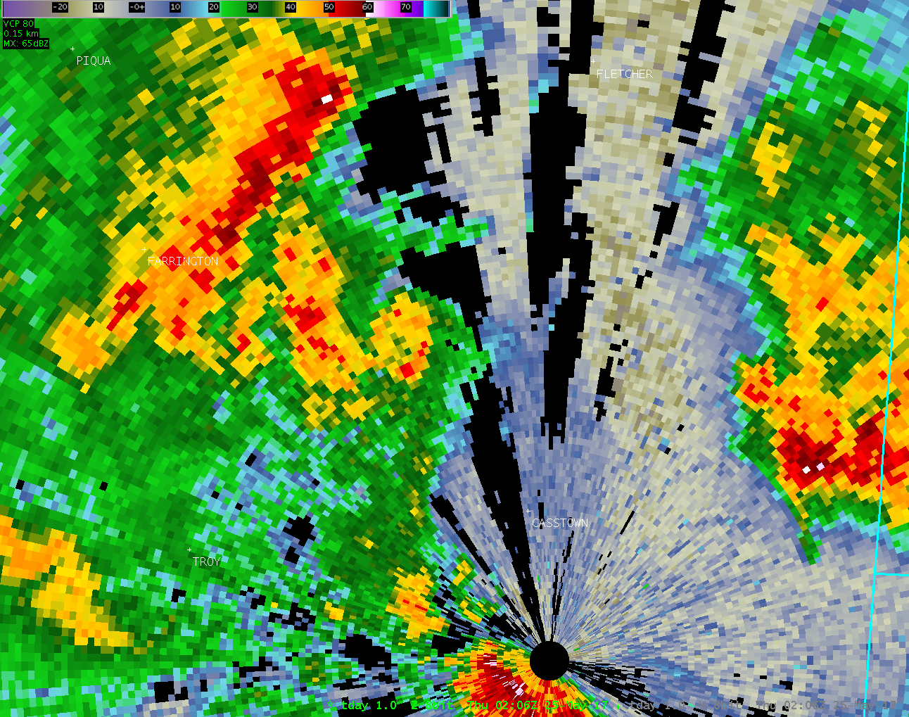
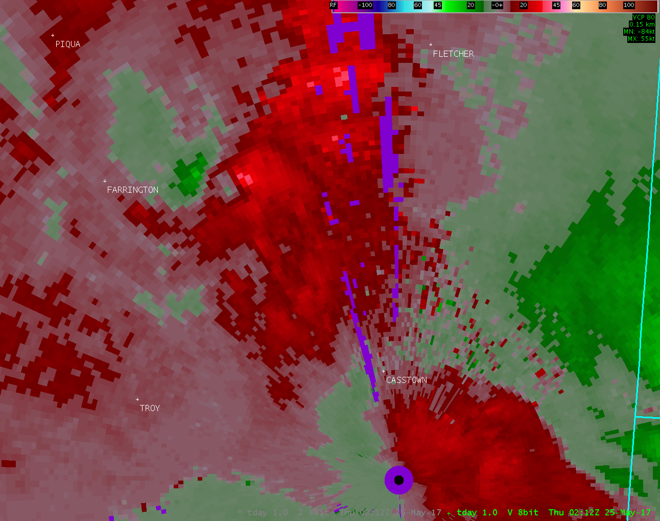
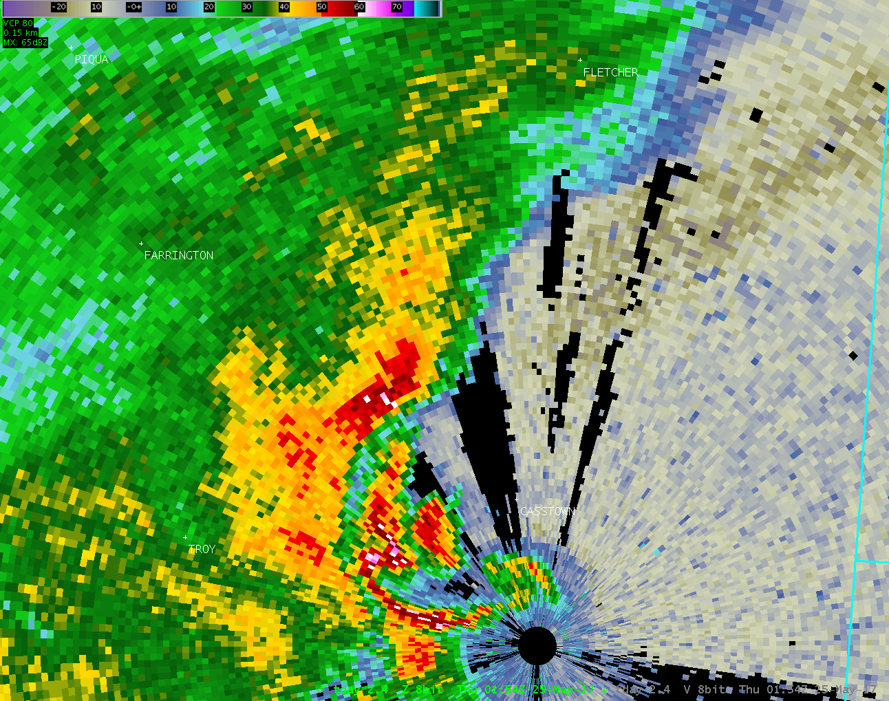
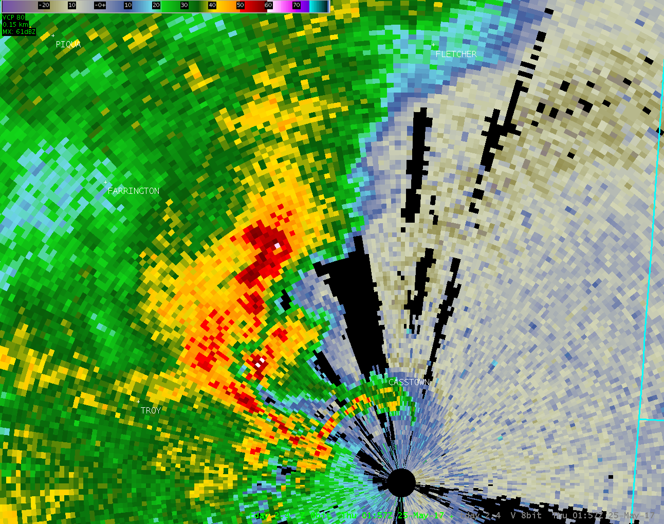
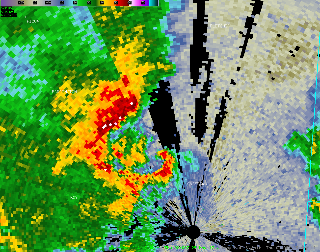
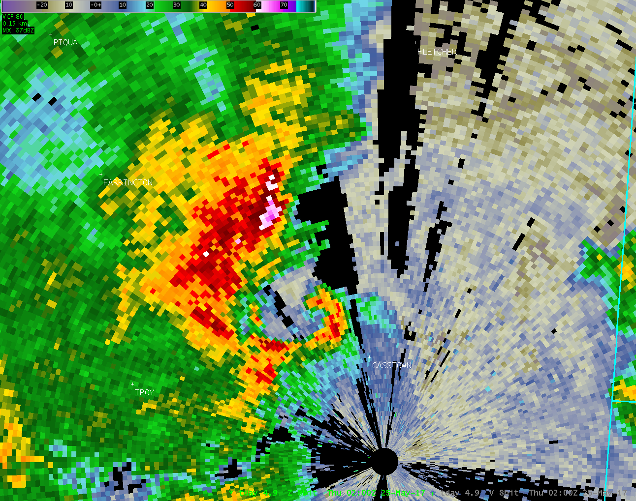
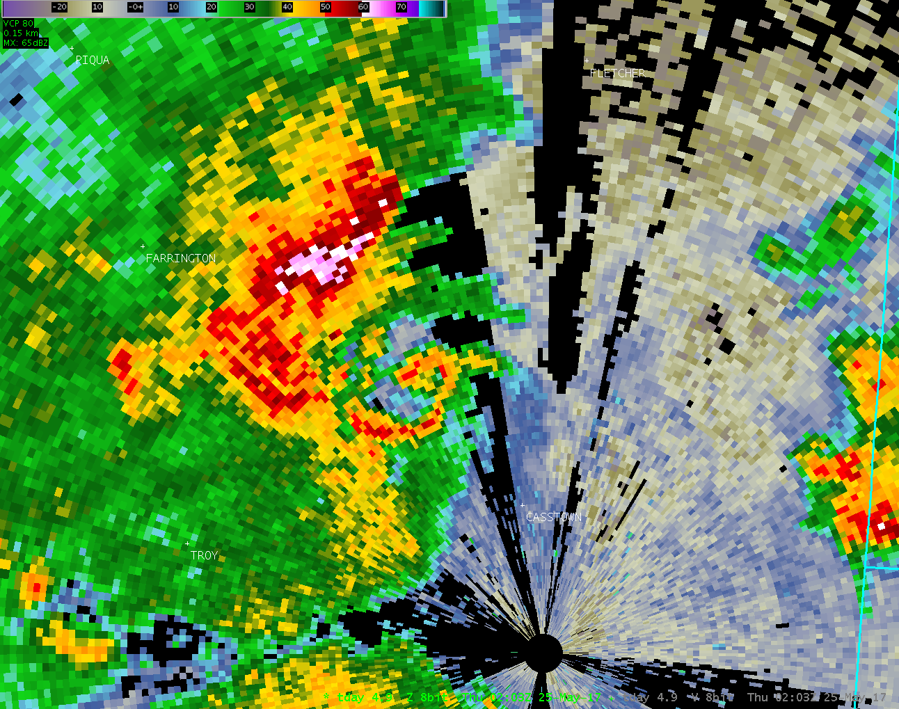
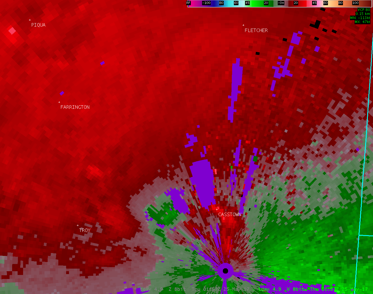
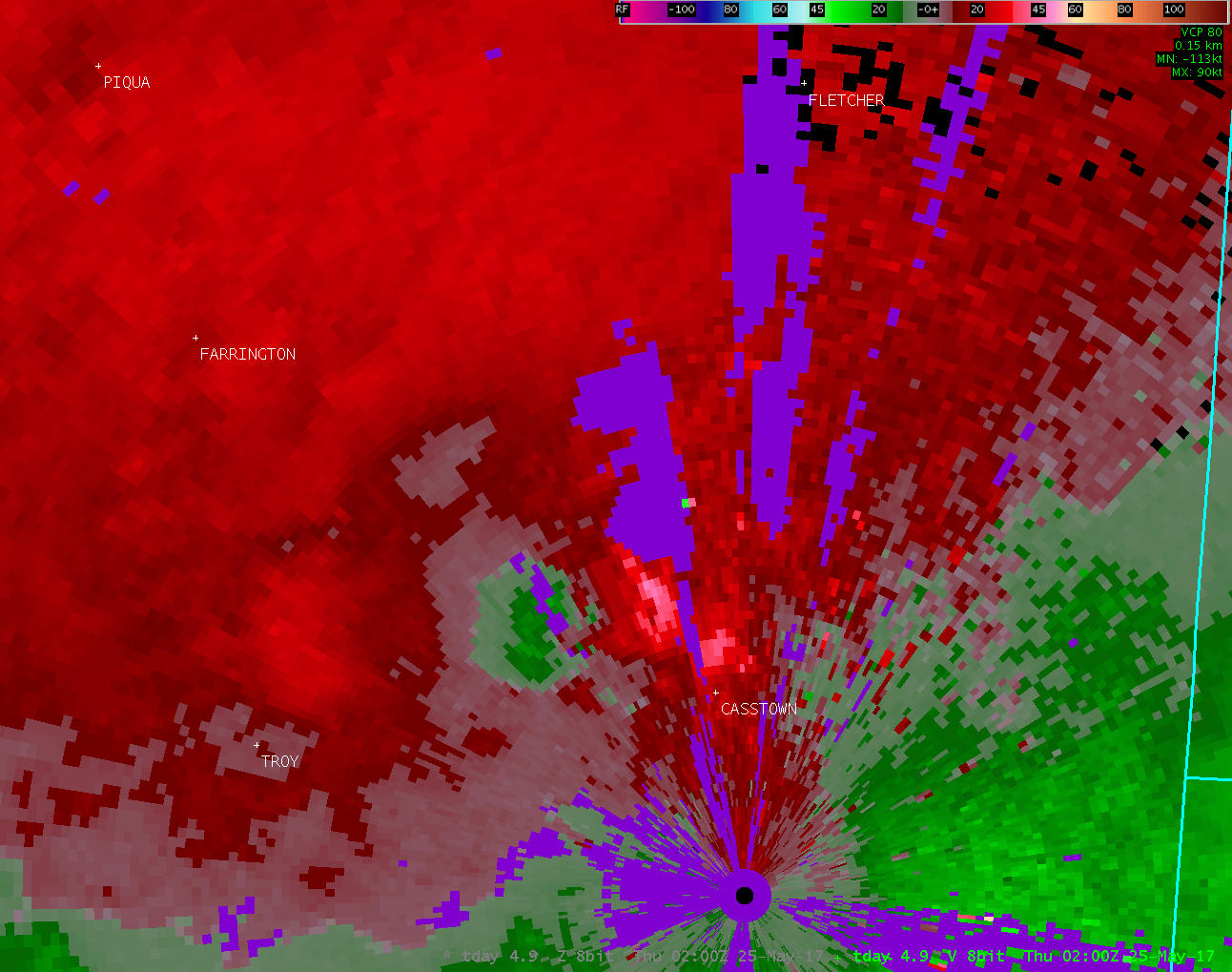
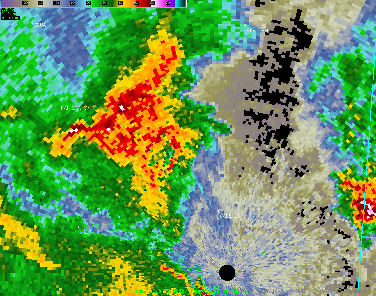
| Radar Loops from NWS Wilmington Ohio (9:58 PM - 10:15 PM) | ||
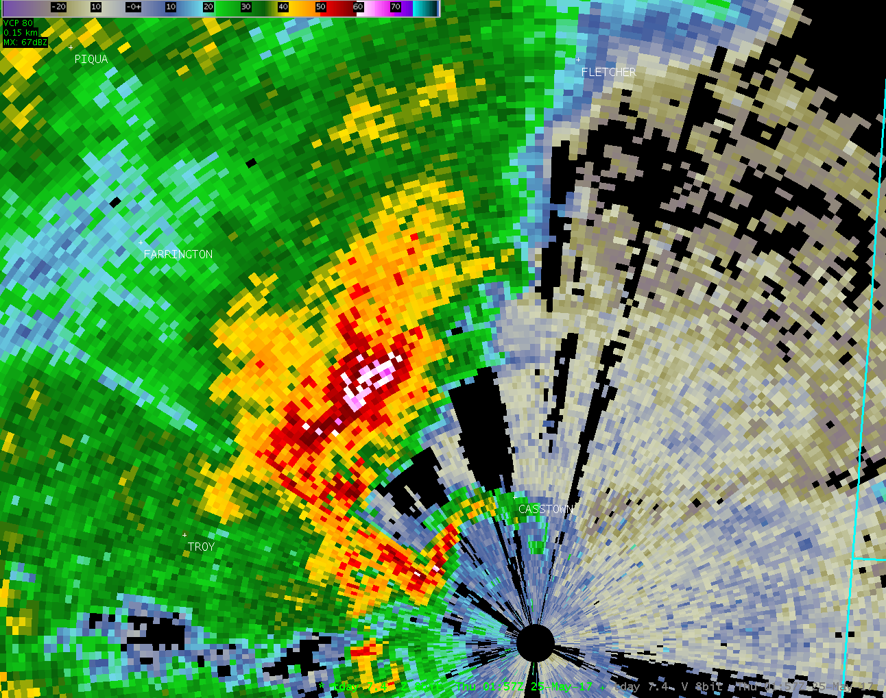
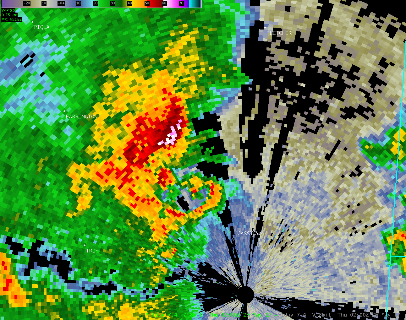
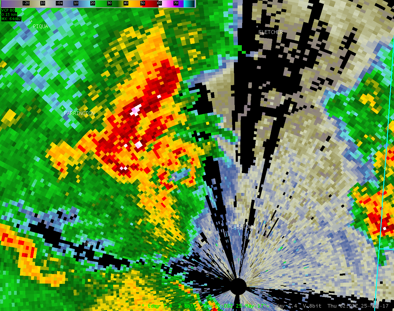
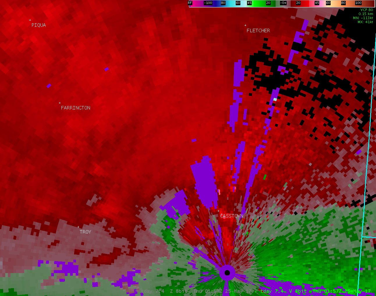
| KILN 0.5° Reflectivity | KILN 0.5° Velocity | KILN 0.5° Correlation Coefficient (raw) |
| 1 2 3 4 5 6 7 8 9 10 11 12 | 1 2 3 4 5 6 7 8 9 10 11 12 | 1 2 3 4 5 6 7 8 9 10 11 12 |
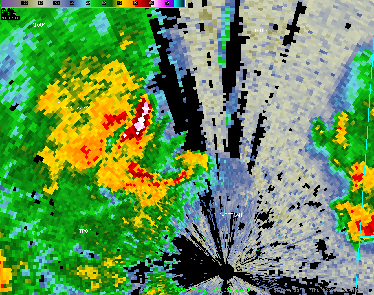
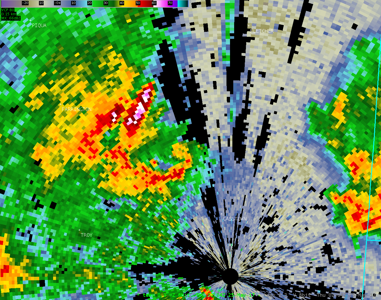
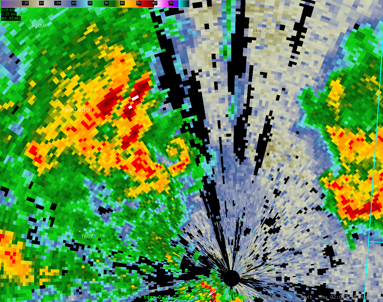
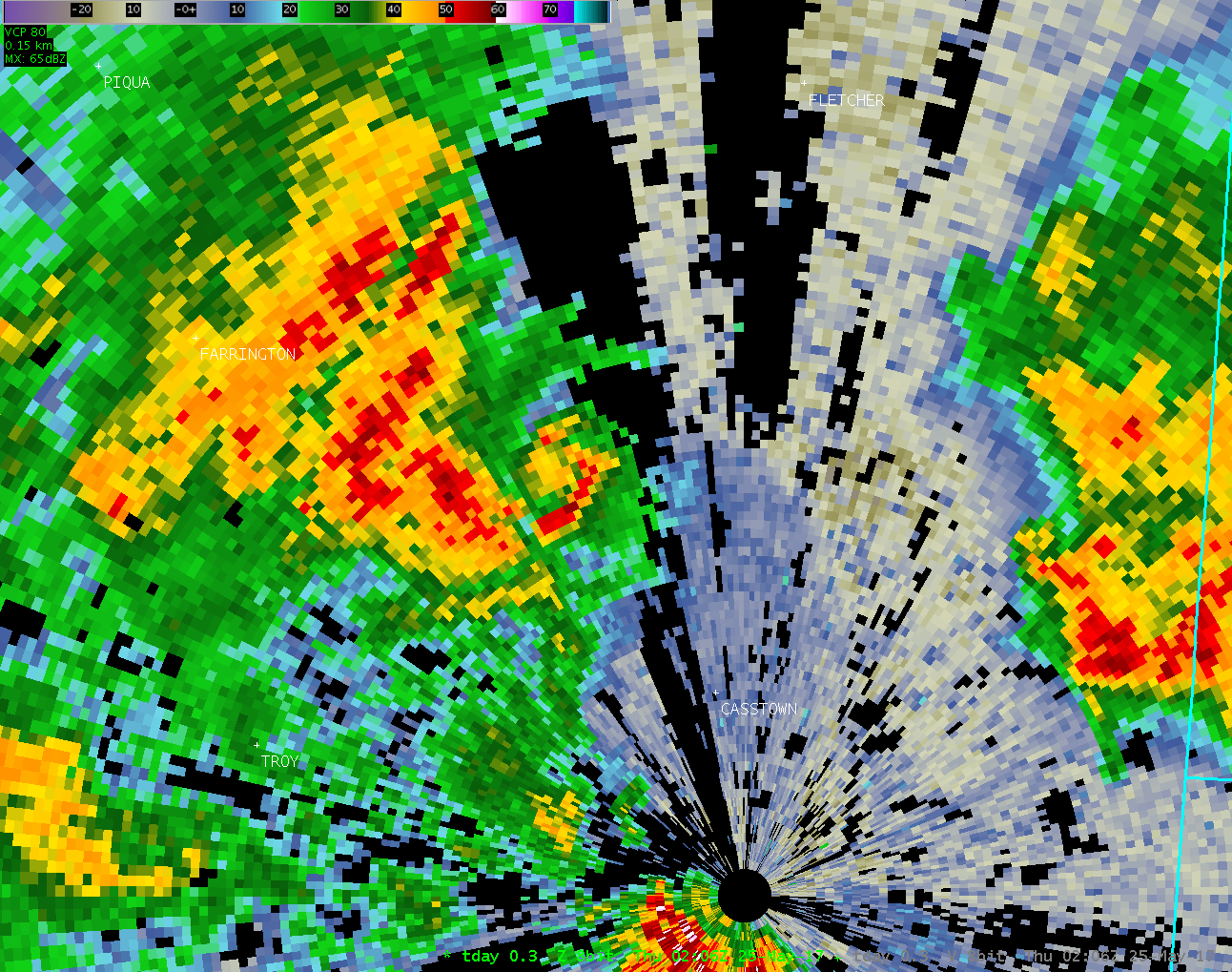
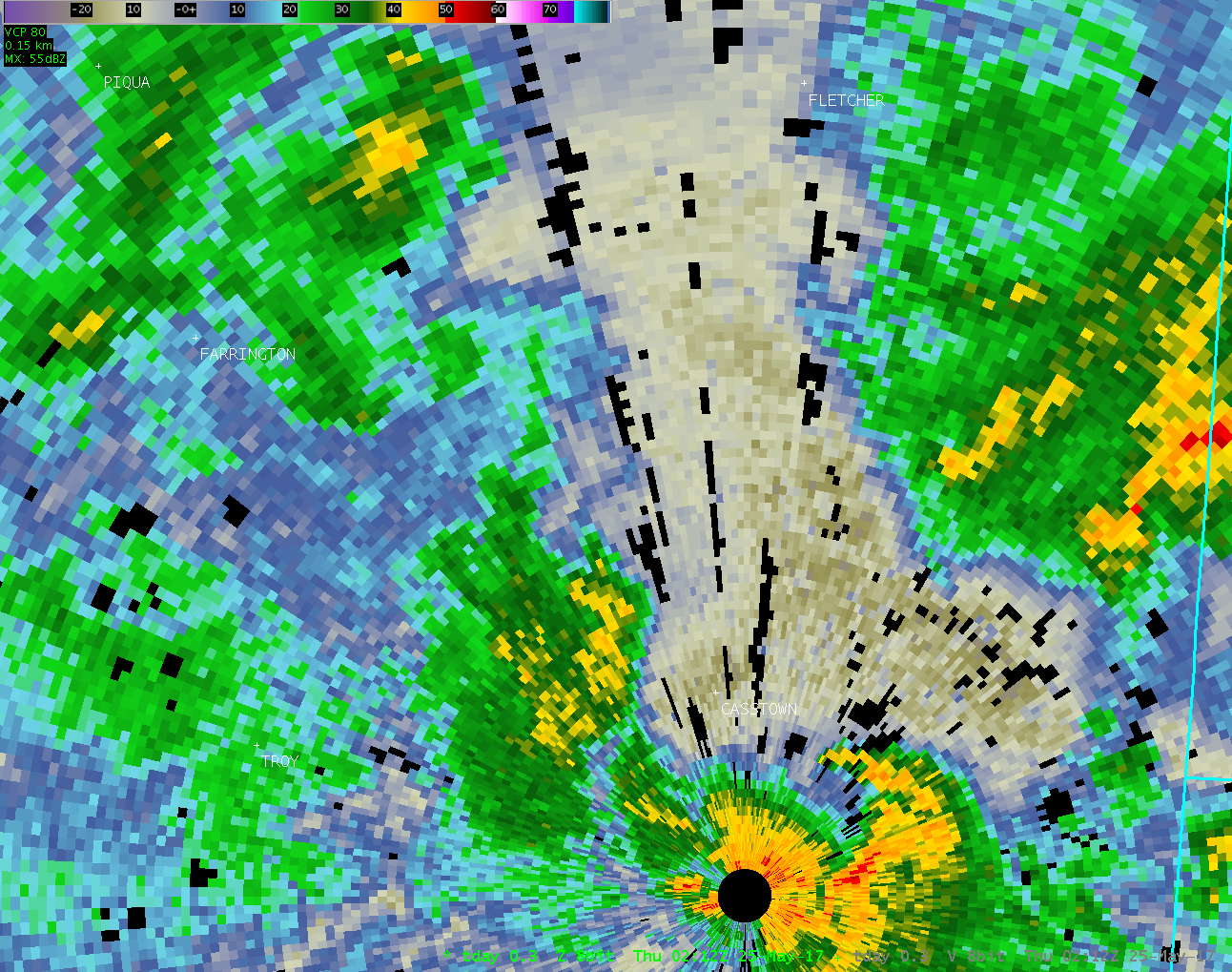
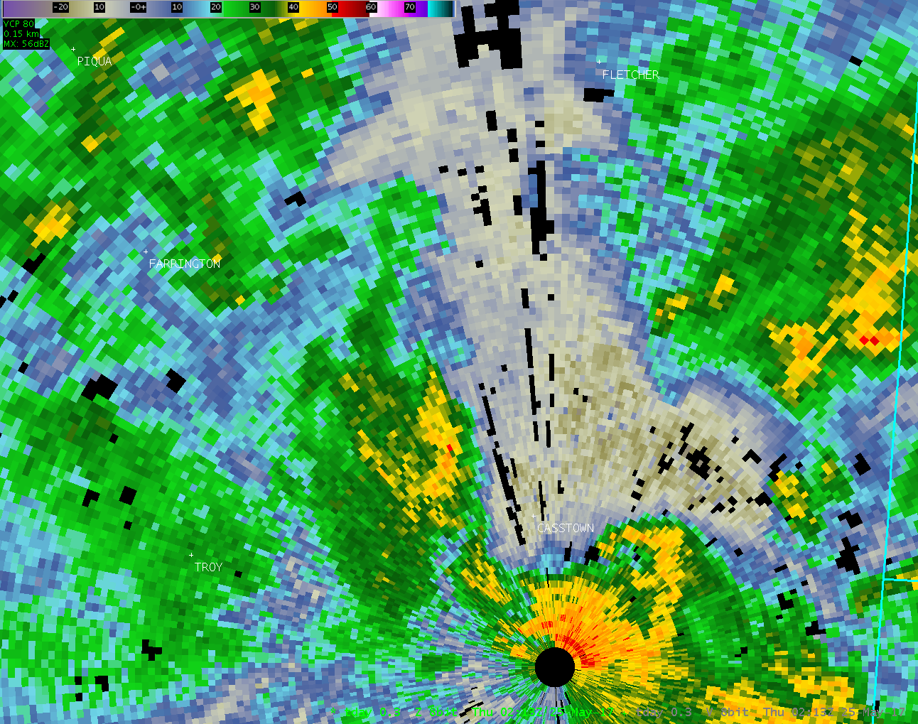
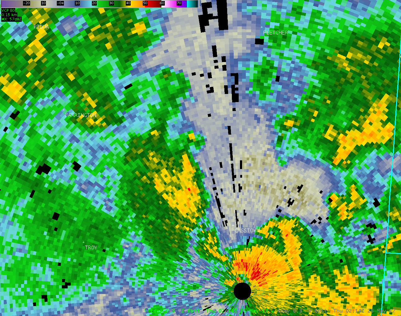
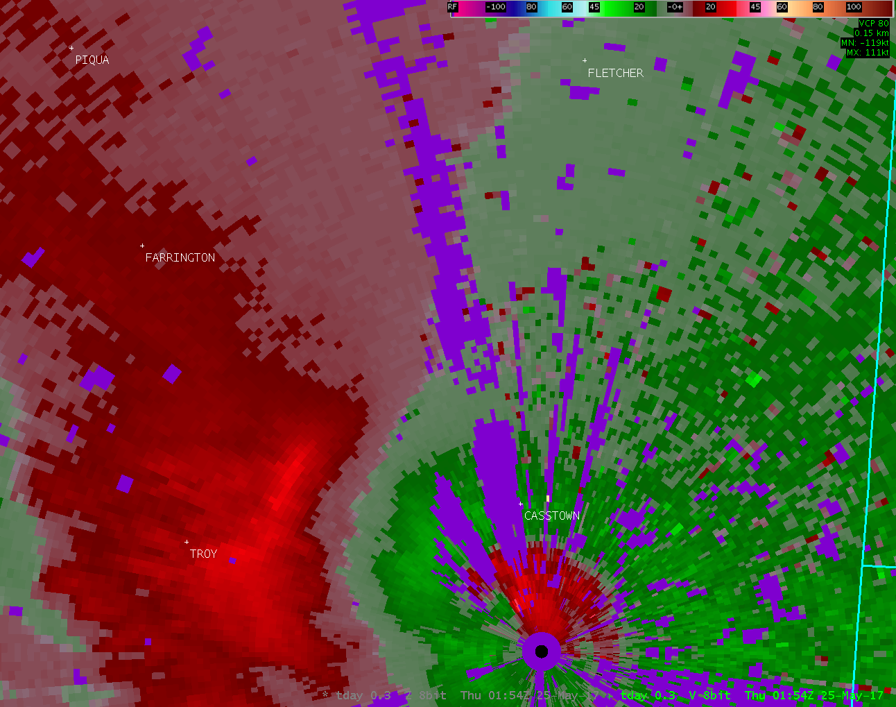
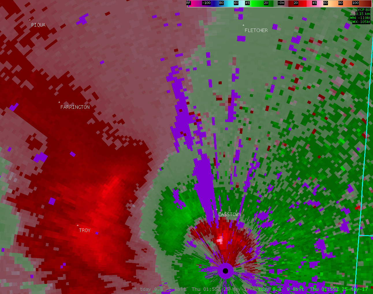
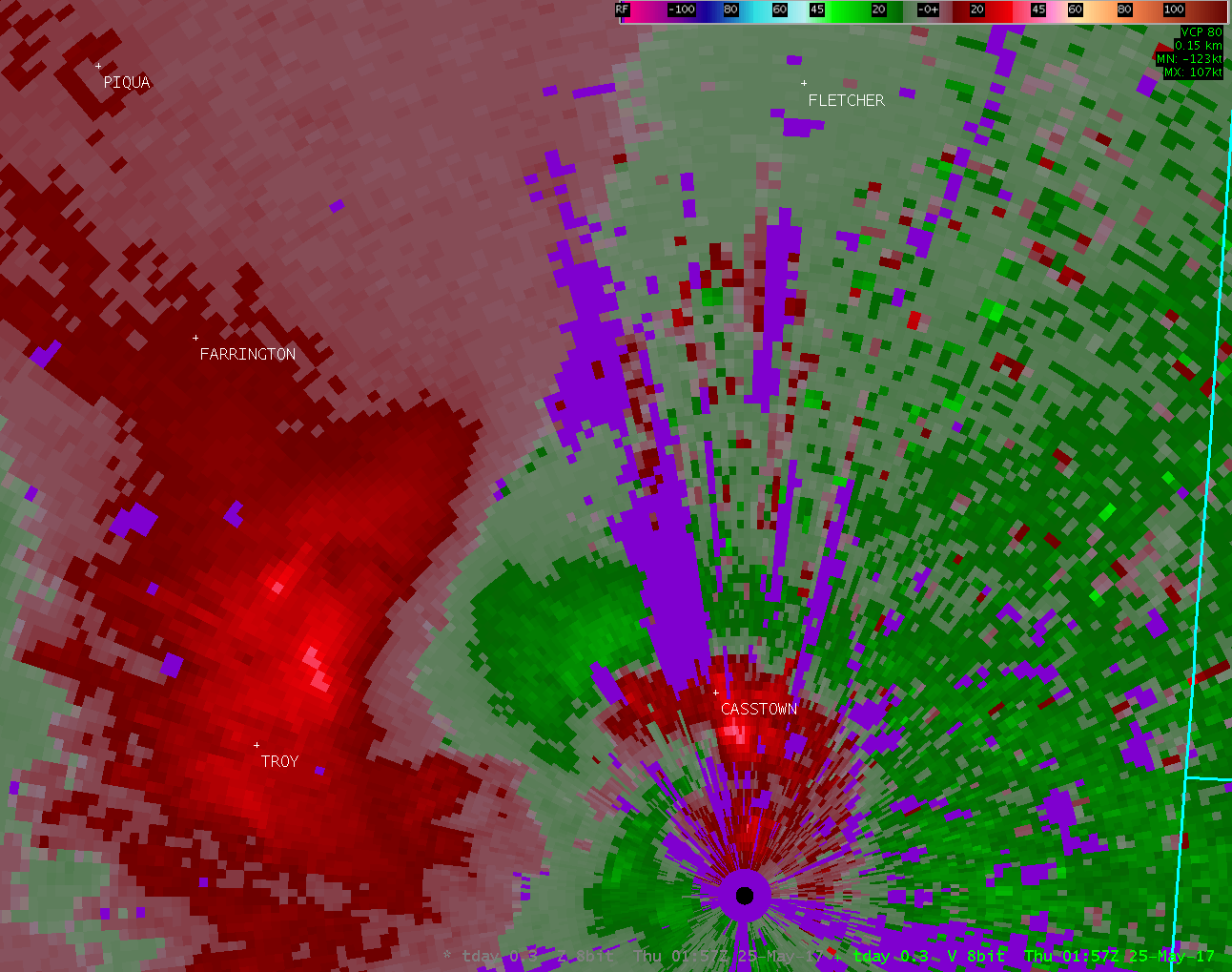
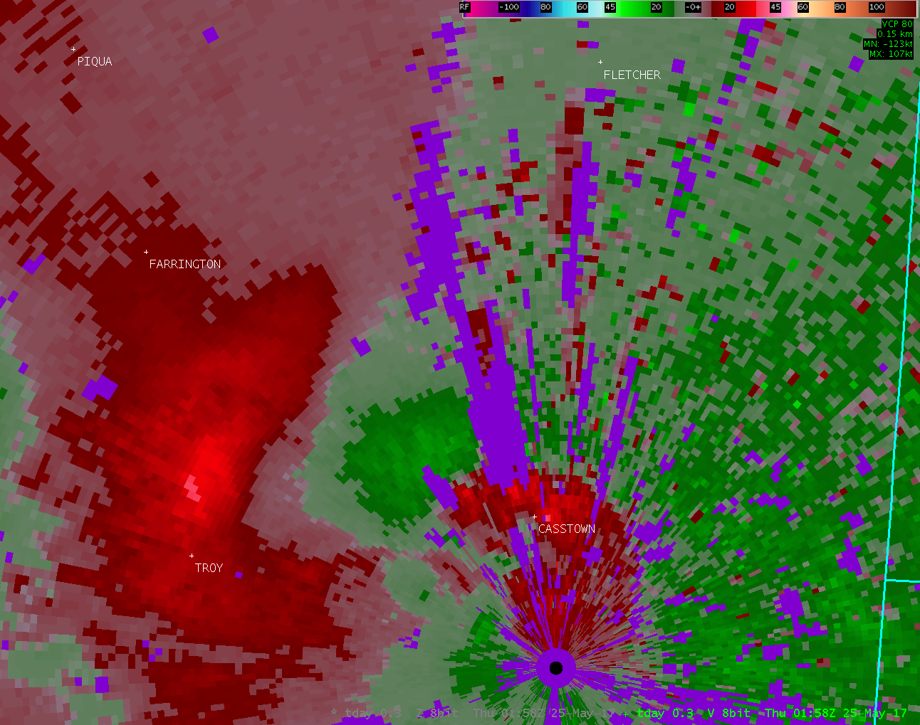
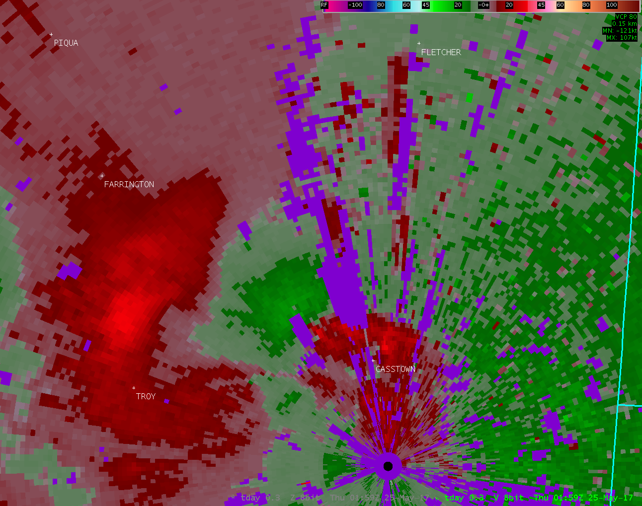
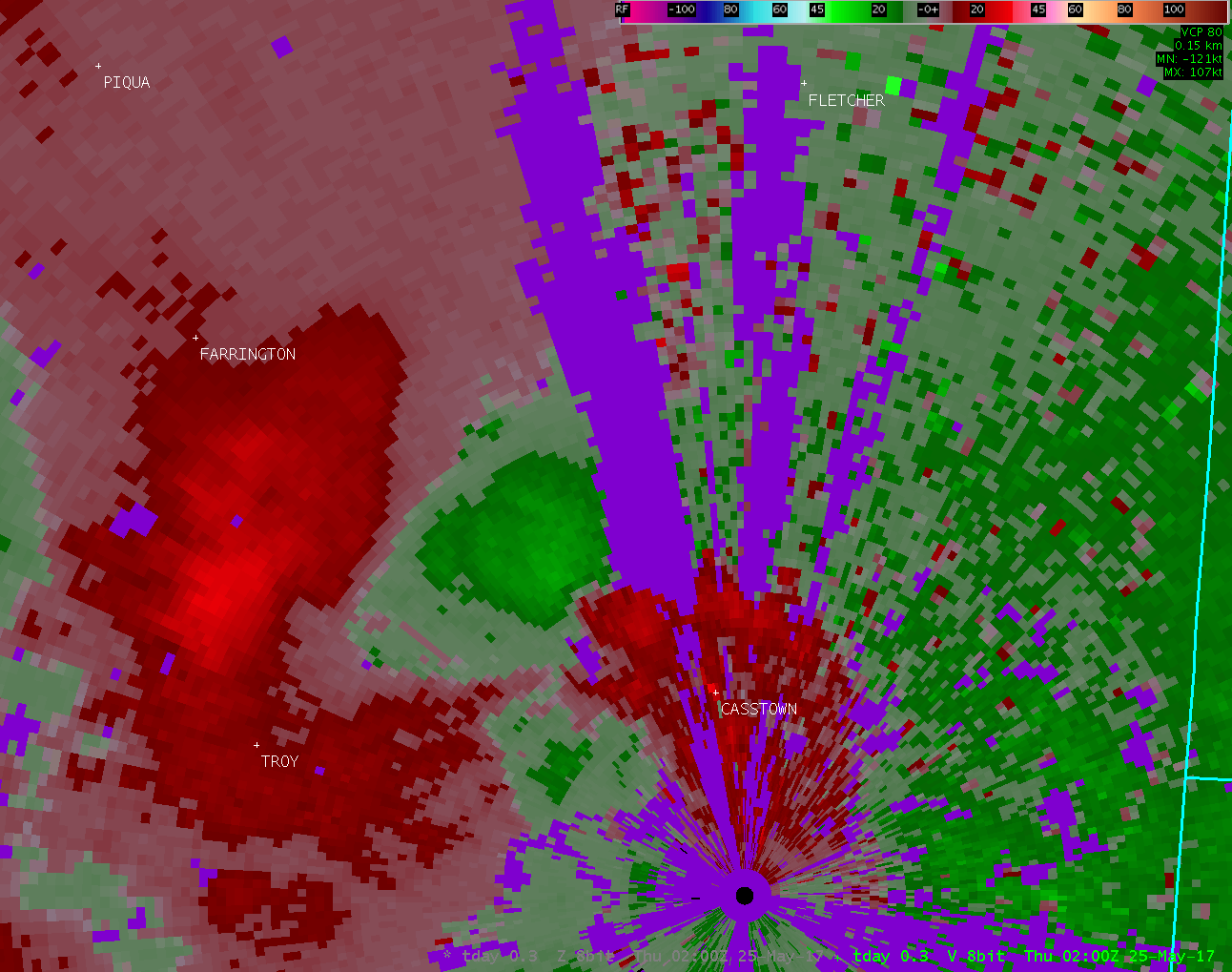
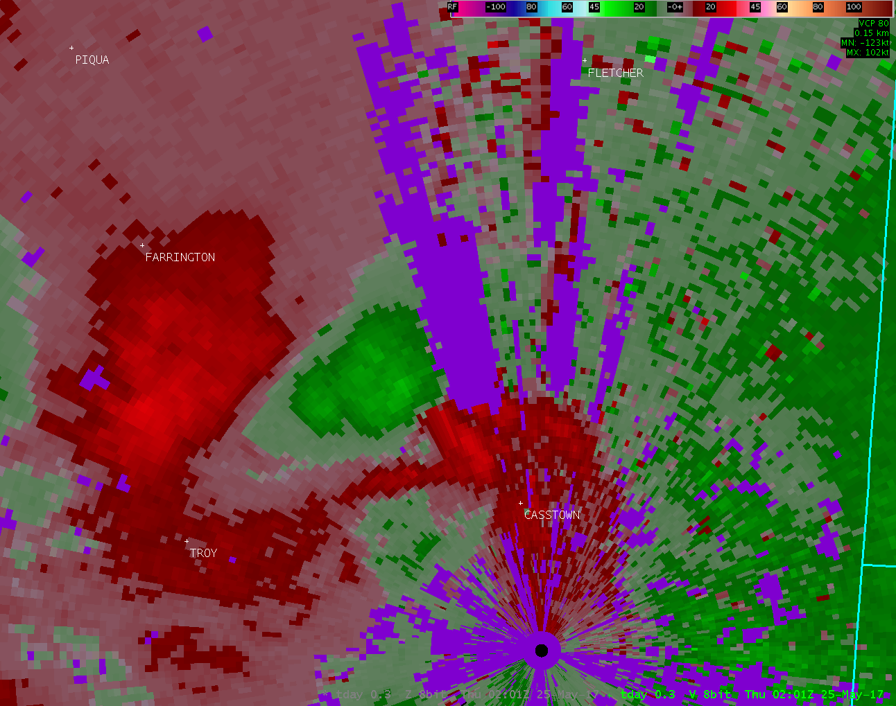
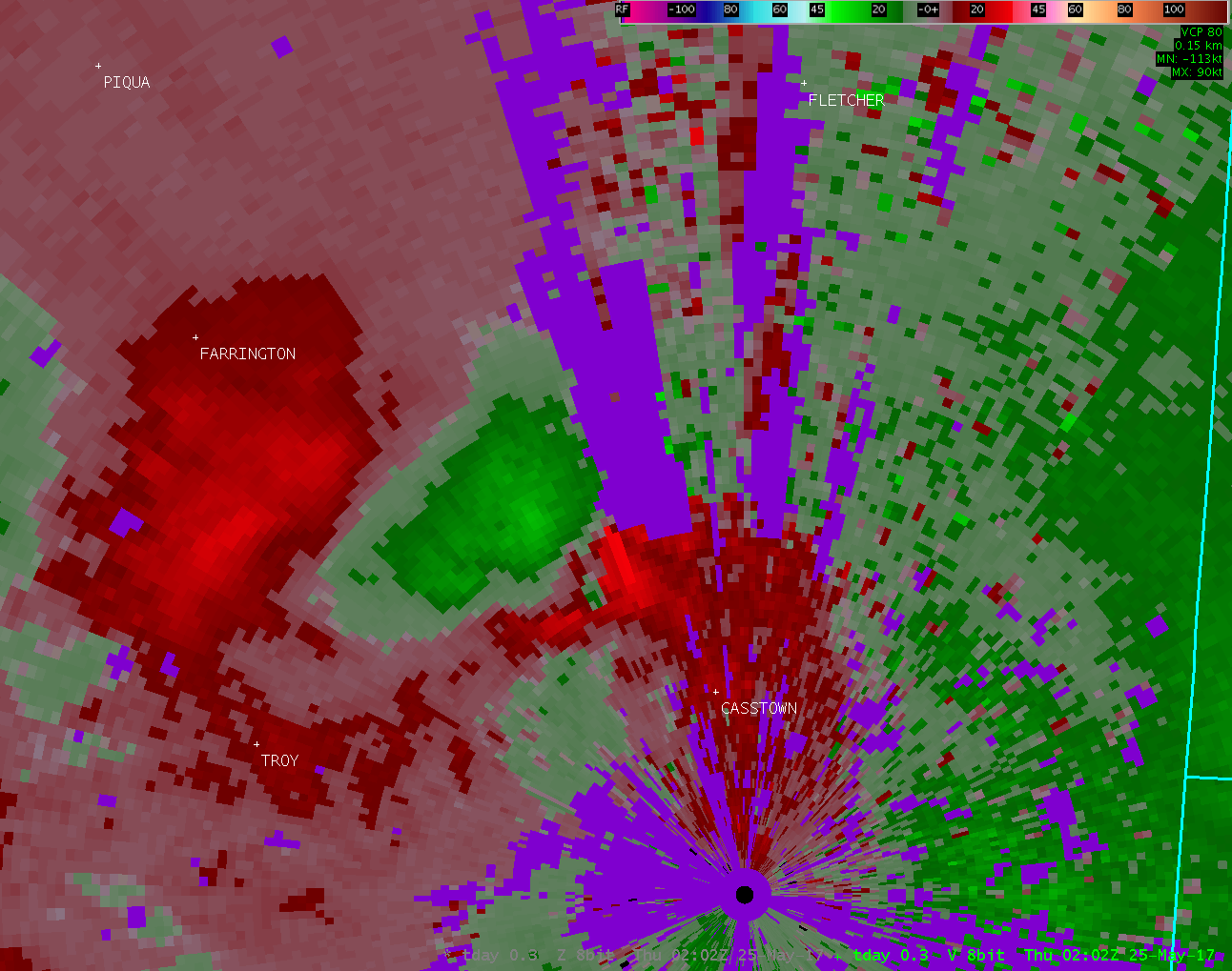
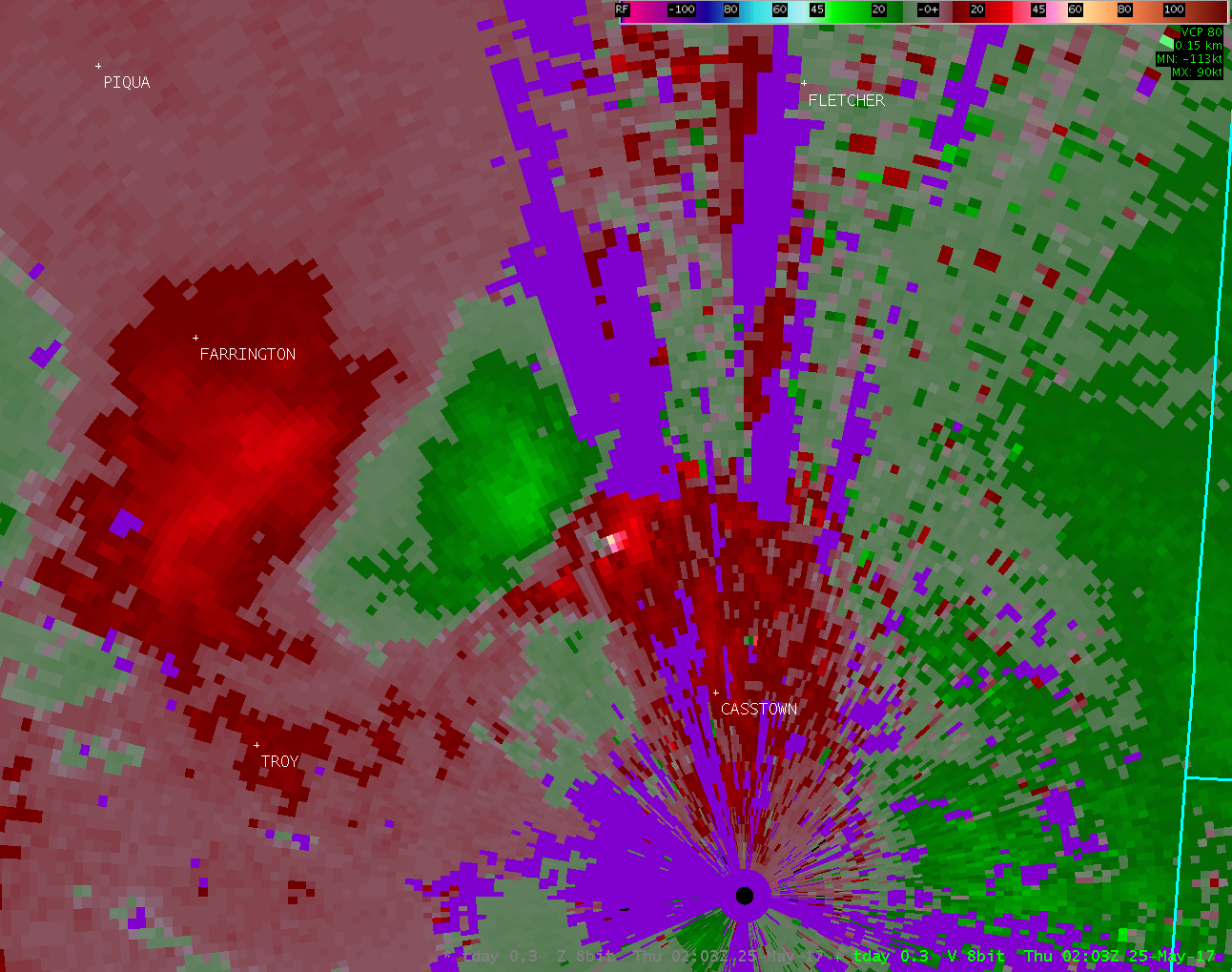
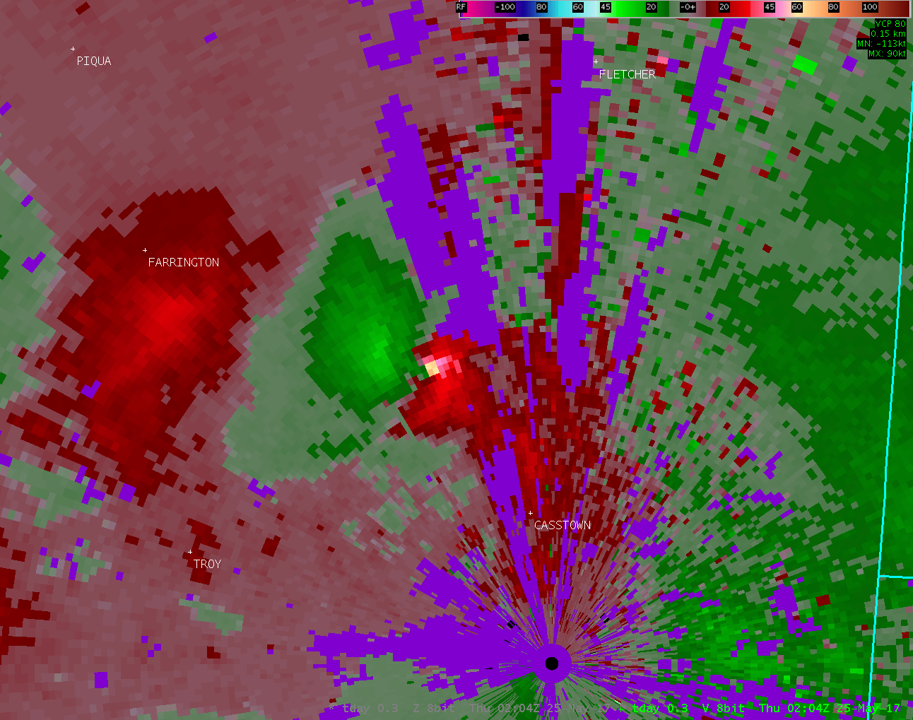
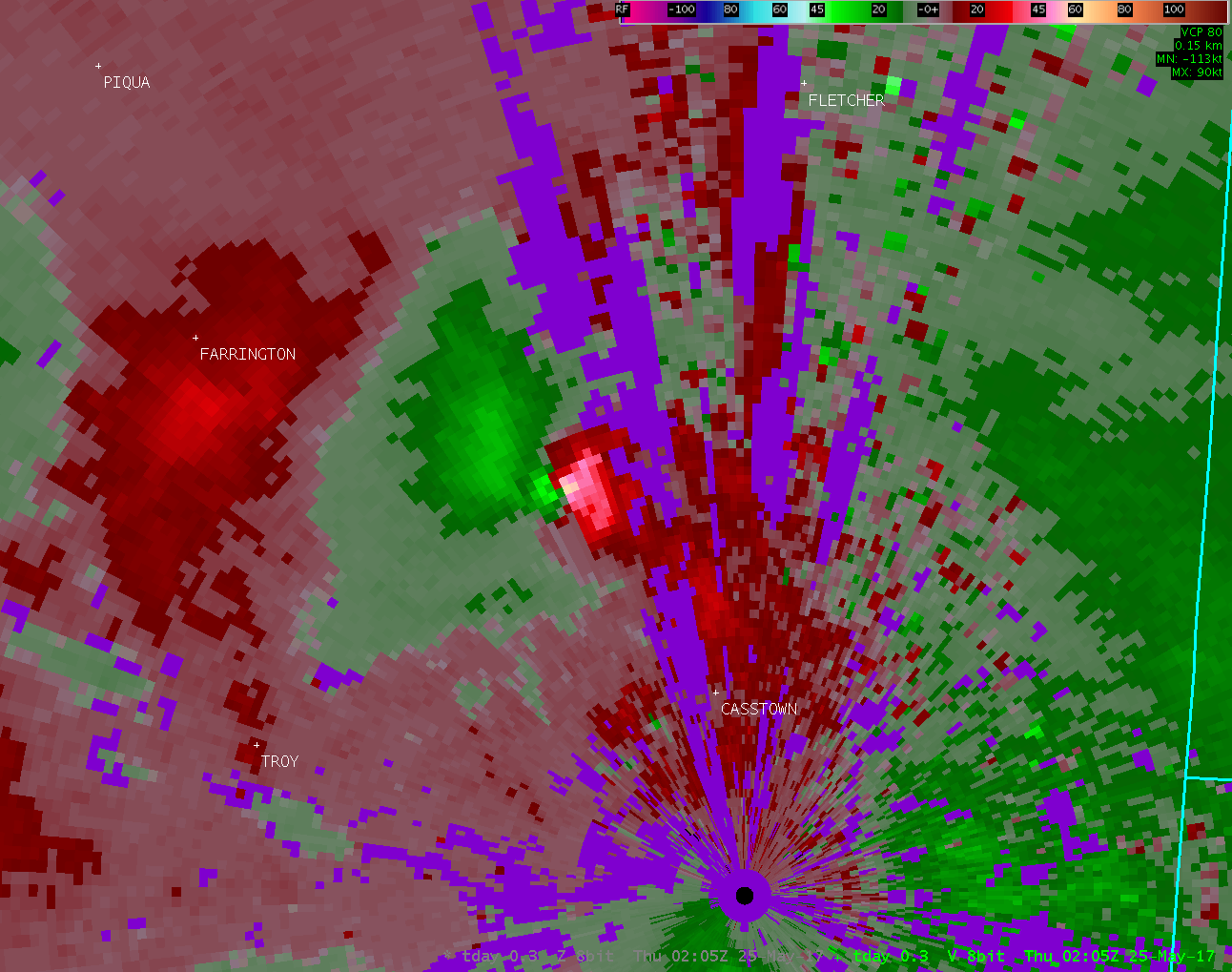
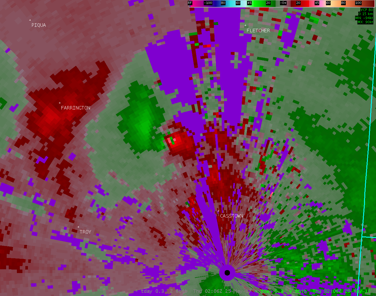
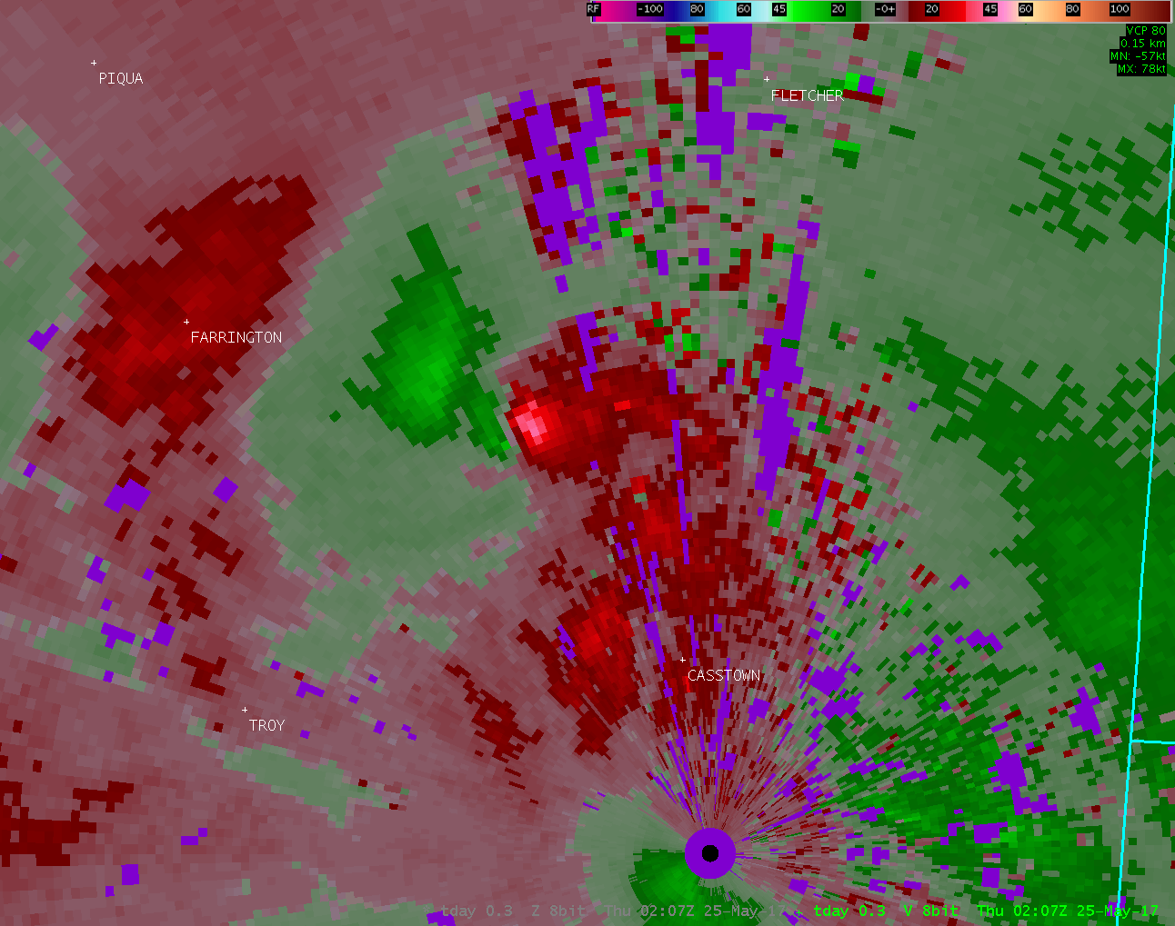
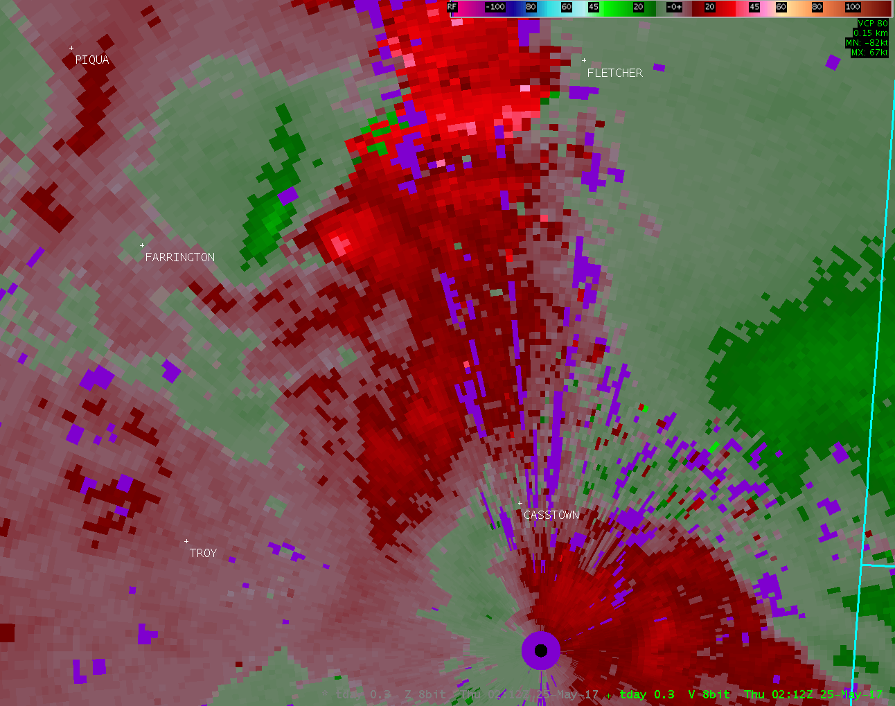
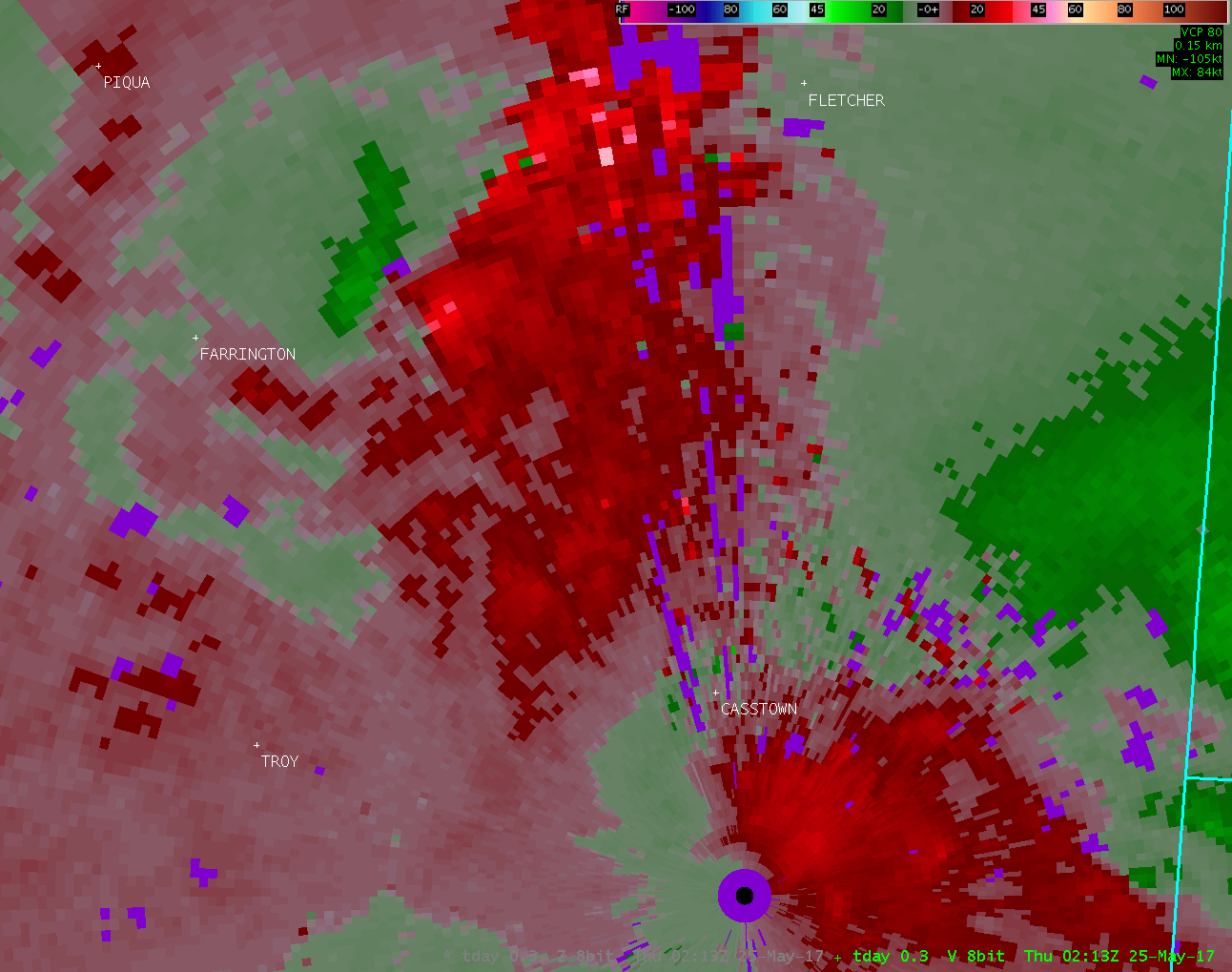
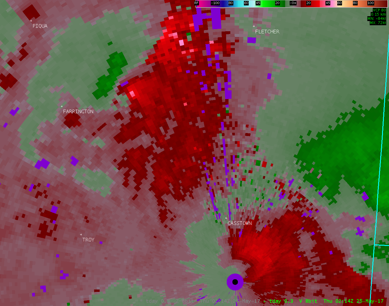
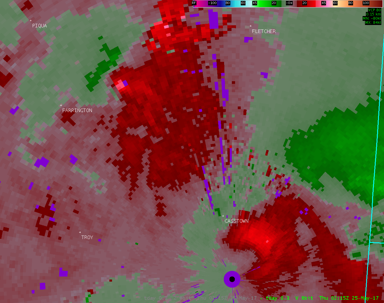
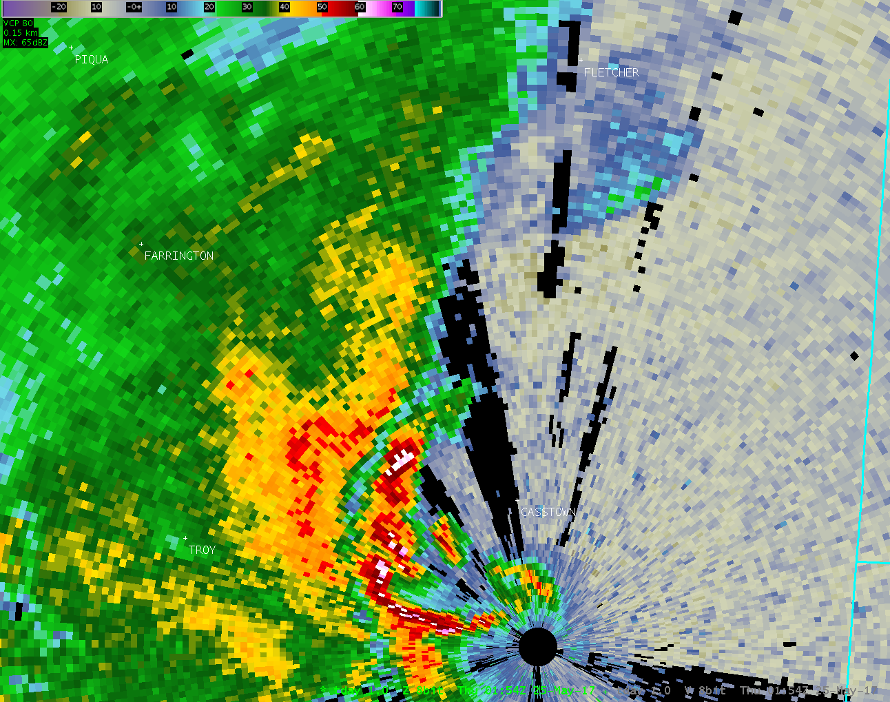
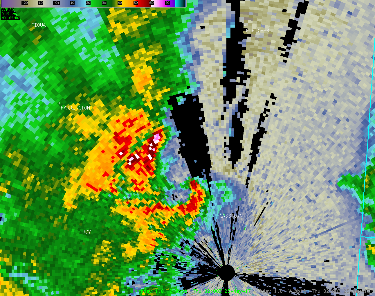
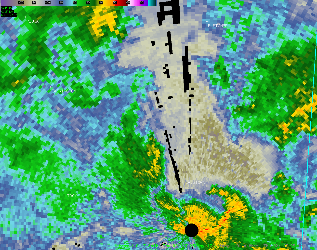
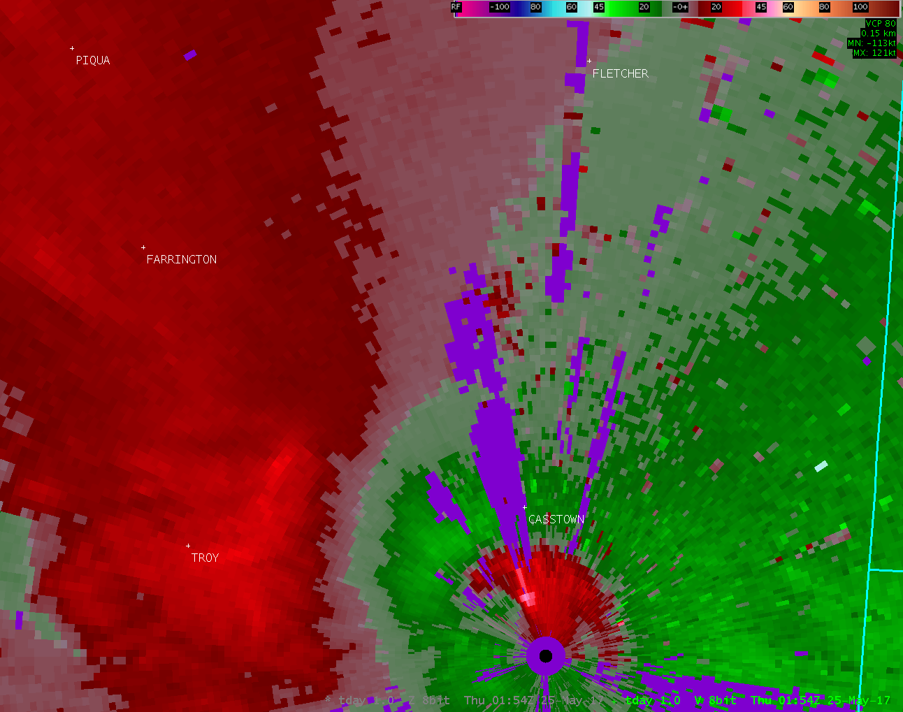
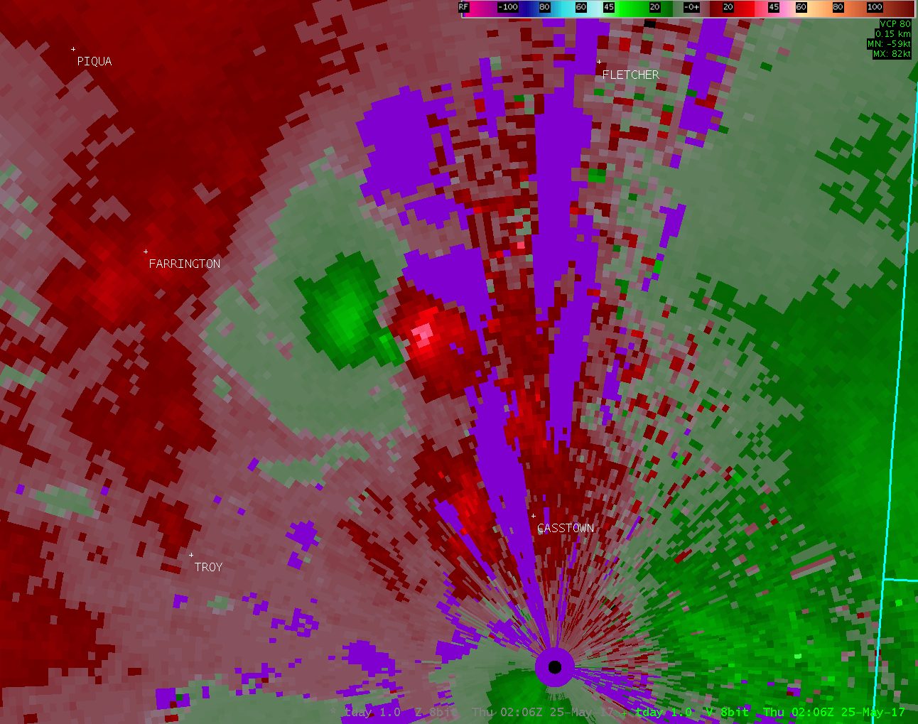
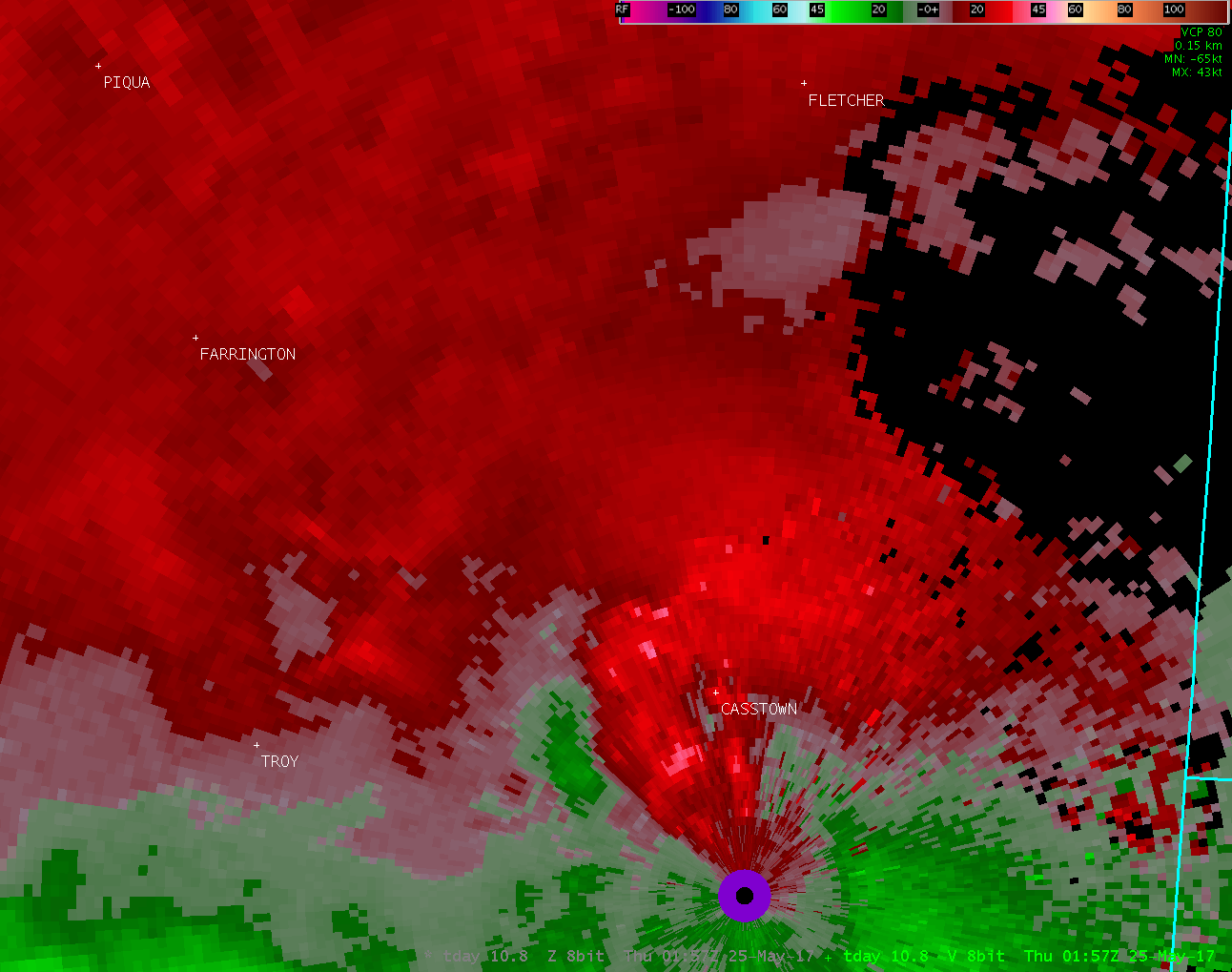
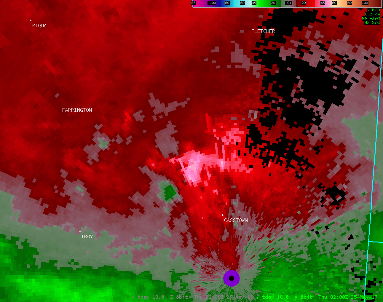
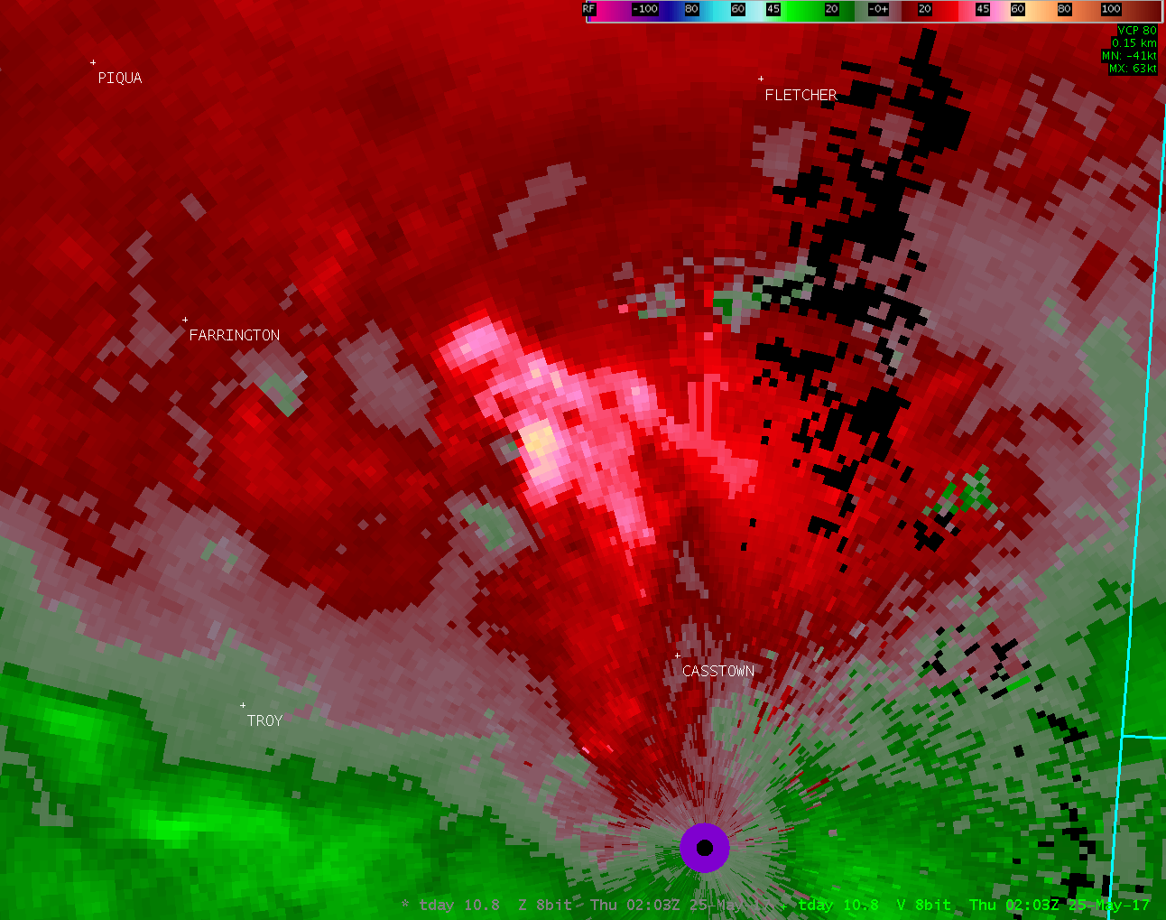
| Radar Loops from the Dayton Terminal Doppler Radar (9:54 PM - 10:15 PM) | |
| note: TDAY radar data was unavailable between 10:07 PM and 10:12 PM | |
| TDAY 0.3° Reflectivity | TDAY 0.3° Velocity |
| 01 02 03 04 05 06 07 08 09 10 11 12 13 14 15 16 17 18 | 01 02 03 04 05 06 07 08 09 10 11 12 13 14 15 16 17 18 |
| TDAY 1.0° Reflectivity | TDAY 1.0° Velocity |
| 1 2 3 4 | 1 2 3 4 |
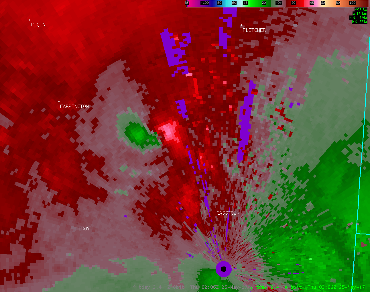
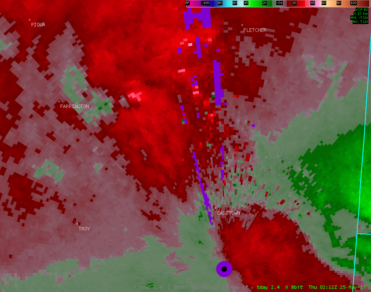
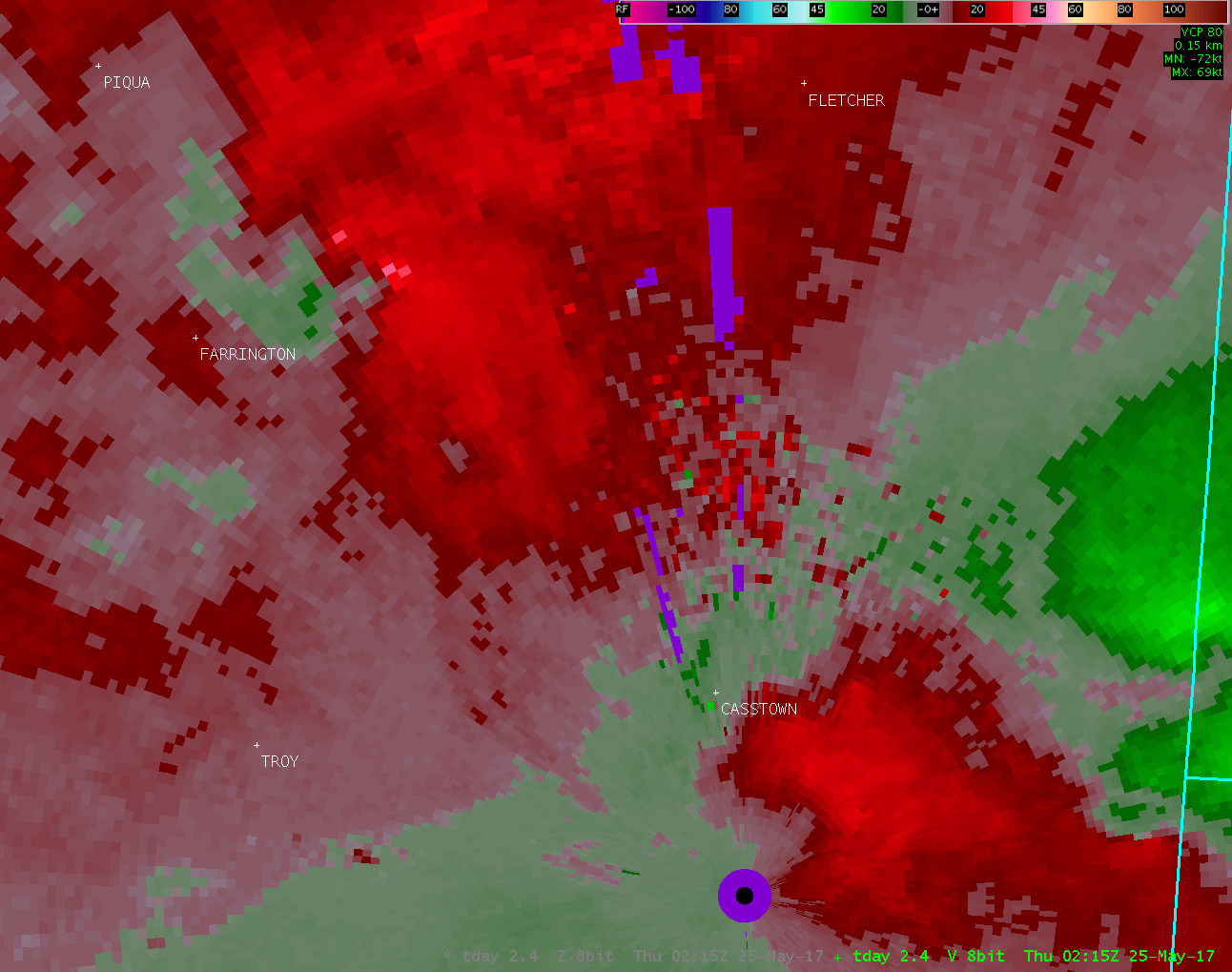
| TDAY 2.4° Reflectivity | TDAY 2.4° Velocity |
| 1 2 3 4 5 6 7 | 1 2 3 4 5 6 7 |
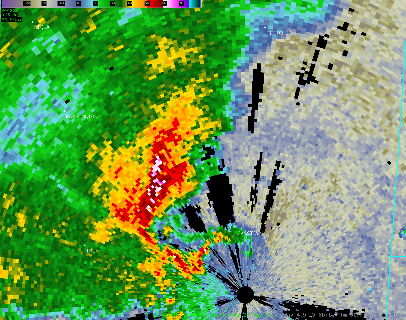
| TDAY 4.9° Reflectivity | TDAY 4.9° Velocity |
| 1 2 3 | 1 2 3 |
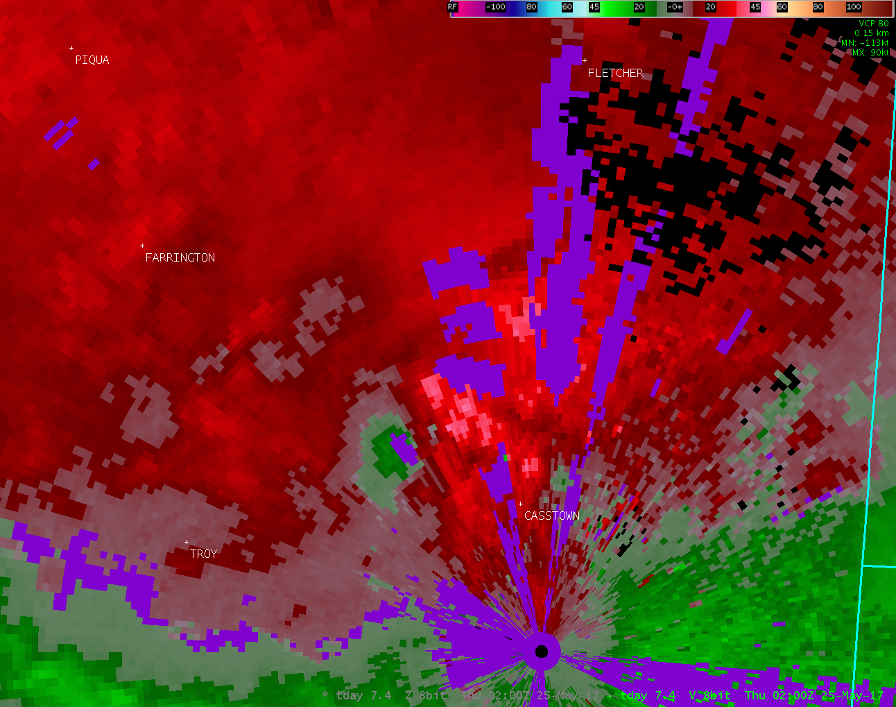
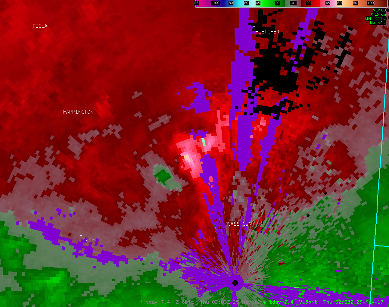
| TDAY 7.4° Reflectivity | TDAY 7.4° Velocity |
| 1 2 3 | 1 2 3 |
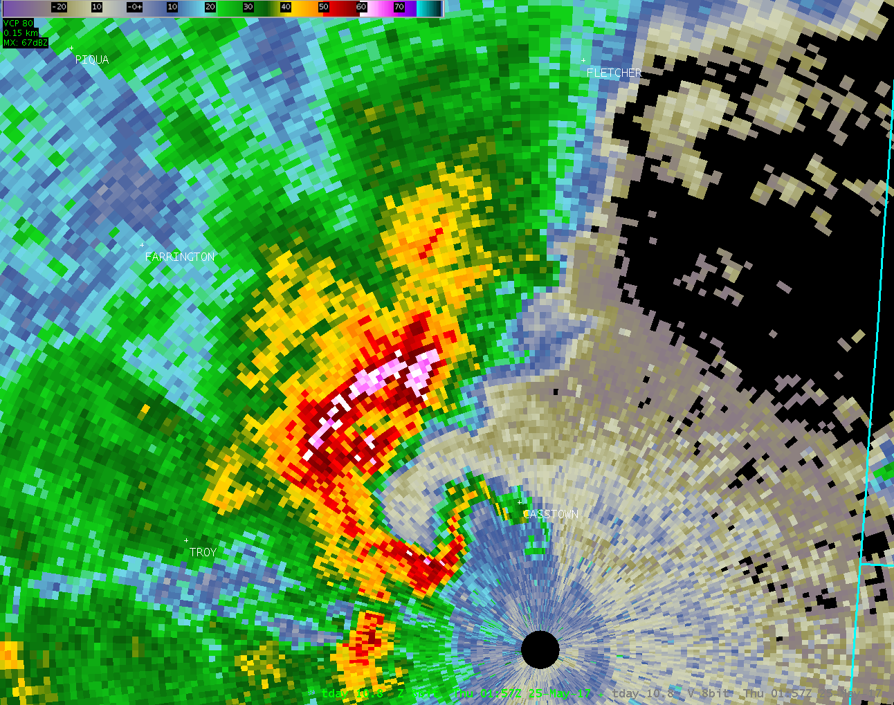
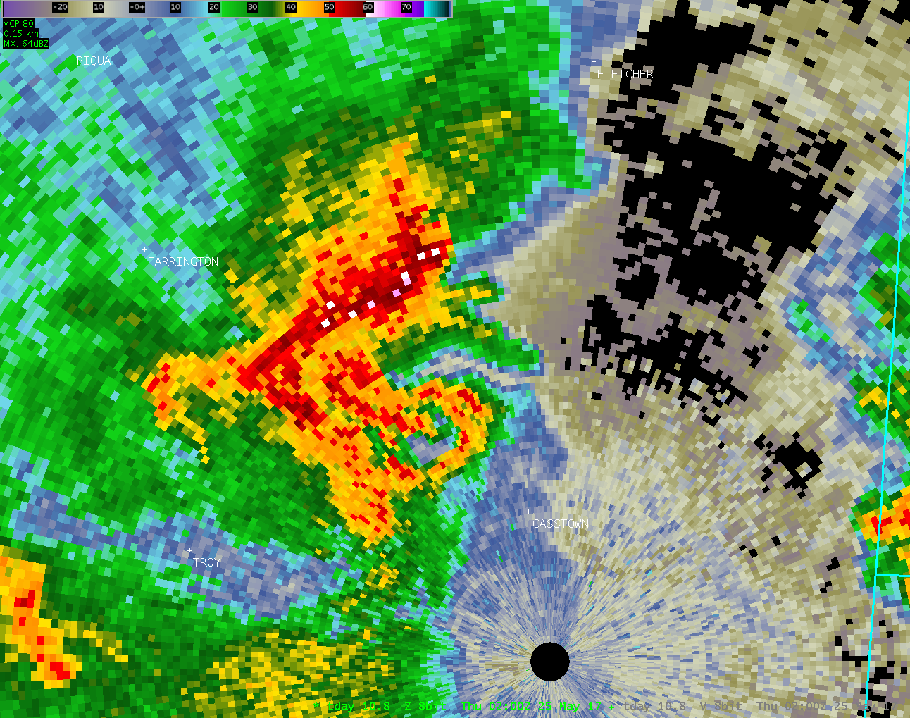
| TDAY 10.8° Reflectivity | TDAY 10.8° Velocity |
| 1 2 3 | 1 2 3 |
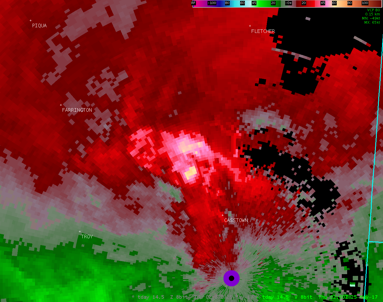
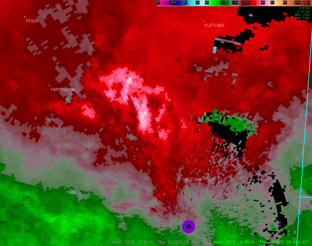
| TDAY 14.5° Reflectivity | TDAY 14.5° Velocity |
| 1 2 3 | 1 2 3 |

