Public Information Statement
National Weather Service Wilmington OH
721 PM EST Mon Nov 6 2017
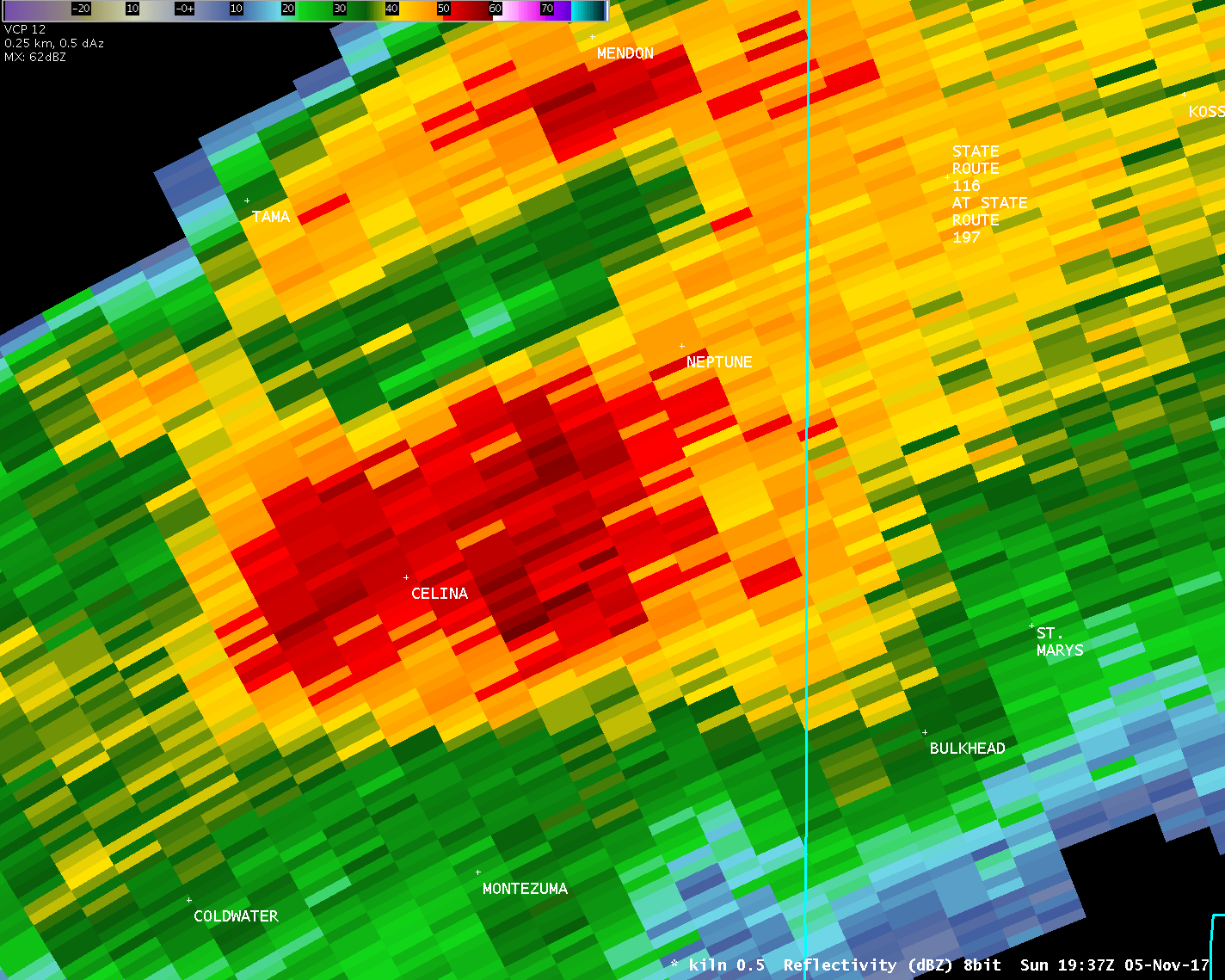
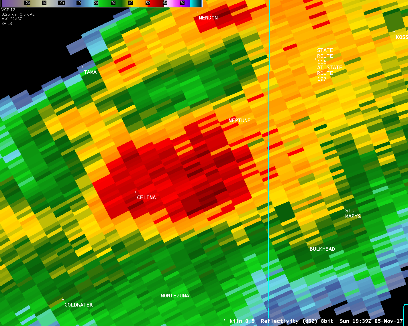
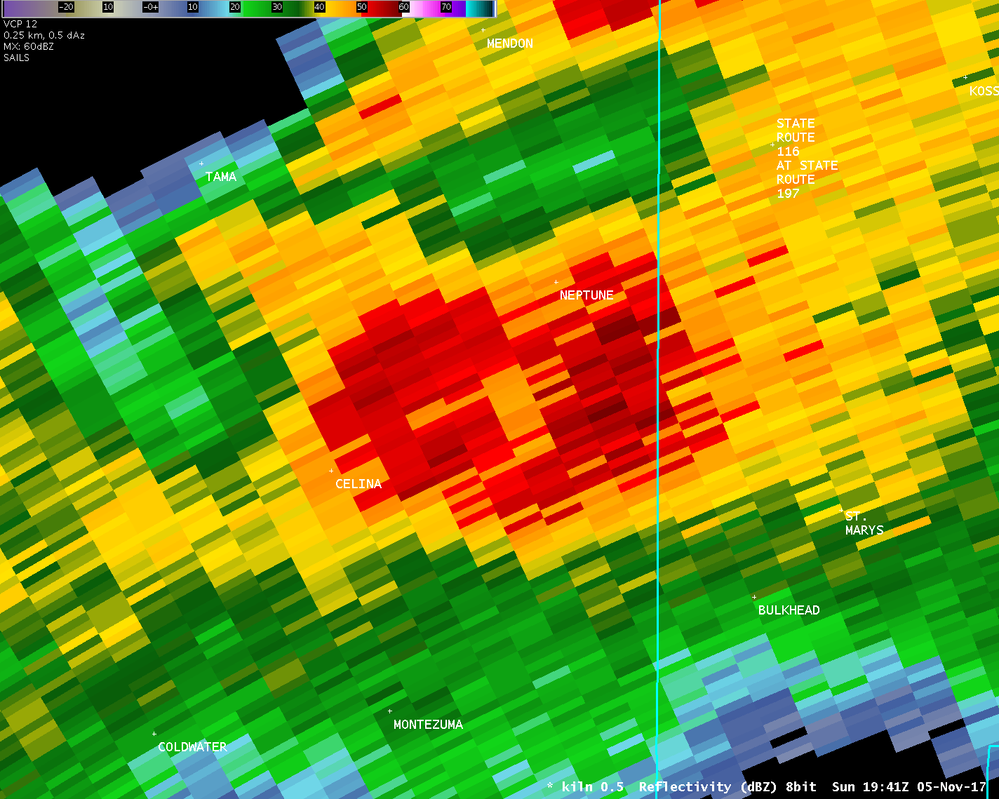
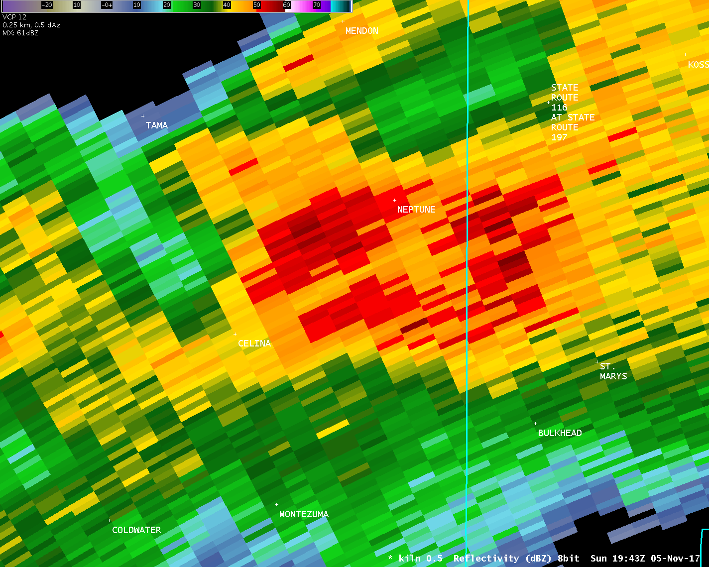
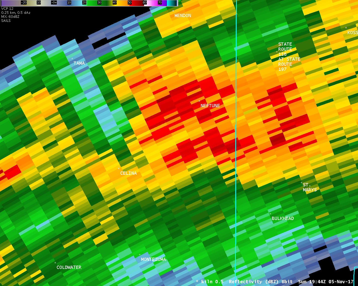
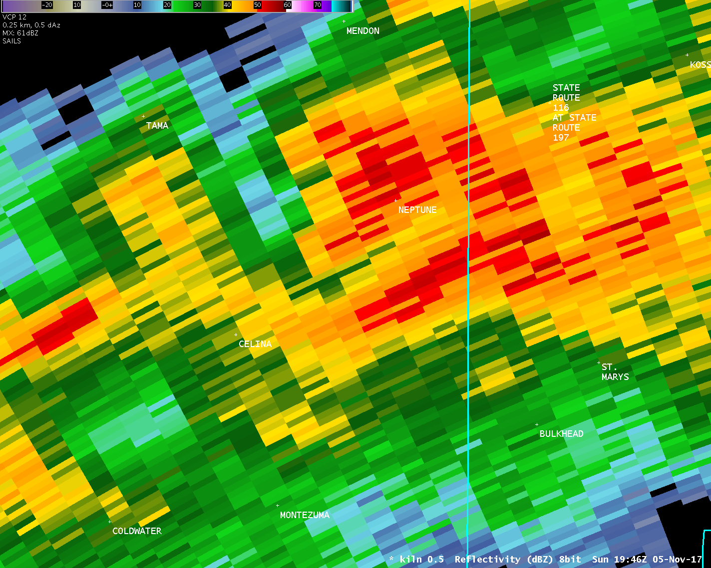
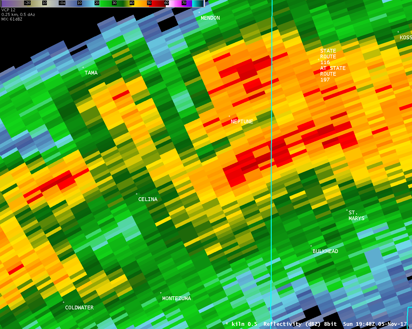
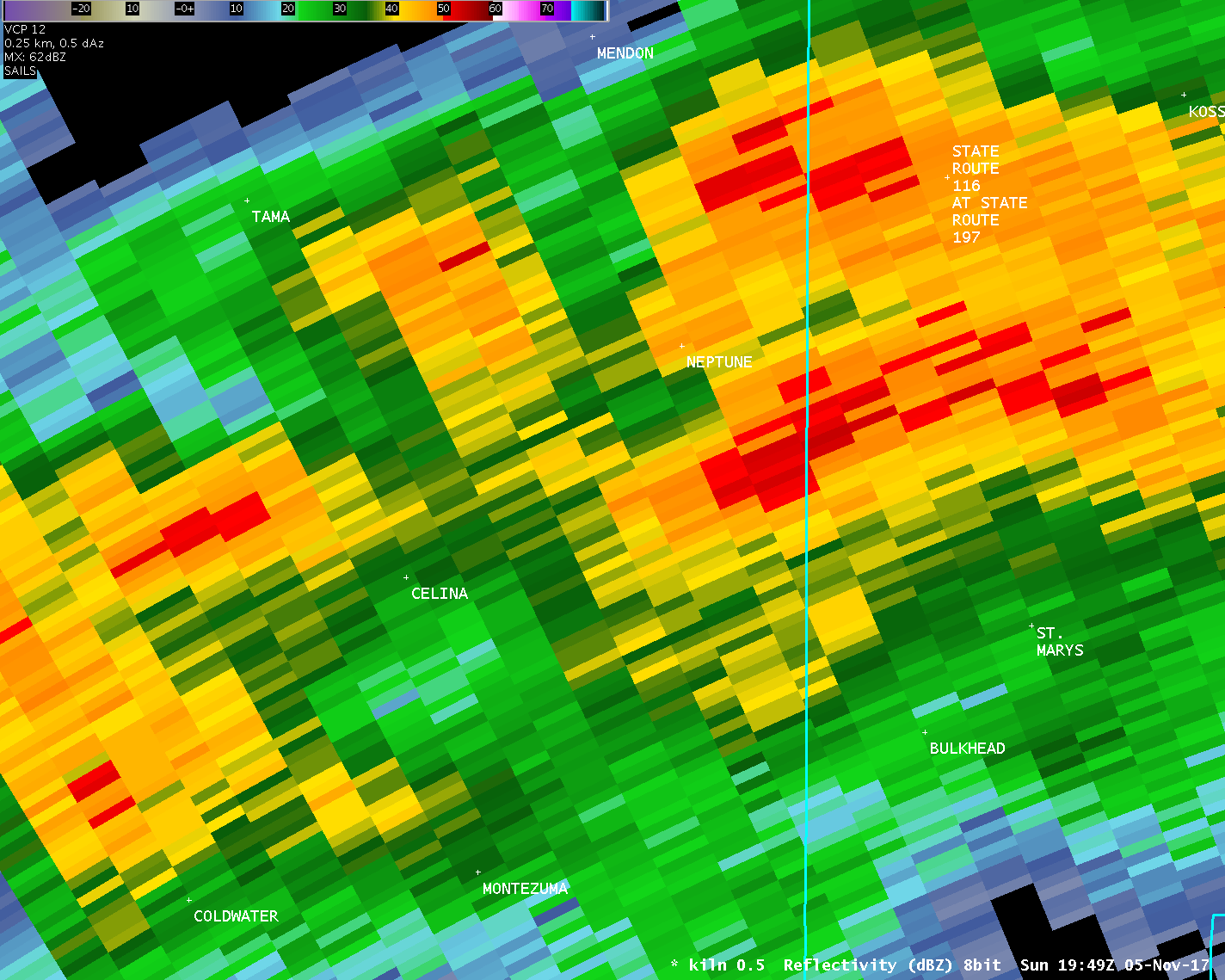
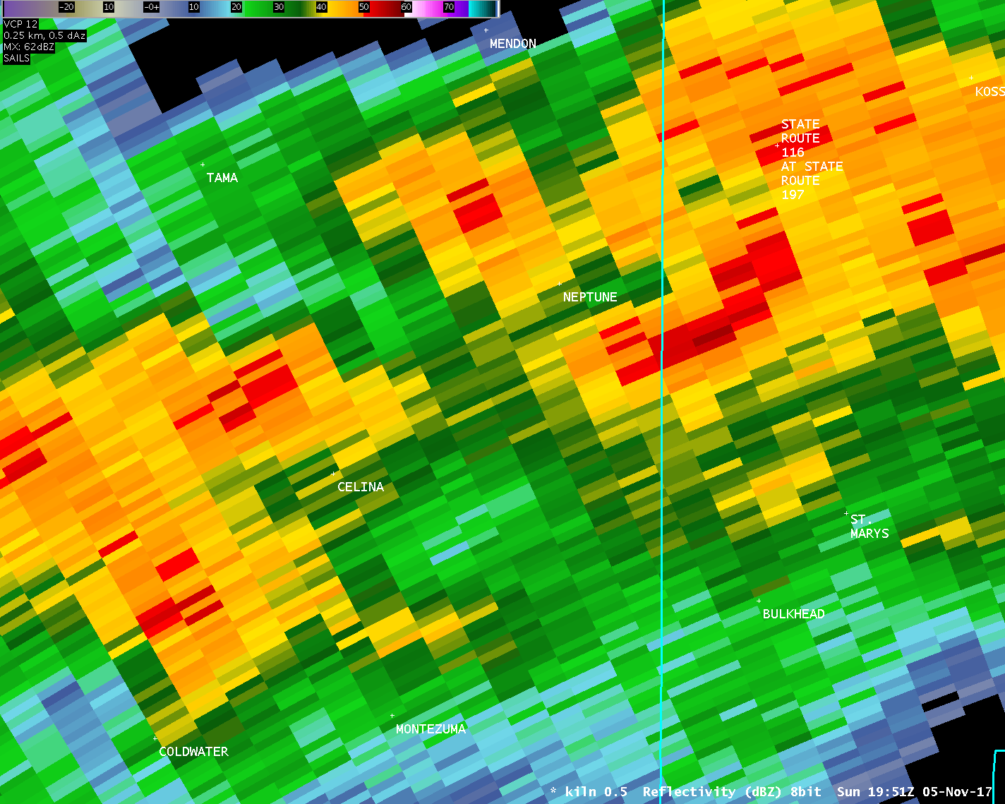
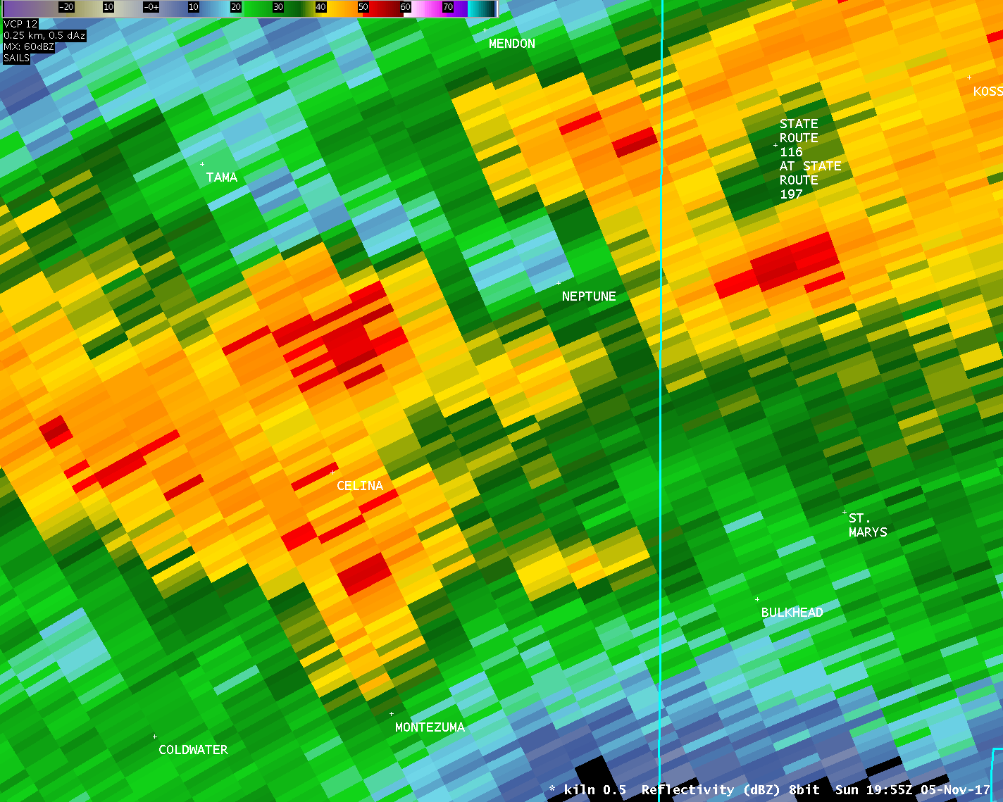
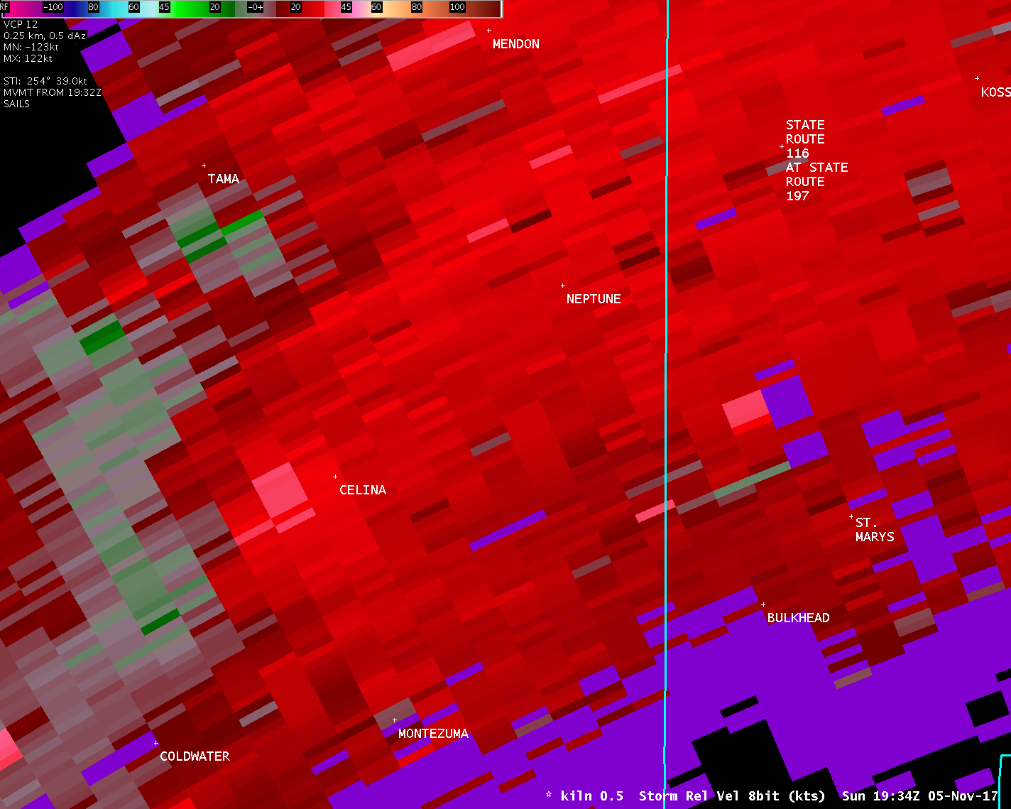
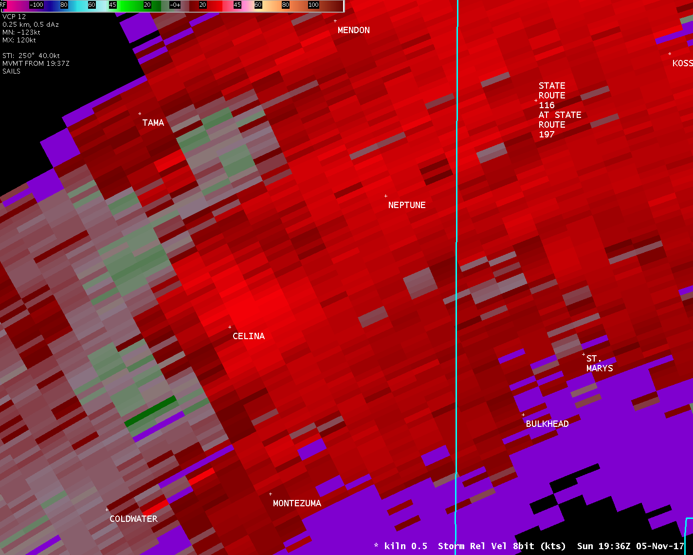
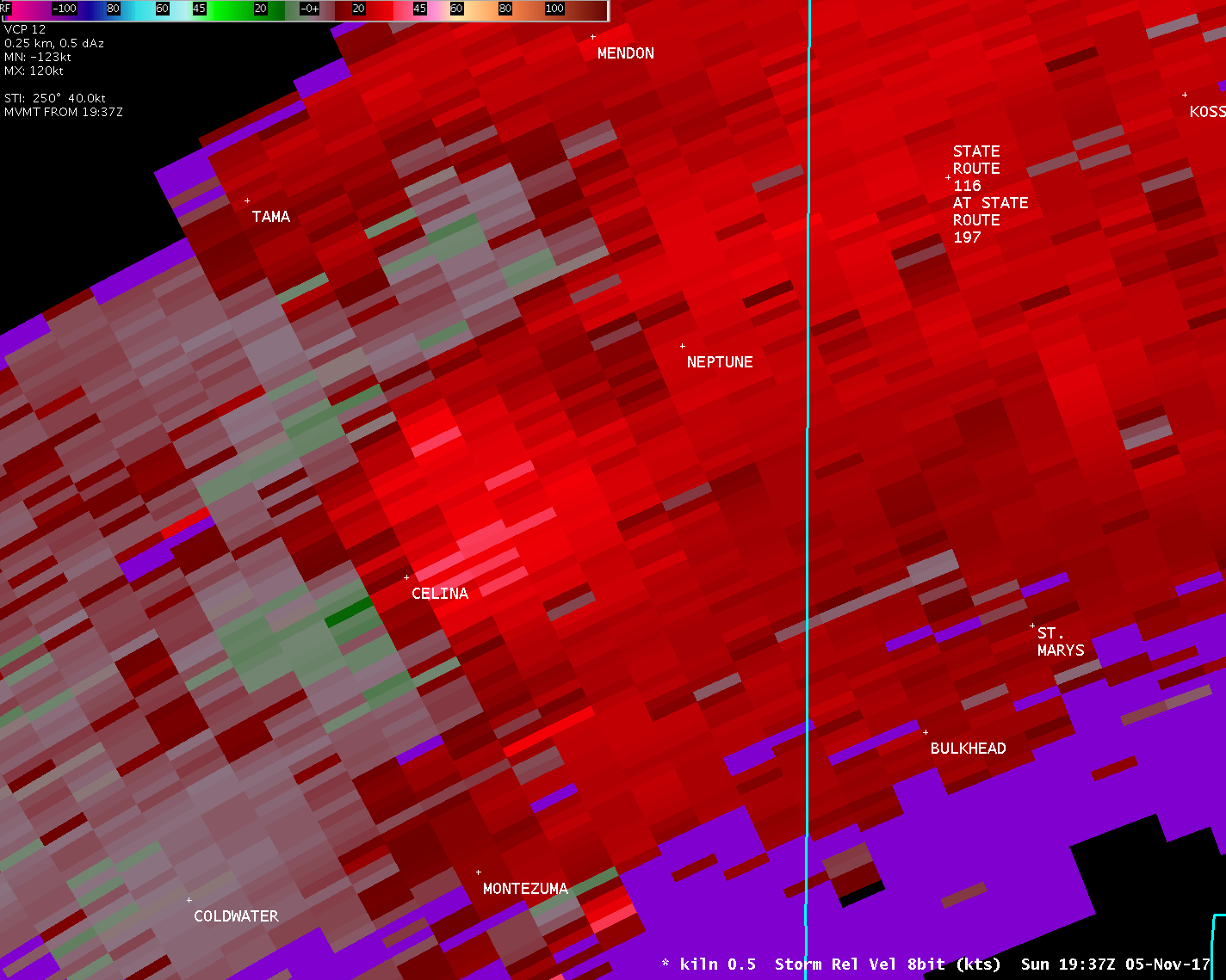
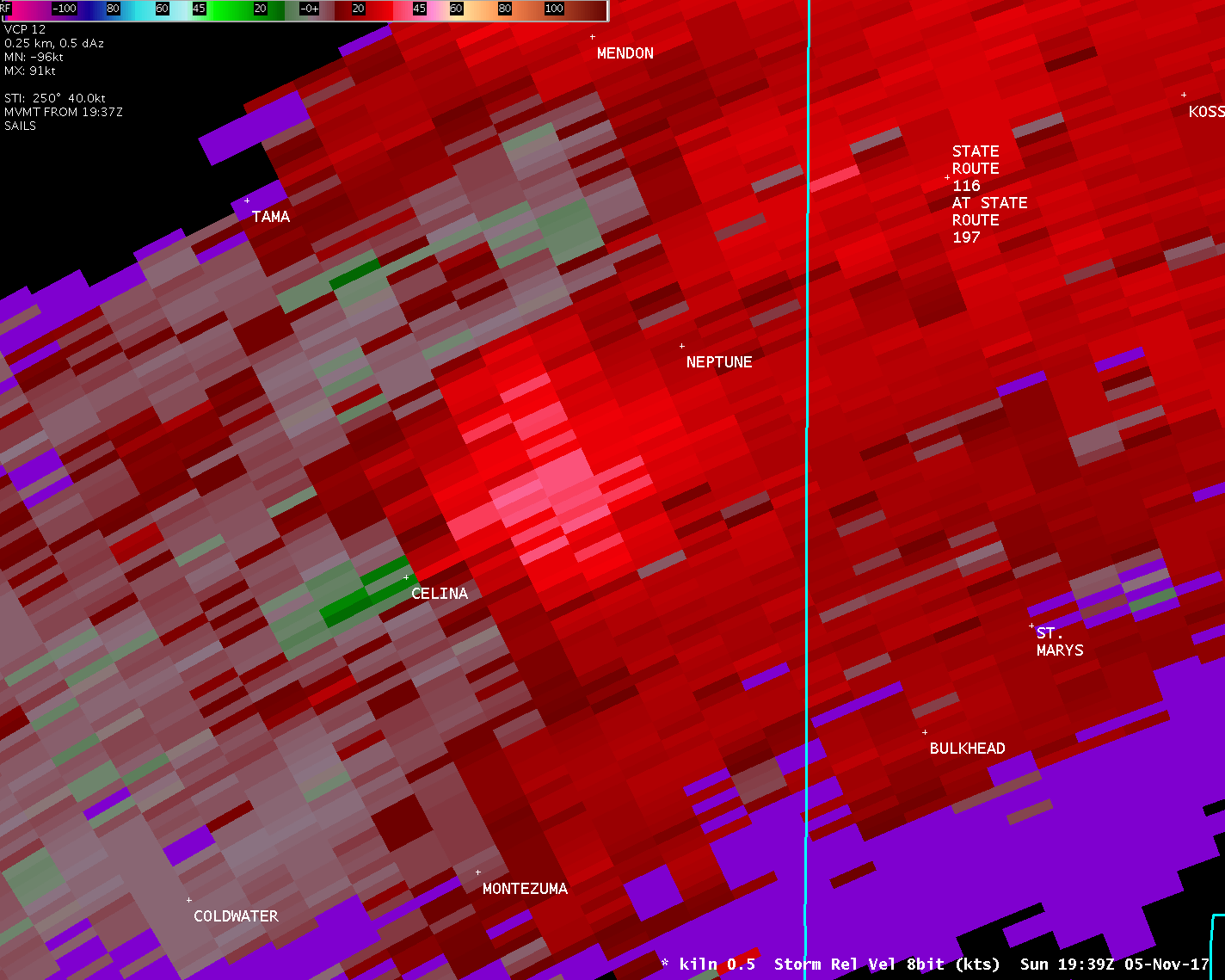
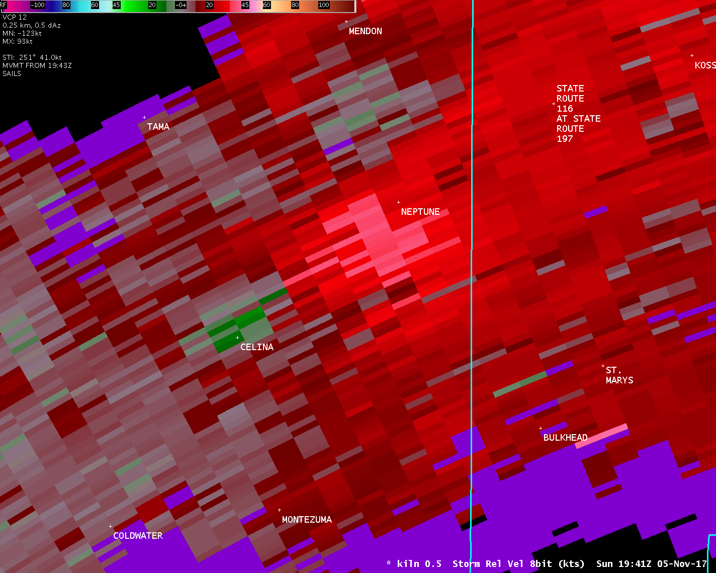
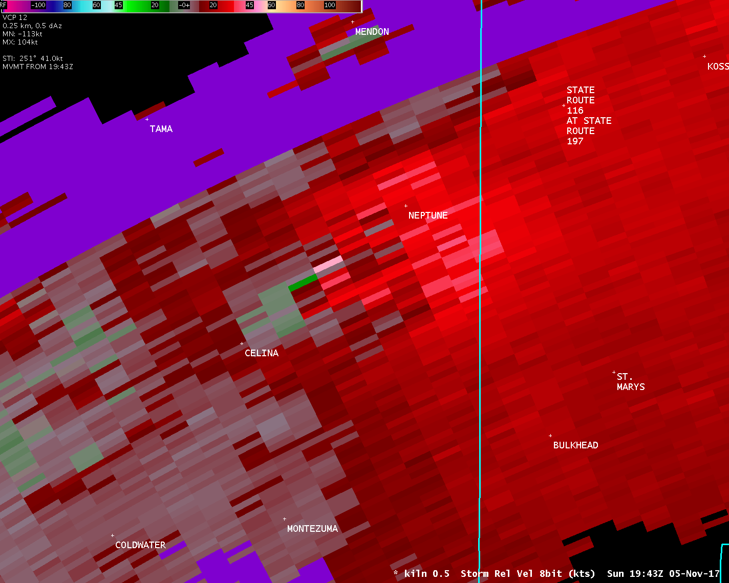
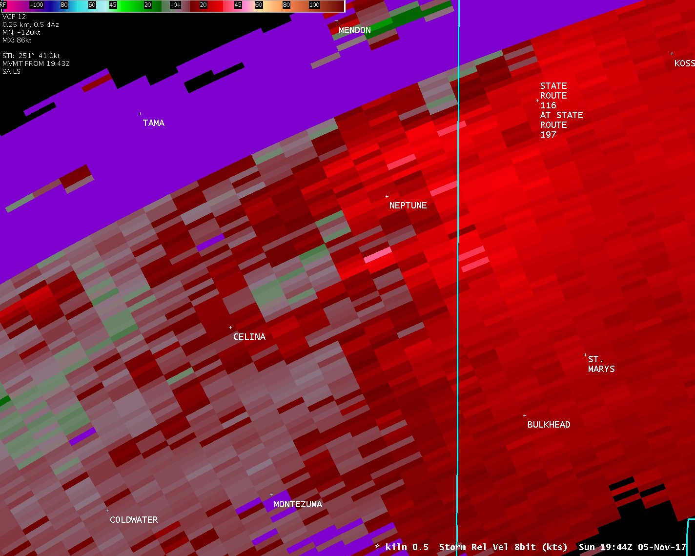
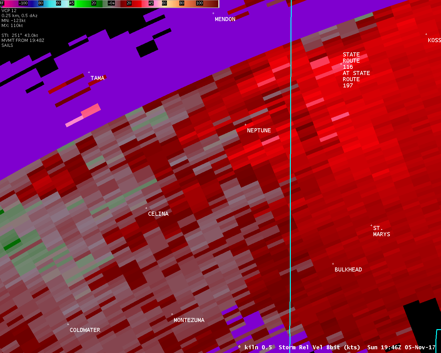
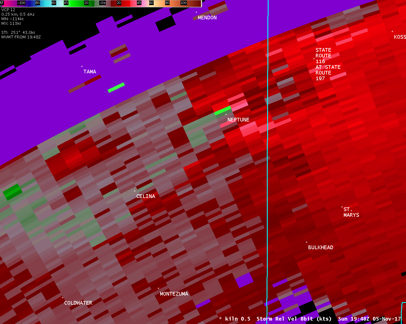
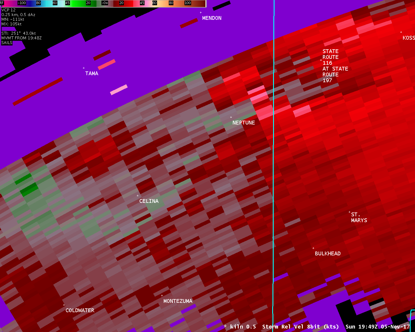
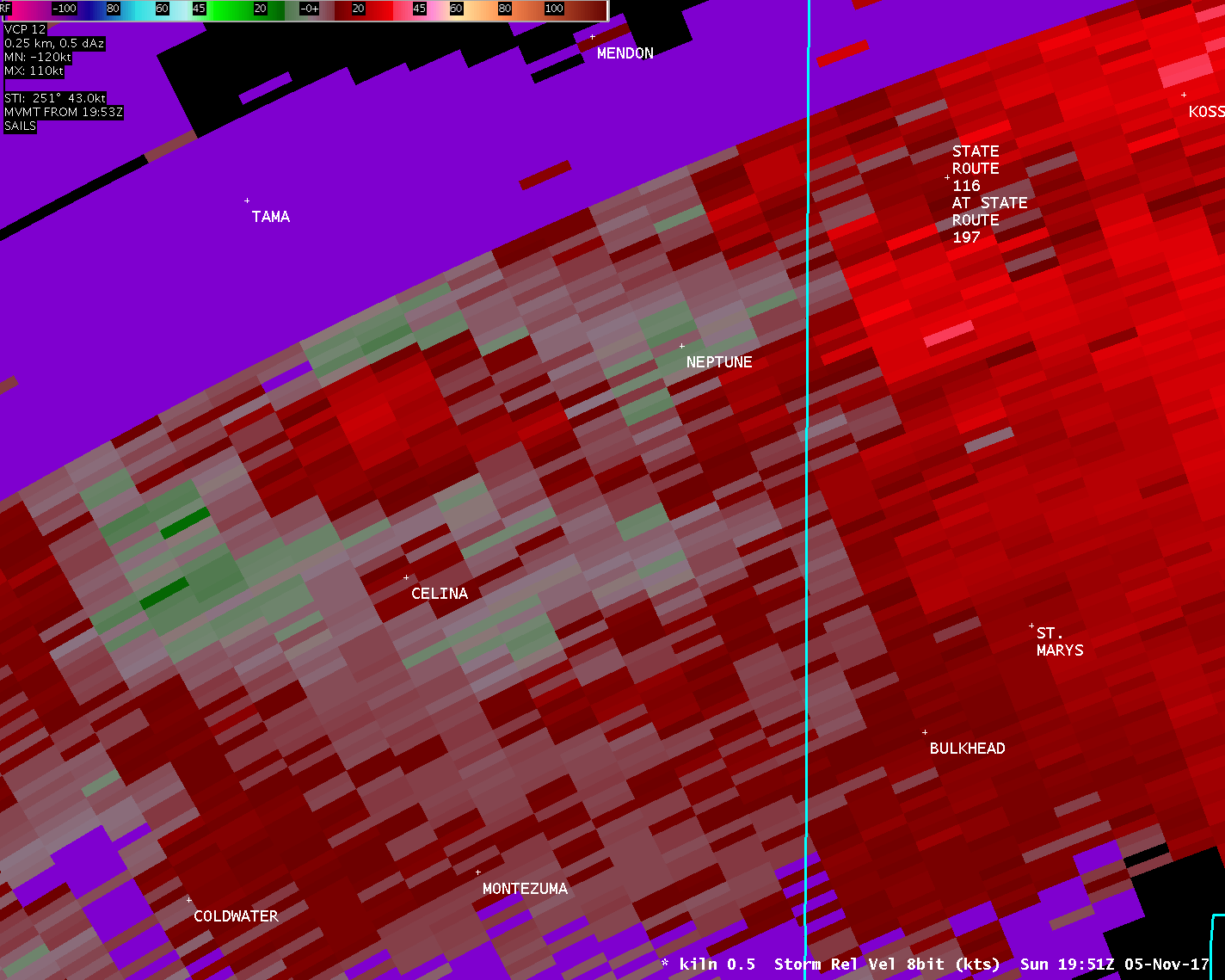
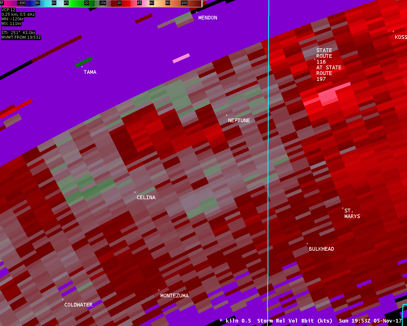
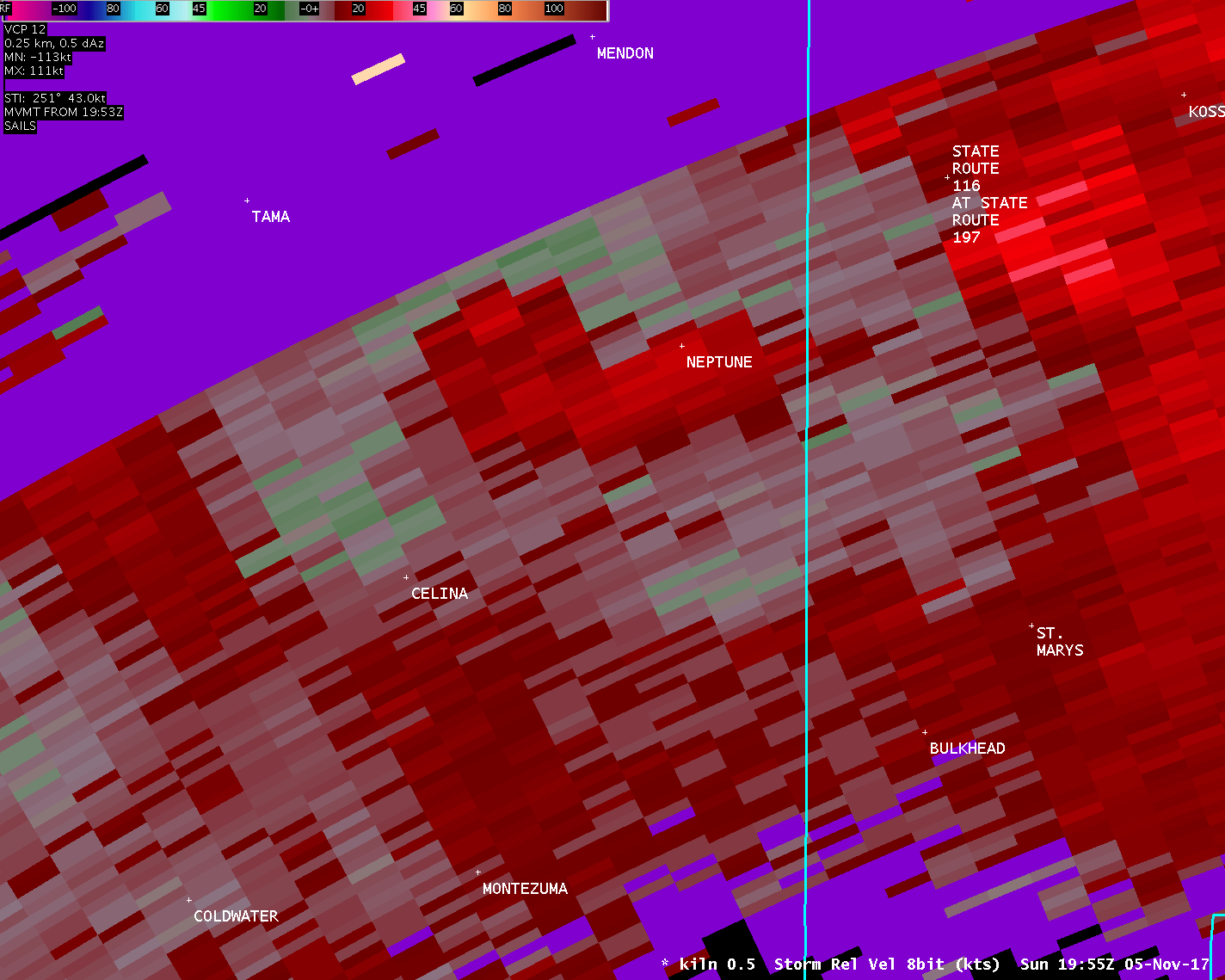
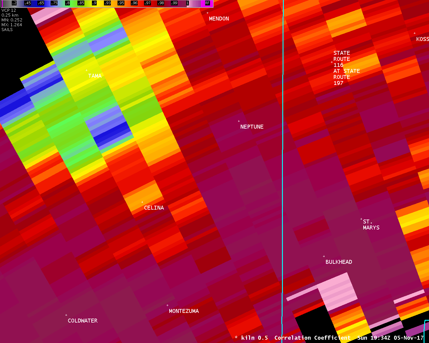
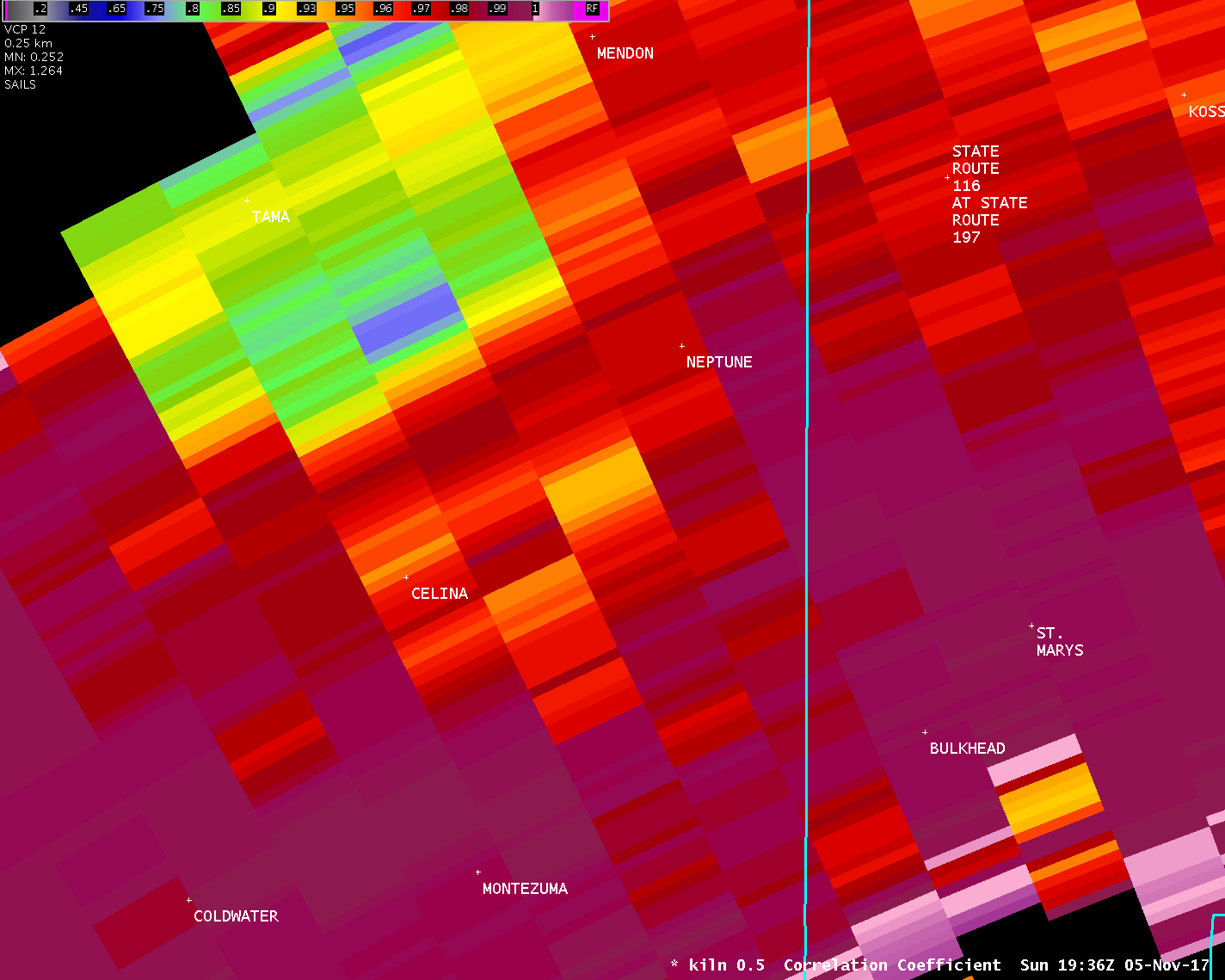
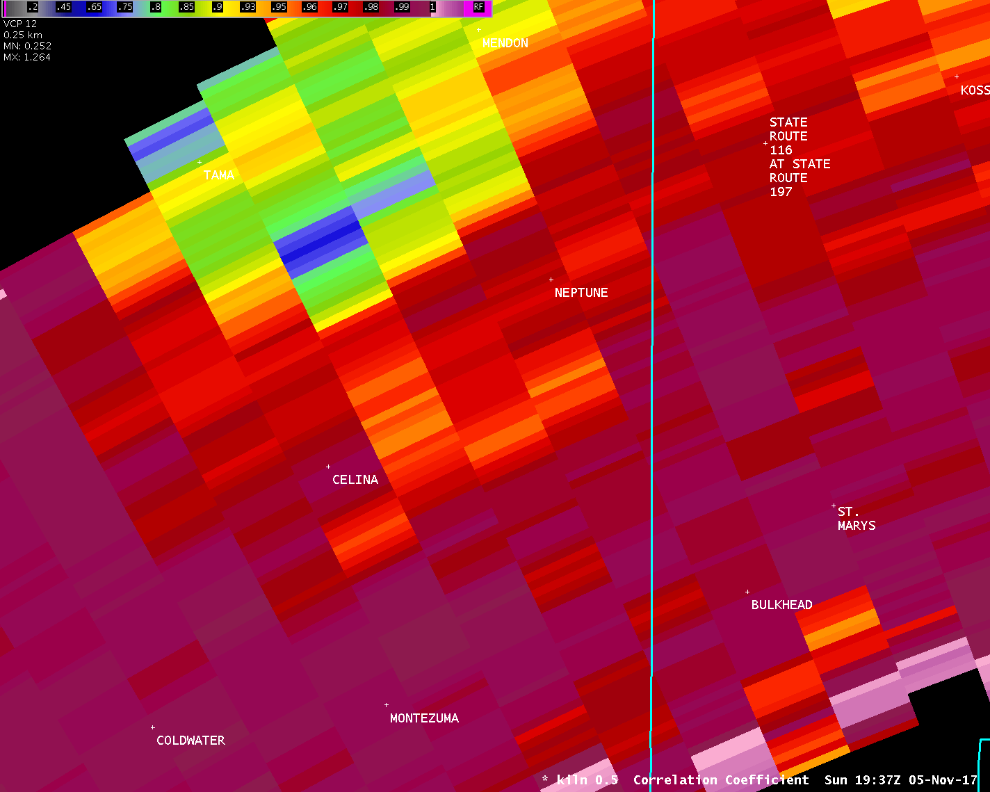
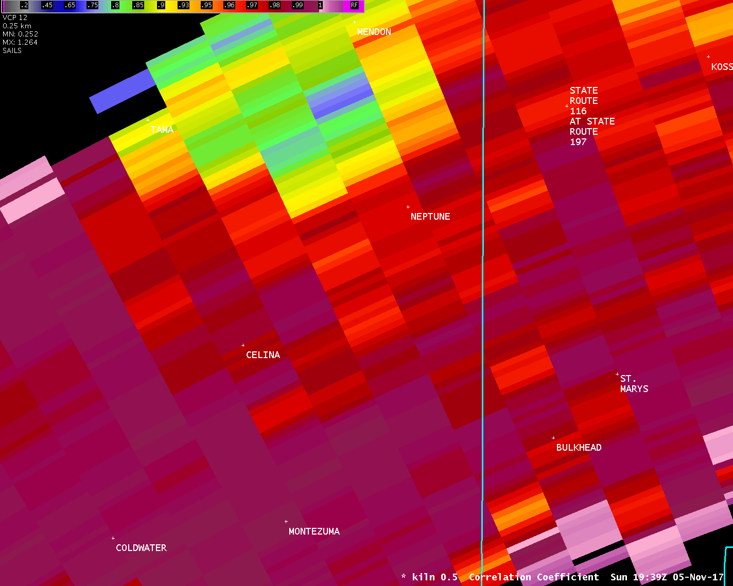
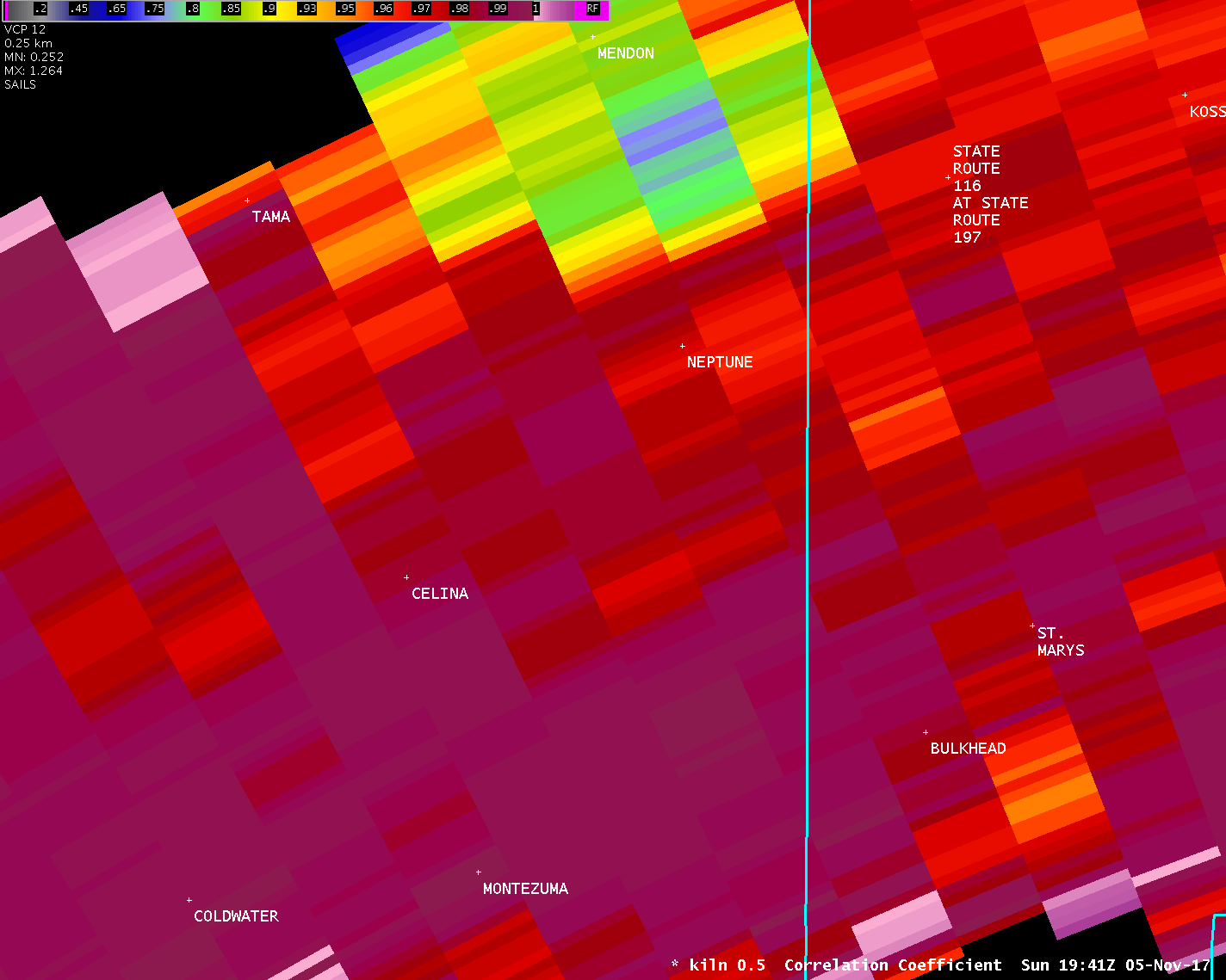
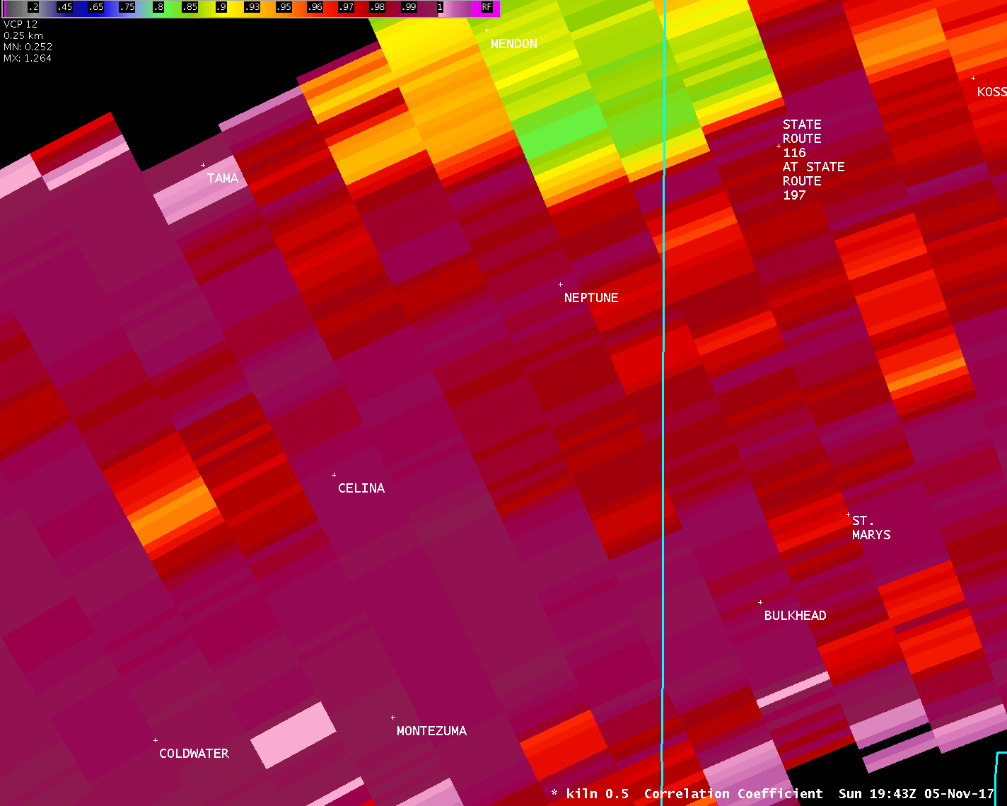
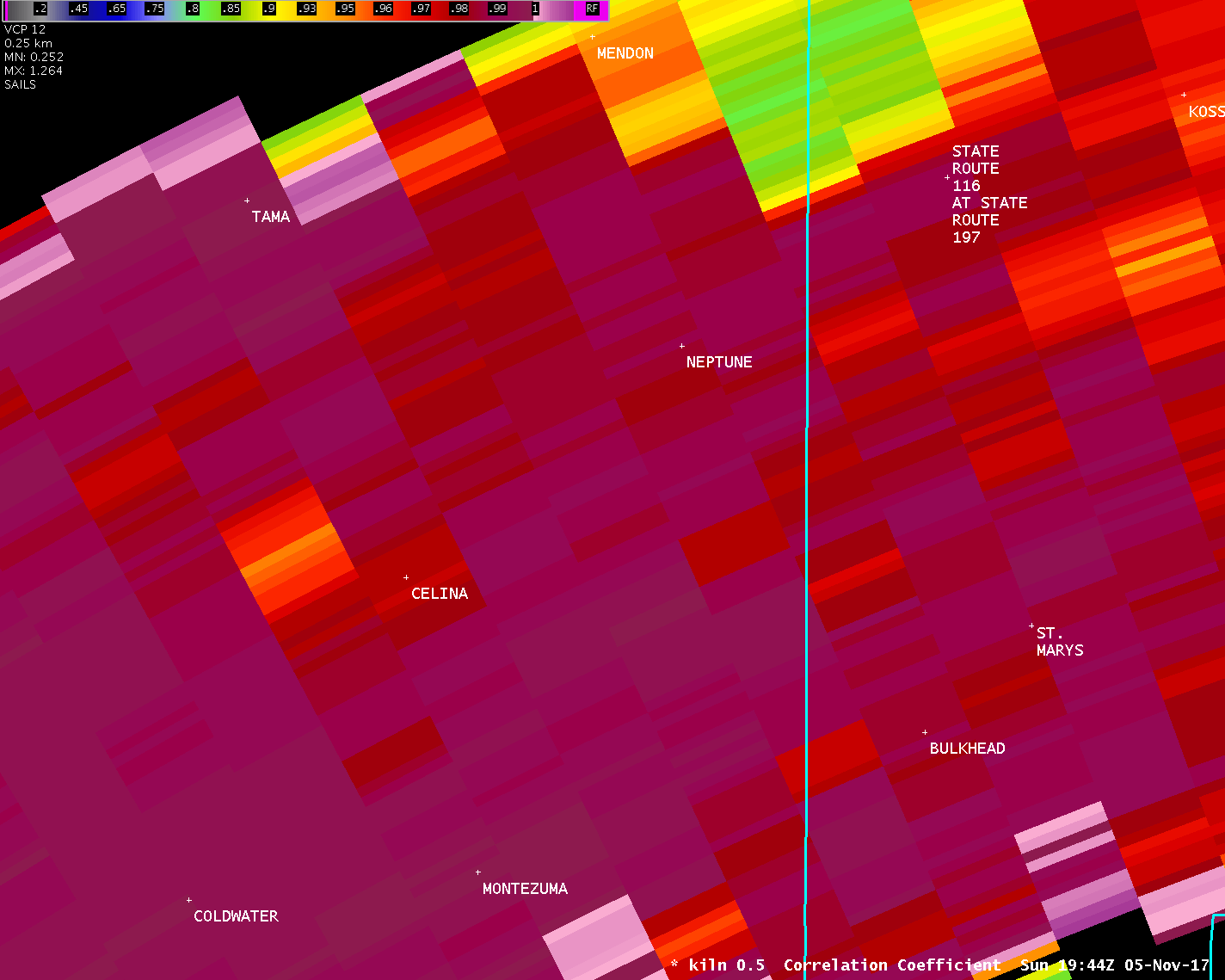
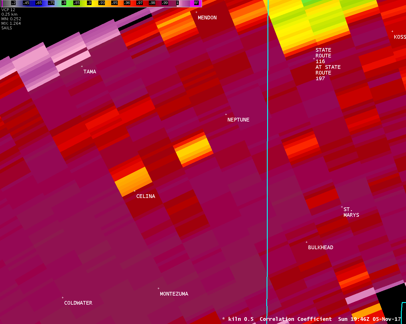
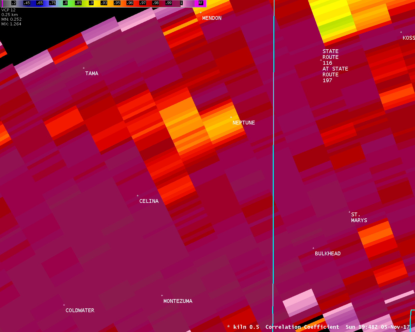
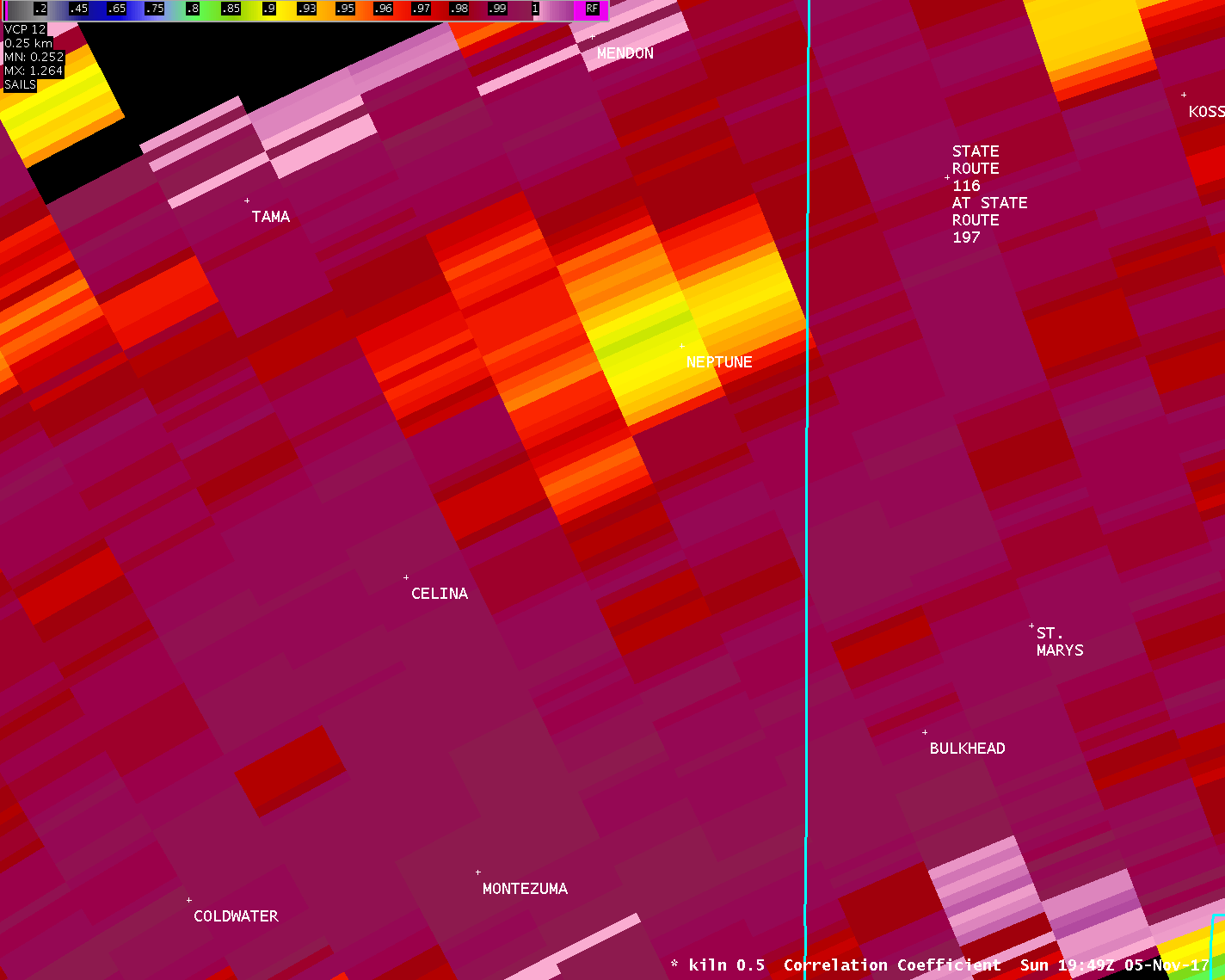
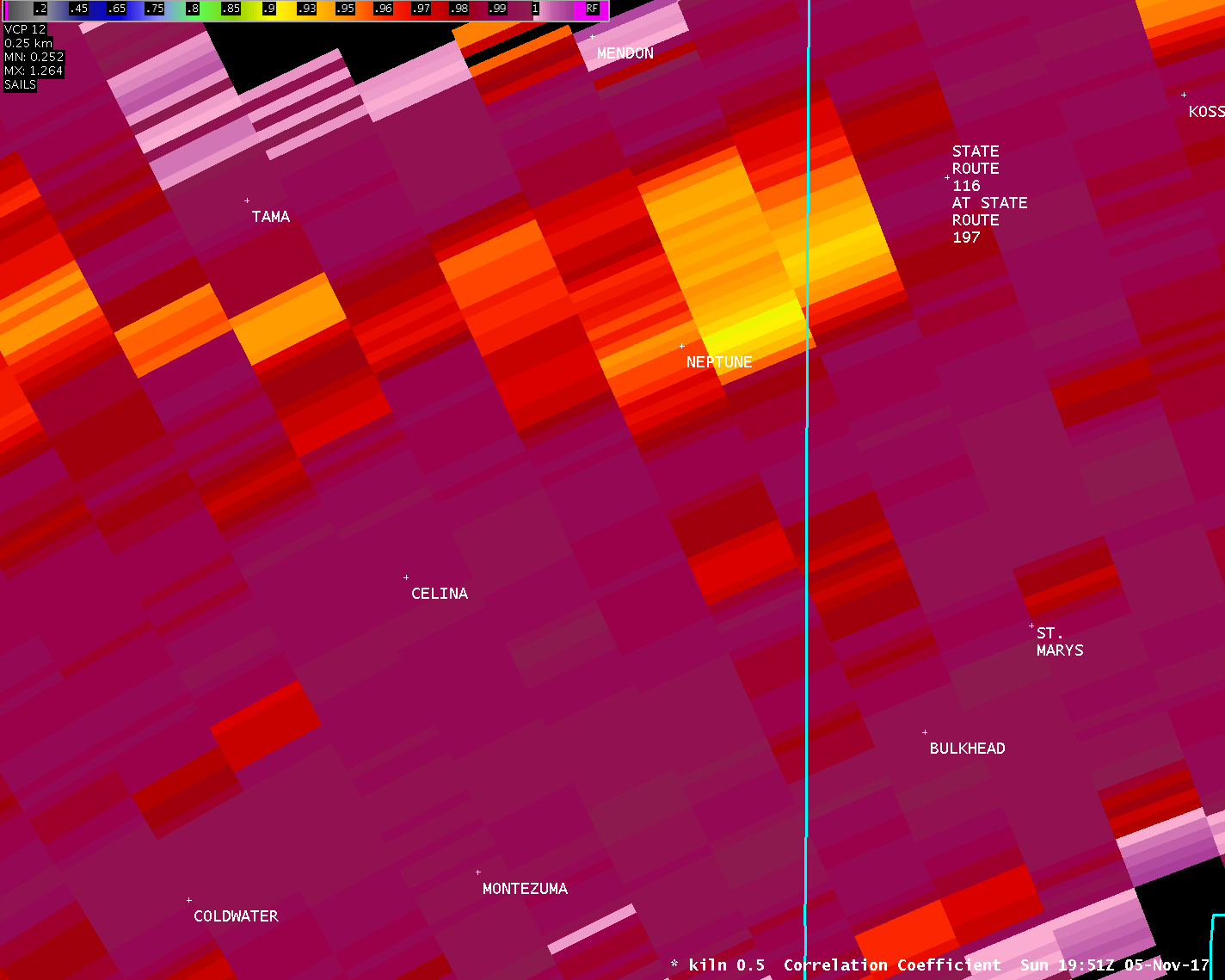
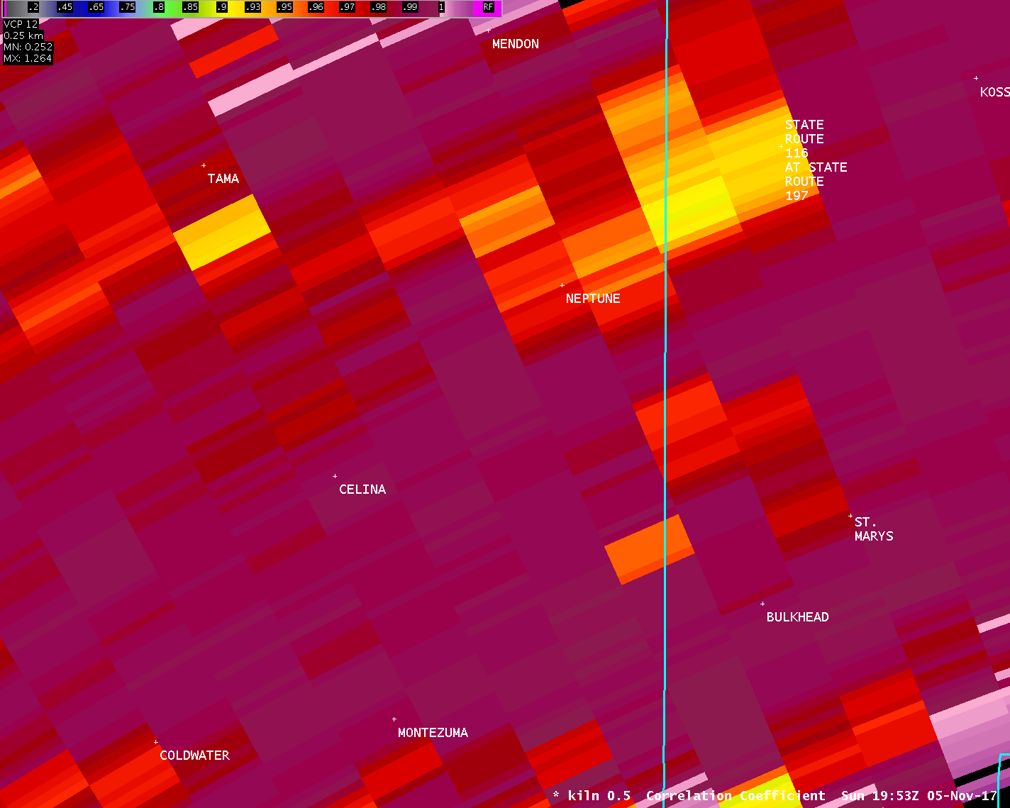
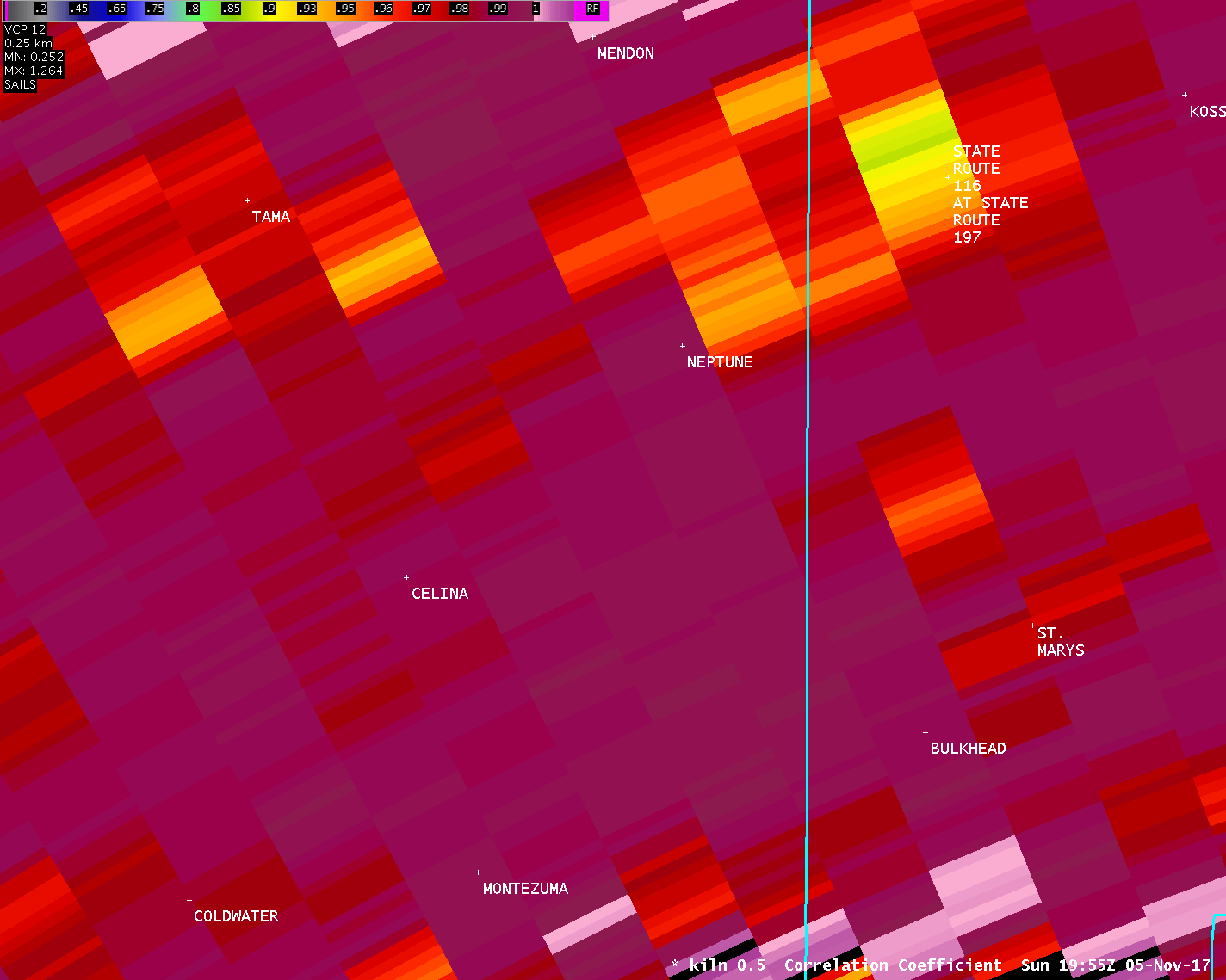
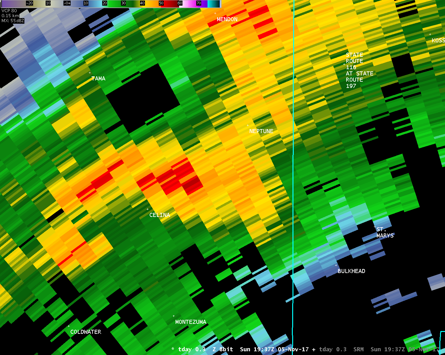
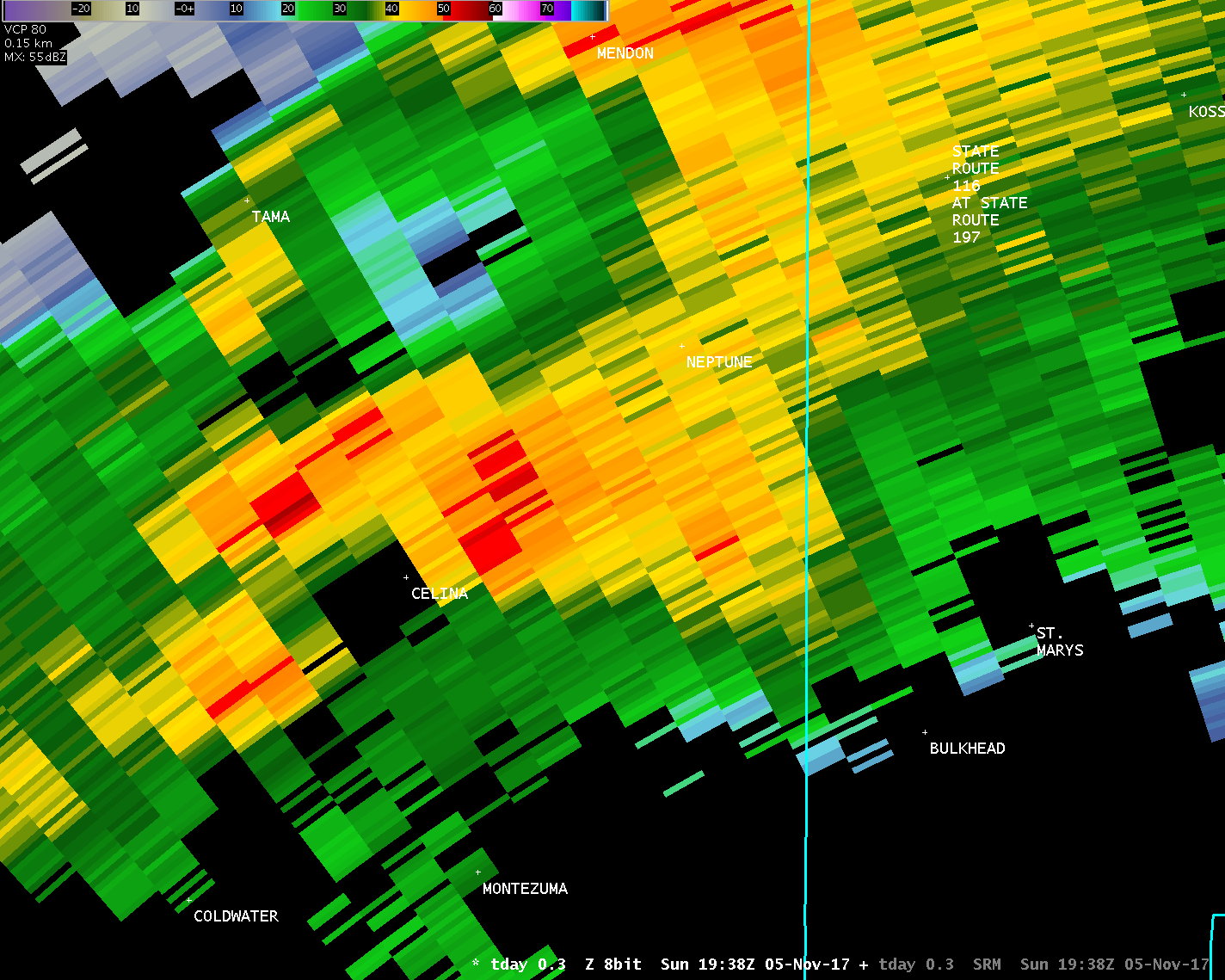
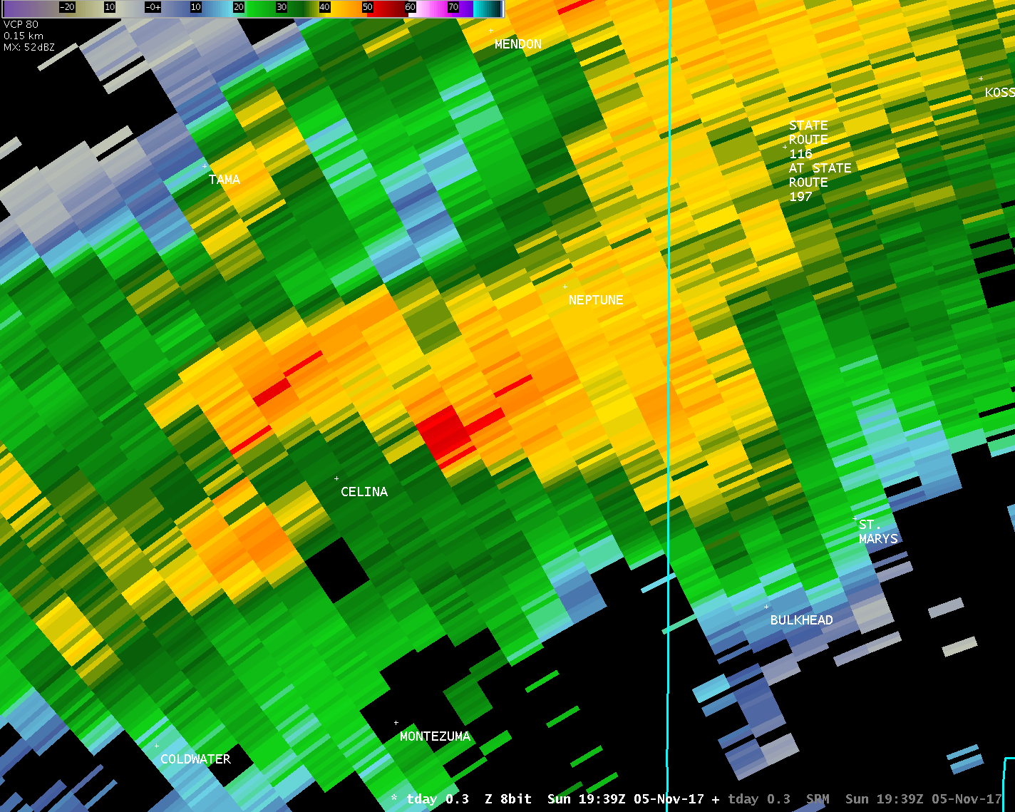
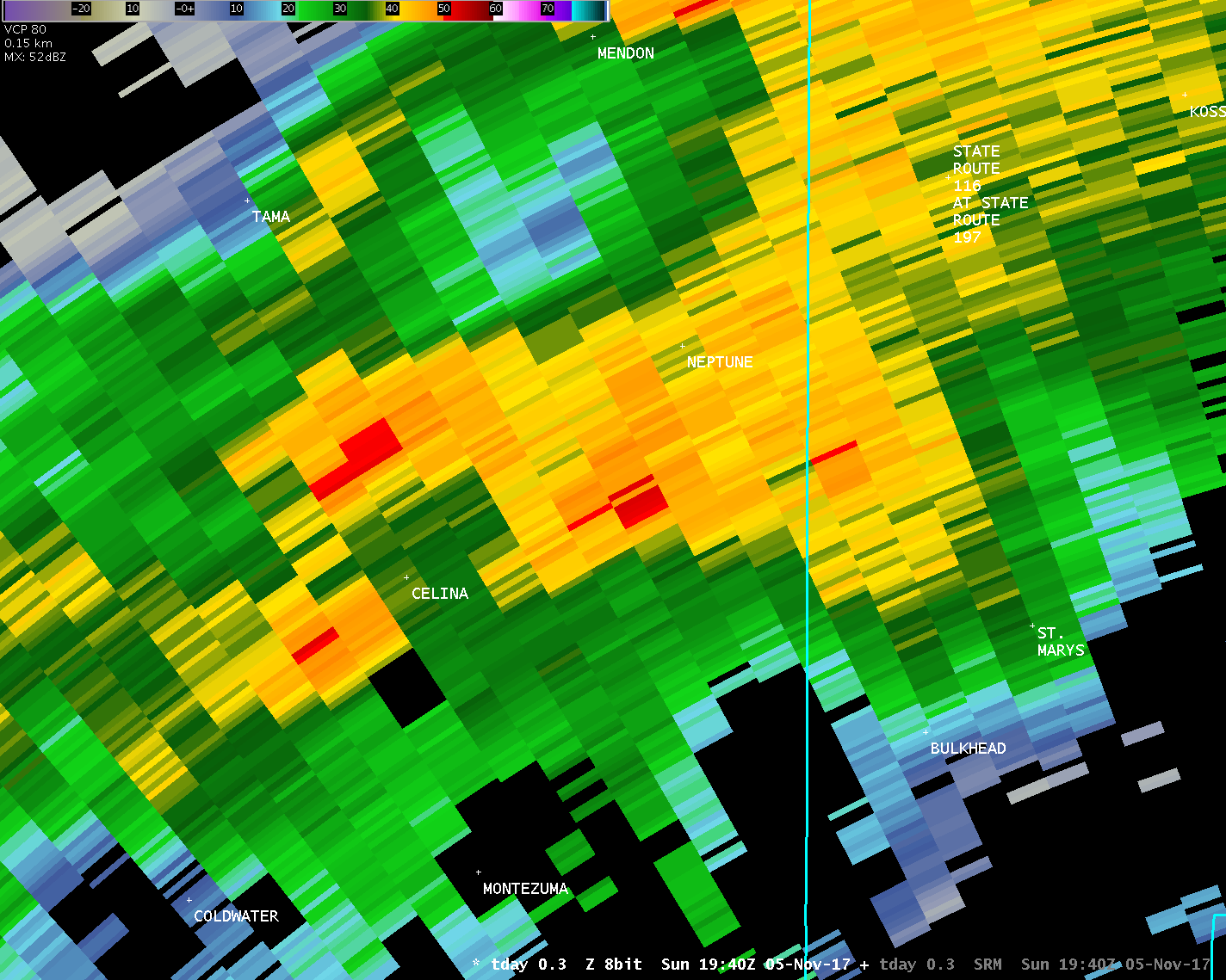
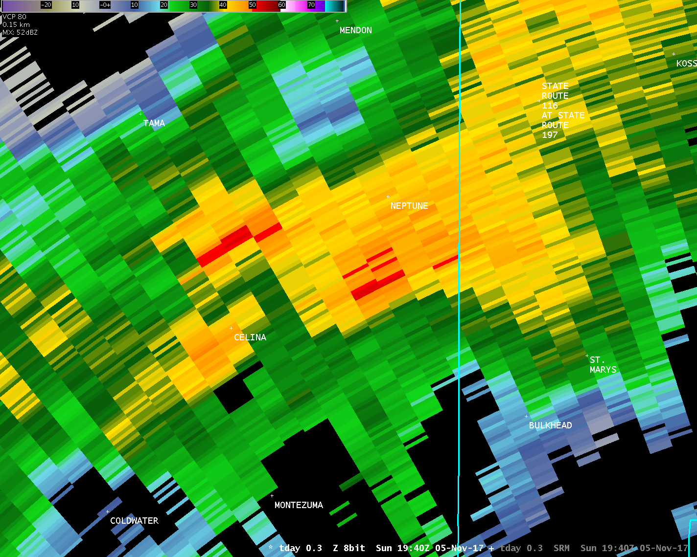
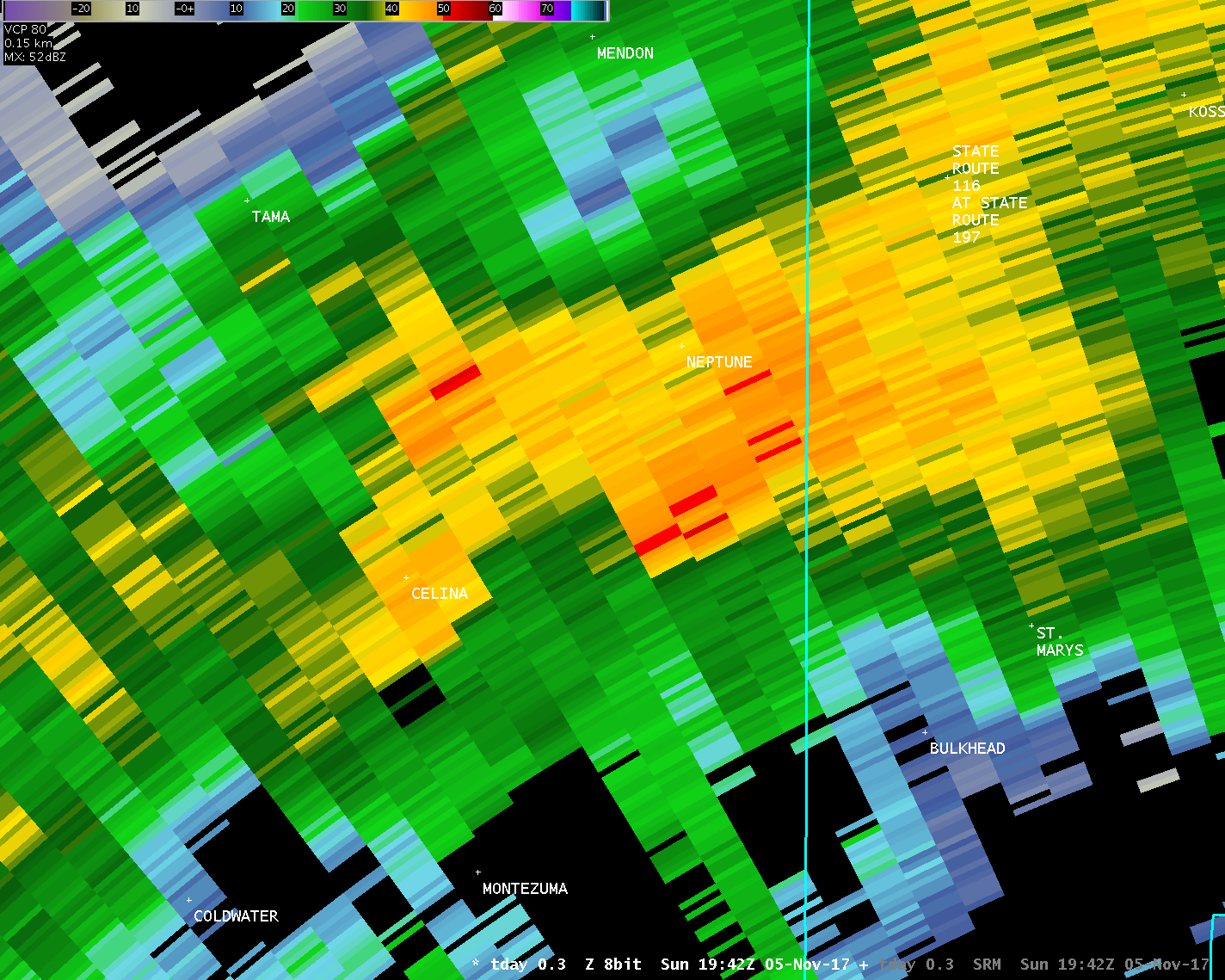
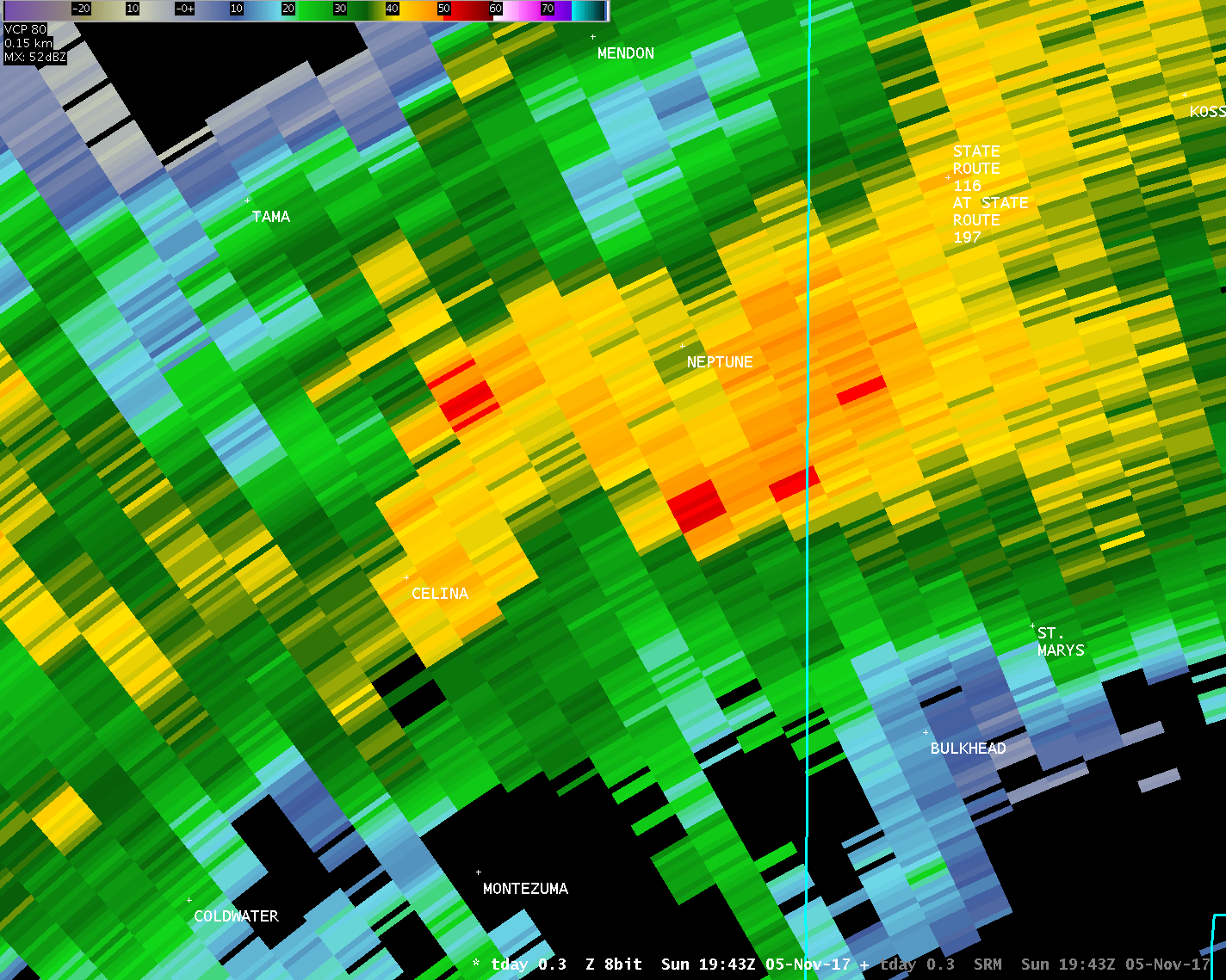
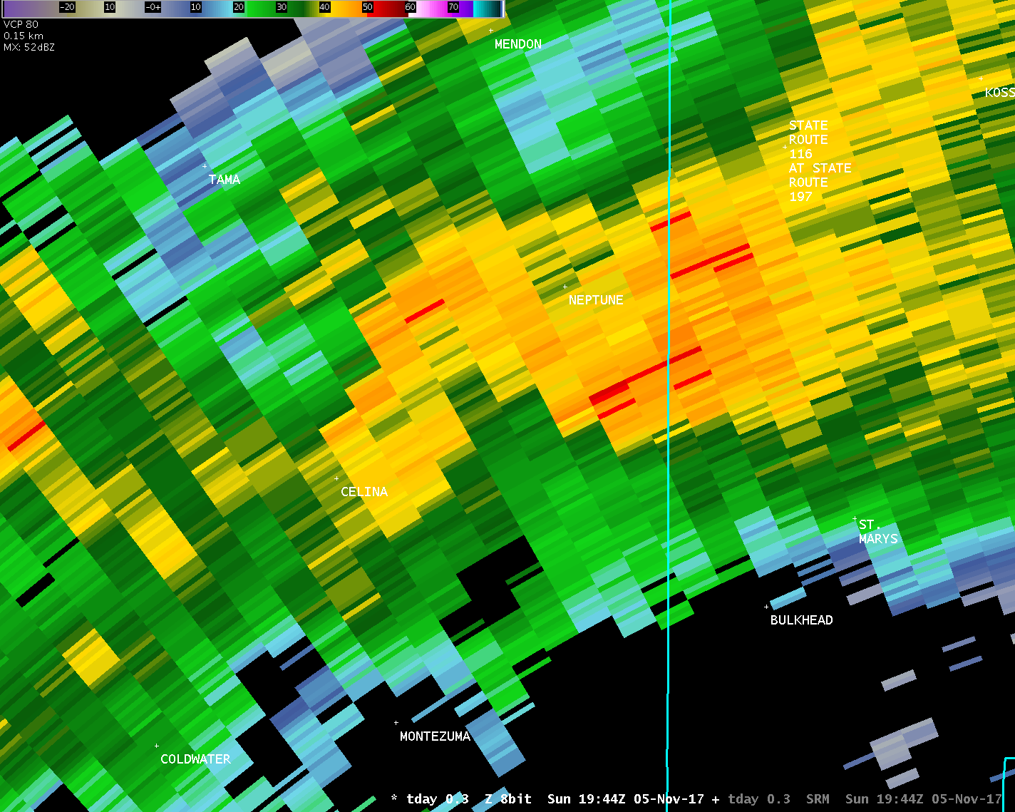
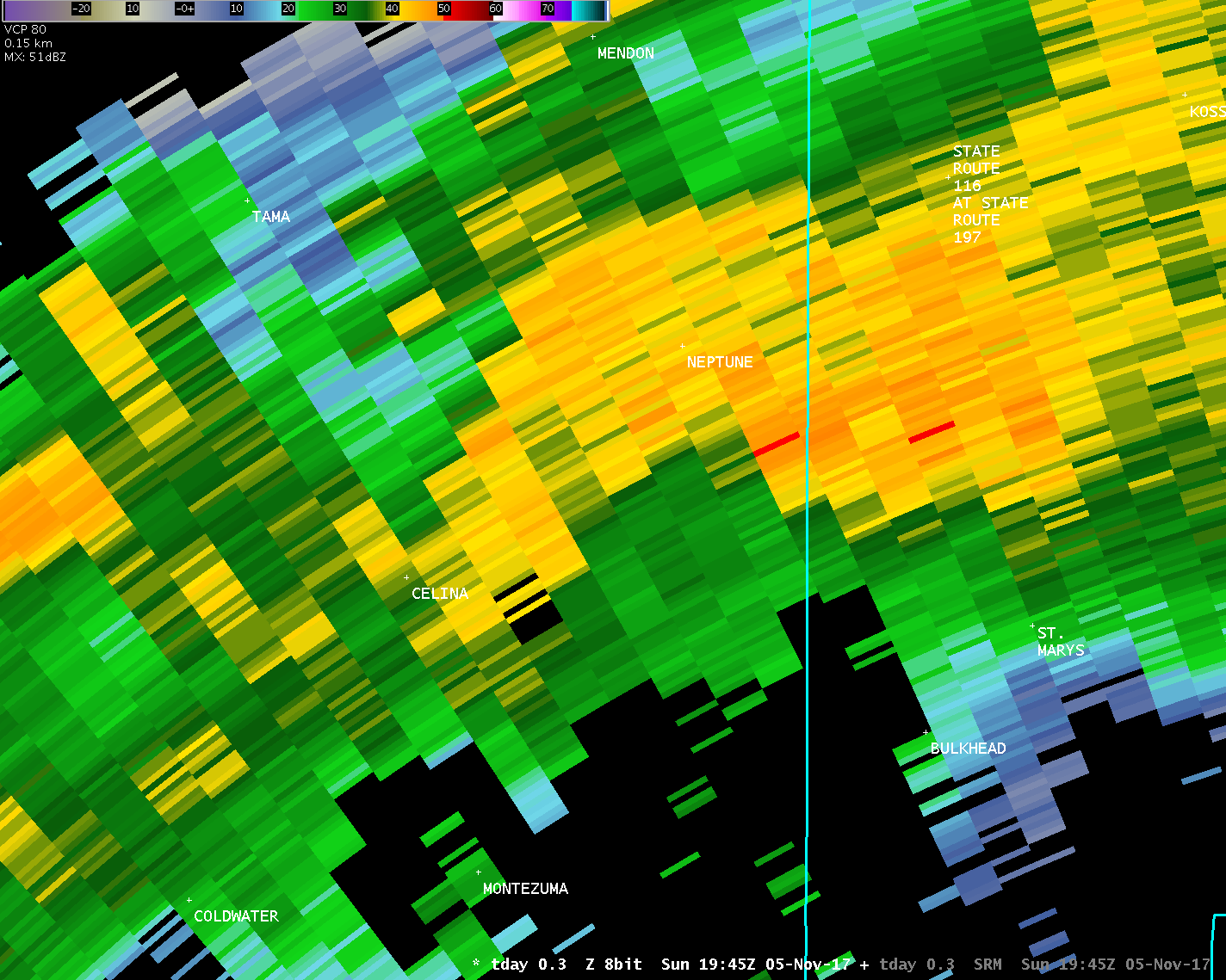
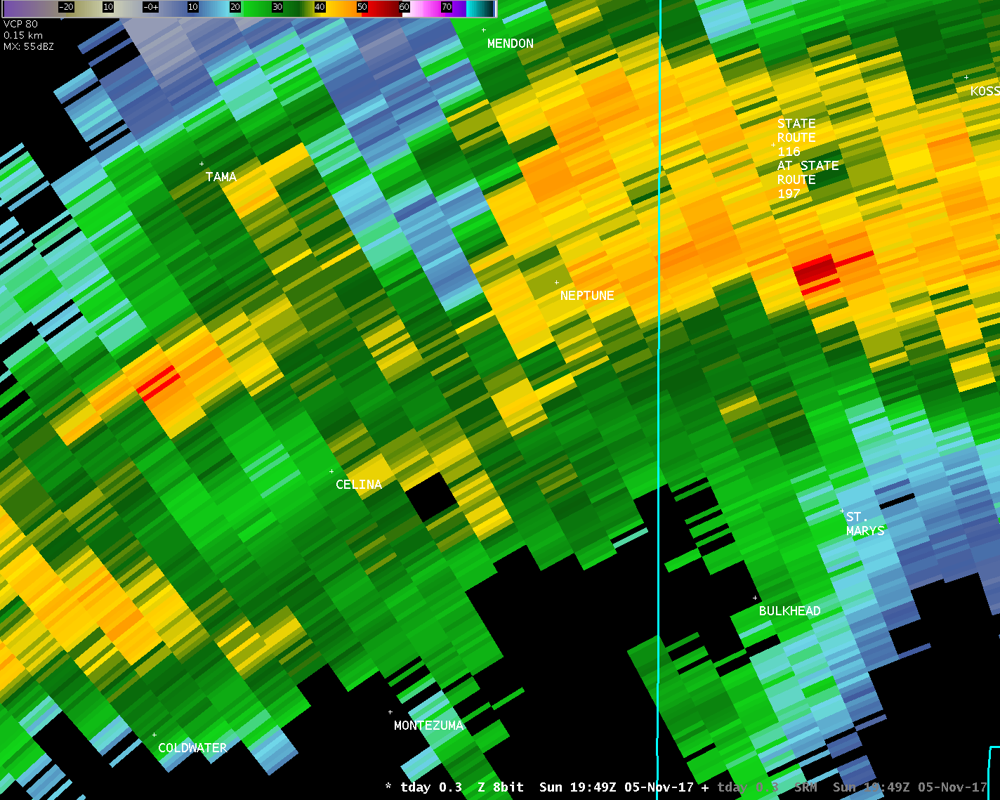
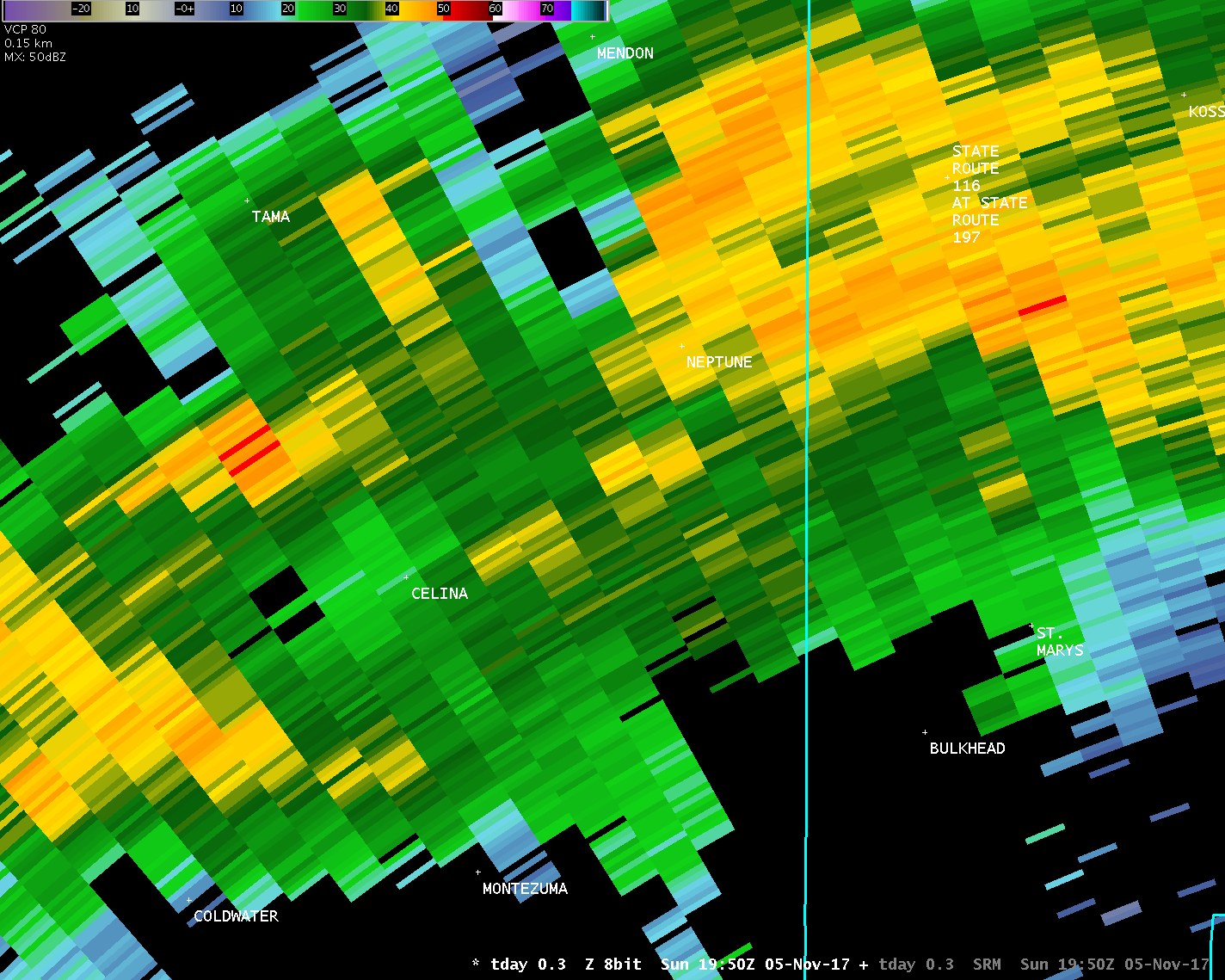
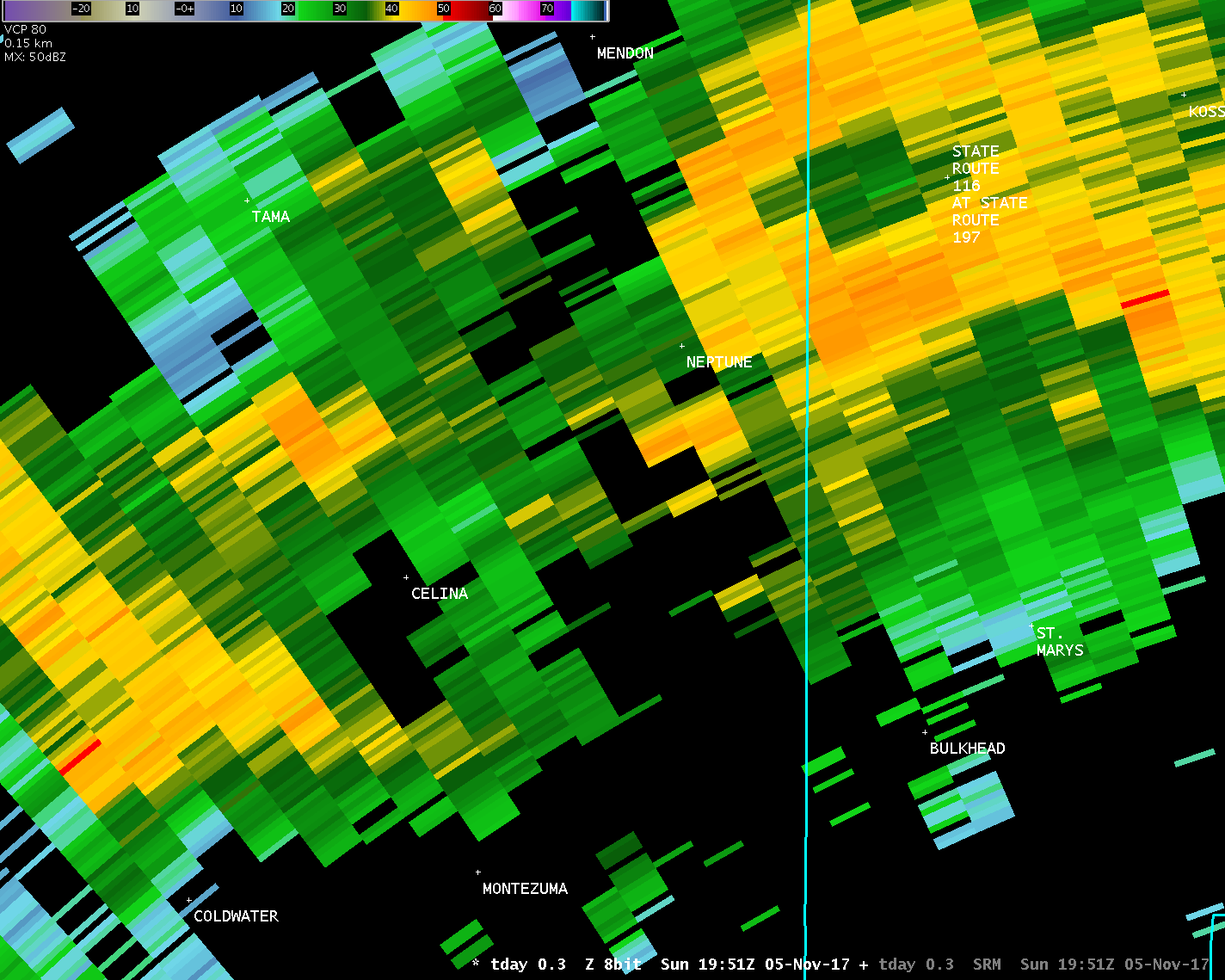
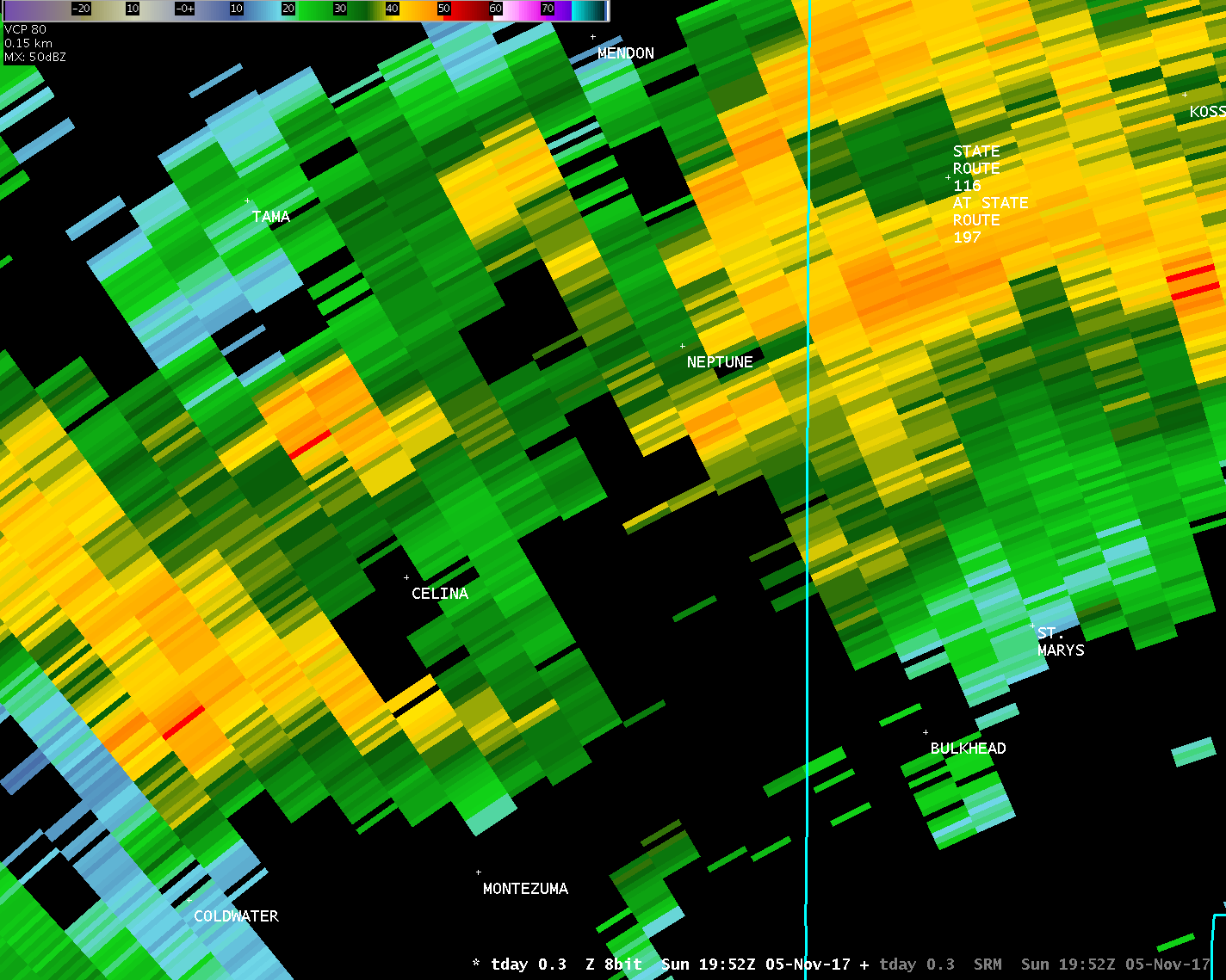
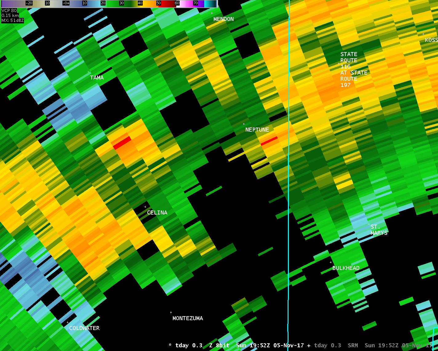
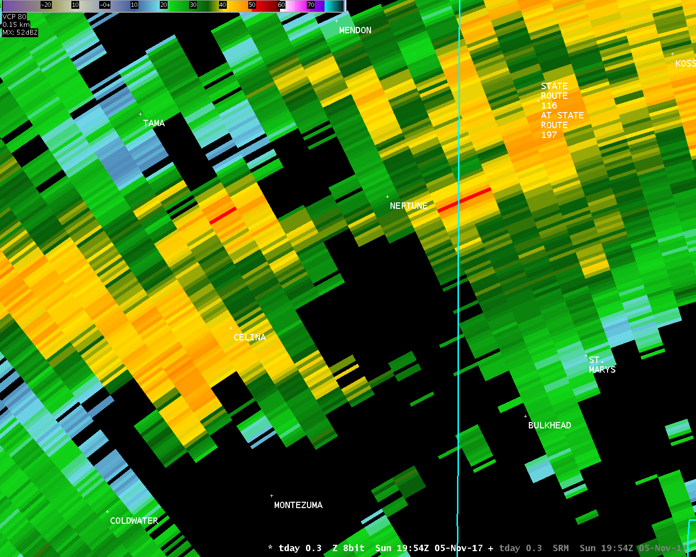
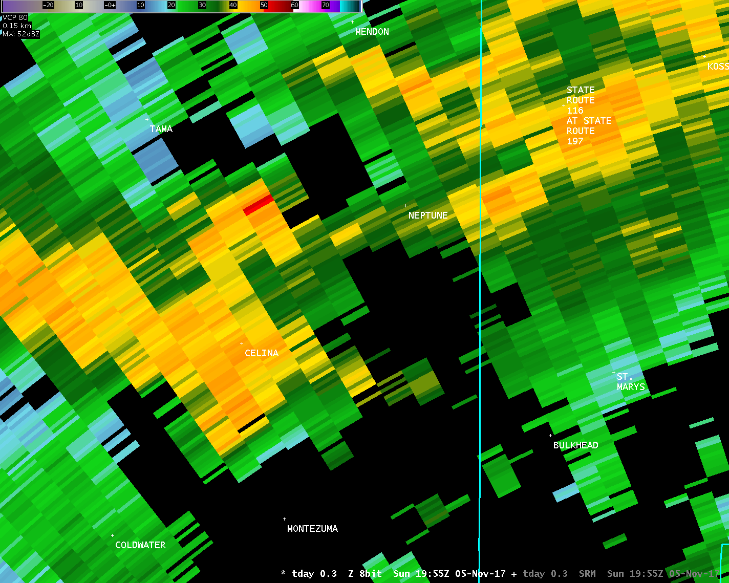
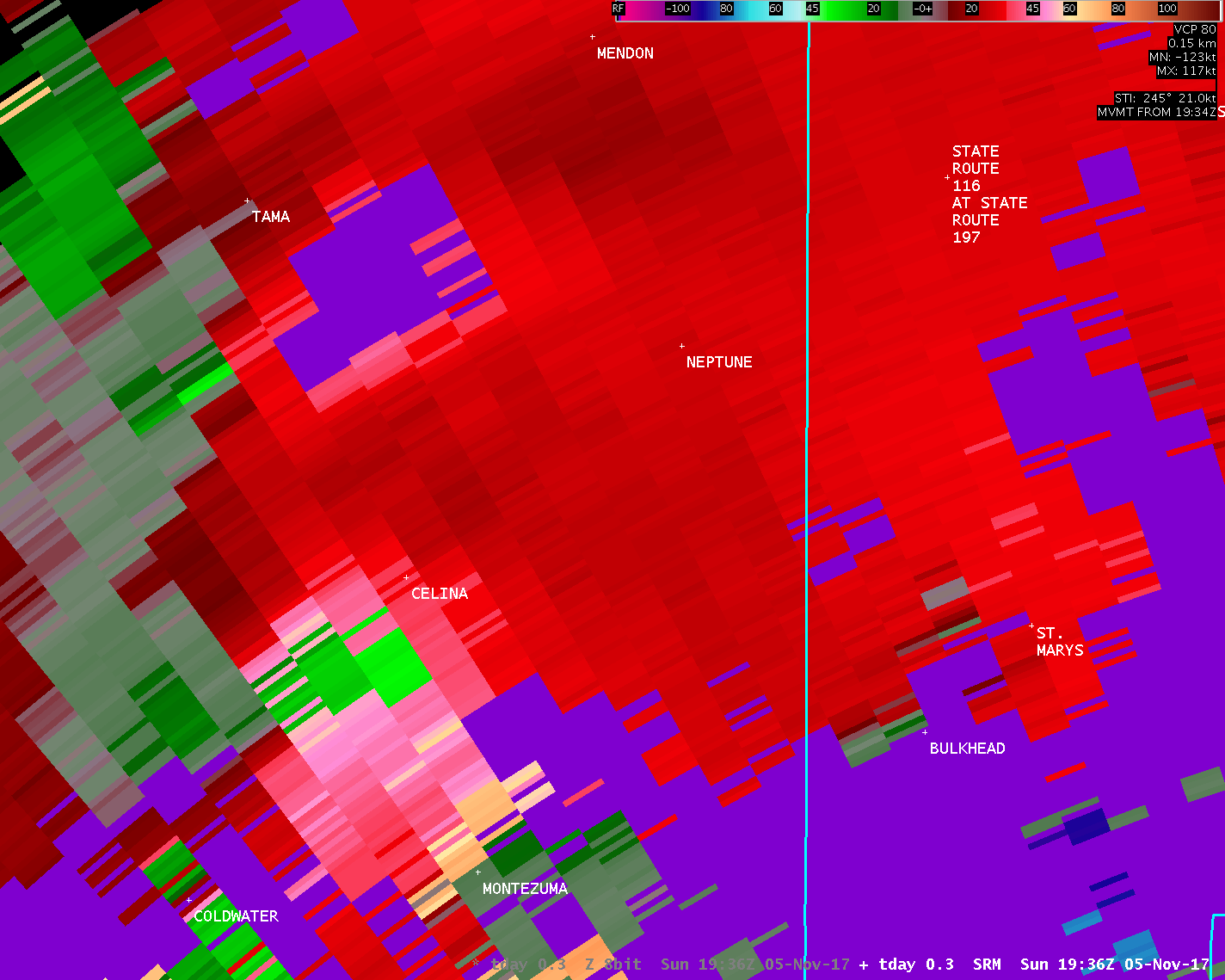
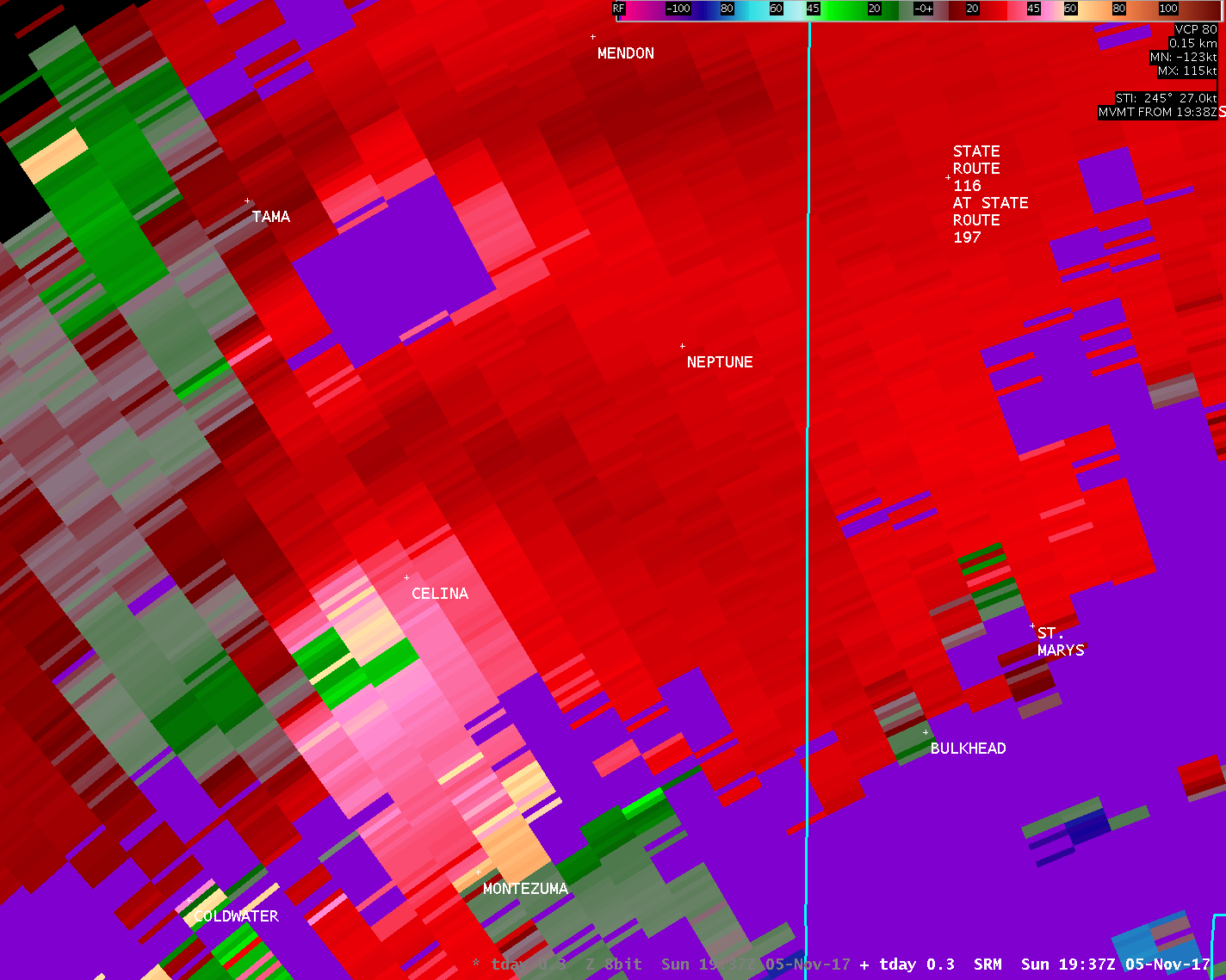
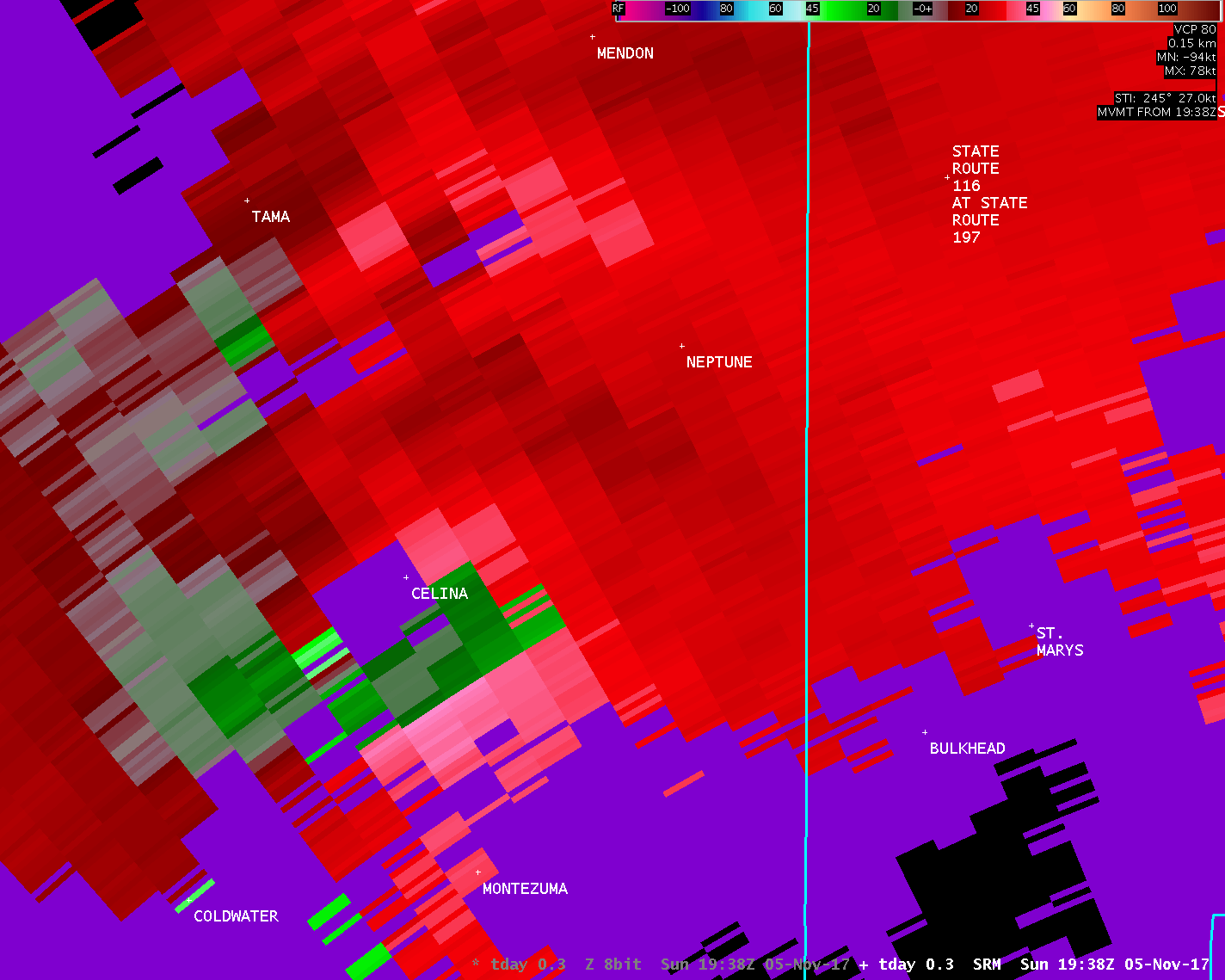
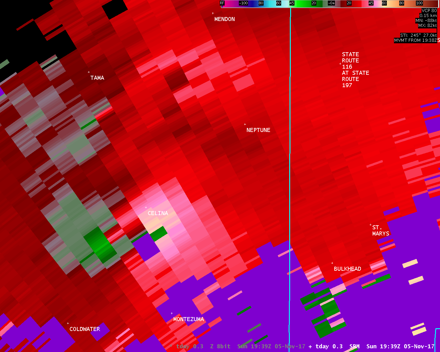
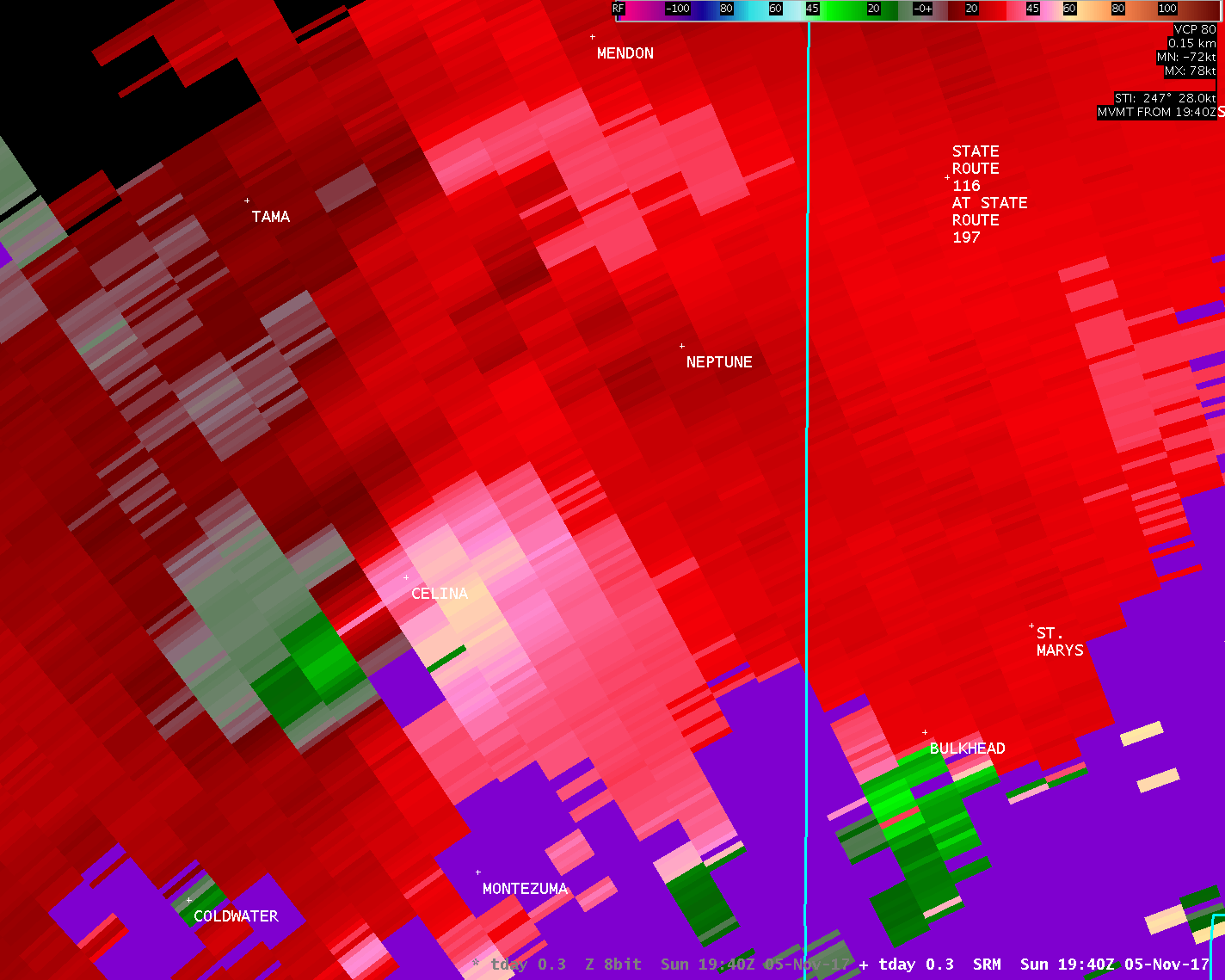
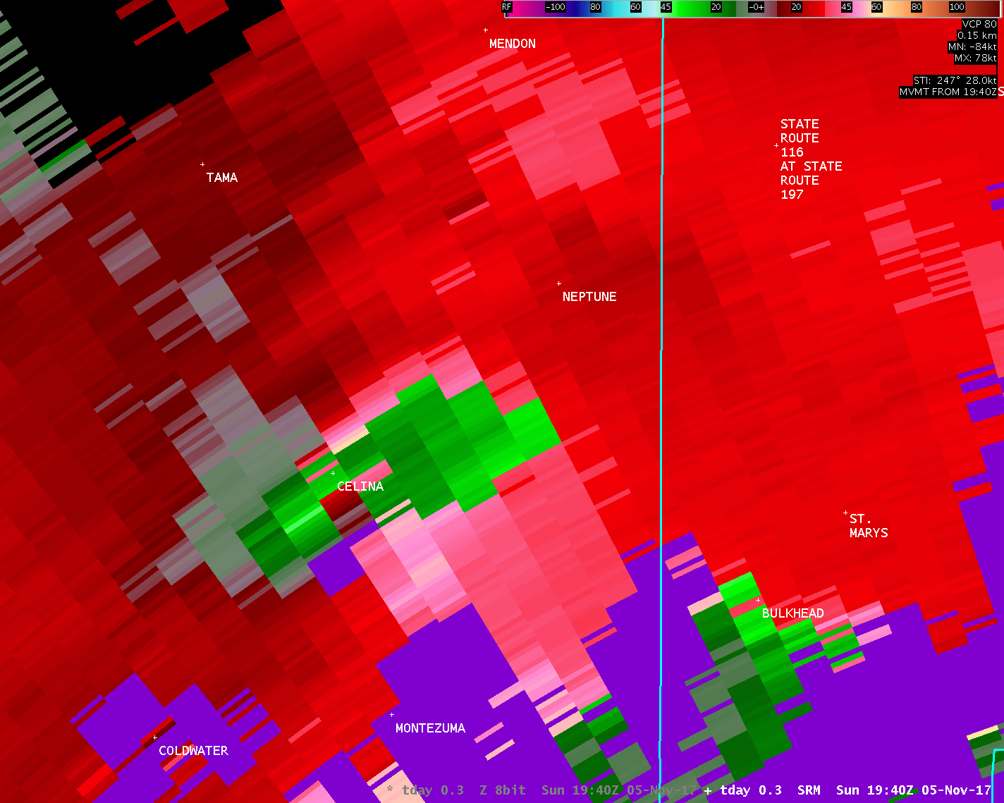
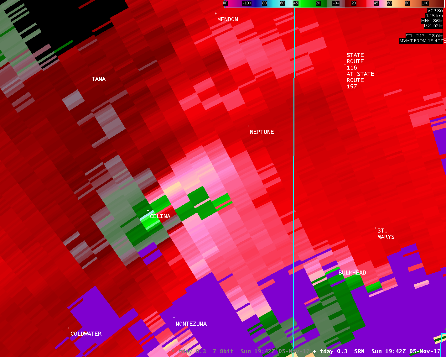
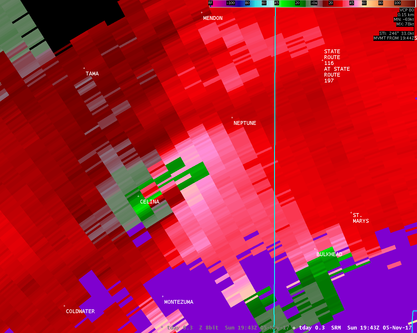
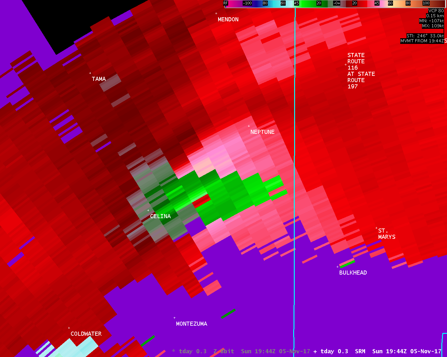
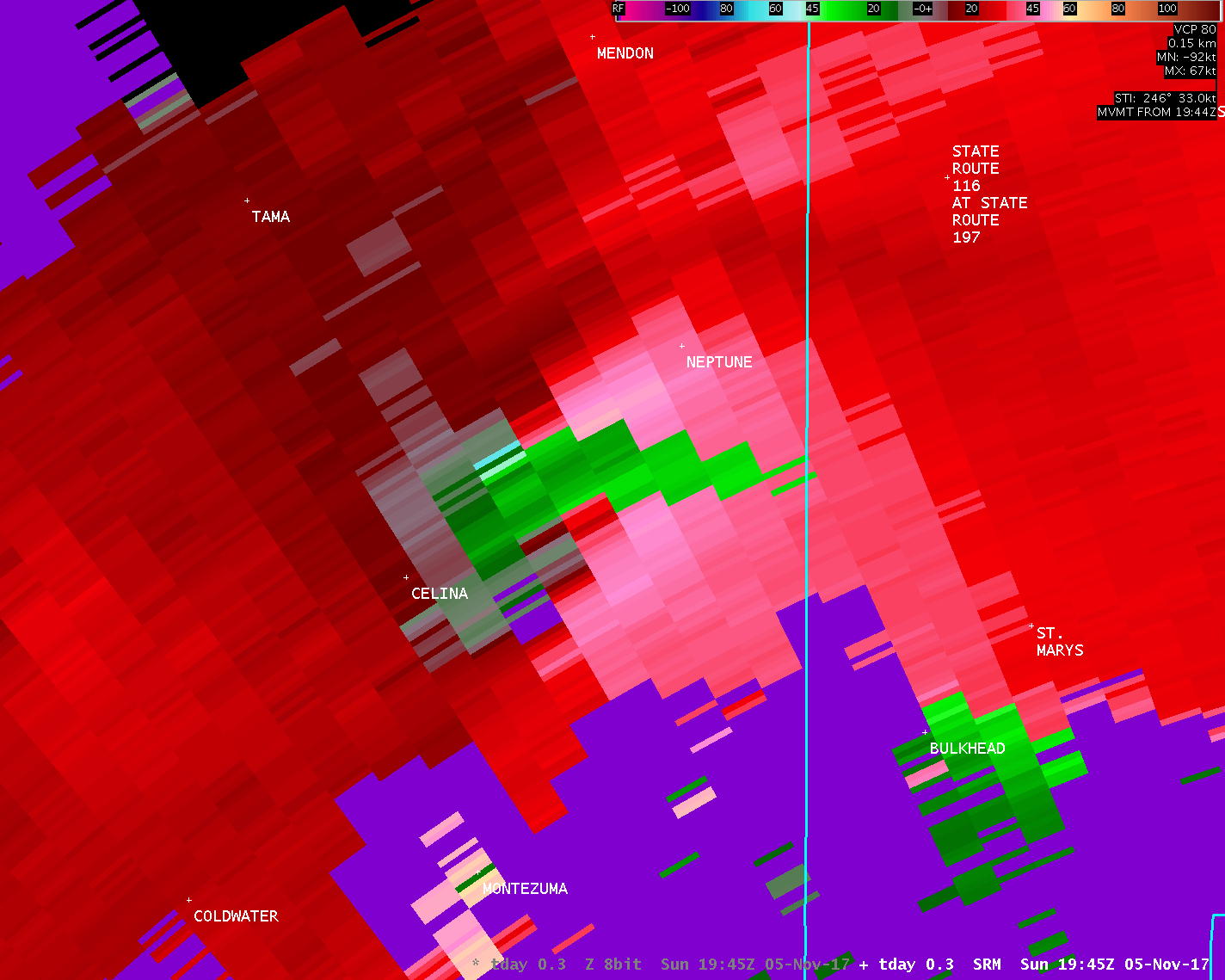
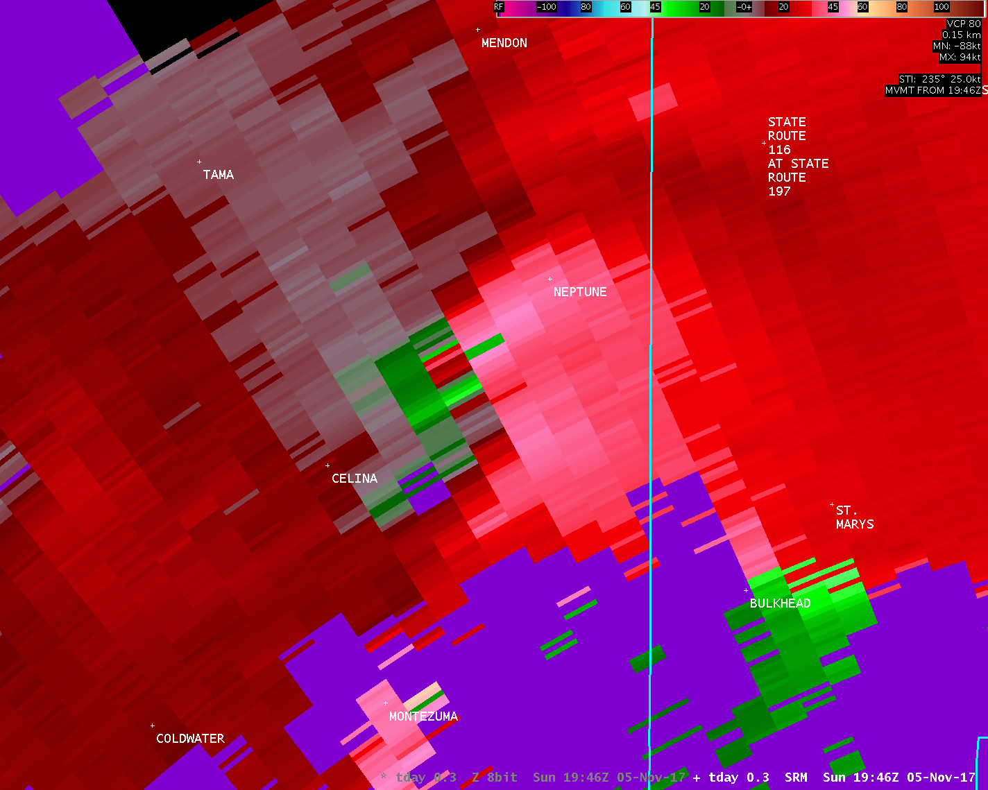
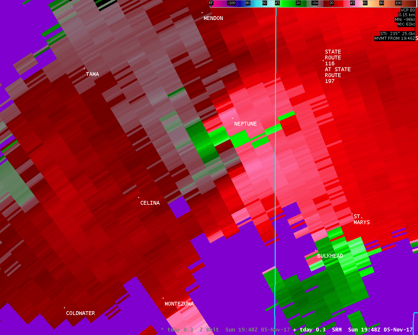
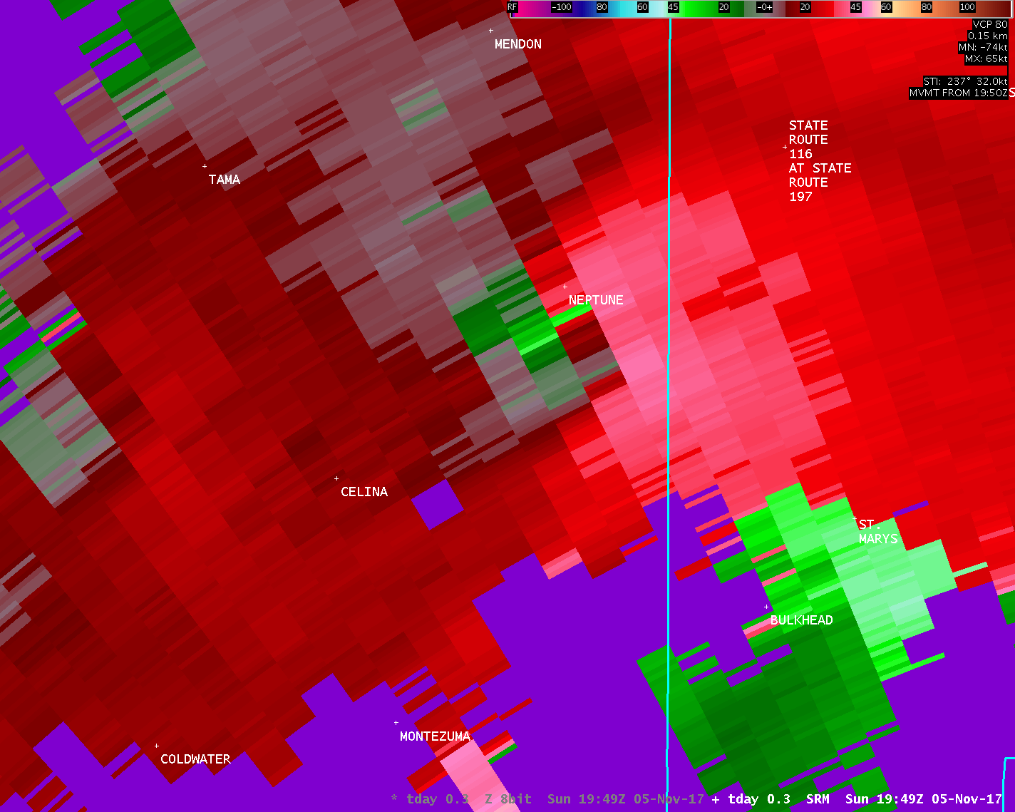
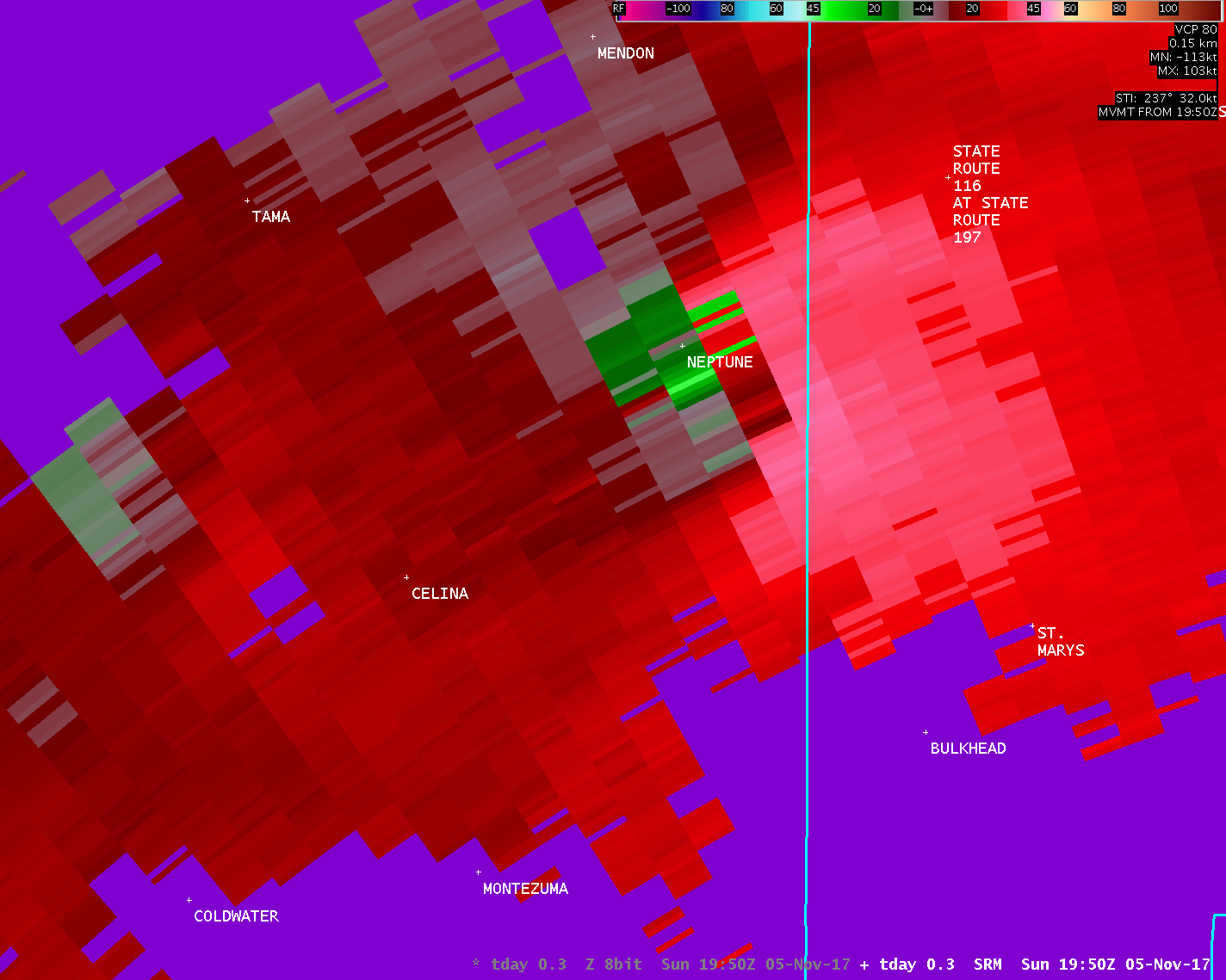
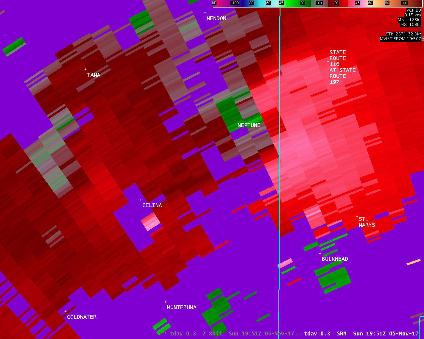
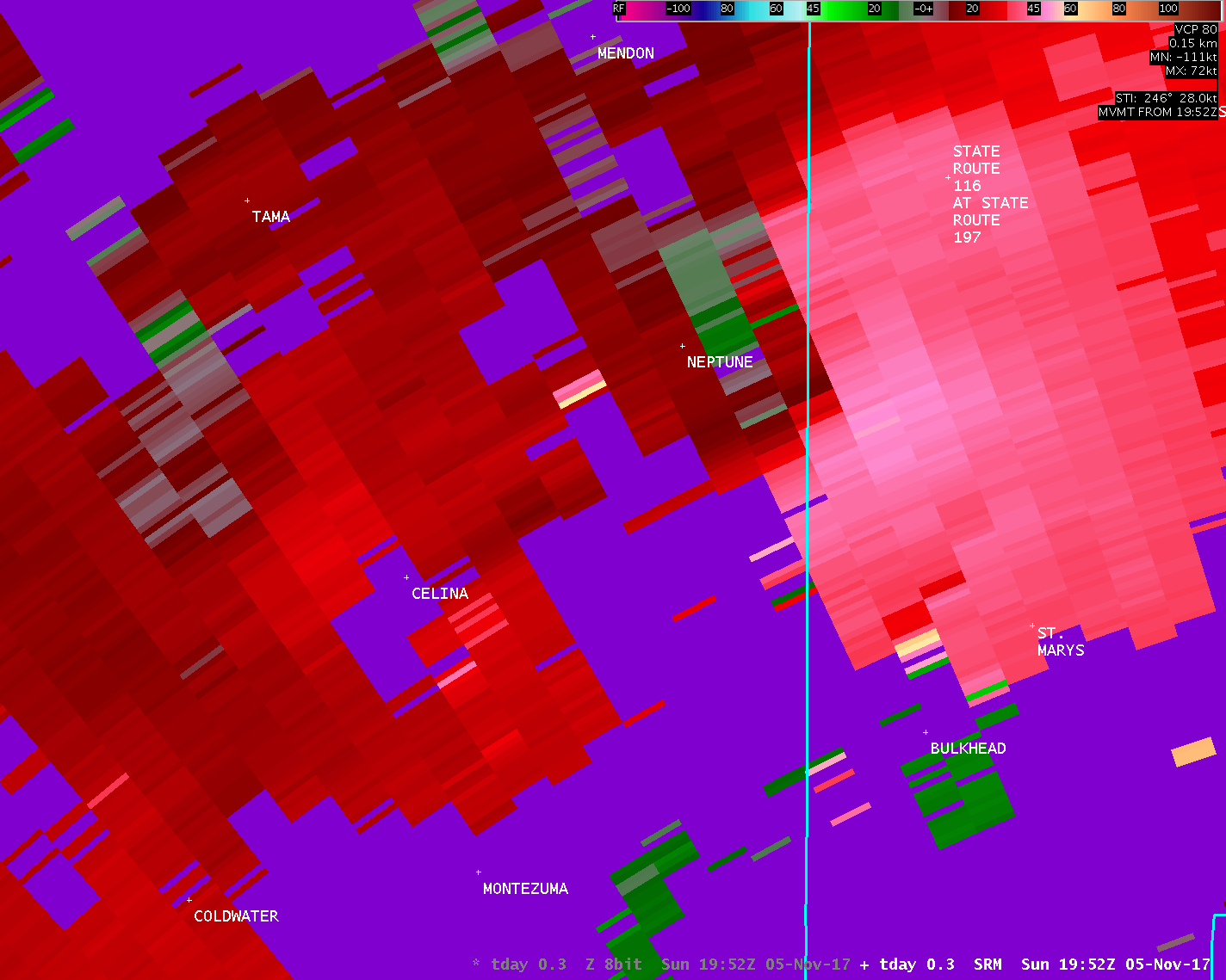
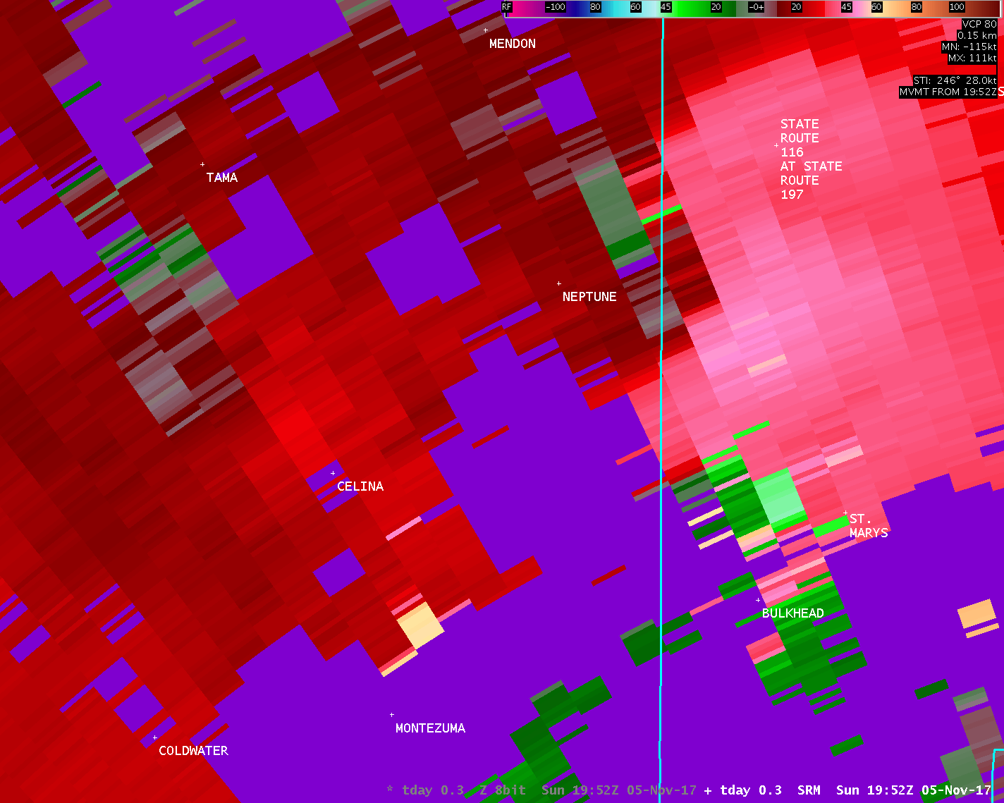
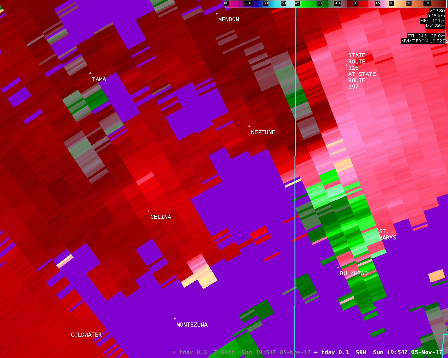
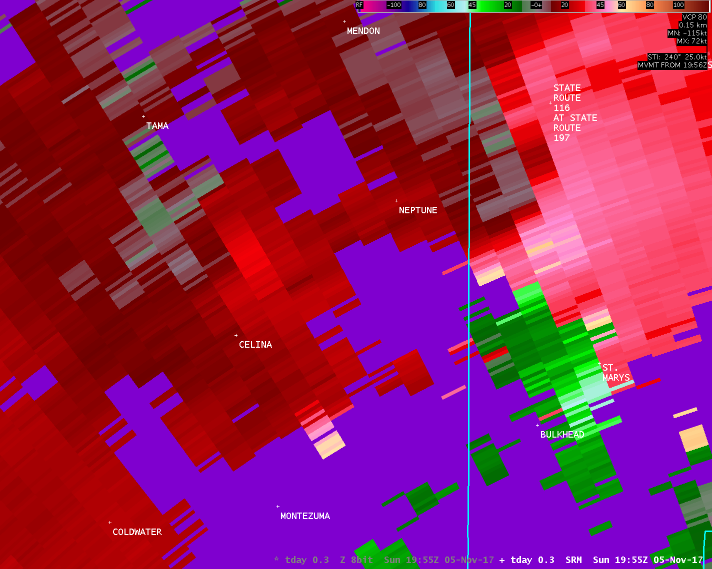
...TORNADO CONFIRMED NEAR CELINA IN MERCER COUNTY OHIO...
Location...Celina in Mercer County Ohio
Date...11/05/17
Estimated Time...240 PM EST TO 249 PM EST
Maximum EF-Scale Rating...EF2
Estimated Maximum Wind Speed...120 mph
Maximum Path Width...200 yards
Path Length...5.3 miles
Beginning Lat/Lon...40.5408N / 84.5732W
Ending lat/Lon...40.5910N / 84.4940W
* Fatalities...0
* Injuries...8
* The information in this statement is preliminary and subject to
change pending final review of the event(s) and publication in
NWS Storm Data.
...Summary...
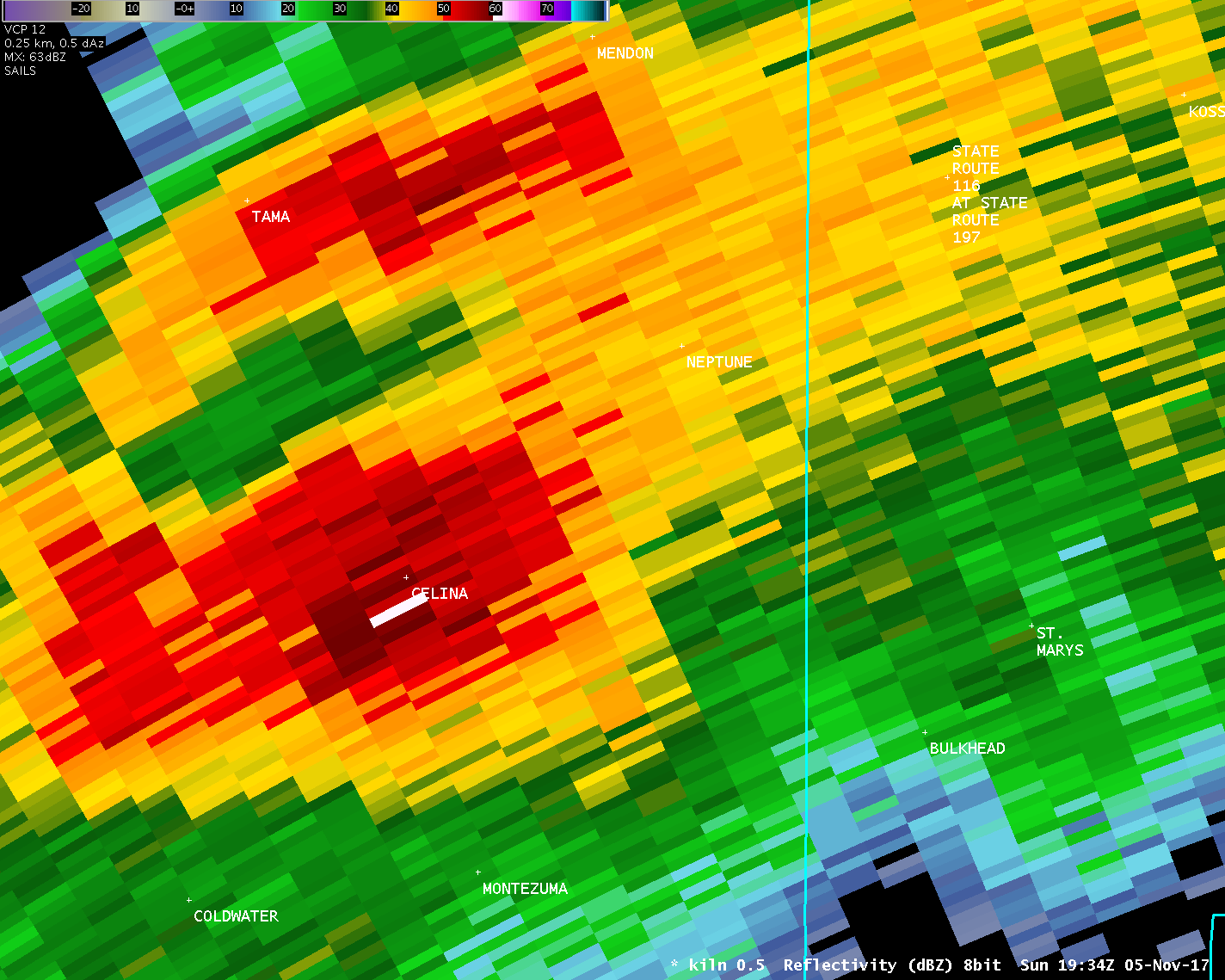
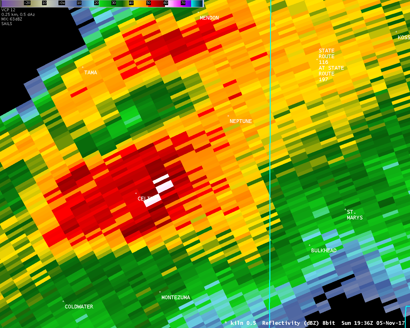
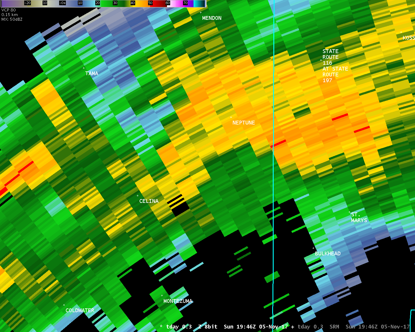
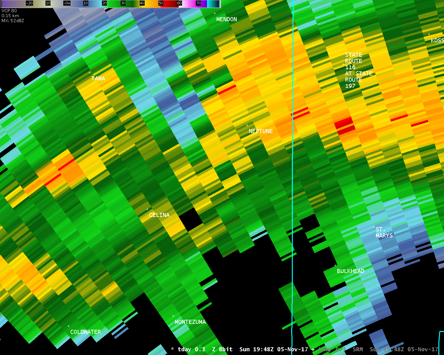
The National Weather Service in Wilmington OH has confirmed a
tornado near Celina in Mercer County Ohio on Sunday afternoon,
November 5, 2017.
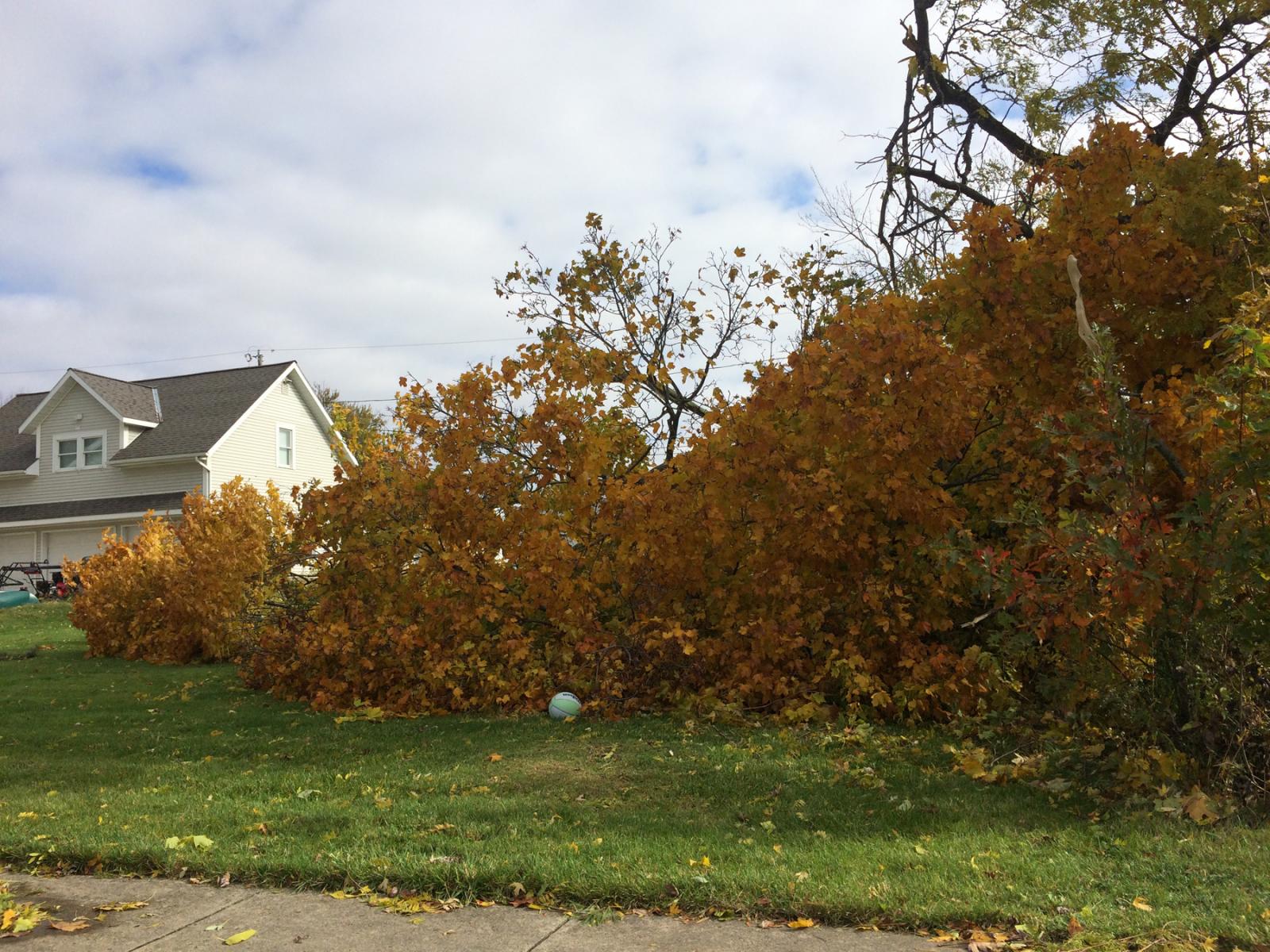
Law enforcement observed a funnel cloud near the intersection of
Main Street and Schunk Road. Just to the northeast of this report
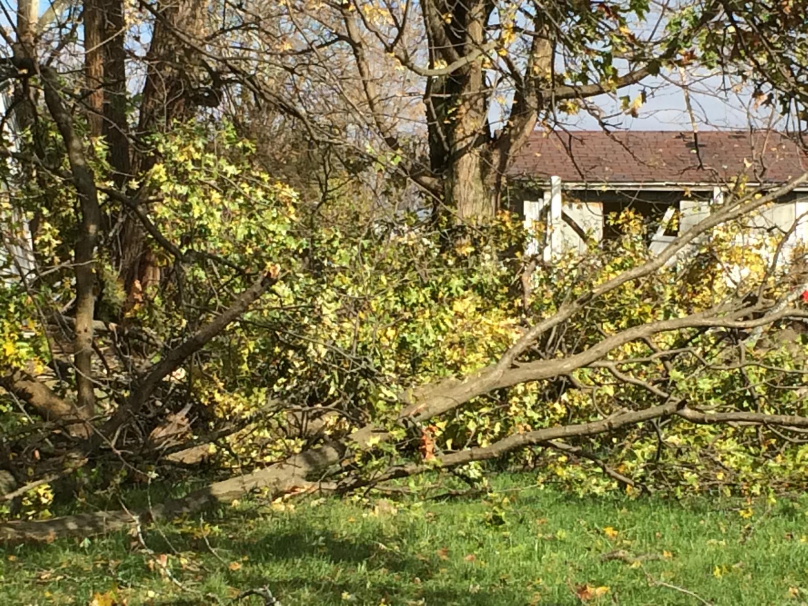
is where it appears the tornado first touched down, where
multiple tree limbs were knocked down between Main Street and W
Bank Road.
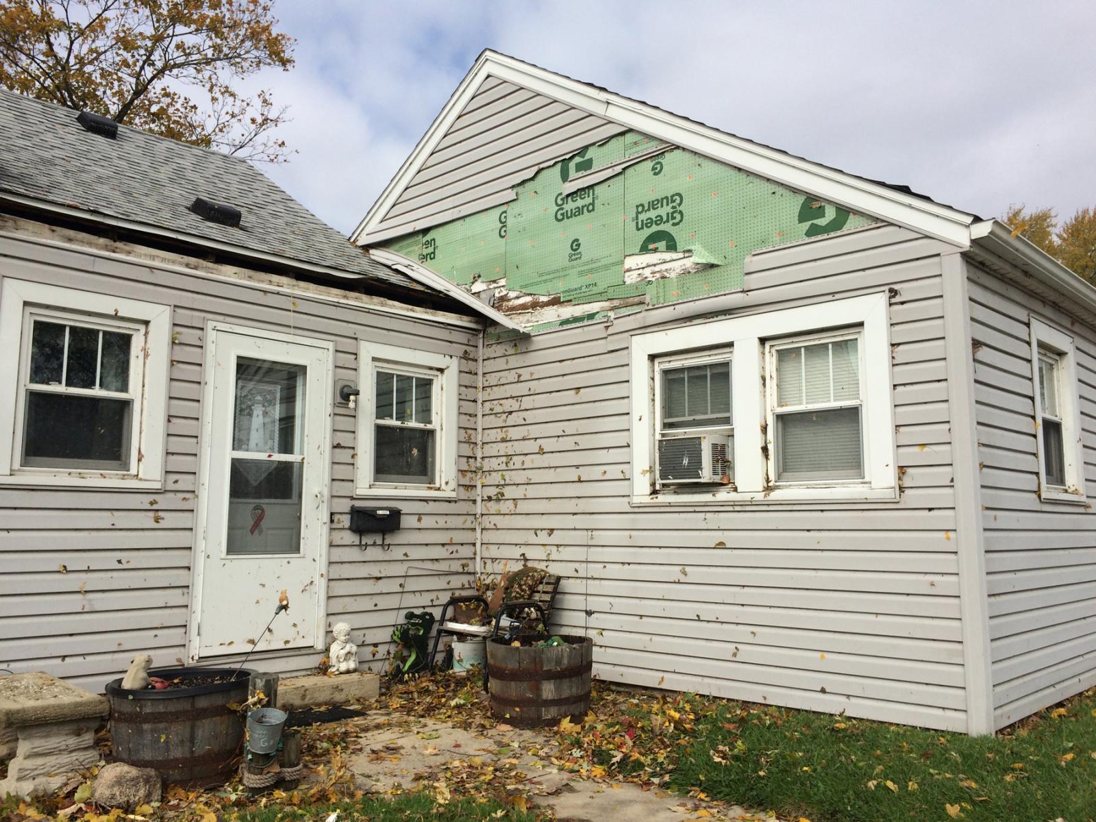
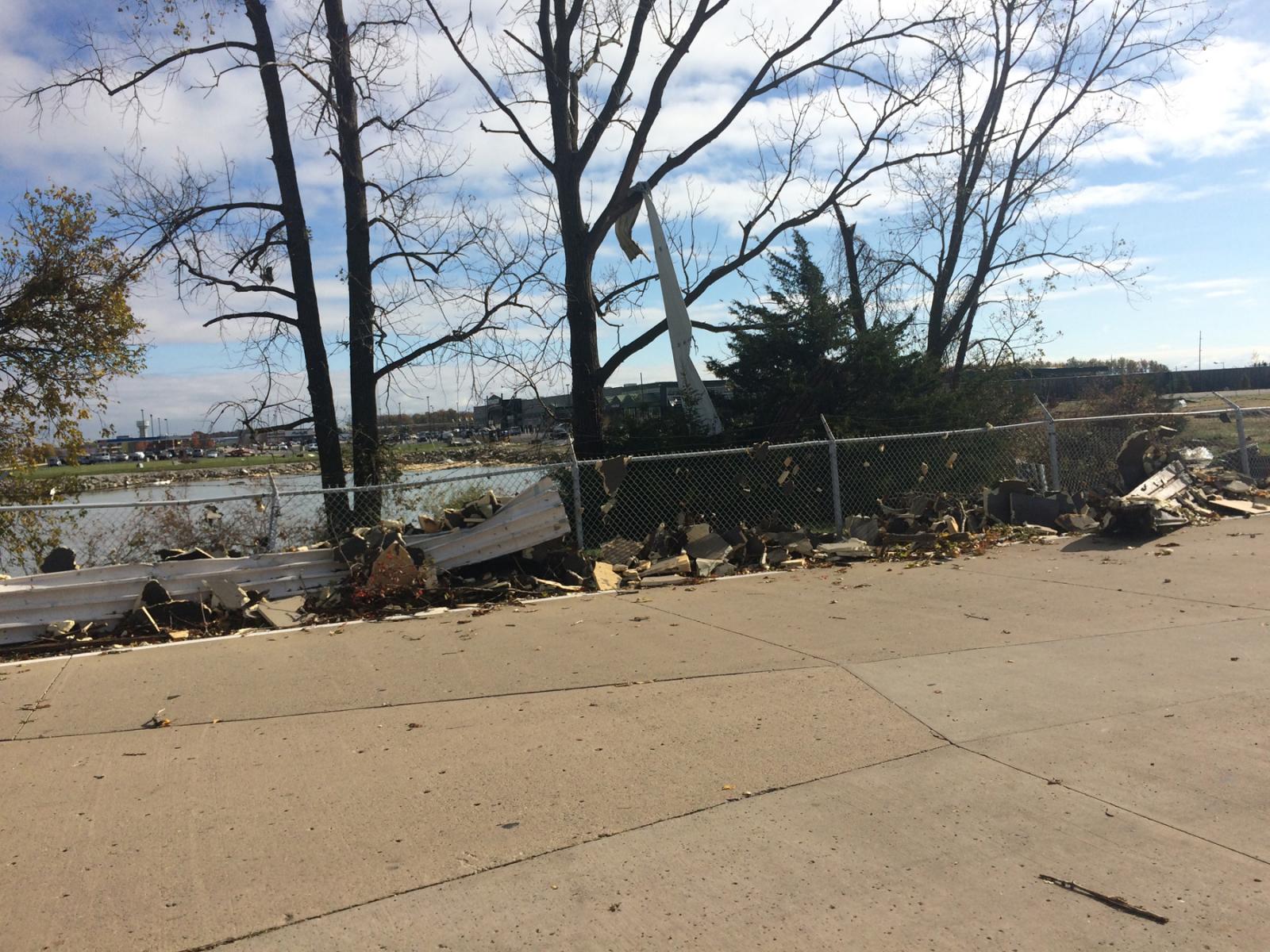
It is believed that the tornado then skirted Grand Lake St. Marys,
producing minor tree and structural damage near the corner of
Lake Shore Drive and Elmgrove Avenue. The tornado then likely
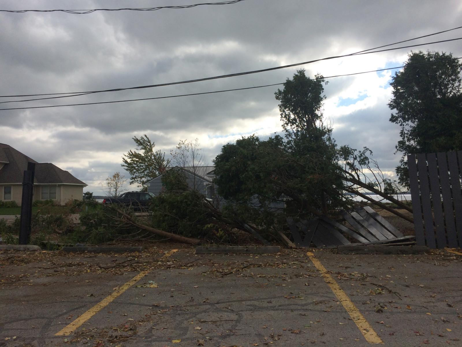
moved back over a small portion of Grand Lake St. Marys before
knocking down a fence and a few small trees at the back parking
lot of Wendy's on E Market Street. A one story home on Vine Street
also had shingles removed from about 10 percent of its roof.
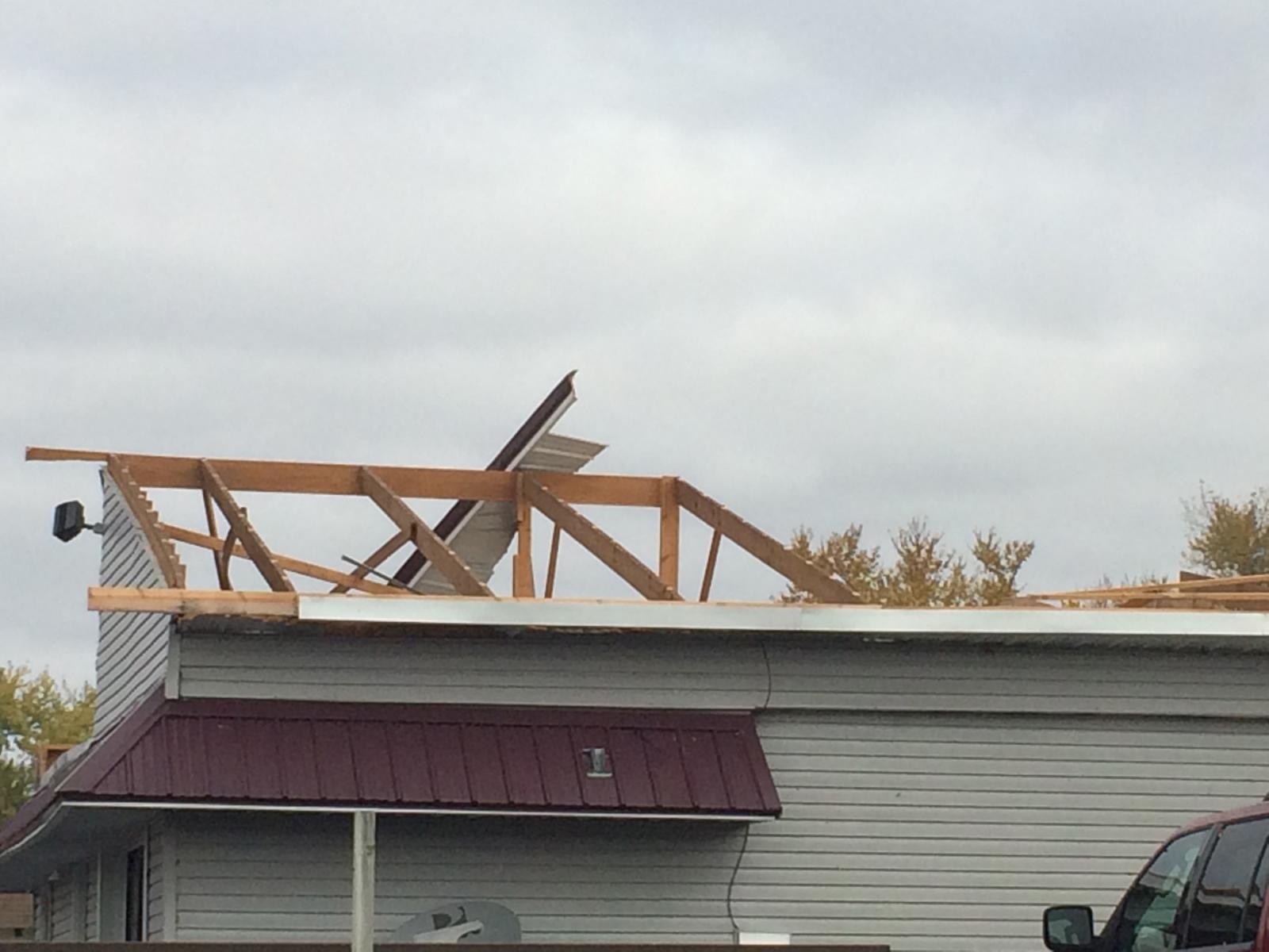
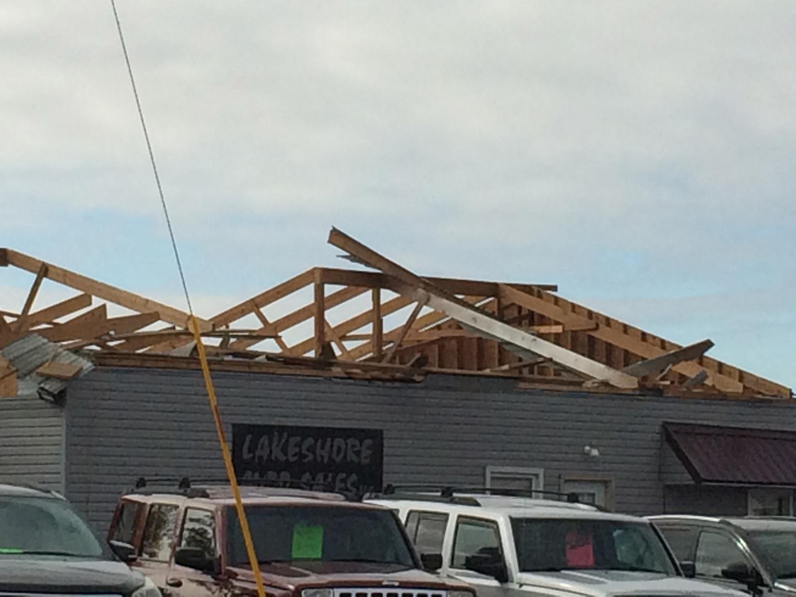
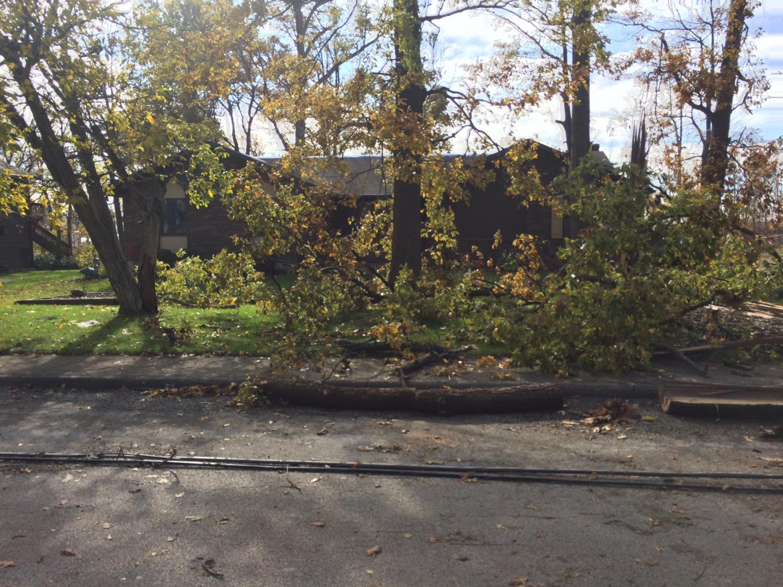
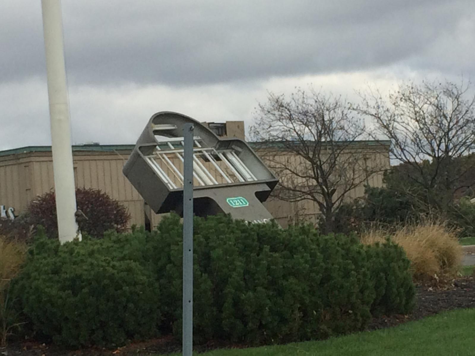
Further east on E Market Street, the tornado intensified as it
impacted Lakeshore Auto Sales. This business had its roof
completely destroyed. Along Lake Street, several large branches
were knocked down on one property, with significant debris
splatter on the east-facing side of a home along with some removal
of siding.
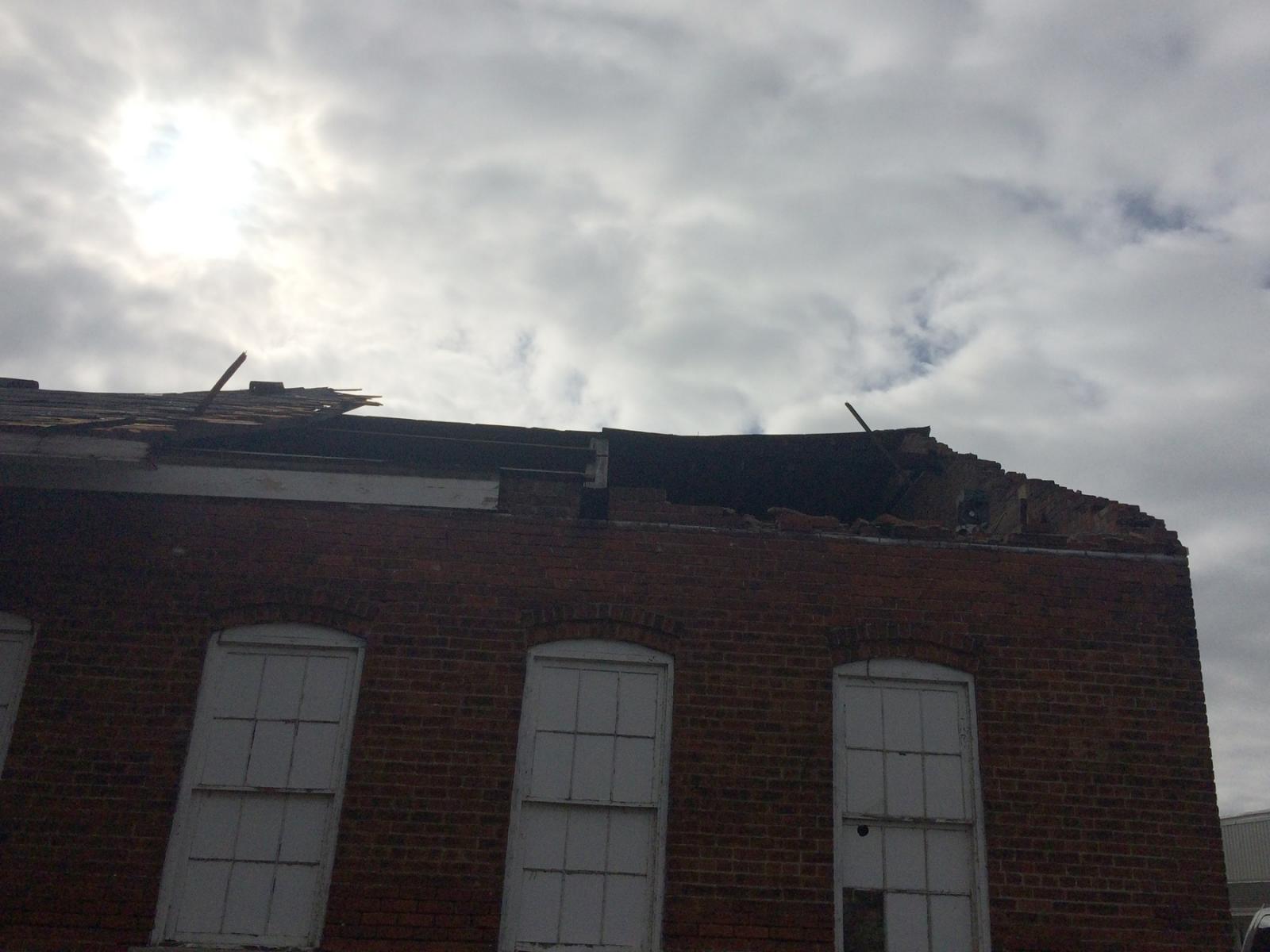
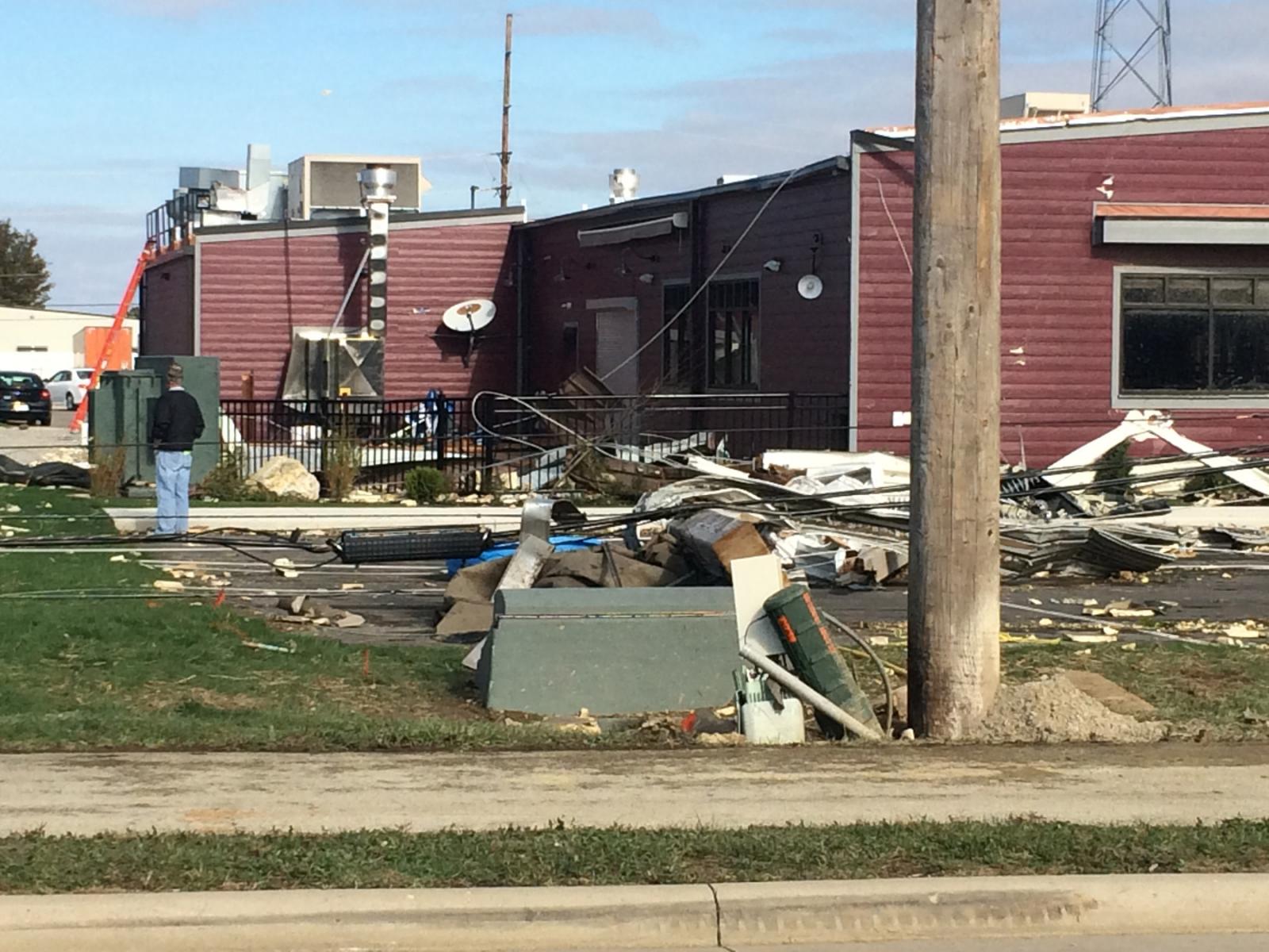
Further east on E Market Street, another business had a
significant portion of its roof removed, and windows at the front
of the business were broken.
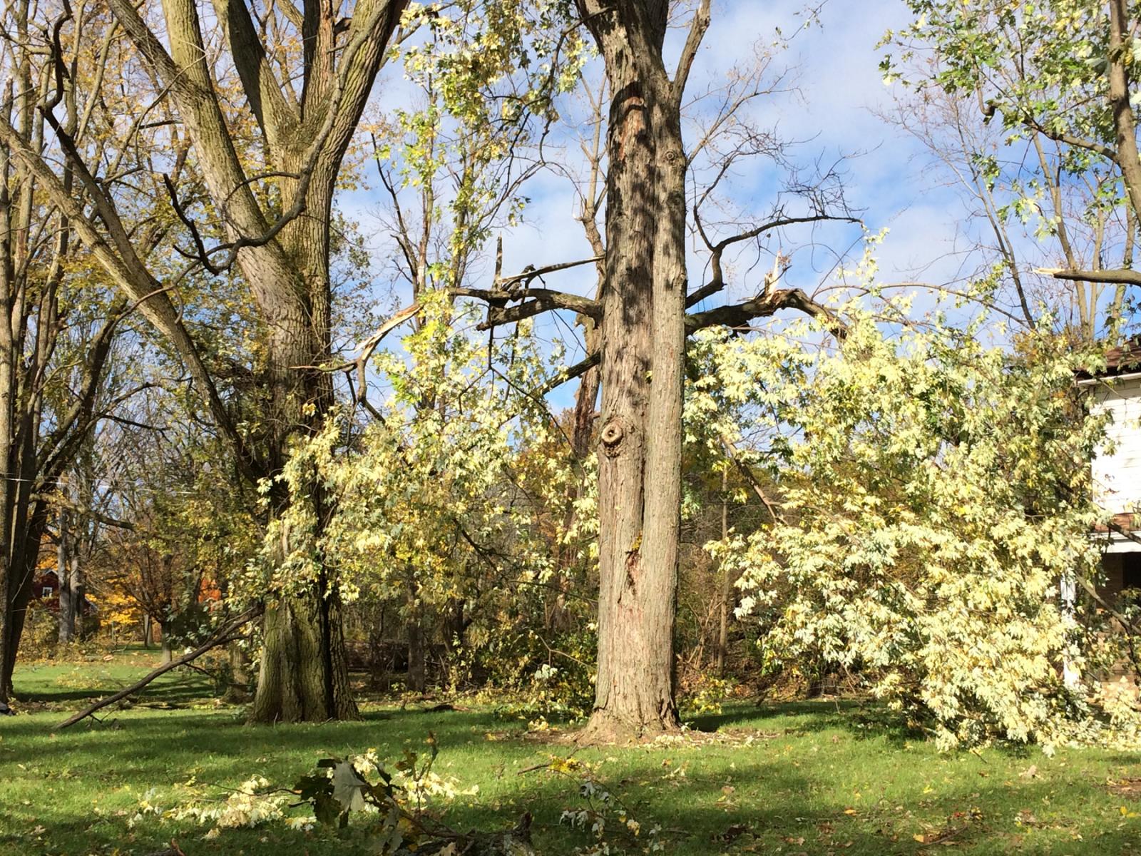
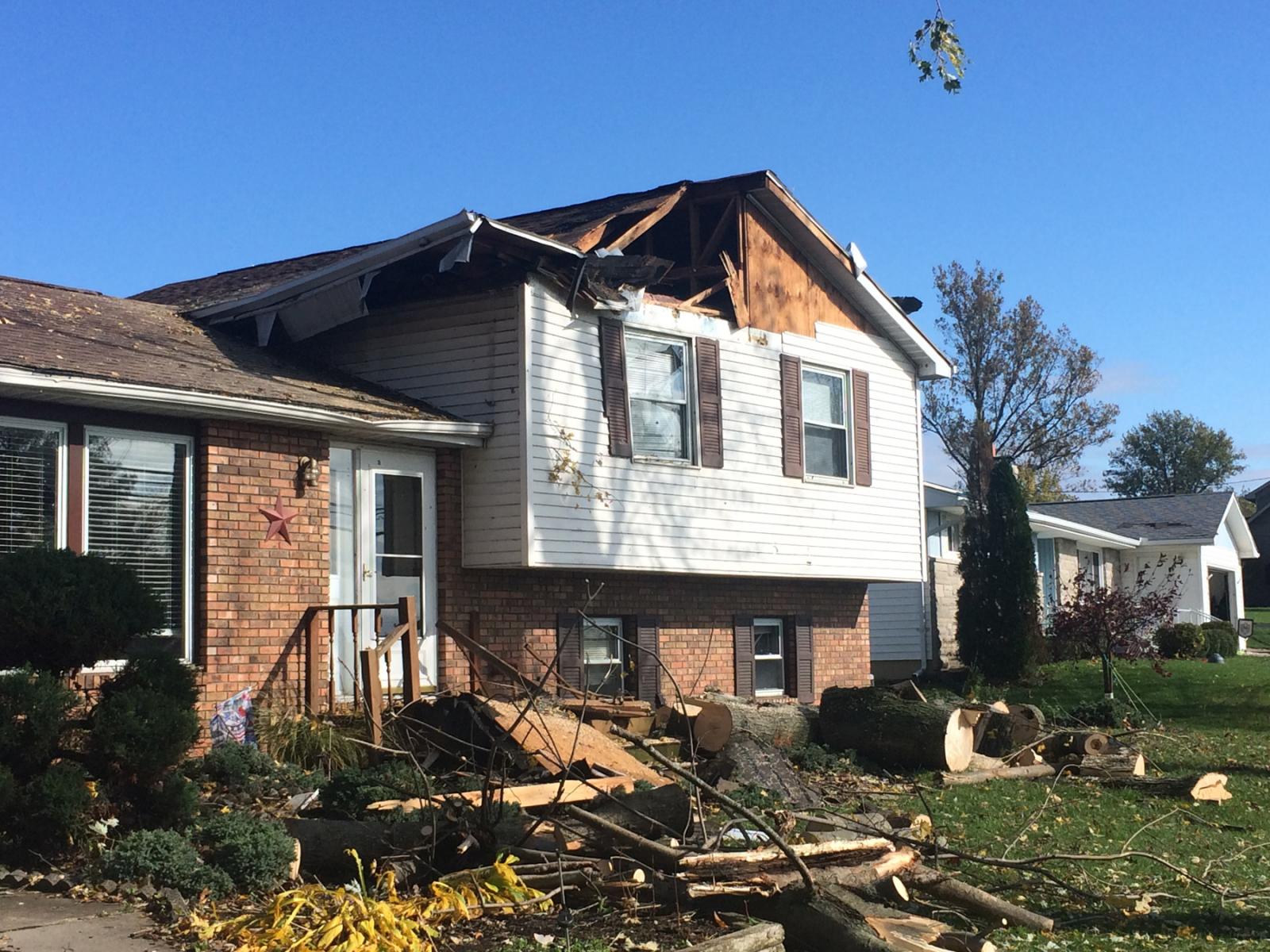
Onto the 1100 block of E Livingston Street, tree damage was
common and several of the homes also exhibited minor roof damage.
One of the homes also had one large hardwood tree knocked down
onto its second floor, producing significant roof damage.
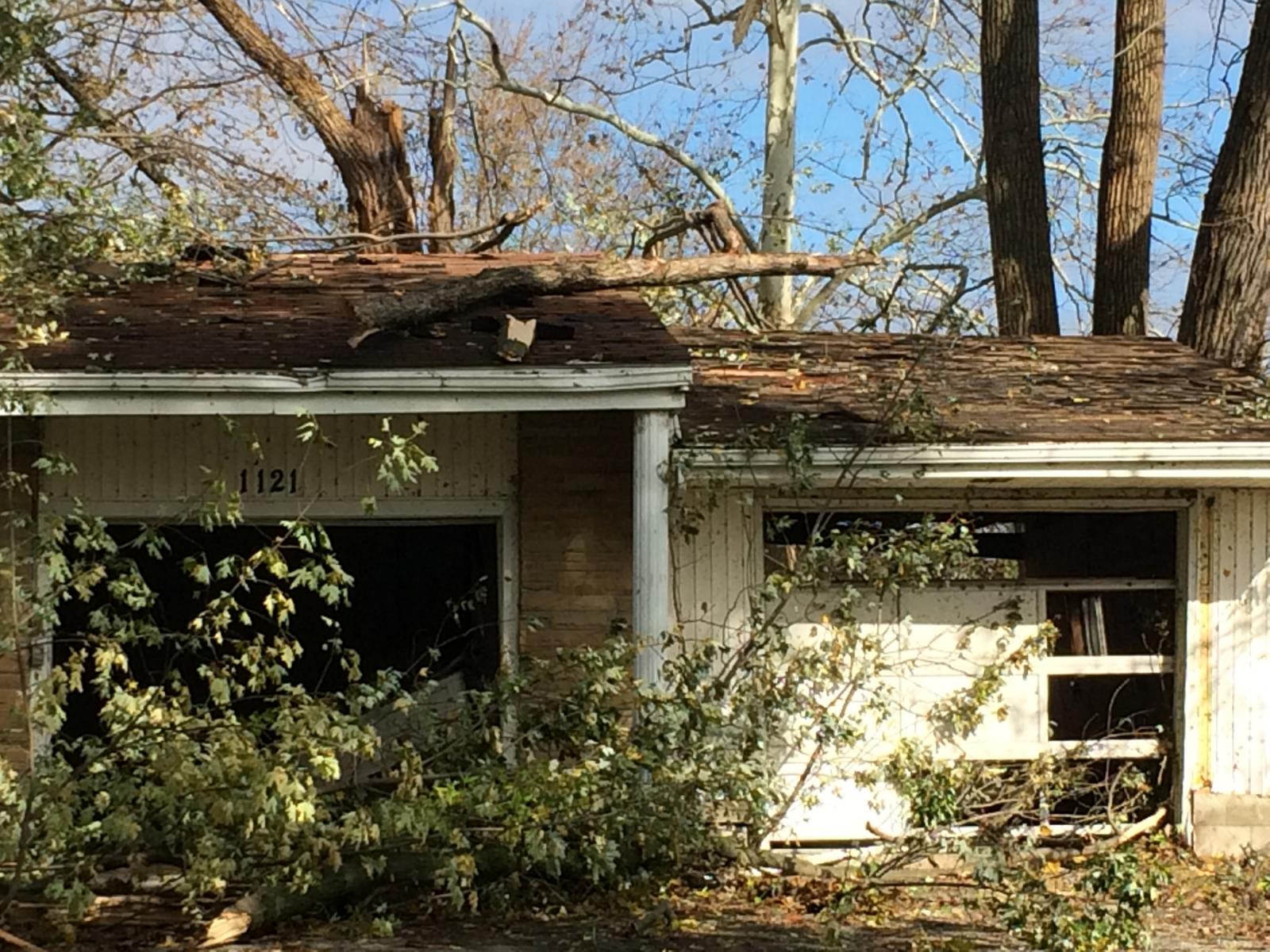
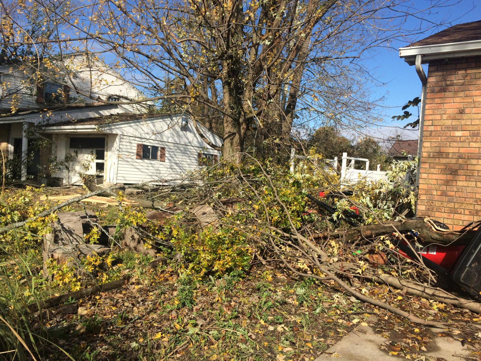
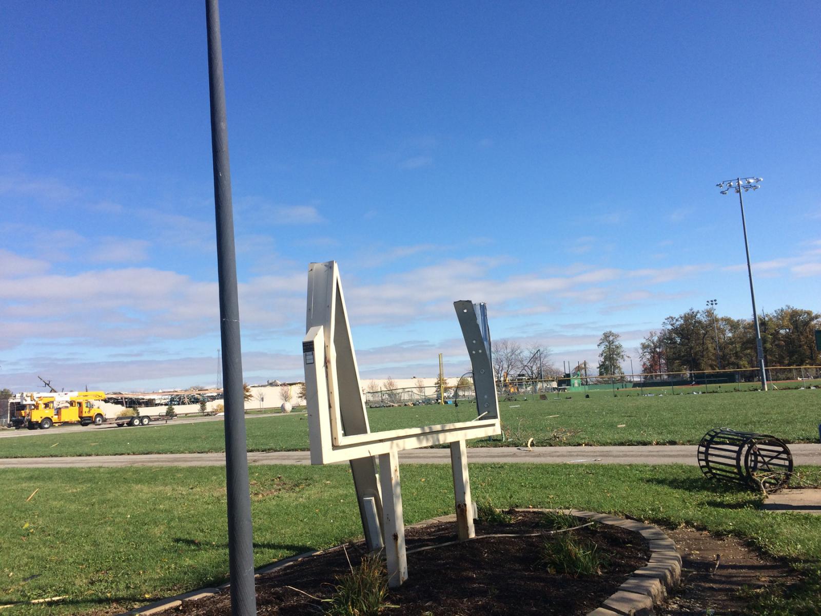
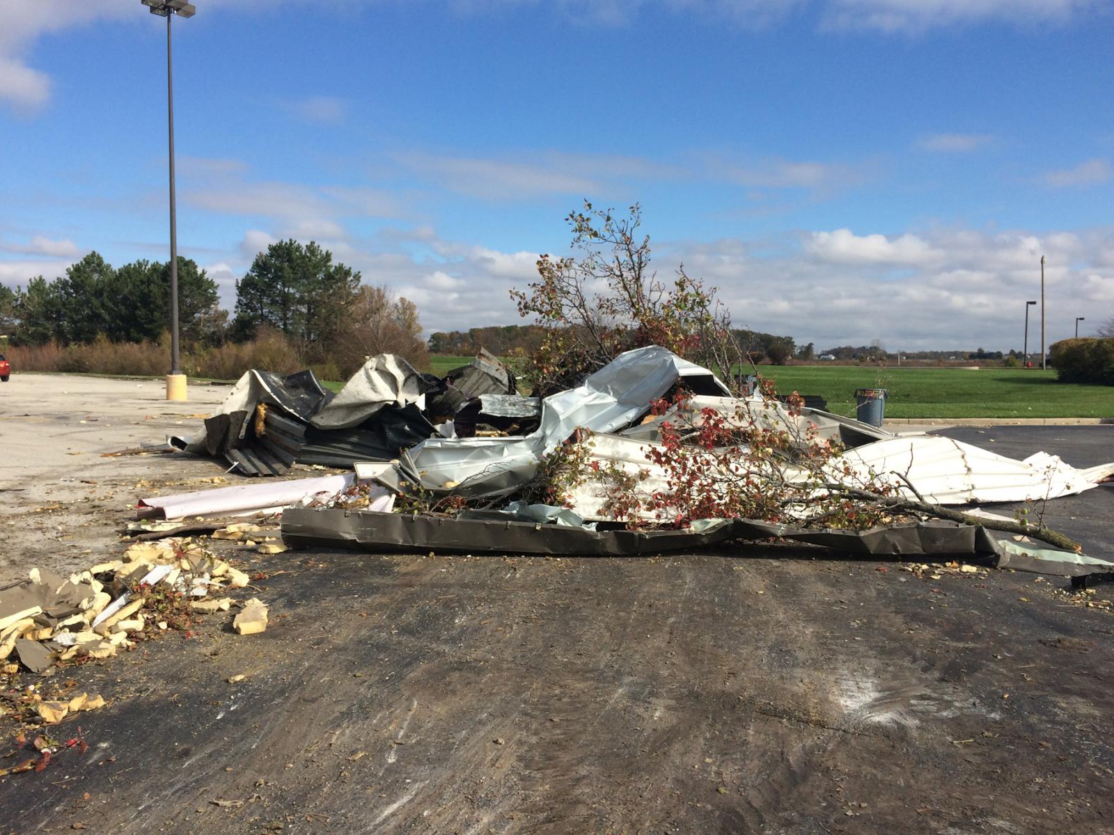
To the northeast, an outbuilding associated with a business on
Grand Lake Road was completely destroyed. On the other side of
Grand Lake Road, significant debris wrapped around a fence on
Montgomery Field. Trees were also uprooted on adjacent May Street.
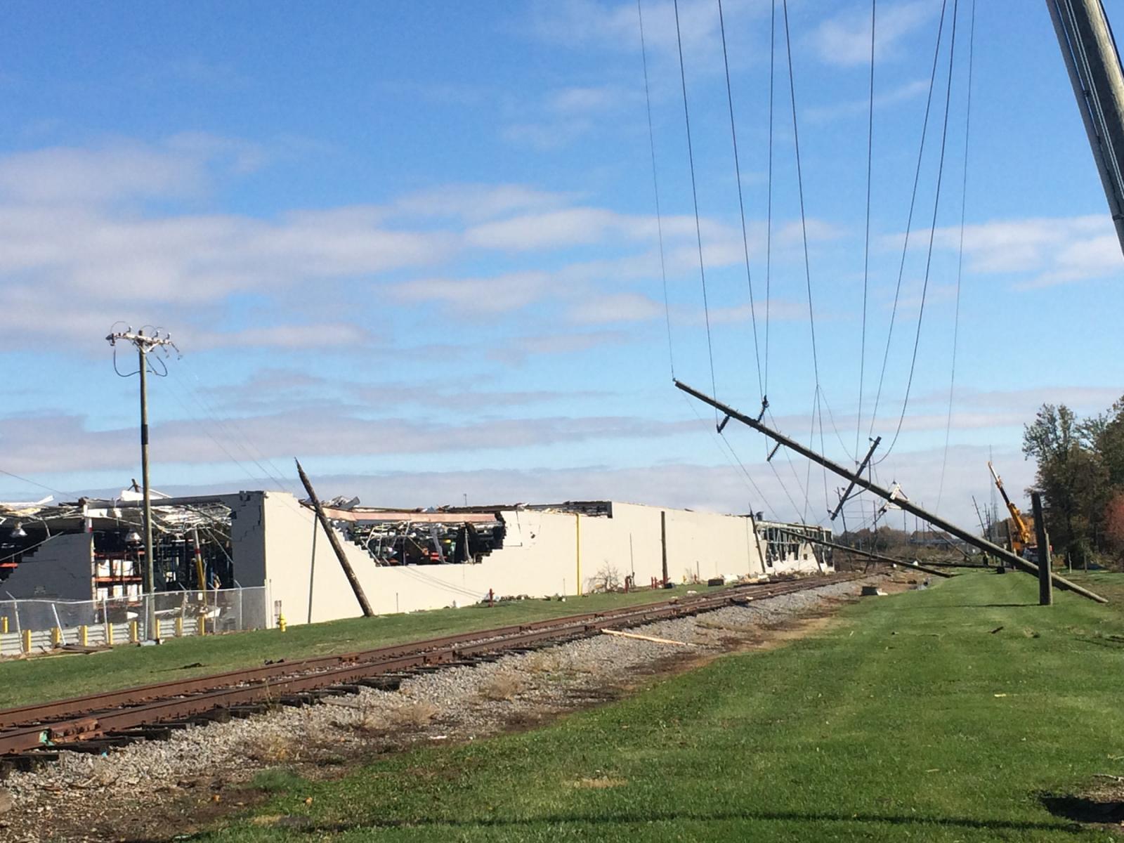
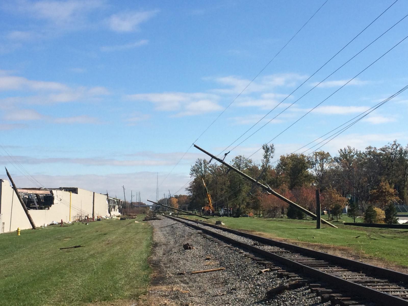
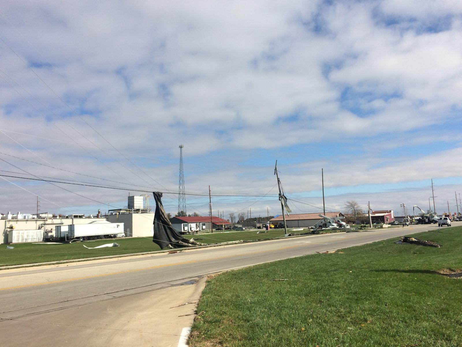
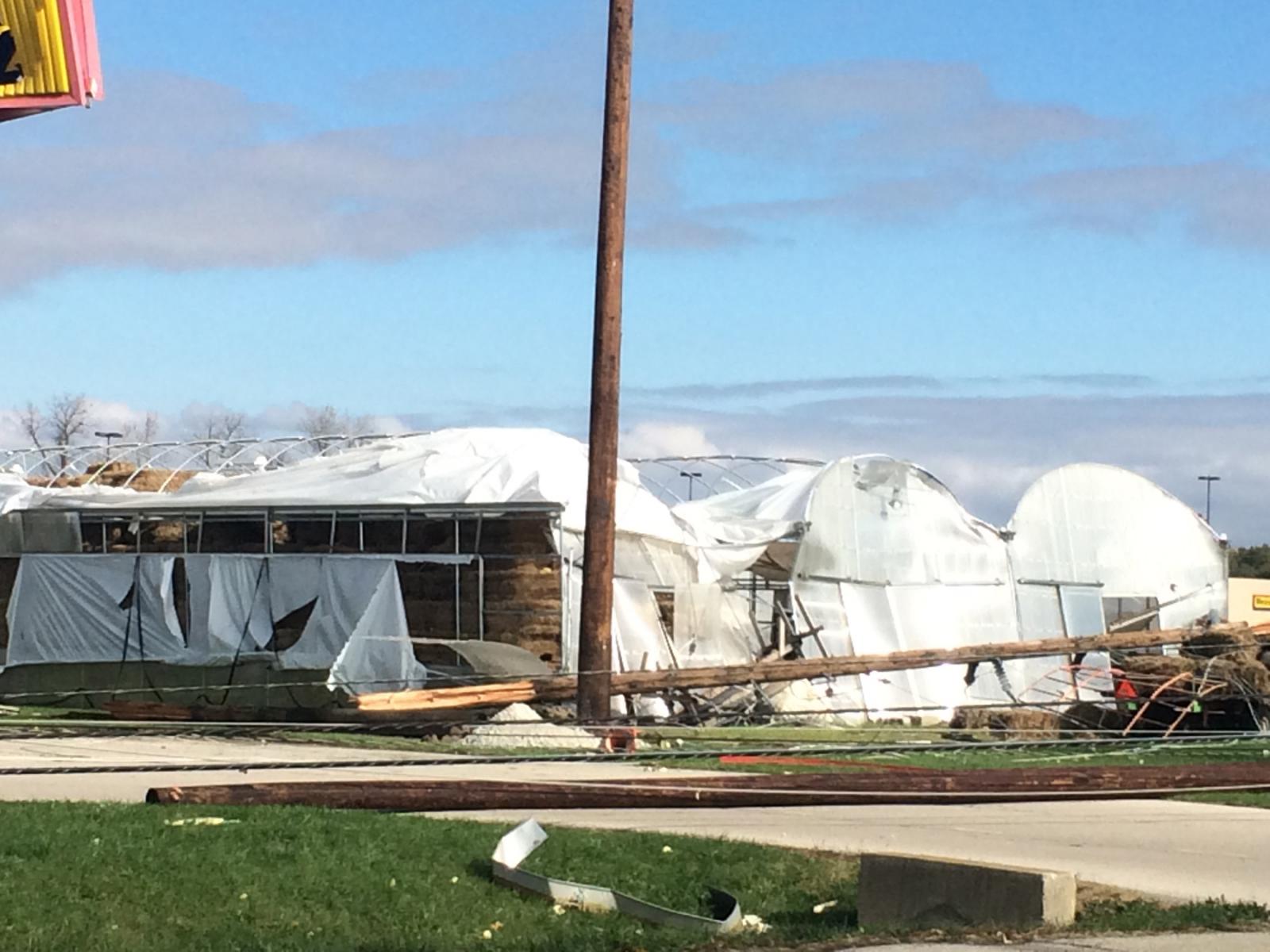
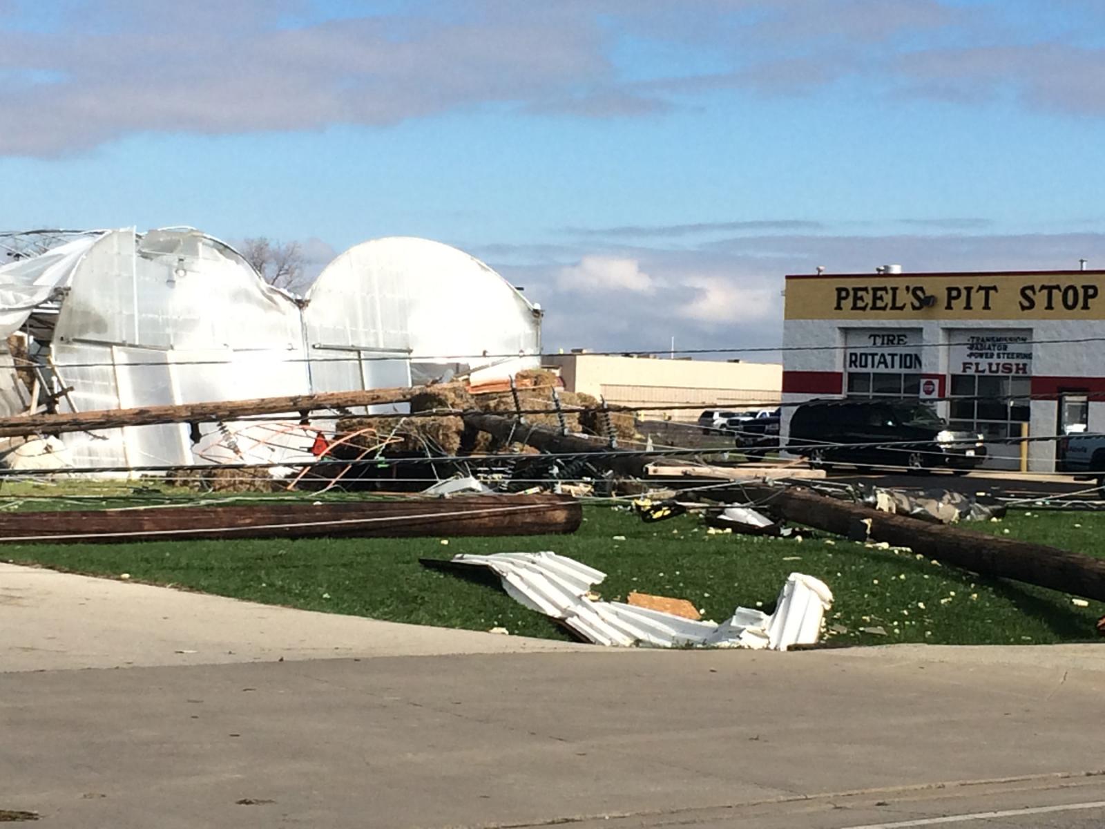
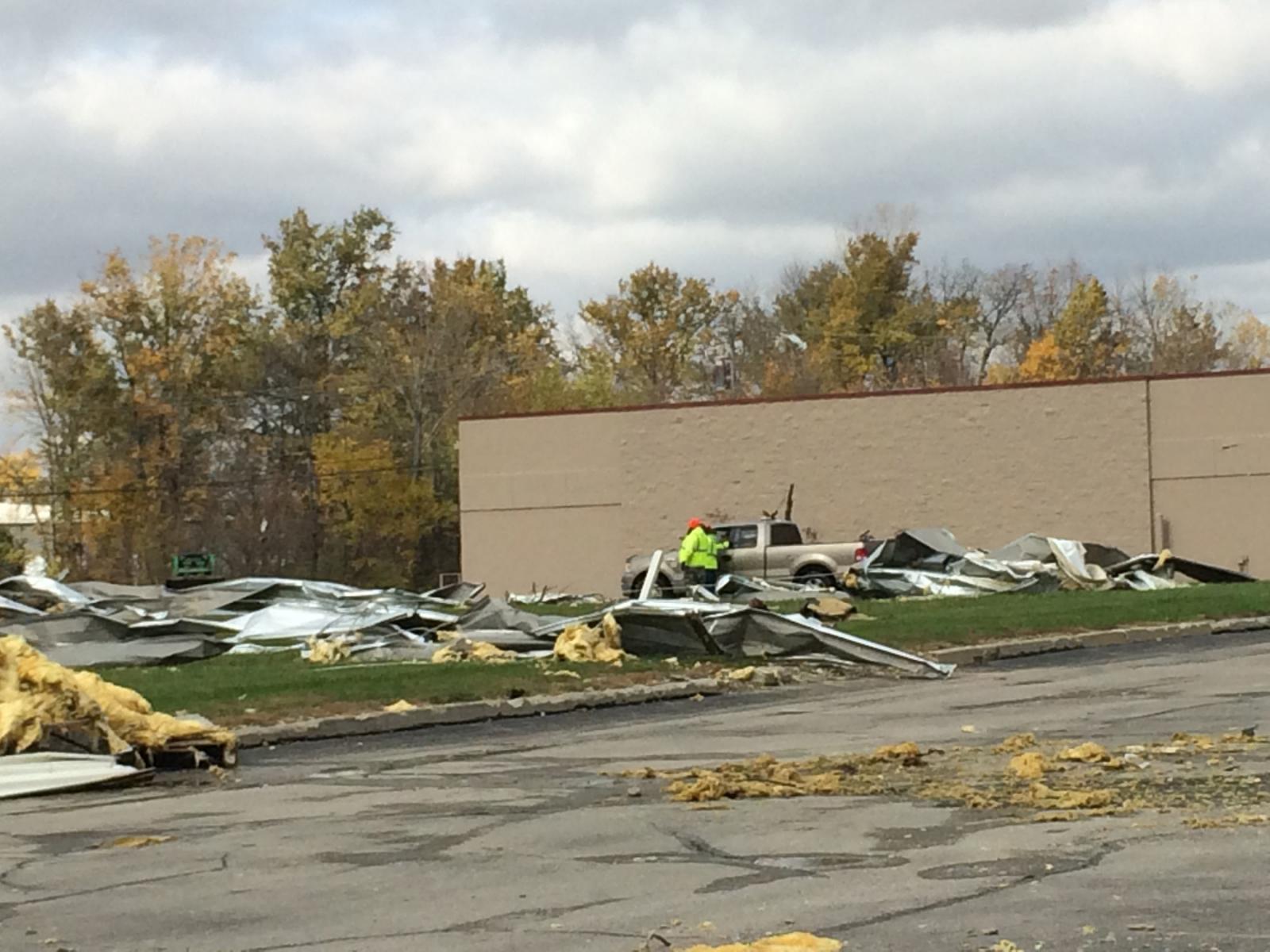
The most significant damage was then observed beginning at Crown
Equipment Corporation. A significant portion of the roof was
removed, and exterior walls on the southwest side of the building
also collapsed. Damage was also noted on the east-facing side of
the building.
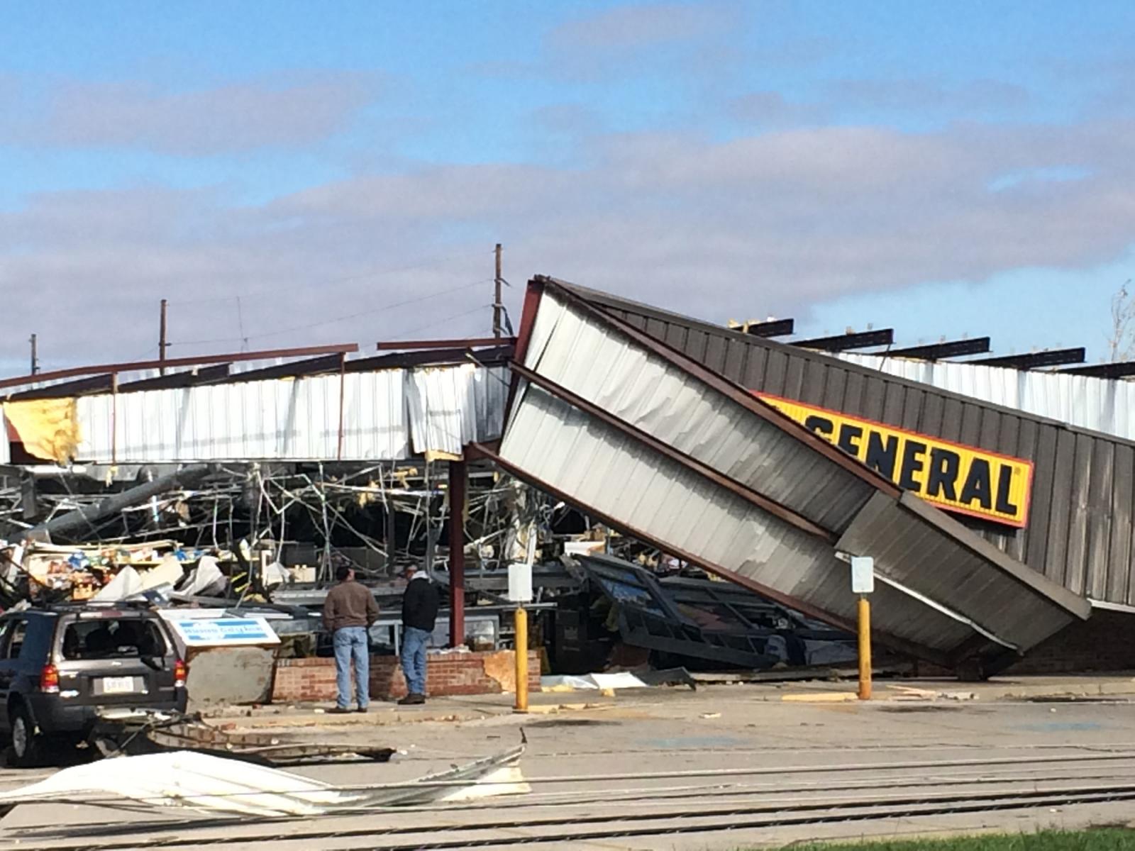
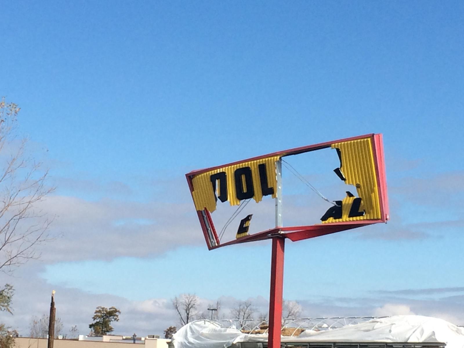
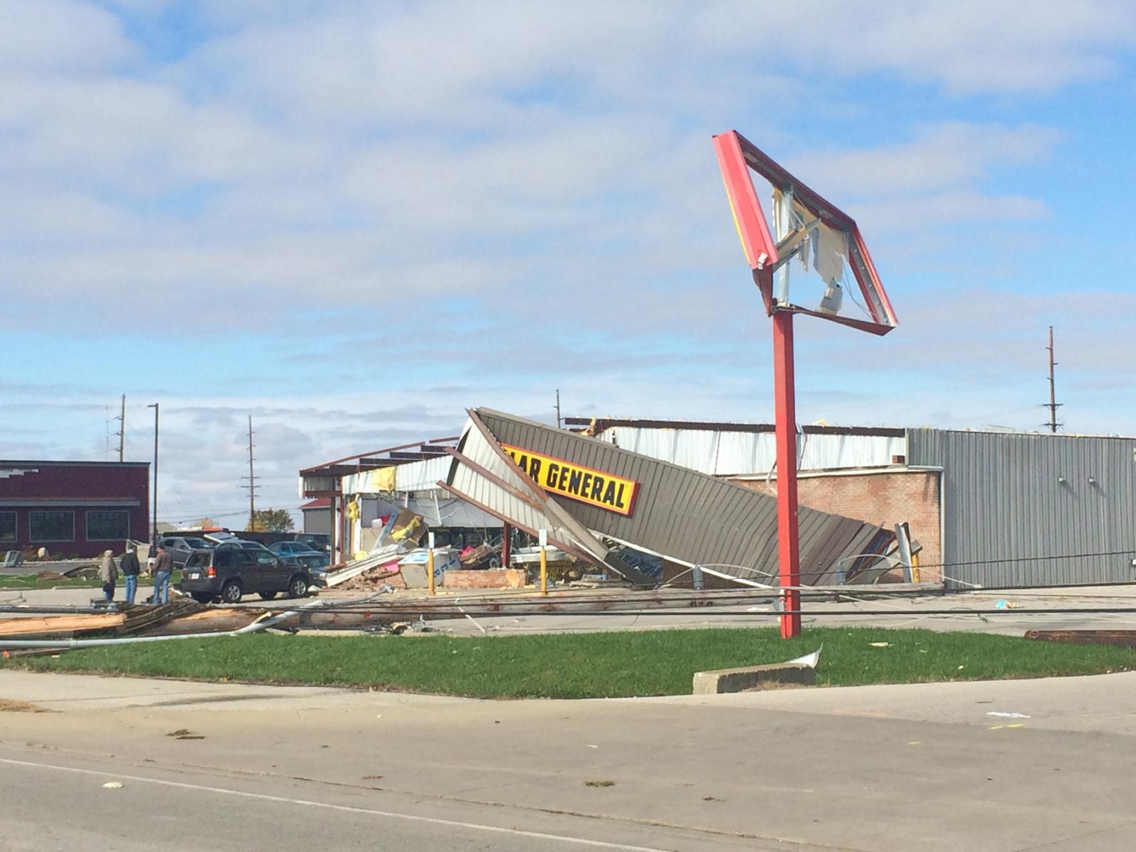
Businesses along Havermann Road were also affected, most notably
C-Town Wings where the front windows were blown out and the Dollar
General which sustained considerable structural damage including
roof collapse and exterior wall failure. Observed damage from the
Crown Equipment Corporation to the Dollar General was consistent
with EF2 tornadic winds.
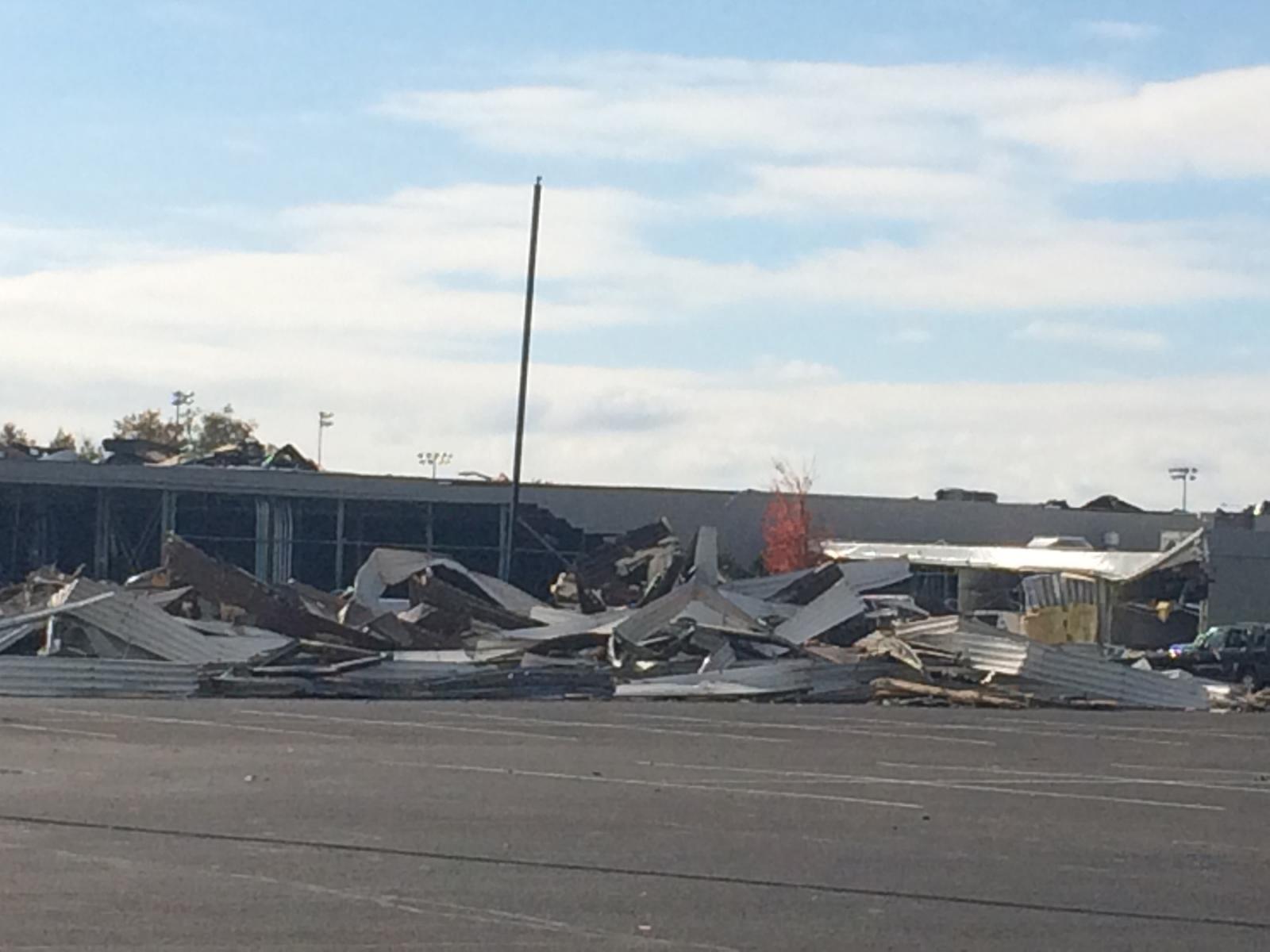
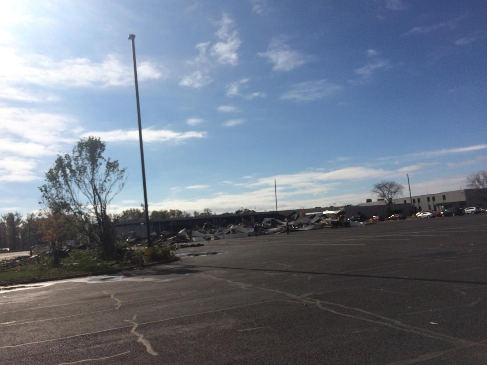
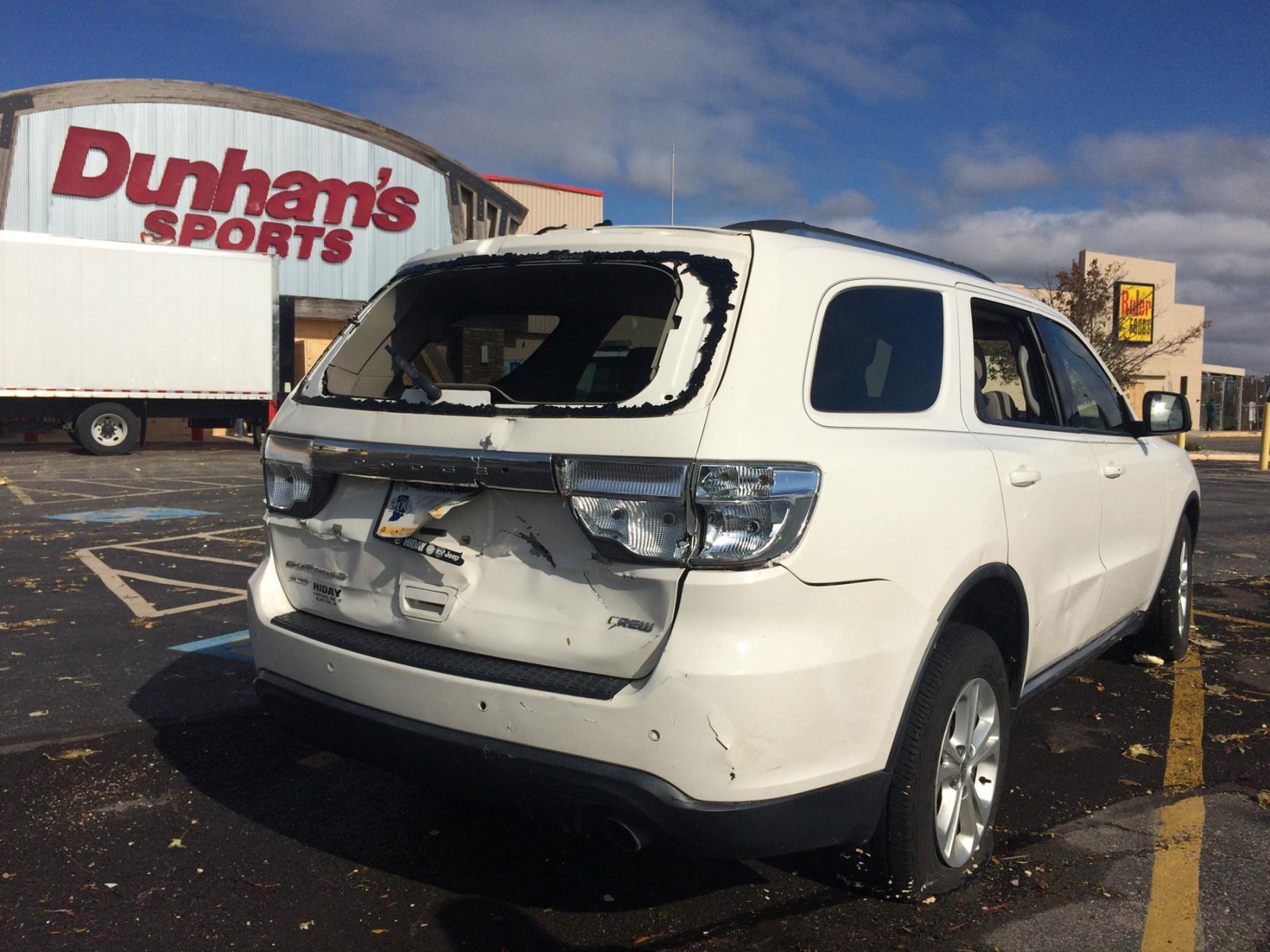
Several businesses within a strip mall along Havermann Road also
sustained some damage, particularly a sports store where the front
doors were blown in and a portion of the roof collapsed into the
store.
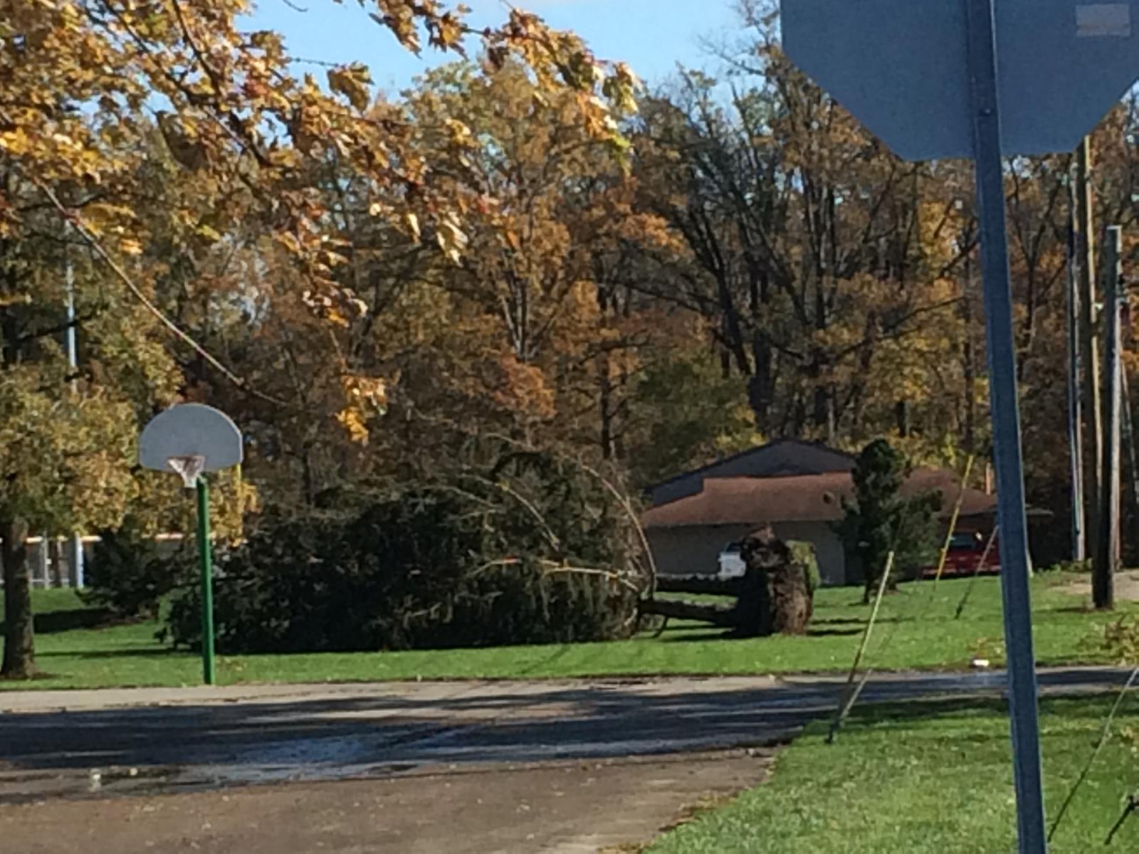
Damage to the northeast of the strip mall became more sparse,
however some trees were downed near the intersection of Howick Road
and Riley Road. The end of the tornado appears to have occurred
near the 8000 block of Riley Road.
The National Weather Service would like to thank local officials
in Mercer County and Celina, including Mercer County Emergency
Management; Van Wert County Emergency Management, the Ohio
Emergency Management Agency and interviewed eyewitnesses for their
assistance with this storm damage survey.
For reference: the Enhanced Fujita Scale classifies tornadoes
into the following categories:
EF0...wind speeds 65 to 85 mph.
EF1...wind speeds 86 to 110 mph.
EF2...wind speeds 111 to 135 mph.
EF3...wind speeds 136 to 165 mph.
EF4...wind speeds 166 to 200 mph.
EF5...wind speeds greater than 200 mph.
$$
BPP/KC
|


