Overview
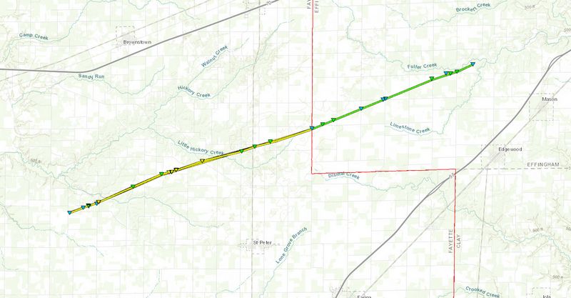
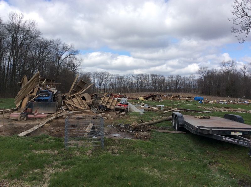
A tornado crossed from eastern Fayette County into Effingham County April 3rd at 4:34 pm CDT. The tornado did EF-1 damage in southwest Effingham County. It remained on the ground for more than 7 miles and dissipated at 4:41 pm CDT 3.4 miles northwest of Mason, Illinois. The Fayette County portion of the tornado was rated an EF-2. For more information about the Fayette County portion of this tornado, see NWS St. Louis web page. |
Tornadoes:
|
Tornado - SW Effingham County
|
||||||||||||||||
|
||||||||||||||||
The Enhanced Fujita (EF) Scale classifies tornadoes into the following categories:
| EF0 Weak 65-85 mph |
EF1 Moderate 86-110 mph |
EF2 Significant 111-135 mph |
EF3 Severe 136-165 mph |
EF4 Extreme 166-200 mph |
EF5 Catastrophic 200+ mph |
 |
|||||
Radar:
Evansville, IN Radar Images
 |
 |
 |
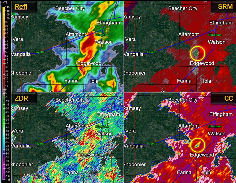 |
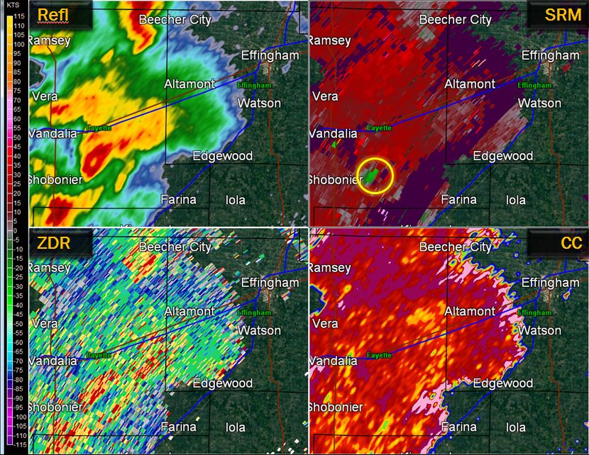
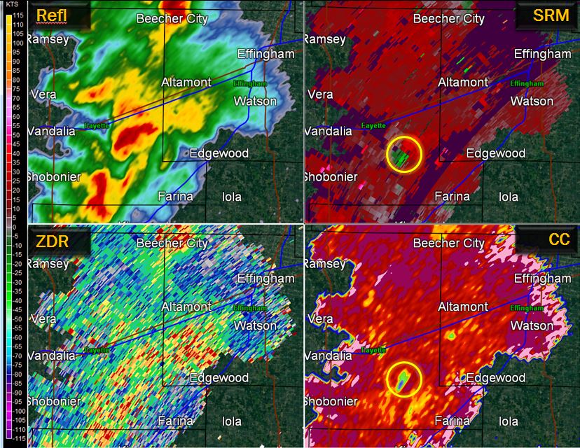
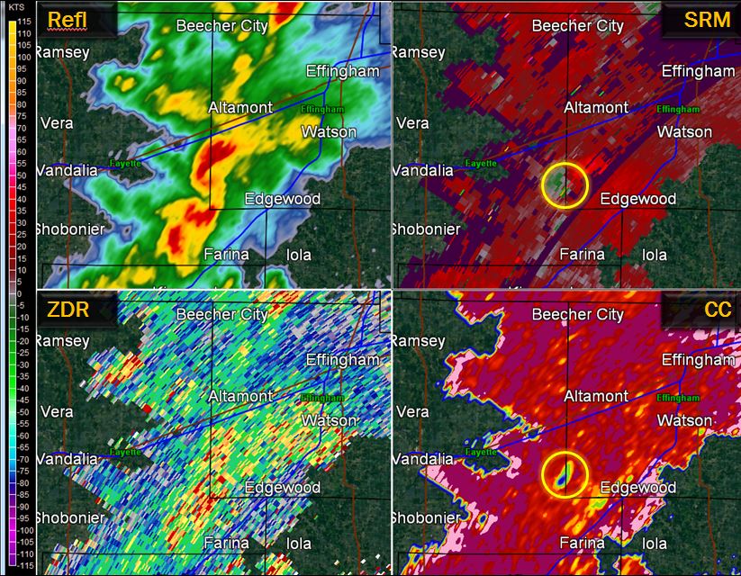
| Figure 1 -- 4:20 pm | Figure 2 -- 4:27 pm | Figure 3 -- 4:33 pm | Figure 4 -- 4:42 pm |
These images were taken from the Doppler radar located north of Evansville, IN. While our radar was operational during the time, this part of Illinois is closer to the Evansville radar, thus the radar beam is looking lower in the storm.
Each image has 4 sub images within it. These were all from the lowest elevation angle (0.5 degrees above the horizontal plane):
A circulation began to develop while the storm was over southeast Fayette County. In Figure 1, the red and green echoes are right next to each other in the top right quadrant of the picture, highlighted by the yellow circle. In Figure 2, the lower right quadrant is showing a green/blue area lining up with the circulation; this indicates debris being kicked up in the air. (Survey results from the St. Louis NWS indicate that an EF-2 tornado was occurring in this area.) This debris signature persists as the storm crosses the Effingham County border (Figure 3), finally starting to fade shortly after 4:40 pm (Figure 4).
Storm Reports
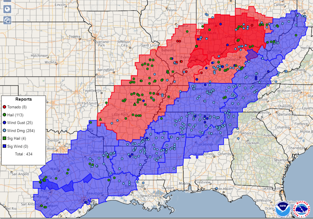
This tornado was part of a larger severe weather outbreak, which extended from eastern Texas to the upper Ohio Valley. In the map below, courtesy of the Storm Prediction Center, tornado watches issued on April 3rd are highlighted in red, with severe thunderstorm watches in purple. The actual severe weather reports are represented by the symbols on the map.
 |
Media use of NWS Web News Stories is encouraged! Please acknowledge the NWS as the source of any news information accessed from this site. |
|







 Follow us on X
 Follow us on Facebook
 Follow us on YouTube
 ILX RSS Feed