Overview
|
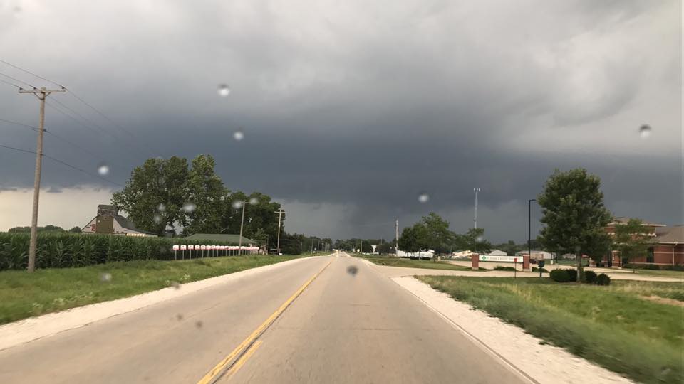
Thunderstorms developed rapidly in west central Illinois from about Monmouth to northwest of Peoria during the late afternoon of July 10th. The storms interacted with a front which was draped from northwest to southeast nearly parallel with I-74. One storm produced a tornado in northern Peoria County around 5:45 pm. Other thunderstorms rapidly clustered together and sank southward, producing large hail and damaging winds gusts in parts of central Illinois between 6:30 pm and 11:00 pm. |
|
 |
 |
 |
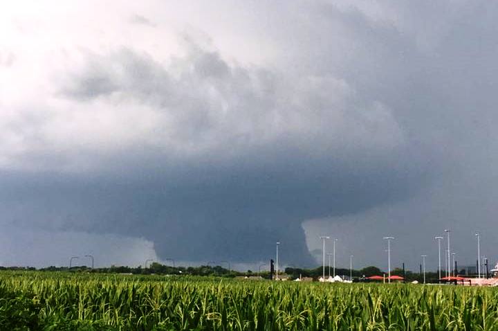
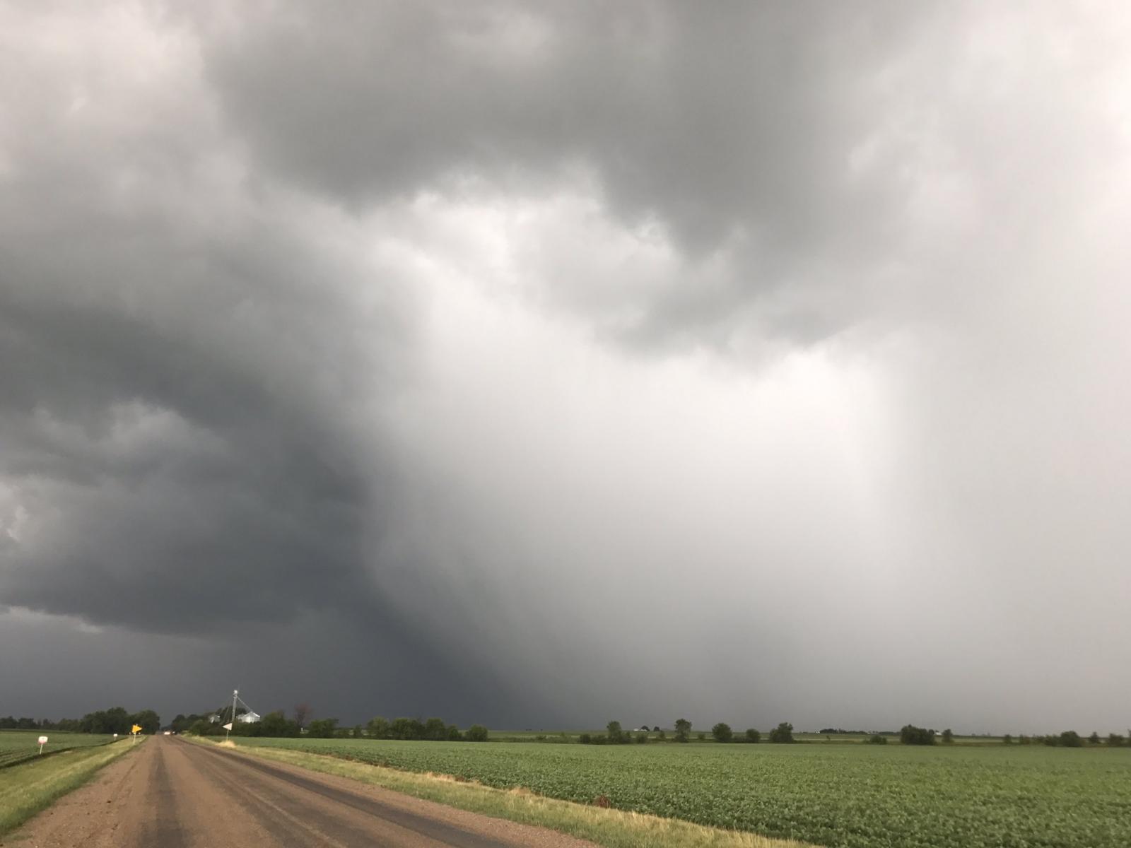
| Wall Cloud SW of Princeville (Photo by Seth Smith) |
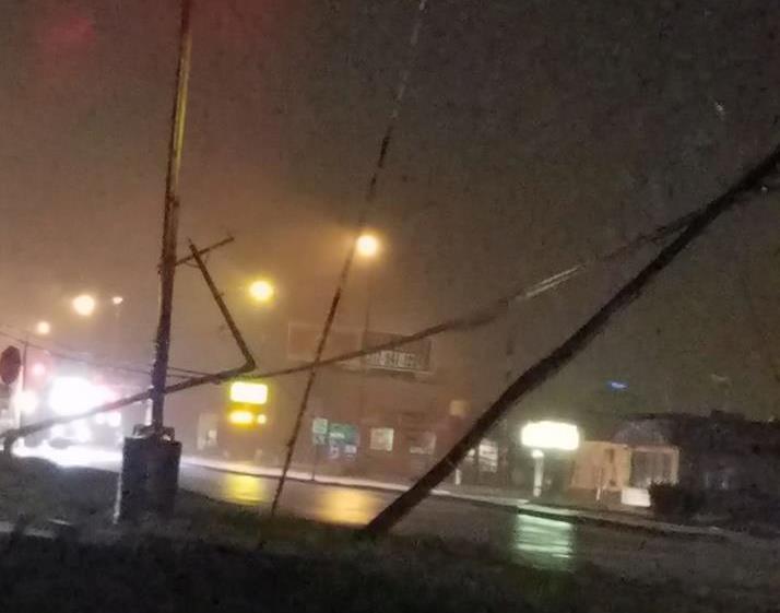
Power Poles damaged in Lincoln on Woodlawn Road (Photo by Braden Connor) |
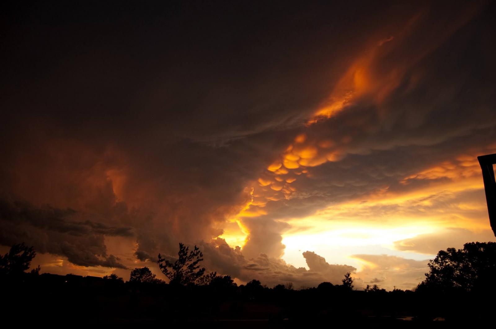
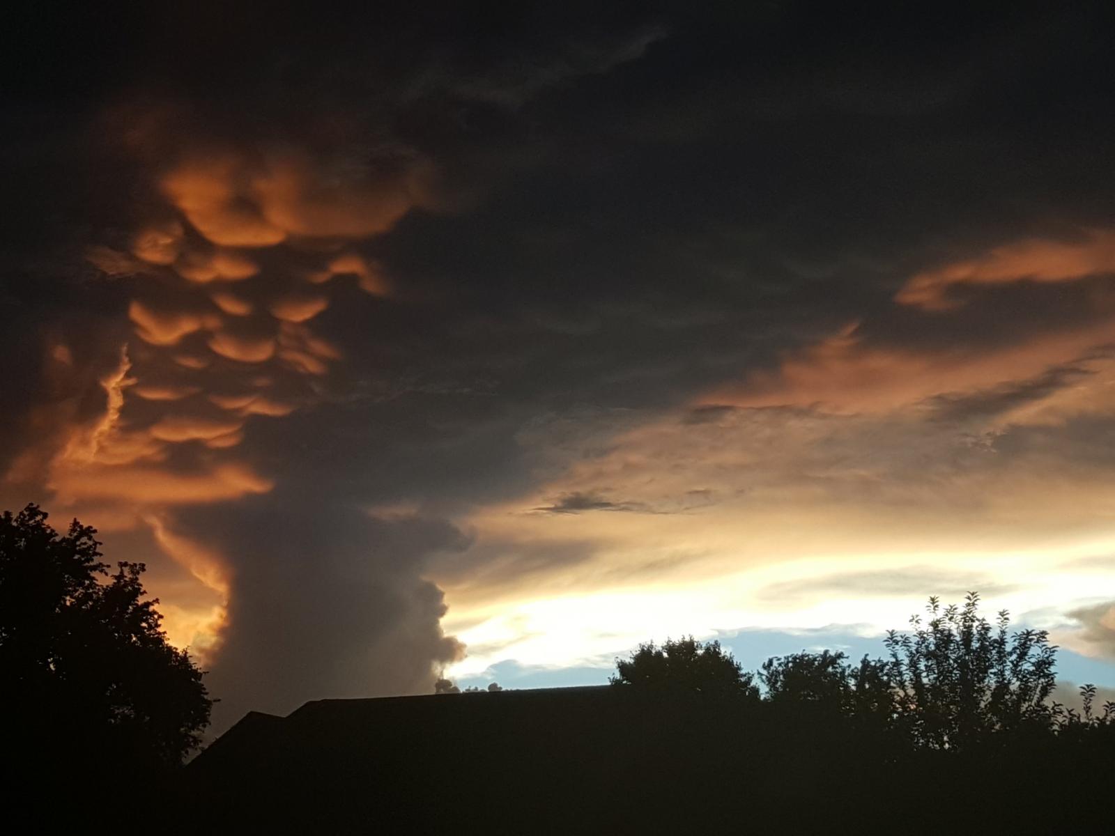
Mammatus Clouds showing intense turbulence in storms south of Bloomington (Photo by Jeff Lovell) |
Tornadoes:
|
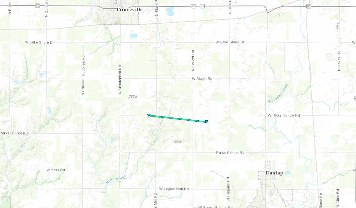
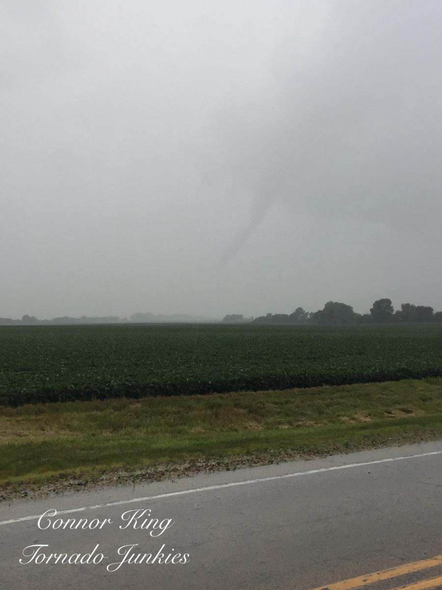
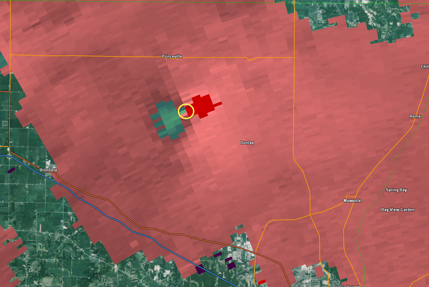
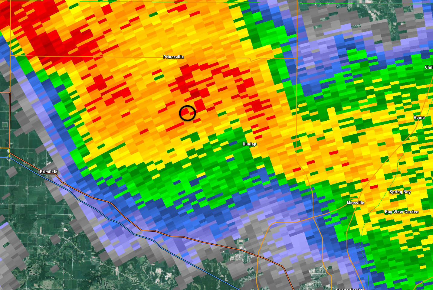
Tornado - Princeville/Dunlap
|
||||||||||||||||
|
||||||||||||||||
The Enhanced Fujita (EF) Scale classifies tornadoes into the following categories:
| EF0 Weak 65-85 mph |
EF1 Moderate 86-110 mph |
EF2 Significant 111-135 mph |
EF3 Severe 136-165 mph |
EF4 Extreme 166-200 mph |
EF5 Catastrophic 200+ mph |
 |
|||||
Wind & Hail:
Wind
Extensive wind damage was done in the city of Lincoln between 8:10 and 8:35 pm CDT on July 10th. Wind gusts of around 60 mph were measured throughout the city. Doppler radar indicated areas just north of Lincoln may have had winds in the 70 to 80 mph range. Several downbursts were the cause of the wind damage to power lines, power poles, hundreds of trees, crops, and structures damaged by falling trees. Northern parts of Logan County sustained wind damage between 7:55 and 8:10 pm, and southern Logan County had wind damage between 8:35 and 8:55 pm.
 |
 |
 |
 |
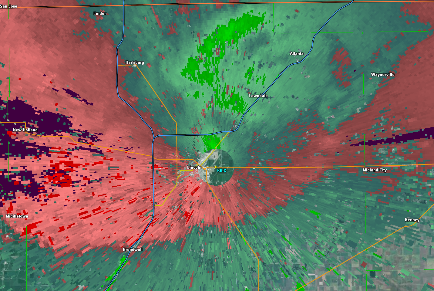
| NWS Lincoln Doppler Radar image of Wind Velocity at 8:10 pm Green = wind toward the radar Red = wind away from the radar Bright green color is 60-70 mph wind in northern Logan Co & approaching Lincoln |
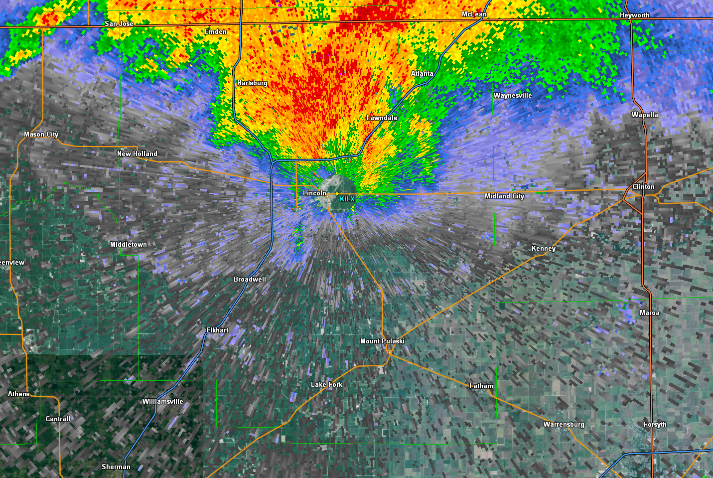
NWS Lincoln Doppler Radar Reflectivity Image at 8:10 pm Red-Yellow = heavy rain |
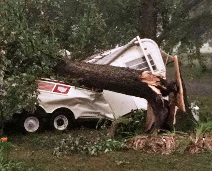
Wind Damage to a camper in Lincoln Photo by Debbie Tungate |
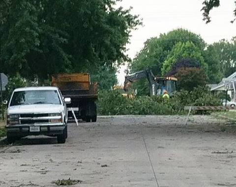
Wind Damage to Trees in Lincoln Photo by Nick Berg |
Hail
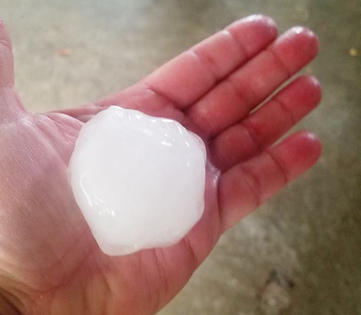
A severe storm in northern Fulton County produced large hail from Fairview to just north of Canton between 7:15 and 7:30 pm. The hail ranged in size from ping-pong balls to tennis balls.
 |
 |
 |
 |
| Bright white in the image is a shaft of hail falling from a supercell thunderstorm in northern Fulton Co. Photo by Ethan Schisler |
Large hail in northern Fulton Co. Photo by Michelle Davies |
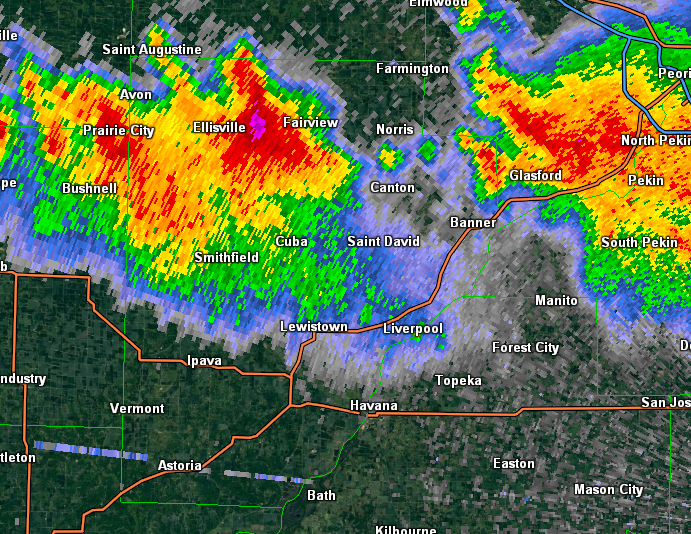
NWS Lincoln Doppler Radar Reflectivity Image at 7:14 pm Purple - Dark Red = Hail / Heavy Rain |
NWS Lincoln Doppler Radar Max Expected Hail Size estimate product at 7:14 pm Pink = 2.00 - 2.50" hail Orange = 1.00 - 2.00" hail |
Photos:
July 10th Severe Weather in Central Illinois
 |
 |
 |
 |
| Wall Cloud near Princeville, IL (Photo by Diane Marie) |
Wall Cloud with Funnel Southwest of Princeville, IL (Photo by Seth Smith) |
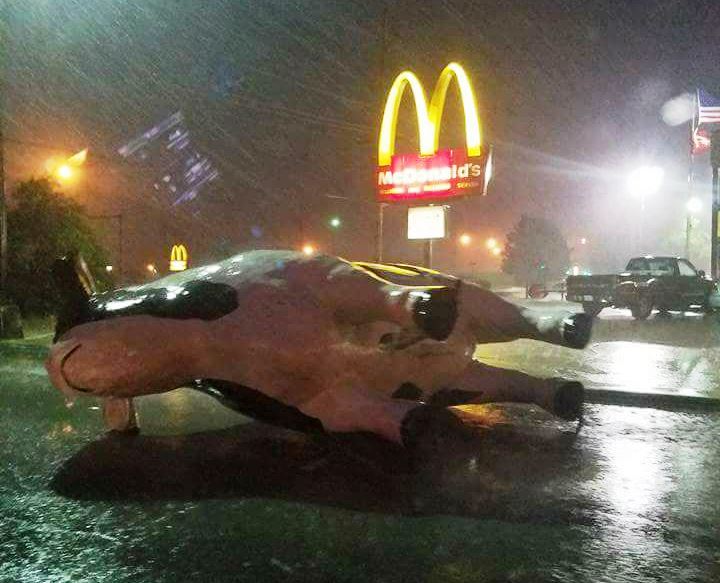
Cow display blown over in Lincoln at the Bonanza Steak House (Photo from Miranda Galvin) |
Mammatus Clouds near Bloomington (Photo by Craig Gocker) |
Storm Reports
PRELIMINARY LOCAL STORM REPORT...SUMMARY
NATIONAL WEATHER SERVICE LINCOLN IL
1205 AM CDT TUE JUL 11 2017

..TIME...   ...EVENT...      ...CITY LOCATION...     ...LAT.LON...
..DATE...   ....MAG....      ..COUNTY LOCATION..ST.. ...SOURCE....
            ..REMARKS..

0545 PM     TORNADO          3 S PRINCEVILLE         40.88N 89.71W
07/10/2017                   PEORIA             IL   TRAINED SPOTTER

            TOUCHED DOWN IN FIELD. BECOMING RAIN WRAPPED.

0545 PM     FUNNEL CLOUD     NW LAURA                40.92N 89.92W
07/10/2017                   PEORIA             IL   TRAINED SPOTTER

0621 PM     HAIL             BRIMFIELD               40.84N 89.88W
07/10/2017  M1.00 INCH       PEORIA             IL   EMERGENCY MNGR

0638 PM     HAIL             3 SE BRIMFIELD          40.81N 89.84W
07/10/2017  M1.00 INCH       PEORIA             IL   NWS EMPLOYEE

0654 PM     HAIL             HANNA CITY              40.69N 89.79W
07/10/2017  M1.75 INCH       PEORIA             IL   EMERGENCY MNGR

0657 PM     TSTM WND GST     HANNA CITY              40.69N 89.79W
07/10/2017  E70.00 MPH       PEORIA             IL   EMERGENCY MNGR

0702 PM     HAIL             4 E HANNA CITY          40.69N 89.72W
07/10/2017  M1.00 INCH       PEORIA             IL   MESONET

0709 PM     HAIL             3 S HANNA CITY          40.65N 89.79W
07/10/2017  M1.00 INCH       PEORIA             IL   MESONET

0715 PM     HAIL             5 E LONDON MILLS        40.71N 90.17W
07/10/2017  M1.50 INCH       FULTON             IL   TRAINED SPOTTER

0720 PM     HAIL             FAIRVIEW                40.65N 90.19W
07/10/2017  M2.50 INCH       FULTON             IL   PUBLIC

            RELAYED BY EMA. TIME ESTIMATED.

0720 PM     HAIL             3 N FAIRVIEW            40.69N 90.19W
07/10/2017  M1.75 INCH       FULTON             IL   PUBLIC

            RELAYED BY EMA

0722 PM     HEAVY RAIN       PEORIA INTERNATIONAL AI 40.67N 89.68W
07/10/2017  M1.32 INCH       PEORIA             IL   ASOS

            RAIN FELL IN 25 MINUTES

0723 PM     TSTM WND DMG     2 ENE PEKIN             40.58N 89.59W
07/10/2017                   TAZEWELL           IL   MESONET

            TREES UPROOTED. TIME ESTIMATED.

0723 PM     HAIL             PEKIN                   40.57N 89.63W
07/10/2017  M1.00 INCH       TAZEWELL           IL   PUBLIC

0727 PM     HAIL             2 WSW FARMINGTON        40.71N 90.04W
07/10/2017  M1.75 INCH       FULTON             IL   EMERGENCY MNGR

0800 PM     HEAVY RAIN       MORTON                  40.61N 89.47W
07/10/2017  M2.25 INCH       TAZEWELL           IL   TRAINED SPOTTER

0800 PM     HEAVY RAIN       MORTON                  40.61N 89.47W
07/10/2017  M2.60 INCH       TAZEWELL           IL   CO-OP OBSERVER

            FELL IN 1.5 HOURS

0801 PM     TSTM WND DMG     SOUTH PEKIN             40.50N 89.65W
07/10/2017                   TAZEWELL           IL   EMERGENCY MNGR

            2 FOOT DIAMETER TREE FELL ON CAR

0810 PM     TSTM WND DMG     LINCOLN                 40.15N 89.37W
07/10/2017                   LOGAN              IL   NWS EMPLOYEE

            TWO 15-20 INCH DIAMETER TREES SNAPPED ON 400 BLOCK OF
            10TH STREET, BLOCKING ROAD

0814 PM     TSTM WND DMG     LINCOLN                 40.15N 89.37W
07/10/2017                   LOGAN              IL   EMERGENCY MNGR

            NUMEROUS POWER LINES AND POLES DOWN IN TOWN

0814 PM     TSTM WND GST     2 E LINCOLN             40.15N 89.33W
07/10/2017  M62.00 MPH       LOGAN              IL   NWS EMPLOYEE

            AT WFO ILX

0815 PM     TSTM WND DMG     3 W ATLANTA             40.26N 89.29W
07/10/2017                   LOGAN              IL   PUBLIC

            SEVERAL TREES DOWN AND TWO CARS DAMAGED FROM FALLING
            TREES

0830 PM     HEAVY RAIN       4 SSE PEKIN             40.51N 89.60W
07/10/2017  M1.79 INCH       TAZEWELL           IL   COCORAHS

            RAIN FELL IN 2.5 HOURS

0835 PM     TSTM WND GST     2 E LINCOLN             40.15N 89.33W
07/10/2017  M59.00 MPH       LOGAN              IL   AWOS

0855 PM     HEAVY RAIN       2 E LINCOLN             40.15N 89.33W
07/10/2017  M1.62 INCH       LOGAN              IL   AWOS

            RAIN FELL IN ONE HOUR

0900 PM     HEAVY RAIN       2 ENE PEKIN             40.58N 89.59W
07/10/2017  M1.83 INCH       TAZEWELL           IL   MESONET

            RAIN FELL IN 2.5 HOURS

1004 PM     TSTM WND DMG     SPRINGFIELD             39.78N 89.64W
07/10/2017                   SANGAMON           IL   AMATEUR RADIO

            POWER LINES DOWN

1025 PM     TSTM WND DMG     ROCHESTER               39.75N 89.54W
07/10/2017                   SANGAMON           IL   AMATEUR RADIO

            4 INCH DIAMETER TREE LIMB BLOWN DOWN

1030 PM     TSTM WND DMG     STONINGTON              39.64N 89.19W
07/10/2017                   CHRISTIAN          IL   PUBLIC

            LARGE TREE BRANCH BLOWN DOWN ON A GARAGE. NUMEROUS TREE
            LIMBS BLOWN DOWN IN YARD.

1040 PM     TSTM WND DMG     ROSAMOND                39.38N 89.16W
07/10/2017                   CHRISTIAN          IL   PUBLIC

            TREES BLOWN DOWN ON SEVERAL PROPERTIES IN ROSAMOND. AN
            AWNING BLOWN DOWN.

1051 PM     HEAVY RAIN       CAPITAL AIRPORT         39.84N 89.68W
07/10/2017  M1.24 INCH       SANGAMON           IL   ASOS

            1 HOUR RAINFALL AT CAPITAL AIRPORT IN SPRINGFIELD

1155 PM     HEAVY RAIN       1 E LINCOLN             40.15N 89.35W
07/10/2017  M1.41 INCH       LOGAN              IL   OFFICIAL NWS OBS

            MEASURED 1.41 INCHES OF RAIN SINCE 8 PM AT NWS ON EAST
            SIDE OF LINCOLN
 |
Media use of NWS Web News Stories is encouraged! Please acknowledge the NWS as the source of any news information accessed from this site. |
|