Overview
|
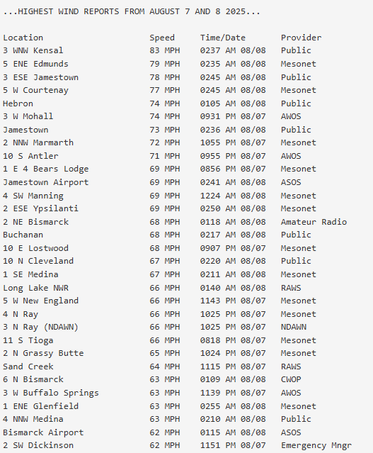
Several lines of severe thunderstorms moved across western and central North Dakota the evening of Thursday, August 7th, continuing into the early morning of Friday, August 8th. These storms produced destructive straight-line winds, with the highest measured gust at 83 mph and highest estimated gust at 100 mph. The hardest hit area was Stutsman County where numerous structures sustained significant damage, including in Jamestown and near Courtenay. Damage to structures was also reported across northern Kidder County from near Tuttle where a camper was destroyed, to near Pettibone where a large, empty grain bin was rolled onto a house. A separate line of storms earlier in the evening caused damage to a farmstead near the town of Ray and flipped a camper along Highway 2 at the Williams/Mountrail County line. Widespread tree damage was also reported with these storms, and some power outages occurred. |
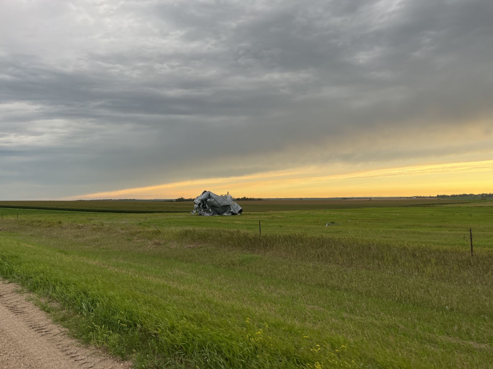
 Thunderstorm damage near Pettibone. Large grain bin was dislodged from its foundation and rolled to the west, wrapping around the side of a house. Photo from NWS damage survey. |
Photos & Video
Header
 |
 |
 |
 |
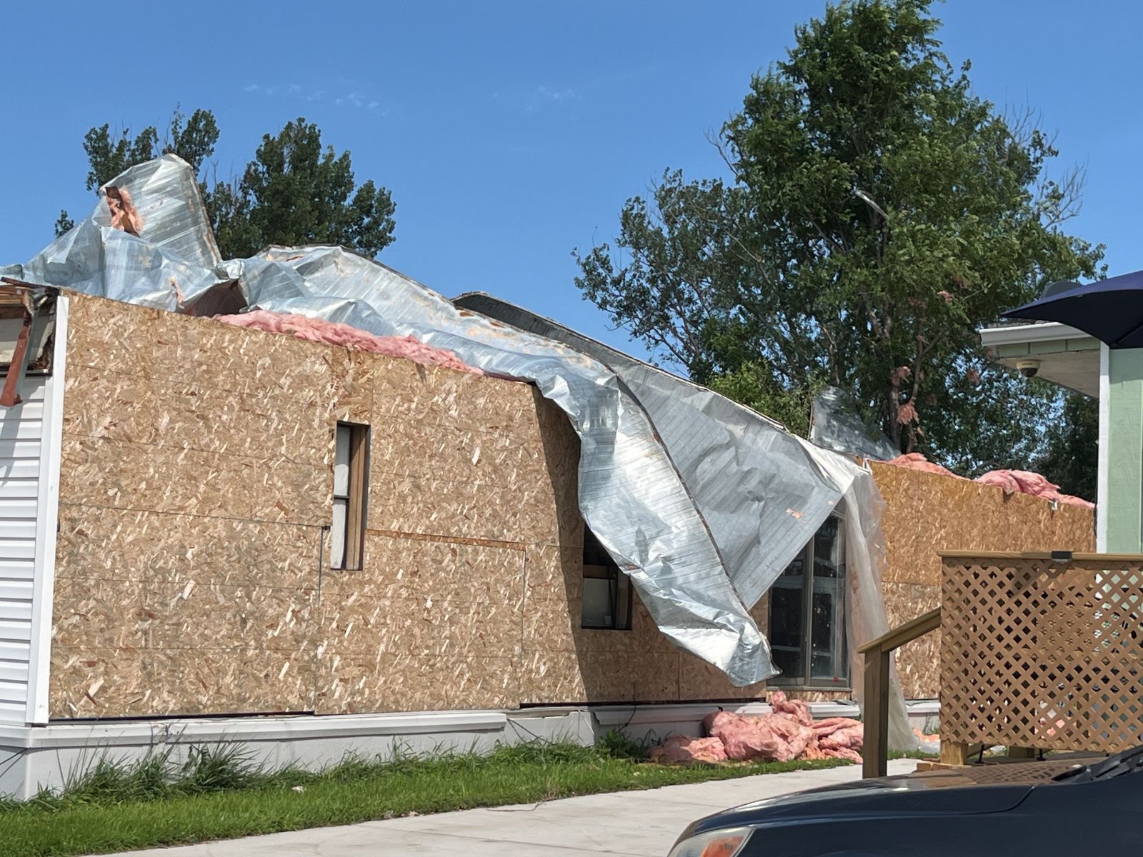
| Damage to a manufactured home in Jamestown. (NWS Damage Survey) |
A large spruce tree was uprooted onto a small garage, destroying the structure, in Jamestown. (NWS Damage Survey) |
Multiple trees had trunks or large branches snapped at McElroy Park in Jamestown. (NWS Damage Survey) |
Roof damage on a building in Jamestown. (NWS Damage Survey) |
 |
 |
 |
 |
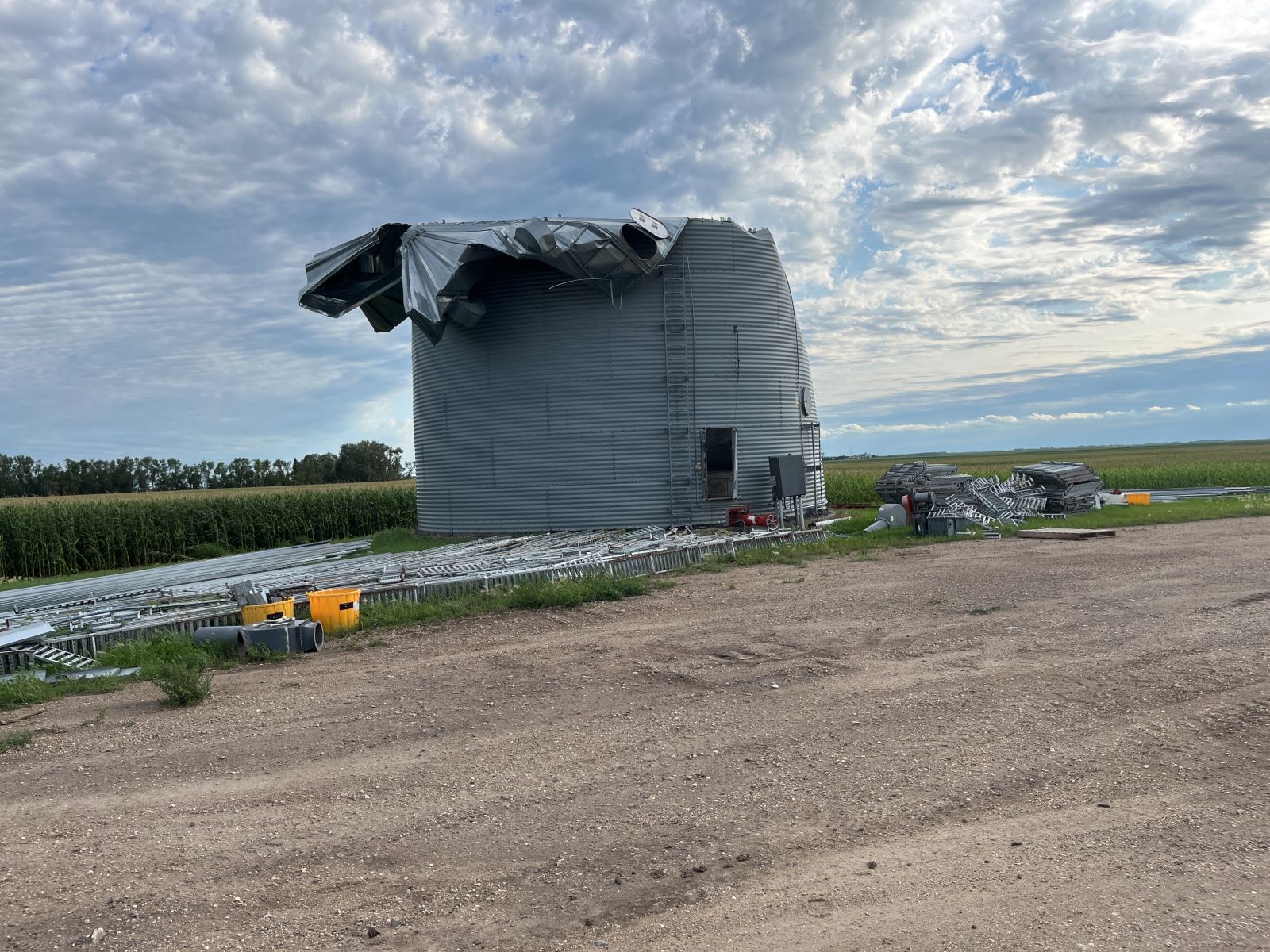
| Large grain bin with the top blown over, north of Courtenay. (NWS Damage Survey) |
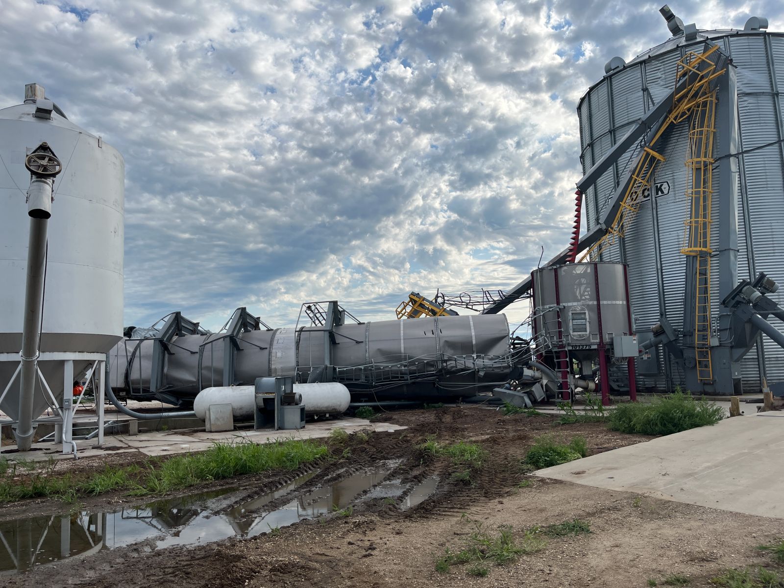
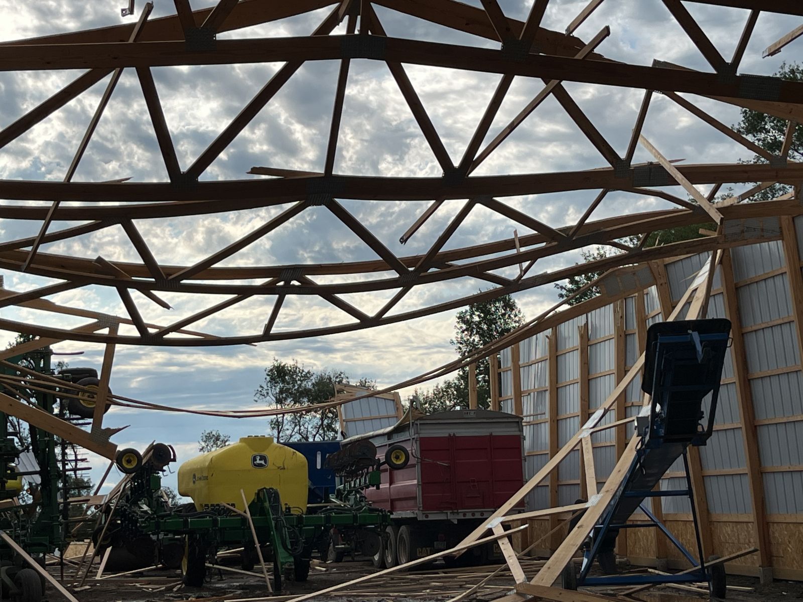
Damage at a farm north of Courtenay. (NWS Damage Survey) |
Damage to a farm outbuilding north of Courtenay. (NWS Damage Survey) |
Large branches snapped on shelter belt trees, north of Courtenay. (NWS Damage Survey) |
 |
 |
 |
 |
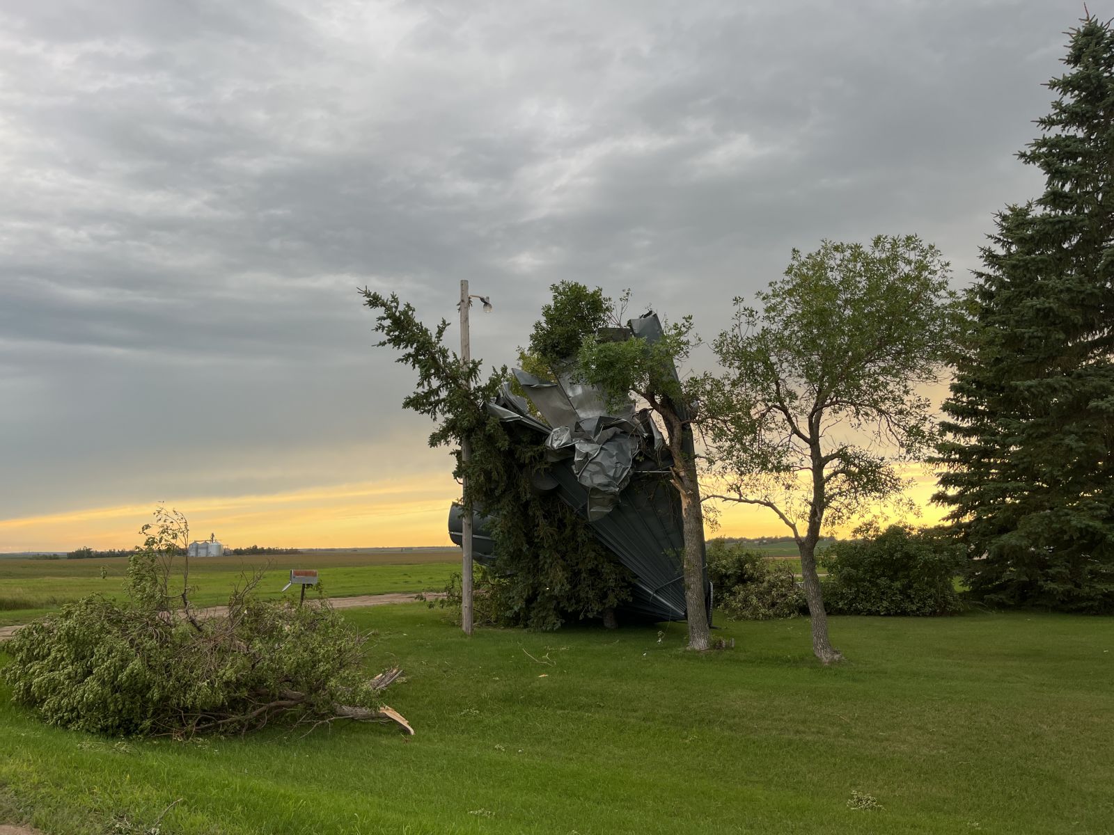
| Thunderstorm damage near Pettibone. (source) |
Thunderstorm damage near Pettibone. (source) |
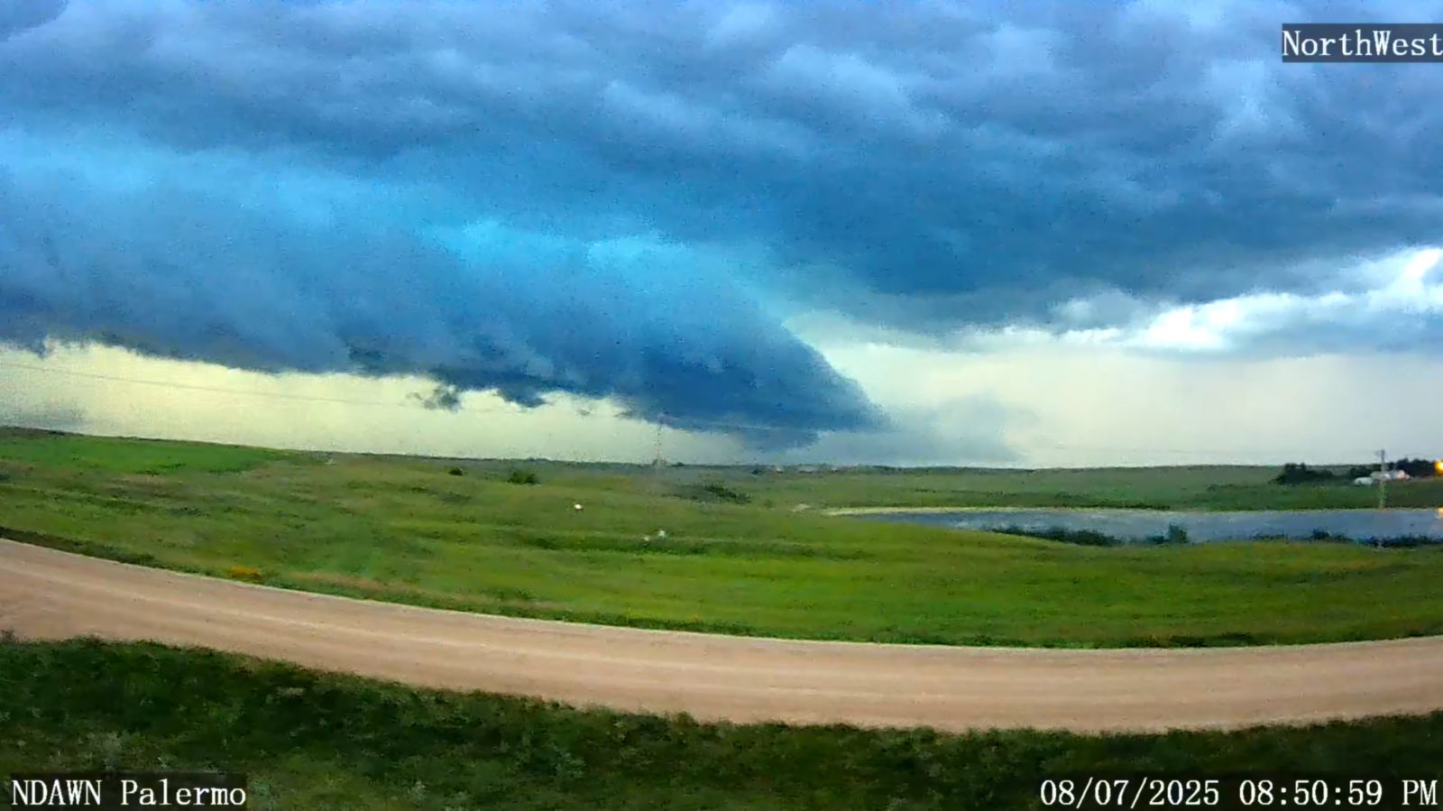
Severe thunderstorm approaching Palermo. (NDAWN) |
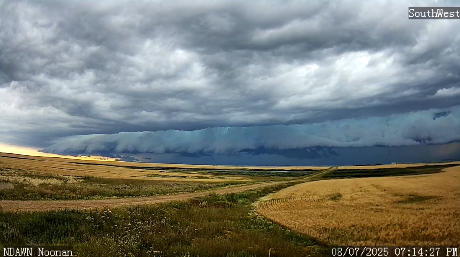
Severe thunderstorm approaching Noonan. (NDAWN) |
Storm Reports
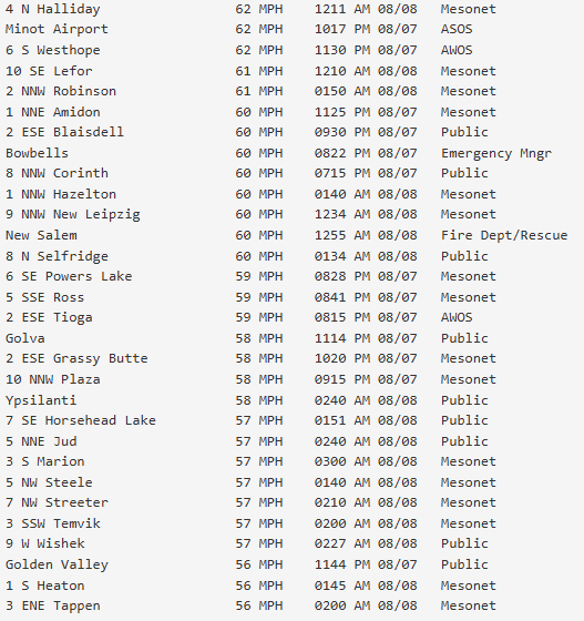
Radar
Environment
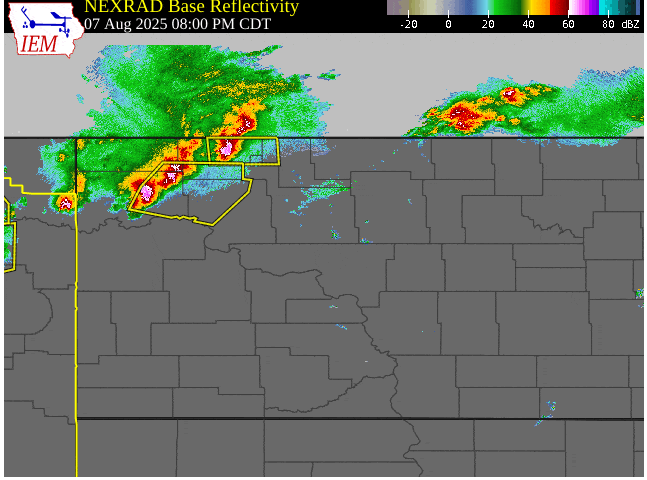
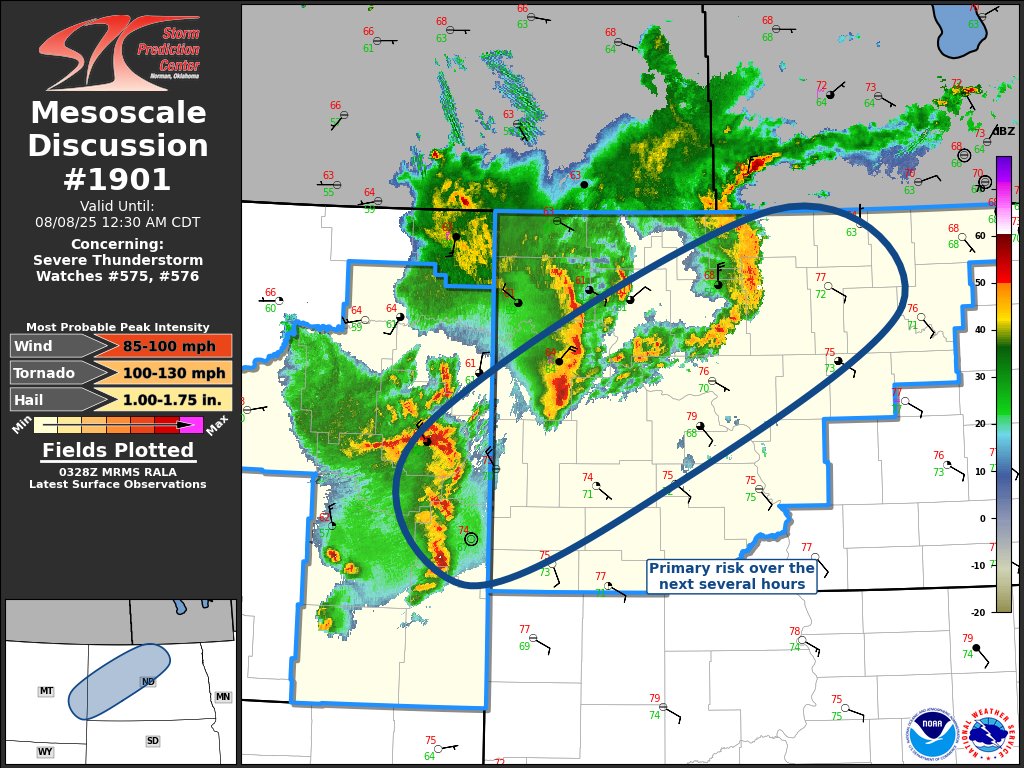
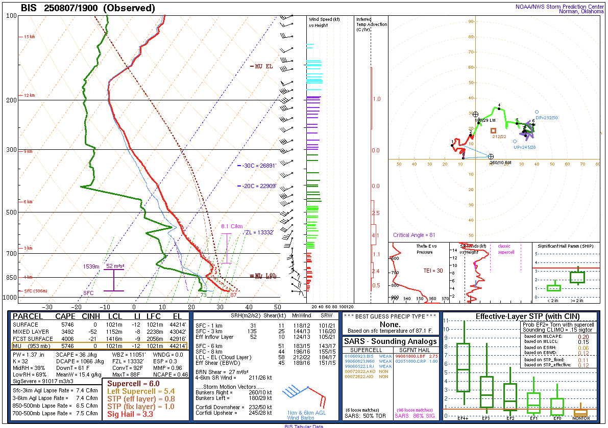
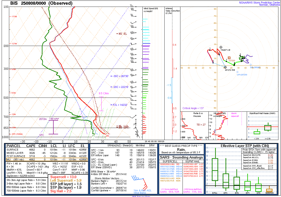
A warm front moved north through North Dakota during the morning and afternoon hours on August 7 (Fig. 6). There was concern for thunderstorm development along this front in western North Dakota during the afternoon, but a layer of warm air aloft (Figs. 4 and 5) prevented updraft growth. There was however a lone supercell that developed near the Turtle Mountains during the late afternoon that moved northeast into Manitoba. By mid evening, stronger forcing mechanisms in the mid to upper levels of the atmosphere provided enough lift for air parcels to overcome the warmer air aloft, allowing severe thunderstorms to develop (Fig. 1). As the late evening progressed into the night, 3 distinct lines of severe storms (Fig. 2) eventually merged into a single line across central North Dakota (Fig. 3). It was around the time of the congealing of the 3 lines into one that the storms became most intense and produced widespread damage across portions of Kidder and Stutsman Counties. The line of storms would later go on to produce several tornadoes in northeastern North Dakota between 3 and 5 am, including near the city of Grand Forks.
 |
 |
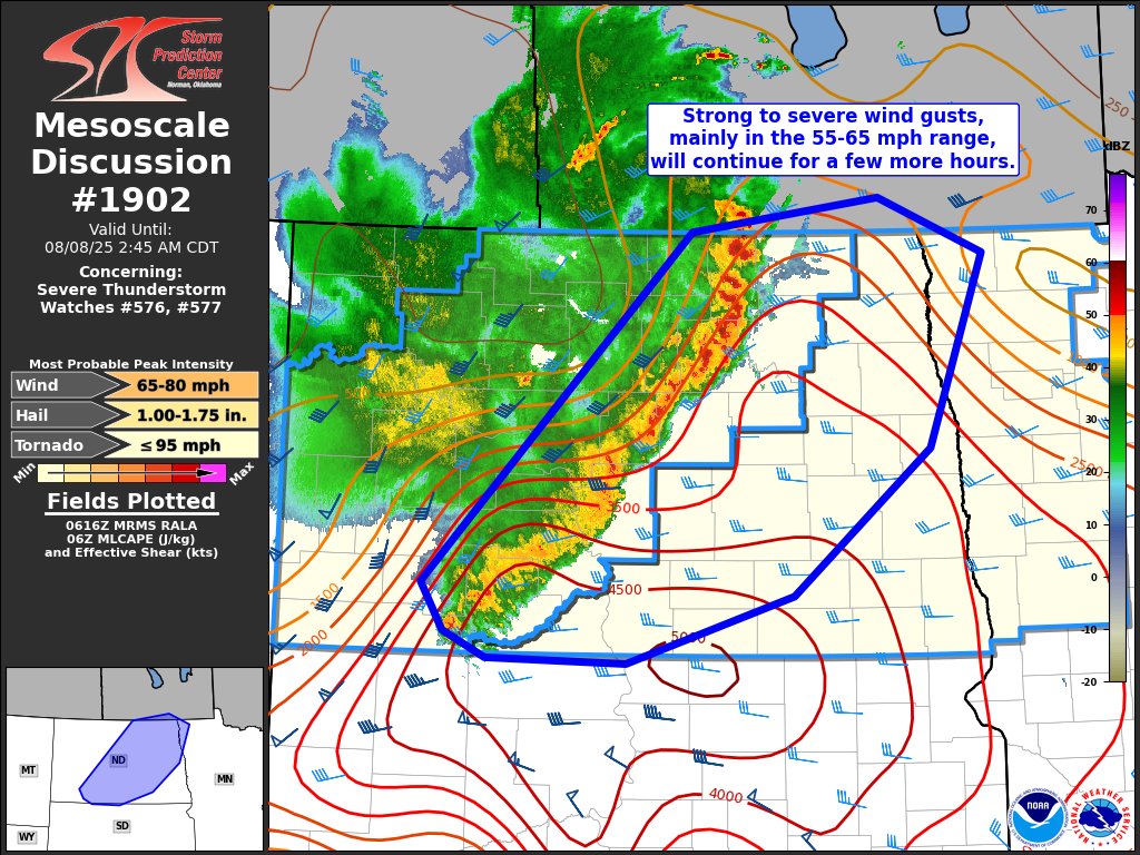 |
| Figure 1: Storm Prediction Center Mesoscale Discussion #1900 issued at 7:41 PM CDT August 7 | Figure 2: Storm Prediction Center Mesoscale Discussion #1901 issued at 10:32 PM CDT August 7 | Figure 3: Storm Prediction Center Mesoscale Discussion #1902 issued at 1:20 AM CDT August 8 |
 |
 |
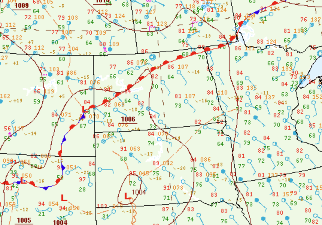 |
| Figure 4: Bismarck Special (2:00 PM CDT) Weather Balloon Sounding | Figure 5: 7:00 PM CDT Bismarck Weather Balloon Sounding | Figure 6: Surface analysis from the Weather Prediction Center at 7 PM CDT August 7 |
 |
Media use of NWS Web News Stories is encouraged! Please acknowledge the NWS as the source of any news information accessed from this site. |
|

