
Heavy rain and widely scattered severe storms capable of large hail, damaging winds, and possibly a tornado are expected over portions of the central and southern Plains into the Lower Missouri Valley. Unseasonable warmth will continue for a few more days across the Midwest and Southeast where several daily record highs could fall. Read More >
Bismarck, ND
Weather Forecast Office
North Dakota Severe Weather History
Severe Weather Maps, Graphics and Data Page
North Dakota County Statistics 1950 on (pdf file...Counties listed alphabetically)
NWS Bismarck Severe Weather Statistics 1986 on (pdf file)
North Dakota Tornado details 1950 on (pdf file)
Fujita Scale and Enhanced Fujita Scale.
Click on the image below to download the complete PDF document. Due to the
amount of data within the map, you will need to zoom in to see finer details (400%).
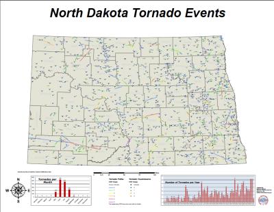
North Dakota 2011 Tornadoes (pdf file)
North Dakota 2012 Tornadoes (pdf file)
North Dakota 2013 Tornadoes (pdf file)
North Dakota 2014 Tornadoes (pdf file)
North Dakota 2015 Tornadoes (pdf file)
North Dakota 2016 Tornadoes (pdf file)
North Dakota 2017 Tornadoes (pdf file)
North Dakota 2018 Tornadoes (pdf file)
North Dakota 2019 Tornadoes (pdf file)
North Dakota 2020 Tornadoes (pdf file)
North Dakota 2021 Tornadoes (pdf file)
North Dakota 2022 Tornadoes (pdf file)
North Dakota 2023 Tornadoes (pdf file)
North Dakota 2024 Tornadoes (pdf file)
North Dakota 2025 Tornadoes (pdf file)
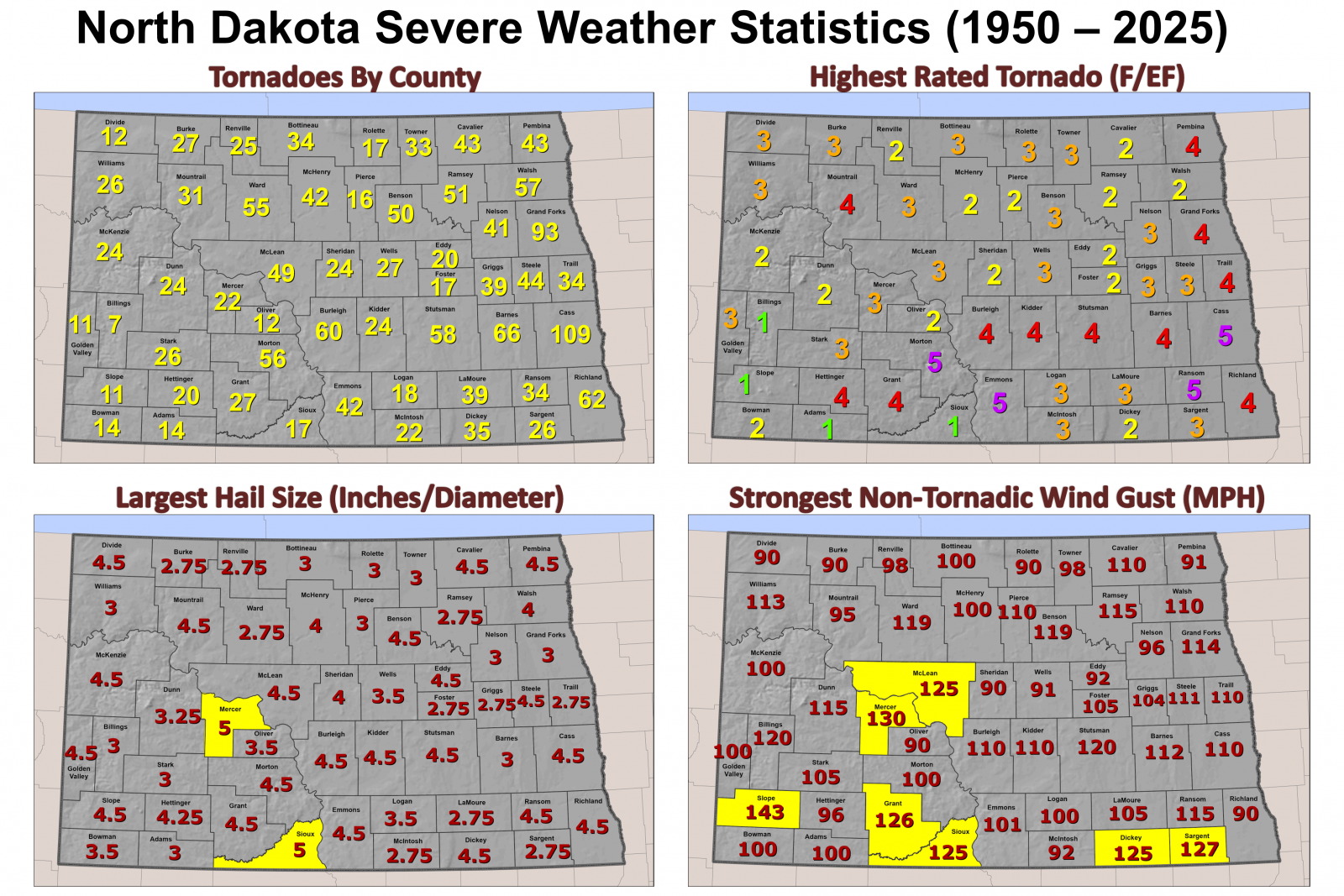
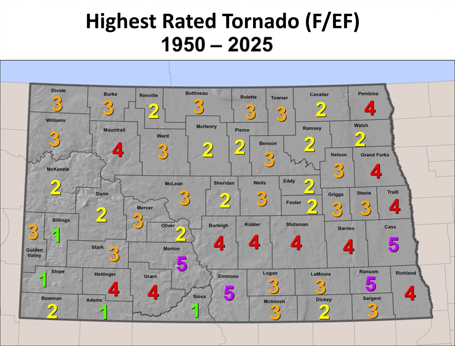
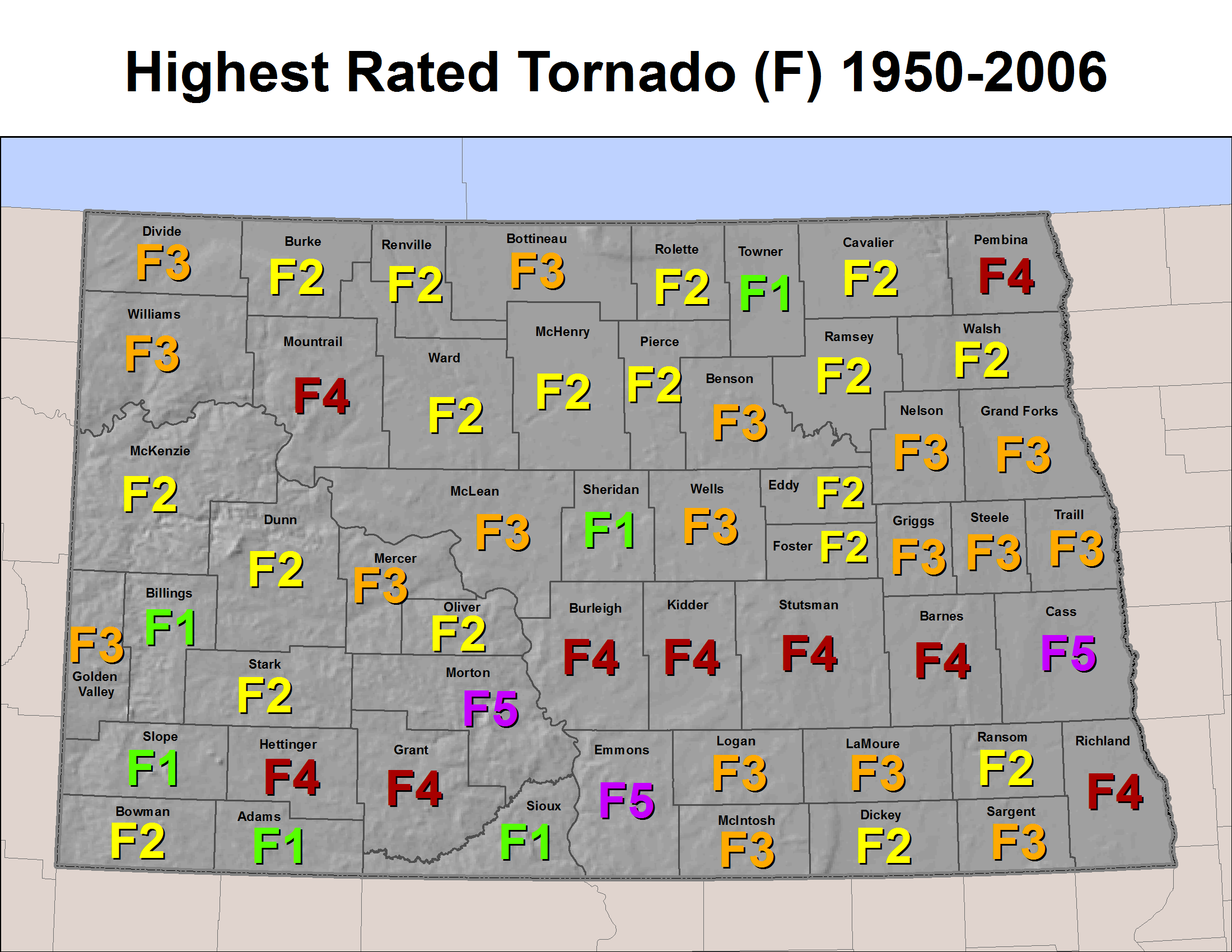
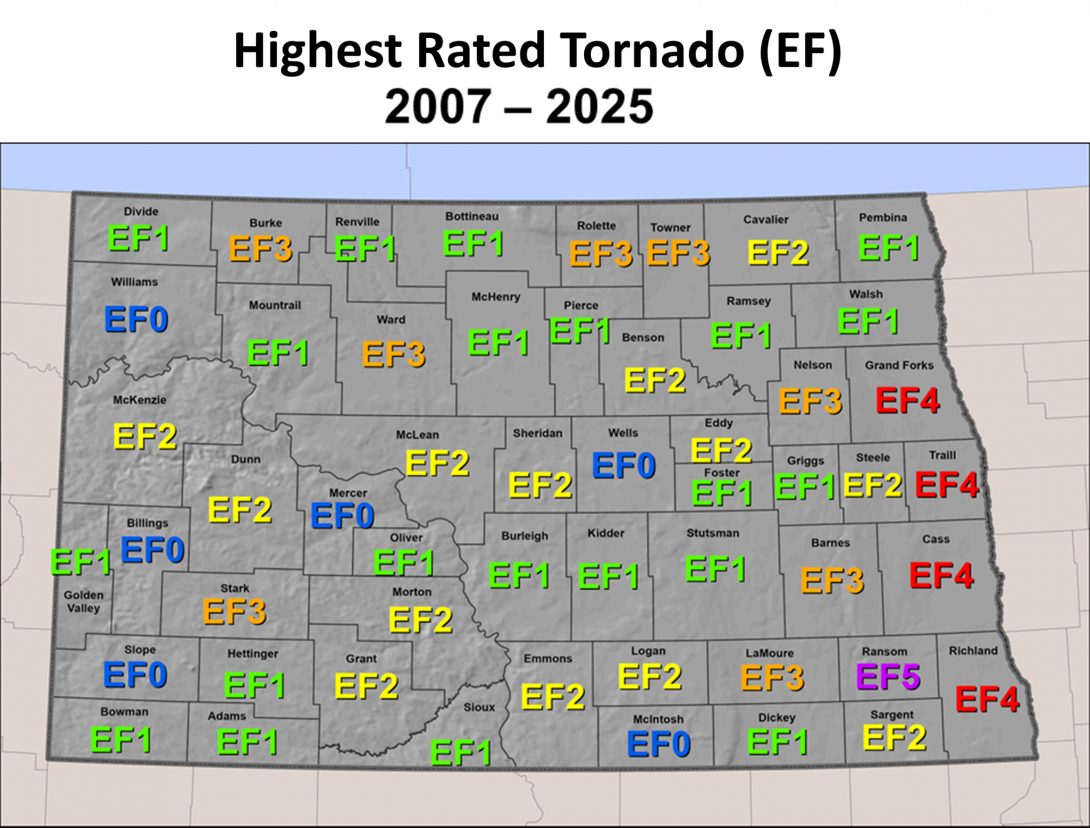
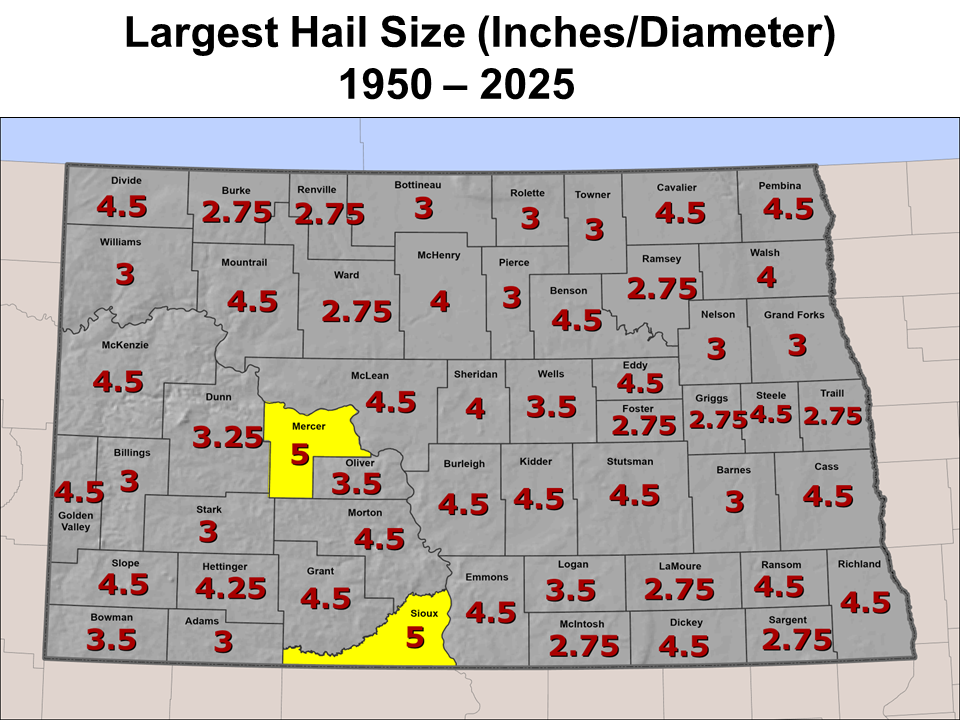
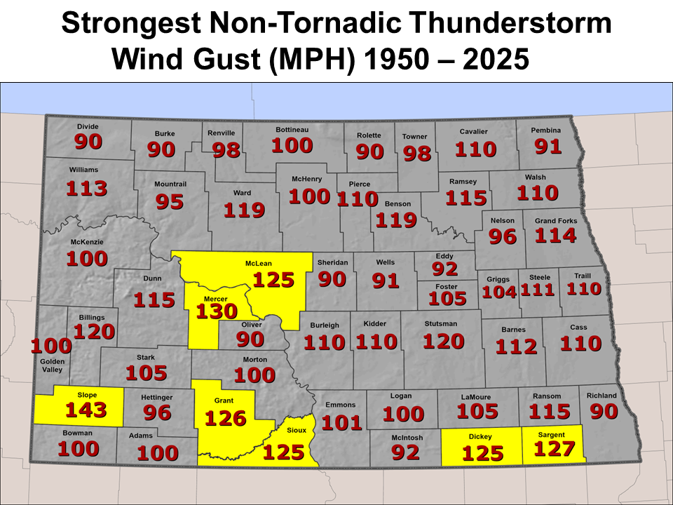
North Dakota Tornado, Greatest Hail size and Highest Wind Gust per county.
Wind speeds are in mph, and hail sizes in inches diameter.
Click on the image below to view the complete document.

US Dept of Commerce
National Oceanic and Atmospheric Administration
National Weather Service
Bismarck, ND
2301 University Drive, Building 27
Bismarck, ND 58504
701-250-4224
Comments? Questions? Please Contact Us.


 Follow us on X
 Follow us on Facebook
 Follow us on YouTube
 BIS RSS Feed