
Wildfire smoke will push into the Midwest, worsening air quality. A frontal system brings severe storms from the Northern Plains to the Mid‑Atlantic the next few days. Heavy Gulf Coast rain is possible as Tropical Depression Two has formed, while monsoonal storms persist in the Southwest with heavy rainfall. Hazardous heat expands from the Plains into the Lower Mississippi Valley. Read More >
Latest Monthly Discussion from the Climate Prediction Center
Tropical Pacific Sea Surface Temperatures:

Tropical Pacific Sea Surface Temperature Anomalies:

Most of the information here is courtesy of climate.gov.
The El Niño Southern Oscillation is a recurring climate pattern across the tropical Pacific. The two phases, El Niño (the warm phase) and La Niña (the cool phase), represent the opposite extremes in the ENSO cycle, with ENSO-neutral conditions the third phase where conditions are near average. This oscillation is characterized by differences in ocean temperatures, winds, surface pressure, and rainfall across the parts of the tropical Pacific, which can influence weather across the globe.

Maps of sea surface temperature anomalies in the Pacific Ocean during a strong La Niña (top, December 1988) and El Niño (bottom, December 1997). Maps by NOAA Climate.gov
We focus on ENSO due to its significant impact on the global atmospheric circulation, which influences temperature and precipitation patterns across the globe. It is also one of the most skillfully predicted climate modes, giving us advanced notice of weather and climate patterns.
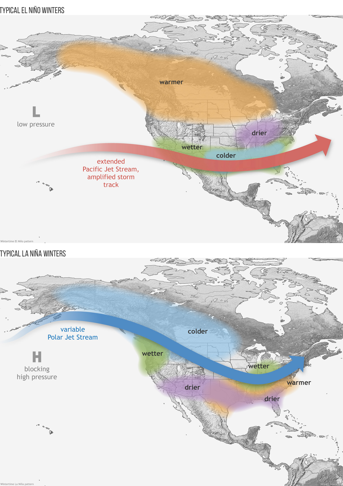
Wintertime El Niño (top) and La Niña (bottom) weather patterns across the United States.
|
|
 |
|
|
|
|
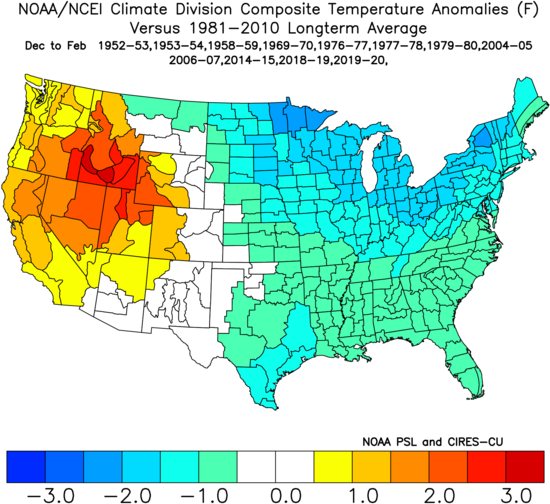
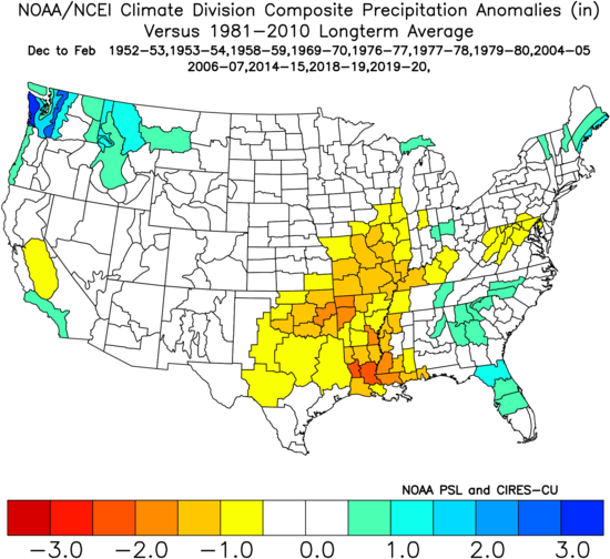
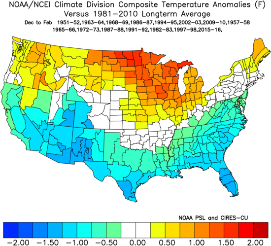
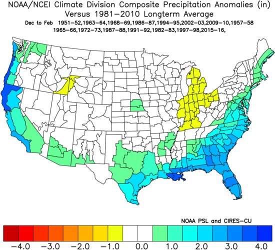
Below are winter (December-January) temperatures and precipitation anomalies for El Niño episodes since 1950. These composites are not meant to be a forecast of expected conditions. Rather, they use historical data to highlight where ENSO phases can potentially impact temperature and precipitation. Other climate modes, as well as atmospheric variability, makes each ENSO event unique and make impacts different.
|
|
|
 |
 |
|
|
|
 |
 |
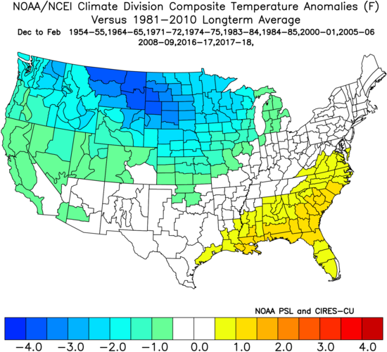
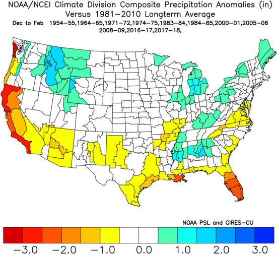
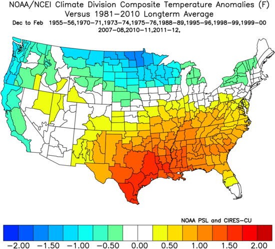
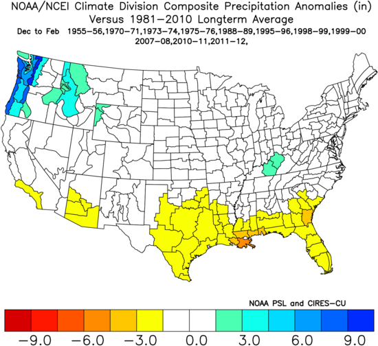
Below are winter (December-January) temperatures and precipitation anomalies for La Niña episodes since 1950. These composites are not meant to be a forecast of expected conditions. Rather, they use historical data to highlight where ENSO phases can potentially impact temperature and precipitation. Other climate modes, as well as atmospheric variability, makes each ENSO event unique and make impacts different.
|
|
|
 |
 |
|
|
|
 |
 |
|
|
|
 |
 |
|
|
|
 |
 |

