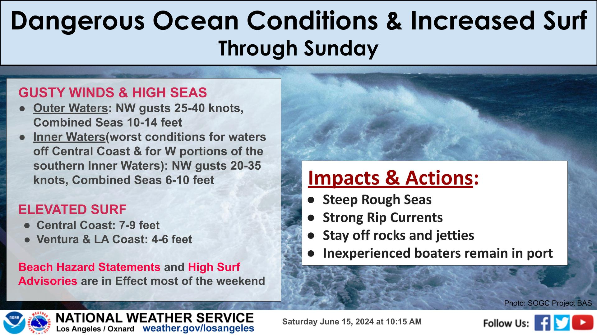
Key Details:
Multiple rounds of southerly swells impacting south facing beaches through this week.
Long periods cause STRONG rip currents and longshore currents and powerful breaking waves. The elevated surf and strong currents will lead to dangerous conditions with increased ocean rescues needed.
Southerly swell from Hurricane Genevieve will bring high surf to the Ventura and LA County coasts through Saturday.
Actions:
Remain out of the water if possible.
Follow local lifeguards advice, and if swimming is advised, stay close to shore in shallower waters. Stay near lifeguards if you decide go into the water. If you get caught in a rip current, swim parallel to the shoreline to escape, then swim at an angle away from the current, toward shore.
Stay off rocks and jetties.


 Hazards
 Observations
 Marine Weather
 Fire Weather
 Aviation Weather
 Hydrology
 Forecast Discussion
 Graphical Forecasts
 Fast Page
 Weather Stats
 Mobile Devices
 Past Weather Data
 Southern CA Radar
 Southwest CA Radar
 Satellite
 Social Media OneStop
 Student Opportunities