
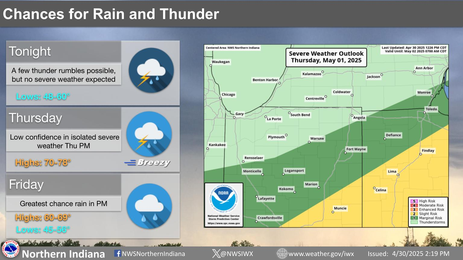
A multi-day thunderstorm and heavy rain event will impact the south-central U.S. this Memorial Day weekend. Severe thunderstorms may produce large hail, severe gusts, and a possible tornado or two across portions of the central and southern Plains through Monday. The threat for heavy to excessive rainfall and possible flash flooding will return to the south-central U.S., especially in the Ozarks. Read More >
Last Map Update: Fri, May 23, 2025 at 1:32:17 pm EDT


 Weather Story
 Weather Map
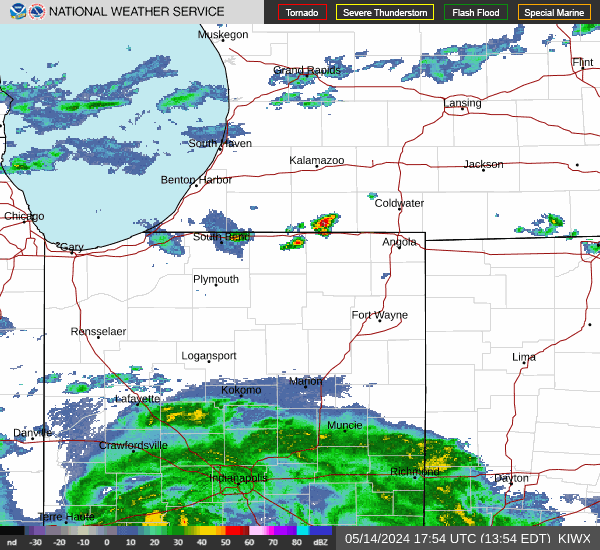 Local Radar