
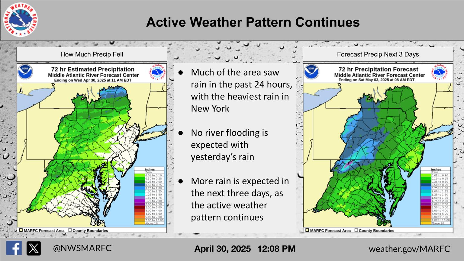
Severe thunderstorms and heavy rain are expected across the central High Plains into parts of the central and southern Plains and in the the Mid-Atlantic today. Intense, dangerous heat will persist across the West, Southwest, and Southern Plains into the end of the week. Elevated to critical fire weather conditions expected in the Great Basin and Four Corners region. Read More >
Middle Atlantic RFC
River Forecast Center

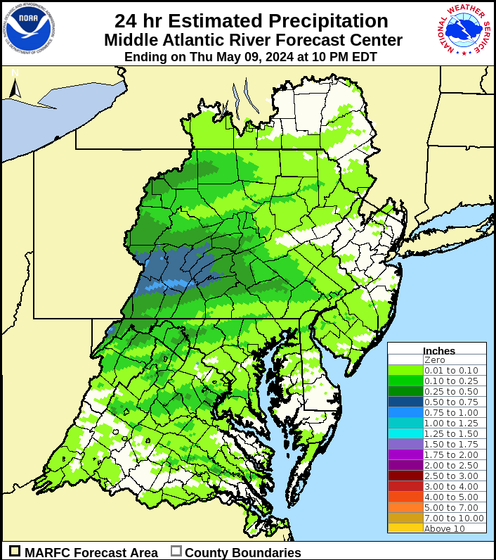
Past Precipitation |
Water Story |
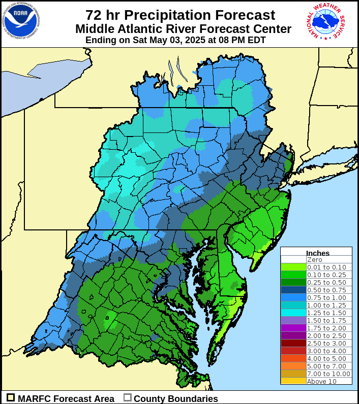
Future Precipitation |
 |
 |
 |
US Dept of Commerce
National Oceanic and Atmospheric Administration
National Weather Service
Middle Atlantic RFC
328 Innovation Boulevard
Suite 330
State College, PA 16803
814-954-6408
Comments? Questions? Please Contact Us.

