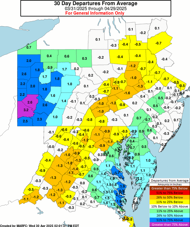
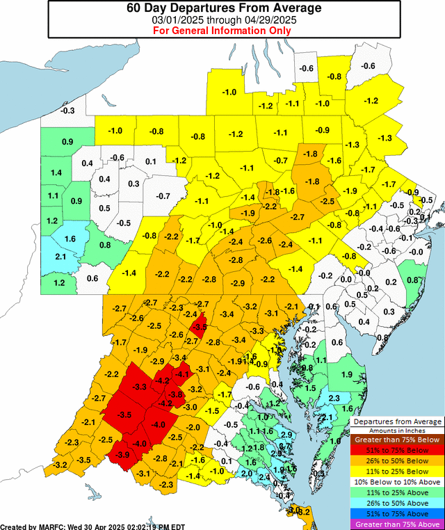
MARFC Precipitation Departure Map and Data are available for a variety of time spans.
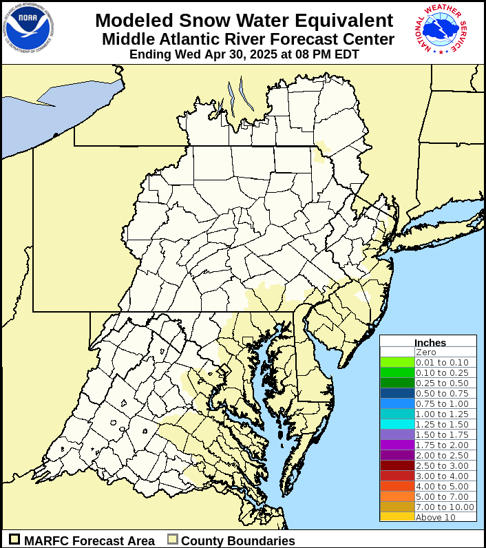
The Snow Water Equivalent of any snow on the ground.
Snow water equivalent is the water in the snowpack that will be released when the snow melts.
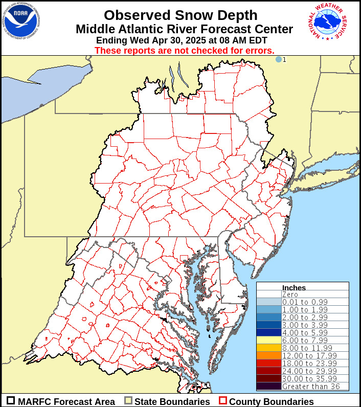
Snow depth if/when snow is on the ground.
For more information on snow in the Mid-Atlantic Region, go here:
For a national perspective on snow, data is available from the National Operational Hydrologic Remote Sensing Center (NOHRSC) where the National Snow Analysis and an Interactive Snow Map are available.
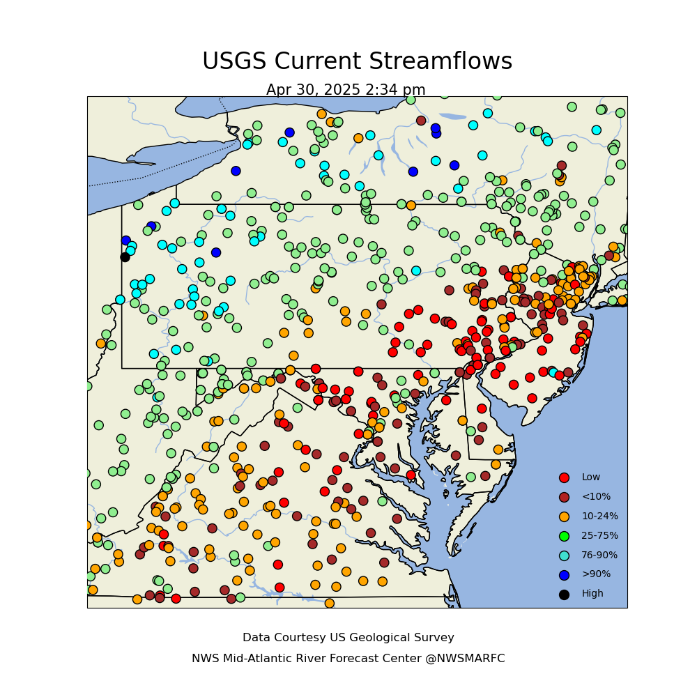
USGS Streamflow Information
USGS Groundwater Data for sites across the nation is available at waterdata.usgs.gov
U.S. Geological Survey Real Time Data
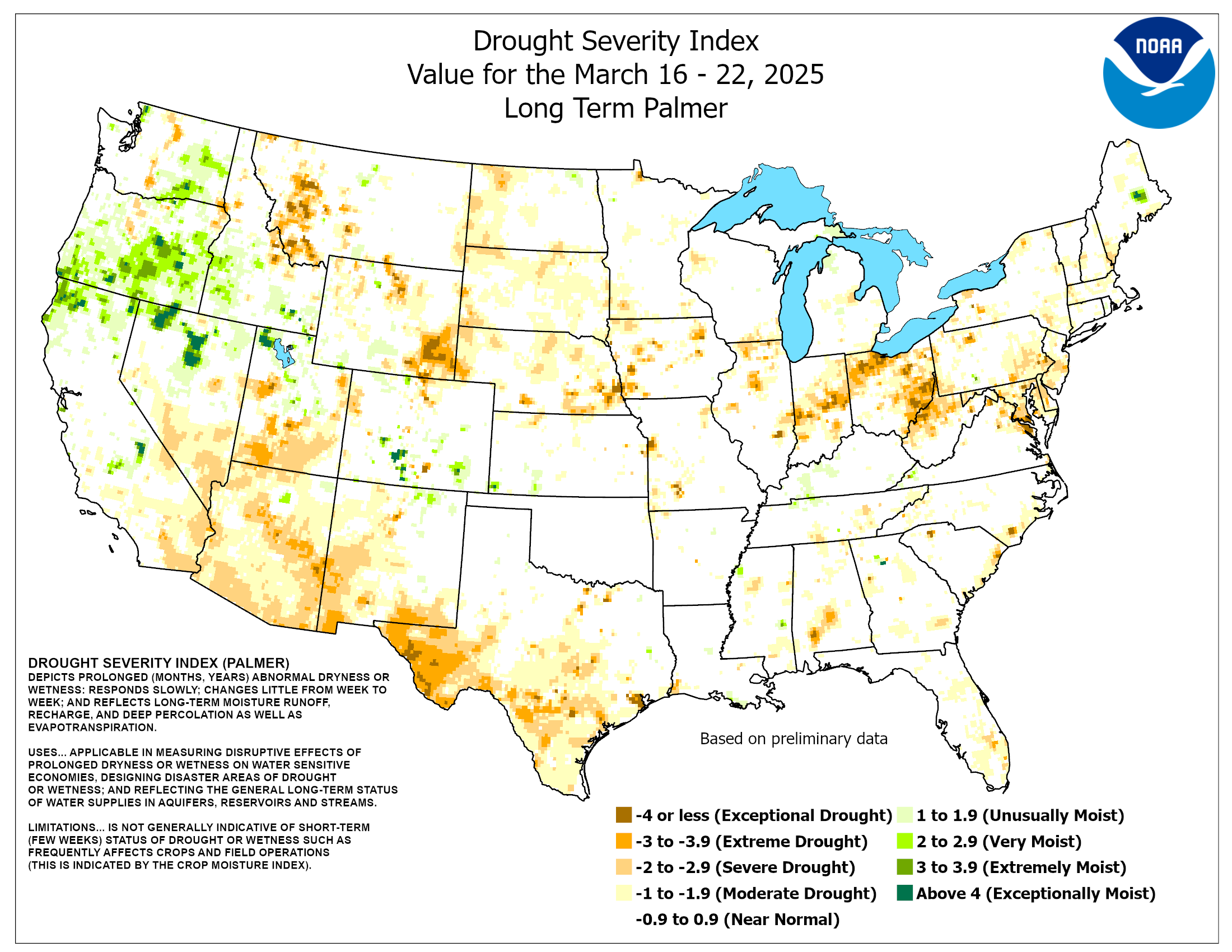
The long-term Palmer drought severity index is useful to estimate deep soil moisture conditions.
Additional soil moisture data is available from the Climate Prediction Center at the following websites.
https://www.cpc.ncep.noaa.gov/products/Drought/Monitoring/smp.shtml
https://www.cpc.ncep.noaa.gov/products/Soilmst_Monitoring/US/Soilmst/Soilmst.shtml
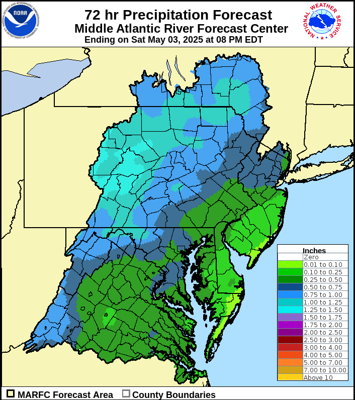
The MARFC Precipitation Forecast for the next 72 hours:
Weather Prediction Center Precipitation Outlook for the next 5 days:

The Climate Prediction Center 6 to 10 Day Outlook:


The Climate Prediction Center 8 to 14 Day Outlook:


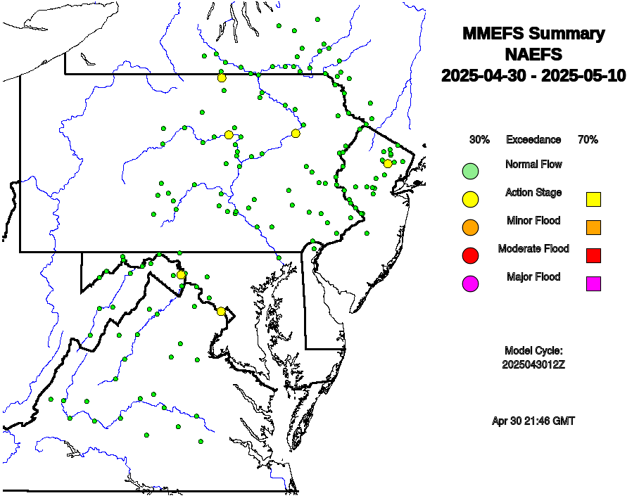
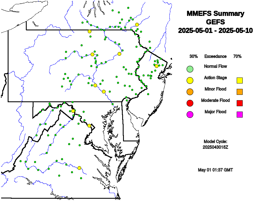
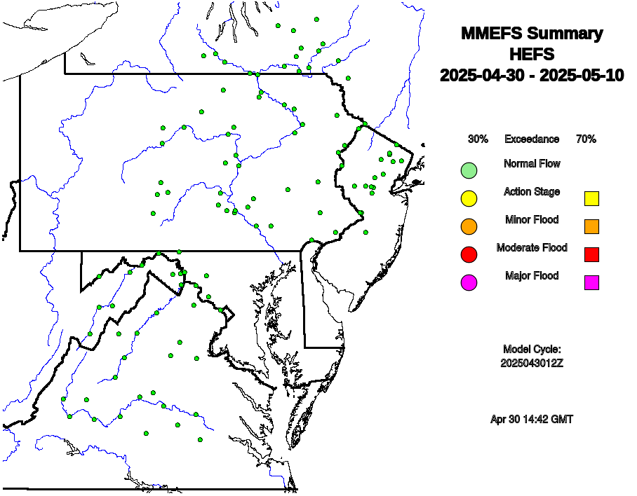
More detailed graphical and tabular Ensemble River Forecast information for the Middle Atlantic is available at the following websites.

