January 25, 2013 – Light Snow/Ice Event
Event Overview –
A fast moving frontal system coupled with strong cold high pressure anchored over northern New England combined to bring a quick shot of wintry precipitation to eastern North Carolina during the late afternoon and evening hours of Friday January 25, 2013. Surface temperatures across the region remainder in the upper 20s to lower 30s through most of the day. As moisture increased ahead of a cold front and a weak surface wave of low pressure moved just south of the region (Fig. 1), precipitation moved into eastern North Carolina and fell into the shallow cold air mass, producing sleet, snow and freezing rain from late afternoon into the evening hours. Light accumulations of up to one half inch of snow and up to one tenth of an inch of ice (Fig. 2) occurred over the central and northern portions of the Newport/Morehead City CWA with some sleet reported as far south as Richlands and the Newport area. Figure 3 illustrates the liquid equivalent of the event with nearly four-tenths of an inch of precipitation across the northern portions to around two-tenths of an inch across southern areas. Severe icing on the Neuse River bridge at New Bern caused as many as 20 traffic accidents prompting the closing of the bridge during the evening.
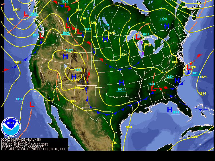
Figure 1: A wave of low pressure developed on a fast moving cold front along the Outer Banks as of 7 PM EST January 25, 2013. Cold air was supplied by high pressure over Ontario nosing south over the eastern U.S., resulting in light wintry weather across Eastern North Carolina.
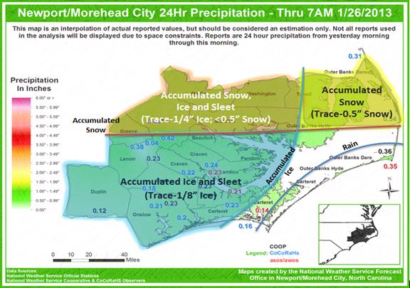
Figure 2: Snow and Ice Accumulation across Eastern North Carolina.
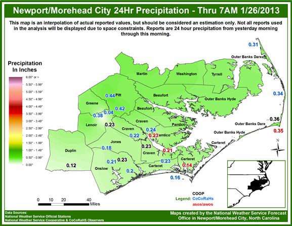
Figure3: Liquid equivalent of wintry precipitation across Eastern North Carolina.
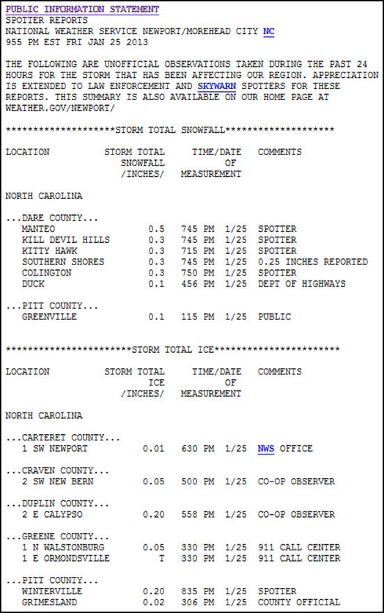
Figure 4: A summary Public Information Statement issued at 955 EST on January 25, highlighting the light snow and ice accumulations across the region.


 Map View
 Weather Hazard Briefing (when applicable)
 Forecaster Discussion
 Marine
 Text Products
.png) Skywarn
Skywarn Submit Storm Reports
 Coastal Flood
.png) Surf Forecast/Rip Currents
Surf Forecast/Rip Currents