 |
National Weather Service Newport/Morehead City, NC Tropical Briefing Page |
 |
| Winter Briefing Page | Severe Briefing Page | Hydrology/Flooding Briefing Page |
| BASIC TROPICAL GRAPHICS (Click on Graphic to Expand) |
|
Tropical Outlook
|
Tropical IR Satellite
|
Full Disk Satellite
|
|
Atlantic Satellite
|
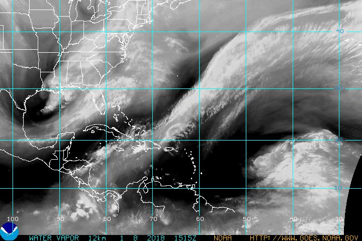
Water Vapor Satellite
|
Sea Surface Temperature
|
|
RAINFALL FORECASTS AND GUIDANCE (Click on Graphic to Expand) |
|
Day One QPF
|
Day Two QPF
|
Day Three QPF
|
|
Probability of Heavy Rain
|
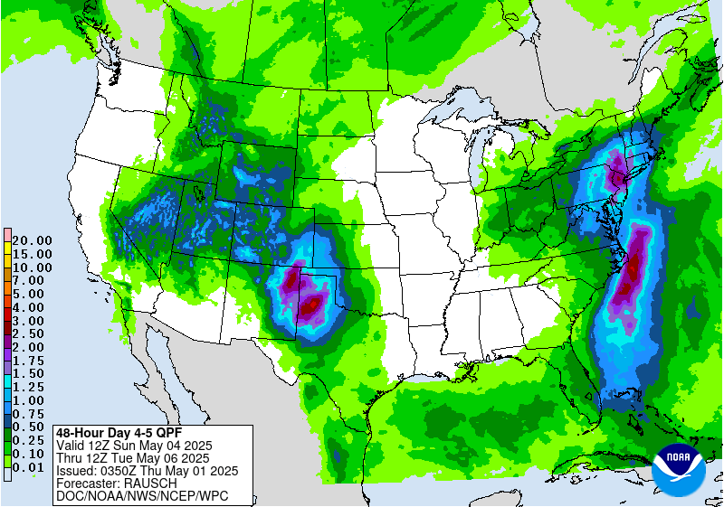
Days 4 and 5 QPF
|
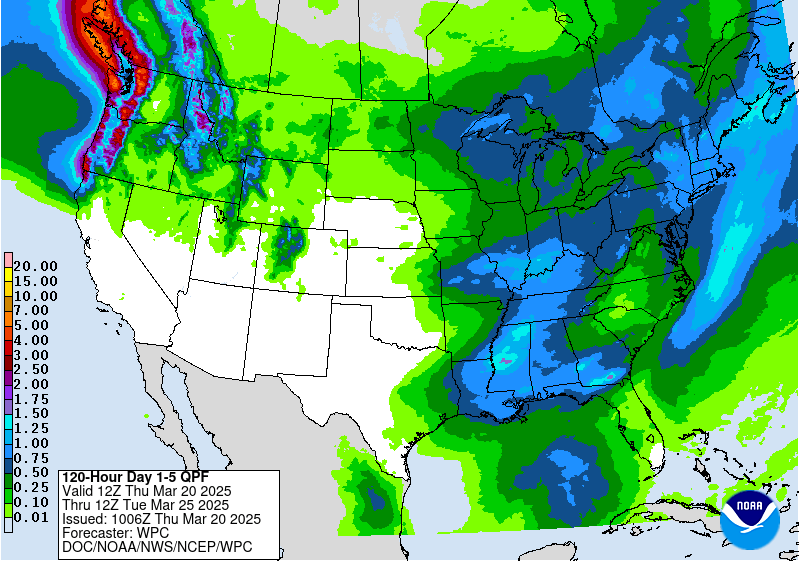
Day 1 to 5 QPF
|
|
Eastern IR Satellite
|
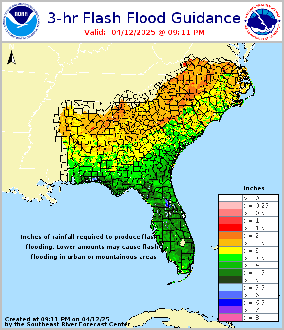
3-Hour Flash Flood Guidance
|
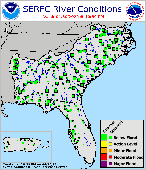
River Conditions
|
| COASTAL FLOOD GRAPHICS (Click on Graphic to Expand) |
|
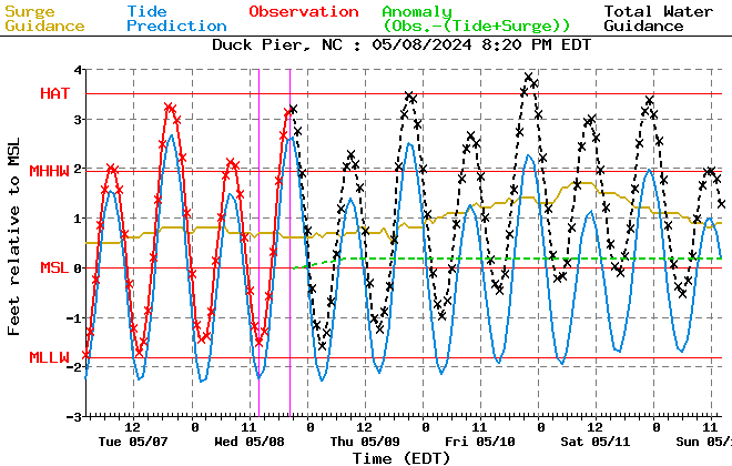
Duck Tidal Surge
|
Beaufort Tidal Surge
|
Hatteras Tidal Surge
|
|
SITUATIONAL AWARENESS GRAPHICS (Click on Graphic to Expand) |
|
Current Watches
|
Mesoscale Discussions
|
Severe Weather Reports
|
|
Area WWA Map
|
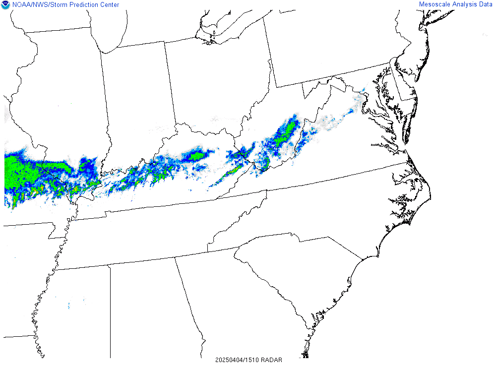
Regional Radar
|
Visible Satellite
|
|
Eastern Visible Satellite
|
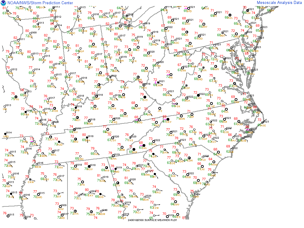
Regional Observations
|
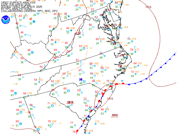
Surface Analysis
|
|
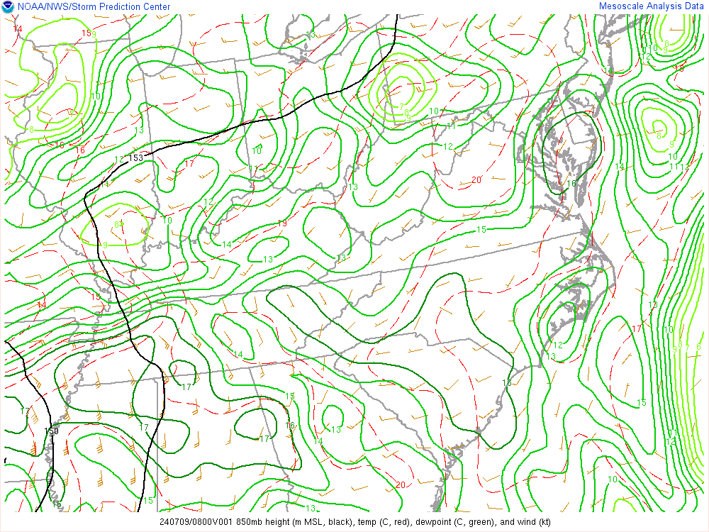
850 MB Analysis
|
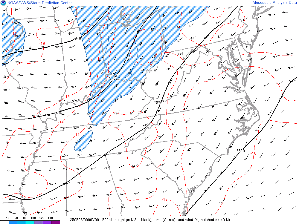
500 MB Analysis
|
300 MB Analysis
|
|
SOUNDINGS (Click on Graphic to Expand) |
|
Charleston
|
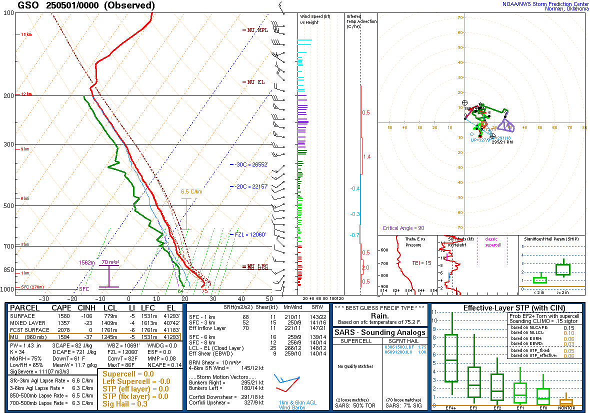
Greensboro
|
Morehead City
|
 |
Wind Speed ProbabilitiesProbabilities of sustained tropical storm force (39+ mph), storm force (58+ mph) and hurricane force (74+ mph) winds |
 |
Track Forecast ConeLikely track of the center of the storm NOTE: Impacts can occur outside the cone so don't focus on the exact track! |
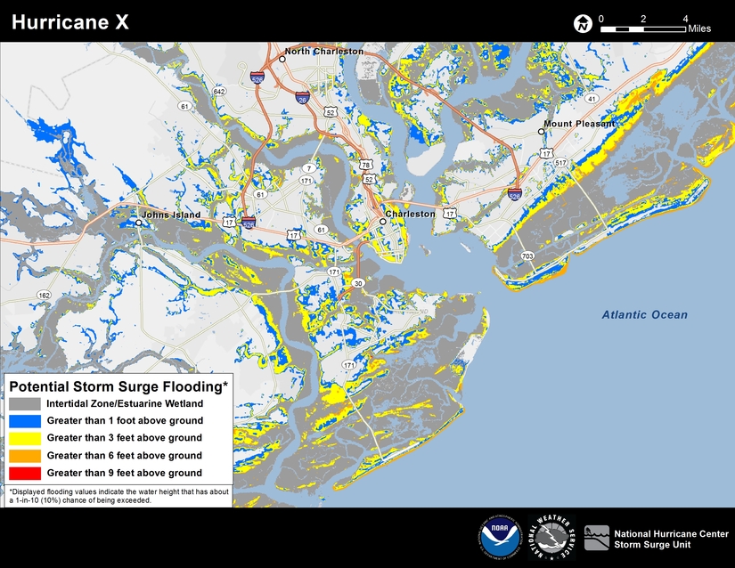 |
Potential Storm Surge Flooding MapAlways represents a reasonable worst-case scenario - what people should prepare for (i.e., depths of inundation which have just a 10% chance of being exceeded) NOTE: Image is an example only - click image for the latest map! |
 |
Satellite ImagerySatellite imagery of the tropical regions (Atlantic Ocean, Caribbean Sea and Gulf of America) |


 Map View
 Weather Hazard Briefing (when applicable)
 Forecaster Discussion
 Marine
 Text Products
.png) Skywarn
Skywarn Submit Storm Reports
 Coastal Flood
.png) Surf Forecast/Rip Currents
Surf Forecast/Rip Currents