
Dangerous and extreme heat will remain across portions of the central U.S. this week, persisting across the mid to lower Mississippi Valley, Gulf Coast, southern Plains and portions of Texas. A heat wave over the Southwest U.S. will peak this weekend. Heavy to excessive rainfall may produce flash flooding from the Delmarva Peninsula north into the Hudson Valley today and tonight. Read More >
Milwaukee/Sullivan, WI
Weather Forecast Office
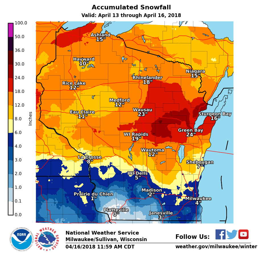
A significant Spring winter storm impacted much of the United States between April 13 and April 16. Across southern Wisconsin, this storm led to severe thunderstorms, wind gusts between 45 and 50 MPH, sleet, freezing rain, and heavy snow. Waves of nearly 15 feet along the Lake Michigan shoreline also led to localized lakeshore flooding.
Across southern Wisconsin, the heaviest snow fell along and north of a line from the Dells to Fond du Lac to Sheboygan, where 6-10" was observed. Further north into Central Wisconsin, snow amounts approached 30" across the Wausau to Green Bay corridor.
Here is the latest estimated snow totals across Wisconsin.
A few of the highest totals include:
Carlsville /Door County/...31.6"
Tigerton /Shawano County/....30.6"
Stiles /Oconto County/...30.5"
Peshtigo / Marinette County/.....27.5"
Suamico /Brown County/....25.5"
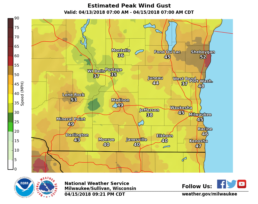
Along with the snow, northeast winds gusted between 45 and 50 MPH in many locations, with the windiest conditions occurring late Friday night and during the day Saturday. The map below shows an estimate of the peak wind gusts during this period.
 ​
​
Hazards
National Briefing
Hazardous Weather Outlook
Skywarn
View Local Storm Reports
Submit A Storm Report
Winter Weather
Summer Weather
Beach Hazards
Local Forecasts
Marine
Aviation
Fire
Local Text Products
Local Precip Forecast
Hourly Forecast Graphics
Forecast Discussion
Climate
Historic Events For Srn WI
Lightning Plot Archive
Daily Climate Graphics
Local Climate Products
Normals/Records MKE/MSN
CoCoRaHS
US Dept of Commerce
National Oceanic and Atmospheric Administration
National Weather Service
Milwaukee/Sullivan, WI
N3533 Hardscrabble Road
Dousman, WI 53118
262-965-2074
Comments? Questions? Please Contact Us.

